
Home » Posts tagged 'landmarks' (Page 2)
Tag Archives: landmarks
UP’s University Avenue
A week ago, I was invited to witness the renewal of a Memorandum of Understanding (MOU) between UP Diliman and a leading and prominent engineering company. I think one of the highlights of that event was getting to go to the Board of Regents meeting room at the top of Quezon Hall. This used to be an open area that we went to during our college days. The only times the place was off limits was when there were important meetings at Quezon Hall (e.g,, meetings of the UP Board of Regents) and during commencement exercises. It has been transformed into an air-conditioned facility that now hosts offices and this conference room. What’s the transportation thing in this post is the magnificent view of the University Avenue, which is the main gateway to the campus.
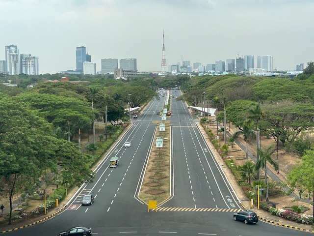 UP Diliman’s University Avenue as seen from the top of Quezon Hall
The University Avenue has also evolved as it now features bike lanes along each direction of the road. There are walkways that also served as bike lanes along either side of the avenue. These are visible in the photo and are protected, exclusive ROWs from the main travel lanes that used to be assigned to motorized traffic. The avenue connects UP’s Academic Oval, its campus core, to Commonwealth Avenue. I remember splendid sunsets viewed from the same vantage point as this generally faces the west.
–
Circulo Verde Bridge
Many roads are quite congested these days during this Christmas season. I wouldn’t get into the causes of congestion but suffice it to say here that the seasonality of traffic would basically explain most of the congestion this time of the year. For a couple of times, I have been advised by Waze to take this alternate route going home via Eastwood City and Circulo Verde. This leads me to the East Bank Road of the Manggahan Floodway and the old De Castro Subdivision before eventually taking me to Ortigas Avenue Extension. Along this route is one of three new bridges crossing the Marikina River near where it connects to the Manggahan Floodway. You can see the floodgates as you cross the bridge. Here are photos of the Circulo Verde Bridge:


The bridge ends in an intersection with Amang Rodriguez Avenue. Going left eventually leads to Ligaya and Marcos Highway. Turning left immediately leads you to the intersection of Amang Rodriguez and the East Bank Road. Taking Among Rodriguez will lead to Rosario and eventually C5 while the East Bank Road takes you to Pasig and the Rizal towns of Cainta and Taytay. Further on leads to Angono and Binangonan. Not so many vehicles currently use this alternate route and Circulo Verde does not seem to be fully developed and occupied yet. Its a nice detour from the usually congested routes.
–
Arches along the Manila East Road
Last October, our office had our first out-of-town workshop since the onset of the COVID-19 pandemic. The venue was not so far – a resort in Baras, Rizal. Along the way, I was able to take a few photos of the arches along the Manila East Road, which is the main highway connecting the towns of Rizal Province.
 One side of the Morong, Rizal arch with the text stating the traveler is leaving the town. The other side is Baras, Rizal.
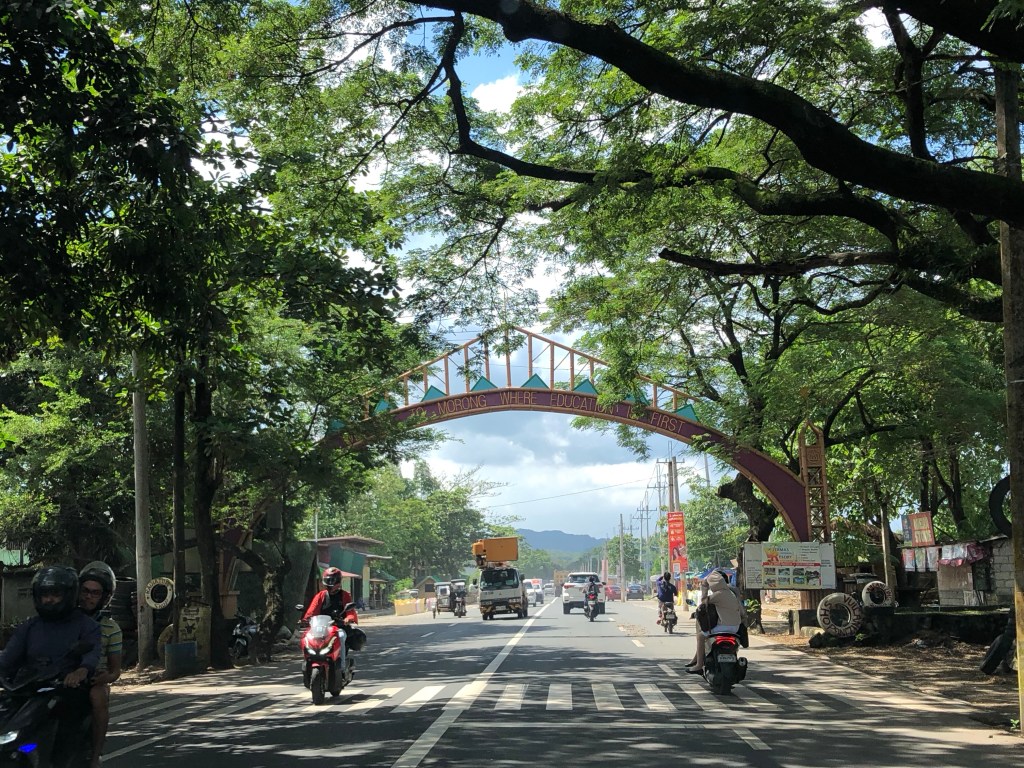 The other side with the text stating one is entering the town of Morong “where education comes first”.
 At the other end is another arch and the town of Teresa.
Many arches have been demolished, casualties of the DPWH’s road widening program. Many of these have not been replaced. These were landmarks to many travelers and the designs used to describe or highlight what a town was known for (e.g., there was a big bat at the center of the arch of Paniqui, Tarlac).
–
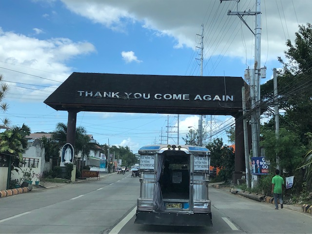
Farewell to the arch?
Arches (arko) were a common sight along national roads across the country. I have written about these arkos in previous posts including those with old photos that I took while on field work:
With all the road widening projects ongoing along many national roads, many arches have been demolished while new ones apparently have not been constructed (whether really new ones or those replacing the old ones). I still think these are good landmarks and an opportunity to feature products, traditions or whatever may represent or identify the city or municipality.
–
Infanta, Quezon Arch
I was just writing about the arches you typically came across as you traveled by road around the Philippines. A former student of mine posted a photo of the arch welcoming travelers to Infanta, Quezon from Rizal province, and I asked to have a copy of the photo. He is an avid cyclist who goes on long rides. The arch bears the seal of the town but few other symbols (that I am familiar with) that could have represented the municipality. Here is a typical low-traffic highway with two lanes and dirt shoulders along either side of the road leading to something mysterious (see that fog/mist at the end of the road?).
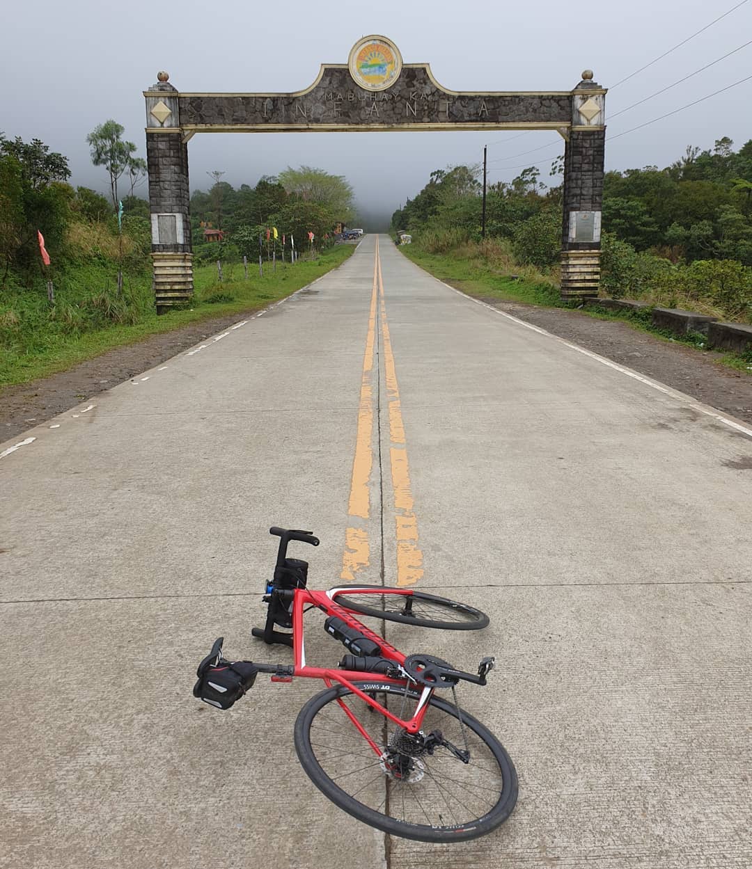 Road to Infanta, Quezon [Photo credit: Dexter Cuizon]
–
Cityscapes and mountains
I’ve been reading about how a lot of people seem to be ‘discovering’ the mountains around Metro Manila. It is not as if these have suddenly appeared or that many have been obscured by pollution. For the latter, perhaps if you lived some distance and pollution was so bad that the smog was thick enough to hide mountains then it would be easier to not see them. In reality, I think most of these people have just been too busy not to see these mountains and other landscapes when they happen to be in plain sight. Perhaps people were too distracted by their daily routines that they didn’t have time or relegated these to the background as if they were noise to be filtered. Parts of the Sierra Madre from Antipolo to San Mateo and Rodriguez (Montalban) are common sights that are not usually appreciated as people go on their daily commutes and are caught in traffic.
Here are some of the mountains that are visible from strategic locations. In my case, I live in Antipolo and an area near my home allows me to see well known mountain landmarks from different provinces.
 Mt. Makiling in Laguna Province without the usual cloud cover of its peak
 Mt. Banahaw and Mt. San Cristobal in Quezon Province are not usually visible unless its really one of those clear days.
 Mt. Arayat in Pampanga Province is visible at the right side of the photo. The view though is marred by rebars sticking out from a house under construction.
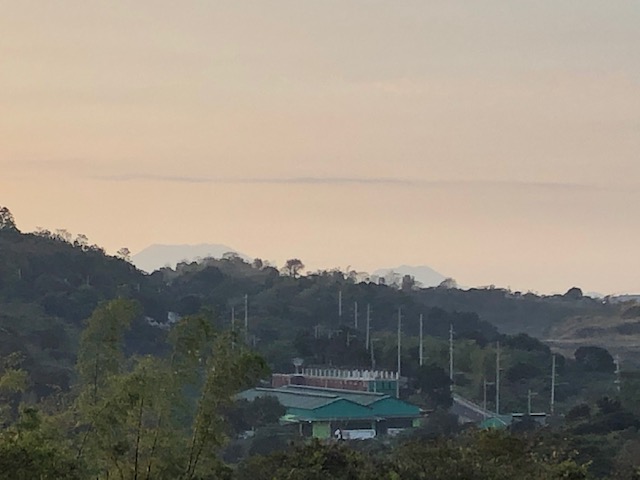
 Mt. Mariveles in Bataan Province with cloud cover serves as a background for the Metro Manila cityscape.
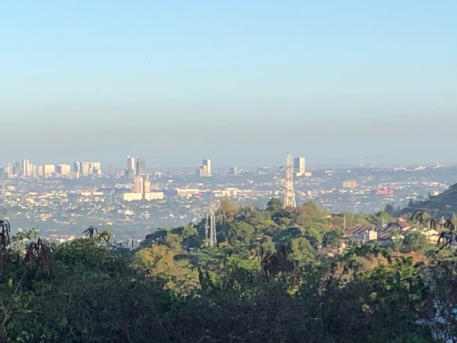 This is what Quezon City usually looks like with layers of smog making it difficult to ascertain any mountains that are visible on clear days.
I have photos of Mt. Natib, Mt. Malarayat and the Tagaytay Ridge that I will be posting here soon.
–
Kilometer Zero
Kilometer Zero for the Philippines’ national road network is located at Rizal Park in Manila. Many people still think that this is designated at the flag pole in front of the Rizal monument at the park. The marker for kilometer zero is actually just across from the flagpole with an elegant kilometer post clearly showing it as KM 0.
 The KM 0 post in front of the another monument on the Quirino Grandstand (west) side of Rizal Park. There are many other markers in the park other than those associated with Rizal and other heroes (e.g., Gomburza). There is also a bronze statue of St. Lorenzo Ruiz (the first Philippine saint) in the middle of the grounds across from the grandstand that was dedicated by Pope John Paul II to the Filipino people to celebrate the saint’s beatification in the early 1980s when John Paul II visited the Philippines for the first time.
 Some people thought that the flagpole in front of the Rizal monument in Manila’s Rizal Park is the marker for kilometer zero. The flagpole is shown in the photo above with the Manila Hotel in the background.
 The marker up close.
–
