
Home » Posts tagged 'Makati'
Tag Archives: Makati
Walking vs. cycling?
I remember an episode in an old series, The West Wing, where White House staff had to meet with various proponents of renewable energy. The very same proponents advocated for the RE they thought should get the most attention, and therefore funding support from the government. They ended up criticising each other’s advocacies, even pointing to the flaws of each and basically putting each other’s proposals down. The POTUS (ably played by Martin Sheen) had to intervene and scolded these people for working against each other rather than working together to push a common RE agenda.
This is pretty much where we are now with many proponents of sustainable transport initiatives. People and certain groups would advocate for walking, cycling, BRT, rail transit, etc. as if these are exclusive from one another. The results have often been haphazard facilities such as entire pedestrian facilities being painted and designated as bikeways and regular bus services being mislabeled as BRT. I have some friends who insist that cycling is the way to go simply because they cycle between their homes and workplaces, not fully understanding that this mode is not for everyone especially with the various issues in urban sprawl affecting our choices of residence. Clearly, what is good for one person is not necessarily applicable to everyone else, and that is why we should have options for travel or commuting. These options would have to be integrated, complementary, affordable and people and environment-friendly.
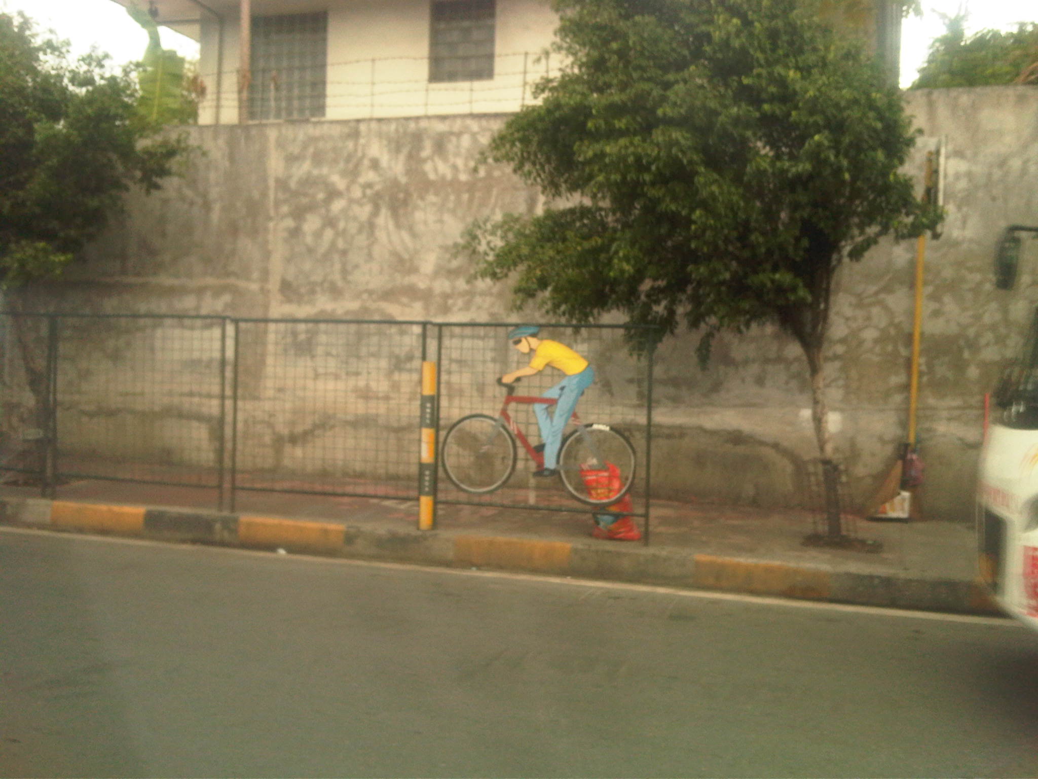
 The MMDA fenced off entire stretches of sidewalks and painted the pavement red to designate them as bikeways. This basically alienates pedestrians and while the wire mesh fence has its benefits from the perspective of safety, it also effectively constricts the space that cyclists and pedestrians have to share. Note also the trees and poles that pedestrians and cyclists would have to evade or risk injury.
 Along EDSA, the same treatment of fences and coloured pavements was applied ahead of Temple Drive/Corinthian Gardens. The space is just too constrained for sharing given the trees and poles and then you have the smoke belching buses adding to the misery of people using these facilities.
While there have been some quick wins for pedestrians and cyclists, it seems to me that many if not all do not seem to be as sustainable as we want them to be. Many cases are classic for their being “pwede na yan.” There is no innovation in design or no design involved at all much like what we typically see as best or good practices abroad. Marikina still has the best examples so far for integrated bikeway and walkway design though there are many examples of good pedestrian facilities around including those in Makati and Bonifacio Global City (I tend to resist saying Taguig because that city practically has no say in how BGC is developed.). Quezon City (along Commonwealth) had a little promise and the UP Diliman campus but perhaps that can be realised with the rise of a new CBD in the North Triangle area. Of course, we look forward to developments in Iloilo City what with the bikeways being constructed along the long Diversion Road. Still, I believe that there should be a conscious effort not just from the private sector but from government agencies, especially the DPWH, to come up with new designs and guidelines that LGUs could refer to. That agency so far has not measured up to the expectations of many for it to take a lead in revitalising our roads so that facilities can be truly inclusive and environment-friendly.
–
Criminality along congested roads
There’s been a rash of criminality along congested roads in Metro Manila. Recently, there have been reports of hold-ups and snatching along Circumferential Road 5 near its junction with Kalayaan Avenue. The suspects are said to be youngsters, teenage boys or even street-smart children, who roam the area and keeping an eye on opportunities for snatching among the hundreds of vehicles crawling along C5 during the peak periods. They look for unlocked doors of cars or taxis and in many cases team-up to confuse the driver and/or the passenger(s). In some instances where they can’t find unlocked doors they supposedly create opportunities by banging the body of the vehicle and goading the driver to step out of the vehicle.
 Vehicles at a standstill along C5 approaching the intersection with Kalayaan Ave – the center island is visible in the photo.
A few years ago, there was a feature on so-called “batang hamog” (roughly translated as children of the dew) opening doors of vehicles caught in traffic jams along EDSA. They snatch items like bags, cellphones or other items that they see through the vehicle’s windows as they loiter along the carriageway. CCTV footage from the MMDA show them to be quite quick in making their getaways. In some footage they are shown as climbing up the wall of the EDSA MRT, which is in the middle of EDSA, crossing the tracks and then climbing down on the other side, oblivious to the dangers of an oncoming train and the crash it might cause that could injure (even kill) many passengers.
A few weeks ago, a colleague and I saw some youths suspiciously scanning jeepneys caught in traffic near the Manila City Hall. My friend remarked that they might be searching for unwary passengers whom they can rob of their bags or jewelry. This modus operandi or mode of operation seems to be a favorite among snatchers in Metro Manila. I myself was almost a victim one time I was heading home on board a jeepney along Shaw Boulevard in Mandaluyong when a guy tried to make for my watch as the jeepney started to move. Fortunately, he failed as I reacted quickly and I saw a smirk on his face as our jeepney sped away.
Now, this kind of criminality is not something that our authorities cannot address. Surely, the Makati and Taguig police together with the MMDA can make a regular sweep of the length of C5 where these suspects are supposed to loiter given that the latter’s activities are quite predictable in time and modus operandi. It’s both frustrating and disappointing when officials make excuses on TV and radio interviews why they cannot catch or deter these criminals from harassing motorists and pedestrians. Hindi naman siguro talaga pwede magamit ang patrol car kapag ma-traffic at pinaka-epektibo ay magkaroon ng foot patrol sa lugar. They can have police and enforcers roam the same areas at the same times when there’s traffic congestion and therefore, a high likelihood that the suspects will be there.Those people aren’t supposed to be roaming the carriageway or loitering along the center island of C5 in the first place since to do that they would be jaywalking along a very busy road and risk being hit by a motor vehicle.
I believe police visibility is only effective if they are actually visible and when required, give chase of the suspects. The problem seems to be that the police and enforcers are usually just at the C5-Kalayaan intersection, focused on number-coding violators, and those who are supposed to be patrolling don’t want to leave the comfort of their vehicles. Surely again, we expect our law enforcers to be fit and ready to run after suspected criminals. After all, that’s what they are supposed to be doing in the first place. It would be nice to see them patrolling the area on foot and accosting people who are not supposed to be in the area.
–
Traffic congestion along Buendia (Gil Puyat Ave.)
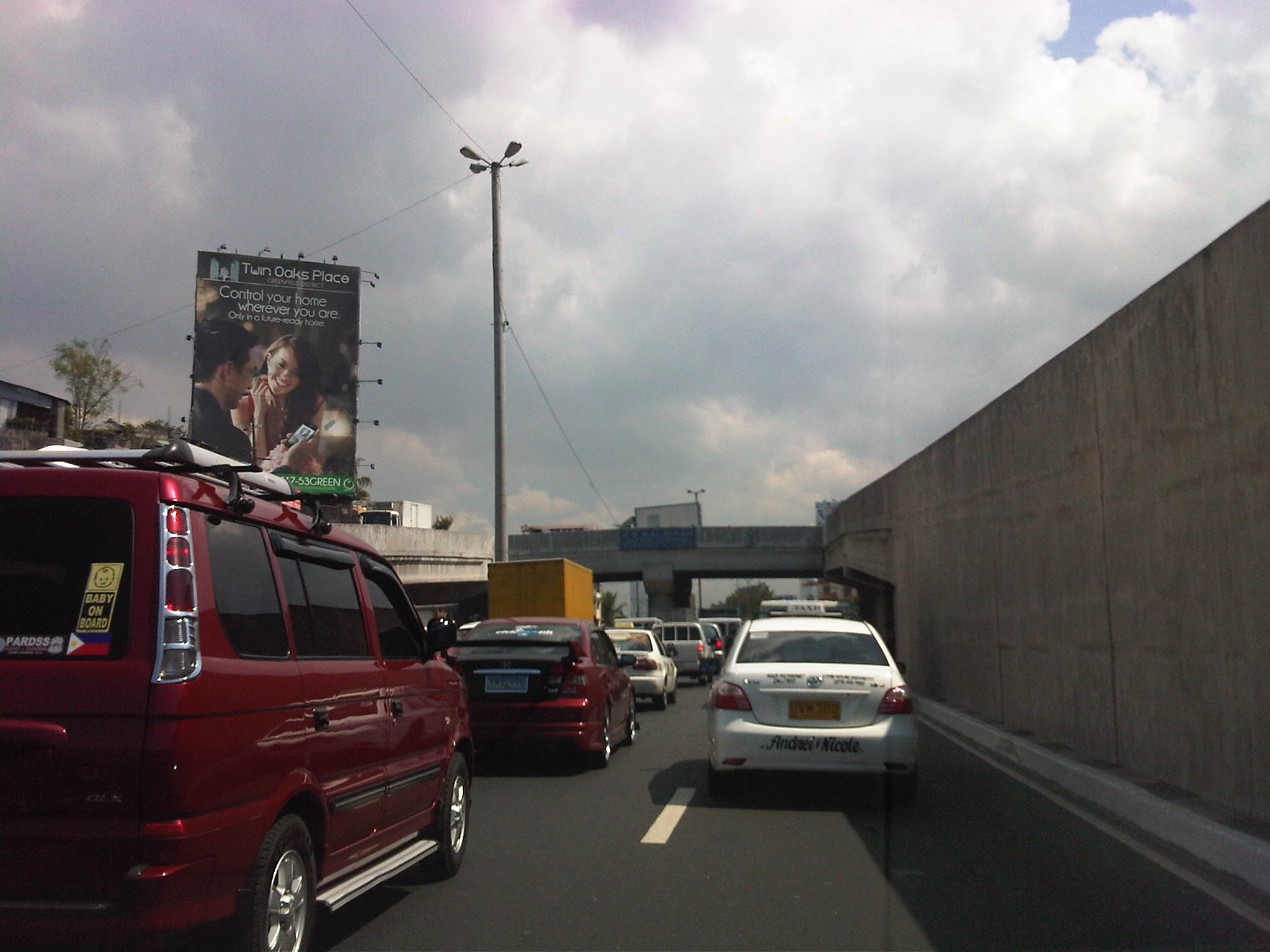
The Makati CBD generates a very high number of trips owing to it being arguably the largest CBD in Metro Manila in terms of offices and workers. There are several other CBDs like Manila, Ortigas, Cubao, Eastwood, Filinvest City, and Bonifacio but they generate less traffic compared to Makati. There are several major roads in the area including four intersecting roads that practically define the CBD. These are Ayala Avenue, Gil Puyat Avenue (formerly but still popularly known as Buendia Avenue), Makati Avenue and Paseo de Roxas. Both Gil Puyat and Ayala Avenue are lined with offices along either side and are often congested due to the vehicle traffic generated by the CBD. Following are a few photos of Buendia Ave.
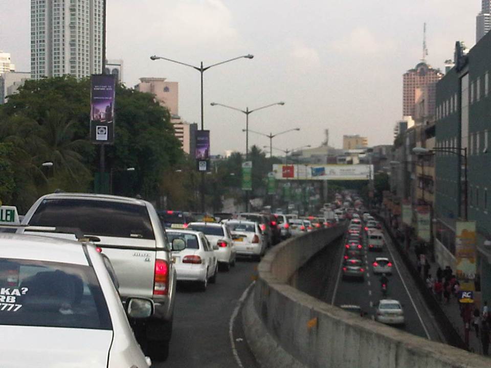 Traffic congestion along Gil Puyat Ave. as seen from the overpass from Kalayaan Ave. Even the sidewalk on the right side of the road is filled with pedestrians.
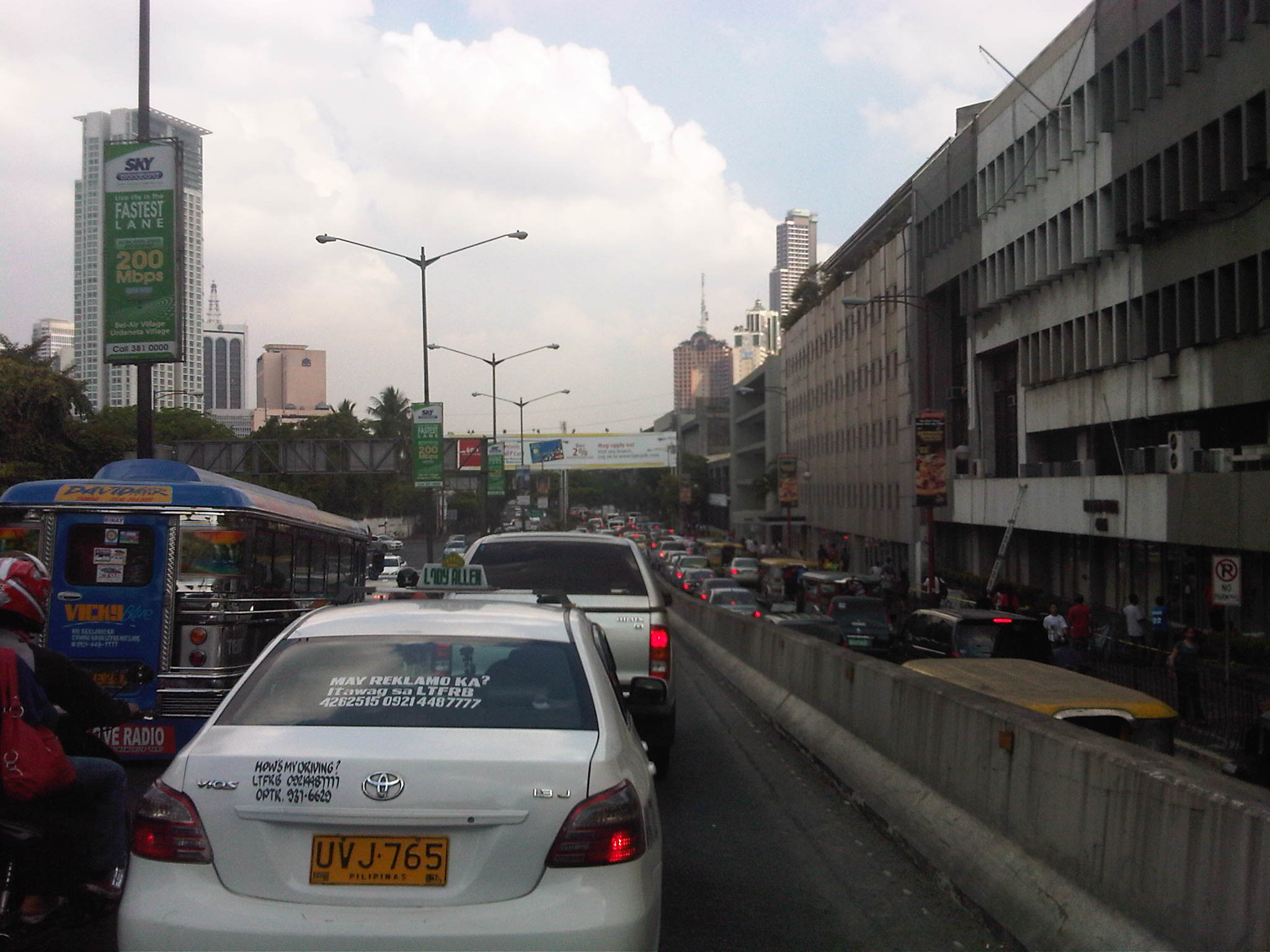
 One can see many people walking along the narrow sidewalk along Buendia. Some buildings have been renovated and refitted but many remain as they were in the last decade or more. The building in the center of the photo has so many air-conditioning units jutting outside the windows that it is quite obvious the units were an afterthought. Other buildings would likely have centralized or more strategically positioned air-conditioning units.
 Another look at the traffic jam along one of Makati’s main roads indicate a lengthy queue from the Buendia Ave.-Paseo De Roxas intersection. The junction is signalized but saturated during peak periods. I am not sure about the optimization of the signal settings but it should be synchronized with at least two other intersections: Buendia Ave.-Makati Ave. and Paseo de Roxas-Makati Ave.
The DPWH is proposing a grade separation project along Buendia that is supposed to alleviate congestion at the intersections with Paseo de Roxas and Makati Avenue. The plan is to have an underpass along the avenue that would allow vehicles to flow through and bypassing the two major intersections. At-grade would still be signalized intersections but minus substantial through traffic along Buendia. The downside of such a project, of course, would be the expected traffic congestion during the construction phase. With very limited alternate routes and restricted space (i.e., unlike the case of the Quezon Ave. underpass at Araneta Ave.), traffic management in the area will surely be a challenge for the combined forces of Makati and MMDA traffic enforcers.
–
Night time congestion along C-5
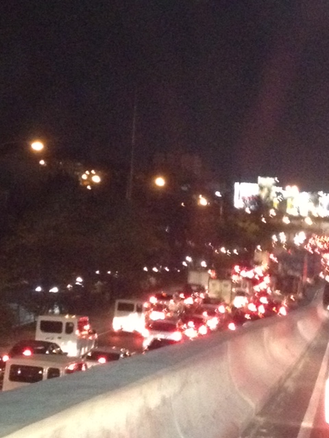
Traffic congestion along Circumferential Road 5 is experienced practically throughout the day with the worst congestion along the southbound direction during the mornings between the Riverbanks Road in Quezon City and Kalayaan Avenue in Makati City, and the northbound direction between Bonifacio Global City and Eastwood from noon to nighttime. The following photos taken by my wife as I fetched her one night from her office shows the traffic jam along C-5 as we turned from the flyover past Market! Market! towards the highway.
Congestion along the C-5 northbound is a regular thing during the weekdays from the afternoon to late at night. While apps like the MMDA’s Traffic Navigator and Waze allow us to have an idea of how congested C-5 is during such periods, the actual experience is much worse than what many of us can just imagine from the apps.
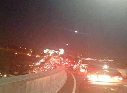 As far as the eye could see – congestion in the form of the taillights of vehicles along the northbound side of C-5 indicate just how many people are caught in traffic from Taguig all the way to Pasig and beyond. The giant billboards from Kalayaan Avenue to Pasig Boulevard including those seen along the bridge crossing the Pasig River. Most of these people are office workers coming from Makati and Global City and heading home to Quezon City, Pasig, and the towns of Rizal. After 7 PM, trucks add to the traffic
Many people are asking if there is a solution in sight for congestion along C-5. To be frank, there is none in the immediate future. There are proposals to introduce a public transport system along the corridor with one option being a Bus Rapid Transit (BRT) and another an elevated rail transit line. The BRT line is a recommendation of a Pre-FS for Metro Manila BRT conducted around 6 years ago though there was a proposal for a bus system (Philtrak) along the same corridor back in the late 80’s and pursued for some time during the 90’s. Not much have been done towards realizing any of these proposals. An efficient mass transit system along the corridor could encourage people to shift from private to public transport and help reduce vehicular traffic along C-5 considering that even as I write this post, vehicle ownership is increasing in Metro Manila and its environs and this could only mean more congestion along C-5 and other roads.
–
Daily penance: traffic congestion along C-5
People have been telling me about the traffic congestion along Circumferential Road 5 (C-5) and I am quick to reply that I know the feeling as I’m one of those who have driven or traveled along C-5 and experienced first hand the traffic congestion, which is worst during the mornings (southbound) and late afternoons and evenings (northbound). Midday traffic jams are not uncommon as C-5 is a truck route and large vehicles contribute to clogging especially at bottlenecks like the U-turns slots along the highway and bridge crossing the Pasig River. C-5 has been this way since its opening (or more appropriately the completion of missing links along the main alignment).
It will not get better. It will only get worse. I say so because of the annual increase in vehicle ownership, including motorcycles, in what is now termed as Mega Manila. I dare say so because of the backlog of public transport infrastructure in the metropolis (or megalopolis?). It is well established that efficient public transport infra and services are good incentives for people to commute rather than drive. This means there will be less vehicles on the road and therefore there will be less congestion as basically only those who really need to drive would be using their cars on a regular basis. Of course, it is not as easy at it seems considering trip making and mode choices are in reality complicated matters. But then the availability of viable, acceptable choices for travel, especially in the urban setting allows for people to have better mobility and more equitable use of the transport system than a car-oriented city. Until then, when we do have the public transport system that our cities require, it will be a daily penitensya for many of us traveling and not just along C-5.
 Congestion along the southbound side of C-5 approaching the flyover crossing Ortigas Ave. The flyover can be seen in the horizon.
 Congestion along C-5 southbound in the Bo. Ugong area approaching the junction with Lanuza Avenue. An overpass was proposed for construction along this section but now it doesn’t look like it will do any good considering the bottleneck is the Pasig Flyover and the bridge across Pasig River.
 Congestion along C-5 southbound at the Pasig flyover. The flyover has 2 lanes per direction and vehicle breakdowns or road crashes have resulted in terrible traffic jams.
 Congestion along C-5 northbound at the C-5/Kalayaan junction. The north U-turn flyover, one of two in the area, is shown in the photo. An underpass was initially proposed, designed and approved (with budget from a JBIC loan) at the junction. A previous MMDA Chair, however, didn’t agree and successfully maneuvered for the twin U-turn flyovers to be constructed instead.
–
