
Home » Posts tagged 'Marikina' (Page 3)
Tag Archives: Marikina
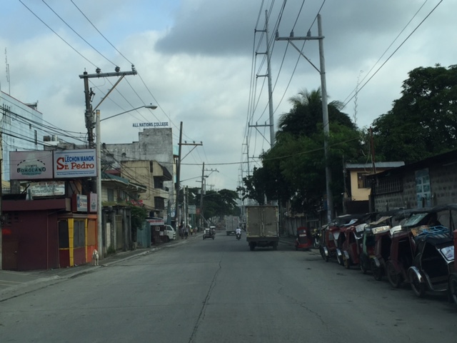
Road and drainage works along Soliven Avenue, Antipolo City
Traffic has been quite terrible for people living along the Marcos Highway corridor and it doesn’t help that one option via Marikina is also currently congested. I am talking about the stretch of Sumulong Highway between Masinag and Soliven Avenue, which is currently being rehabilitated with drainage and pavement works. The work seems to be progressing but not as fast as most commuters would want it to be. Complicating things are more serious road and drainage works along the Antipolo section of Soliven Avenue. This has rendered the street to become one-way and from what I have seen, work here is proceeding much more slowly (perhaps excruciatingly for those residing or working along this stretch). Following are photos I took of Soliven Avenue from the intersection with Sumulong Highway to the border with Marikina City where Soliven Ave. becomes Lilac Street. I won’t put any labels anymore and let the photos speak for themselves.
 1
1  2
2  3
3  4
4  5
5  6
6  7
7  8
8  9
9
Hopefully, these road and drainage works can be completed very soon and would allow for the alleviation of traffic along these roads and the alternate route between Antipolo and Quezon City via Marikina. Such will also help ease congestion along Marcos Highway.
–
Is Antipolo ripe for high capacity and premium transit services?
About 5 years ago, I wrote about transport in Antipolo in another blog. The article was more about this old city being a major destination attracting people for pilgrimage (Shrine of Our Lady of Peace and Good Voyage) and tourism (e.g., Hinulugang Taktak). I am quoting from that article from 5 years ago and adding a few comments here and there. Note that for most of the article, nothing much has changed except perhaps that the Line 2 extension from Santolan to Masinag is now underway.
“There are now many ways from Metro Manila and its neighboring provinces to Antipolo, although several of these eventually merge into three main roads en route to the Shrine. One is via the old route along Ortigas Avenue, a second is the route via Sumulong Highway, and the third is through a “back door” via the Antipolo-Teresa Road. Routes from the general areas of Manila, Makati, Pasig, Mandaluyong, Taguig and the southern cities of Metro Manila and towns from Laguna, Batangas and Cavite will most likely merge to Ortigas Avenue. Meanwhile, people coming from Quezon City, Caloocan, Marikina, Bulacan, Pampanga and the northern Rizal towns of San Mateo and Rodriguez (Montalban) will likely converge along Sumulong Highway. Meanwhile, those coming from the east including the Rizal towns like Tanay, Teresa, Morong, and Jala-jala, the Laguna towns like Paete, Pakil, Pangil, the Quezon towns of Luisiana, Lucban, Infanta and General Nakar, and others will most likely take the Antipolo-Teresa Road that climbs from the east of Antipolo. People from Marikina, Cainta and Pasig generally may take either the Ortigas or the Marcos Highway/Sumulong Highway route.”
I didn’t mention there that another backdoor was via Marcos Highway if one were coming directly from Tanay instead of through Teresa. This route is now popular and traffic has been steadily increasing due in part to some additional attractions in that part of Antipolo and Tanay.
“Public transport to Antipolo these days include mostly jeepneys as the city is the end point of many routes – a testament to its importance even as a reference point for public transportation. One can easily spot the Antipolo-Cubao jeepneys in the Araneta Center in the Cubao business district in Quezon City. There are two lines, one via Cainta Junction (where jeepneys eventually turn to Ortigas Avenue) and another via Marcos Highway, turning at the Masinag Junction towards Sumulong Highway). Another terminal is at the EDSA Central near the Ortigas Center in Mandaluyong where Antipolo-Crossing jeepneys are queued. And still there is another, albeit somewhat informal terminal near Jose Rizal University (JRU, which was formerly a college and hence the old JRC endpoint), which passes through Shaw Boulevard, Meralco Avenue and eventually turns towards Ortigas Avenue. Other jeepneys from the Rizal towns all have routes ending in Antipolo Simbahan, referring to the shrine.”
There are also UV Express and shuttle vans (legitimate vans for hire or colorum operations) offering express trips between Antipolo and the same end points of Cubao or Crossing. Others go all the way to Makati in the Ayala financial district. These evolved out of the Tamaraw FX taxis that started charging fixed fares during the 1990’s and competed directly with the jeepneys. These are popular, however, with office employees and students during weekdays and the nature of their ownership and operations do make them serious competitors to the jeepneys even during the merry month of May (fiesta period) and the Lenten Holy Week.
“There was an Antipolo Bus Line before. These were the red buses that plied routes between Antipolo and Divisoria in Manila. These died out sometime between the late 80’s and the early 90’s probably due to decreasing profitability and likely because of its competition with the jeepneys. That bus company, along with the green-colored G-Liners, the red EMBCs (Eastern Metropolitan Bus Co.) and CERTs, and the blue Metro Manila Transit Corp. buses used to form a formidable mass transport system for Rizal and the eastern towns of Metro Manila. There were even mini-buses (one I recall were the Antipolo “baby” buses and those that plied routes betwen Binangonan and Recto with the cassette tapes stacked along the bus dashboard). Most of these, except the G-Liners eventually succumbed to the jeepneys.”
At present, there is another bus company operating along Ortigas Ave and the Manila East Road – RRCG. There is also a revival of the EMBC with buses providing transport services between Quiapo and Tanay. The only other bus is the inter-provincial Raymond Transit, which operates between Crossing, Mandaluyong and Infanta, Quezon via Antipolo, Teresa, Morong and Tanay.
“In the future, perhaps the jeepneys should give way to buses as the latter will provide a higher level and quality of service along Ortigas Avenue and Marcos and Sumulong Highways. Already in the drawing boards is a plan to ultimately extend LRT Line 2, which currently terminates at Santolan, Pasig, to Masinag Junction and then have a branch climb along Sumulong Highway and terminate near the shrine. This will bring back the trains to Antipolo and would surely make the church and the city very accessible to people. I look forward to these developments both in my capacity as a transportation researcher-engineer and a Catholic who also visits the Shrine to pray for safe travel for loved ones and myself.”
This proposition for rationalizing public transport to/from Antipolo and other towns of Rizal plus Marikina is all the more important as the Line 2 extension from Santolan, Pasig to Masinag, Antipolo is currently underway. There is an opportunity here to upgrade public transport following the hierarchy of transport modes. I have noticed, for example, electric and conventional tricycles providing what are basically feeder services but along Marcos Highway between Cogeo and Masinag. And a lot of people have been stranded or have difficulty getting a jeepney or UV express ride along the Marcos Highway corridor. I am aware that the DOTC in the previous administration was mulling an express bus service through Marcos and Sumulong Highways terminating and turning around at Robinsons Place Antipolo. That, of course, never happened but is something that I think is worthwhile and would be beneficial to a lot of commuters.
–
Line 2 to be transformed into a BRT? Definitely not a good idea!
There are news reports stating that the Department of Transportation (DoTr) is considering replacing the LRT Line 2 with a BRT instead. I think this is not something worth considering at this point since the construction of the Line 2 extension from Santolan to Masinag is already underway. Also, there is the fact that Line 2 is the only heavy rail system among the three LRT/MRT lines in Metro Manila. It has the potential to have the highest capacity among the three as well as the potential to have the highest ridership especially after the extension is complete and the two additional stations are operational.
With lots of people requiring public transport beyond Masinag, the question is not whether to convert Line 2 into a BRT but instead what services can be provided for a more efficient system for Rizal and Marikina. I took the following photos along my commute from Antipolo to Quezon City. Note the number of people waiting for public transport along Marcos Highway.

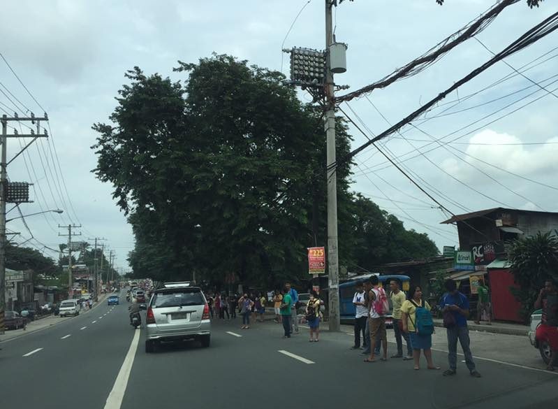
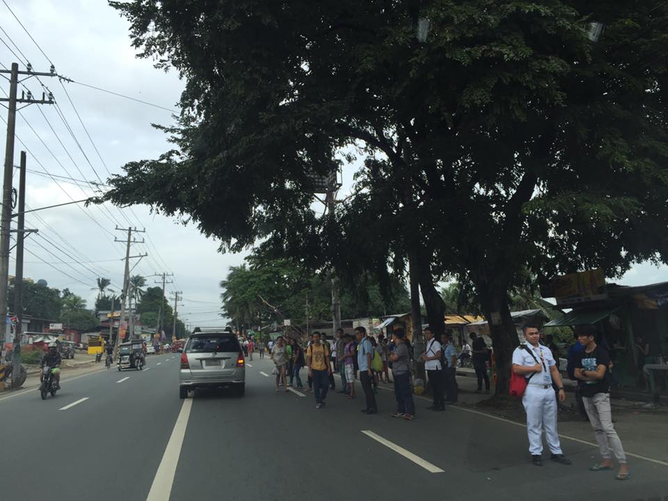

These are people who would typically take jeepneys or UV Express for their commutes. It is obvious from my regular observations that jeepneys and UV Express cannot cover the demand for public transportation and my opinion is that it is high time to introduce a higher capacity and more efficient mode in order to encourage people to keep taking public transport and to encourage those taking private transport to shift to PT.
A BRT service can be connected to Line 2. Since the Line 2 extension to Masinag is scheduled to be completed next year and be operational by third quarter of 2017, a bus service can already be piloted between Santolan and several end points. Four for consideration would be Cogeo, Antipolo Simbahan, Marikina and Cainta.
- Cogeo should be a no-brainer given that there is already demand there and this is growing rapidly with all the subdivisions being developed in this area.
- For Antipolo Simbahan, perhaps the final stop need not be at the shrine but at Robinsons Antipolo.
- For Marikina, there can be three lines – one branching from Ligaya where there is a major Ayala development, a second at Gil Fernando and another at Masinag. These may terminate at the city center, perhaps in the vicinity of the Rodriguez Sports Complex, which is near the Marikina City Hall and public market.
- The last line could traverse Felix Avenue (Imelda Avenue) and may terminate at Cainta Junction where commuters can transfer to transport along Ortigas Avenue Extension.
Surely, pilot services can be provided where limited stops or express services can be experimented on to see what clicks in terms of ridership. It would be nice to get feedback about such services and hopefully there will be champions for these bus services. Note that such services terminating at Santolan means that there should be terminal facilities in that area. Former MMDA Chair and now Marikina Congressman Bayani Fernando has developed an area precisely for an eastern transport terminal and so bus services present a good opportunity for this terminal to be a busy one. Maybe BF can champion these bus services? And perhaps the Antipolo and Cainta (paging Mayors Ynares and Nieto!) can also push for these services as commuters from these would stand to benefit the most from a good transport system.
–
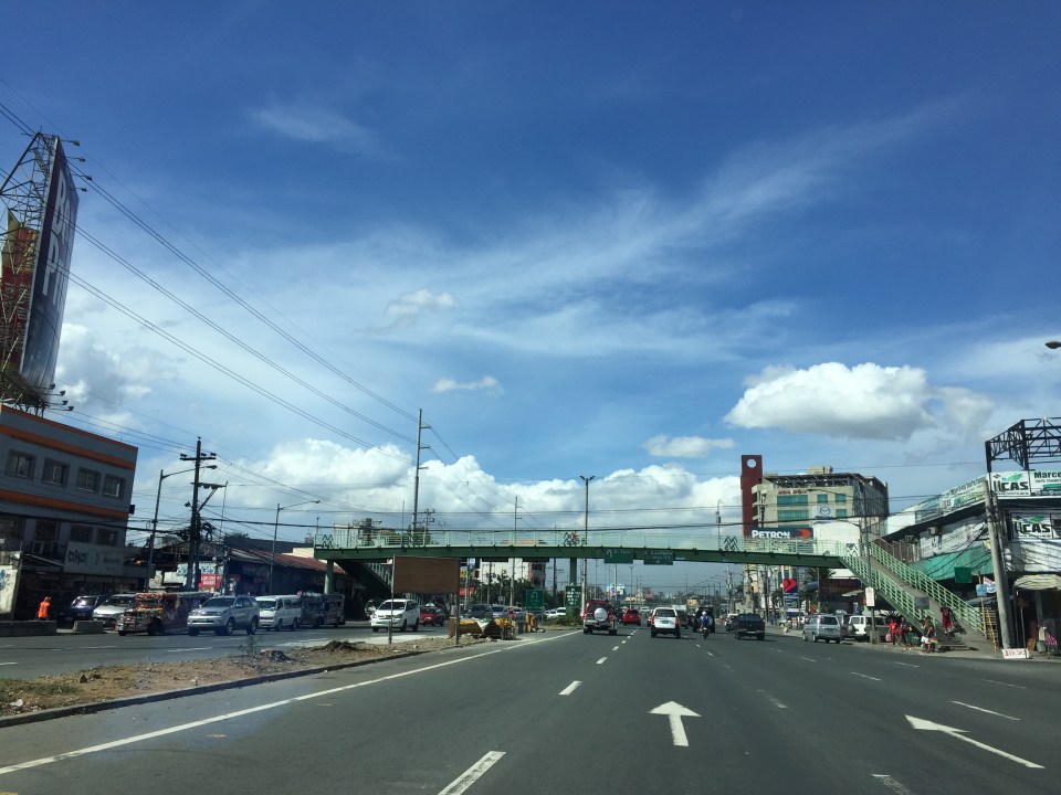
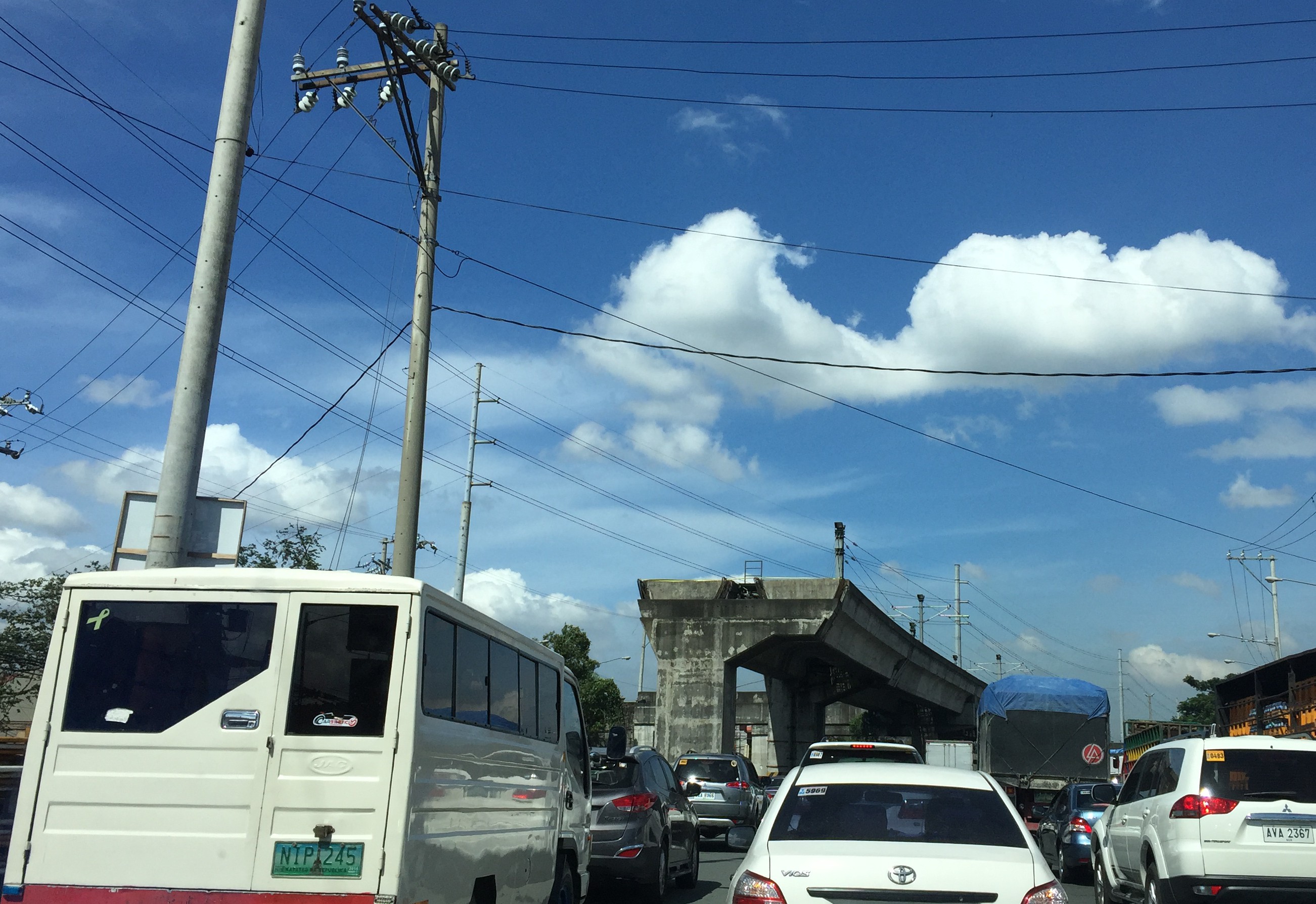
Eastern transport terminal in Marikina City
I noticed the roadworks near SM Marikina beneath the Marcos Highway Bridge. These are part of what is being developed as an Eastern Transport Terminal. Although there is a sign there announcing the location as a terminal it is more a garage for UV Express vehicles and jeepneys that eventually proceed to the LRT Line 2 Santolan Station to get passengers.
The terminal is a pet project of former Metro Manila Development Authority (MMDA) Chair Bayani Fernando or BF. His company’s and his name is on a couple of signs proclaiming he gets it done. BF is now a newly minted congressman, having won the seat for the First District of Marikina City. In an upset of sorts, the former congressman who vacated this seat (after the maximum 3 terms), Marcelino ‘Marcy’ Teodoro, defeated incumbent mayor Del De Guzman who was running for a 3rd and final term. The development of the terminal actual started during BF’s stint as MMDA Chair where he conceptualized a terminal near SM Marikina and Santolan Station. Unfortunately, it did not materialize as he had planned with Typhoon Ondoy (Ketsana) flooding the area (and devastating much of Metro Manila and neighboring areas) and BF eventually exiting the MMDA to run for Vice President the following year.
The terminal will probably be completed but there are currently few public transport including provincial routes terminating at Santolan. Most jeepneys, for example, are bound for Cubao with the opposite trip ends in various towns of Rizal. Eastbound buses do not pass through Marcos Highway but instead take the older route through Ortigas Avenue and Antipolo and Teresa. It would take some effort to re-route these or perhaps there can be new routes via Marcos Highway? Provincial routes to the north and south are currently concentrated in Pasay, Cubao and Manila. It makes sense to decongest Cubao and have some buses have their terminal instead at Marikina. However, that means loading Aurora Boulevard, C5 and perhaps the FVR Road (Riverbanks) with additional bus traffic. Those impacts need to be evaluated and I am sure countermeasures can be developed for this transport terminal to work.
–
Towards safer roads: design, respect and education
Fatal crashes involving cyclists have been posted in social media including a recent one involving a mother of two who was run over by a garbage truck that encroached on the on-street/painted bike lane in, of all places, Marikina City. Emphasis on Marikina is made here because it is a city well-known for its comprehensive bikeways network. The network is comprised of segregated and on-street bikeways.
Following are some photos showing examples of good and bad practices pertaining to bikeways design in the Philippines:

Example of segregated bikeway at the University of the Philippines Diliman campus. Cyclists actually share the carriageway lane allocated from the Academic Oval with pedestrians and joggers. They are not physically protected from motor vehicles that can encroach on the bike lane.

Example of segregated and protected bikeway along Marcos Highway in Pasig City (similar design for the sections in Marikina, Cainta and Antipolo) – bikeway is on the sidewalk and cyclists essentially share space with pedestrians despite delineations.

Example of segregated and protected bikeway/walkway along EDSA in Makati City – note that space to be shared by pedestrians and cyclists is very constricted.

Example of poor design along White Plain Avenue – the MMDA seems to have designated the entire sidewalk space for cyclists.
Three examples from Marikina’s bikeways are shown below:
 Painted, segregated bikeways on the carriageway on either side of a two-way road [Note: This is basically the design along the street where the crash in Marikina occurred.]
 Painted, segregated bikeways on the carriageway along a one way road
 Segregated and protected bikeway off the carriageway along Sumulong Highway
Granted that the ideal set-up would have segregated or protected bikeways that are designed properly, we take a look at two other very important elements that are not at all as technical as design and planning of bikeways – respect and education.
Education is an important aspect of driving. Many Filipino drivers are poorly educated in terms of traffic rules and regulations, road design as well as local policies pertaining to transport and traffic. As such, there is a tendency for many drivers to disregard rules and drive/ride aggressively and recklessly. This must change and it starts with reforms in the way licenses are issued to all types of drivers including perhaps stricter certification systems for truck drivers and public utility vehicle drivers. Traffic education should also be integrated into the academic curricula of schools starting at a very young age. Road safety parks are one way to promote traffic education for kids.
Respect is partly derived from education but is also related to attitude. No matter how much driver or road user education or skill you get if you have a bad attitude, you will still have the tendency to be reckless or irresponsible with your actions on the road. One way to curb bad attitudes on the road and to educate road users (particularly errant drivers and riders) is strict traffic enforcement. Many cities already have CCTVs installed at major intersections that allow law enforcement units to be able to monitor traffic behavior and perhaps zoom in to determine driver and vehicle information including license plate numbers.
The crash that killed the single parent in Marikina is not so much as an issue one whether we need segregated and protected bikeways but is more an urgent need to assess the state of traffic education and enforcement in this country.
–
Articles on the crash and calls for reforms may be found in this link.
Updates on the LRT 2 Extension – no more trees!
It’s been a while since I last passed by along Marcos Highway. This morning, I was a bit surprised by what I saw (or perhaps, more appropriately, what I didn’t see). The median along the section between Imelda Avenue all the way to Santolan has been cleared of trees. This was already expected as the contractor was already clearing the median for the past weeks. The work entailed fencing off the inner lanes of Marcos Highway and has caused congestion with the highway’s capacity significantly reduced and many motorists slowing down to observe what was going on (usyoso). Following are a few photos of Marcos Highway taken this morning.
 DMCI removed the barriers securing the inner 2 lanes to reveal a median clear of trees. The median will be where the columns for the elevated LRT Line 2 extension to Masinag will be constructed.
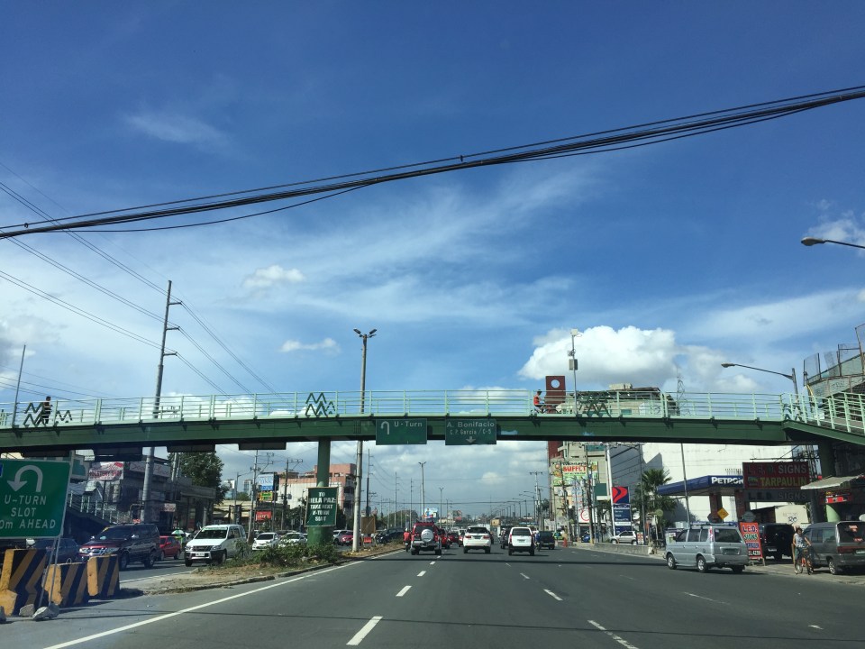 I wonder what will become of the pedestrian overpasses along Marcos Highway. These structures would have to be redesigned with respect to the elevated structure of the LRT Line 2.
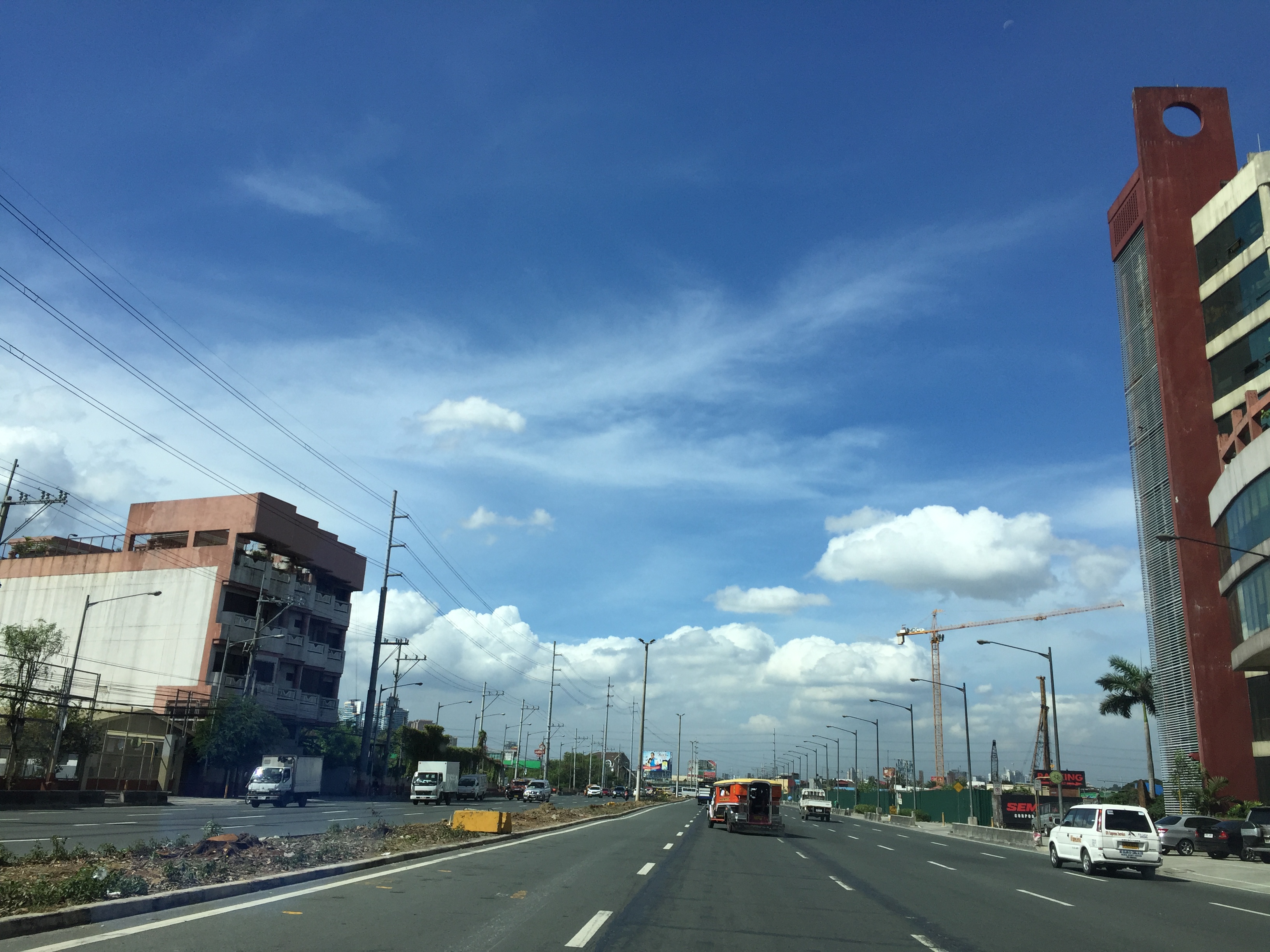 Here’s the conspicuously clear median along Marcos Highway approaching Ligaya. The Ayala development can be seen on the right side along the Quezon City bound side of the highway.
 Waiting – Line 2 currently terminates just after Santolan Station where trains make the switch for the return journey.
–
Trip cutting with respect to the LRT Line 2
Trip cutting is one of the undesirable behaviors of public utility vehicle drivers. It is most common with jeepneys and UV Express than with buses.
The findings of the study completed by our students last June 2015 are the following:
- It was proven that trip-cutting behavior is a common practice by both jeepney and UV Express drivers with routes along Marcos Highway and Aurora Boulevard, covering parts of Pasig City, Marikina City and Quezon City.
- The underlying factors involving trip-cutting behavior by PUV drivers were found to be the following:
- Jeepneys and UV Express unload most of their passengrs during peak hours at the LRT Santolan and Katipunan Stations – there was a higher likelihood for passengers to ride the Line 2 from these stations to their destinations including Cubao and the University belt. A lot of passengers are students and trying to keep their schedules. Road transport can be very unpredictable and the trains offer more reliable travel times.
- Drivers can maximize profit by having shorter trips and at the same time having passengers at full capacity – jeepney and UV express drivers unloading most of their passengers at the stations and turning around there (i.e., cutting their trips) means they avoid the congestion along Aurora Boulevard and faster turnarounds translate to their being able to carry more passengers thereby earning more revenues.
- It was observed that the top trip-cutting routes for PUVs along Marcos Highway and Aurora Boulevard are as follows:
- For jeepney vehicles:
- Cogeo – Cubao and Antipolo – Cubao routes in relation to the LRT Santolan Station;
- Calumpang – Cubao and SSS Village – Cubao routes in relation to the LRT Katipunan Station.
- For UV Express vehicles:
- SSS Village – Cubao and Cogeo – Cubao routes in relation to the LRT Santolan Station;
- Marikina – Cubao and Rodriguez/Montalban – Cubao routes in relation to the LRT Katipunan Station.
- For jeepney vehicles:
The following recommendations were made in relation to the findings of the study:
- Route modification of top trip-cutting routes to take into account the realities with respect to the current demand.
- Study on supply of PUVs with respect to the Cubao terminal station in relation to trip-cutting violations.
- In the future, when the construction of the LRT Line 2’s Masinag and Emerald stations is completed, it is recommend to that further route modifications be made relative to these new stations.
Such studies are important especially in light of the construction of railway lines including this case of the extension of Line 2 from Santolan, Pasig to Masinag, Antipolo. There is an opportunity here for the rationalization of jeepney routes to complement the obviously higher capacity and more efficient trains of Line 2. Rationalization here translates to the shortening of jeepney routes with many units terminating at Line 2 stations. ‘Cogeo-Cubao’ jeepneys would become Cogeo-Masinag jeepneys while ‘Antipolo-Cubao’ jeepneys will become either ‘Antipolo-Masinag’ or ‘Antipolo-Emerald’ jeepneys. A Masinag route end would apply to ‘Antipolo-Cubao via Sumulong Highway’ jeepneys while the Emerald route end would apply to ‘Antipoli-Cubao via Junction’ PUJs. Such will reduce the travel distances covered by the jeepneys as well as reduce their travel and turnaround times. Also, such a rationalization will lead to a better structured public transport system following a hierarchy among modes.
–
Let’s revisit the Marikina Bikeways
Calls for more walkable and bicycle-friendly cities and a lack of local data for these modes of transport got me thinking about Marikina. The city has its own bikeways office, the Marikina City Bikeways Office (MCBO), that was under City Planning and Development Office but borrowed staff from other offices of the city. The MCBO has gone through many challenges since the time of Bayani Fernando, who instituted the office, and his wife Ma. Lourdes under whose terms the office was downgraded. I’ve learned that the office has been strengthened recently and is implementing a few programs to promote cycling especially among school children. I wonder, though, if Marikina has been collecting and keeping tabs on cycling related data. I recall that during the conduct of the study for the Marikina bikeways network, it was established that there was a dearth of data on cycling and data collected pointed to cyclists primarily comprised of workers in factories or construction sites in the city and neighbouring areas. These are the regular commuters using bicycles instead of motorised vehicles. It would be nice to see if these increased in numbers (observations along major roads like Sumulong Highway seems to support the increase) and if there have also been shifts to motorcycles as the latter became more affordable in recent years. Enforcement is still an issue with regards to the bikeways as not all paths are segregated. As such, those lanes painted on the roads are more susceptible to encroachment by motorised vehicles. Still, Marikina is a very good example of realising people-friendly infrastructure and many LGUs could learn from the city’s experiences with the bikeways.
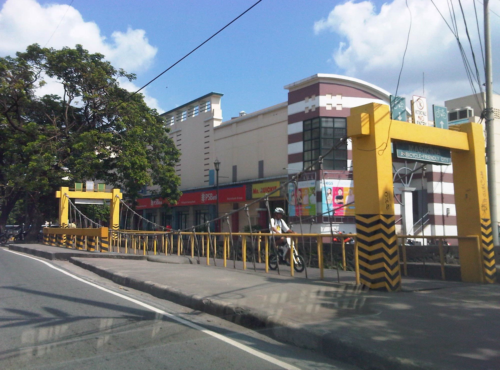 A bicycle bridge along Sumulong Highway in Marikina City
Recently, some students consulted about designing bikeways in other cities as well as in a bike sharing program being planned for the University of the Philippines Diliman campus. These are good indicators of the interest in cycling that includes what discussions on the design of cycling facilities and programs intended to promote bicycle use especially among young people. We strongly recommended for them to check out Marikina to see the variety of treatments for bikeways as well as the examples for ordinances that support and promote cycling.
–
Flooded roads and some thoughts on flooding
I’ve always said that transport and traffic problems will always take a back seat to flooding. Traffic also takes a back seat to floods in this post. Issues like congestion and terrible public transport services are experienced by many everyday but basically do not stop people from their routines. Floods on the other hand are a major inconvenience that makes things like congestion or getting a ride during the rush hours much worse. Floods also have a way of making things stop as people cannot go to work and students cannot go to school. It seems that whenever there are floods, everything grinds to a halt and productivity takes a dive. Such losses, of course, are in addition to the cost of damages directly brought about by the floods.
The following photo was taken by a staff of our office who was going around near his home. Fortunately, their place was not flooded so that afforded him time to go around and take some photos of the swollen Marikina River along Marcos Highway in the Pasig-Marikina border.
 Marcos Highway Bridge over a swollen Marikina River – not visible in the photo is the road leading to FVR Road and C-5, which is usually subject to flooding. The tall building in the background is SMDC’s Blue condominium along Katipunan Avenue. [Photo credit: Roy Velasco, NCTS, September 2014]
These extreme floods have been happening more frequently lately. I think these extreme rain events brought about by typhoons or monsoons are the norm now and we should be more prepared than ever in dealing with such heavy rainfall. Flooding can be alleviated if not eliminated and the experiences of some flood-prone LGUs can help us in determining suitable approaches to alleviate the problem and mitigate its impacts.
The philosophy applied by previous administrations of Marikina City did not have the objective of eliminating flooding. That was too expensive for a growing city that needed to put resources to other aspects or areas of development. The main objective was to alleviate flooding; mainly to reduce the depth as well as the duration of flooding. That is, instead of having waste-deep waters, perhaps knee-deep would be more tolerable. And instead of having to deal with flooded homes or streets over a day or more, half a day would make life better for people affected. The key was to address issues that led to severe flooding. Such issues include poor drainage stemming from inadequate maintenance of facilities and the still tremendous amounts of garbage irresponsibly disposed off by people, especially those living near waterways.
Marikina, Antipolo and Cainta at least should consider building retention basins in order to mitigate serious flooding. A lot of waterways were lost as residential subdivisions were developed and developers responsible for these should bear part of the burden by doing their part (e.g., identifying and turning over or donating lands than can serve as sites for the basins) in helping alleviate flooding. One friend pointed out that the critical time for flooding would be when rains are heaviest (e.g., last Thursday to Friday for Mario or the 6 hours of extreme rains by Ondoy in 2009). Basins should be designed so they can accommodate waters from the rains during the critical period so that instead of neck-deep floods, perhaps there will only be knee-deep or waist-deep waters. Yes, there will still be floods but they will be more tolerable and perhaps faster to dissipate than when you don’t have the basins to mitigate such events. There will be significant costs for such facilities but then the costs surely don’t compare to the annual losses that can be attributed to flooding and relocating whole communities definitely is much more costly and is not an option for those in the Marikina Valley and other food prone areas. Floods have been issues for many LGUs during elections and whoever can come up with a good plan to alleviate flooding will surely win a lot of votes.
–
Another killer highway: Marcos Highway
Marcos Highway, stretches from the Marikina River at Santolan, Pasig to the Sierra Madre Mountains of Antipolo and Tanay in Rizal Province. It is one of the major thoroughfares connecting the towns of Rizal with Metro Manila with traffic already comparable to if not exceeding the volumes along Ortigas Avenue. It is wider that Ortigas Avenue for the sections along the more populated areas (i.e., Pasig, Marikina, Cainta and Antipolo) and connects to other major roads like Amang Rodriguez, Imelda/Felix Ave., Angel Tuazon, and Sumulong Highway. Widening of the highway is currently underway between Masinag Junction (Marcos-Sumulong intersection) and Cogeo. The increasing traffic volume seems to have also led to an increase in the incidence of road crashes. The past few days saw two fatal crashes along the highway – one near Masinag and another at the Filinvest East main gate.
The wife was able to take a couple of photos of the overturned truck and one of the vehicles it hit as the driver lost control of the truck. The area at the main gate of a large residential subdivision in Antipolo/Cainta usually has a lot of people due to the subdivision, the school beside it (shown in the photo) and the commercial and other residential developments beside and across from it.
 A wayward truck lies on its side at the exit of Filinvest East along Marcos Highway just a few meters from a jeepney stop and a school.
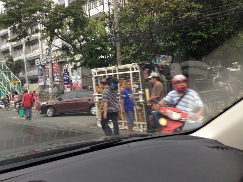 The truck with one of the vehicles (brown sedan) it hit before turning on its side.
I travel along Marcos Highway almost everyday and notice that there are many (and likely increasing numbers) of aggressive public transport (e.g., patok jeepneys) and truck drivers. Many of these people operating the vehicles are definitely not qualified to drive public utility vehicles based on their behavior on the road. Then there are also the motorcycle riders many of whom weave along the highway, often cutting in the path of other vehicles. Many split the lanes during congested periods and who knows how many vehicles have been damaged by motorcycle riders bumping or sideswiping into them. Many have back riders (riding in tandem?) including children. There are also what looks like entire families riding a single motorcycle with children often not having any protection (usually they are sandwiched between parents). I can only wonder how safe the riders think they are and if they thought about risking the lives of their loved ones before each journey.
A friend mentioned that there are regular drag races along Marcos Highway during the wee hours of the morning when the volume of traffic is at its lowest during the day. This goes on despite the police checkpoints along the highway. Are they turning a blind eye to these races? Or are they also involved somehow?
Perhaps the LGUs along Marcos Highway should work together to arrest the trend of increasing road crashes. Even the Provincial Government of Rizal should have a say in ensuring safe travel along this arterial as many of its constituents use the road every day. This is a very urgent matter that needs to be addressed in order to prevent the incidence of more crashes in the future. Simple observations of traffic along Marcos Highway show that there are many crashes waiting to happen. Prevention through timely intervention is what’s needed for this road so that we can save lives and limbs.
–
