
Home » Posts tagged 'MMDA'
Tag Archives: MMDA
On transport strikes – are they still relevant or effective?
One of my students casually asked me about the effectiveness of transport strikes. I replied that while the strikes may and can raise awareness of the issues being protested, their effectiveness may have been diminished as people have become insensitive not just to them but to many of the issues we face these days. The latter includes the political mess we have that affects everyone regardless of who you side with.
Here is the series I wrote back in March 2023 – “A Brief History of Transport Strikes”:
Part 1: https://d0ctrine.com/2023/03/04/a-brief-history-of-transport-strikes-part-1/
Part 2: https://d0ctrine.com/2023/03/06/a-brief-history-of-transport-strikes-part-2-reasons-for-a-strike/
Part 3: https://d0ctrine.com/2023/03/08/a-brief-history-of-transport-strikes-part-3-advocacy-and-bandwagon/
And then this short piece in October of the same year:
What do you think?
–
Traffic congestion due to flood control project – another interceptor for Cainta and Marikina
This week, another flood control project commenced that is expected to bring more congestion along Marcos Highway. The construction involves constriction along the corridor. That is, the capacity of Marcos Highway will be reduced due to the space required by the project. This meant the closure of U-turn slots and the reopening of the Marcos Highway-Felix Avenue-Gil Fernando Avenue intersection. There is significant traffic from Felix that turns left to Marcos Highway towards Quezon City. Instead of continuous, uninterrupted flow towards the former U-turn slot across Burger King, vehicles now need to queue for their turn to make a left turn. And this has led to long queues along Feliz Avenue that reaches Karangalan Village, even Vista Verde on a bad day.
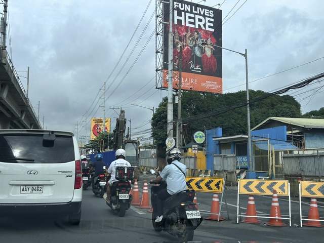 Two lanes have been closed to give way to excavations and the installation of large pipes that will connect with the existing drainage in the area. This interceptor will eventually drain to the Marikina River and is expected to reduce flooding particularly in Cainta and Antipolo where residential subdivisions have endured floods during the wet season for many years.
The project will run for a year. That, of course, assumes that there will be no delays for whatever reasons might come up. The LGUs concerned including Antipolo, Cainta, Marikina and Pasig are cooperating with the MMDA to address traffic management issues.
–
A tollway over Padre Faura?
We had a recon survey of the streets surrounding the UP Manila and UP PGH compound this morning. We walked the entire time and got to see firsthand the conditions along the streets including Pedro Gil and Padre Faura. I’ve seen and read a lot about the proposed SALEX with an alignment that will have the proposed tollway above Padre Faura.
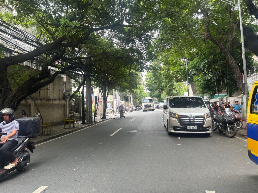
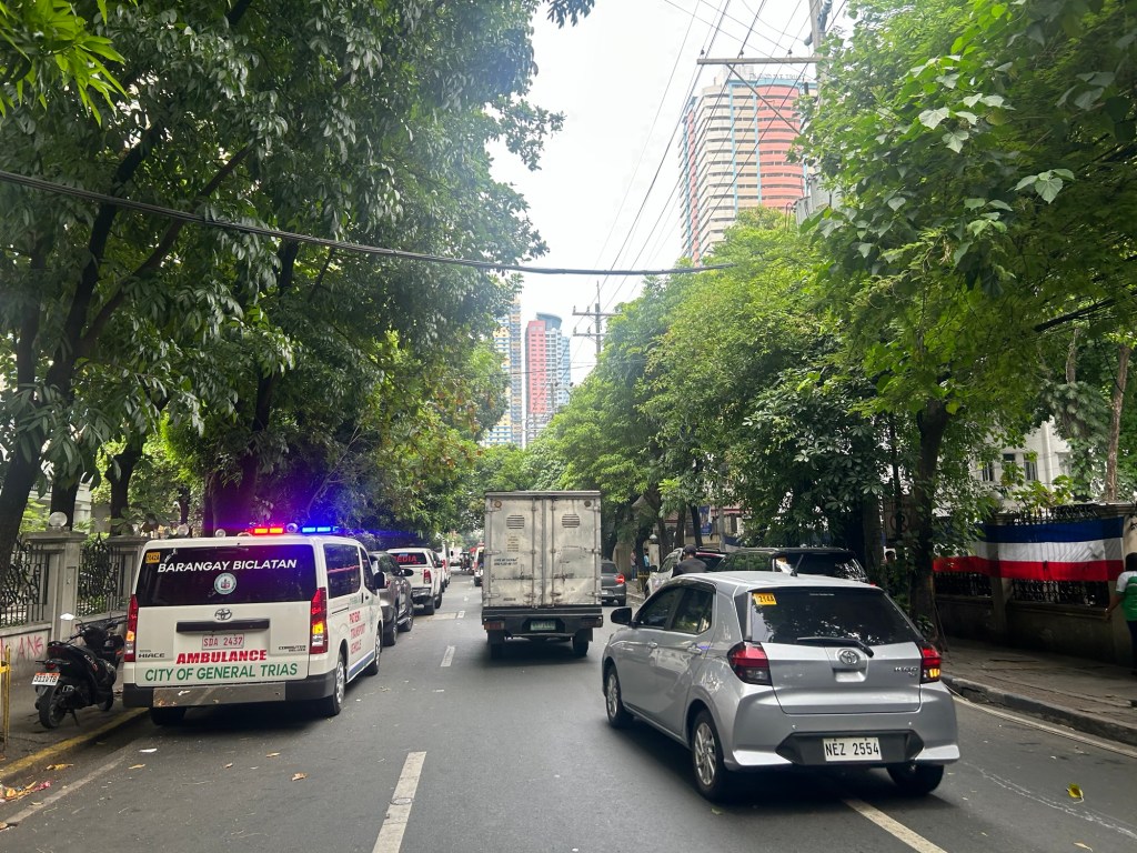
I can’t imagine the blight that the elevated tollways will have on Padre Faura. It will surely affect traffic along the street during construction. There is a lot of AI-generated renders of what it will look like. However, not clearly shown would be the effect of the tollway on a narrow street like Padre Faura. It will be higher than the Line 1 along Taft Avenue though so most renders you see on social media are incorrect in terms of elevation.
Were the establishments along Padre Faura consulted before the alignment of the proposed tollway was submitted for approval? That alone seems to be a glaring flaw in the PPP law considering the location of the tollway. Why is another tollway for construction in the metropolis when what are required are mass transit lines and better public transport?
–
Updates on the Katipunan jeepney terminal
Here are some photos I took while waiting for the green light
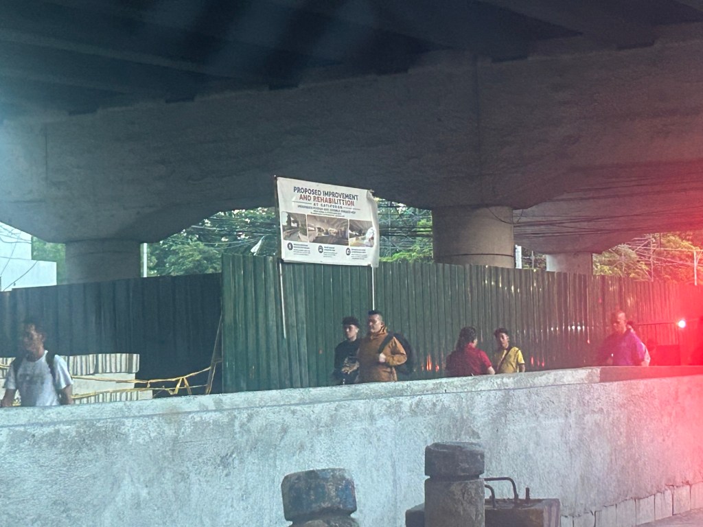
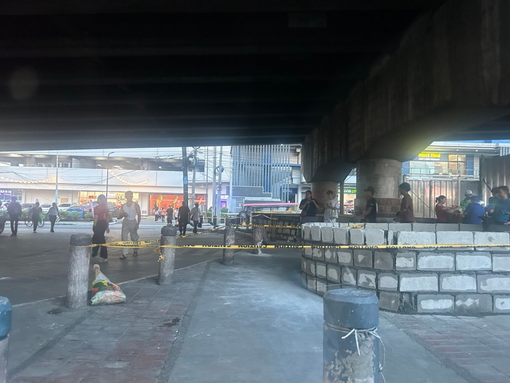
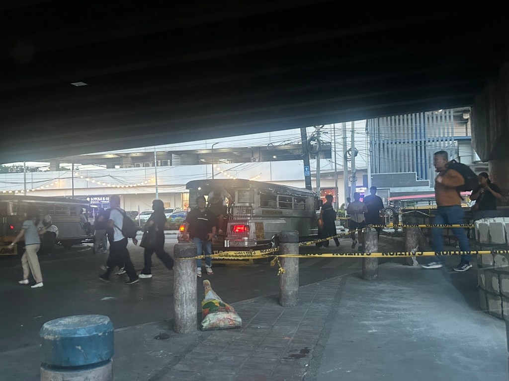
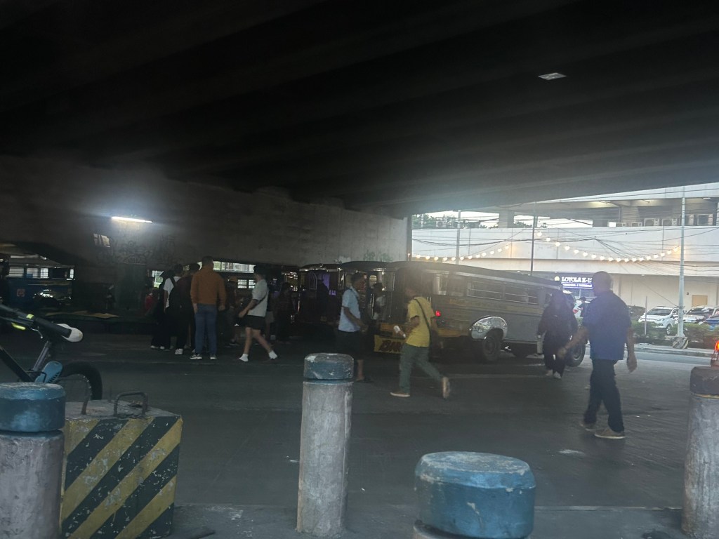
The bottom line is that the terminal will not be completely displaced. Jeepney parking spaces though have been reduced. I wonder where the other jeepneys spend their idle time considering not all Katipunan jeepneys are allowed entry to the UP Diliman campus.
–
On road clearing and towing of illegally parked vehicles
The MMDA conducted road clearing operations along Katipunan Avenue this Tuesday. To be exact, they towed illegally parked vehicles in the area. We saw a fleet of tow trucks lined along C.P. Garcia Avenue prior to the operations.
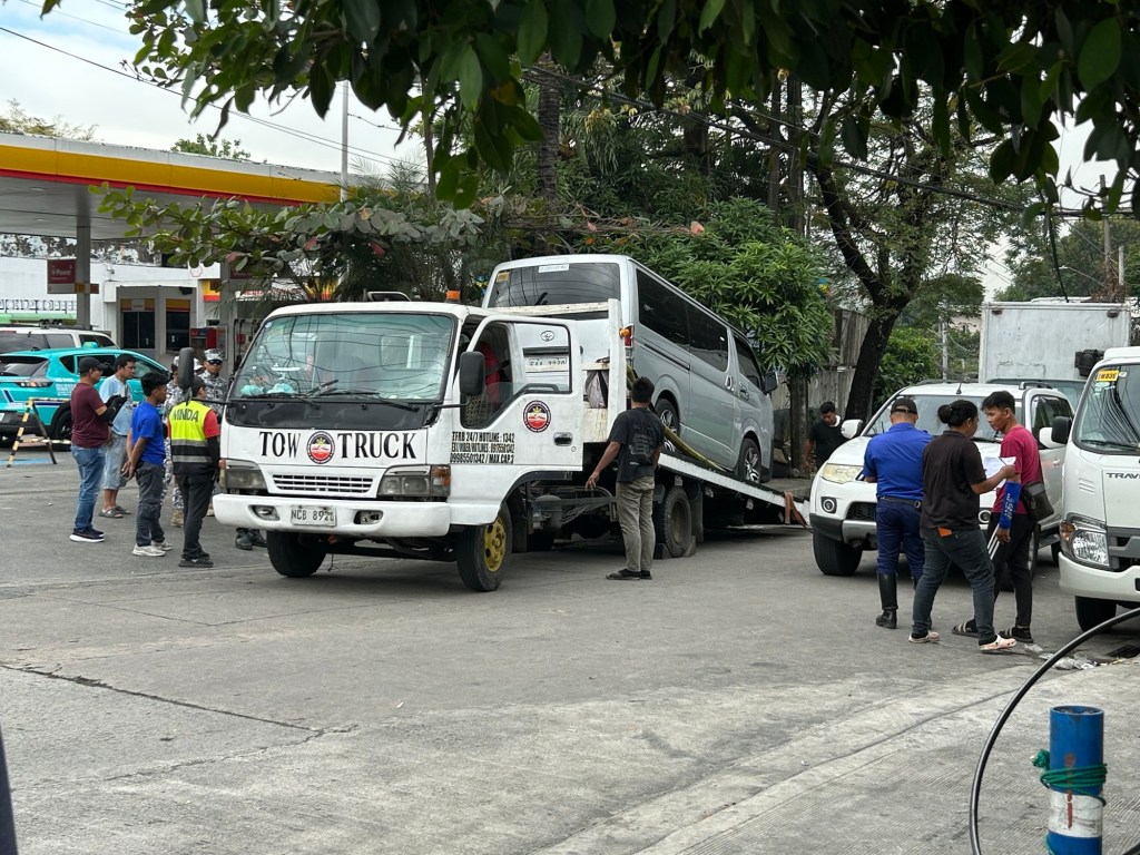
There are many illegally parked vehicles along Katipunan and the side streets to it. It is partly due to parking minimums (as stipulated in the National Building Code) not being followed and mainly because of the dependence on cars and high car ownership attributed to residents there.
Operations like this by the MMDA or LGUs are important because spaces need to be reclaimed especially for pedestrians. There is of course their main objective of easing traffic along roads whose capacities were decreased by on street parking. Do these streets need to be redesigned? Maybe but not now considering the resources required for transformation. It’s not as easy as the examples being peddled on social media.
–
Ortigas Avenue Extension counterflow
One traffic scheme that has been constant along Ortigas Avenue Extension is the counterflow scheme. The scheme is applied in the mornings for westbound (outbound from Rizal) traffic. It has been implemented for as long as I can remember; perhaps since the early 1980s. One variant before was a form of “Buhos” where eastbound traffic is stopped for several minutes at certain intervals (6:30am, 7:00am, 7:30am and so on), and westbound traffic is allowed to take all the available lanes during the periods.
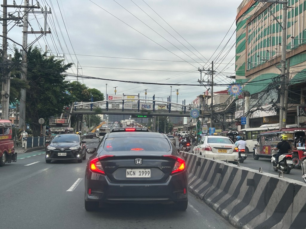
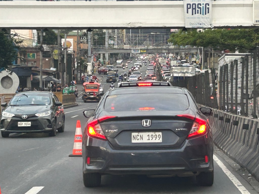
Considering this scheme has been implemented for more than 4 decades now, there must be some measure of effectiveness there. It is an example where the directional distribution during the peak hours allow for such scheme to be implemented. Note that the scheme pre dates number coding and similar counterflow schemes elsewhere in other major roads in Metro Manila (correct me if I’m wrong).
The scheme though only shows that there should have been a better transport system put in place along the corridor, which has had a steady growth in travel demand. There should have already been a transit line along this corridor a long time ago. What happened? Was it not in the government’s radar? There was a line proposed and shown in various master plans before.
–
After getting engrossed with EDSA, is Marcos Highway next?
If you monitored the news articles and social media post over the past two decades, there seems to be an obsession for EDSA. Circumferential Road 4 is the busiest corridor in Metro Manila, stretching across several jurisdictions including Caloocan, Quezon City, Mandaluyong, Makati and Pasay City. Aside from the MMDA, national agencies like the DPWH and DOTr have been heavily involved in traffic schemes and transportation infrastructure development along the corridor. These include variants of the travel demand management (TDM) scheme commonly called number coding. Since the 1990s, there’s the Line 3 and several overpasses/flyovers and underpass that have been constructed along major intersections (e.g., EDSA-Shaw, EDSA-Ortigas, EDSA-Kamuning, EDSA-Quezon Avenue, etc.). Nowadays, people are more into the EDSA carousel and most recently the pavement rehabilitation for EDSA. It seems we failed to realize that EDSA is just one corridor. There are others that also demand attention including those in other parts of the country.
Recently, a “carmaggedon” along Marcos Highway was in the headlines or shall I say was trending in social media. There was a lot of excitement for what has been a recurring nightmare to those residing along the corridor. I recall something worse occurred more than 15 years ago (pre-Ondoy), before social media and influencers and digital creators. At the time, Line 2 terminated at Santolan Station. And even back then, the MMDA insisted on playing with their U-turn scheme. I don’t recall a more in-depth study that could have involved micro-simulation modeling being done for the corridor. And since then, populations and traffic have grown steadily and as I’ve written about previously, the extension of Line 2 to Masinag seems to have had little impact on traffic. And so here we are with the MMDA still insisting on tweaking their U-turn schemes and relying mainly on gut-feel instead of a more scientific approach that may actually lead to more sound solutions for the corridor.
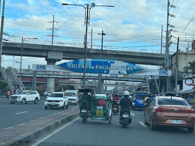 Approach to Marcos Highway from Felix Avenue – that’s the elevated Line 2 superstructure behind the Cainta arch.
 Intersection of Marcos Highway, Felix Avenue and Gil Fernando Avenue – there’s a major foot bridge installed here so people can cross at the intersection, which used to be a signalized junction before the MMDA opted for U-turns for Marcos Highway sections under its jurisdiction.
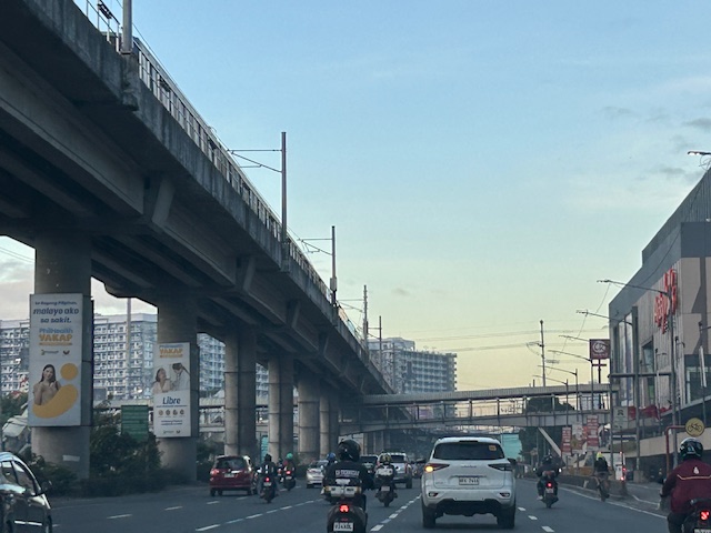 Marcos Highway section fronting the Ayala Feliz Mall – the MMDA has played with the location of the U-turn slots in the vicinity of the Marcos Highway-Amang Rodriguez-J.P. Rizal intersection as they tried to determine the “optimum” locations of these slots.
Of course, there is also the case of Commonwealth Avenue. How many carmaggedons have occurred along that corridor? Isn’t it an everyday thing there? And there’s also Ortigas Avenue Extension and many other roads and streets where congestion seems to have been accepted as the norm. How do we make travel easier for most people? How do we improve commutes given the constraints and realities concerning behavior and choices?
–
On parking for typhoons
The Metro Manila Development Authority (MMDA) recently issued a memo to shopping mall operators in Metro Manila in relation to the anticipated arrival and onslaught of a super typhoon. I reproduce the memo below:
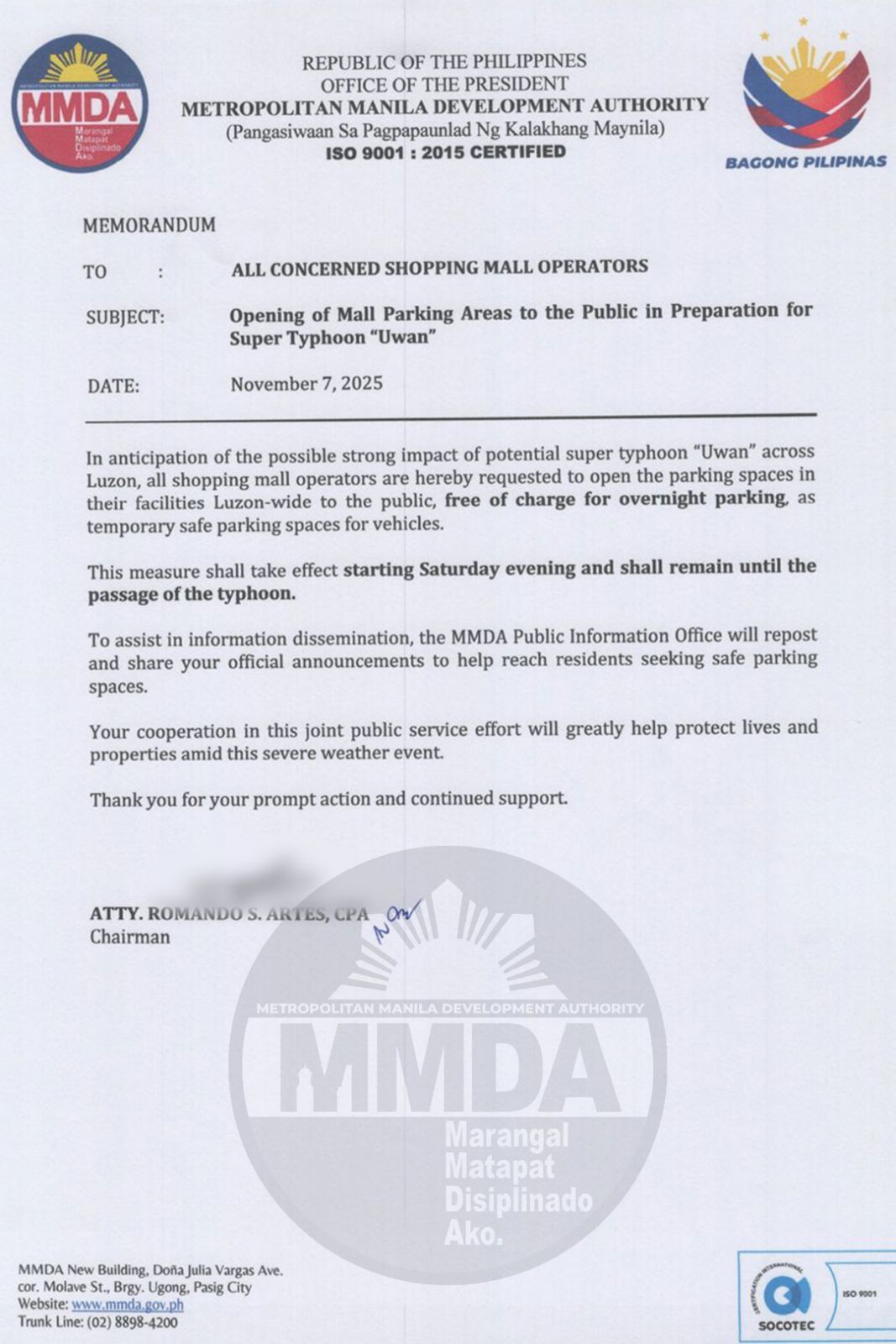
As of this morning, most if not all mall operators (at least all of the major ones – SM, Robinsons, Ayala and Megaworld) have responded positively. Some observations this morning though shows a lot of people already lining up their vehicles at the malls to take advantage of the free parking. It seems a lot of people have misunderstood the memo and responses (from the malls) to mean there’s free parking from today til Monday. Let’s assume that most of these people live in flood prone areas and that many of them probably don’t have garages in their homes. This somewhat shows us another angle of vehicle ownership and the lack of parking for many. It also somehow tells us something about our dependency on cars and how we really need to have a better transportation system.
–
Needed: MMDA Transport Authority similar to Transport for London
I am sharing this article from Business World about the idea (or is it already a proposal) for an MMDA Transport Authority. I seem to recall there were already proposals for something like this but I have to check for references and sources. In the meantime, I am content with sharing the following:
On Nov. 11, 1999, the British Parliament established the Greater London Authority. Prior to that, there was no single entity managing the entirety of London. The governance of the city was fragmented, and responsibilities for planning, transport, and other city-wide matters were divided between local boroughs and national authorities. The Greater London Authority was established […]
Source: Needed: MMDA Transport Authority similar to Transport for London
Traffic congestion along EDSA
I’ve taken some photos of EDSA traffic as well as the EDSA Carousel buses. Here are the more recent EDSA photos I took as I traveled from Makati to Quezon City after serving as a panelist in the Energy Transitions Dialogue last Wednesday.
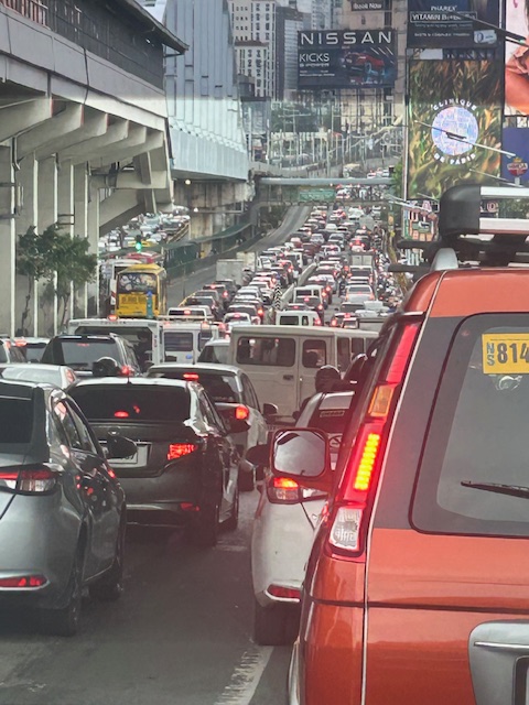 I took this photo as we passed Guadalupe. I like this in the sense that it shows the clear ROW for the EDSA Carousel buses. One wonders why most of these motorists would prefer to drive their vehicles rather than take the bus or the MRT.
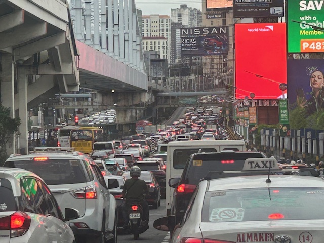 You can see in the photo that EDSA’s northbound side is clogged as far as the eye could see. If you check the image under the MRT bridge, it shows the southbound side was also congested. These photos were taken around 4 PM so this was still an hour before most people would be going home from work.
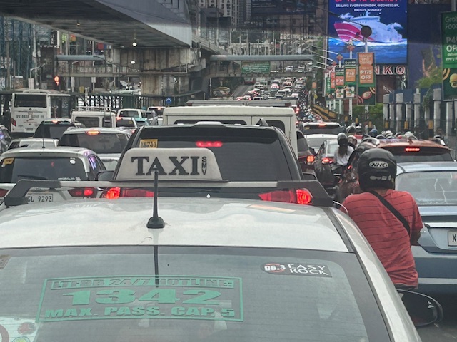 I mentioned in my comments at the panel that one consequence of giving number coding exemption to electric and hybrid vehicles is that this further diminishes the effectiveness (is it still effective?) of the MMDA’s number coding scheme. I don’t have the stats of how many EV’s and hybrids are registered and running in Metro Manila. Those numbers combined with actual counts will tell us how they are impacting traffic. That would be a nice topic for a paper. 🙂
The photos pretty much describe the transport situation in Metro Manila. Many of our major cities will be heading this way unless they improve their public transportation fast. If they do, then public transport mode share will be sustained if not increased. Metro Manila’s is already being eroded by inefficient public transport, motorcycles (including taxis) and perhaps unintentionally, electric and hybrid vehicles.
–

