
Home » Posts tagged 'national roads'
Tag Archives: national roads
Landmarks – the Lion’s Head, Kennon Road
The main landmark along Kennon Road is the Lion’s Head. I think most people heading to or coming from Baguio have taken a photo of if not with the Lion. Here are photos I took as we descended from Baguio via Kennon Road last December 2024 after participating in a workshop.
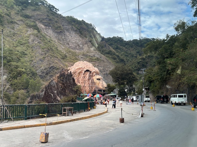 Approaching the Lion’s Head along Kennon Road, the monument appears to be under maintenance with scaffolding around the head.
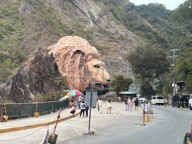 An entire section is cordoned off, likely for tourists or visitors. The lane though looks newly paved, perhaps part of a road widening project.
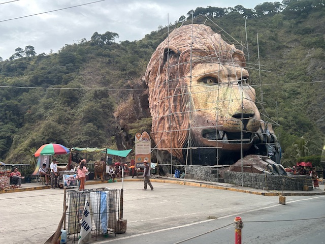 A closer look of the Lion’s Head and the touristy things in the area. Notice there weren’t too many tourists at the time and there weren’t so many shops and vendors set-up.
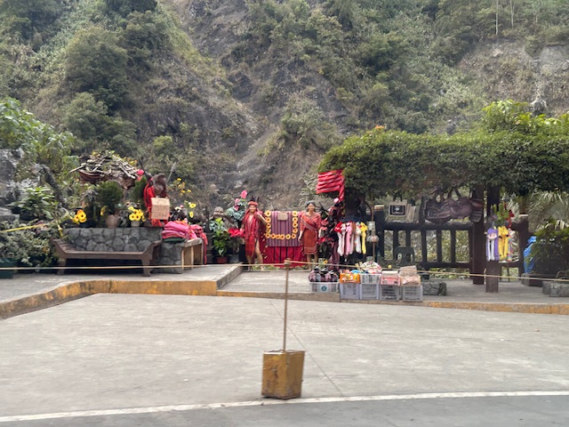 Among the activities are dressing up in local costume and taking photos wearing these with the mountains or the monument in the background.
–
–
Foggy roads – Part 2
This is supposed to be a follow-up to the post on foggy roads in Tagaytay last month. Unfortunately, I could other things came in the way of finishing this Part 2. Intersections can be quite dangerous if all approaching one have limited visibility. Add to that the flaws in intersection geometry that may contribute to it being risky to travelers. Following is an example along the Tagaytay-Calamba Road with an intersection with Belleview Drive, which is the main access road to Tagaytay Highlands.
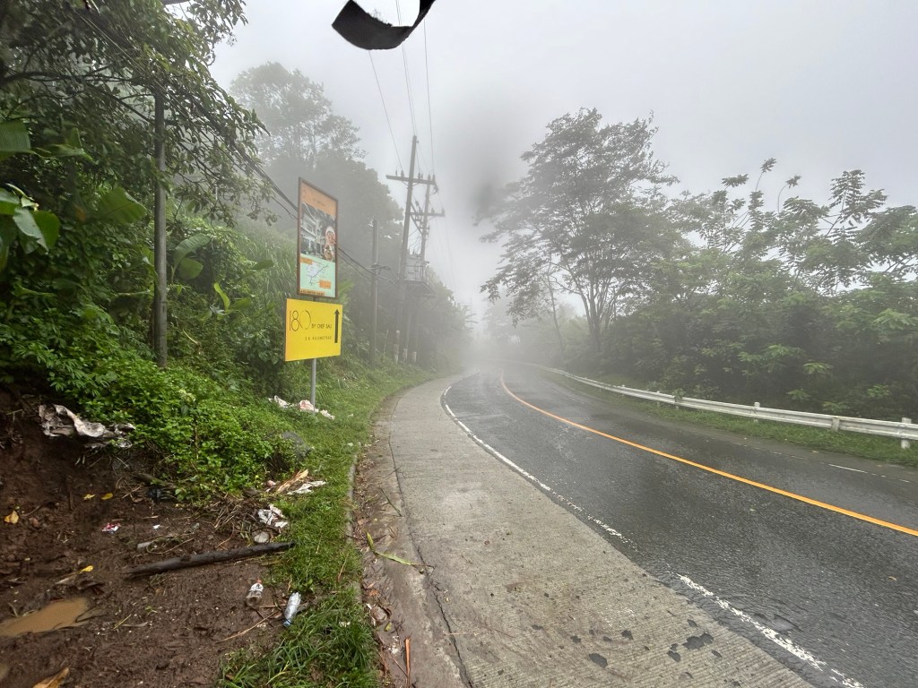 The approach from Tagaytay features a curve. I didn’t notice any streetlights along the road so I can imagine it must be poorly lit at night. What more if there is a thick fog in the area?
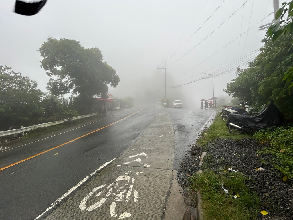 The bike lane is a product of the government’s efforts to come up with a bike lane network along national roads during the pandemic. This is actually the shoulder painted to become a bike lane. This is the view of the intersection approach if you’re coming from Tagaytay. The leg to the right with the people with umbrellas is Belleview Drive and towards Tagaytay Highlands. You can easily miss this if you were not familiar with the area and cruising along the highway. Note the thick fog obscuring your vision of the intersection. The curvature to the left also adds to the complex situation.
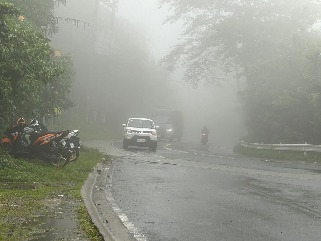 This is a closer look at the highway approach from Tagaytay taken a few minutes after I took the first photo in the article. Note the fog quickly setting in and the limited visibility. The motorcycle moving away from us would disappear into the fog. This is during the daytime and supposedly in broad daylight. Vehicles would need to turn on their lights so others may see them on the road.
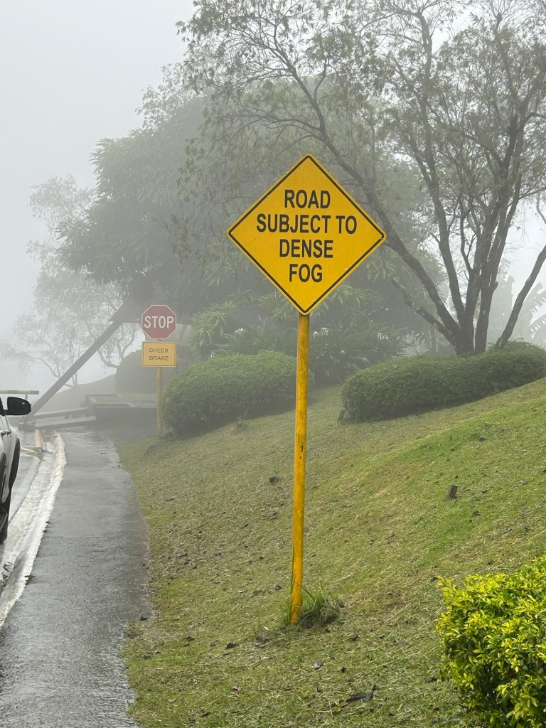 The sign along Belleview Drive states the obvious. There should be more signs like this located strategically along the Tagaytay – Calamba Road and others usually cloaked in the fog we experienced in Tagaytay recently.
I assume there would be similar situations elsewhere including in Baguio City. We also experienced fog (not smog) in Antipolo but these were quick to dissipate unlike the ones in Tagaytay and Baguio.
–
Scenic highways? On the irony of “Daang Kalikasan”
There’s a lot of buzz about new roads nearing completion in the provinces of Pangasinan and Zambales. What is touted as scenic highways became an instant hit and attracted a lot of visitors who apparently wasted little time in trashing the area. The recent news now state that the road has been closed due to the garbage and some road crashes attributed to the influx of tourists in the area:
Mountain roads linking Pangasinan, Zambales closed over accidents, trash
There were a lot of posts that appeared on my social media newsfeed about these roads and the scenery around them. While I have seen a lot of roads with splendid or even magnificent sceneries whenever I go on road trips, the first thing that came to my mind was a question whether the landscape was like that before. I suspected that there used to be forests on these mountains and that the trees were irresponsibly cut down (some people will use the word ‘harvested’ as if they grew and cared for the trees) and never replaced. Some friends from Zambales say there used to be trees there and another recalled old dirt roads in the areas used for logging. So it’s ironic that the road is named “Daang Kailkasan” when nature was practically raped by people who ravaged the land many years ago. Indigenous people who we often refer to as “katutubo” also would likely have never consumed more than what they needed. Scenic? Maybe ‘depressing’ is a more suitable term for these roads.
–
Looking forward to another long road trip
It has been a while since I had a long road trip. The last one was not particularly long as it was only until Lucena City in Quezon. Prior to that was a trip to Baguio City. And so I am looking forward to this trip to Bicol this week and I do hope to take a lot of photos along the way. That includes photos of arches that I have not had the chance of taking that I know I can get a lot of during this trip that will take us through several provinces in Southern Luzon. Those photos and the experiences from the trip will probably dominate the postings this February.
Data on local roads – digital maps
Here’s another quick reference to an article describing a current undertaking to map the 45,000+ kilometers Philippine road network:
PH undertaking $5M digital mapping of 45,000-km road network
What’s significant with this development is that soon the country will have excellent maps, including 3D and 360-degree views of most if not all local roads. While there are similar maps via Open Street Maps and Google Maps, the latter are not as comprehensive. These maps will be very useful for a lot of applications including transport planning, urban and regional planning, and disaster mitigation. A lot of people are surely looking forward to the completion of this project as well as when the maps can be accessed and used.
–
Dang Bakal road widening in Antipolo
We go to church at the Parish of the Immaculate Heart of Mary along Daang Bakal in Antipolo City. Quite obvious is the current road widening project being implemented along Daang Bakal. While the improvement of the road was welcome, my opinion is that widening the 2-lane road to 4 lanes was not necessary given the traffic in the area served by the subject section (basically traffic generated by the parish and the exclusive subdivisions along the road). For one the section being widened from the intersection with the Antipolo Circumferential Road leads to a dead-end (i.e,, the gate of an exclusive subdivision). And so, traffic is generally very light along this road section
Are there plans to revive the original right of way of the old railway line but in the form of a road connecting Hinulugang Taktak to Ortigas Avenue via Valley Golf? If not, then the road widening of Daang Bakal is unnecessary. Even if the justification were for cyclists, I would argue that perhaps you only needed to have paved shoulders that need not have the same width as the carriageway lane. Following are photos of Daang Bakal featuring the road widening project.


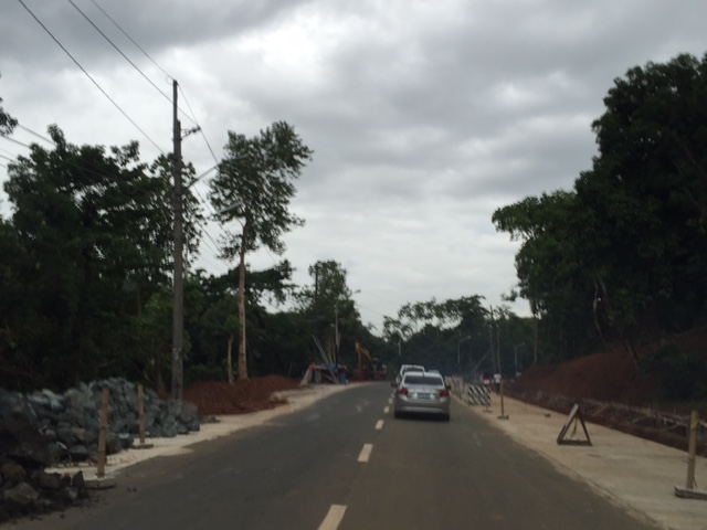


From the photos, it is clear that a lot of trees have been cut in order to make space for the additional lanes for the road. While most of these trees are too close to the original carriageway, there were many that I felt didn’t need to be cut if a narrow shoulder was deemed sufficient for the road. Traffic in the photos are typical peak period traffic on a Sunday when the road carries the most traffic in a day due mainly to churchgoers.
–
