
Home » Posts tagged 'Ortigas Avenue'
Tag Archives: Ortigas Avenue
On the chronic congestion along Ortigas Avenue Extension
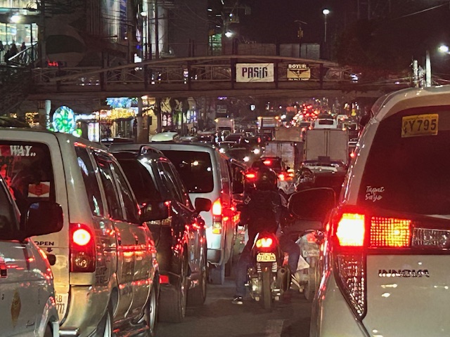
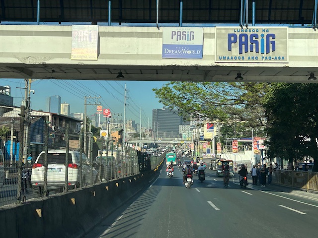
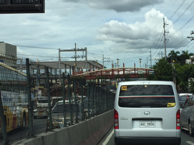
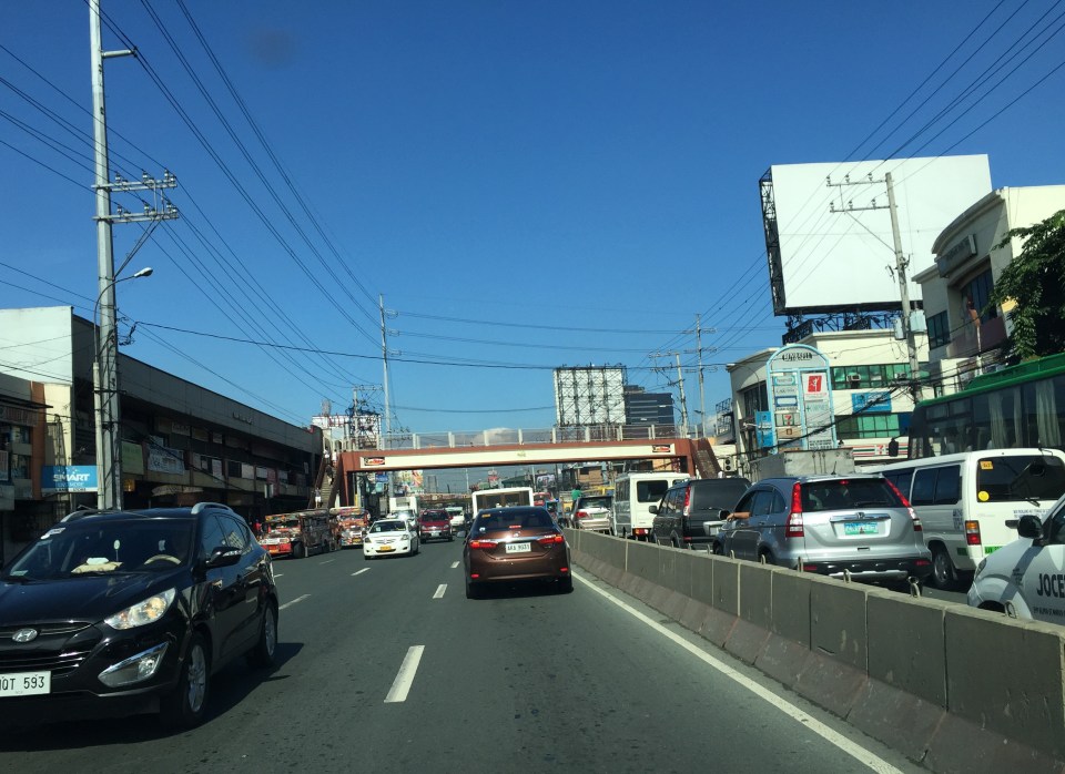
I previously wrote about the counterflow scheme along Ortigas Avenue Extension. While this is usually implemented during the mornings. A similar scheme is not applied in the afternoons or evenings. Apparently, the directional distribution in the afternoons and evenings is not suitable for a counterflow scheme. The photos below show the typical eastbound traffic as seen from the Manggahan Floodway bridge.
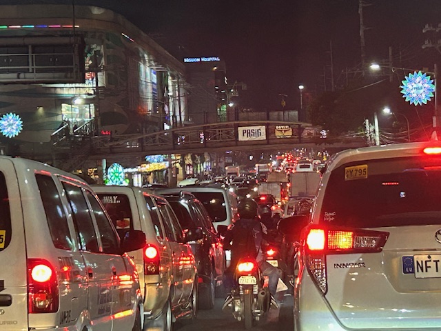 Typical weekday evening traffic along Ortigas Avenue Extension
 The photos show that the traffic along the opposing direction (westbound) is as heavy as the eastbound traffic. This means a counterflow scheme similar to that in the mornings cannot be implemented during this period.
I have mentioned in the previous article that the corridor already required a mass transit system since the 1980s. Despite the operations of several bus companies over the past decades, these have not been enough (together with jeepneys and vans) to serve the demand along the corridor. It is not uncommon to find so many people stranded along the corridor and waiting to get a ride even during the early mornings. While Lines 2, 3 and 7 were being constructed, people in Rizal who have long endured the traffic along Ortigas Avenue Extension could only wonder why a transit system has not been provided for them. Will the proposed Line 4 be finally constructed? When will it be completed? What could be the traffic impacts of construction considering the limited space available for the construction? Should commuters prepare for more miserable travel once construction is underway?
–
Counterflow irony along Ortigas Avenue Extension, Pasig City
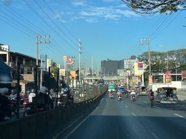
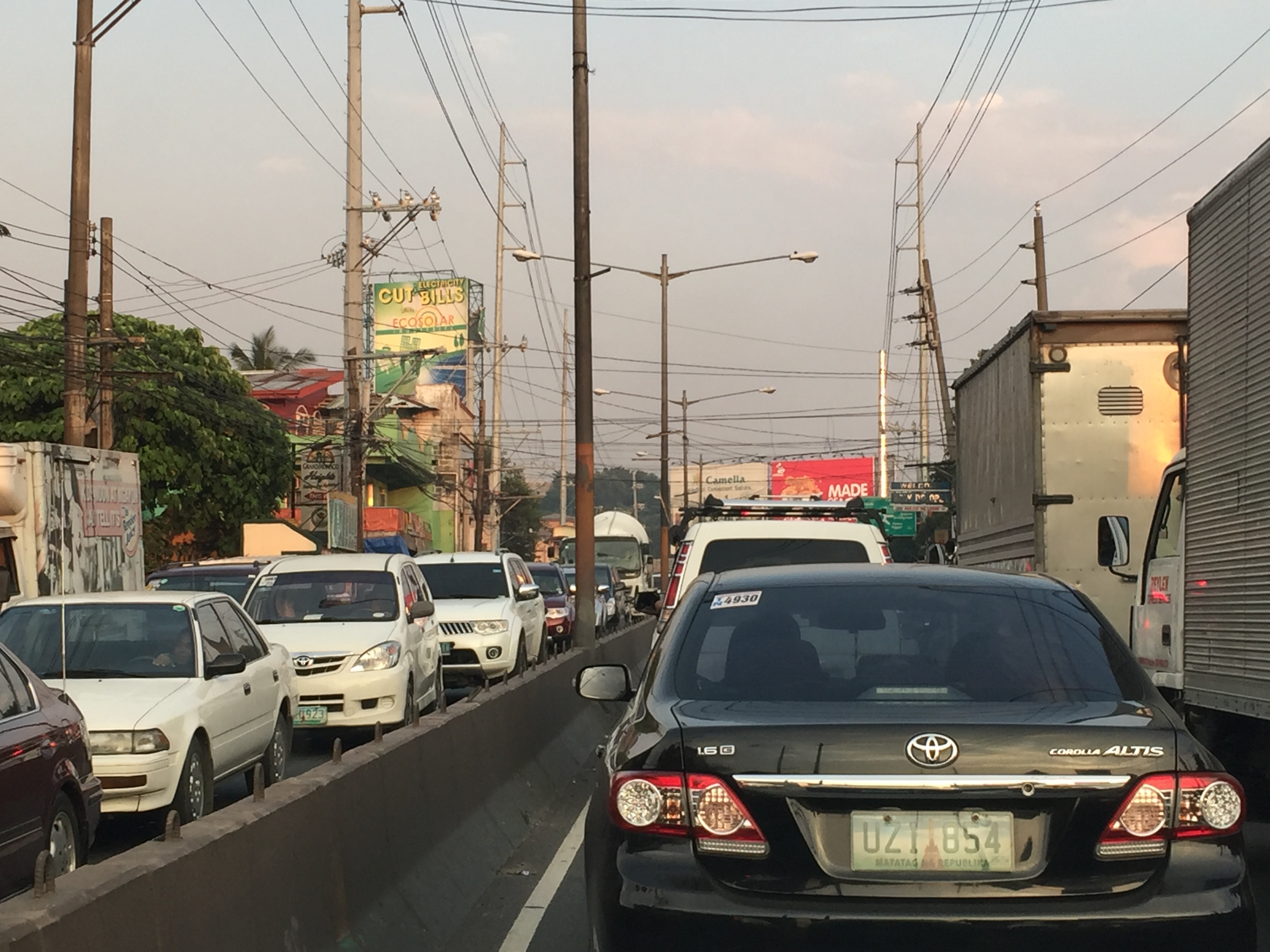
One Friday, I traveled to Ortigas Center from Antipolo via the most direct route using Ortigas Avenue Extension. I was not surprised by the counterflow scheme being implemented starting from De Castro all the way to Rosario Bridge. I was also not surprised that the more congested lane was the counterflow lane. I thought everyone expected the main traffic lanes to be congested as PUVs like jeepneys, buses and vans usually create bottlenecks as they block traffic while passengers board/alight along that section of Ortigas Avenue Extension. Here is what you might encounter in terms of traffic if you opt to stay along the westbound traffic lanes:
 Traffic before the Manggahan floodway bridge at what was generally called Mariwasa. The Filinvest residential development on the left used to be the Mariwasa tiles plant.
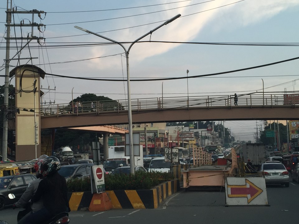
 Traffic after the crossing the bridge. Note the pedestrian overpass in the photo.
 Meters after and near the overpass, you can already see the build-up in the Rosario area
 The Rosario bridge area is usually congested not just because of the PUV operations but also because there is the junction of Ortigas Avenue Extension and Amang Rodriguez Avenue, which is another major thoroughfare connecting this area to other parts of Pasig, Quezon City and Marikina City.
I will post about the counterflow scheme in Bangkok in the next post.
–
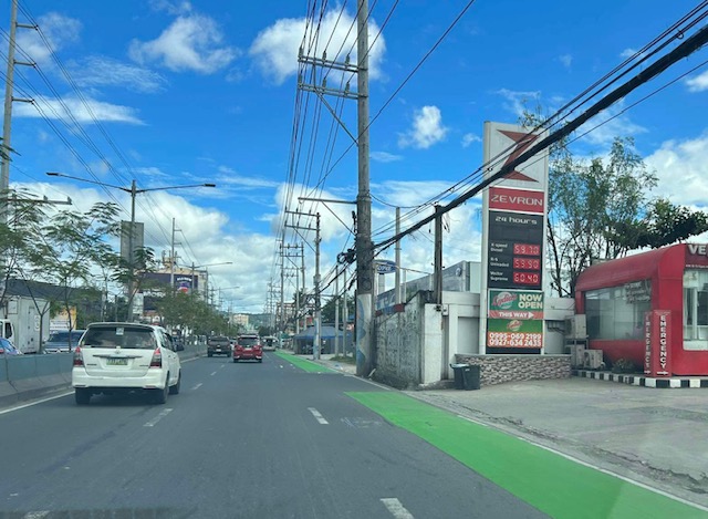
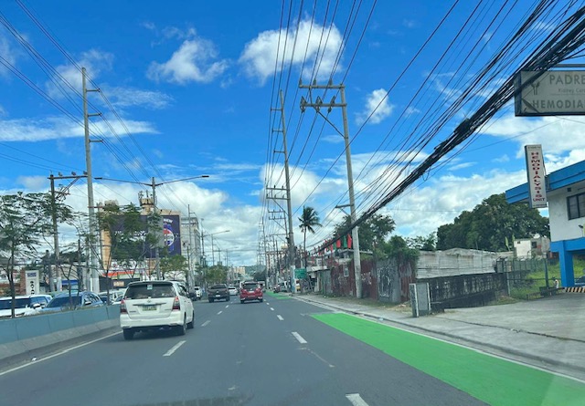
Westbound bike lane along Ortigas Avenue Extension, Cainta, Rizal
I was not able to post these photos of the westbound bike lane along Ortigas Avenue Extension immediately after I shared photos of the eastbound bike lane. The bike lanes, as can be seen from the photos, are painted green.
 Bike lane past Valley Golf and STI
 Bike lane approaching Brookside (Sunset Drive) with the CK Square as a landmark
 Still a big issue for bike lanes is the presence of electric and communication poles/posts that have not been relocated after so many years since Ortigas Avenue had been widened.
 Bike lane across from Tapsi ni Vivian
 These photos were taken before the solar studs were installed to delineate the bike lanes and make them more visible at night or when its dark.
 Also, challenges and concerns for cyclists are parked vehicles and those maneuvering from the various establishments along the road. This photo pretty much captures those two concerns – a parked UV Express van and a truck maneuvering out of a store occupying the bike lane.
 Cyclist pedaling along the bike lane approaching the Shell Gas Station (where there is also a McDonald’s)
 Bike lane in front of the Ortigas Hospital just outside the Brookside Gate 1 and near Cainta Junction
More photos of the bike lanes soon!
–
Eastbound bike lane along Ortigas Avenue Extension, Cainta, Rizal
I recently posted about the newly painted bike lanes along Ortigas Avenue Extension between Cainta Junction and Valley Golf in Cainta, Rizal. Here are more photos of the bike lanes along the eastbound direction of the avenue.
 Just past Cainta Junction and across from a gas station. The bike lane marking here though should have been for a driveway due to the service station.
 Bike lane approaching the Ford dealership
 Bike lane in front of the Ford dealership along Ortigas Ave. Ext.
 An unusual discontinuity in front of a vacant lot
 Another discontinuity
 The broken lane markings are supposed to be for driveways and approaches to intersections like this section at a gas station. This was the appropriate marking for the station in the first photo.
 Car parking are a concern for cyclists as they often encroach on the bike lane.
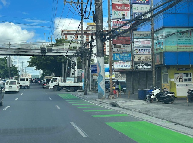 Approach to an intersection (J.G. Garcia Street) across from Brookside Subdivision gate
 Approach to intersection with Huners ROTC Street and just before STI.
I will share photos on the westbound bike lane along the same section in the next post.
–
Bike lanes along Ortigas Avenue Extension, Cainta, Rizal
The bike lanes along Ortigas Avenue end at the border of Pasig City and Cainta (or Metro Manila and the Province of Rizal). This is just after SM East Ortigas if you are eastbound, headed towards Cainta Junction. Last Friday, I was able to take a photo of the newly painted bike lane along Ortigas Avenue Extension’s eastbound side but which starts just after Cainta Junction across from the main gate of Brookside Hills Subdivision.
 The new bike lane along Ortigas Avenue Extension used luminous paint, which makes it glow at night especially when exposed to vehicle headlights.
There have been bike lanes in Rizal prior to this development. Marcos Highway and Sumulong Highway have painted bike lanes. The Manila East Road from Tikling Junction also has bike lanes. This ‘missing link’ between the boundary of NCR and Rizal and Tikling is long overdue. Hopefully, this will encourage more active transport users particularly from “bike to work” and “bike to school” trips.
–
More major traffic generators along Ortigas Ave. Extension?
There’s another mall being constructed along the westbound side of Ortigas Avenue Extension just before the Lucky Gold Plaza and across from the One Oasis residential enclave. That area is already very congested as will be attested to by the thousands who pass this way especially during the morning rush. Here’s a photo of the mall that is currently under construction as seen from the bridge crossing the Manggahan Floodway. The steel frame on the left and behind the pedestrian bridge is the mall’s.
 That’s another mall being built across the Bali Oasis near the Manggahan Floodway
Among the future major traffic generators that will likely make traffic congestion along Ortigas Avenue worse are the following:
- Residential development across Countryside subdivision
- Town center development near Valley Golf
Commuters using this corridor will likely find traffic worsen (could it really get worse than what it is now?) and traffic schemes by the LGUs along the corridor (i.e., Pasig, Cainta and Taytay) will not be enough to alleviate traffic over the medium to long term. Only a dedicated mass transit line can provide significant improvements for travel along this corridor.
I am still wondering about the mass transit solution for this corridor. There are arguably more people traveling along Ortigas Avenue compared to Marcos Highway that already has Line 2 under construction. I’m sure if you asked people when a mass transit line’s needed along Ortigas, they will reply “years ago”. Being one who has traveled along this corridor since the 1970s (I was a resident of Cainta and then of Antipolo), I can say that traffic indeed has worsened over the last 3 decades. Travel demand management (TDM) measures such as number coding and transport systems management (TSM) schemes such as Pasig’s one-way scheme will not be enough to address the growth along the corridor as they were and are not enough in the first place.
–
Landslide in Antipolo
What’s been causing some traffic congestion along Ortigas Ave. Extension is the collapse of a side of the mountain at a section just before the Antipolo City arch (if you’re coming from Tikling Junction). The soil probably was already saturated after the past few days heavy rain and it didn’t help that the old wall holding the soil and consisting mainly of blocks was also already weakened (I am assuming that it was built following standards for such walls.).
 The area had been partially cleared of soil and rock, which initially blocked 2 lanes of the 4-lane road. Kudos to the DPWH for their work clearing part of the debris and easing traffic along this busy thoroughfare.
 The wall at this section was completely obliterated revealing soil that appeared to be already unstable.
Hopefully, funds can be allocated very quickly in order to build the necessary slope protection. Perhaps the barrier should be designed to allow for more water to seep through without compromising the structure. Such weep holes are necessary especially given the saturated soils due to heavy rainfall experienced during this wet season and others in the future.
–
Addressing congestion due to school traffic congestion
There are two important traffic news stories yesterday:
- MMDA successfully clears parked vehicles outside La Salle Greenhills
- MMDA sets drop off, pick-up points for Ateneo students
For some reason that’s a bit surprising for many, the MMDA seems to have solved two of the most enduring issues on traffic congestion along two major thoroughfares. LSGH is along Ortigas Avenue while Ateneo is along Katipunan Avenue (C-5). Both have high trip generation rates and a significant percentage of their trip gen is comprised of private vehicles. While, Ateneo’s trip generation has led to traffic congestion due to the sheer number of trips the university attracts, the congestion due to La Salle is due to the poor traffic management and lack of parking spaces for vehicles attracted by the school.
I only wonder why it took so much time to address these problems considering the solutions mentioned in the articles are basically ones that could have been implemented years ago. In the case of La Salle, good old fashioned traffic enforcement apparently did the trick. But then, the MMDA even with the LGU constraint could have been stricter before whether when they were under Bayani Fernando (BF) or any of his successors as MMDA Chair. With Ateneo, the scheme is very similar if not the same as what BF proposed over a decade ago when he was MMDA Chair. At that time though a touchy issue was the U-turn scheme he installed along Katipunan that cost trees and the former service road on the west side of the avenue. We can only hope that these claimed ‘successes’ will be sustained and ensure smoother flow of traffic along the major roads they directly affect.
–
On the severity of traffic congestion along Ortigas Avenue and the necessity of a mass transit line
With the worsening congestion along Marcos Highway due to the construction of the LRT Line 2 Extension to Masinag, I have been using Ortigas Avenue as an alternate route to go home. Granted, the stretch from the Park Place gate near Cainta Junction and Brookside is currently undergoing roadworks elevating that entire section (which is prone to flooding), and this is the main cause of much congestion as fewer lanes are usable to traffic. However, what is perceived to be relief from traffic once the project is completed will eventually and surely revert to a very congested Ortigas Avenue.
Traffic congestion along Ortigas Extension is primarily due to a dependence on road transport, particularly private vehicles, by people living along Ortigas Ave. and the roads feeding into it. The Manila East Road, for example, passes through the most populous towns of Rizal outside of Antipolo City. The dependence on road transport (especially private vehicles) is due to limited options for public transport. There are buses, jeepneys and UV Express but these, too, contribute to congestion due to their increased numbers and limited capacities given the high demand for public transport. Among the infrastructure proposed along this corridor is an overpass along Ortigas Ave. at Cainta Junction. A mass transit system has also been required along this corridor for a very long time but for some reason, such infrastructure has not been provided.
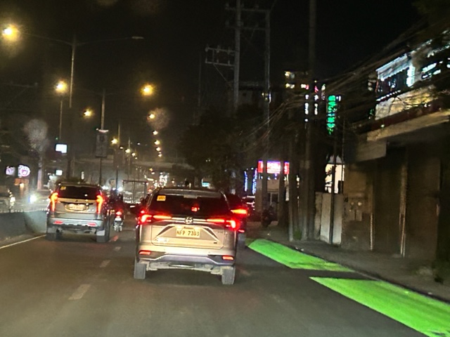
 Severe traffic congestion along both directions of Ortigas Avenue Extension
 Congestion stretches all the way along the Manila East Road
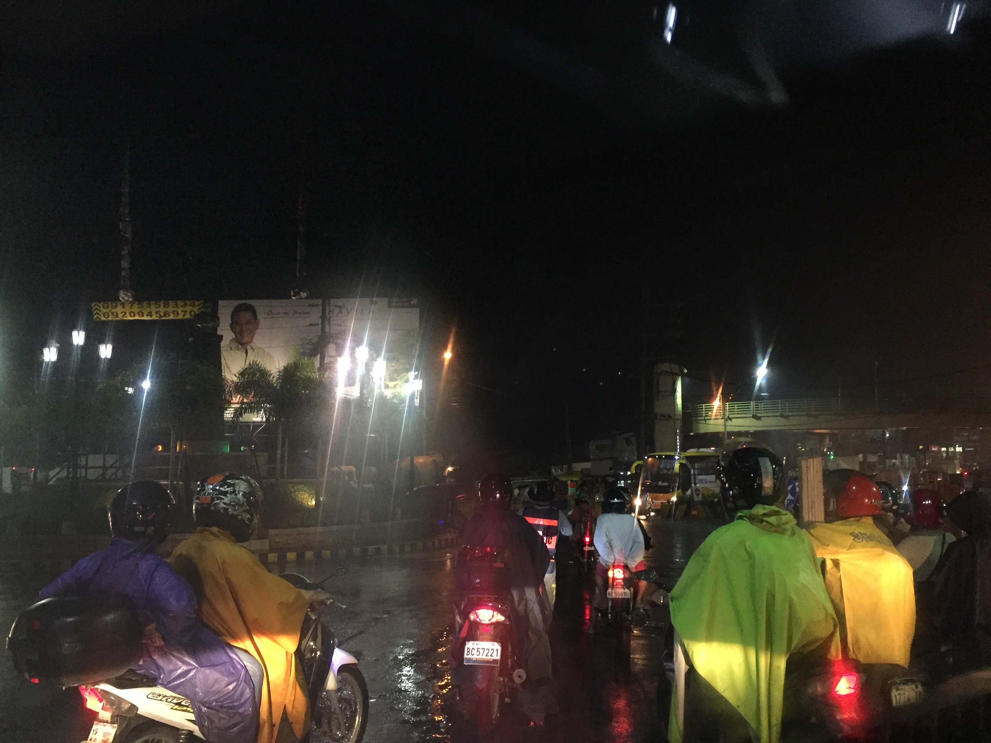 Night-time traffic congestion at the Tikling Junction
There is a proposal for a mass transit system along this corridor. Following are references to the project:
From the PPP Centre: https://ppp.gov.ph/?ppp_projects=ortigas-taytay-lrt-line-4-project
From CNN Philippines: http://cnnphilippines.com/metro/2015/07/22/neda-approves-naia-lrt-ppp-projects.html
I found it quite odd that the stations are not referenced according to the more common place names for the locations. For example, ‘Bonifacio Avenue’ should be ‘Cainta Junction’ and ‘Leonard Wood’ should be ‘Kaytikling Junction’. Nevertheless, this is the least of our concerns pertaining to transport and traffic along this corridor.
Perhaps the conditions are ripe now to finally implement transport infrastructure projects along this corridor. The proposal and approval of a rail transit line by NEDA means the corridor has the national government’s attention. The local government leaders along this corridor are also more progressive and aggressive than their predecessors. These include a very dynamic mayor in Cainta and the former governor-turned mayor in Antipolo. A collaboration towards better transport among these two LGUs alone would be influential and instrumental to improving travel along Ortigas Avenue.
–
On the Ortigas Avenue counter-flow scheme again
Here are some more recent photos of the morning traffic congestion and counter-flow scheme along Ortigas Avenue. The counterflow scheme starts at the approach to the Manggahan Channel Bridge and ends at the approach to C-5 right after the Rosario Bridge. This counter-flow scheme has been used by Pasig, as far as I can remember, since the early 1980s. Ortigas Avenue is one of those roads where the directional distribution of traffic very pronounced for the peak direction.
 Vehicles crowding towards the counter-flow lane on the eastbound side of Ortigas Avenue. Traffic along this lane is moving, unlike the standstill you will likely experience along the westbound side. This is particularly true at the bridge where buses and jeepneys occupy two lanes and stop for long periods to get passengers. Congestion is exacerbated by vehicles coming out of the residential development in the area. Pasig and MMDA traffic enforcers fail miserably at their duties here. Perhaps this is a job for the PNP-HPG?
 The effort of positioning towards the counter-flow lane is worth it as traffic moves faster here. The argument for counter-flow lanes (or zipper lanes as they are also called) is based on the availability of capacity along traffic lanes of the opposing direction that can be used to optimize utility of these unused lanes (i.e., off-peak direction) by peak traffic. This is a classic transport systems management scheme directed towards efficient and optimum use of existing facilities.
–
