
Home » Posts tagged 'Pan Philippine Highway'
Tag Archives: Pan Philippine Highway
Another look at the Bitukang Manok
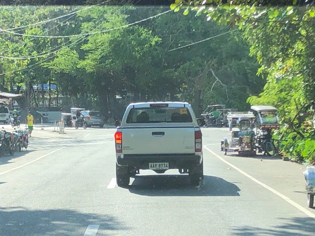
I recently featured photos of the old zigzag road along the Pan Philippine Highway that is more popularly known as the “Bitukang Manok”. Those photos were taken on an early morning while we were on our way to Bicol earlier this month. Following are photos of the old zigzag road taken on the afternoon of our return trip to Manila.
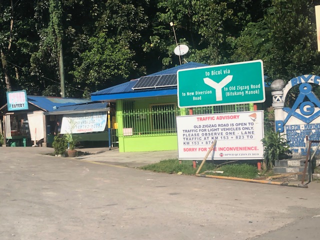
 Crossroads – at the intersection at the southern end where travellers decide whether to take the Bitukang Manok or the newer and easier bypass road
 The sign states: Vehicles with 6 or more wheels are prohibited from using the old zig-zag road.
 Sign for the Quezon National Forest Park – this designation is attributed to a former President and local congressman
 Here’s a photo of one of the more challenging sections. A team of flagmen manage traffic by giving turns to either direction, ensuring slower speeds and wider turning at the hairpin curve. Travelers often toss coins as a token of gratitude for these flagmen who man this challenging section of the national highway 24 hours/day.
 The barriers and signs along Bitukang Manok have been upgraded and are well-maintained.
 Approach to the northern end of the old zigzag road
 Directional sign at the other end of Bitukang Manok showing the options for travellers and another advisory stating the prohibition of large vehicles along the old zigzag road.
–
Bitukang Manok
I woke up from a long nap just before we entered a major zigzag section of the Pan Philippine Highway that is more popularly known as the “Bitukang Manok”. That literally translates to “chicken innards or intestines”, which is how many travellers would describe the alignment of this section of the national highway network. We decided to take the “old zigzag road” instead of the “new diversion road” since the latter is known to be already congested especially as trucks and buses take this road instead of the zigzag.
 Expectedly, the road offered all kinds of curves and grades throughout. I was glad to see relatively new barriers already installed or constructed along the entire length of Bitukang Manok.
 Here is a particularly challenging section combining sharp hairpin curves with steep inclines.
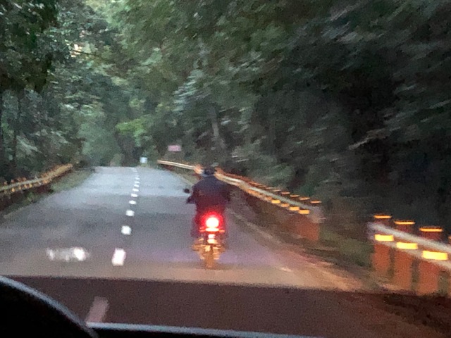 We caught up with this rider along a relatively straight and level segment of the road
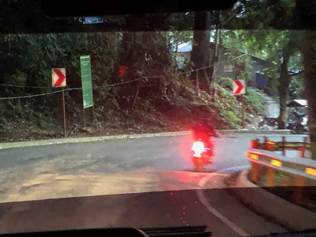
 There are flagmen strategically deployed along the most difficult parts of the road including this one that might lead inexperienced or erring drivers to drive/ride straight off a cliff.
 Here’s another hairpin curve; this time on the way down from the mountain.
 The final turn of the road before it merged with the diversion road
 Sign at the other end of the road showing travellers the divergence of the national highway into the “old zigzag road” and the “new diversion road”. Notice the platoon of southbound trucks at right.
I remember Bitukang Manok as a dreaded section among travellers before not just from the safety viewpoint but also because many can get sick (e.g., motion sickness that may result into throwing up) going through the section especially if the driver is not as smooth in manoeuvring the vehicle through the zigzags. There were also long distance bicycle races before where the Bitukang Manok featured as the main challenge to the best cyclists and the winner of that leg of the race was pronounced as “king of the mountain”.
–
