
Home » Posts tagged 'Quezon City' (Page 5)
Tag Archives: Quezon City
Completed Quezon Avenue-Araneta Avenue underpass
The underpass along Quezon Avenue at its intersection with Araneta Avenue was finally completed and opened to traffic last September 28, 2012. It is perhaps one of the most anticipated inaugurations of infrastructure for Metro Manila and not an anti-climactic one like what was hyped as the completion of the loop formed by MRT3 and LRT1 a few years ago. That didn’t turn out well as we now know there is no loop at all with real connection of the two rail lines. But that, as they say, is another story worth another post or two.
Based on reports from different people including our office’s drivers and some colleagues, traffic has significantly improved in the area. The only joke going around is if the underpass will not be a catchment for floodwaters should there be strong rains considering that it was flooded during construction due to its proximity to the San Juan River and the perennially flooded areas of Talayan and Espana. There are, of course, pumps that have already been installed for the underpass to reduce if not eliminate the possibility of flooding. Following are a few photos taken one Saturday mid-morning when I passed along the area.
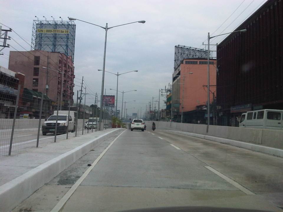
 A view of the approach to the underpass from Banawe. The pedestrian overpass is across Sto. Domingo Church.
 The section has 4 lanes with opposing traffic physically separated by a median island. The fence is likely to prevent jaywalking as well as maybe dissipate glare from headlights during night time.
 Potted plants have been placed along the median and though perhaps more are needed, I am glad there are no concrete balls that look like goat poop used to “decorate” the underpass. Columns and girders support the underpass walls at near the junction with Araneta Ave.
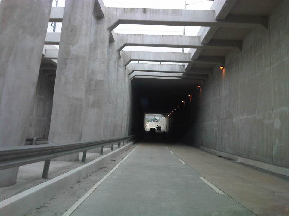 Approaching the section directly under Araneta Avenue, the first impression is that it is quite dark though motorists can see the end of the underpass. Pumps have been installed to drain water from this lowest parts of the underpass and prevent it (or reduced) from being flooded during times of strong rains.
 The end of the tunnel is practically a mirror image of the other. There are few potted plants as shown and perhaps more are needed to soften the look of the underpass as well as to reduce headlight glares.
 Back at-grade – emerging from the underpass, motorists will eventually merge with the traffic along the wide sections of Quezon Avenue. On the opposite direction, I noticed some congestion for vehicle emerging from the underpass as there is a U-turn slot a few meters from the ramp at the Banawe area.
There are traffic signals to manage flows at the at-grade junction of Quezon Ave. and Araneta Ave. It is expected that by reducing the volume of through traffic along Quezon Ave., the signals would be able to handle the remaining traffic and that the intersection will not be as congested as the case prior to the construction of the underpass. Of course, I would also like to see for myself how traffic is in the area during the regular weekdays, particularly on the typically busy days of Monday and Friday.
–
Walking and parking in Quezon City: West Avenue
Parking spaces and walkways were also constructed along West Avenue. Bollards separate the parking spaces from the pedestrian right of way. As mentioned in a previous post, many commercial establishments benefitted from this “freebie” from the Quezon City government considering many establishments didn’t even have the minimum number of parking spaces as stipulated in the National Building Code. The local government balked at charging parking fees but one opinion is that they should charge fees for on-street parking facilities that generally benefit car-owners more than they benefit non-owners. I personally believe that there should be parking fees in order to recover some funds that could be used for other programs that could have otherwise received funding that also could have benefited more people. Following are photos taken along West Ave.
 Parking along West Ave. in front of an office building
 One advantage of the project was the reduction of on-street parking though there are still those who prefer to wait along the roadside (i.e., those with drivers).
 Parking spaces in front of a fine dining restaurant.
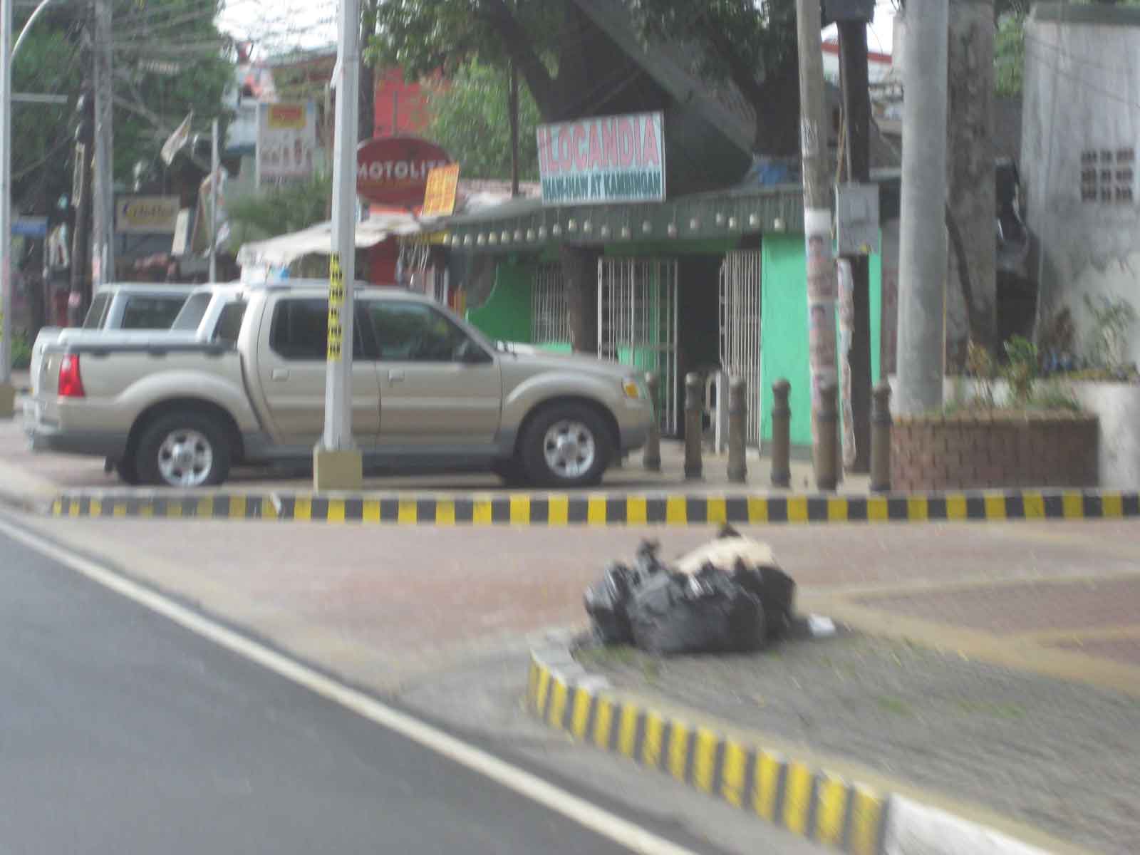
 Parking spaces near the Delta area, which is the intersection of 3 major roads – Quezon Ave., West Ave., and Timog Ave.
–
Walking and parking in Quezon City: Visayas Avenue
I’m initiating a series of posts on Quezon City – focusing on the pedestrian and parking facilities that were constructed not so long ago. As part of a city-wide project using local funds generated from QC’s internal revenue allotment (IRA) and other incomes, the city constructed pedestrian sidewalks and off-street parking spaces along its major roads. These included roads like Quezon Avenue, Visayas Avenue, West Avenue and Tomas Morato Avenue. I believe that these facilities provide example of good practices for other cities seeking to enhance walkability while addressing on-street parking issues.
Following is a photo journal of pedestrian and parking along Visayas Avenue.
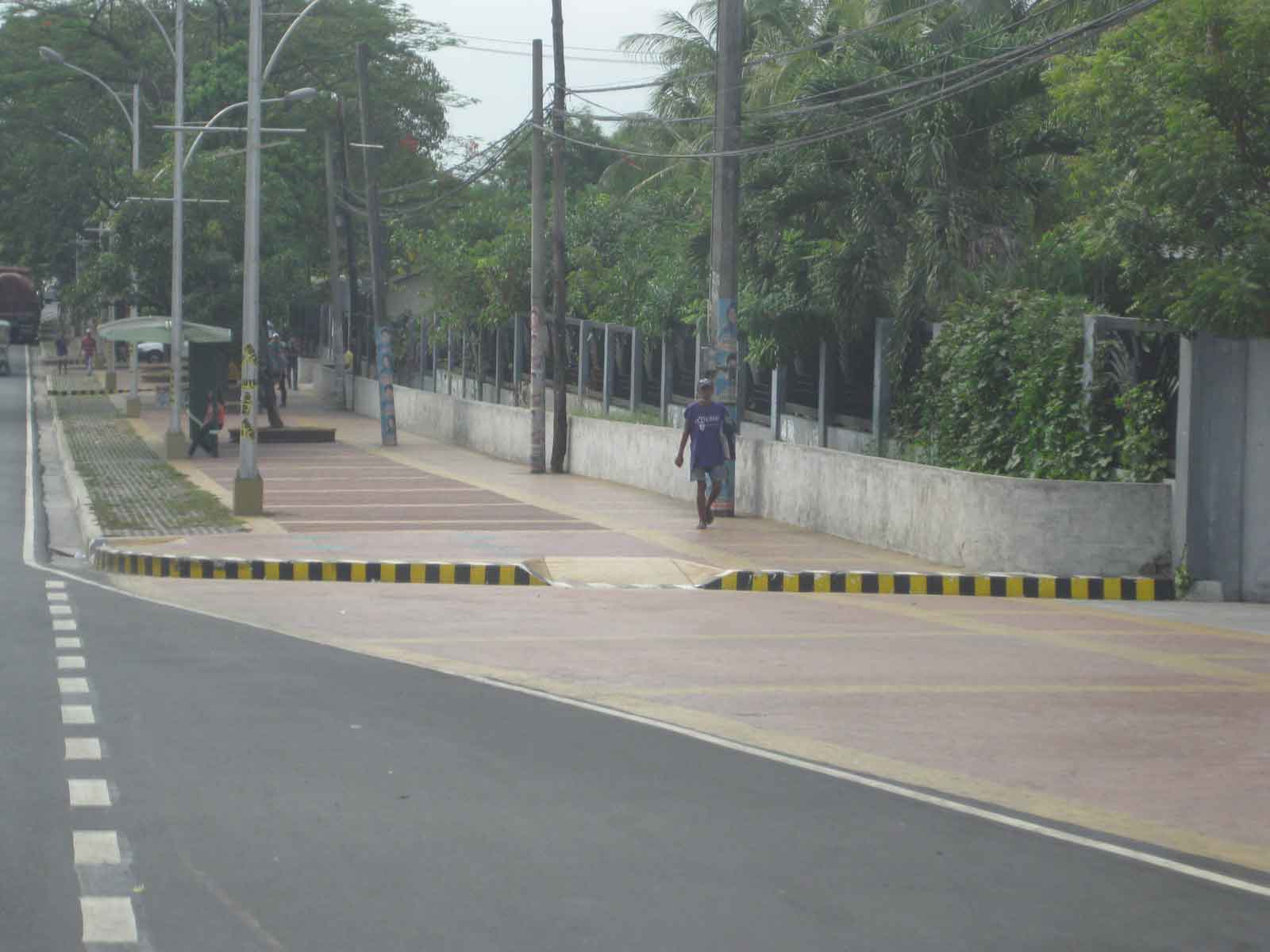
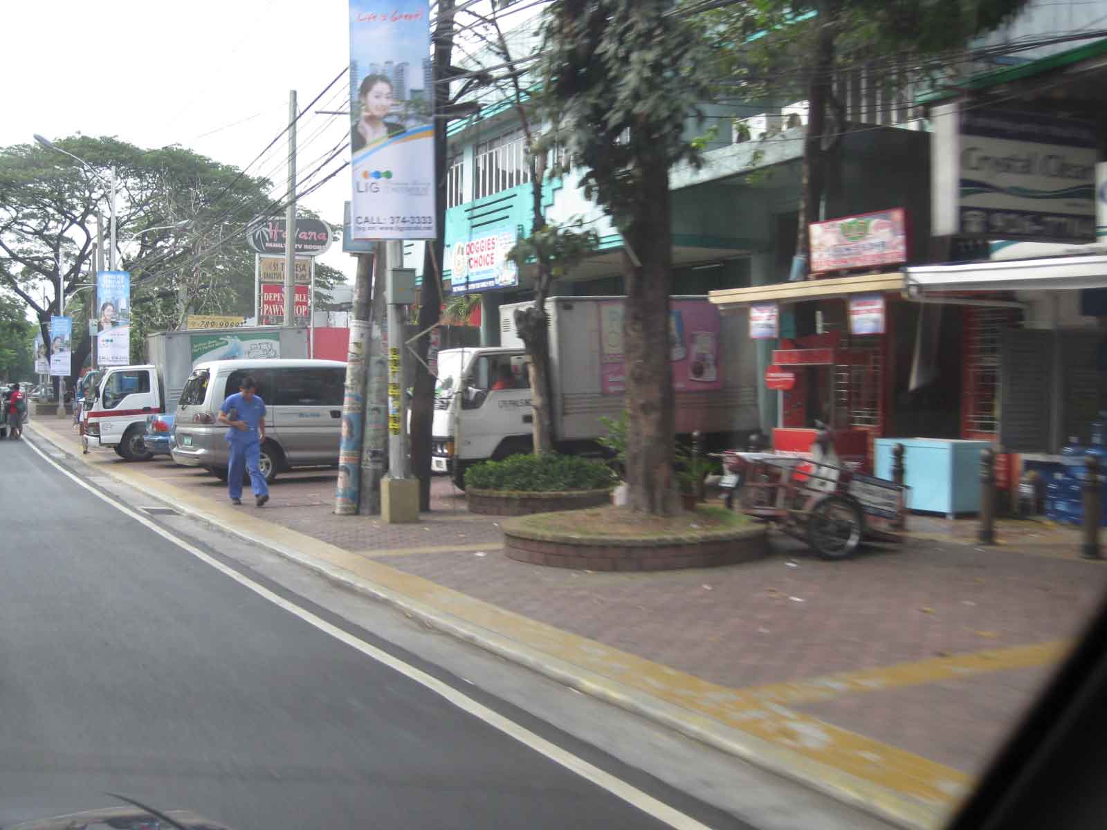
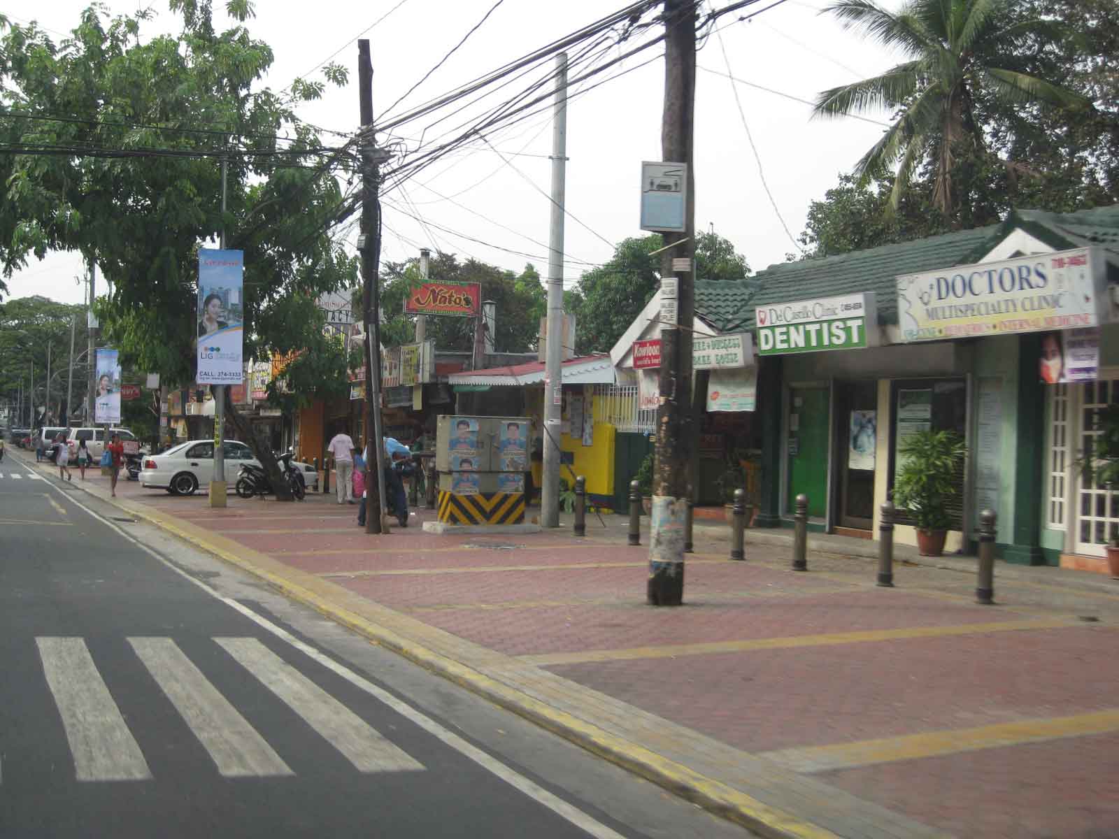
Spacious pedestrian walkways along Visayas Ave. visible upon turning right from the Elliptical Road.
 Combination of parking and pedestrian walkway along Visayas Ave. along a line of commercial establishments, mostly restaurants and shops along the road. There are bollards to separate parking spaces from the walkways.
 Despite the opportunities during the project, many lamp or electric posts have not been moved/transferred. These create obstructions in addition to the common practice of delivery trucks backing up and blocking pedestrian paths.
 Commercial and residential buildings along Visayas Ave. have benefited from the project as there were no off-street parking along most sections of the road and pedestrian facilities were often the token sidewalks that are also often obstructed with debris or vendors.
 There are few other cities in the Philippines with off-street parking such as this that does not intrude into the rights of way for pedestrians. Then again, there are also limited opportunities where space is generally not available for such projects.
 Most establishments along this side of Visayas Ave. had adequate frontage space or buffers (likely part of the road’s ROW) that made it possible to have pedestrian and parking spaces.
In the last local elections, parking fees for these spaces became an issue. Since government money was used to construct the parking facilities where there were none despite minimum parking requirements for establishments as stipulated under the National Building Code, some councilors proposed parking fees to recover the cost of construction. Some sectors including the businesses rejected the proposal stating that these benefit the general public. In an unusual move, the Catholic Church in QC even stated in a pastoral letter (!) that parking fees were anti-poor, something that was difficult to understand given that car-owners were the first to benefit from off-street parking. I doubt if what we regard as poor people would own cars. Parking fees were never implemented along this road and others like it.
–
Quezon Ave. underpass at Araneta Ave.: some expectations and issues
The underpass along Quezon Ave. at its junction with Araneta Ave. is set to open to general traffic this coming week. I got this from a reliable source who was involved in the project as well as friends from the DPWH and the MMDA. If the opening pushes through, the underpass is expected, based on analysis, to ease traffic along both major roads with Quezon Avenue’s through traffic having the most benefit from the uninterrupted flow provided by the underpass. At-grade traffic management at the intersection will still be provided mainly by traffic signals but the substantial reduction of traffic attributed to the through movements along Quezon Ave. The reduction of congestion comes as a relief to a lot of travelers as well as businesses affected by the construction of the underpass in the last year. Fortunately, there has been little delay in the construction and so it seems that lost times due to construction-related congestion (translated here as sacrifices for those who had to endure daily traffic congestion and had to adapt to the situation) will finally be compensated for. Many, indeed, have been anticipating the eventual opening of the underpass, expecting the facility to solve congestion in the area.
The area has been subject to flooding considering its proximity to the San Juan River. Official data for flood occurrences in the area can be accessed through the Department of Science and Technnology’s (DOST’s) Nationwide Operational Assessment of Hazards website where it is clear that flooding will be an enduring problem for the underpass and surrounding areas. Recent reports (from last week until today) indicate that there is still the specter of flooding that will have to be addressed given that prior to the construction of the overpass, this issue had already been flagged by various stakeholders including the Quezon City Government. It is for this reason that the underpass will have pumps to ensure that water will not accumulate and lead to the closure of the facility in times of heavy rains resulting in flash or regular flooding.
–
Luzon Avenue: Unfinished business
Luzon Avenue stretches from Commonwealth Ave. near Tandang Sora towards the Congressional Avenue Extension and currently ends at Sampaguita Avenue near the Fairview area. It is supposed to be part of Circumferential Road 5’s northern alignment that will connect with NLEX and McArthur Highway. It took quite some time to complete the bridge crossing Commonwealth Ave. and connecting Luzon Ave. to Tandang Sora near the end of the Katipunan Ave. stretch of C5. Issues were mainly on informal settlers occupying the land where the southern foot of the bridge and service road were to be constructed.
While much of the area has been cleared of informal settlers now, the ROW for the area has not been sufficiently cleared to complete the construction of the approach to the bridge. As such, only the northbound direction of the bridge has been opened to traffic as there is no space available for two-way traffic at the southern end where the bridge will ultimately connect to an intersection with Tandang Sora. Following are photos showing the approach at the north end of the bridge.
 Approach at the north end of the bridge across Commonwealth Avenue – the south end connects to Tandang Sora Ave. near the University of the Philippines Diliman campus. The south end approach is partly finished and allows only right turns from Tandang Sora towards the bridge or to the one-lane service road that leads to Fairview-bound side of Commonwealth.
 Service road – southbound traffic would have to take the service road that leads to Commonwealth Ave. and a short drive to the intersection of the latter with Tandang Sora.
 Talipapa? – this area under the bridge used to be occupied by informal settlers and there was a market here that usually spread to Commonwealth, with vendors and customers occupying the outer lanes of the highway during weekends and causing congestion for vehicles approaching Tandang Sora
 Remnants – there are still stalls, many of them mobile, selling a variety of goods including food, clothes, bags, plastic items and other commodities found in most wet and dry markets. There is a Puregold supermarket near the intersection on the left side and unseen in the photo.
 Exit to Commonwealth – the one lane approach to Commonwealth is sufficient now due to the light traffic but will not be enough once Luzon Ave and C5 is completed, bringing more vehicles to this area.
–
EDSA traffic: view from the top
Traffic along Epifanio Delos Santos Avenue (EDSA) or Circumferential Road 4 is quite infamous considering it being a if not the main artery of Metro Manila and carrying much vehicular and passenger traffic between cities like Pasay City, Makati City, Mandaluyong City, Pasig City, Quezon City and Caloocan City where it has major junctions with other major thoroughfares like Roxas Boulevard, South Superhighway, Ayala Ave., Gil Puyat (Buendia) Ave., Shaw Blvd., Ortigas Ave., Aurora Blvd., East and Timog Avenues, Quezon Ave., North Ave., Roosevelt Ave., NLEX and A. Bonifacio Ave., Rizal Ave. and MacArthur Highway.
Shown in the following photos are traffic conditions along EDSA during a holiday, and typical afternoon peak and evening on a weekday. The section featured is the stretch from the Ortigas junction to Camp Aguinaldo. Visible in the photos are the high-rise condominiums along Connecticut Street (upper left) and the developments at the Araneta Center including the Araneta Coliseum in the Cubao commercial district. The green area on the upper right is Camp Aguinaldo, headquarters of the Armed Forces of the Philippines (AFP), while the rooftops at the right are of houses located in an high-end exclusive subdivision (Corinthian Gardens). In the middle of EDSA is the MRT-3’s elevated tracks.
 Photo taken from the 35F of the Robinsons-Equitable Tower shows light traffic along EDSA during a holiday. Traffic probably is similar during Sundays while such volumes may be observed on Saturdays only in the early mornings; before 9:00 or 10:00 AM when the shopping malls open.
 Photo taken at 5:44 pm showing traffic congestion on both directions (northbound and southbound) of EDSA including the overpasses at its intersection with Ortigas Ave. An MRT-3 train is visible in the middle of the photo.
 Photo taken at 6:16 pm with the headlights and taillights indicative of the traffic density during the early evening. Such congestion now usually extends past 8:00 pm with cases where EDSA is still congested near midnight. Such cases are more common now rather than exceptional.
–
