
Home » Posts tagged 'Rizal'
Tag Archives: Rizal
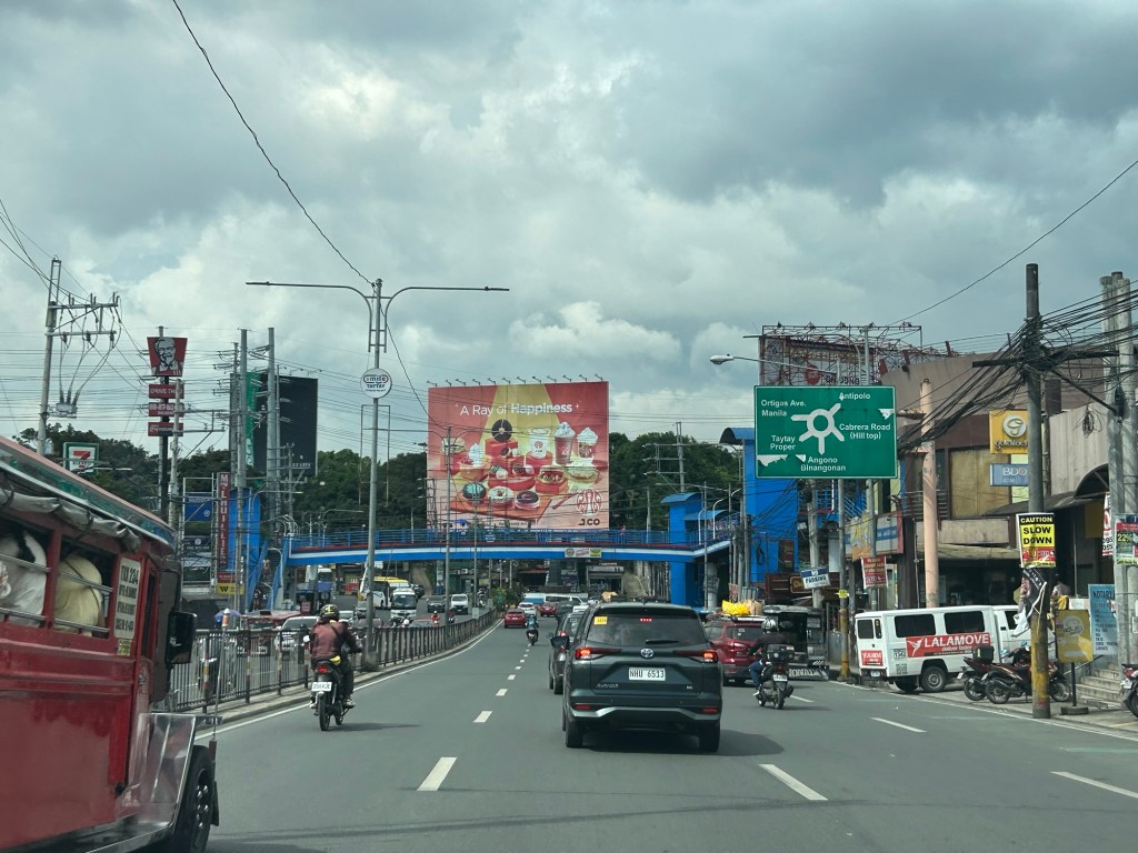
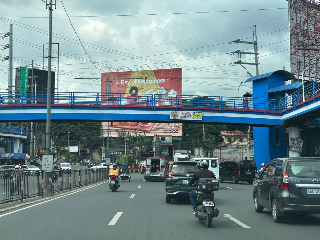
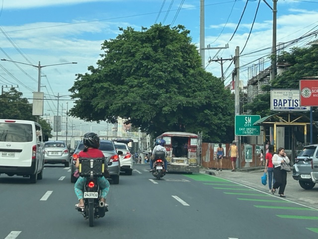
Ortigas Avenue Extension counterflow
One traffic scheme that has been constant along Ortigas Avenue Extension is the counterflow scheme. The scheme is applied in the mornings for westbound (outbound from Rizal) traffic. It has been implemented for as long as I can remember; perhaps since the early 1980s. One variant before was a form of “Buhos” where eastbound traffic is stopped for several minutes at certain intervals (6:30am, 7:00am, 7:30am and so on), and westbound traffic is allowed to take all the available lanes during the periods.
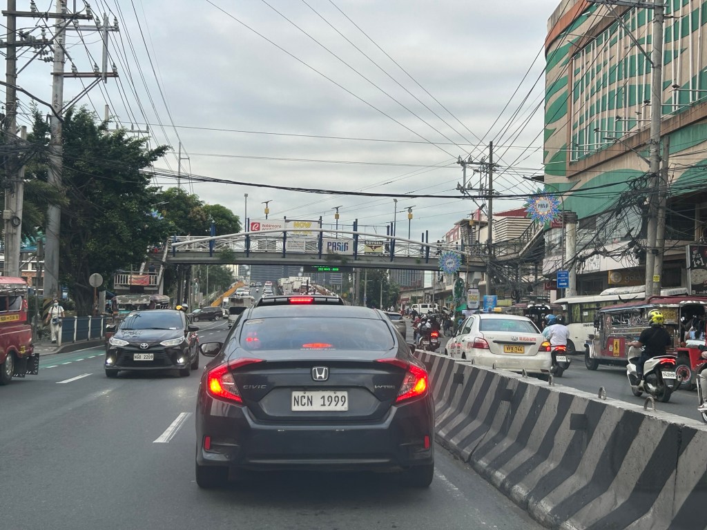
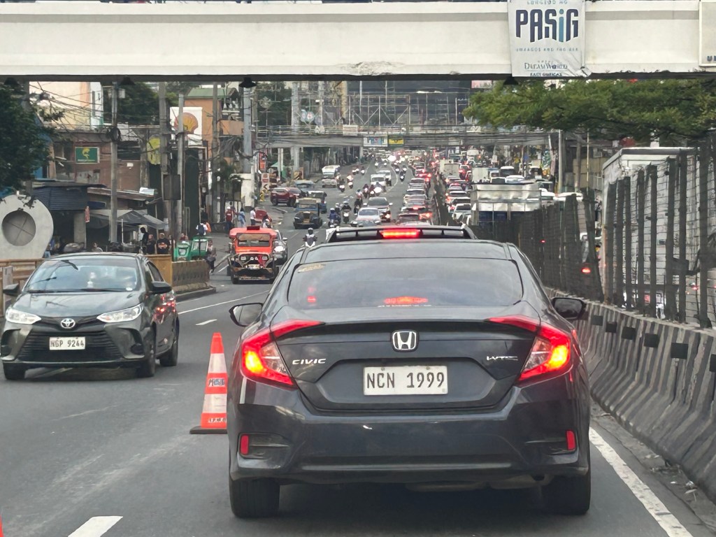
Considering this scheme has been implemented for more than 4 decades now, there must be some measure of effectiveness there. It is an example where the directional distribution during the peak hours allow for such scheme to be implemented. Note that the scheme pre dates number coding and similar counterflow schemes elsewhere in other major roads in Metro Manila (correct me if I’m wrong).
The scheme though only shows that there should have been a better transport system put in place along the corridor, which has had a steady growth in travel demand. There should have already been a transit line along this corridor a long time ago. What happened? Was it not in the government’s radar? There was a line proposed and shown in various master plans before.
–
After getting engrossed with EDSA, is Marcos Highway next?
If you monitored the news articles and social media post over the past two decades, there seems to be an obsession for EDSA. Circumferential Road 4 is the busiest corridor in Metro Manila, stretching across several jurisdictions including Caloocan, Quezon City, Mandaluyong, Makati and Pasay City. Aside from the MMDA, national agencies like the DPWH and DOTr have been heavily involved in traffic schemes and transportation infrastructure development along the corridor. These include variants of the travel demand management (TDM) scheme commonly called number coding. Since the 1990s, there’s the Line 3 and several overpasses/flyovers and underpass that have been constructed along major intersections (e.g., EDSA-Shaw, EDSA-Ortigas, EDSA-Kamuning, EDSA-Quezon Avenue, etc.). Nowadays, people are more into the EDSA carousel and most recently the pavement rehabilitation for EDSA. It seems we failed to realize that EDSA is just one corridor. There are others that also demand attention including those in other parts of the country.
Recently, a “carmaggedon” along Marcos Highway was in the headlines or shall I say was trending in social media. There was a lot of excitement for what has been a recurring nightmare to those residing along the corridor. I recall something worse occurred more than 15 years ago (pre-Ondoy), before social media and influencers and digital creators. At the time, Line 2 terminated at Santolan Station. And even back then, the MMDA insisted on playing with their U-turn scheme. I don’t recall a more in-depth study that could have involved micro-simulation modeling being done for the corridor. And since then, populations and traffic have grown steadily and as I’ve written about previously, the extension of Line 2 to Masinag seems to have had little impact on traffic. And so here we are with the MMDA still insisting on tweaking their U-turn schemes and relying mainly on gut-feel instead of a more scientific approach that may actually lead to more sound solutions for the corridor.
 Approach to Marcos Highway from Felix Avenue – that’s the elevated Line 2 superstructure behind the Cainta arch.
 Intersection of Marcos Highway, Felix Avenue and Gil Fernando Avenue – there’s a major foot bridge installed here so people can cross at the intersection, which used to be a signalized junction before the MMDA opted for U-turns for Marcos Highway sections under its jurisdiction.
 Marcos Highway section fronting the Ayala Feliz Mall – the MMDA has played with the location of the U-turn slots in the vicinity of the Marcos Highway-Amang Rodriguez-J.P. Rizal intersection as they tried to determine the “optimum” locations of these slots.
Of course, there is also the case of Commonwealth Avenue. How many carmaggedons have occurred along that corridor? Isn’t it an everyday thing there? And there’s also Ortigas Avenue Extension and many other roads and streets where congestion seems to have been accepted as the norm. How do we make travel easier for most people? How do we improve commutes given the constraints and realities concerning behavior and choices?
–
Complicated intersections in Rizal – Tikling Junction
There are several major intersections in Rizal Province. Among them are 3 junctions in Cainta, Taytay and Antipolo – Cainta Junction (Ortigas Ave Ext.-Felix Ave), Masinag Junction (Marcos Highway-Sumulong Highway), and Tikling or Kaytikling Junction. The first two are signalized intersections. The last one is supposed to be a roundabout. All three are problematic in various ways and have been associated with congestion along the major roads intersecting at these junctions.
Tikling is quite interesting as traffic seems to have worsened after it was set up as a roundabout. Taytay enforcers have been deployed here but they seem to contribute more to worsening congestion rather than easing it. Motorists familiar with the area will tell you that traffic is better when there are no enforcers. Unfortunately, not all motorists here are from the area or are familiar with the rules for navigating or positioning at a roundabout. And so the intersection is often constricted with vehicles whose drivers and riders don’t practice courtesy.
Perhaps a combination of geometric improvements and more clever enforcement/management can improve intersection performance?
–
Vehicle refuge during floods
Passing Felix Avenue one early morning this week, I saw familiar scene. There were lots of vehicles parked along Felix Avenue (formerly Imelda Avenue) including the service roads along either side of this major road connecting Marcos Highway and Ortigas Avenue Extension.
These vehicles are owned by residents of subdivisions along the avenue whose areas are prone to flooding. These include Vista Verde, Metroville, Kasibulan, Karangalan and the two Green Parks. I didn’t see this along the stretch so the other flood prone villages like Village East and Country Homes. Perhaps they have been able to adapt better?
Car-centric discussions aside, when you go the ‘east’ you will notice a lot of people using SUVs. One reason probably is because many Rizal towns including Antipolo City, and Pasig and Marikina Cities are prone to flooding. Can you imagine over 50 years of flooding in these areas? And then with the current investigations concerning flood control projects, have you wondered if the ‘east’ really got their taxpayers’ money’s worth in terms of interventions?
–
On C-6 and the proposal for another expressway, Part 2
The recent announcement and launch of the Southeast Metro Manila Expressway (SEMME) included this map showing the (very) rough alignment for the proposed tollway. The map also shows the proposed locations of interchanges including one in Tikling and another in Masinag. There is also another in Tumana. From the looks of this, the SEMME will be a skyway or elevated expressway/tollway.
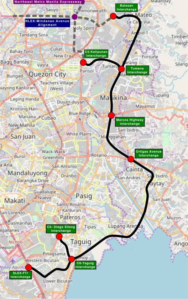
My first impression is that this elevated tollway will pass through predominantly residential areas with columns rising from private subdivisions. It doesn’t help that the topography also means the columns will be built along hilly or mountainous terrain, thereby making construction more challenging than the elevated tollways in Metro Manila.
Do we really need another circumferential road and particularly another tollway? I think that is a very important question that not only needs to be asked but also answered the right way. I, for my part, don’t believe we need another tollway, elevated or not, as this will not solve the so-called traffic problem. In fact, it creates more problems than what is supposed to be solved with the induced traffic this will generate and its promotion of car-centricity. For the price and effort of such an infrastructure, you will get more bang for your buck with a mass transit line or lines. Road congestion can only be solved by constructing the public transport system we needed decades ago.
–
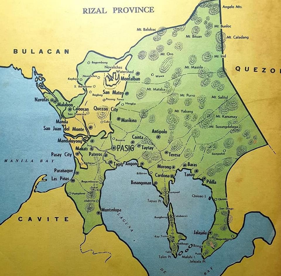
Old maps of Rizal Province
I found these two old maps of the Province of Rizal. I was trying to trace their sources but couldn’t find them yet. These were shared from social media pages.
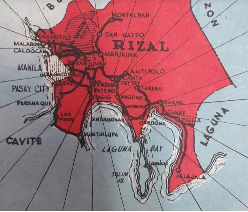
The second map clearly shows the Rizal towns that eventually became part of Metro Manila in the 1970s. These include Navotas, Malabon, Caloocan, Marikina, Pasig, Tagig, Mandaluyong, Makati, Pateros, Paranaque, Las Pinas and Muntinlupa. Pasig used to be the capital of the province; hence, Kapitolyo, which is still in Pasig. Note, too, that Caloocan was connected via a narrow strip between Quezon City and Bulacan. That part of Bulacan is the then town of Valenzuela that was also integrated with Metro Manila. I wrote about a ‘what if’ a while ago where politics would have been different in the province if it remained as it is before the creation of Metro Manila. History teaches us a lot of things including decisions made that led to how we are today. That certainly applies to transportation and definitely applies to politics if you come to think of it particularly for Rizal.
–
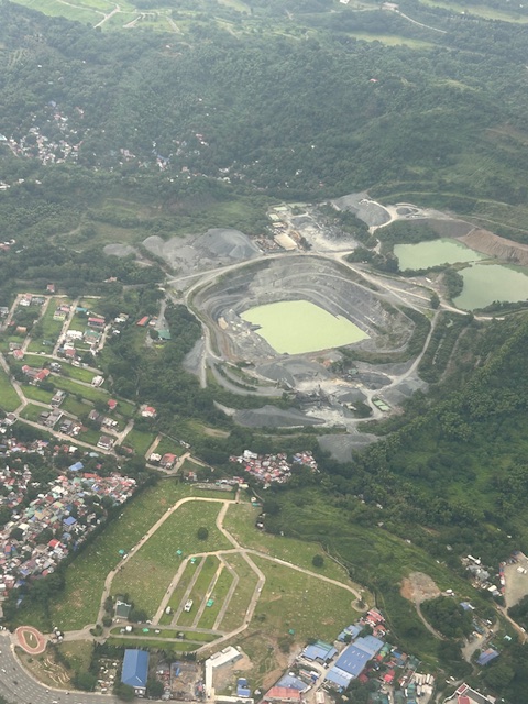
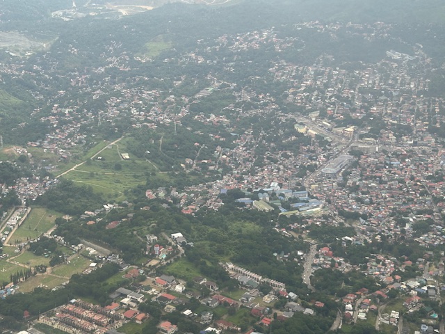
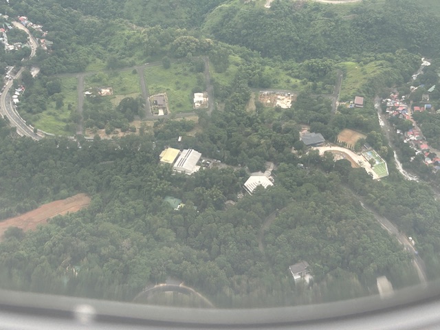
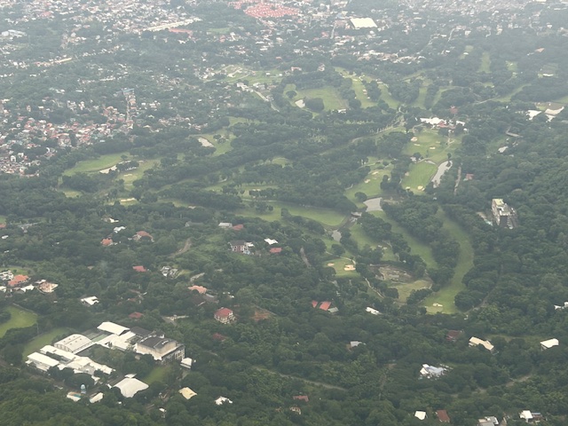
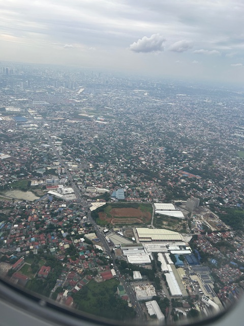
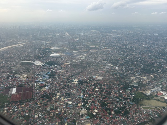
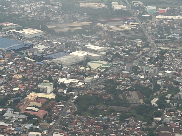
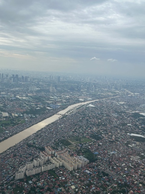
Aerial photos of Rizal
Following is a continuation of my recent post on aerial photos I took when I went to Iloilo for some meetings. This set is from our plane’s approach to land at NAIA. The path led us through Rizal province and the following photos mainly of Antipolo and Cainta.
–
Change in scenery
We had an off-campus workshop last week in Baras, Rizal, and it was a welcome change in environment and pace. The venue also afforded a view of the provinces of Rizal, Laguna and even Quezon.
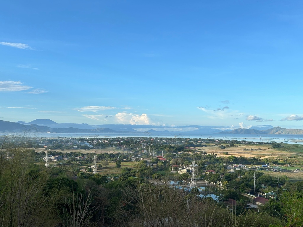 We had a nice view of Laguna de Bai. At the center of the photo is the town proper of Tanay, which has an old church at the center and along the old national road. In the background are mountains, volcanoes actually, including on the left Mt. Banahaw in Quezon Province. Mt. Makiling in Laguna is also in the horizon on the right.
If you notice the power lines in the photo, these connect to the two power plants in the area – the Malaya Thermal Plant and the Pililla Wind Farm both in Pililla, Rizal.
Tanay has a small port and a lighthouse. There are many fish pens in the area so most boats using the port are probably fishing boats. There was a proposal many years ago for extending the ferry service along the Pasig River to towns along the lake. This required clearing the lake of many fish pens to make it navigable. I hear the plans are being revived but I think its a wait and see in as far as these projects are concerned.
–
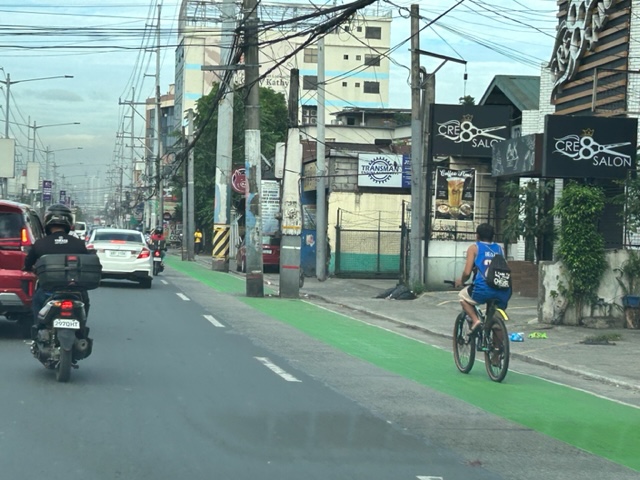
Westbound bike lane along Ortigas Avenue Extension, Cainta, Rizal
I was not able to post these photos of the westbound bike lane along Ortigas Avenue Extension immediately after I shared photos of the eastbound bike lane. The bike lanes, as can be seen from the photos, are painted green.
 Bike lane past Valley Golf and STI
 Bike lane approaching Brookside (Sunset Drive) with the CK Square as a landmark
 Still a big issue for bike lanes is the presence of electric and communication poles/posts that have not been relocated after so many years since Ortigas Avenue had been widened.
 Bike lane across from Tapsi ni Vivian
 These photos were taken before the solar studs were installed to delineate the bike lanes and make them more visible at night or when its dark.
 Also, challenges and concerns for cyclists are parked vehicles and those maneuvering from the various establishments along the road. This photo pretty much captures those two concerns – a parked UV Express van and a truck maneuvering out of a store occupying the bike lane.
 Cyclist pedaling along the bike lane approaching the Shell Gas Station (where there is also a McDonald’s)
 Bike lane in front of the Ortigas Hospital just outside the Brookside Gate 1 and near Cainta Junction
More photos of the bike lanes soon!
–
Arches along the Manila East Road
Last October, our office had our first out-of-town workshop since the onset of the COVID-19 pandemic. The venue was not so far – a resort in Baras, Rizal. Along the way, I was able to take a few photos of the arches along the Manila East Road, which is the main highway connecting the towns of Rizal Province.
 One side of the Morong, Rizal arch with the text stating the traveler is leaving the town. The other side is Baras, Rizal.
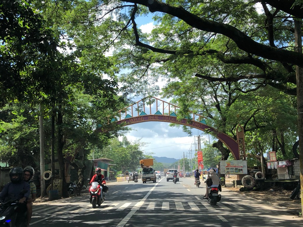 The other side with the text stating one is entering the town of Morong “where education comes first”.
 At the other end is another arch and the town of Teresa.
Many arches have been demolished, casualties of the DPWH’s road widening program. Many of these have not been replaced. These were landmarks to many travelers and the designs used to describe or highlight what a town was known for (e.g., there was a big bat at the center of the arch of Paniqui, Tarlac).
–
