
Home » Posts tagged 'Rizal' (Page 4)
Tag Archives: Rizal
Improvements to alternative route between Rizal and Makati
I finally got another look at the conditions along the alternate road to Highway 2000 and C-6 Extension a couple of weeks ago while en route to Bonifacio Global City. Traffic along Ortigas Ave. is usually terrible these days even during the weekends due to the road and drainage works between Cainta Junction and Brookside. I am glad to say that there have been significant improvements to the section of Don Hilario Cruz Ave nearest to the Manggahan Floodway and beside the Megawide plant. There have been significant developments, too, along C-6 Extension in the Lupang Arenda area of Taytay, Rizal. Here are some photos of the area.
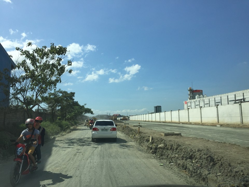 Don Hilario Cruz Ave., the road beside the Megawide plant and parallel to Highway 2000, is being improved with half the carriageway already prepared for paving. The other half appears to be graded is being used by vehicles.
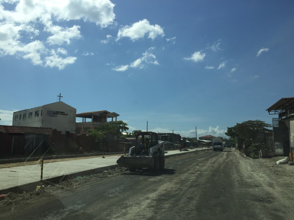
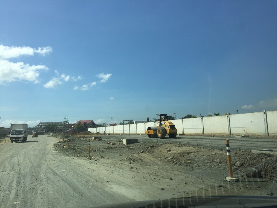 A roller runs along the base layer of the road that’s being paved. These sections were usually muddy and full of craters during the wet season and very dusty and still full of potholes during the dry season.
 Sections of C-6 Extension at the Lupang Arenda area have been widened and the expropriated lands are now being transformed into paved roads. The original sections have been overlayed with asphalt to improve their ride-ability.
 Another section in Lupang Arenda shows finished PCCP for the eastbound side of C-6.
 Another photo of C-6 extension. Once the finished lanes are usable, authorities will probably divert traffic there so they could also pave the rest of the road.
Travelers between Rizal and Makati/Taguig will benefit the most from the improvements along these roads. These will increase road capacity as well as travel speeds along this route. Now, if only authorities can also improve C-6 itself in Taguig…
–
On the severity of traffic congestion along Ortigas Avenue and the necessity of a mass transit line
With the worsening congestion along Marcos Highway due to the construction of the LRT Line 2 Extension to Masinag, I have been using Ortigas Avenue as an alternate route to go home. Granted, the stretch from the Park Place gate near Cainta Junction and Brookside is currently undergoing roadworks elevating that entire section (which is prone to flooding), and this is the main cause of much congestion as fewer lanes are usable to traffic. However, what is perceived to be relief from traffic once the project is completed will eventually and surely revert to a very congested Ortigas Avenue.
Traffic congestion along Ortigas Extension is primarily due to a dependence on road transport, particularly private vehicles, by people living along Ortigas Ave. and the roads feeding into it. The Manila East Road, for example, passes through the most populous towns of Rizal outside of Antipolo City. The dependence on road transport (especially private vehicles) is due to limited options for public transport. There are buses, jeepneys and UV Express but these, too, contribute to congestion due to their increased numbers and limited capacities given the high demand for public transport. Among the infrastructure proposed along this corridor is an overpass along Ortigas Ave. at Cainta Junction. A mass transit system has also been required along this corridor for a very long time but for some reason, such infrastructure has not been provided.
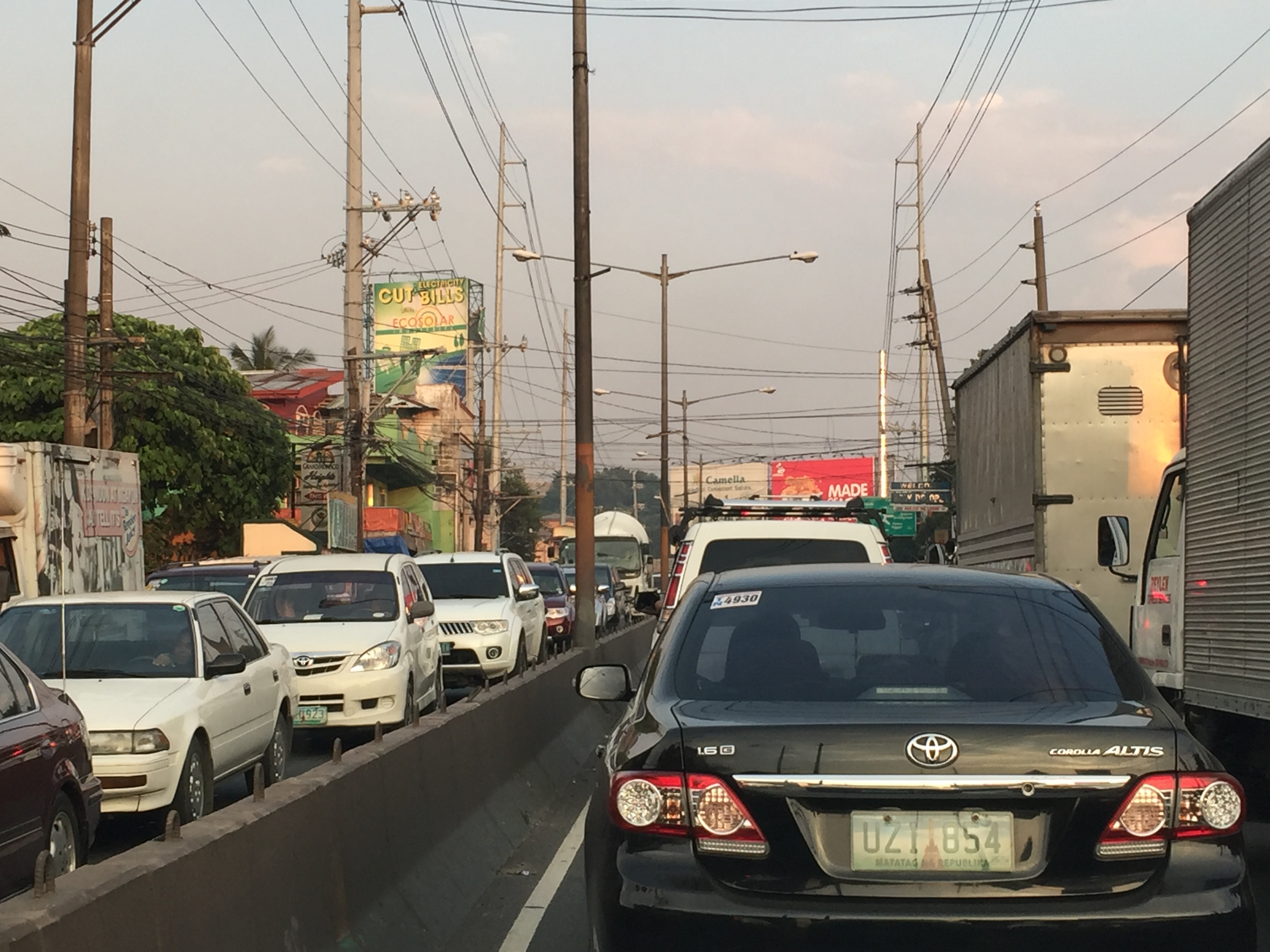 Severe traffic congestion along both directions of Ortigas Avenue Extension
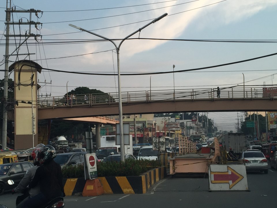 Congestion stretches all the way along the Manila East Road
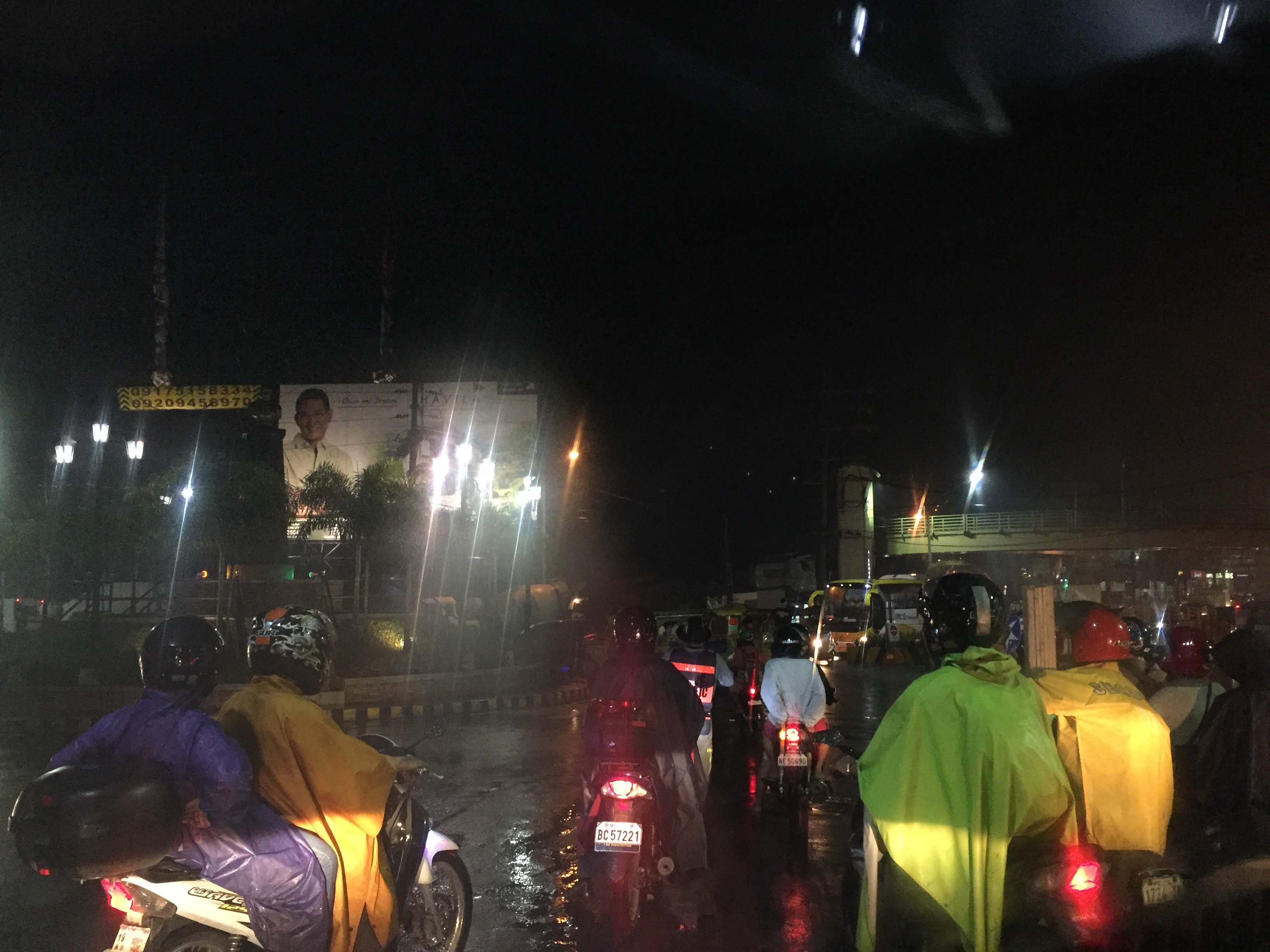 Night-time traffic congestion at the Tikling Junction
There is a proposal for a mass transit system along this corridor. Following are references to the project:
From the PPP Centre: https://ppp.gov.ph/?ppp_projects=ortigas-taytay-lrt-line-4-project
From CNN Philippines: http://cnnphilippines.com/metro/2015/07/22/neda-approves-naia-lrt-ppp-projects.html
I found it quite odd that the stations are not referenced according to the more common place names for the locations. For example, ‘Bonifacio Avenue’ should be ‘Cainta Junction’ and ‘Leonard Wood’ should be ‘Kaytikling Junction’. Nevertheless, this is the least of our concerns pertaining to transport and traffic along this corridor.
Perhaps the conditions are ripe now to finally implement transport infrastructure projects along this corridor. The proposal and approval of a rail transit line by NEDA means the corridor has the national government’s attention. The local government leaders along this corridor are also more progressive and aggressive than their predecessors. These include a very dynamic mayor in Cainta and the former governor-turned mayor in Antipolo. A collaboration towards better transport among these two LGUs alone would be influential and instrumental to improving travel along Ortigas Avenue.
–
Roadside views of the Pillila, Rizal Wind Farm
A highlight of our recent road trip to and from Lucena, Quezon via the Rizal – Laguna – Quezon route is the impressive roadside views of the new Pillila Wind Farm. The array consists of 27 turbines, more than the number in Bangui, Ilocos Norte. Following are a few photos of the turbines of the farm which has a total capacity of 5.2 Megawatts. I noticed though that many of the turbines were not running so the capacity is likely not reached and the output highly varies depending on the season and time of day.


There are two access points from the national highway to the wind farm. Via these access roads, one can get near the wind turbines to get photos including ‘selfies’ with the turbines as background, just like those trending photos posted on social media taken at the Bangui Wind Farm.
The Philippines needs more of these clean energy sources. The promotion and spread of such types of energy generation should be able to reduce our dependence on fossil fuels. This would be good in the long run and also for transportation since there are already many initiatives for electric vehicles. E-vehicles are not necessarily zero contributors to air quality and ultimately to climate change if we consider the sources of electricity when these vehicles re-charge their batteries.
–
Proposals for EDSA and some alternate roads
The hellish traffic congestion along EDSA and other roads in Metro Manila spawned a bunch of ideas for alleviating congestion. Among those that were offered as solutions are the following:
- Odd-Even Scheme – suggested by the Philippines President himself in a speech delivered in Mandaluyong City
- Car-pooling (and HOV lanes) – suggested by the DPWH Secretary in another forum
- Bus Rapid Transit (BRT) and/or express bus – proposed and being studied by the DOTC
What seems to have been forgotten was a proposal to have two lanes of EDSA, one on either direction, devoted to bicycles. This proposal now seems to be the most viable compared to the above three and could have the potential for major behaviour change towards a departure from motor vehicle use. Cycling along with walking does not require fuel and these modes also promote healthy lifestyles. Also, this could become the ultimate example for road diets, which can also be applied along other roads as well. What sounds or reads like an outrageous idea (i.e., bicycle lanes along EDSA) might just be revolutionary and result in what could be a tipping point for sustainable transport in the midst of traffic mayhem.
EDSA has become the proverbial battleground representing the war with traffic congestion. However, EDSA is just one part of our arterial network comprised of circumferential and radial roads. There is also C-5 (also known for its sections – Katipunan, E. Rodriguez, C.P. Garcia), which is also a very congested road but along which there are few fixed route public transport services. It is a primary alternative route (to EDSA)for people traveling between the northern and southern halves of Metro Manila. It also serves as a collector and distributor, being connected with major radial roads like Aurora Boulevard, Ortigas Avenue and Shaw Boulevard as well as to the South Luzon Expressway. C-5 is a major truck route, however, and so carries a lot of heavy vehicles during the permitted times under the truck ban scheme being implemented in Metro Manila. C-5 is already ripe for a mass transit system and should have one along it. The quickest to put up would be a bus system on exclusive lanes. Strategically though, a rail transit line (likely elevated) should already be planned and implemented and with as seamless as possible connections to current and future lines along major corridors.
There are other routes that can be considered which I think have been overlooked (too much focus on EDSA?). C-6, for example, badly needs to be improved and this has started but is being implemented at a slow pace. This could have significant positive impacts on traffic coming from the east (towns of Rizal province) that are bound primarily for Makati and BGC. But then there also has to be a good road bypassing the narrow and already congested streets of Taguig and Pateros that are currently the only roads connecting C-5 and C-6. The roads on the Rizal side (attention: Cainta and Taytay) also need to be improved including Highway 2000 and the Barkadahan Bridge. Perhaps the Rizal Provincial Government should also get involved in this as such routes are in the best interest of Rizalenos. And then there is also the highly urbanized city of Antipolo that is a major destination and already is the 7th most populous city in the country, whose residents also use this route, which is often a faster option to Ortigas and C-5 despite the poor conditions of roads.
–
Alternative to Highway 2000, Taytay, Rizal – Part 2
The stretch of Don Hilario Cruz Avenue between Megawide and the Manila East Road is paved and generally wider than Highway 2000. While there are residential villages along this stretch as well as a significant traffic generator in Club Manila East, which is a resort, traffic is usually light. There are actually few establishments and informal settlements along the road, which retains its exclusive subdivision feel.
 Section in front of Club Manila East
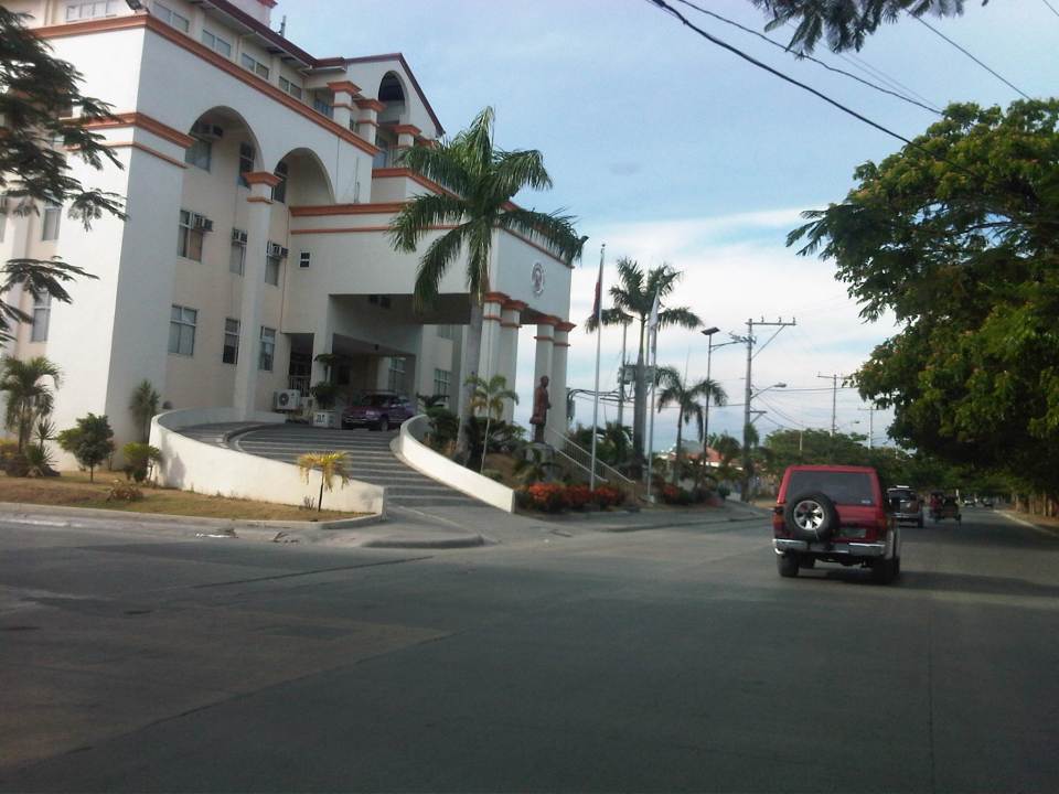 Taytay (Rizal) Municipal Hall – the Land Transport Franchising and Regulatory Board (LTFRB) office is just beside the municipal hall and often you could see taxis lined up along this road to have their meters calibrated and sealed.
 This entire area used to be an exclusive subdivision and Don Hilario Cruz Ave. was a private road. The old guardhouses are still there and heavy vehicles may not use this road without paying a toll fee.
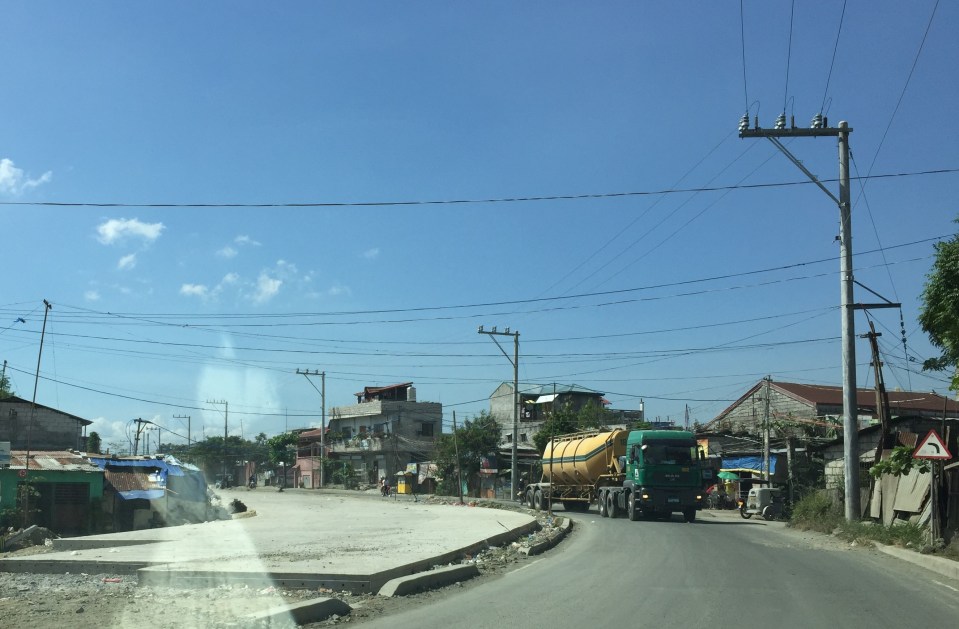
 On-street parking is prevalent along the section connecting to the Manila East Road because of the clothes/garments market on either side of the road. Taytay, Rizal is well-known for its garments factories and tailors.
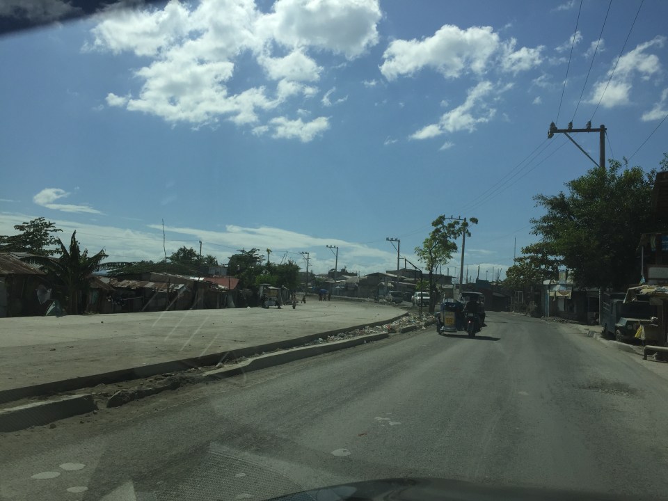
 Section approaching the Manila East Road
The only setback when traveling using this alternate route to Highway 2000 is that stretch beside Megawide. It very dusty during the dry season and muddy during the wet season. The road can be quite rough and will damage cars over time. You definitely cannot speed up along this section even if you are on an SUV and are familiar with the bumps along the road. Hopefully, the Taytay could address this issue and the Rizal Provincial government can also facilitate the paving of this section, which is used by many Rizalenos heading to work or school in Metro Manila.
–
Alternative to Highway 2000, Taytay, Rizal – Part 1
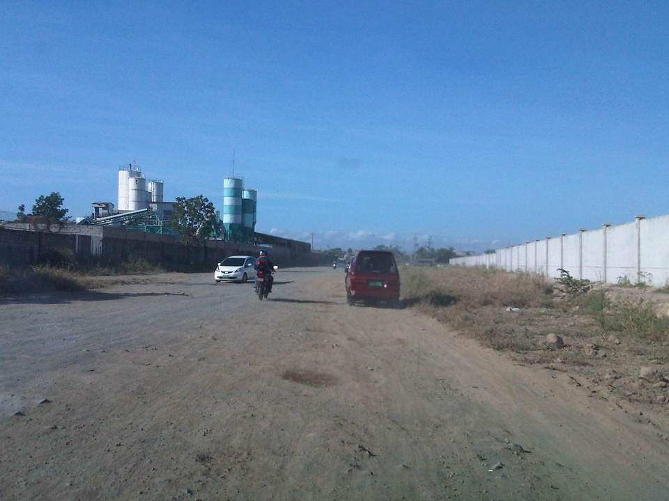
An alternate route to the poorly maintained Highway 2000 in Taytay, Rizal that leads to Barkadahan Bridge and Circumferential Road 6 (C-6) is via Don Hilario Cruz Avenue, along which is the new Taytay Municipal Hall, the Land Transportation Office in Taytay, and Club Manila East. While most of Don Hilario Cruz is paved, there is a significant section that remains unpaved. It is very dusty during the dry season and muddy during the wet season.
 The road section is unpaved but appears to be graded (probably by the tires of all the vehicles using it everyday). The wall on the right is Megawide’s. Megawide is a major contractor.
 Motorcycles are the fastest along these types of roads. Other vehicles including trucks need to slow down so their suspensions will not be damaged by the rough road.
 I have wondered whether Megawide has considered contributing to paving the road considering their stature in the construction industry. This can be their CSR project and one where a lot of people will be very appreciative with the results.
 Intersection with Velasquez Street, which connects to the Manggahan East Service Road to the north and the Manila East Road to the south.
–
All roads lead to Antipolo: rerouting for the Alay Lakad
The Rizal Provincial Government and the Antipolo City Government recently posted traffic rerouting schemes on their Facebook pages. Lalawigan ng Rizal was the first to post schemes that affect traffic in at least 3 major local government jurisdictions – Antipolo, Cainta and Taytay. The schemes affect the two major corridors that basically lead to Antipolo’s National Shrine of Our Lady of Peace and Good Voyage (or Antipolo Cathedral to many) – the Ortigas Avenue corridor and the Marcos Highway-Sumulong Highway corridor. There are many major and minor routes connecting to these corridors and are clearly seen in the maps.
Within Antipolo, there are also re-routing schemes, which the Antipolo City Government posted along with a “clearer” re-posting of the maps from the Rizal FB page. The Antipolo FB page includes information/maps on the rerouting within the city center. These schemes will affect traffic circulation including public transport routes. Critical would be the permanent and temporary terminals and parking areas set-up around the city that should be able to accommodate the thousands of vehicles that are also expected to be used by people who won’t be walking or cycling.
What the maps basically say is that from 4:00 PM today, Maundy Thursday, to 6:00 AM tomorrow, Good Friday, the stretch from Cainta Junction to the Shrine will be closed to traffic. This is to allow the hundreds of thousands expected to make the trek to Antipolo to have the road for themselves. What the maps don’t say is that motorcycles and tricycles would likely be allowed, too. I can understand that motorcycles could easily squeeze into the throngs of people but then allowing tricycles to operate among the walkers and bikers would be risky given their drivers’ behavior. Add to this that they would be making a killing out of charging opportunistic fares.
Technically, the rerouting schemes don’t appear to be as well thought of as can be expected from the LGUs. Baka ito lang nakayanan ng staff o ng consultants nila, and surrender na agad ang Rizal and Antipolo with regards to the coming up with more options for people to travel to the Antipolo Shrine? Not all people can walk or cycle but are willing to an could take public transport for their pilgrimage. The maps themselves are a bit crude and the Province of Rizal and City of Antipolo could have done much better maps given the resources of these LGUs. There are open source tools now available as well as your basic software like PowerPoint or Photoshop (even Word!) that can be used to render good quality images to guide people making the Alay Lakad. This is a regular event and though it happens once a year then perhaps the LGUs could have better plans especially to transport people who cannot make the walk to Antipolo. The objective after all is to convey the masses to and from the shrine safely and efficiently – something a mass transport system can do whether via Marcos/Sumulong or Ortigas corridors.
One reminder to all doing the Alay Lakad: keep your garbage to yourselves if you cannot find a proper waste bin. Do not dispose of your waste along the route and make a dumpsite out of Ortigas Avenue, Marcos Highway, Sumulong Highway or whatever roads you are taking! Kasalanan din po ang irresponsableng pagtatapon ng basura. While you might be forgiven for these “sins” through the Sacrament of Reconciliation (which many will likely take at the Cathedral), nature will have a way of getting back at you for your environmental travesty. –
Flooded roads and some thoughts on flooding
I’ve always said that transport and traffic problems will always take a back seat to flooding. Traffic also takes a back seat to floods in this post. Issues like congestion and terrible public transport services are experienced by many everyday but basically do not stop people from their routines. Floods on the other hand are a major inconvenience that makes things like congestion or getting a ride during the rush hours much worse. Floods also have a way of making things stop as people cannot go to work and students cannot go to school. It seems that whenever there are floods, everything grinds to a halt and productivity takes a dive. Such losses, of course, are in addition to the cost of damages directly brought about by the floods.
The following photo was taken by a staff of our office who was going around near his home. Fortunately, their place was not flooded so that afforded him time to go around and take some photos of the swollen Marikina River along Marcos Highway in the Pasig-Marikina border.
 Marcos Highway Bridge over a swollen Marikina River – not visible in the photo is the road leading to FVR Road and C-5, which is usually subject to flooding. The tall building in the background is SMDC’s Blue condominium along Katipunan Avenue. [Photo credit: Roy Velasco, NCTS, September 2014]
These extreme floods have been happening more frequently lately. I think these extreme rain events brought about by typhoons or monsoons are the norm now and we should be more prepared than ever in dealing with such heavy rainfall. Flooding can be alleviated if not eliminated and the experiences of some flood-prone LGUs can help us in determining suitable approaches to alleviate the problem and mitigate its impacts.
The philosophy applied by previous administrations of Marikina City did not have the objective of eliminating flooding. That was too expensive for a growing city that needed to put resources to other aspects or areas of development. The main objective was to alleviate flooding; mainly to reduce the depth as well as the duration of flooding. That is, instead of having waste-deep waters, perhaps knee-deep would be more tolerable. And instead of having to deal with flooded homes or streets over a day or more, half a day would make life better for people affected. The key was to address issues that led to severe flooding. Such issues include poor drainage stemming from inadequate maintenance of facilities and the still tremendous amounts of garbage irresponsibly disposed off by people, especially those living near waterways.
Marikina, Antipolo and Cainta at least should consider building retention basins in order to mitigate serious flooding. A lot of waterways were lost as residential subdivisions were developed and developers responsible for these should bear part of the burden by doing their part (e.g., identifying and turning over or donating lands than can serve as sites for the basins) in helping alleviate flooding. One friend pointed out that the critical time for flooding would be when rains are heaviest (e.g., last Thursday to Friday for Mario or the 6 hours of extreme rains by Ondoy in 2009). Basins should be designed so they can accommodate waters from the rains during the critical period so that instead of neck-deep floods, perhaps there will only be knee-deep or waist-deep waters. Yes, there will still be floods but they will be more tolerable and perhaps faster to dissipate than when you don’t have the basins to mitigate such events. There will be significant costs for such facilities but then the costs surely don’t compare to the annual losses that can be attributed to flooding and relocating whole communities definitely is much more costly and is not an option for those in the Marikina Valley and other food prone areas. Floods have been issues for many LGUs during elections and whoever can come up with a good plan to alleviate flooding will surely win a lot of votes.
–
Repair C6 now!
The existing roads that comprise what has been designated as Circumferential Road 6 is an important link that serves as an alternate route for people and goods traveling between the eastern towns of Rizal province and Metro Manila to urban centres in Makati (Ayala CBD) and Taguig (Bonifacio Global City) as well as the southern areas of Metro Manila all the way to Laguna and Cavite. During the last dry season or summer, the roads conditions have been quite good such that travellers from Rizal could easily reach BGC or Makati in less than an hour give and take typical congestion during the peak periods.
The situation has significantly worsened since the onset of the wet season as the pavement quickly deteriorated with the combination of heavy rains and heavy vehicles utilising the road. Highway 2000 from Taytay, Rizal was already in bad condition during the summer so it became only worse once the rains came. However, it is the C6 segment from Pasig to Taguig that has deteriorated and is now in a state of disrepair. Following are photos that show how bad the conditions are and which have led to travel times worsening to more than double than what it should be if the roads were in good condition.
 Section in Taguig along the shores of Laguna de Bay where even large trucks avoid the deep holes along the road. These situations along C6 constrict traffic everyday.
 C6 section in Pasig City where what used to be asphalt is now a muddy mess.
 Another section in Pasig City where C6 passes through a relocation area (Lupang Arenda) where local traffic affects through traffic and C6 is probably at its narrowest.
The section from Pateros to Taguig was built as a road dike protecting these areas from floods brought about by the increasing level of Laguna de Bay during the wet season. While it is basically a secondary road compared to the other circumferential roads, traffic has significantly increased along C6 due to many people discovering that you can travel faster between Rizal and Makati or BGC via this road. Sadly, there seems to be little or no attention given to its current state.
I understand that the DPWH has a process for determining whether a road needs to be repaired and given limited resources, the agency also applies a process for prioritisation of road repairs (i.e., there are many other roads that also need repairs). However, there should be a way to allocate resources for the repairs of the road and this includes involving the LGUs whose constituents benefit from the use of the road. Rizal province and towns and Pasig City should take the initiative to find ways to improve the conditions along C6. It is also in the interest of Taguig to improve this road as many of its residents use it, too. Hopefully, the road will be repaired sooner rather than later and travel times will improve again. Of course, this should be the case whether or not the proposed C6 expressway is realised.
–
Another killer highway: Marcos Highway
Marcos Highway, stretches from the Marikina River at Santolan, Pasig to the Sierra Madre Mountains of Antipolo and Tanay in Rizal Province. It is one of the major thoroughfares connecting the towns of Rizal with Metro Manila with traffic already comparable to if not exceeding the volumes along Ortigas Avenue. It is wider that Ortigas Avenue for the sections along the more populated areas (i.e., Pasig, Marikina, Cainta and Antipolo) and connects to other major roads like Amang Rodriguez, Imelda/Felix Ave., Angel Tuazon, and Sumulong Highway. Widening of the highway is currently underway between Masinag Junction (Marcos-Sumulong intersection) and Cogeo. The increasing traffic volume seems to have also led to an increase in the incidence of road crashes. The past few days saw two fatal crashes along the highway – one near Masinag and another at the Filinvest East main gate.
The wife was able to take a couple of photos of the overturned truck and one of the vehicles it hit as the driver lost control of the truck. The area at the main gate of a large residential subdivision in Antipolo/Cainta usually has a lot of people due to the subdivision, the school beside it (shown in the photo) and the commercial and other residential developments beside and across from it.
 A wayward truck lies on its side at the exit of Filinvest East along Marcos Highway just a few meters from a jeepney stop and a school.
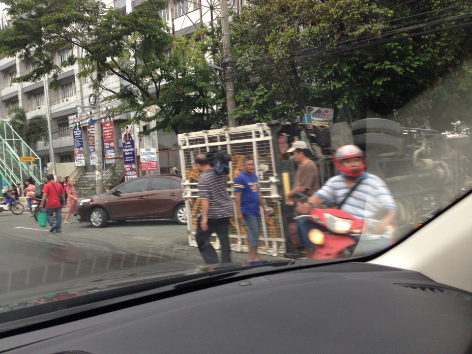 The truck with one of the vehicles (brown sedan) it hit before turning on its side.
I travel along Marcos Highway almost everyday and notice that there are many (and likely increasing numbers) of aggressive public transport (e.g., patok jeepneys) and truck drivers. Many of these people operating the vehicles are definitely not qualified to drive public utility vehicles based on their behavior on the road. Then there are also the motorcycle riders many of whom weave along the highway, often cutting in the path of other vehicles. Many split the lanes during congested periods and who knows how many vehicles have been damaged by motorcycle riders bumping or sideswiping into them. Many have back riders (riding in tandem?) including children. There are also what looks like entire families riding a single motorcycle with children often not having any protection (usually they are sandwiched between parents). I can only wonder how safe the riders think they are and if they thought about risking the lives of their loved ones before each journey.
A friend mentioned that there are regular drag races along Marcos Highway during the wee hours of the morning when the volume of traffic is at its lowest during the day. This goes on despite the police checkpoints along the highway. Are they turning a blind eye to these races? Or are they also involved somehow?
Perhaps the LGUs along Marcos Highway should work together to arrest the trend of increasing road crashes. Even the Provincial Government of Rizal should have a say in ensuring safe travel along this arterial as many of its constituents use the road every day. This is a very urgent matter that needs to be addressed in order to prevent the incidence of more crashes in the future. Simple observations of traffic along Marcos Highway show that there are many crashes waiting to happen. Prevention through timely intervention is what’s needed for this road so that we can save lives and limbs.
–
