
Home » Posts tagged 'roads'
Tag Archives: roads
Landmarks – the Lion’s Head, Kennon Road
The main landmark along Kennon Road is the Lion’s Head. I think most people heading to or coming from Baguio have taken a photo of if not with the Lion. Here are photos I took as we descended from Baguio via Kennon Road last December 2024 after participating in a workshop.
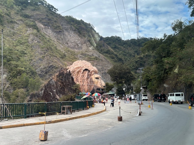 Approaching the Lion’s Head along Kennon Road, the monument appears to be under maintenance with scaffolding around the head.
 An entire section is cordoned off, likely for tourists or visitors. The lane though looks newly paved, perhaps part of a road widening project.
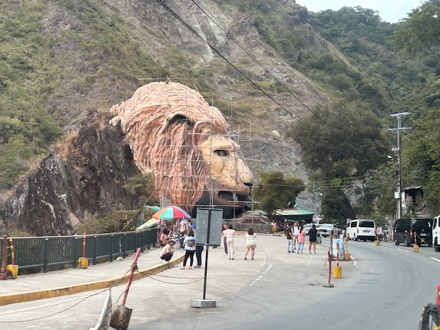
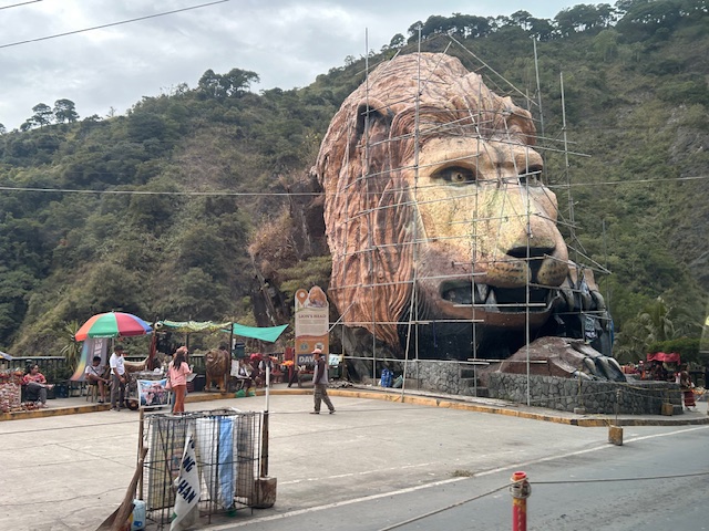 A closer look of the Lion’s Head and the touristy things in the area. Notice there weren’t too many tourists at the time and there weren’t so many shops and vendors set-up.
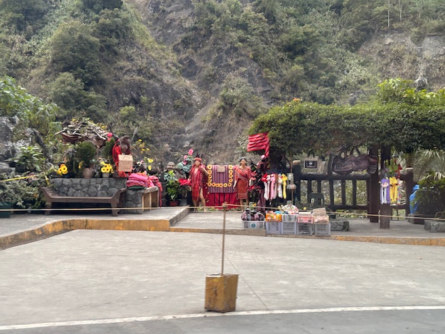 Among the activities are dressing up in local costume and taking photos wearing these with the mountains or the monument in the background.
–
–
Political garbage along our roads
While it is not formally campaign season, you’ve probably seen all those ads, posters, tarps and other obviously campaign materials that have sprouted around the country. Even before the filing of COCs, there were already a lot of political garbage (as I refer to them) along our roads. Many that you see on large billboards promote their purported TV or radio shows. Others pretend to be concerned about your safety while traveling (e.g., “Ingat sa biyahe!”, “Ride safe!”, etc.).

The government, particularly the COMELEC, seems to be inutile and inept about these brazen, even flamboyant displays by politicians. And so we end up with a lot of literal and figurative garbage along our streets. These are the politicians that people continue to vote while stating they want changes and reforms in government and society. You vote for these clowns and you get exactly the misery and incompetence that dooms us especially during times of difficulties and calamities.
–
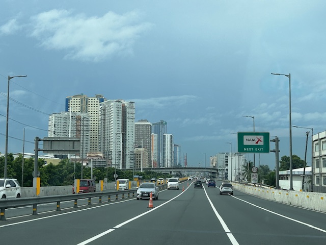
Skyway to the south
Instead of going via C5 and then SLEX en route to Tagaytay last week, we opted to take the Skyway via Quezon Avenue. The travel was smooth between 6:30 AM and 7:30 AM maybe because it was a Thursday and regular classes have not yet resumed (i.e., less trips). Note the counter flow lane adjacent to the median? This is implemented likely due to the experience of heavier traffic along the northbound (Metro Manila-bound) direction during the mornings. I wonder if the reverse is implemented in the afternoons/evenings.

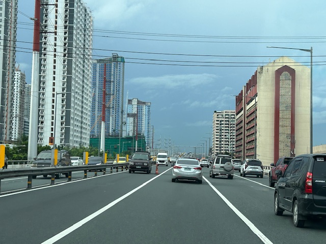
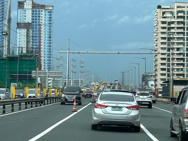
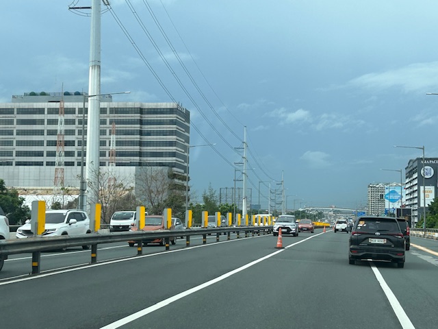


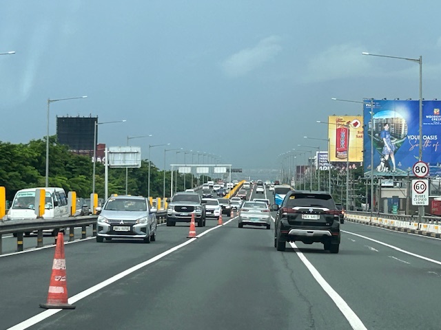
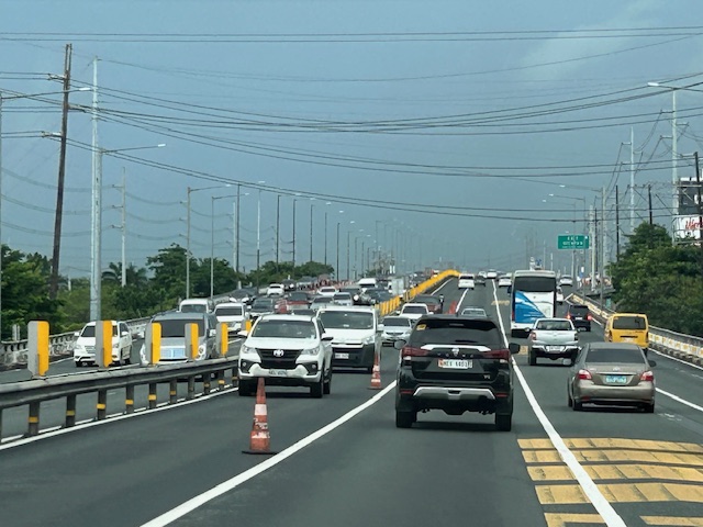
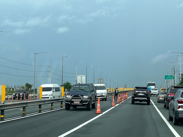
Note that there was more traffic as we traveled between Makati and Muntinlupa. The traffic represented commuters residing in the south and traveling to Metro Manila for work purposes.
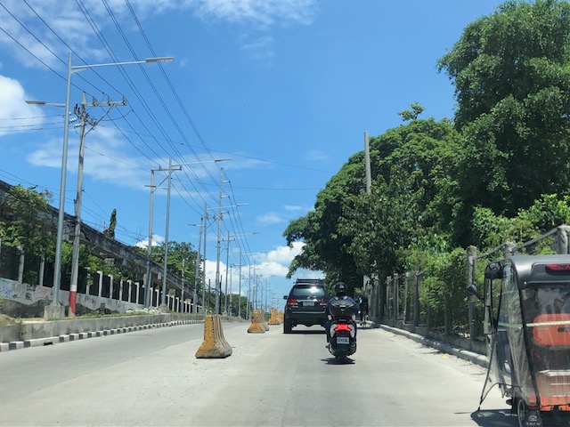
Widening of Gen. Santos Avenue, Taguig City
This is a very late post. I saw this draft that I made more than 7 months ago when I passed by General Santos Avenue in Taguig en route to Laguna where I was to attend a nephew’s wedding. General Santos Avenue is the road connecting C6 with the South Luzon Expressway (SLEX).
 Fence dividing traffic along either side of the road
 The fence stretches along a significant length of the avenue, effectively preventing people from crossing the street anywhere.
 Unfinished section (should be done by now) showing the original carriageway on the left. The new lanes due to the road widening project is on land acquired from the DOST lot on the right.
 It becomes clear in this photo that the median of the widened road is actually where the walls of the DOST compound used to be. Note the dead end where DOST land has not been expropriated yet for the road widening project.
 Either side of the road are DOST lands. The main compound is at right while the left is the MIRDC compound.
 The experimental Automated Guideway Transit (AGT) is found at the MIRDC compound.
More on similar cases in future posts. Road widening projects are very popular with the DPWH, and the agency has been criticized for being somewhat lazy or applying a non-imaginative approach to solve traffic problems. The project is a good example of DPWH fulfilling its mandate. Never-mind that this is not a sustainable approach to addressing transport problems.
–
Article share: on making roads greener
I came upon this article on ‘greening’ roads:
Goldfarb, G. (December 23, 2023) “This Radical Plan to Make Roads Greener Actually Works,” Wired, https://www.wired.com/story/this-radical-plan-to-make-roads-greener-actually-works/?bxid=5bd6761b3f92a41245dde413&cndid=37243643&esrc=AUTO_OTHER&source=Email_0_EDT_WIR_NEWSLETTER_0_DAILY_ZZ&utm_brand=wired&utm_campaign=aud-dev&utm_content=WIR_Daily_010324&utm_mailing=WIR_Daily_010324&utm_medium=email&utm_source=nl&utm_term=P8 [Last accessed: 1/4/2024]
To quote from the article:
“The very notion that a road can be “green” seems oxymoronic: A vast body of scientific literature demonstrates that roads befoul air and water, fragment ecosystems, introduce non-native species, and obliterate wildlife.”
That was a pretty damning or severe statement about roads considering such infrastructure are necessities in today’s world. Perhaps we should revisit road planning and design to address these issues referred to. Aside from that quote, the article related a number of good examples worth replicating. In fact, I recall that many Philippine roads were envisioned, even designed, to have greenery along them. The tragedy is when the DPWH and LGUs departed or deviated from these plans. The road widening projects of the past years are examples on how national and local agencies have proven the article’s author right about green roads being oxymoronic.
–
Some old drawing tools for clothoids
I took some photos of old (vintage if you prefer) drawing tools that I have at our laboratory at the university. We found this in the storage many years ago and people seem to have forgotten about them. Instead of heading for storage or being forgotten or worse, thrown away, we decided to keep them at our laboratory mainly to show our students how certain highway or street curves were drawn in the ‘old days’. I am currently the custodian of this and another set that I have kept at my other office at the civil engineering building.
 The wooden box is at my office at UP Diliman
 The sign basically translates to clothoid drawing tools made by a company based in Setagaya in Tokyo. There are 14 instruments in the box for clothoid parameter values of A = 20m to 350m.
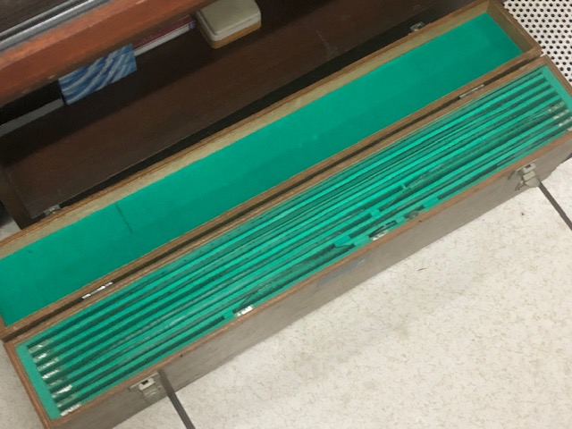 Opening the box shows slots holding instruments for drawing clothoids or spiral curves
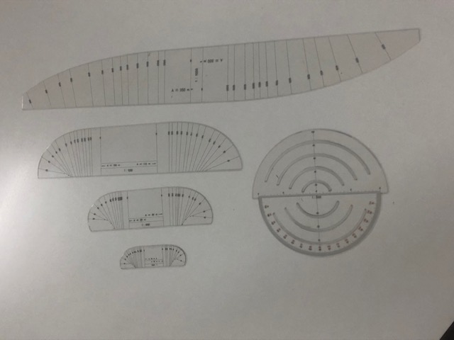 Some of the instruments from the case – the large one on top is for A = 300m and 350m (scale 1:1000)
 Comparison of size of instruments for (top) A = 60m and 65m, and (bottom) A = 30m and 35m (scale 1:1000)
 Instrument for A = 30m and 35m (Scale 1:1000)
 A protractor came along with the set but I assume other instruments such as a compass were used in drawing/drafting the curves.
I shall take photos of the other set when I get to visit the other office. These will be for records purposes as well as for posterity. These are practically museum pieces that are now perhaps rarely if even used.
–
Is the concept of induced demand a hard sell?
Here’s a quick share of an article on ‘induced demand’ particularly why it appears to be a hard sell:
Blumgart, J. (February 28, 2022) “Why the concept of induced demand is a hard sell,” Governing, https://www.governing.com/now/why-the-concept-of-induced-demand-is-a-hard-sell [Last accessed: 3/8/2022]
To quote from the article:
“Transportation experts say that the way to defeat induced demand, and actually ease traffic, would be to price roadways through tolls and congestion fees. But such alternatives are not popular. It’s hard to imagine running a political campaign on such a promise, as opposed to pledging an answer that looks free and easy… “Highway expansion is an attractive project regardless of your political orientation or what the state of the economy is,” says Thigpen. “There’s always a good argument for why we should be expanding highways. We need more jobs, or we need to unlock economic opportunity. There’s always a good political argument in favor of that.”
That last statement there relating highway or road expansion to politics is relevant everywhere. In our case in the Philippines, politicians are perceived to be very conservative and the type to use road projects as accomplishments. They are not as progressive as politicians abroad who may have the backgrounds and/or advocacies relating to sustainable transport to pursue the more difficult programs and projects needed improve the transport system. Instead, most are content with projects that they can put their name on and claim as hard accomplishments. Many of their constituents appear to agree. And agencies like the DPWH are only too happy to support this never-ending road construction and widening projects with the length of roads and the number of lanes added being their metrics for success. Of course, these (e.g., understanding and how to address induced demand, performance metrics, etc.) need to change if we really want to transform our transportation system towards something more efficient for everyone’s benefit.


–
An opinion on sharrows
We conclude November 2021 with an article about shared lanes or shared right-of-way (thus, the term ‘sharrow’). These are lanes designated for use of both motorized vehicles and bicycles. I share many of the sentiments of the writer and there are many ways to go about to have legitimate, separate and maybe protected bike lanes for multi-lane roads (yes, the kind DPWH has been so keen in having along many national roads) should be the rule. For local roads/streets, however, there might be a need to compromise.
Flax, P. (November 7, 2021) “Why Sharrows are Bullshit,” Medium, https://medium.com/@peterflax/why-sharrows-are-bullshit-b01fea1fea6f [Last accessed: 11/30/2021]
I think the issue at the local level in the Philippines is that many roads are already quite narrow and cannot really accommodate bike lanes unless you ban motorized vehicles from using them (e.g., pedestrianization of certain roads/streets). While you cannot really close off so many roads, careful study by local governments should identify which streets can be pedestrianized over a certain period (i.e., phases) while others have shared lanes to accommodate the needs of residents and commercial establishments.
The above is just an example and should be subject to scientific or evidence-based assessments if such is indeed feasible. This can also provide an opportunity for education as people (i.e., road users) generally don’t understand the need for active transport facilities including what we assume to be common knowledge about the need for sidewalks, for example. Of course, other interventions may be implemented in order to “calm” traffic. Streets that are predominantly residential should have 20 kph tops as the speed limit. If such speed limits can be achieved and enforced then perhaps we can have safer streets, too, not just for cyclists but pedestrians as well.
–
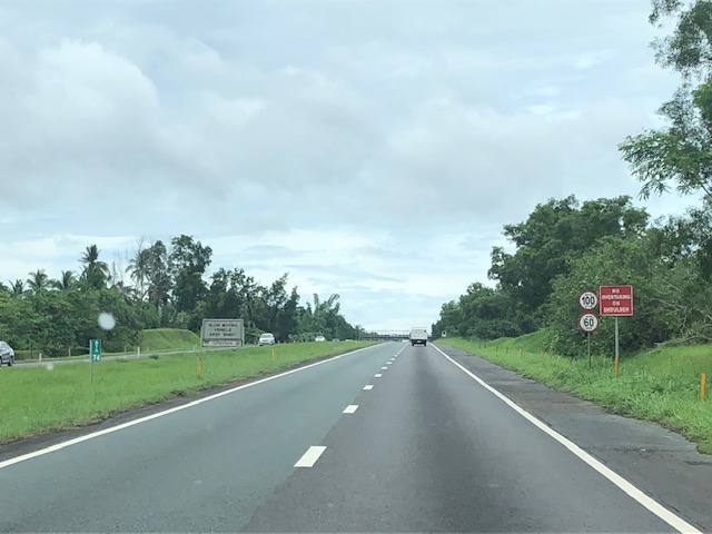
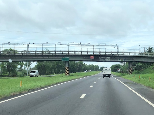
On the STAR Tollway, some recent photos
A trip earlier this year allowed me to take a few photos of the STAR Tollway. STAR stands for Southern Tagalog Arterial Road, which was what the expressway was before it became a tollway. I have memories of this being a regular highway in the early 1990s. Then, it was still a two lane road and there were even animals walking around and at times crossing the highway. Later, even after it became an expressway, the ROW was still not secured (i.e., fenced) so motorists would regularly encounter animals creating unsafe situations to both.
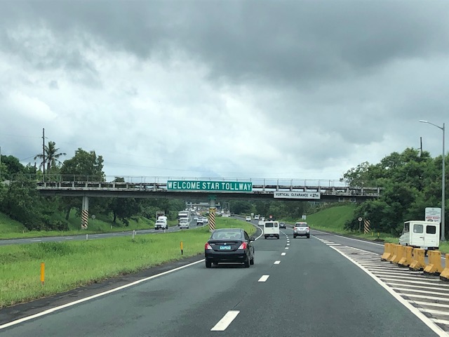


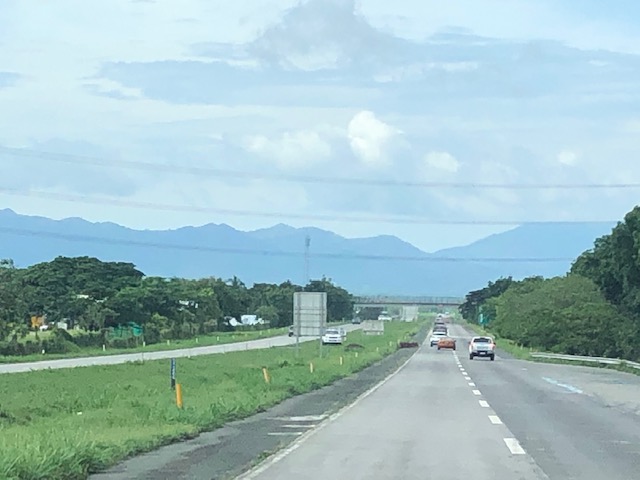
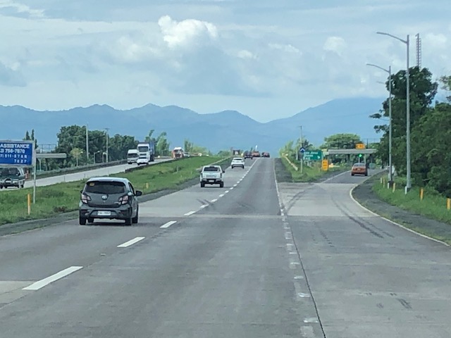
Noticeable in the photos are the wide medians. These are typically used for expansion (i.e., additional lanes) when the time comes that the capacity of the tollway is no longer enough to cater to the demand. Both the NLEX and SLEX used to have these wide medians that are now part of the motorway. Are there alternate uses or purposes for this median? Perhaps, and this has been done abroad, one could fit bicycle paths there? Or maybe install solar panels to generate power? Or maybe do both?
–
On riders’ perception of safety
The Federal Highway Administration (FHWA) of the US Department of Transportation released some infographics recently to highlight road safety. One very timely and relevant graphic image asks about which facilities make bicycle riders feel safer:

There were some initial reactions when I shared this on social media with one immediately criticizing share-use paths and citing the one along Marcos Highway (stretch under Pasig, Marikina, Cainta and Antipolo) as an example. I quickly explained that the graphic assumes good designs instead of the flawed one along Marcos Highway. In fact, the shared use path is also quite popular in Europe and particularly in the Netherlands where they have many examples of these paths stretching for kilometers that are exclusive to active transport (pedestrians and cyclists). The good designs need to be shared and circulated so people will know about what they look like and learn about their features. These can be adopted and adapted to local situations.
Did you notice the images of cyclists/riders at the top of the graphic? These are important, too, because they provide context in terms of the type of riders who are the targets for infrastructure and campaigns that support and promote cycling across different types of people. Cycling shouldn’t just be for the most fit or the weekend warriors but rather for everyone who could take it up and not just for recreation but for everyday, utilitarian use (e.g., commuting, shopping, etc.).
