
Home » Posts tagged 'stations'
Tag Archives: stations
PNR Espana Crossing
Prior to the lockdown, I was able to take a few photos of the PNR line crossing Espana Avenue in Manila. These now appear to be somewhat nostalgic as I am unsure when I can go around again without (or with reduced) fear of getting infected by COVID-19.
 Commuter train crossing Espana Avenue towards the Espana Station of the PNR line
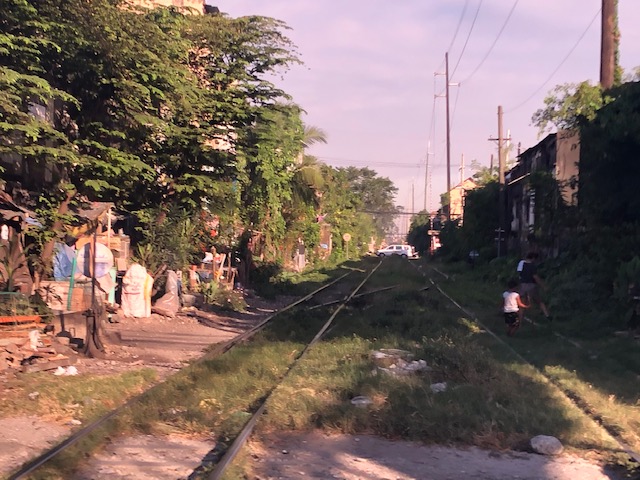 Crossing the PNR line towards UST, I got this photo of the PNR line showing the informal settlements along it
 On the way back, I made sure I had the opportunity to take this photo of the PNR Espana Station
The PNR was supposed to have resumed operations, and implementing physical distancing and other measures to reduce the risk of COVID-19 infection. Here’s a photo they posted prior to the resumption of operations when Metro Manila went into GCQ status:
 The photo shows where passengers may sit or stand inside a PNR train. I have yet to see a photo of the actual conditions inside the train.
–
Zamboanga City Integrated Bus Terminal
I open the year by sharing photos of the Zamboanga City Bus Terminal. It is a ‘central’ terminal as most most buses terminate here and cannot proceed to the city center. At the terminal, passengers may transfer between buses, jeepneys and vans.
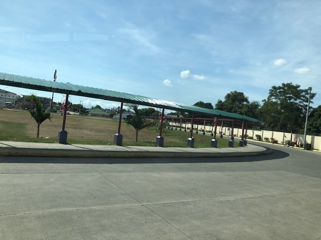
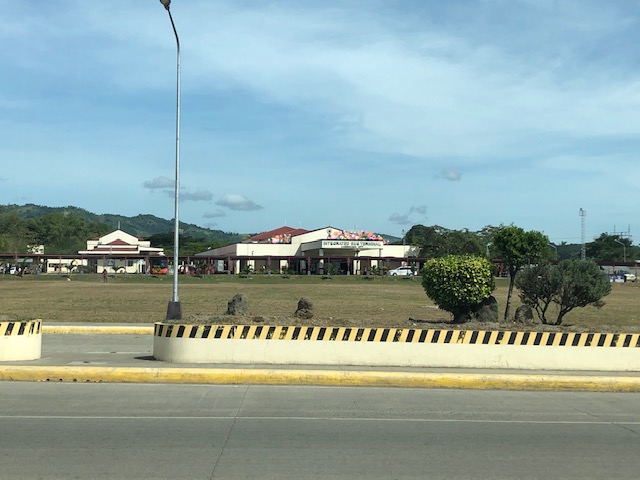 View of the terminal from the national highway. There are driveways leading to and from the terminal from the highway and one can appreciate the expanse between the facility and the main access road.
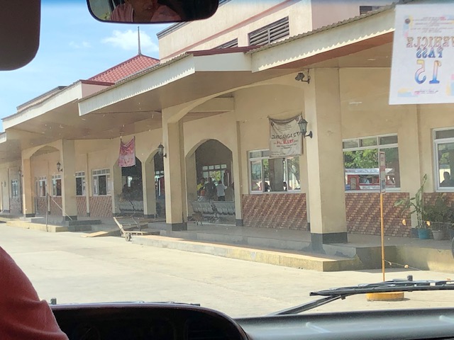
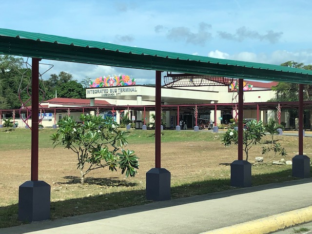 There are covered walks connecting the terminal to the national road.
 Provincial buses and long-distance vans at the terminal
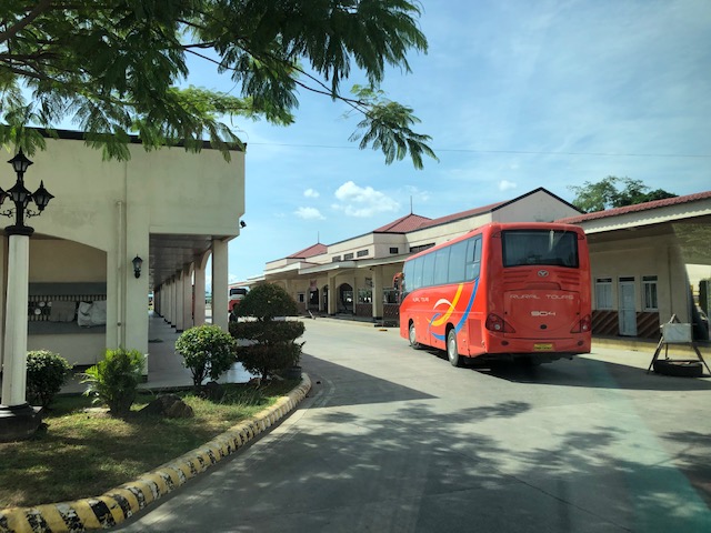 Provincial bus arriving at the terminal
 Jeepneys at the terminal
 Motorcycles parked along a shaded area. The lamp’s vintage design seems to be a good accent to the terminal.
 Close-up showing the spacious parking area shared by cars, jeepneys, motorcycles and even tricycles
 Another look at the covered walkways leading to the national highway. Not all public transport go to the terminal because of the fees and the distance for the diversion from the highway.
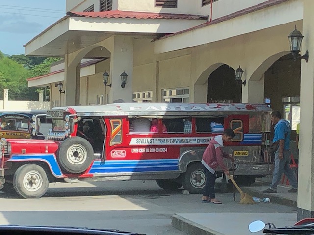 Jeepneys waiting to be filled with passengers prior to departure
 A look at the front of the terminal shows a wide driveway and the connection of the covered walkway to the main entrance
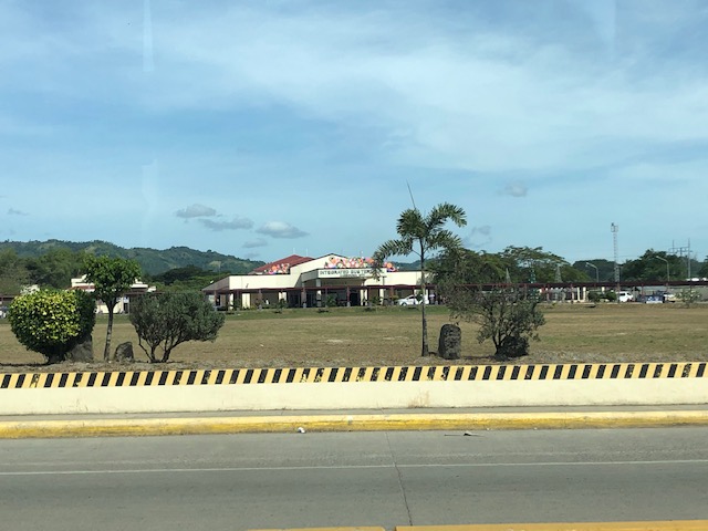 Another look at the integrated terminal from the highway
We will be evaluating the terminal soon as part of a study we are doing for the city. More photos and some assessments about its features soon!
–
Progress of Line 2 Extension station construction
This is another one of those quick posts. Here are a couple of photos showing the progress of the construction of the stations of the Line 2 Extension:
 The Masinag Station under construction as viewed from the westbound side of Marcos Highway. That’s SM City Masinag on the right. The structure is very visible as you descend Sumulong Highway near the Valley Golf gate.
 Here is a blurry shot of the Emerald Station as viewed from the eastbound side of Marcos Highway. That’s Robinsons Metro East on the right side.
While the stations’ construction seem underway, a colleague pointed out that there seems to be nothing going on with the rest of the system including the electrical and the tracks for the extension from Santolan to Masinag. This is along my daily commute and I also haven’t seen anyone working on the tracks. Perhaps it hasn’t been bid out or there’s a timetable for this somewhere?
–
A quick update on the Line 2 Emerald Station construction
Here are a couple of photos of Line 2’s Emerald Station, which is under construction. There’s significant progress in the construction but this will definitely take months to complete along with the Masinag Station, which is in a similar state of progress in construction.
 Here is what the Emerald Station, which is just across from Robinsons Metro East and Sta. Lucia Mall, looks like. It’s still far from being completed but you can already see what seems to be an area underneath the tracks where people can cross from one side to the other. Stairs have been constructed to connect what could be a station concourse to the street level. The building under construction to the right in the photo is Sta. Lucia’s. From the looks of it, this will be an office building, likely to host a BPO office. We hope that the station will have direct connections with the two malls as well as this office.
 Right after the station is the intersection of Marcos Highway with Felix Avenue and Gil Fernando Avenue where there is still pedestrian overpass that allows people to cross the wide roads safely. There are only rare instances when people attempt to cross at street level here but there were some security concerns as there was a spate of snatching incidents on the overpass. Cainta authorities seem to have addressed this despite some border issues with Marikina and the former has posted policemen to deter crime on the overpass.
The last image connects to the first one in the sense that there should be a connectivity for the existing pedestrian infrastructure (i.e., overpass and sidewalks) with the future Emerald Station. This connectivity would be in the form of suitably designed walkways that can and should include provisions for cyclists, too. Perhaps the two malls can pitch in to make these designs a reality and not just be content with token steel structures like what are usually constructed elsewhere and at the junction near the station. There is a good opportunity here to come up with good design that can become a good example for replication.
–
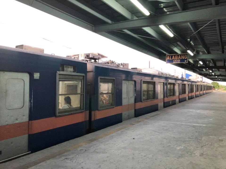
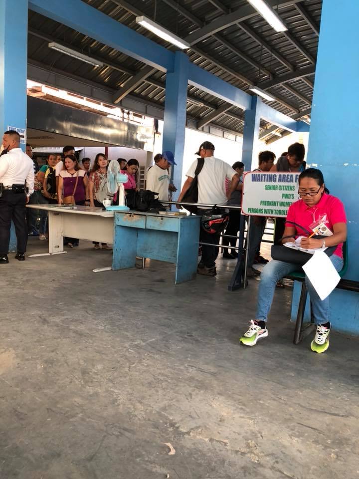
PNR Alabang Station
My colleagues conducted a survey at several Philippine National Railway (PNR) stations in relation to studies being made for proposed new railway lines including those for rehabilitation. One was already posting photos on her social media account so I asked if I can use some of her photos here on this blog. She generously obliged so here are photos taken just a few weeks ago at the PNR Alabang Station.
 PNR commuter train at the Alabang Station – note the conditions of the railway tracks and how open the station is.
 People (not necessarily passengers) walk along the railway tracks
 Passengers queued to get tickets for their journey
 Station platform
 Another photo of the platform and train
 Passengers queued for tickets and entering the platform (yes, no turnstiles here) while a surveyor works
 Here’s a train that’s about to close its doors after loading passengers
More photos soon!
–
Den Haag Central Station
One of the most aesthetically pleasing modern railway stations I’ve seen is the Den Haag (The Hague) Central Station. The columns and roof structure alone provide travellers with a feeling of space while also having the functionality required for a central station. Contrast this to the old station feel of Amsterdam Central Station (plus the crowds) and somehow I would rather have the conditions at Den Haag. Of course, I have been to much crowded stations than Amsterdam as I lived in Tokyo and Yokohama for 3 years.
 Arriving on the platform at Den Haag Central Station
 Looking back towards the end of the platform
 To the turnstiles!
 Station plaza
 Tram stop just outside the station
 You can easily get on a tram upon exiting the station. Above is another train line, which crosses the station and its platforms.
–
Updates and resolution on the common railway station in North-EDSA
The big news today is the agreement among the government and the big corporations involved in the issue of the common station at North Avenue-EDSA where three rail transit lines (Line 1, Line 3 and the future Line 7) will be converging. The key features of the agreement are reproduced here:
“KEY FEATURES OF AGREEMENT
- The Common Station has three components: (a) Area A, where the platform and concourse for LRT-1 and MRT-3 are located; (b) Area B, which consists of two Common Concourses connecting Area A and Area C; and (c) Area C, where the platform and concourse for MRT-7 is located.
- Area A will be financed and built by DOTr. Area B will be financed and built by Ayala and its partners (NTDCC) (this is Ayala’s contribution to the Common Station project). And Area C will be financed and built by San Miguel.
- The portion of Area A for LRT-1 will be operated, maintained, and developed by LRMC. The portion of Area A for MRT-3 will be operated, maintained, and developed by DOTr. Area B will be operated, maintained, and developed by Ayala. And Area C will be operated, maintained, and developed by San Miguel.
- The MOU contains the design parameters for the Common Station, which will be the basis of the Detailed Engineering Designs to be developed after signing of the MOU. The Detailed Engineering Designs will be completed within 240 calendar days from signing date.
- The designs shall ensure that a defined level of service is maintained at all times by all components of the Common Station.
- The designs shall ensure that all components of the Common Station are interconnected, and that SM City North EDSA and Trinoma are interconnected to the Common Station.
- The Common Station is targeted to be completed by 2 April 2019, subject to extension as may be justified under the MRT-7 Agreement with respect to Area C.
- SM’s TRO will be lifted soon after the Detailed Engineering Designs are completed.
- DPWH will build an underpass along EDSA at the area where the Common Station will be constructed. This will be financed and built by DPWH.”
That was a direct copy and paste from the DOTr’s Facebook page.
There is another piece of information that’s gained a popular following and that is the design for the common station that was shared to the public:
Proposed design of the common station
I think the design is basically okay in terms of location. The layout would need to be refined in order to address concerns pertaining to optimum and efficient transfer of passengers between lines. I assume from the drawings that all three lines will be at the same level but with a plaza separating Lines 1 &3 from Line 7. There are also issues pertaining to proposed road grade separation in the area but that seems to have been addressed already by item #9 in the preceding list. We can only hope that the current government and private sector partnership can expedite this project.
–
San Diego’s Sta. Fe Train Depot
A highlight of my ‘do-it-yourself’ tour of San Diego, CA was the Sta. Fe Train Depot or Railway Station. The depot was celebrating is centennial and for me represented part of America’s railway heritage being part of a railway line stretching along the US’ Pacific coastline. Following are photos in and about the Sta. Fe depot.
 The historic Sta. Fe Train Depot building as seen from the San Diego MTS trolley station.
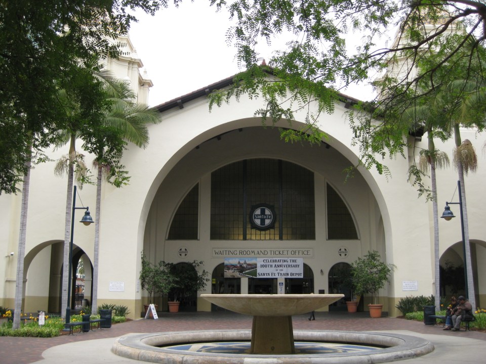 Front of the train deport showing a fountain and the main doors to the station building.
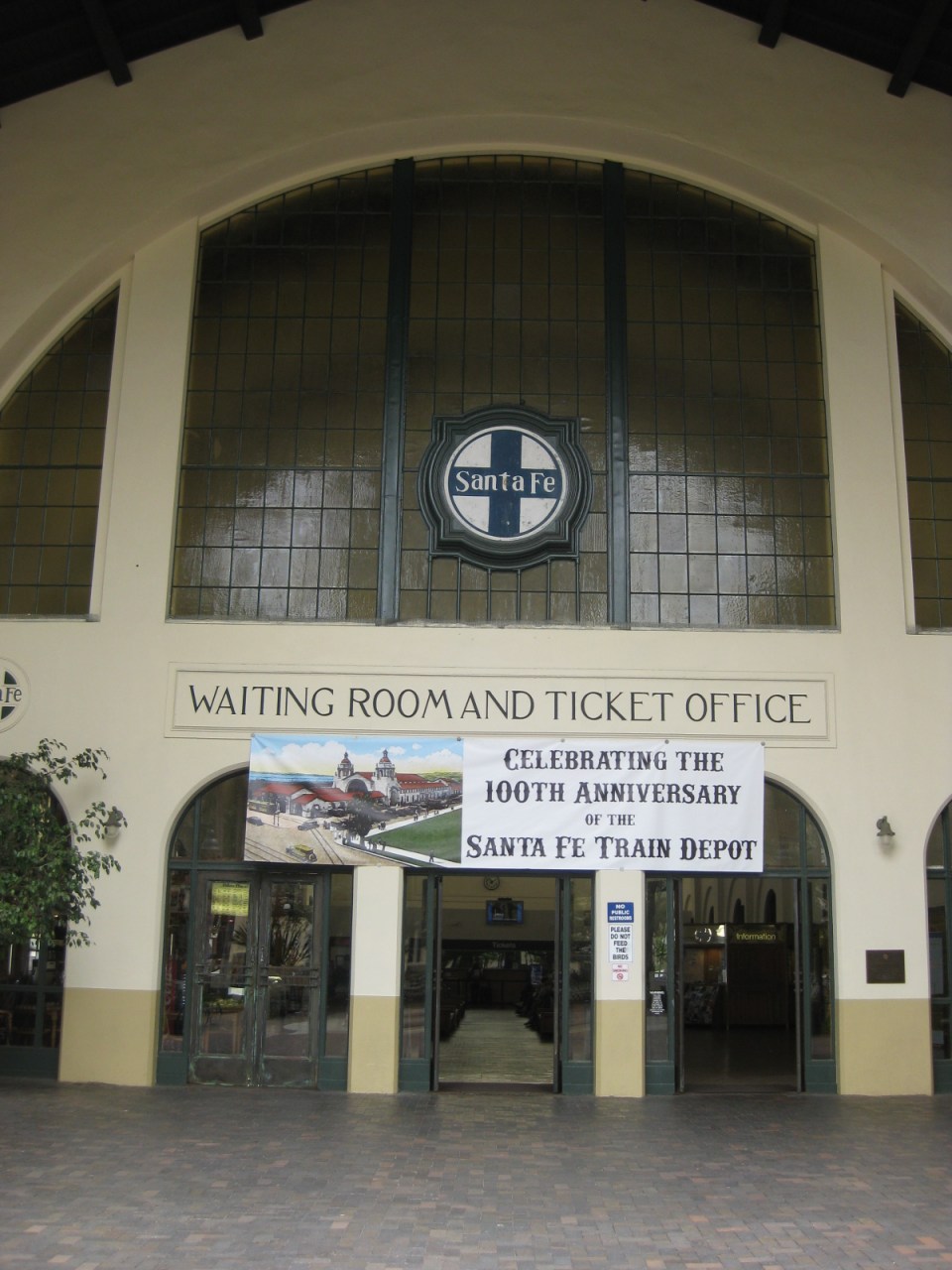 Entrance to the building, which contains the ticket office and waiting room for passengers and well-wishers.
 One is greeted by this splendid view of the building’s interior evoking a time when trains ruled in land transportation. An information booth is seen at the right while the food kiosk is at the left. The ticket windows are further at the center.
 The kiosk inside the station building provides sustenance to passengers, well-wishers and passers-by. Note, too, the mosaic designs on the columns of the building.
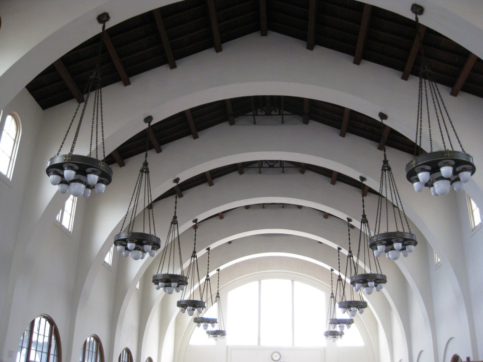 A closer look at the station’s ceiling and chandeliers shown arches emanating from the columns to support the roof. Such features are of earthquake resistant structures in this earthquake-prone region and particularly in the State of California.
 Pedicab, trolley and the Sta. Fe Train Depot
I took some refreshments at the kiosk in the station. The hotdog sandwich was good and the coffee was strong. I took the trolley from the station to explore San Diego along its commuter train lines. More on San Diego’s trains and stations in future posts.
–
Crowded EDSA MRT 3 stations
There have been a lot of posts on social media about the very crowded MRT and LRT stations. These posts are not new and the situation is not because of the Christmas season when a lot of people seem to be out and about the entire day, many doing their shopping. In fact, the stations have become very crowded mainly due to the increasing number of people taking the MRT and LRT lines. Unfortunately, the LRT 1 and MRT 3 stations were not designed to handle so many people. Only LRT 2 stations, which were designed like metro or subway stations in Singapore and Japan, seem adequate for its passengers.
Below are two photos taken by a good friend, Raul, who is a regular user of the MRT 3. He took these photos sometime September of this year while heading home from his workplace. The photos don’t lie about the platforms being filled by people so much so that there’s a big risk of an incident occurring when people might fall off the platform. So far, there has been none reported. But of course, we don’t want such accidents to occur despite the conditions indicating one or more are likely to happen sometime soon if precautions are not taken.
 One cannot tell arriving from departing passengers except maybe by the direction they are going at the stairs to the platform at an MRT station.
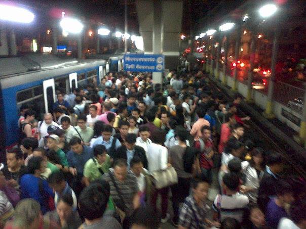 “Walang mahulugan ng karayom” translates into “nowhere a pin can be dropped” is a saying that is apt to the very crowded platform of the MRT 3’s Boni Avenue Station. Meanwhile, the conditions inside the trains are said to be like “sardines in a can.” I have even heard some of my students say it is more like “corned beef in a can” to describe how packed trains are during peak periods. I have experienced riding trains during the peak hours in Tokyo and Singapore and the experiences of my friend who took these photos (who also studied in Japan) are pretty much the same.
The obvious issue aside from platform capacity is the fact that the MRT and LRT lack the rolling stock (i.e., cars or trains) to increase their frequencies of service (or reduce the headways between trains). They cannot lengthen their trains also because they are limited by the lengths of the station platforms. It doesn’t take a genius to determine how many units more the LRTA and MRTC need to add to the rolling stocks of LRT 1 and MRT 3 to improve their services. It is also imperative that the stations be improved, perhaps re-designed, to accommodate more passengers with more sophisticated fare machines and turnstiles, and longer, more spacious platforms. This is something that could have been anticipated by the agencies responsible like the DOTC, LRTA and MRTC years ago. For some reasons, however, there have been no significant actions regarding these transport needs. The end result is what we now see as the supply side of transport being inadequate for the increasing demand.
There are many questions that commuters are asking regarding this situation with the LRT and MRT. The biggest seem to be about when the government will finally act on the issues mentioned. Is this something that requires Public-Private Partnership (PPP)? Is the government reneging on its responsibilities by not investing in mass transit? What can be done in the immediate term? Hopefully, these questions will be answered soon and agencies will have the sense of urgency to address the needs of the commuting public.
–
On vending machines at rail station platforms in Japan
Earlier, I featured some conveniences at train stations that included vending machines on the platforms. Following are a few more photos including a couple showing the newest models of vending machines. These have touch screens showing the products for sale and even shows weather forecasts.
 Passengers using the new touch screen vending machines at a JR Line platform.
 The screen displays products as well as the weather forecast. On the right are disposal bins for bottles and cans.
 Conventional vending machines and trash bins at the Enoshima Dentetsu platform.
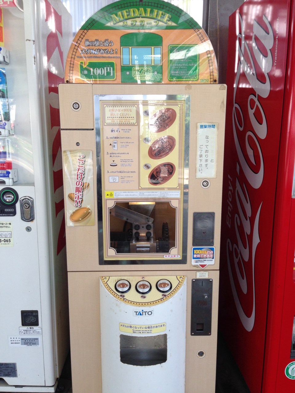 A souvenir machine featuring a metal press where the customer can choose among 3 designs.
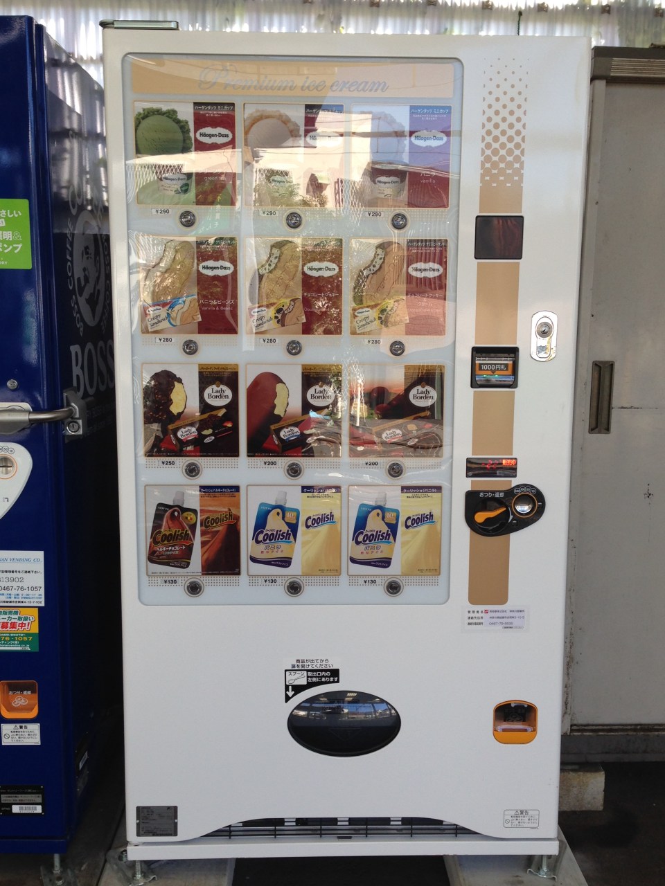 Ice cream vending machine.
–
