
Home » Posts tagged 'streets'
Tag Archives: streets
On street transformations using AI
My social media feed is full of images generated by artificial intelligence (AI). The street transformations are generated using a variety of AI tools. I’ve tried Canva and Gemini in producing similar images of street transformations; an exercise I’ve included in my undergraduate and graduate classes for more than a decade now but using their sketching and software (CAD, Sketch-up, etc.) skills to do the transformations. The photos below show an example of transformation along the University of the Philippines Diliman Academic Oval using Google Gemini.
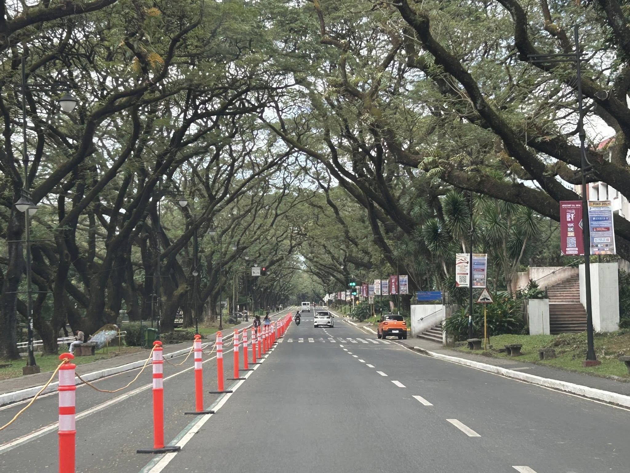 The original photo I took at the UP Academic Oval
 The first attempt at replacing the orange bollards/barriers with something that blended with the campus.
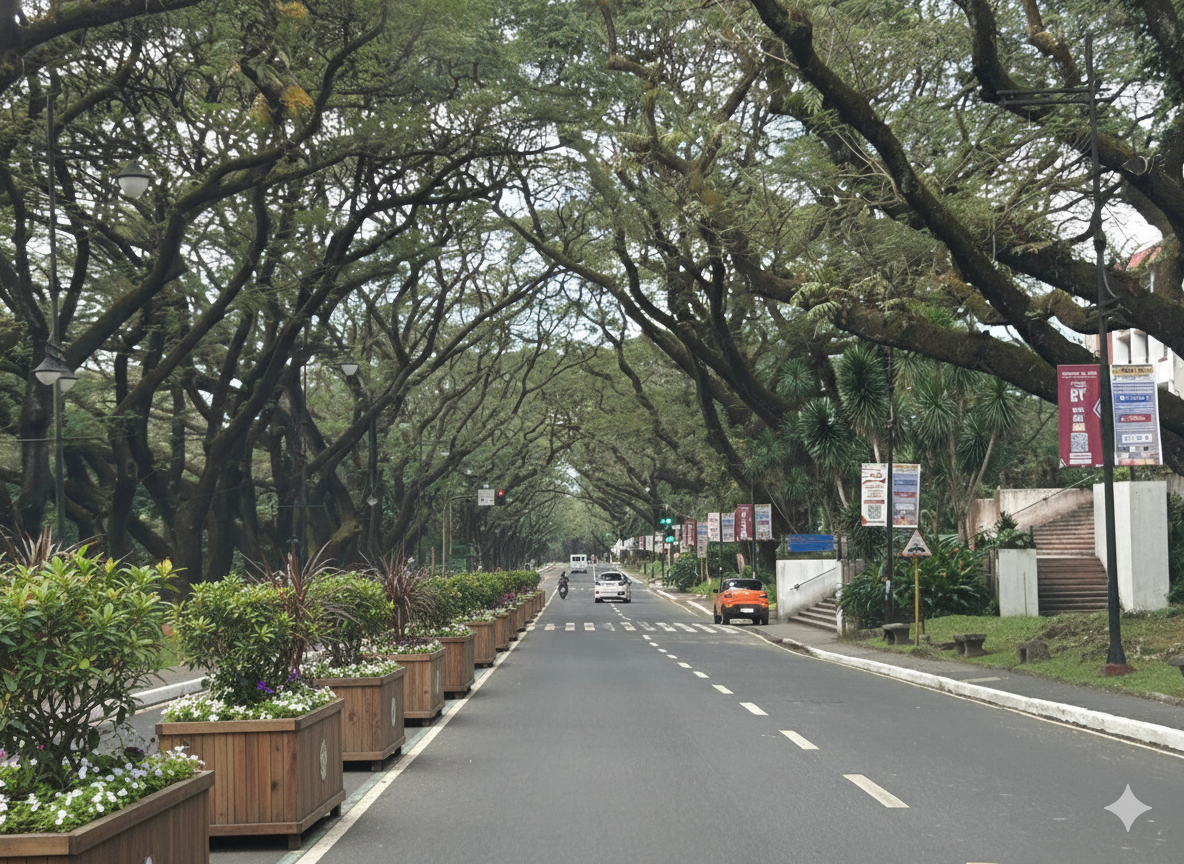 The second attempt showing plant boxes instead of the fence in the previous photo.
I think it’s possible to have excellent transformations of whatever roads or streets there are. One just needs to prompt or instruct the AI well enough to obtain these alternative designs. While the transformations are nice though, context is still important. Many of the transformations circulating on social media call for almost all major streets to be transformed. (Kulang na lang pati expressway gawan ng transformation.) Advocacy is good but context-sensitive solutions require a more constructive and cooperative. It certainly can do without being combative or antagonistic.
–
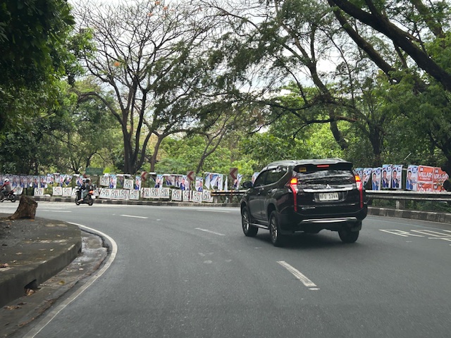
More garbage along our streets
Election Day approaches in the Philippines and despite certain rules that are supposed to be in place and followed by candidates and their supporters. Enforcement from the COMELEC is really bad (and that’s the truth everywhere around the country). Otherwise, we’d have a lot of disqualifications every election and perhaps many incumbent politicians won’t be able to run for office. Here are a few examples in my home city of Antipolo in Rizal where a dynasty “rules” and also has connections with another family in Cavite.
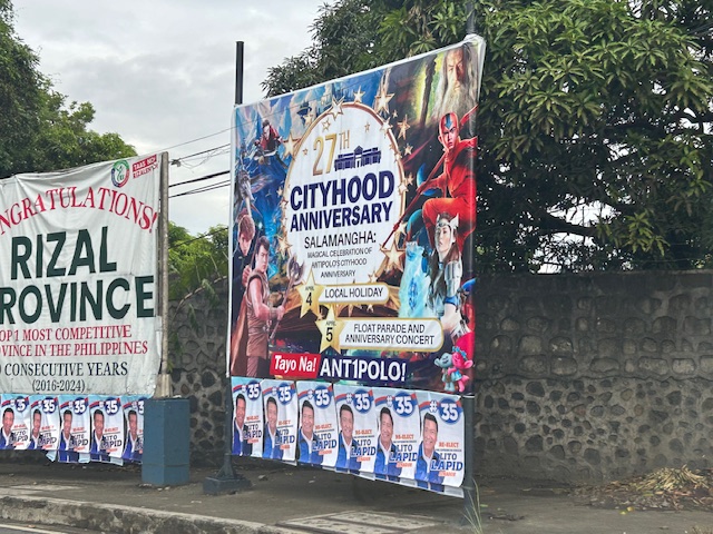 Antipolo’s city hood anniversary tarp features a Cavite politician who is closely related to the current leaders of the city and the Province of Rizal. Below the tarp are posters of a Pampanga politician who is also a movie actor like the other guy.
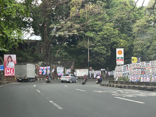 Antipolo roads are full of these campaign materials. Supporters have not spared private property of the garbage.
 Perhaps those who will do the Alay Lakad to Antipolo this coming Maundy Thursday should each remove a poster, tarp or more as they journey to the Shrine of Our Lady of Peace and Good Voyage. This could be part of their penance and serve also as cleansing of minds in preparation for elections.
Try to explain again how these politicians are not overspending (and probably charging the costs to taxpayers). The math is pretty easy. You can check how much a politician’s monthly income is based on the salary grade of the position he/she is running for. Compare that to the amount spent for his/her campaign. You can’t recover the amount spent in one term. Are they billionaires willing to part with their money to get elected to positions that demand a lot in terms of the competence and dedication to good governance. Rather, the suspicion is that politicians will likely be corrupt and get his/her money back in a variety of ways to recover millions or even billions spent. It’s really a vicious cycle that doesn’t end well for the Filipino people in terms of the infrastructure and services we could have if only politicians moderated their greed.
–
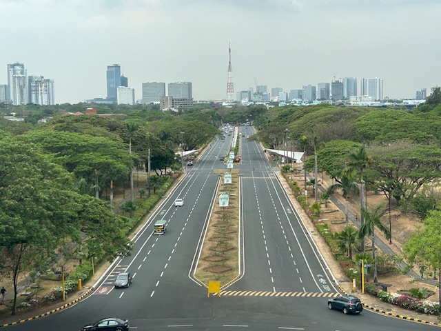
A widened Col. Bonny Serrano Avenue and opportunities for complete streets
Col. Bonny Serrano Avenue is one of the major roads directly connecting EDSA (C-4) and C.P. Garcia Avenue (C-5). The last time I used the road was before the pandemic. So it came as a surprise to pass by last weekend and see the avenue had been widened. I guess that pretty much “solved” the traffic along this usually busy thoroughfare that is part of jeepney routes to Cubao (via Murphy – referring to Camp Aguinaldo, which was formerly Camp Murphy). The avenue was renamed after a Korean War Hero (my uncle fought under him with the 10th Battalion Combat Team in the Korean War in the 1950s). It was called Santolan Road before.
 What used to be a 4-lane road is now an 8-lane road
The area used for road widening was carved out of Camp Aguinaldo. The headquarters of the Armed Forces of the Philippines (AFP) gave up quite a lot of square meters for this project and you can see from the photo the now very wide avenue. I thought perhaps they could have placed a median island where they could have also planted some trees (note how exposed to the sun the area is). They also could have designed protected bike lanes along either side of the road. These could have connected the EDSA and C5 bike lanes. And, of course, they should have also improved the pedestrian sidewalks. You can see how narrow the sidewalks are and how electric and light posts block pedestrians using the sidewalks. There were opportunities here for the application of complete streets and its not too late to do just that.
I assume there are many men in uniform who use bicycles for their commutes and recreation. Camp Crame is just across EDSA from Camp Aguinaldo and Bonny Serrano Avenue also passes along the headquarters of the Philippine National Police (PNP). Down the road towards Marikina City in Libis is another camp, Camp Atienza, which is home to the 51st Engineering Brigade of the Philippine Army. I mention these camps as I know many there regularly use Bonny Serrano for commuting and many use bicycles. A cousin-in-law (my wife’s first cousin) who is an army officer bikes a lot from Camp Atienza and Camp Aguinaldo and tells me there are many enlisted men who bike to work.
–
Article share: on making more affordable neighborhoods
I’ve been commenting about how transportation cannot be isolated and the need to relate it to other factors such as housing or home location choice. The latter though is also affected by other factors as well that affect the affordability of homes near the city centers or CBDs where workplaces and schools are located. The result of course is sprawl or the encouragement of sprawl. Private companies take advantage of this or contribute to this ‘encouragement’ by developing land farther away from the center. Thus, for Metro Manila’s case, many people reside in the peripheral provinces of Bulacan, Rizal, Laguna and Cavite. There are even those who choose to reside in Pampanga, Bataan and Batangas.
Kayatekin, C.S. and Sanmiguel, L.U. (April 16, 2024) ” ‘Urban form’ and the housing crisis: can streets and buildings make a neighborhood more affordable?” The Conversation, https://theconversation.com/urban-form-and-the-housing-crisis-can-streets-and-buildings-make-a-neighbourhood-more-affordable-224108 [Last accessed: 4/23/2024]
Quoting from the article:
“Our main finding was that the bottom-up districts we looked at had, overall, more small-scale apartments. The reason is simple: they had more small-scale buildings, built on small-scale plots. Once divided into apartments, this produces small apartments – homes in the bottom-up areas were 10% to 23.1% smaller than their top-down counterparts. This also made their real estate markets for small homes more competitive, and therefore more affordable.
However, our study showed there is nothing inherently magical about bottom-up areas. Their more intricate housing stock has little to do with the layout of streets and blocks, and a lot to do with how that land is built upon.
Plot size appears to be the deciding factor: the districts with greater numbers of small buildings built on small plots supported a denser and more affordable housing stock, regardless of whether they were top-down or bottom-up.
Older bottom-up areas seem to naturally lend themselves to having more small-scale plots. This is likely due to the incremental development of these areas, and the complex land ownership patterns that developed as a result. However, there is no reason why a top-down area cannot be designed to replicate these characteristics.”
–
UP’s University Avenue
A week ago, I was invited to witness the renewal of a Memorandum of Understanding (MOU) between UP Diliman and a leading and prominent engineering company. I think one of the highlights of that event was getting to go to the Board of Regents meeting room at the top of Quezon Hall. This used to be an open area that we went to during our college days. The only times the place was off limits was when there were important meetings at Quezon Hall (e.g,, meetings of the UP Board of Regents) and during commencement exercises. It has been transformed into an air-conditioned facility that now hosts offices and this conference room. What’s the transportation thing in this post is the magnificent view of the University Avenue, which is the main gateway to the campus.
 UP Diliman’s University Avenue as seen from the top of Quezon Hall
The University Avenue has also evolved as it now features bike lanes along each direction of the road. There are walkways that also served as bike lanes along either side of the avenue. These are visible in the photo and are protected, exclusive ROWs from the main travel lanes that used to be assigned to motorized traffic. The avenue connects UP’s Academic Oval, its campus core, to Commonwealth Avenue. I remember splendid sunsets viewed from the same vantage point as this generally faces the west.
–
Lower speed limits may not slow drivers, a before-and-after study shows
I am sharing this article on drivers not reducing their speeds after speed limits have been lowered along certain roads. My first reaction after reading the article is that it is that perhaps in the US case, the after study was conducted quite early and before people have become aware, understood and adjusted to the lower speed limits. The responses or reactions to lower speed limits (particularly those posted or on signs) may vary among cities and countries. In the Philippines, where drivers and riders appear to be oblivious to speed limits, other interventions may be required including some types of traffic calming devices. This is very much a concern particularly in school zones where children are exposed to the risks of being run over by motor vehicles speeding along the roads and not minding the speed limits in the area.
Here is the Research report:
Source: Lower speed limits may not slow drivers, a before-and-after study shows
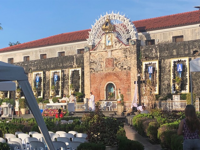
Morning walks in Zamboanga City – Part 3
Part of our walks took us to Fort Pilar and the Shrine of Our Lady of the Pillar. The shrine is originally located within the walls of the Fort, which served as a refuge for citizens when the city was under attack during various times in history. It is near the Paseo so can easily be integrated in our morning walks.
 The Shrine of Our Lady of the Pillar is open/outdoors and there’s a daily early morning Mass
 Instead of candle stands for prayer intentions, there is this trench set-up where you can put your candles and pray nearby.
 The main altar of the shrine apparently faces the sunrise
 Bells at the shrine
 Pigeons just outside the shrine and near the souvenir shops just across from Fort Pilar
 Entrance to Fort Pilar, which is administered by the National Museum of the Philippines
 Plaque describing the fort and its history
More posts on walking in Zamboanga soon!
–
Morning walks in Zamboanga City – Part 1
Before I return to Zamboanga City for another workshop, I wanted to at least post the first of a series about walking in the city. One advantage of staying at a hotel in downtown is that it is close to the parks and city hall. You can also walk towards Lim Boulevard or perhaps towards Fort Pilar on the opposite direction.
 Rizal Park
 Arcade style walkways integrated into the older buildings in downtown Zamboanga City
 Valderosa Street with the Zamboanga City Hall on the right

 Rizal Park viewed from City Hall
 A close up of the Rizal monument
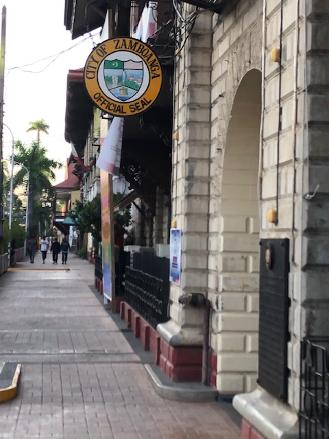 One of the entrances to city hall has the official seal of the city on display.
 Historical market for the building, which was first constructed during the American Period. It states that the building also used to be the Provincial Capitol. It is a heritage structure that is over a century old.
 The sidewalks are wide and paved. Planters are located along the curb to enhance the environment.
 Historical marker on an old house that was the official residence of Gen. John Pershing (yes, that Pershing) and which became BPI’s first branch in the city.
 Other old houses may be found along Valderosa Street. Many if not most are in a state of disrepair.
 Sidewalk fronting what used to be the Lantaka Hotel. Part of the hotel is now with Ateneo de Zamboanga.
 Graffiti on the walls along Valderosa Street
 Section fronting what used to be the Lantana Hotel. It is now part of Ateneo de Zamboanga.
More photos in Part 2, which is coming out soon!
–
On addressing global warming
Here is another quick share of an article; this time on “warming”. The evidence for global warming is strong and we need to address this pressing issue if future generations are to survive a planet that is heating up fast.
Litman, T. (August 31, 2022) “Cool Planning for a Hotter Future,” Planetizen.com, https://www.planetizen.com/blogs/118535-cool-planning-hotter-future?utm_source=newswire&utm_medium=email&utm_campaign=news-09012022&mc_cid=ead7ee914a&mc_eid=9ccfe464b1 [Last accessed: 9/5/2022]
To quote:
“Many of these strategies provide significant co-benefits. For example, reducing road and parking supply with more efficient traffic and parking management helps reduce infrastructure costs and traffic problems, and by reducing impervious surface area it reduces stormwater management costs. Planting more urban shade trees helps create more attractive neighborhoods and increase wildlife habitat. Improving natural ventilation creates more comfortable and healthier buildings, as summarized below.”
I recall people calling for more trees to be planted along roads and how our city streets can become something like Orchard Road in Singapore. I agree with having more trees and other plants, landscaping, along our roads. I also lament the times (and it continues) when the DPWH chopped so many old trees along national roads for road widening projects that didn’t need to destroy so many that gave those roads shade as well as character. We need more change in mindsets particularly when we design highways and streets towards sustainability and yes- reducing heat.
–
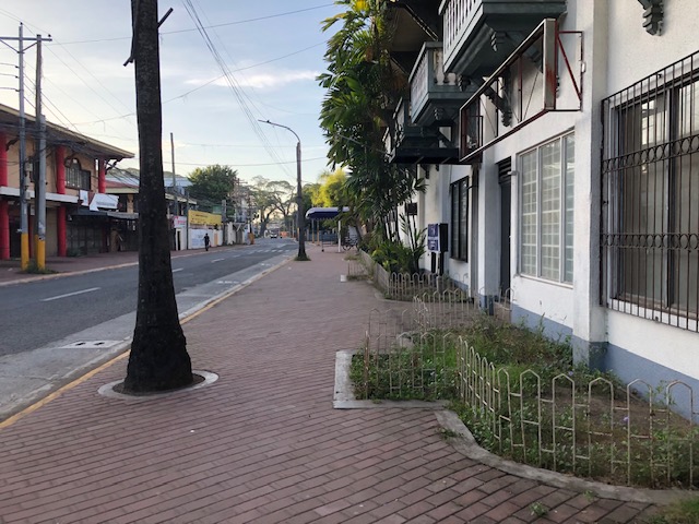
On the importance of trees along streets
I’ve written before about the importance of having parks around a city or town. Here’s an article I recently read about the positive impacts of trees along streets:
Stimpson, A. (March 12, 2021) “Green health: a tree-filled street can positively influence depression, study finds,” The Guardian, https://www.theguardian.com/us-news/2021/mar/12/baltimore-study-trees-mental-health-study [Last accessed: 3/29/2021]
 Tree-lined street somewhere in Antipolo City, Rizal
We often refer to cities as the urban jungle. Why not really, literally make cities as urban jungles by planting more trees and other plants where its possible to grow and nurture them. Gardens may be grown not just for flowers or aesthetics but for food. Perhaps architecture should deliberately be oriented for greens? Orchard Road in Singapore is much admired for its trees. Surely, similar streets in our country can be landscaped accordingly.
–
