
Home » Posts tagged 'traffic schemes'
Tag Archives: traffic schemes
Ortigas Avenue Extension counterflow
One traffic scheme that has been constant along Ortigas Avenue Extension is the counterflow scheme. The scheme is applied in the mornings for westbound (outbound from Rizal) traffic. It has been implemented for as long as I can remember; perhaps since the early 1980s. One variant before was a form of “Buhos” where eastbound traffic is stopped for several minutes at certain intervals (6:30am, 7:00am, 7:30am and so on), and westbound traffic is allowed to take all the available lanes during the periods.
Considering this scheme has been implemented for more than 4 decades now, there must be some measure of effectiveness there. It is an example where the directional distribution during the peak hours allow for such scheme to be implemented. Note that the scheme pre dates number coding and similar counterflow schemes elsewhere in other major roads in Metro Manila (correct me if I’m wrong).
The scheme though only shows that there should have been a better transport system put in place along the corridor, which has had a steady growth in travel demand. There should have already been a transit line along this corridor a long time ago. What happened? Was it not in the government’s radar? There was a line proposed and shown in various master plans before.
–
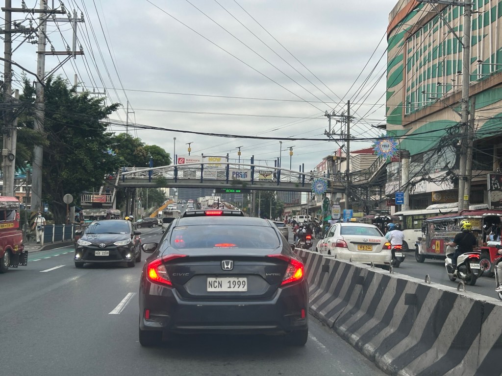
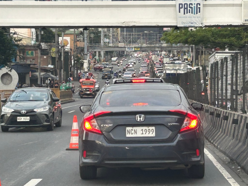
Quick comments on the NCAP
The No Contact Apprehension Policy (NCAP) is finally being implemented in Metro Manila. The results so far has been dramatic in terms of the number of violations recorded and the images being shared so far about how motorists are behaving. Below is one of those photos being shared on social media to which I added some annotations. I will use this later to comment on the NCAP and how we can use the outcomes to assess the transportation situation and determine what interventions can be done. Some are already obvious from the photo – the lack of public transport options lead to people depending on private motor vehicles like cars and motorcycles for their commutes. MRT7 is yet to be operational and road public transport has not been rationalized.
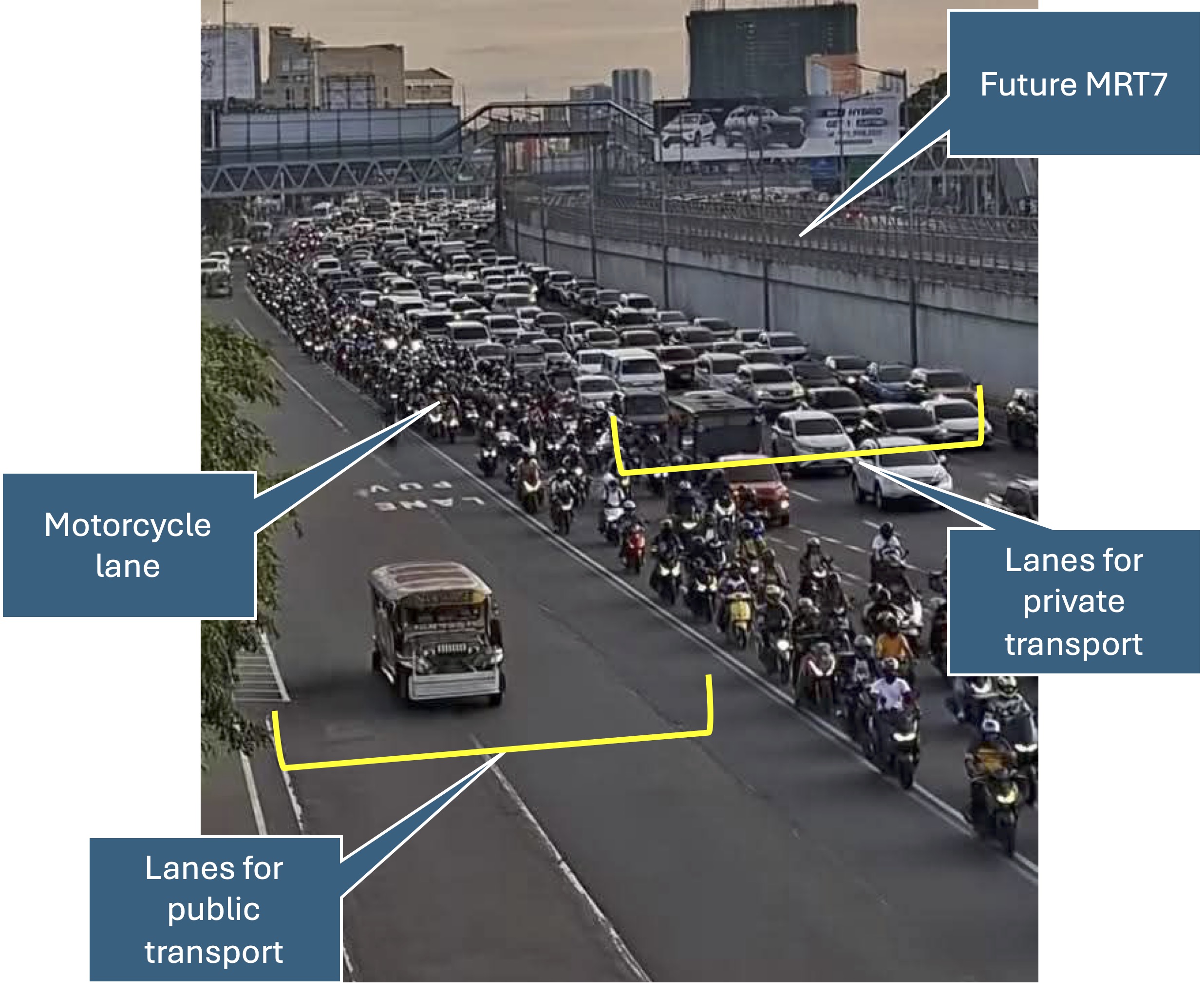
More on this topic soon!
–
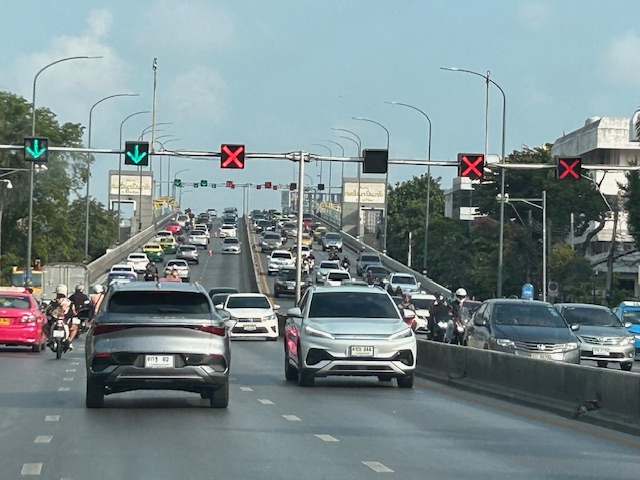
Counterflow lanes in Bangkok, Thailand
I almost forgot again about this set of photos showing the implementation of a counterflow scheme along a long stretch of road in Bangkok. Heading out of Bangkok, I was able to take photos of the counterflow lanes and variable traffic signs used for this purpose. We were northbound meaning we were traveling outbound of the metropolis and opposed to the peak direction (southbound was inbound to Bangkok).
 Approaching an overpass where variable traffic signs are installed overhead (i.e., on a gantry).
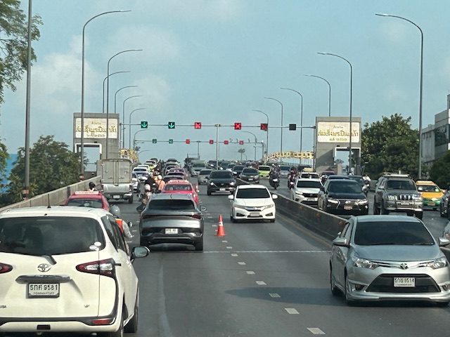
 It is easy to see which lanes are assigned for our direction and which ones for the opposite flow.
 On the overpass, you can see that the variable signs are installed at regular intervals. There are a few cones that act as physical separators (not really barriers) between opposing flows.
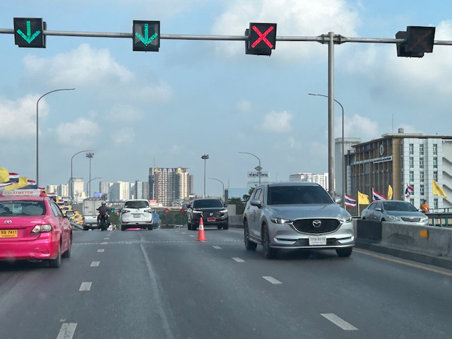 Sort of a close up of the variable signs and a cone. I assume the cones are placed there by traffic authorities. They might be transferred to the other side of the overpass if the counterflow was in favor of our direction.
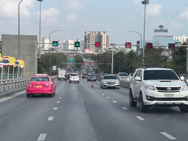 Another photo showing the installed variable signs towards the other end of the overpass.
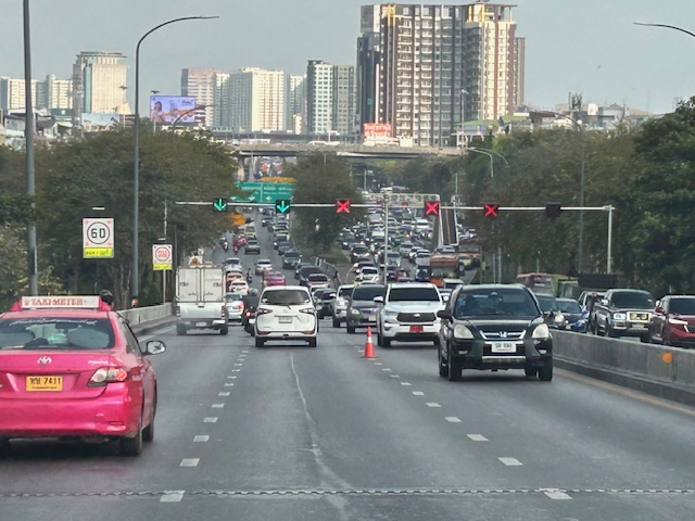 Four lanes are assigned to inbound traffic while only two are for outbound traffic.
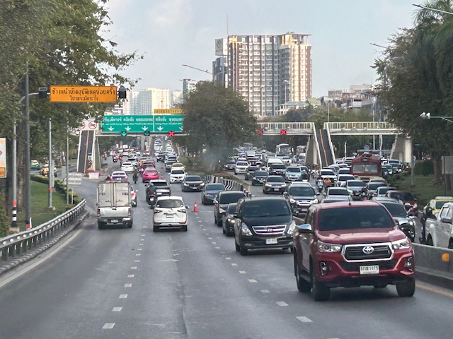 At the foot of the overpass is a pedestrian overpass. The stairs appear to be quite steep based on the photo. I’m not aware of criticisms of the pedestrian footbridges in Bangkok. I would have to ask my Thai friends about their designs.
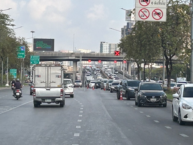 Another overpass where all lanes are assigned to the southbound direction
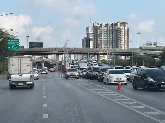 The parked vehicle on the chevron is with the traffic authority of Bangkok.
I actually started writing this in April last year. I will try to finish some drafts I started last year this month while also posting about my recent travel to Bicol.
–
Article on the evaluation of congestion pricing
I want to share this article on the congestion pricing zone in London. This is called the Ultra Low Emission Zone (ULEZ), which also met resistance when it was first implemented.
Selby, O. (January 16, 2025) “ULEZ expansion hasn’t hurt high street spending,” Centre for Cities, https://www.centreforcities.org/blog/ulez-expansion-hasnt-hurt-high-street-spending/ [Last accessed: 2/1/2025]
Quoting from the article:
“The benefits ULEZ has provided to public health have been studied extensively. The data is clear: London has the worst air quality of any UK city and the capital’s emission zone is helping to change this.
So far, card transaction data does not suggest that ULEZ is harming high street spend. This should reassure policy makers in London, who committed to the emission zone a while ago, and strengthen the convictions of policy makers in New York who are now following suit.”
The article is a nice reference not just for evaluation of similar congestion pricing schemes but can also be used for carless streets or zones. I wonder if there are similar work being done for Baguio’s congestion pricing scheme as well as the carless programs in Ortigas Center. Quezon City should also do this for the newly implemented program along Tomas Morato.
–
On the number coding options for Metro Manila ca. 2022
The Metropolitan Manila Development Authority (MMDA) recently announced that the agency was studying options for a new number coding scheme under its Unified Vehicular Volume Reduction Program (UVVRP). UVVRP is basically a travel demand management (TDM) program focused on vehicle use restraint. In this case, private vehicles, particularly cars, are the target of volume reduction. Here’s a graphic from their Facebook page:

The schemes are not really new as these were also considered before. Are the conditions new at all? Are we assuming things changed due to the pandemic? Or will there just be a return to the old normal in terms of traffic congestion? Here are some past writings on the topic including a 3-part series I wrote back in May 2011:
- From Odd-Even to UVVRP…and back
- Traffic congestion in Metro Manila: Is the UVVRP Still Effective? – Part 1
- Traffic congestion in Metro Manila: Is the UVVRP Still Effective? – Part 2
- Traffic congestion in Metro Manila: Is the UVVRP Still Effective? – Conclusion
I think many of the arguments I made in those more than decade old articles hold or apply to the present. Even with the increasing popularity of active transport in the form of bicycle facilities appear to have not made a dent to the transport problems in the metropolis. Many questions abound and I have seen and read comments pointing to the many transport infrastructure projects currently ongoing around Metro Manila as proof that transport and traffic will be improving soon. Transportation in general may indeed improve once the likes of the Metro Manila Subway, Line 7, Line 1 Extension, and the PNR upgrades come online (i.e., all operational) but we have yet to see their impacts outside the models created to determine their potential benefits. Will they be game changers? We do hope so. Will UVVRP be needed in the future when these mass transit lines (including others in the pipeline) are all operational? Perhaps, but a scaled down version of this TDM scheme might still be needed and may suffice if people do shift from their private vehicles to public transportation. The fear is that most people eventually taking the trains would be those who are already commuting using road-based public transport like buses, jeepneys and vans. If so, the mode share of private transport will not be reduced and those traffic jams will remain or even worsen. Maybe we should be discussing road pricing now?
–
Proposed downtown traffic scheme for Tacloban City
The team from the National Center for Transportation Studies of the University of the Philippines presented their recommendations for the traffic scheme in downtown Tacloban City last May 4, 2018 in the city’s Traffic Summit cum City Development Council (CDC) meeting. I am sharing the image showing the proposed traffic circulation and other features for the proposed downtown scheme below:

The scheme calls for a reduction in on-street parking; restricting such to one side of the street only and where applicable. That is, on-street parking is not allowed where there is already off-street parking along establishments, where there are driveways, and within one or two vehicle length from intersection corners. There will also be designated loading/unloading areas for public transport so parking is also prohibited there.
A couple of important features in the scheme are the enhancement of pedestrian facilities, particularly sidewalks, and the introduction of bicycle lanes. These are more clearly shown in the cross-section examples included in the map. Note that for other streets where there are no designated bike lanes indicated, it is assumed that lanes will be shared with motor vehicles. This is an application of the concept of shared right of way or “sharrow” as it is also termed. The scheme is contextualised along the lines of “people-oriented” transport rather than “car-oriented”, and hopefully would lead to a more walkable downtown area and encourage more people to use bicycles. This promotion of active transport should also lead to a healthier city. I will post about the transport plans prepared for the city in future articles here.
–
On the Pasig HOV traffic experiment
Someone shared a post about a traffic scheme they will be implementing along Julia Vargas Avenue in Pasig City. The proposal is for the avenue to have a high occupancy vehicle (HOV) lane where vehicles with 4 or more occupants are to take one lane and all other vehicles the other. I am not entirely sure about the objective other than to promote high occupancies for vehicles. However, it would be nice to see how travellers will be behaving (e.g., complying) and how Pasig (with MMDA?) will be enforcing this scheme.
This is what a segment of Julia Vargas currently looks like with 2 wide lanes designated for motor vehicles (separated by the solid yellow line) and one narrow lane for cyclists (adjacent to the shoulder):

The intent is good but as a major link the scheme can be quite confusing especially for those who are not necessarily frequent users of this road. I assumed the yellow line was painted by the DPWH but it seems it was by Pasig. Perhaps they should have removed the old markings? Or maybe better if they rationalised the carriageway width to accommodate 3 lanes for motor vehicles and 1 wider lane for bicycles? From the photo above, it appears to me that it is possible to have 2 narrow lanes for general traffic and one wider lane for HOVs (in this case defined as having 4 or more occupants) and public utility vehicles. This configuration maximises the capacity of the road while having a the “best” lanes allocated for HOVs and bicycles.
I wish them success on this social experiment. Perhaps there can be valuable learnings from this including the need for connectivity to other links as well.
–
On one way schemes
A proposed one-way scheme for EDSA, C-5 and Roxas Boulevard raised not a few eyebrows among transportation and traffic professionals. While it seems to some that the three major thoroughfares are parallel or can be paired in such a way that EDSA can be one-way southbound, and C-5 and Roxas Blvd. can be one-way northbound, it is not as easy at it seems because these arterial carry a heckuva lot of traffic compared to the roads they are being compared to (New York?). The road network layout is also quite different. We have a circumferential and radial road network as the backbone of road-based transportation. A one-way scheme could be more effective if we had a grid type network where you have several pairs of roads that can be designated as one-way streets.
Take the case of Tacloban City, whose central business district has a grid-type network with intersections relatively closely spaced. The city implemented a one-way scheme as shown below:

Note the pairs of roads designated for one-way flow. These basically make for efficient traffic circulation provided the capacities of streets and intersections are not significantly reduced by factors such as on-street parking and other roadside friction. This can be achieved in various places in Metro Manila where streets are similarly laid out and there are multiple pairs to promote good circulation. Makati, for example, has many one-way streets in its CBD, and these are also in pairs. While having high capacities, EDSA, C-5 and Roxas Boulevard just does not have the closely spaced intersections to effect efficient circulation. In fact EDSA (or C-4) and C-5 are arterials that function to distribute the traffic carried by radial roads such as Roxas Blvd., Shaw Blvd., Commonwealth Ave, Aurora Blvd., etc.
A better option is to focus on improving road -based public transport by setting up high capacity, express bus services with exclusive lanes. These may not necessarily be full Bus Rapid Transit (BRT) systems but requires a drastic reduction and restructuring of current numbers of buses along EDSA and their deployment along corridors like C-5 and Roxas Blvd. Express means longer intervals between stops (hint for EDSA: express bus stops coinciding with MRT-3 stations), and increased travel speeds made possible by exclusive lane(s). This could have been piloted during the APEC meetings in the previous administration where 2 lanes for each direction of EDSA were appropriated for APEC vehicles. These lanes could have been used afterwards for a BRT (-lite?) system and what could have been an pilot could have also provided an appreciation or “proof of concept” for BRT in Metro Manila that we could have learned a lot from.
–
MMDA statement on the odd-even scheme
The MMDA released a statement today about the much criticized Odd-Even scheme for EDSA that was floated on mainstream and social media. I will not comment on the statement but instead just reproduce the post on Facebook here:
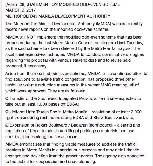
What do you think?
–
Addressing congestion due to school traffic congestion
There are two important traffic news stories yesterday:
- MMDA successfully clears parked vehicles outside La Salle Greenhills
- MMDA sets drop off, pick-up points for Ateneo students
For some reason that’s a bit surprising for many, the MMDA seems to have solved two of the most enduring issues on traffic congestion along two major thoroughfares. LSGH is along Ortigas Avenue while Ateneo is along Katipunan Avenue (C-5). Both have high trip generation rates and a significant percentage of their trip gen is comprised of private vehicles. While, Ateneo’s trip generation has led to traffic congestion due to the sheer number of trips the university attracts, the congestion due to La Salle is due to the poor traffic management and lack of parking spaces for vehicles attracted by the school.
I only wonder why it took so much time to address these problems considering the solutions mentioned in the articles are basically ones that could have been implemented years ago. In the case of La Salle, good old fashioned traffic enforcement apparently did the trick. But then, the MMDA even with the LGU constraint could have been stricter before whether when they were under Bayani Fernando (BF) or any of his successors as MMDA Chair. With Ateneo, the scheme is very similar if not the same as what BF proposed over a decade ago when he was MMDA Chair. At that time though a touchy issue was the U-turn scheme he installed along Katipunan that cost trees and the former service road on the west side of the avenue. We can only hope that these claimed ‘successes’ will be sustained and ensure smoother flow of traffic along the major roads they directly affect.
–
