
Home » 2012 (Page 4)
Yearly Archives: 2012
Suvarnabhumi Airport revisited
The first time I traveled to Bangkok in 2002, the international airport was still at Don Muang, which is to the north of the central business district. A few years and few more subsequent visits later the international gateway was moved to the new Suvarnabhumi International Airport located to the east of Bangkok. It is the 4th largest single terminal in the world and has the tallest control tower of any airport. At the time of the transition from the old airport, there were already other infrastructure in place or being constructed for an efficient connection to the metropolis. These included an elevated expressway and an airport rail link. Both cut down travel time between the airport and Bangkok’s CBD significantly. I was able to use the expressway several times in my previous visits to Bangkok but was only able to use the rail link recently. It is a good option particularly when arriving during the peak hours when traffic can still terrible along Bangkok roads and when your destination happens to be accessible via the BTS Skytrain to which the rail link connects at Phaya Thai station.
Following are a few photos taken upon my arrival at Suvarnabhumi after something like 5 years since my last visit to Thailand.
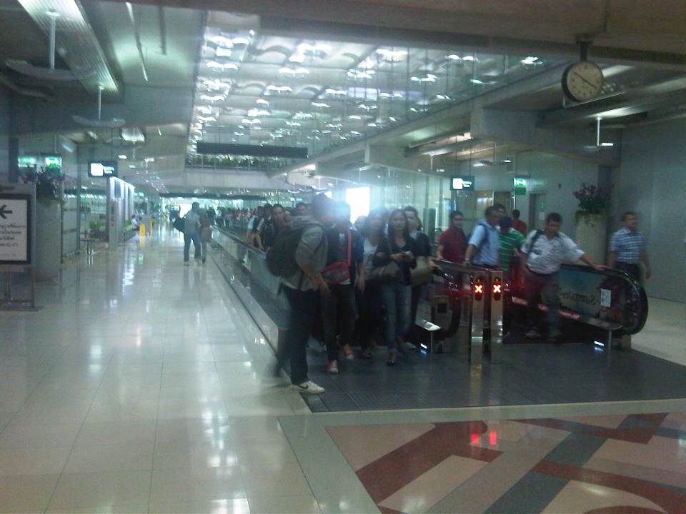 Ready, get set, go? – Filipino overseas foreign workers (OFW) in transit to Dubai and other destinations via Bangkok seem to be rushing to their transfer flight using the moving walkway or “walkalator.”
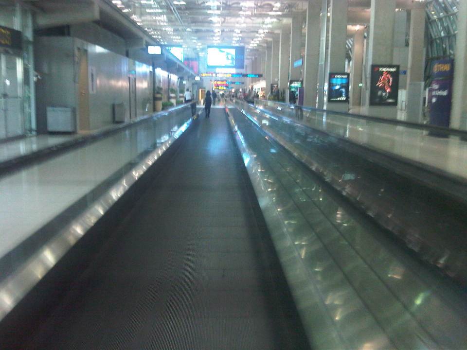 Long walks – the airport terminal is basically linear and moving inside the terminal would probably require one to use the many moving walkways especially if one is in a hurry to board or for a transfer.
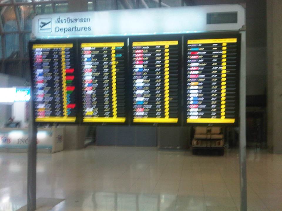 Departures – flight information board for departing aircraft
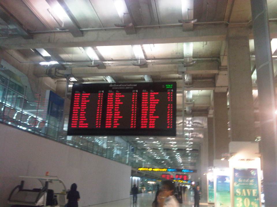 Can’t get enough of info – overhead electronic information boards for passengers can be quite useful for transfers or boarding information
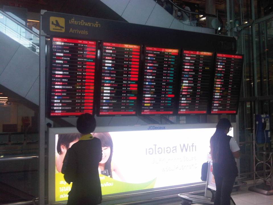 Arrivals – information board for arriving aircraft are useful to people picking up friends or clients.
 Airport concourse – the spacious airport terminal provides enough room for moving around. There are information booths for visitors/tourists as well as those catering to currency exchange, transport services, souvenirs, and snacks.
 Up and down – escalators and elevators are available for the convenience of airport users particularly when traveling to or from the rail link.
 In transit within – heading to the airport rail link, travelers will be guided by the signs along the way.
 Airport rail link – ticket vending machine for the rail express link between the airport and the city center
I will post more photos later of the interior of the passenger terminal. There is not much difference between the terminal as I remember from the last time I was in Bangkok 5 years ago and this recent trip. This will be obvious in the next post on the airport.
–
Walking and parking in Quezon City: Tomas Morato
Continuing on the series featuring pedestrian and parking facilities in Quezon City, featured in this post is the case of Tomas Morato Ave. Like Visayas and West Avenues, the pedestrian sidewalks and off-street parking spaces along the avenue were constructed to address the lack of off-street parking facilities and sufficient pedestrian walkways along streets that had significant commercial development. It should be noted, however, that the lack of parking spaces is due likely to many establishments not complying with the minimum standards set under the National Building Code and City Hall’s approval of plans and construction despite this non-compliance (note: LGUs issue the building permit upon approval of plans including what is supposed to be a review of compliance to various standards.).
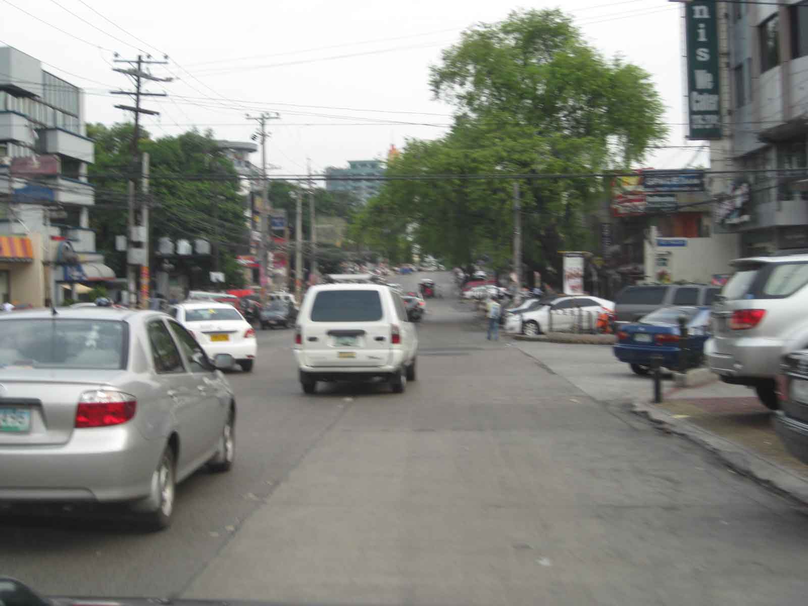 A view of a stretch of Tomas Morato Ave. – note the absence of or weathered pavement markings and the vehicles parked at spaces constructed by the Quezon City government. Space was relatively more limited along Morato and so much of the spaces available were allocated for parking. Pedestrians, thus end up walking along whatever remained or along the edge of the carriageway.
 Establishments such as the many restaurants along the street. From a purely transport planning perspective, one wonders how these establishments were able to get approval from City Hall without having enough parking slots for their customers. These are not your neighborhood turo-turo or karinderya types and so they will generate a lot of vehicle traffic and require more parking spaces in addition to the token slots they provide.
 Some of the larger and older establishments along Morato already have sufficient parking spaces and these were upgraded by the LGU to have uniformity along the road.
 The off-street parking spaces definitely benefited traffic as road capacity is not reduced by on-street parking. There are still problems though especially during noon and night time when the restaurants generate traffic resulting to some vehicles parked or standing along the street.
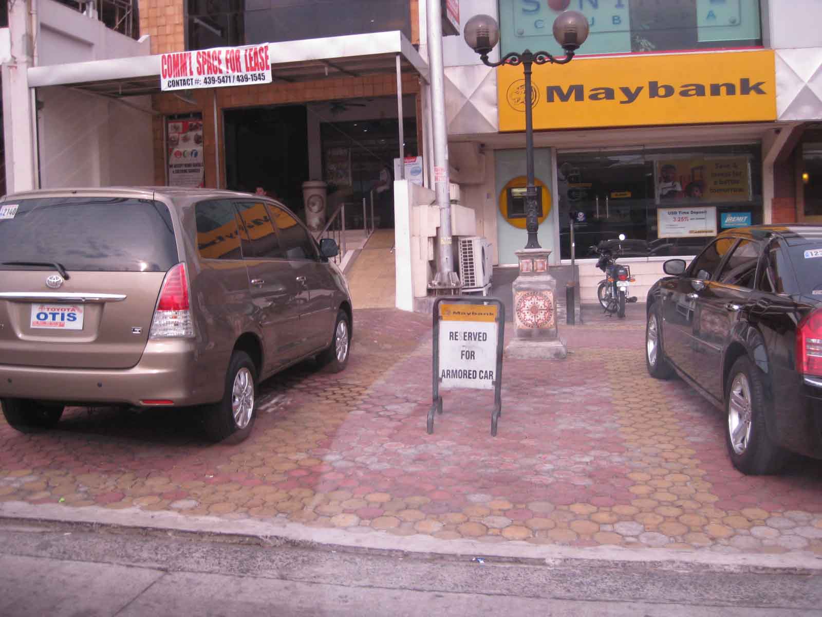 One issue along the street are public parking constructed using public funds being reserved by establishments such as this bank along Morato.
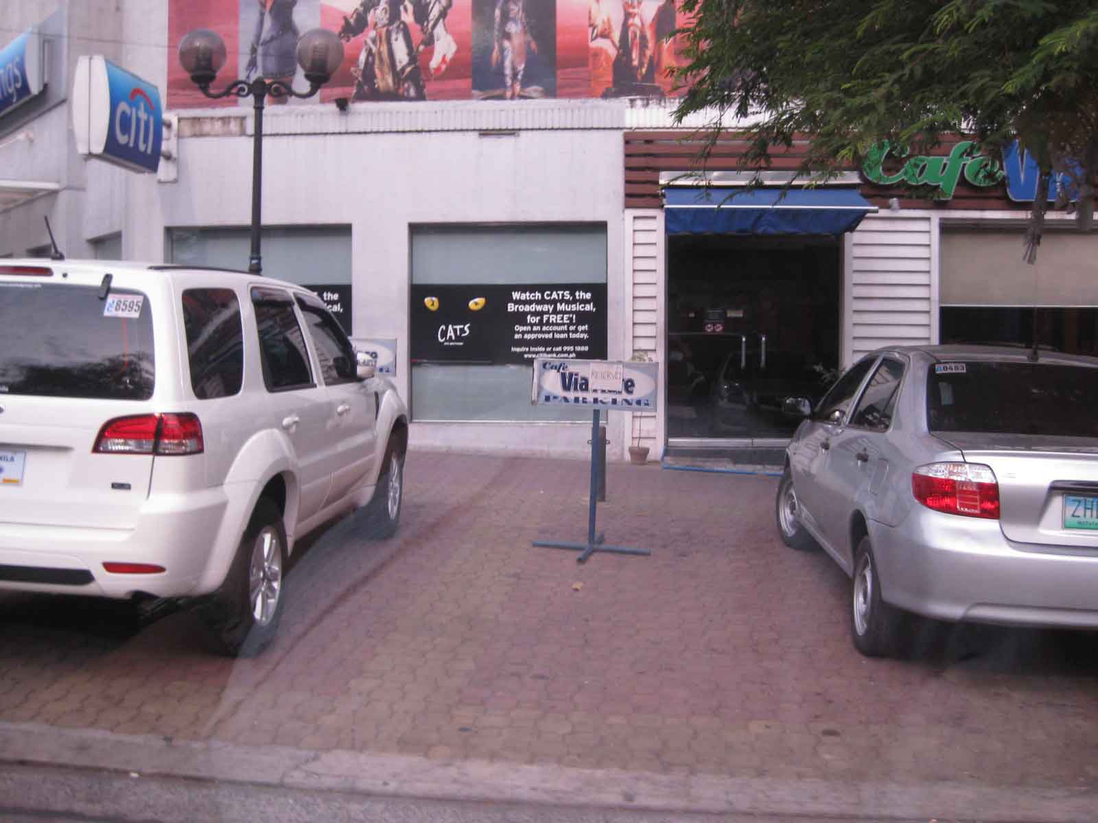 Another case concerns slots reserved by restaurants like this one.
There are still issues concerning the construction of parking spaces for establishments who have not complied with building standards (minimum parking spaces). These issues are rooted on the use of public funds that otherwise could have been used for other, perhaps more important purposes such as healthcare or classrooms. However, one should not lose sight of the fact that there are benefits derived from these parking spaces from the perspective of traffic flow. Moreover, the inclusion of pedestrian facilities definitely enhance safety. These are benefits which are often quite difficult to quantify in monetary terms but contribute to better quality of life for the general public. Such projects also show that the city is doing something to improve public facilities unlike the cases of other LGUs that have sufficient revenues but seem to be lacking in the provision of similar infrastructure.
–
Completed Quezon Avenue-Araneta Avenue underpass
The underpass along Quezon Avenue at its intersection with Araneta Avenue was finally completed and opened to traffic last September 28, 2012. It is perhaps one of the most anticipated inaugurations of infrastructure for Metro Manila and not an anti-climactic one like what was hyped as the completion of the loop formed by MRT3 and LRT1 a few years ago. That didn’t turn out well as we now know there is no loop at all with real connection of the two rail lines. But that, as they say, is another story worth another post or two.
Based on reports from different people including our office’s drivers and some colleagues, traffic has significantly improved in the area. The only joke going around is if the underpass will not be a catchment for floodwaters should there be strong rains considering that it was flooded during construction due to its proximity to the San Juan River and the perennially flooded areas of Talayan and Espana. There are, of course, pumps that have already been installed for the underpass to reduce if not eliminate the possibility of flooding. Following are a few photos taken one Saturday mid-morning when I passed along the area.
 A view of the approach to the underpass from Banawe. The pedestrian overpass is across Sto. Domingo Church.
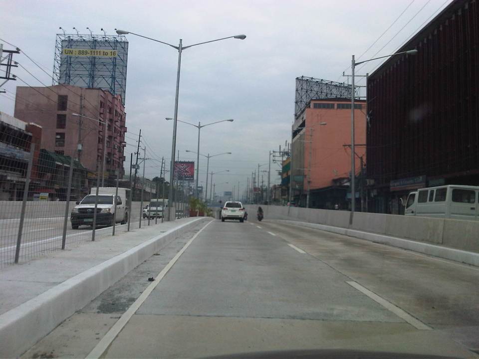 The section has 4 lanes with opposing traffic physically separated by a median island. The fence is likely to prevent jaywalking as well as maybe dissipate glare from headlights during night time.
 Potted plants have been placed along the median and though perhaps more are needed, I am glad there are no concrete balls that look like goat poop used to “decorate” the underpass. Columns and girders support the underpass walls at near the junction with Araneta Ave.
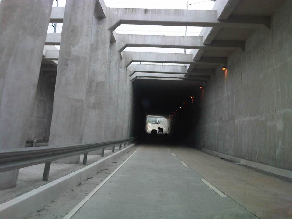 Approaching the section directly under Araneta Avenue, the first impression is that it is quite dark though motorists can see the end of the underpass. Pumps have been installed to drain water from this lowest parts of the underpass and prevent it (or reduced) from being flooded during times of strong rains.
 The end of the tunnel is practically a mirror image of the other. There are few potted plants as shown and perhaps more are needed to soften the look of the underpass as well as to reduce headlight glares.
 Back at-grade – emerging from the underpass, motorists will eventually merge with the traffic along the wide sections of Quezon Avenue. On the opposite direction, I noticed some congestion for vehicle emerging from the underpass as there is a U-turn slot a few meters from the ramp at the Banawe area.
There are traffic signals to manage flows at the at-grade junction of Quezon Ave. and Araneta Ave. It is expected that by reducing the volume of through traffic along Quezon Ave., the signals would be able to handle the remaining traffic and that the intersection will not be as congested as the case prior to the construction of the underpass. Of course, I would also like to see for myself how traffic is in the area during the regular weekdays, particularly on the typically busy days of Monday and Friday.
–
Nomination for the next NCTS Director
The nomination process for the next Director of the National Center for Transportation Studies of the University of the Philippines is currently underway. The Nomination Committee is comprised of three members – Dr. Aura Matias (Dean, UP College of Engineering & Committee Chair), Dr. Mario Delos Reyes (Dean, UP School of Urban and Regional Planning), and Dr. Rene Rollon (Director, Institute of Environmental Science and Meteorology of the UP College of Science). The nomination was open to all qualified persons from the University and particularly from the units currently having an active part with the NCTS through the Research and Extension Fellows from these units (i.e., Engineering, SURP, National College of Public Administration and Governance or NCPAG).
As of the deadline last September 28, 2012 only one person has been nominated. The lone nominee is Dr. Hilario Sean O. Palmiano, an Assistant Professor from the Institute of Civil Engineering and currently the ICE’s Deputy Director for Students and Alumni. Dr. Palmiano previously held posts as technical staff of the NCTS, first as Transport Development Officer in the early 1990’s when the Center was still known as the Transport Training Center (TTC). Later, he was a University Extension Specialist and headed the Traffic Engineering & Management Group of the NCTS before eventually joining the faculty of the College of Engineering of UP Diliman. Dr. Palmiano graduated with a degree in BS Civil Engineering from UP Diliman and obtained his M.Eng. and Dr. Eng. degrees from the Tokyo Institute of Technology.
Formal presentations were made today including one on the accomplishments of the NCTS under its outgoing Director, Dr. Jose Regin F. Regidor, also from the ICE followed by Dr. Palmiano’s on his proposed plans and programs for the Center. The presentations were followed by an open forum and afterwards, interviews of stakeholders and the nominee by the Committee.
 Dr. Palmiano starting his presentation on his proposed plans and programs for the next 3 years.
 Dr. Palmiano reading from his notes during his presentation.
 The presentation was attended by staff and fellows of the NCTS.
The Nomination Committee is to complete their evaluation this week and submit their recommendation to the UP Diliman Chancellor next week. The new NCTS Director will assume his post from November 2012.
–
Of stored value cards and other ways for paying fares
I was in Thailand for at least once a year during a certain stretch in the last decade as part of my university work. Whenever I was in Bangkok, I bought a one-day pass for me to have practically unlimited use of the BTS Skytrain for a day. Other times, I bought a 3-day pass in order for me to also see and experience the system. Those times in the past, there were no IC or stored value cards for use in commuting in the Thai capital like those in Singapore, Hongkong or Japan. And so I was quite happy to see the availability of a stored value card when I familiarized myself with the Skytrain last week.
The Rabbit card, as it was called, is a stored value card that still has limited use for commuting and other purposes. At present, it can only be used for the BTS Skytrain and a few shops. It cannot be used for buses, taxis or the MRT (Bangkok’s subway). There are three variants for the Rabbit card – one for students, one for senior citizens, and another for adults (all other people).

 Back of the card where simple instructions for use of the card are indicated in both Thai and English.
The Rabbit card is not yet as useful, versatile or convenient as Singapore’s EZ-Link or Japan’s Suica and Pasmo commuter cards. Still, it is an improvement that will surely and steadily have more uses in the future. And so I look forward to the next trip to Bangkok when perhaps my Rabbit card will be useful for other modes of transport as well.
I am posting this article about the Rabbit Card as I listen to news about problems currently being experienced by the EDSA-MRT 3 in Metro Manila. It seems they had run out of stored value cards (maximum load of 100 PhP) and single journey cards that the administration had to resort to issuing paper tickets to accommodate the many commuters using the system.
There used to be RFID cards issued by the two giant telecommunications companies in the Philippines that could have been the solution to the current problems for the MRT3. Unfortunately, these have been phased out a few years ago. And so perhaps for the sake of the thousands of commuters using the MRT3 and other rail lines (and later even buses, jeepneys and taxis) in Metro Manila, transport officials finally invest in a card and/or pass that can be used by commuters and tourists alike. One would think that many who are with the DOTC, MRTC and the LRTA would have already experienced the systems in other countries and so they could have an idea of what could be so beneficial to public transport users here.
–
NAIA Terminal 1 arrival driveway and well-wishers area
Despite several opportunities in the past, I haven’t been able to take photos of the area for arriving passengers to be picked up by relatives or friends. I seem to forget doing including taking some while waiting for people at the building designated for sundo. And so I took a couple of photos while waiting for my ride showing the well-wishers area and the driveway for vehicles making pick-ups. Airport security usually limit the time for pick-ups as some vehicles tend to park and clog the area. There is another driveway immediately after exiting the main terminal building that is reserved for VIPs but some people who feel they are important have their drivers wait for them at the driveway featured below making them another breed of pasaway or pa-importante.
 Well-wishers area – building for people fetching arriving passengers from across the Terminal 1 building. At the back of the building is an open parking lot. Inside the building at the second level is a branch of a popular fast food chain and a coffee shop, and just behind the building before the parking lot are kiosks offering refreshments and even meals to waiting people.
 Duty Free Philippines branch at the waiting area.
Last year when talk was hot particularly about NAIA Terminal 1 being one of the worst hotels in the world, plans were being drawn about the renovations for T1. These plans included those from well-known Filipino architects that were eventually “dismissed” in favor of contracting the firm that originally designed the airport. While I have nothing against architects, I feel that T1 is one of those cases where they went more about aesthetics than functionality. This is an observation by many other people who have wondered why the airport didn’t have enough space for the typical groups (or droves?) of well-wishers that seems to be a cultural thing with Filipinos. And so the areas and buildings shown above will likely be among those to be included in a major renovation for T1 that is supposed to increase the capacity of this terminal and improve facilities for passengers and other users. However, more than a year has passed and I’ve seen nothing yet being done to the terminal.
–
Eastbound walk along Marcos Highway
I took a couple of photos of the walkway and bikeway along the eastbound side of Marcos Highway while traveling to Antipolo one weekend. This used to be a wide, open canal along the eastbound side of the highway, which forced pedestrians and cyclists to use the outermost lane of the carriageway. Such exposed people to a high risk of being sideswiped by motor vehicles that often speed along the sections shown in the following photos.
 Sign indicating bicycle path along the eastbound side of Marcos Highway. The space is supposed to be shared with pedestrians. Concrete barriers are supposed to provide protection from wayward vehicles.
 Treatment at driveways of establishments along Marcos Highway. Notice the white line delineating space for pedestrians and cyclists. The overpass at Dela Paz can be seen downstream in the photo. The overpass has a ramp for cyclists and persons with disabilities.
The pedestrian and cycle paths along both sides of Marcos Highway greatly enhance the safety features of the highway. These will especially be important come summer, particularly during the month of May, when many people take the Marcos Highway route to Antipolo Church in what is one of the most popular (if not the top) pilgrimages in the Philippines.
–
Loss of productivity due to congestion and inefficient public transport
I recently read two articles appearing in a major Philippine daily and a popular online site. The first one is an article that appeared in the Philippine Daily Inquirer – “PH economy losing $3.27B in human productivity due to traffic mess” – last September 25, 2012. The other article was posted on Rappler – “Traffic and infrastructure delays cost the Philippines” – last September 27, 2012. These were articles written after the authors’ attendance of what was an Energy and Infrastructure Forum last Sept. 25 where a transport official mentioned a recent study in his talk that estimates productivity losses of about 3.27B USD per year from Metro Manila traffic alone.
 Traffic congestion along Commonwealth Avenue
 Unusual traffic management scheme along Ortigas Avenue
The study from the National Center for Transportation Studies that was mentioned in both articles was actually first featured in a Yahoo! Philippines article – “Traffic congestion costs Metro Manila P137B per year” – that appeared a month earlier in Aug. 28, 2012. The study being referred to is actually a paper presented by Dr. Jose Regin F. Regidor in his Professorial Chair lecture at the University of the Philippines Diliman’s College of Engineering Colloquium in early August 2012. A copy of the paper may be found below:
Prof Chair 2012 JRFR 02July2012
The main reference for this paper is the study on congestion costs that was produced by the National Center for Transportation Studies back in 2000. Credits go to the core team of Dr. Ricardo Sigua (Institute of Civil Engineering of UP Diliman), Dr. Noriel Tiglao (now with the National College of Public Administration and Governance) and Dr. Val Teodoro (now in the US) for the study. The
Economic Impacts of Traffic Congestion in Metro Manila – Cover+Chap 1 and 2
Economic Impacts of Traffic Congestion in Metro Manila – Chap 3
Economic Impacts of Traffic Congestion in Metro Manila – Chap 4 and 5
Economic Impacts of Traffic Congestion in Metro Manila – Appendix
A much needed update may be possible in the next two years once the traffic model for Metro Manila is updated and calibrated using new data from Household Informations Surveys (HIS) and other transport and traffic surveys under the current MUCEP study that is supported by the Japan International Cooperation Agency (JICA). Hopefully, such a model can be updated and calibrated more often in order to assess losses due to congestion and our continuing inability to provide the necessary infrastructure to alleviate the situation. While the paper and the study mentioned above focus on productivity losses, it should be emphasized that there are other costs that should be highlighted including those related to health (respiratory diseases and road crash fatalities and injuries), energy (fuel consumption and inefficiencies), and emissions (carbon and other GHG).
–
Walking and parking in Quezon City: West Avenue
Parking spaces and walkways were also constructed along West Avenue. Bollards separate the parking spaces from the pedestrian right of way. As mentioned in a previous post, many commercial establishments benefitted from this “freebie” from the Quezon City government considering many establishments didn’t even have the minimum number of parking spaces as stipulated in the National Building Code. The local government balked at charging parking fees but one opinion is that they should charge fees for on-street parking facilities that generally benefit car-owners more than they benefit non-owners. I personally believe that there should be parking fees in order to recover some funds that could be used for other programs that could have otherwise received funding that also could have benefited more people. Following are photos taken along West Ave.
 Parking along West Ave. in front of an office building
 One advantage of the project was the reduction of on-street parking though there are still those who prefer to wait along the roadside (i.e., those with drivers).
 Parking spaces in front of a fine dining restaurant.
 Parking spaces near the Delta area, which is the intersection of 3 major roads – Quezon Ave., West Ave., and Timog Ave.
–
Airport Rail Link in Bangkok
The last time I was in Bangkok was in 2005 or 2006 and so it has been a while since that last trip that I was curious about how the city would look like after 6 years. Was there anything new? Did it change much since the last time? At the very least, I was expecting to have new experiences and it didn’t take long before I had one, trying out the express rail link between Suvarnabhumi Airport and the city. The rail link was still under construction the last time I was in Bangkok and one had no choice at the time but to take a taxi or a shuttle between the airport and the hotel.
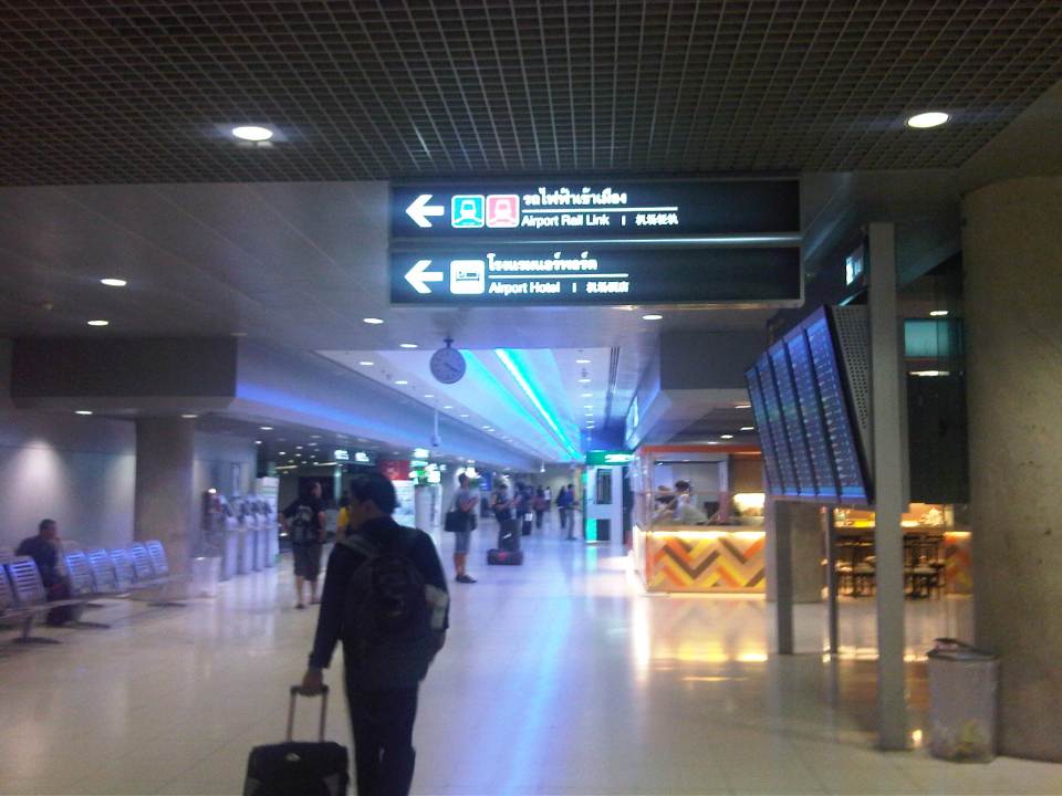 The walk from the arrival area to the Airport Link
Ticket vending machine with English instructions upon the press of a button. We purchased tickets for the Phaya Thai Express to transfer to the BTS Skytrain
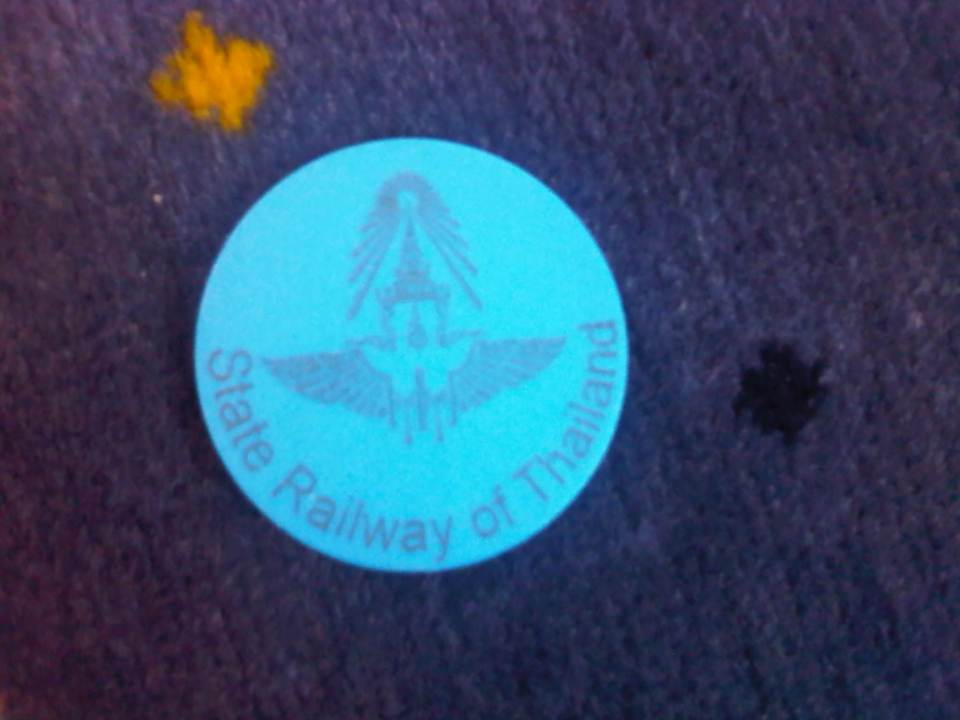 Token for the Express Rail Link trip from the airport to Phaya Thai Station – the link is operated by the State Railway of Thailand, their counterpart of our Philippine National Railways. The trip cost 90 Baht (~ 130 PhP), very cheap compared to taking a taxi.
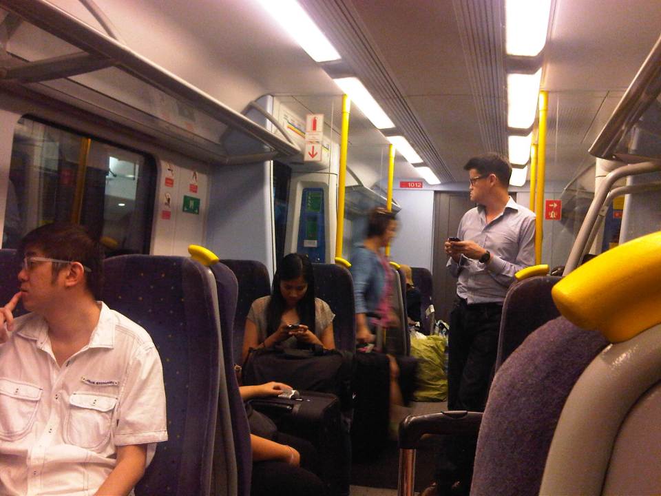 Passengers inside the Airport Link Train
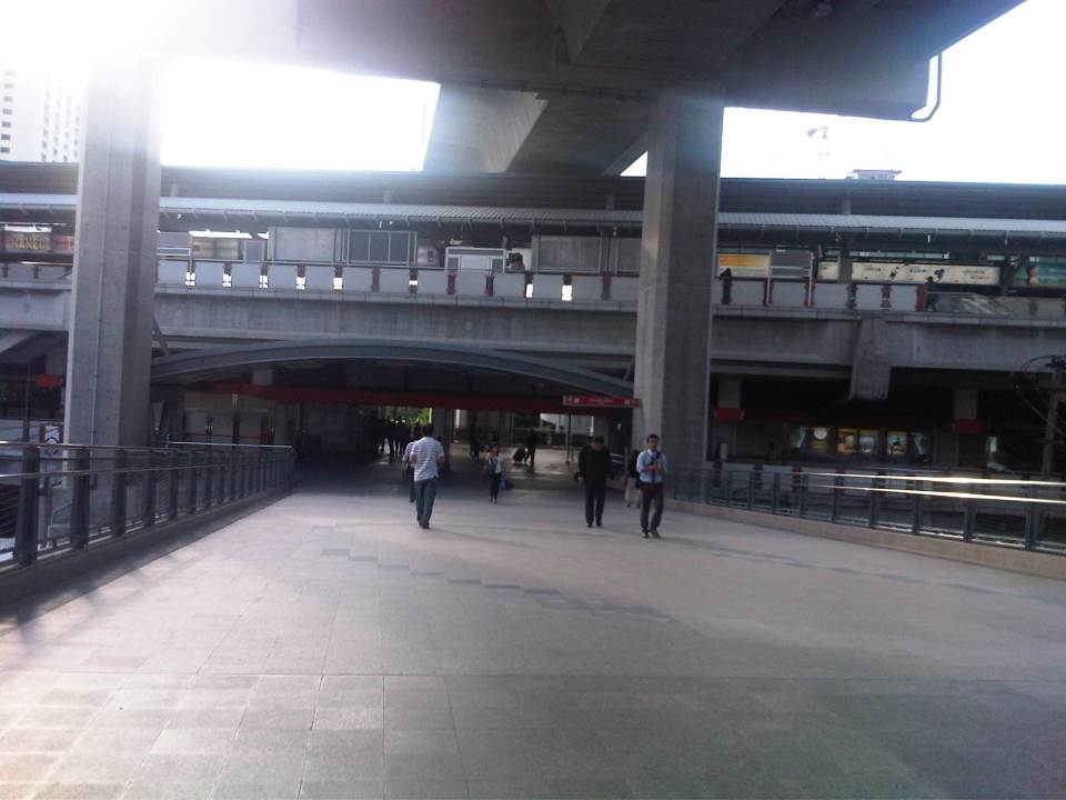 Walk from the Airport Rail Link’s Phaya Thai Station to the BTS Skytrain Station
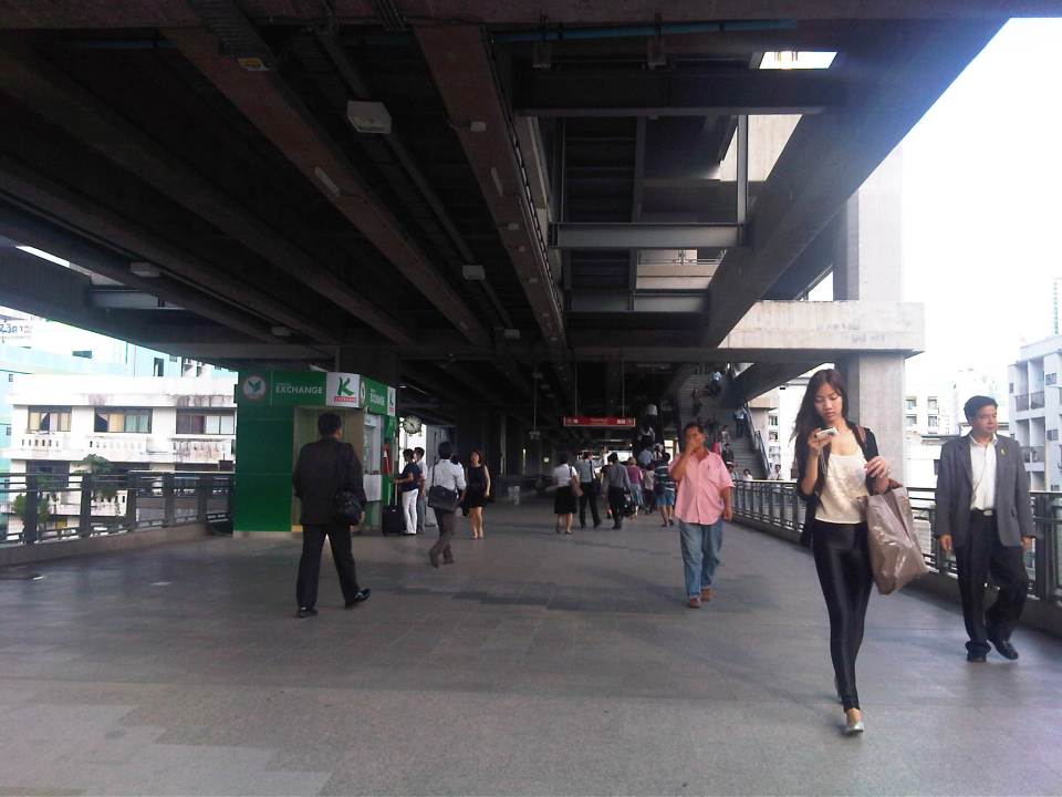 Looking back at the Phaya Thai Station
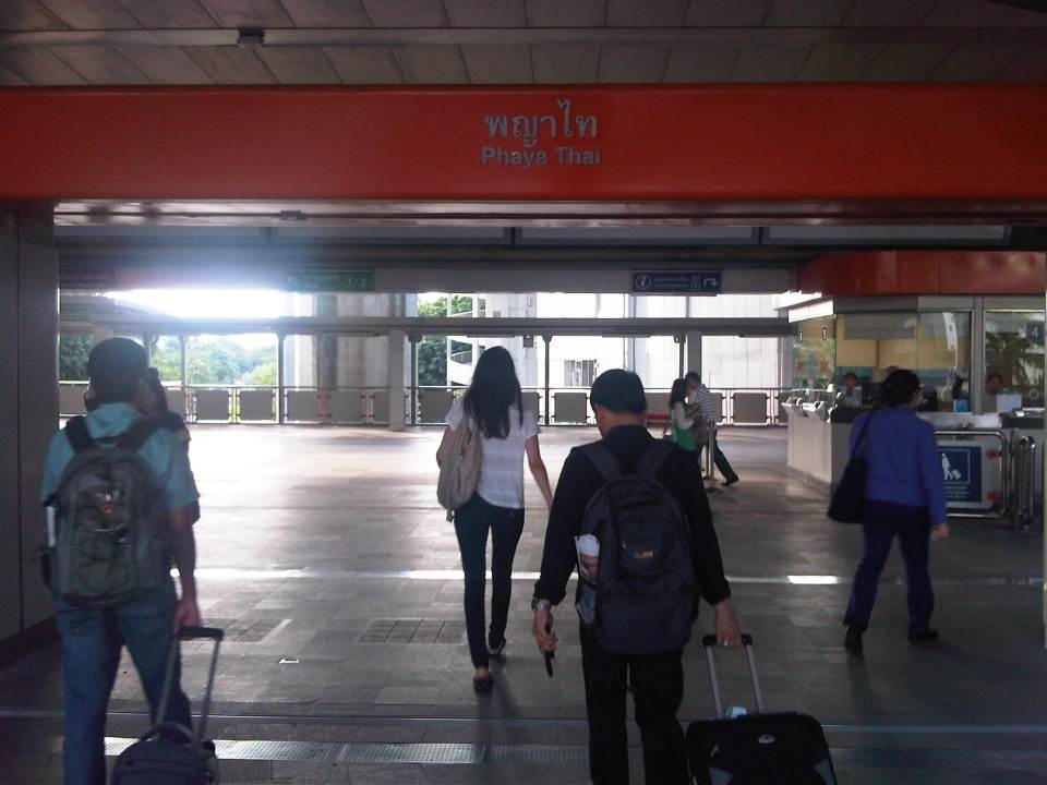 Phaya Thai Station of the BTS Skytrain
It would be very nice to have a similar rail link between the MRT 3 or LRT 1 Lines and NAIA in Manila. In fact, how difficult would it be for the LRT1 Line to have an extension to the airport terminals of NAIA when it’s depot is just across the road from the old domestic terminal? This would probably be easier than constructing a new monorail or whatever system it is that is being planned between Bonifacio Global City and NAIA. It is definitely much easier and perhaps cheaper compared to the still-born Northrail between Caloocan and Clark. One thing for sure is that we are really behind our ASEAN neighbors when it comes to providing the infrastructure for public transport, in this case airport access.
