
In-vehicle tools for road safety
I recently came across a provincial bus operator who is promoting a device for limiting the speeds of vehicles. He states that all their buses are fitted with the device and together with an on-board camera and GPS, they are able to monitor their buses and ensure the safety and security of their passengers. It’s always good to know there are responsible and progressive bus operators like him. Unfortunately, his kind is a minority among many who appear to be after the proverbial quick buck rather than ensuring a high quality of service for travelers.
Devices limiting the speeds of vehicles are not new. These have been installed in many public transport and commercial vehicles like buses and trucks in order to regulate their speeds along highways and streets. Trucks from Japan are fitted with these devices and those second hand trucks being sold in the Philippines have these but are allegedly disabled by their new owners. They are not violating any laws here as there are no regulations requiring such devices to be installed in vehicles.
Tracking devices that include GPS are more recent technologies being used mainly by logistics companies to track their vehicles. These are particularly important for trucks laden with high value cargo or for delivery vans who schedules and routes need to be managed to ensure timely delivery of packages consigned to them. Data from these devices would allow for the assessment of driving speeds and behavior such as lane changing that can be used to determine if drivers are, for example, reckless. The same data can also be used to evaluate fuel efficiency.
Such devices also have research applications because data can be used to determine real-time traffic conditions. In fact, there have been probe car studies conducted in other countries such as Japan, Thailand and Indonesia where taxis were employed to gather traffic information along urban road networks (e.g., Tokyo, Bangkok, Jakarta). Similar experiments can be implemented for Philippine cities to derive traffic information that can be used to guide travelers regarding travel times and route planning.
Perhaps the DOTC through the LTO and the LTFRB, should look into the mandatory installation and use of these devices to regulate vehicle speeds for public and freight transport and also monitor driver behavior. Mandatory speed regulation devices as well as tracking systems have a high potential for weeding out reckless, irresponsible drivers that will ultimately lead to a reduction in road crashes that have resulted in serious injuries and loss of lives. Definitely, there will be objections or opposition to such a requirement but these devices can be justified given the clamor for safer transport and safer roads. After all, everyone of us are vulnerable road users where even the safest driver can be involved in crashes. It takes only one reckless driver or rider to cause a crash.
–
Queuing at NAIA immigration
A lot of people get angry or feel aggravated when they arrive at Manila’s international airport and encounter the long, chaotic queues at the immigration section. This is particularly the cases at NAIA’s Terminals 1 and 2, which handle the most international arrivals among the 3 terminals. Terminal 3 has significantly less passengers despite it being the hub of Cebu Pacific, which currently enjoys higher passenger loads compared to rival Philippine Airlines but apparently serves less international passengers than PAL.
 Multiple queues seem to merge into one mass of people, all eager to get to a booth for their passports to be stamped. Early on, you will hear a lot of people already complaining about the queues and stating out loud how the system could be improved.
 Another photo showing multiple queues at the immigration section for arrivals at the NAIA Terminal 1.
The solution to this problem is quite simple and is actually already being implemented at the immigration section for departing passengers at Terminals 2 and 3. In both cases, there is only 1 queue for passengers that is served by several booths. This same approach to manage queues of arriving passengers is already being applied in many other airports elsewhere including Japan’s Narita and Thailand’s Suvarnabhumi where they have to handle even more passengers. Perhaps, also, a couple of booths and a separate line can be provided as courtesy to citizens of other ASEAN countries. There are such courtesy lanes in airports in other ASEAN countries, with whom we have existing agreements for visa free travels like Indonesia, Malaysia, Singapore, Thailand and Vietnam. An illustration of the system is shown in the following diagram:

I posted the figure above to be clear about the systems I’ve seen in other airports that worked quite well in being able to handle the large number of arriving passengers at the airports. It is more orderly and efficient, and to me at least, it is fair for all passengers who tend to shift to lines they think are moving faster but eventually are frustrated when the line turns out slower than their previous one. We’re hopeful that airport or immigration staff can improve the system and really soon as this will effectively cut down the times people spend at the airport terminals.
–
Off-street parking along Tomas Morato
Not too long ago, the Quezon City government constructed off-street parking slots throughout the city. These included spaces along major roads such as Visayas Avenue, Mindanao Avenue, Quezon Avenue, West Avenue and Timog Avenue. Tomas Morato as well as the streets connecting to it were also included in the project, which benefited many people, whether they be car-users or taking public transport. I took a couple of photos last week as the wife picked up some food at a panciteria along Morato. It was early an early afternoon so traffic was free-flowing and many parking spaces are available along the avenue. Morato is well known for having many restaurants and cafes lined up along either side of the street and during their off-periods, Morato would usually be an easy drive.
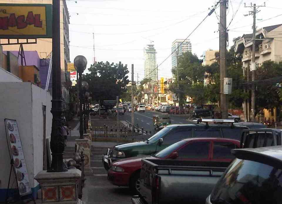 The off-street parking spaces along Tomas Morato are free and are not allocated for any specific establishment. In practice though, the spaces in front of certain restaurants, shops, banks, etc. are “reserved” by their staff for their customers/clients.
 Many newer establishments along Tomas Morato have no provisions for off-street parking for their clients. This means the burden for parking continues in being passed on to the local government and, likely, at the expense of taxpayers.
I still believe that establishments that are required under law to provide at least the minimum number of parking spaces as per national building code should be made to compensate for the city’s construction of parking spaces to solve on-street parking issues along streets like Morato. I understand that they pay local taxes but that is an entirely different requirement that is not related to their being required to provide parking spaces for their customers/clients. It’s really a matter of doing the right thing for both city and these establishments but such cases are often muddled and are not tackled as the general public is usually not interested in these somewhat unpopular topic of parking.
–
Cubao Aurora
Cubao is one of the busiest areas in Metro Manila where a lot of public transport routes converge. It is a major transfer point for road and rail transport particularly near the junction of three major roads – EDSA, Aurora Boulevard, and E. Rodriguez Avenue, which is only a few meters from EDSA. I took a few photos when I was in the area one time and here they are:
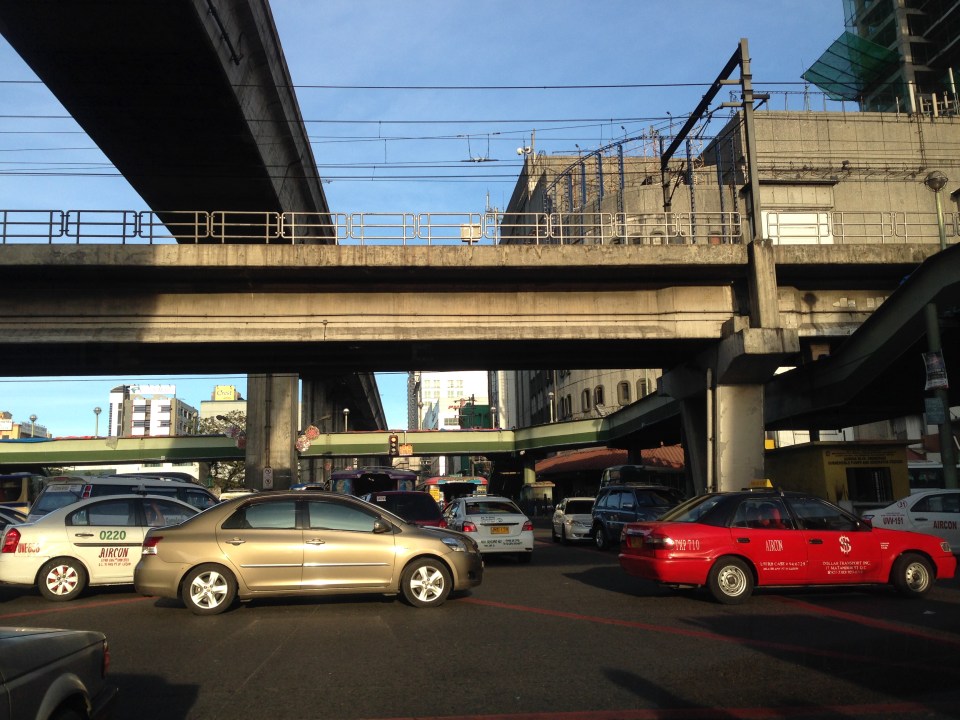 EDSA and Aurora Boulevard intersect at ground level. There is, however, an underpass along EDSA bypassing the at-grade intersection. Shown in the photo are the two rail transit lines passing through the area – EDSA MRT 3 at the 2nd level and LRT Line 2 at the 3rd level.
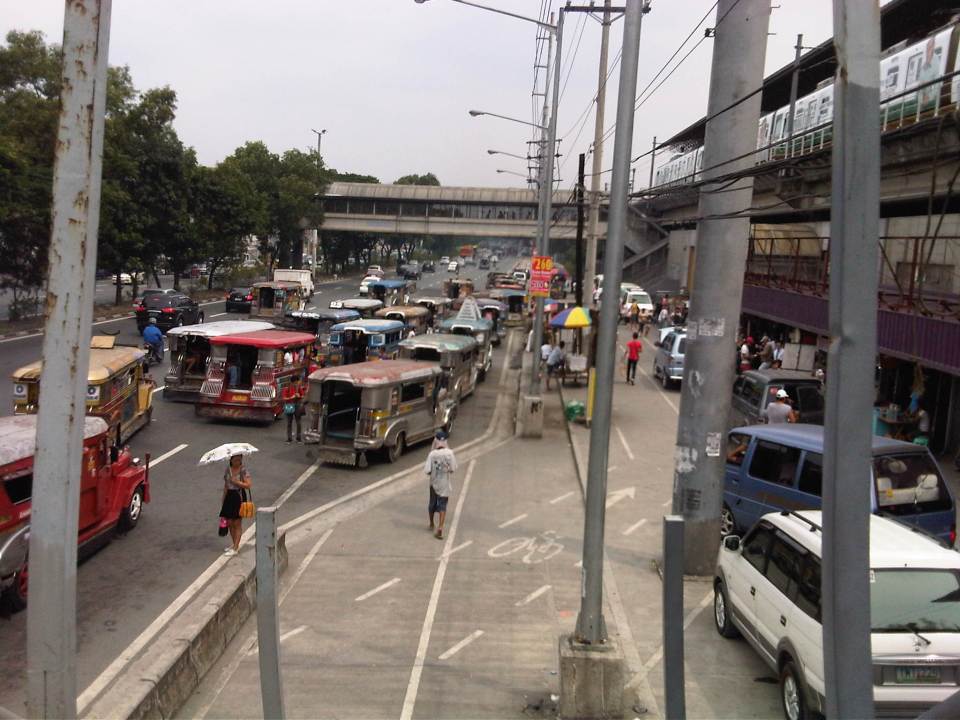
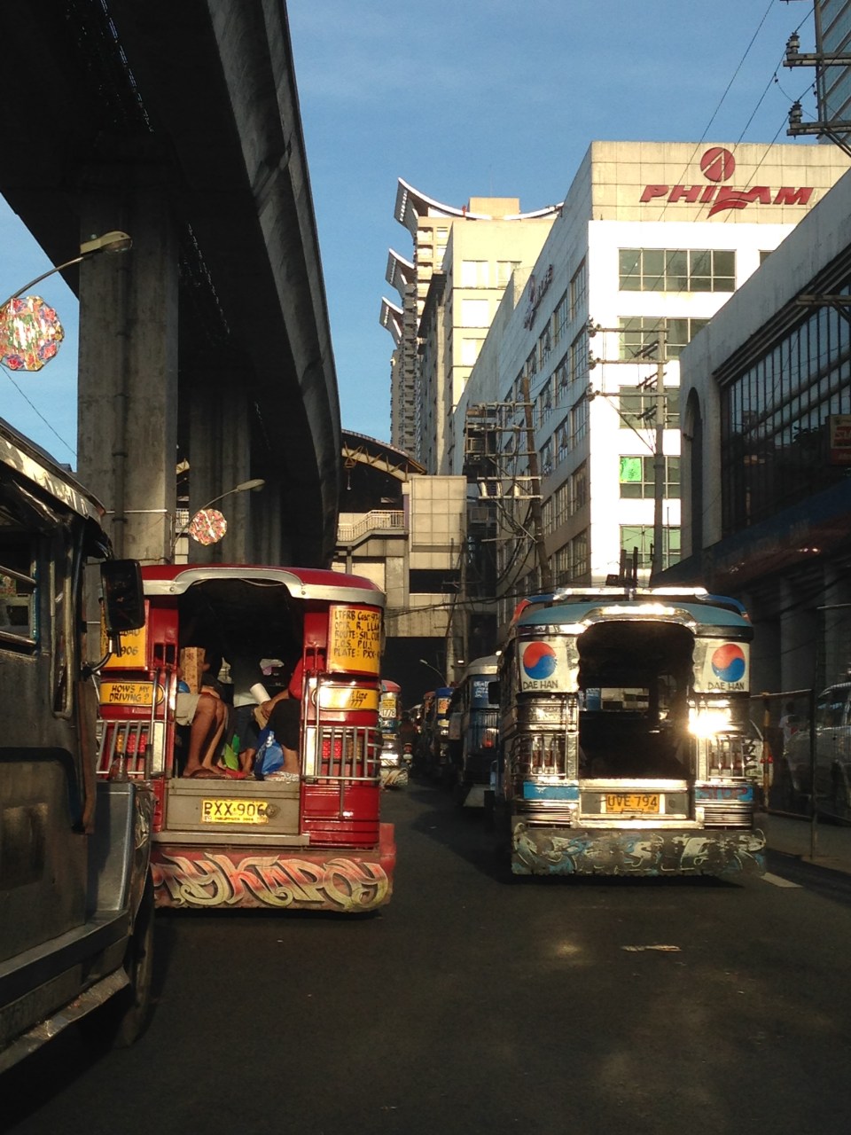 After crossing EDSA, eastbound jeepneys approach the LRT 2 Cubao Station, which is beside the Gateway Mall of the Araneta Center. Traffic along this section of Aurora Blvd. is typically slow as jeepneys bound for different destinations in the east congregate here. Meanwhile, on the other side of EDSA, the same situation is experienced as jeepneys line up along informal terminals on the street. This usually leads to congestion and low throughput along Aurora at the intersection.
 Jeepneys tend to linger under the LRT 2 station and occupy practically all the lanes with most jeepneys deliberately moving at snail’s pace as they try to get passengers. This is the case along both directions of Aurora Boulevard, which makes one wonder why many people don’t take the LRT instead. Of course, for eastbound passengers, the answer is simply that the LRT ends at Santolan Station in Pasig (along Marcos Highway and just after the Marikina River). Most passengers would rather take a single, direct jeepney ride from Cubao to their destinations rather than make the difficult transfer at Katipunan (for Marikina-bound passengers) or Santolan (for Rizal and Pasig-bound commuters).
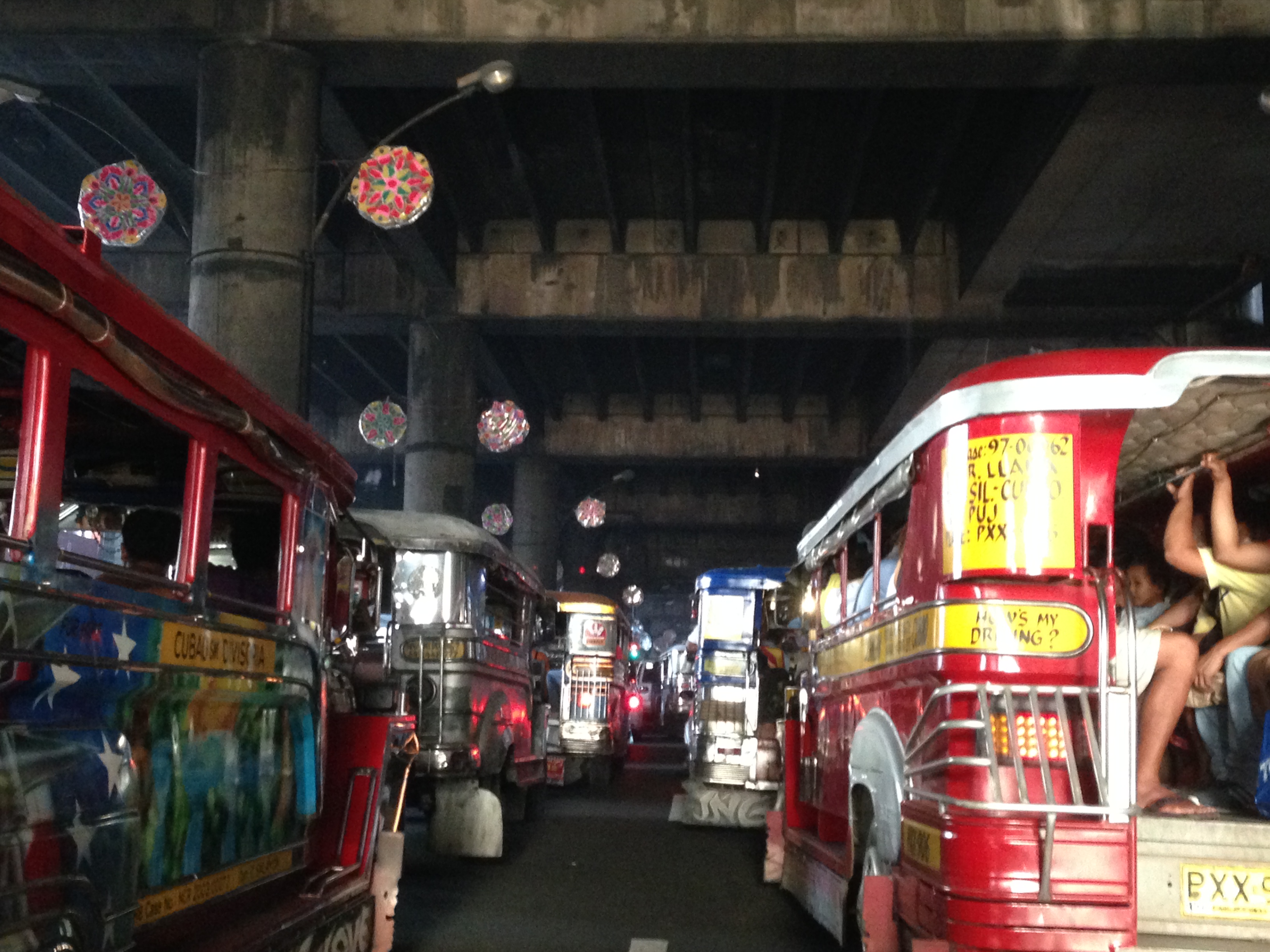
I wanted to take some photos during the night time one time we were passing under LRT 2 along Aurora Boulevard near the Gateway Mall. The area wasn’t well lighted though so all the photos didn’t come out right. This blight is similar to the situation along the LRT Line 1 corridor stretching from Caloocan to Pasay, and affecting areas along Taft Avenue and Rizal Avenue. The areas including the rail superstructure are so dirty mainly because of the emissions from road vehicles, particularly jeepneys, buses and trucks with surplus and generally poorly maintained engines. Hopefully, the local governments and MMDA can address problems of bright with a campaign to install pocket and hanging gardens like the ones already along EDSA. The plants, if cared for properly, will surely help improve both air quality and aesthetics in these areas darkened by design and soot.
–
Clear message to transport service providers
The cancellation of the franchise of the Don Mariano Bus Transit last January 14, 2014 is a long overdue decision. I say this because there have been so many incidents of road crashes in the past involving public transportation that led to the deaths and serious injuries of a lot of people whether they are passengers, the drivers themselves, pedestrians or even innocent people who happen to be at the wrong place and the wrong time (i.e., when and where the crash occurred). The cancellation of the franchise sends a strong message to erring operators and drivers of public utility vehicles including those of buses, jeepneys, UV express and taxis that the Land Transportation Franchising and Regulatory Board (LTFRB) is dead serious about enforcing franchise rules and regulations particularly in the light of road and public safety concerns. The decision is also a strong statement by the agency. One that says they have the balls to make game-changing decisions that is assumed to be intended for operators and drivers to take heed.
I had the opportunity to attend a few congressional hearings at the Batasan a few years ago that were convened by the Committee on Metro Manila Development. The main topics of those hearings were on public transportation. I recall that one hearing focused on the proposal to increase the penalties for traffic violations while others focused on policies being introduced by the MMDA (e.g., dispatching scheme, painting the bodies of buses with their plate numbers, RFID, etc.). In these hearings, the MMDA had been asked by the congressmen to present statistics on road traffic violations by public transport vehicles and they did present the numbers indicating also which bus companies were involved in the most crashes and which incurred the most violations. One question asked by a congressman was why, despite all the incidents and violations that bus companies were involved in, have no franchises been cancelled or revoked. The MMDA quickly and correctly replied that it is the LTFRB that has authority over the franchises. I do not recall how the LTFRB managed to answer the follow-up question trained on them but I don’t think anything close to a solution came out of those hearings. The transcript of these meetings and the data reported by the MMDA should be with the committee and, I presume, should be for public consumption given that these hearings were made in the interest of the general public.
Public transport as a form of “livelihood” should not be made an excuse for the poor quality of public transport services. A driver cannot drive like crazy, crash into other road users and claim that they were only trying to earn a living. Operators cannot scrimp on maintenance and spare parts costs (resulting in poorly maintained vehicles that are prone to mechanical failure and obviously violate emission regulations) just because they want to earn a larger profit. It is a card that is always put on play by public transport operators, drivers, conductors and their lawyers when interviewed, especially by TV reporters. One take on the news reports on TV is that those interviewed were nagpapaawa lang (acting for people to pity them or sympathize with them. Yet afterwards, once the suspension is lifted, these same drivers go back and drive as if nothing happened and still oblivious to the dangers they pose on others travelers. I have written about this in the past and share the opinion that we will get nowhere near the efficient and safe transport services we aspire to have unless we do away with the current practices of reckless driving and smoke-belching PUVs. And the improvement begins when the LTFRB starts canceling franchises of erring operators of public utility vehicles and the Land Transportation Office (LTO) starts revoking the licenses of irresponsible drivers.
Now, if we can only have the LTFRB cancel the franchises of erring jeepney, taxi and UV express operators, then that will send even clearer messages to all that government is really serious about road safety and public transport regulations. Included also are initiatives on truck operators and drivers who are also guilty of irresponsible driving. Perhaps the LTO should follow suit and be more aggressive in their part to rid our roads of erring private vehicle drivers and motorcycle riders? I think such actions are definitely what’s needed under the banner of “Matuwid na Daan” (literally “straight path” but also translates to “right or correct path”). In order to achieve “Matuwid na Daan,” we should also have “matuwid na pagmamaneho” (“responsible driving”).
–
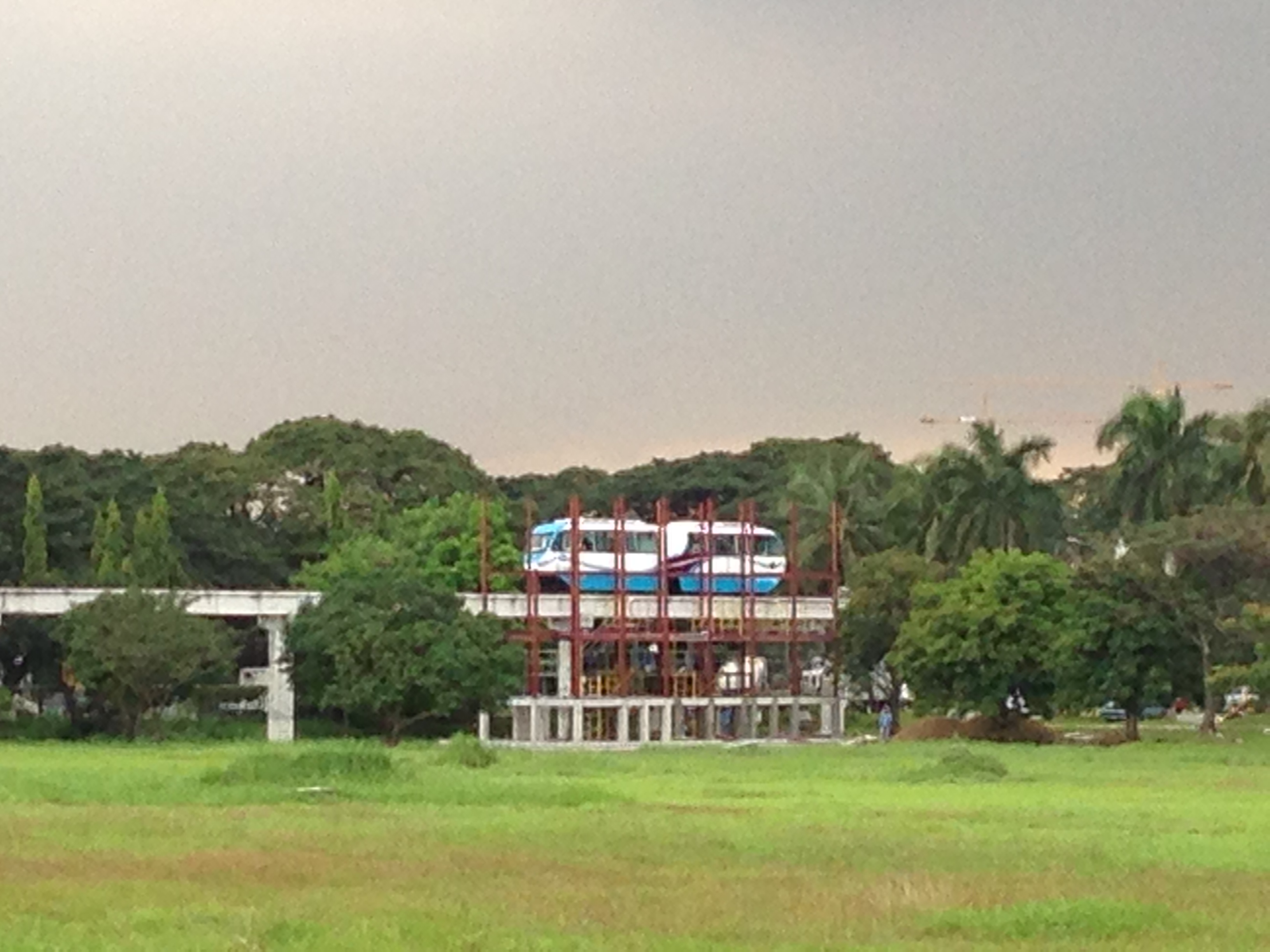
Some updates on the AGT prototype and test site at UP
Passing by the test site for the Automated Guideway Transit (AGT) prototype at the University of the Philippines Diliman campus, you will notice the ongoing work on the construction of three platforms for the AGT. These are the latest improvements to the test track and I assume involves faculty members at the UP’s College of Architecture in the design (based on previous discussions pertaining to this project). Nevertheless, the station at Jacinto Street end of the test track already has a mock-up of a ticketing office and I learned from the staff there that there will also be turnstiles once the station is completed. These would allow for a simulation of passenger operations for the AGT system, which is part of the R&D for this locally-developed transit system.
We were back at the AGT test track last Monday to show the prototype and related works to Prof. Fumihiko Nakamura, Professor and head of the Transportation and Urban Engineering Laboratory at Yokohama National University. He is also currently the Dean of YNU’s Institute of Urban Innovation. Prof. Nakamura is an expert in public transportation and has done extensive work on bus and bus rapid transit (BRT) systems. He was Visiting Professor at the Asian Institute of Technology in Bangkok, Thailand as well as at the Pontifical Catholic University of Parana in Curitiba, Brazil. Previously, we have taken other Japanese professors to visit the site and have a first-hand look at the AGT prototype. These include Prof. Tetsuo Yai, Dr. Daisuke Fukuda and Dr. Hirata of the Tokyo Institute of Technology (Tokyo Tech).
 Prototype AGT stopped at the University Avenue end of the test track, where a platform is currently under construction.
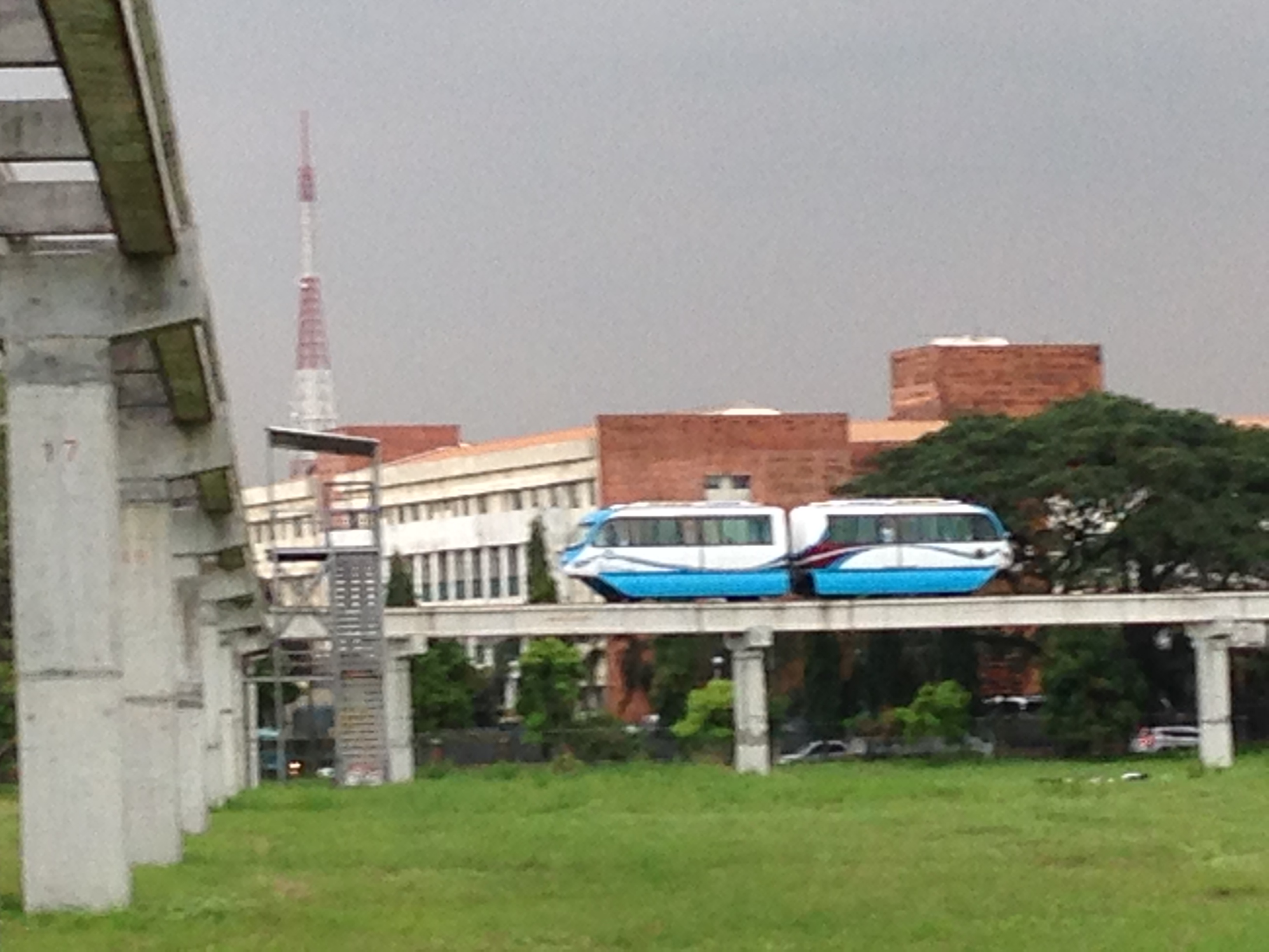 Prototype running along the test track with the photo also showing the unfinished platform at the midpoint of the track. On the background is the CHED building.
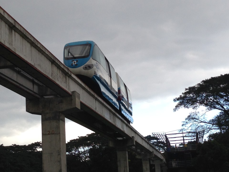
 AGT running along the test track towards the Jacinto Street end of the line.
 AGT leaving the Jacinto “station.” In the photo is the station under construction near Jacinto Street and the entrance to the College of Fine Arts and Veterinary Hospital.
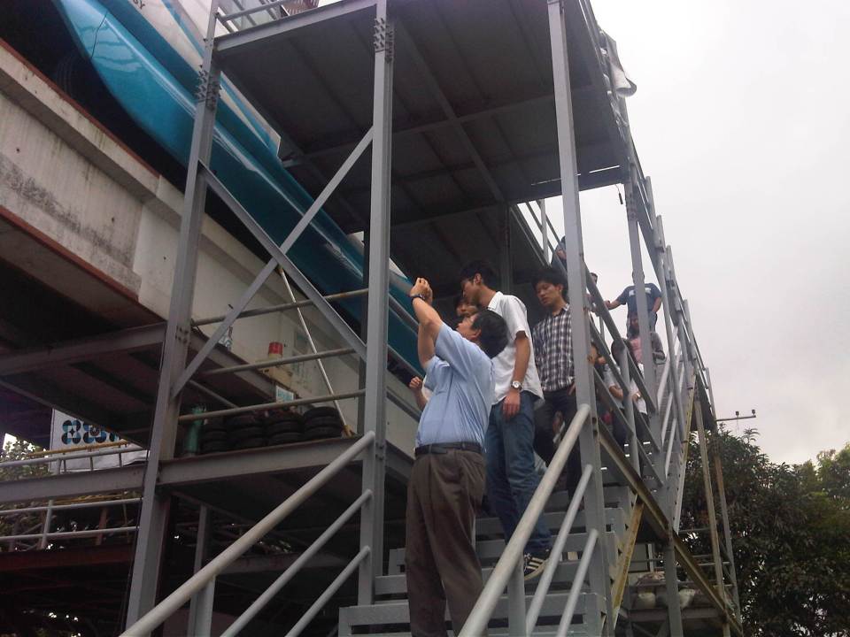 Our guests, Prof. Fumihiko Nakamura, Dean of the Institute of Urban Innovation of Yokohama National University, and his students rode on the prototype and took photos of the ongoing work at the Jacinto station platform.
 The Jacinto Station will have a ticketing station and turnstiles to simulate passenger operations. These were demonstrated last year during the test runs conducted in conjunction with the UP Diliman Lantern Parade.
The prototype is now being run at faster speeds (30+ kph?) and this was noticeable for me considering I have taken the test runs several times already including the initial ones when the vehicle was only topping 10 kph. Unfortunately, other tests/assessments have not performed yet including those for stability that will be critical to ensure the safety of the system for actual use. We look forward to the succeeding work including the determination of the AGTs suitability for application along several alignments/corridors identified by the DOST. There is also the current work on another test track at the MIRDC compound in Bicutan, Taguig where they hope to test a larger AGT vehicle. I hope to see that one soon…
–
Plaridel Bypass Road
I attended a regional consultation workshop of the National Economic and Development Authority (NEDA) last October 2013. The workshop was held in Bustos, Bulacan, which is located north of Metro Manila. There are two options to go there. One is via Quirino Highway starting from Quezon City, through North Caloocan City, and the through San Jose del Monte, Norzagaray and Angat in Bulacan where Quirino becomes the Gen. Alejo Santos Highway (which also connects to the Dona Remedios Trinidad Highway or Pan-Philippine Highway). Another route is via the North Luzon Expressway exiting right after the Guiguinto Exit and unto the Plaridel Bypass Road.
Following are a few photos of the bypass road that I was able to take. It was nice and sunny that day and my driver didn’t seem to be comfortable having someone beside him taking photos of the road. That uneasiness plus the reflection on the windshield prevented me from taking more photos. There will be a next time…
 The road is basically a two-lane, two-way undivided highway with concrete pavement for the carriageway and gravel shoulders. There’s adequate signs and road marking along the road.
 Areas on either side of the highway are agricultural land and at certain sections, the elevation of the highway requires barriers on either side of the RROW. Note the lack of lamps along the road that makes it quite dark at night time. At daytime, travelers get a nice view of the countryside or rural Philippines.
 Near intersections, the carriageway is wider to accommodate channelization including the median island shown in the photo.
 I recall at least 2 intersections with traffic signals including this one with the Gen. Alejo Santos Highway. Note the sign on the right indicating directions to Bustos, Angat and further on to Cabanatuan, Nueva Ecija.
The construction of this bypass road effectively cut down the travel time to Bustos and the nearby Bulacan towns of Angat, Baliuag and even San Ildefonso and Norzagaray. Such highways are good examples of infrastructure that provides good access to farms around the country while also providing alternate routes to bypass congested roads through fast developing towns.
–
To commute or not to commute
To commute or not to commute? That seems to be the question many people would like our political leaders and government officials to ponder the answer to. Of course, the word “commute” itself refers to traveling whether by public or private transport. However, in the Philippines we have equated “commuting” with taking public transportation. Anyhow, the reality is that most of our top officials, elected or appointed are car owners and are most likely to drive or be driven between their homes, offices and appointments. This is what is perceived by many people as “The Reason” why public officials have little or no appreciation of the difficulties experienced by the commuting public.
While sympathy is usually assumed or claimed by responsible persons, it is empathy that is most desirable from our public officials as they should feel how most people feel when they commute every working day. But how can you empathize if you have not experienced the difficulties of commuting in Metro Manila or other city? How can you say you understand the plight of pedestrians, cyclists and those taking public transport if you prefer or opt to drive or be driven in your car or SUV to and from your office? Did you really commute when you were in high school or college? Or maybe you were one of those cool guys or gals driving their own cars?
Almost every week, I have left my car at the office to commute or hitch a ride with my wife where our routes overlap. I have used public transportation since I was in high school so I am quite familiar with taking pedicabs, tricycles, jeepneys, buses and trains. I have also commuted whenever I am on trips to other cities including those abroad. Public transport is part of the experience whenever I am on trips and when I am in a new place, I make it a point to take long walks first to explore the surrounding area. It is a familiarization of sorts and makes me comfortable with the area. I remember that when I was a student in Japan, I would try to look for the nearest church to where I was staying, especially if I was there over the weekend.
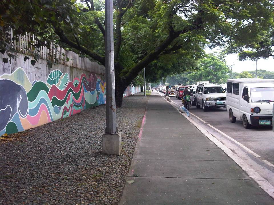 Walking is part of commuting and I am thankful that where I work, the surroundings are basically pedestrian-friendly. The photo above shows the sidewalk along Katipunan Avenue on the side of the university.
 Seamless transfers are not yet quite the norm in the Philippines. The photo shows one of the better examples where transfers between modes are more convenient. This is at the LRT 2 Santolan Station. Note the markings for the bicycle path. I took this as I was descending from the pedestrian overpass that connected with a nearby mall by the Marikina River.
While traveling within other cities, whether in the Philippines or abroad, the first option for many if not most people would be to take public transportation. Taking out a rental vehicle is not common and taxis are considered as part of the public transport system. As such, we try to get information on how to get to places of interest from relatives, friends, hosts or staff of the hotel we are staying at. These include maps like the old fashioned ones we can get at airports, train stations and tourist booths. Nowadays, there’s a wealth of information available online and apps that can help us navigate around cities.
We tend to comment on how good the public transportation is in the places we’ve visited or how easy it was to commute in these cities. And upon returning to our country we are quick to criticize our public transport, pedestrian and cycling facilities. The irony, of course, is that many of those who are quick to criticize don’t even use public transport, walk or cycle. Even more tragic (for lack of a better word, I think) is that we don’t demand for better public transport, pedestrian or cycling facilities. Perhaps that should change and in this New Year, we should resolve to push the government and its partners for better transit, pedestrian and cycling infrastructure for our cities. And part of that push is by getting involved in advocacies, including projects, for these causes on transport. We should not forget that though we need and seek champions for public transport, walking and cycling among our leaders, we should also be champions in our own ways.
–
Another look at Narita Airport Terminal 1 – check-in and dining
Last year was quite fun in terms of the travels I made. After about 5 years I was back in Japan for a couple of trips. I decided to stay a couple more days in the last one last October so that I could go around and revisit some of my former haunts in Yokohama and Kamakura. Back at Narita’s Terminal 1, I took the opportunity to take more photos at the departure area.
 Entrance to the North Wing of Narita Airport’s Terminal 1.
 Information counter and automated check-in machines with a mosaic column as backdrop.
 Automated and manual check-in counters at Narita Terminal 1.
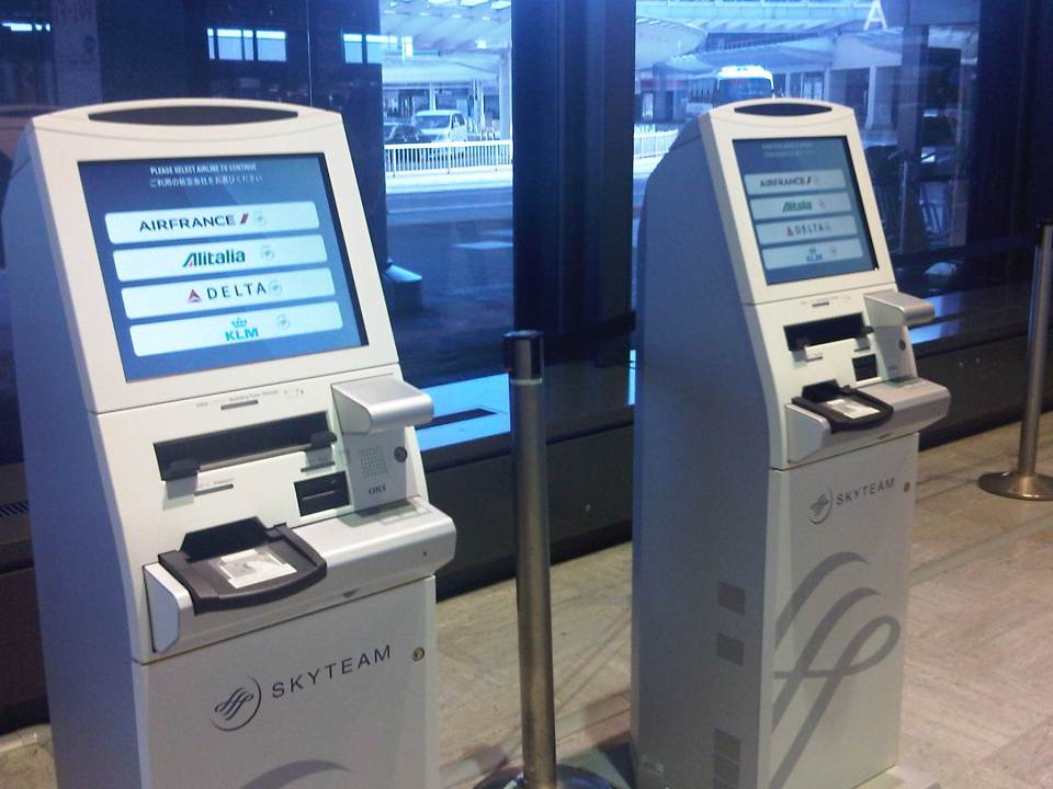 Automated check-in machines for Skyteam member airlines (e.g., Air France, Alitalia, Delta and KLM).
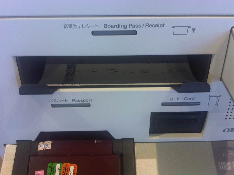 Automated check-in machines at the terminal scan your passport and retrieve electronic ticket information. You can select seats using the terminal and it will issue your boarding pass. You can also upgrade your seat using the machine but you would have to pay for the upgrade using your credit card.
 Weighing scales are available for passengers to be able to check if their luggage are within weight limits.
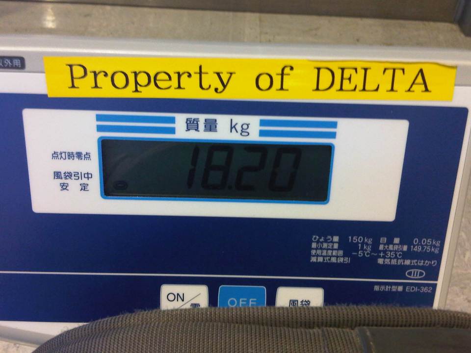 My luggage was well within my 23 kg (50 lb) limit. I like to assume that’s because I’m good at packing my things and estimating how much my bags weigh.
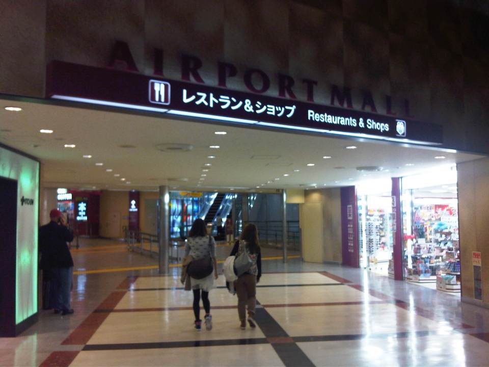 Entrance to restaurants and shops inside Narita Terminal 1. Tip to travelers: the convenience store on the right sells all those special KitKat chocolates that you can only buy in Japan (e.g., Green Tea, Strawberry, etc.) at slightly lower prices than other stores.
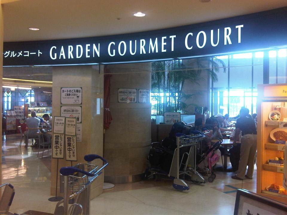 The Garden Gourmet Court provides many choices for the hungry traveler.
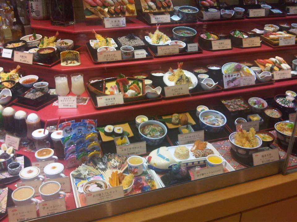 There are also more exclusive restaurants at the airport where travelers, especially tourists, can experience and enjoy Japanese food.
 The last time I was at the food court, I went for the ramen so I decided to try out another stall.
 I opted for this one that seemed popular enough judging with the number of people who bought lunch there. When I’m traveling, I’ve learned to first observe which restaurants, stalls or shops seem to have more customers especially locals. That is usually an indicator of the quality of the food though some times its because of the prices (i.e., less expensive compared to others).
 The chicken karaage lunch set was okay but not as good as the ones I’ve had at the university shokudo or obento shop. I guess the saying “you get what you pay for” applied here. Next time, I’ll stick to the ramen shop.
 Narita has an observation deck where travelers, their companions or the general public can sit around and maybe watch the aircraft taxiing, taking off or landing at the airport.
 Delta airlines plane docked at Narita Terminal 1 – those are solar panels installed at the terminal rooftop.
 It’s pretty windy at the observation deck and this time of year when it’s wintertime in Japan, it would definitely be cold here.
–
Identifying opportunities with the MRT 7 and the LRT 1 extension
As we welcome 2014, we also look forward to major projects that will help alleviate transport and traffic problems in our cities and elsewhere in the Philippines. With the approval of the MRT 7 and LRT 1 south extension projects late last year, there should be less impedance to these much-delayed projects starting construction within the current term. These lines should have been built way back, – “ideally” in the 1980s, “practically” in the 1990s, and “urgently” in the last decade. At this time, I think the need for these lines are beyond urgent. I think perhaps we have reached the state of “desperation” is so far as mass transportation is concerned for Metro Manila and its surrounding cities and municipalities.
 MRT 7 map from a public presentation made by the line’s proponents about 5 years ago.
Opportunities that can be related to the MRT 7 and LRT 1 lines include land development that fall under the category of transit oriented development (TOD). I think the government should not be too dependent on the private sector for developments around and near the future stations of the rail lines. The prevailing assumption that the private sector will do what’s best is only applicable to themselves and not the public good. Note the difference between perspectives here where it is only to be expected that private companies will be concerned with their own bottom-lines, i.e., revenues generated towards the maximization of profits. Economic benefits are and should be treated or regarded differently from such a perspective. The latter is the responsibility of the government as it concerns the public good and interest, and with a more macroscopic and strategic scale, with a long-term vision for development.
One such opportunity concerns informal settlers and their resettlements to areas outside the CBDs. Why do these people keep on returning to the cities when they are already supposed to have been provided housing elsewhere (e.g., Bulacan, Laguna, Cavite, Rizal)? The answer seems almost automatic: they don’t have the means for livelihood where they have been relocated and access to basic services and jobs/workplaces is limited (i.e., very difficult). The government must be involved and very deliberate in developing lands for housing around or near rail stations such as those for the future MRT 7 development. It cannot rely on the private sector to push for public housing when, frankly, those companies are driven by their desires to maximize their profits rather than push for the public good. That’s a bit of reality that we must accept and we must factor in decision making. The government already lost a huge opportunity when the National Housing Authority (NHA) effectively gave away prime lands in Quezon City for an upscale development. I leave it up to the reader to check the mandate of the NHA. It could have pushed instead for a development much like the HDBs in Singapore, which are not located in the boondocks but in prime locations in the city state. It need not be purely residential but a healthy mix of commercial development should be pursued along the lines of equitable transit oriented development (TOD).
Note that it should be clear here that when I say public housing this does not necessary mean the mass housing or low cost housing we tend to associate with failed projects in the peripheral provinces to Metro Manila. These are more like multi-level, medium to high rise developments you now find in major cities in Japan, China, Thailand and Singapore, which can be the model development for replication in other cities around the country. These can be reasonably priced units that can be affordable in terms of payments over a reasonable period of time. The concept is not new as there have already been BLISS projects before and Quezon City continues to collaborate with private sector for projects like Smile, Sunny Villas and the current Bistekville. These should be extended not just to your middle class and upper class (yes, they do make investments and have their units rented out to derive income) but formulated for the lower income classes (e.g., informal settlers), which now occupy much lands with their shanties. “Formalizing” these settlements should be a priority and the best locations for such developments, I think, should be around stations. Of course, there should be clear rules regarding the neighborhood and these rules should be strictly enforced for the buildings and area to keep their integrity (e.g., no extensions to the balconies or windows).
The concept and application of land-banking is not new and has been used by the private sector especially major developers like Ayala Land, Filinvest, Sta. Lucia, SM and Robinsons. Properties are acquired based on criteria regarding their potential for development. These lands are usually of low value and in many cases the land use need to be changed in order for these to be developed (e.g., agricultural lands being converted into residential, commercial or industrial uses). The national government and local government units should also do land-banking perhaps to address issues, for example, on informal settlers. And land banking should be along transit lines that are being planned (e.g., in Bulacan for MRT 7, in Cavite for the LRT 1 Extension, in Rizal for the LRT 2 Extension, and in Laguna for the PNR Commuter Line) so that issues pertaining to access to jobs, education and other services can be addressed by such transport infrastructure.
We look forward to the government realizing such opportunities that have for so long been available yet it has not taken into serious consideration. These require both strategic and practical thinking to be able to undertake master planning for such developments and their implementation over the immediate to long terms. No easy task but if our leaders are focused and determined to see these through, there’s no reason why these cannot be implemented and operational soon. Hopeful we are for these things this 2014.
Happy New Year!
–
