
Bottlenecks and other traffic issues in Antipolo
Commuting between our home in Antipolo and my work place in Quezon City, I have noted a lot of issues on transport and traffic that needs to be attended to by the local government in coordination with other entities like the DPWH and Meralco. Here are some photos with my notes and comments.
 Much of Sumulong Highway have been widened to 4 lanes but many electric posts remain in the middle of the additional lanes and pose hazards to motorists and cyclists. These posts seem to have been here for quite some time now and the paint on them gives the message that they will be here for the foreseeable future. Paint or no paint, they are road hazards and have the potential to kill people on vehicles crashing into the poles. I think this is supposed to be the responsibility of the power company (Meralco) but there needs to be a firm request and coordination coming from Antipolo City Government to finally relocate these poles.
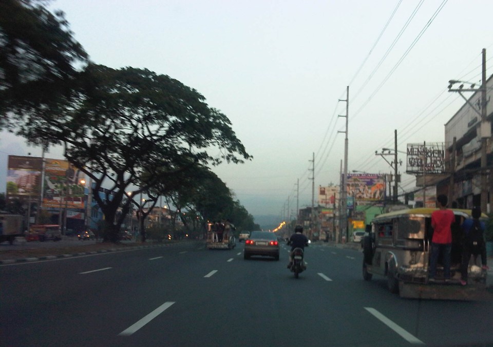
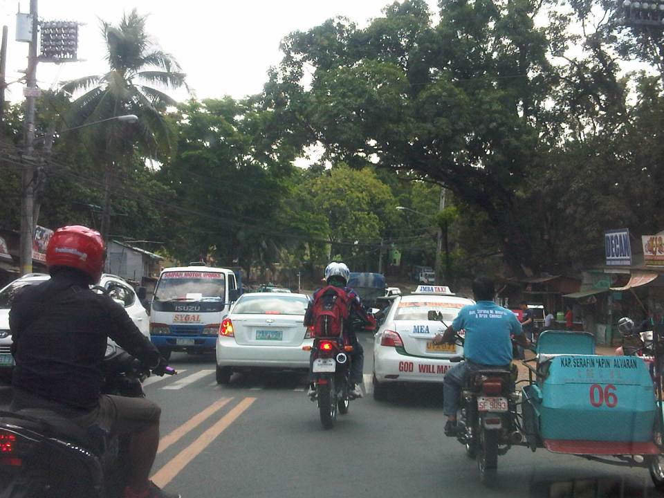 Congestion is often caused by counter-flowing vehicles forcing their way back into the right lane (like the car in the middle of the photo) upon encountering opposing traffic. It doesn’t help that there are motorcycles splitting the lanes to make for a very crowded road.
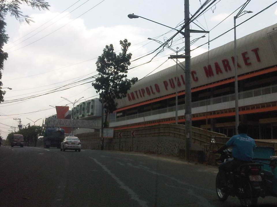 The new but still closed Antipolo Public Market along Sumulong Highway and near the intersection with Daang Bakal (the old railroad line that’s now a road). I wonder about the trip generation potential of this complex as it is not yet operational. Meanwhile, a huge Robinsons mall (looks larger than their Magnolia property) is currently under construction just across from it and will definitely be a major traffic generator in that area. The combined traffic to be attributed to these commercial complexes will surely have a tremendous impact on Sumulong Highway and other roads in the vicinity.
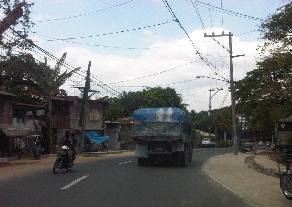 Both Sumulong Highway and Ortigas Avenue Extension carry significant truck traffic. These often cause congestion as they are slow going up to Antipolo and can block the entire road as Sumulong Highway and Ortigas Extension have some narrow sections where the shoulders could not provide enough space for other vehicles to pass the slower moving ones. In certain cases like the one in the photo above, there are electric posts in the middle of the shoulder lane.
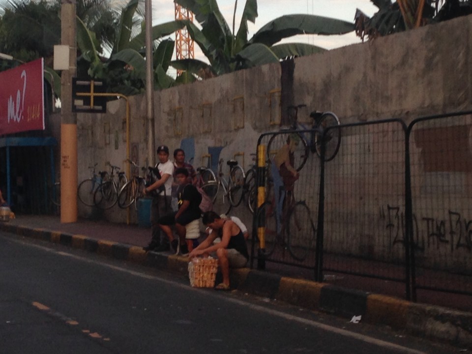
 Tricycles occupy the outer lane of Ortigas Ave. Ext./Olivares Street. Such informal and on-street terminals are illegal along national roads and yet the city tolerates them. One explanation for this is that there are informal communities along the highway on shanties built along what is supposed to be a ledge along the mountainside (shown at right in the photo). These are where tricycle drivers and their families reside.
 Tricycles from different tricycle operators and drivers associations (TODAs) seem to roam the entire city. This is contrary to the common practice in other cities and municipalities where tricycles are limited within a certain area or district that in many cases just overlap with others (e.g., UP Teachers Village-Philcoa-Krus na Ligas).
 Many tricycles serve as school service. However, the observation is that most tricycles tend to be overloaded with passengers. These are usually small children so the driver probably figured that they could cram more passengers than what is legally allowed.
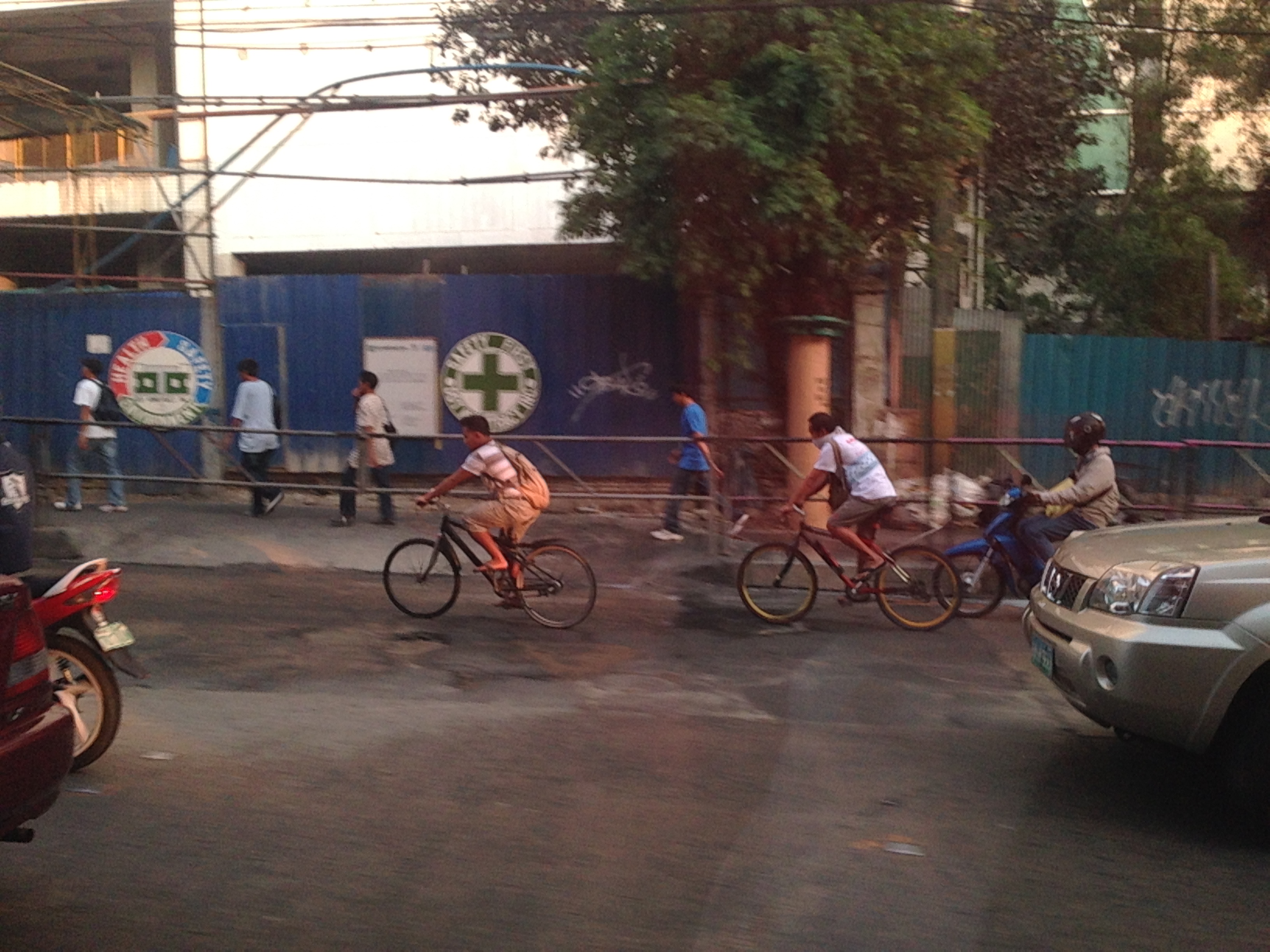
 Sharing the road? Antipolo is very popular with cyclists and weekends bring a lot of them to the city as they come from all over via the main routes along Sumulong Highway and Ortigas Avenue (there should also be those coming from the east via the Antipolo-Teresa Road and Antipolo-Tanay Road). Most motorists are aware of these cyclists and give way to them. Most experienced cyclists are also aware of the ROW of other vehicles and so keep to the inner lanes. This mutual awareness and respect are vital to make roads safe for all. I think the only thing needed is to provide space for pedestrians as there are significant numbers of people walking, hiking or jogging along these roads.
–
Roads as solar dryers – Part 2
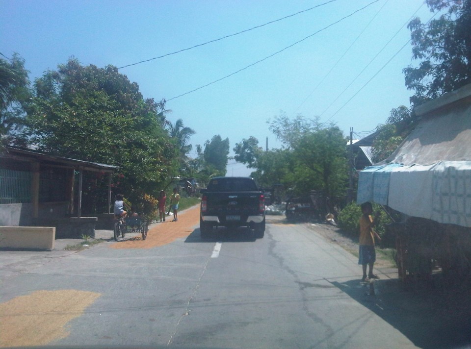
This is a continuation of an earlier post on roads being used as solar dryers. Our trip across Tarlac brought us to more of these facilities being used for agricultural purposes. The following photos are from San Jose and Mayantoc towns, which are obviously predominantly agricultural. The photos show lands devoted to agricultural as far as the eye could see and most are planted with rice.
A friend commented that something should be done to reduce if not eliminate such practices along roads. I replied that this is basically the responsibility of local government units including barangay officials who should be educated about the dangers posed to travellers as well as the deterioration in the quality of the rice as it gets compromised from the waste and grinding they get from vehicles. In terms of practicality and recognising the limitation in funds for solar dryers, roads seem to be the easier and versatile option. Basketball courts and other concreted spaces scattered around the countryside do not make sense where roads would have more use especially to address accessibility issues (e.g., farm to market roads).
Another friend commented on the earlier post that he almost had a collision with another motorcycle rider as the entire road was covered with rice being dried by farmers. I reasoned out that for rural roads with very low traffic, a single lane covered with rice could be tolerable but using the entire road width just is not right. Motorcycle can easily slip or skid along such rice-covered roads resulting in serious injuries if not fatalities. For most cases of what I’ve seen recently, the roads quality as having low traffic and rice is being dried only along one lane so we know at least that people are aware that one lane should at least be free of obstructions.
 1
1
 2
2
 3
3
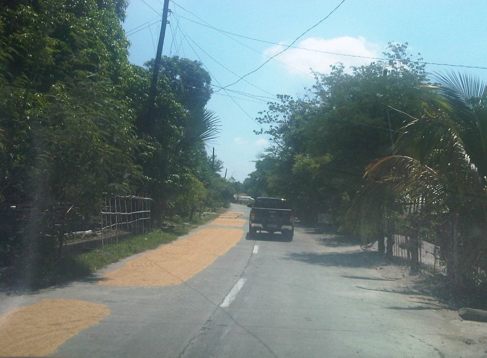
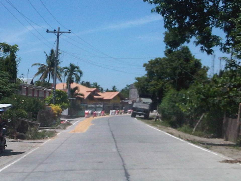
 4 – That’s corn being dried just beside the pick-up truck in the photo.
 5
5
 6
6
 7
7
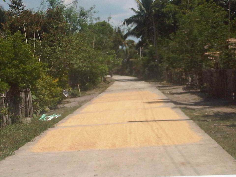
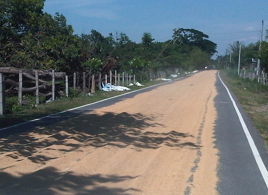
 8 – Bad practice of spreading the grains across the entire road carriageway
 9
9
The last photo is of corn kernels being dried on a basketball court. You can see the cobs piled near the stage, which shelters what looks like sacks of corn. As I mentioned earlier, it is possible to have such basketball courts or social facilities to be used as solar dryers. Even schools grounds can be used for this purpose but only for weekends or during the summer breaks. However, it would be impractical to have basketball courts and plazas scattered all over the countryside just for this purpose especially in places where there aren’t much people in the first place. Roads still offer the more flexible use (i.e., access/FMR and solar dryer) as long as traffic is not significant. Perhaps where traffic is significant (i.e., significantly populated areas) then such “off-road” facilities should be constructed. But again, the responsibility for making sure roads are clear of agricultural products would fall unto the LGUs.
–
Roads as solar dryers – Part 1
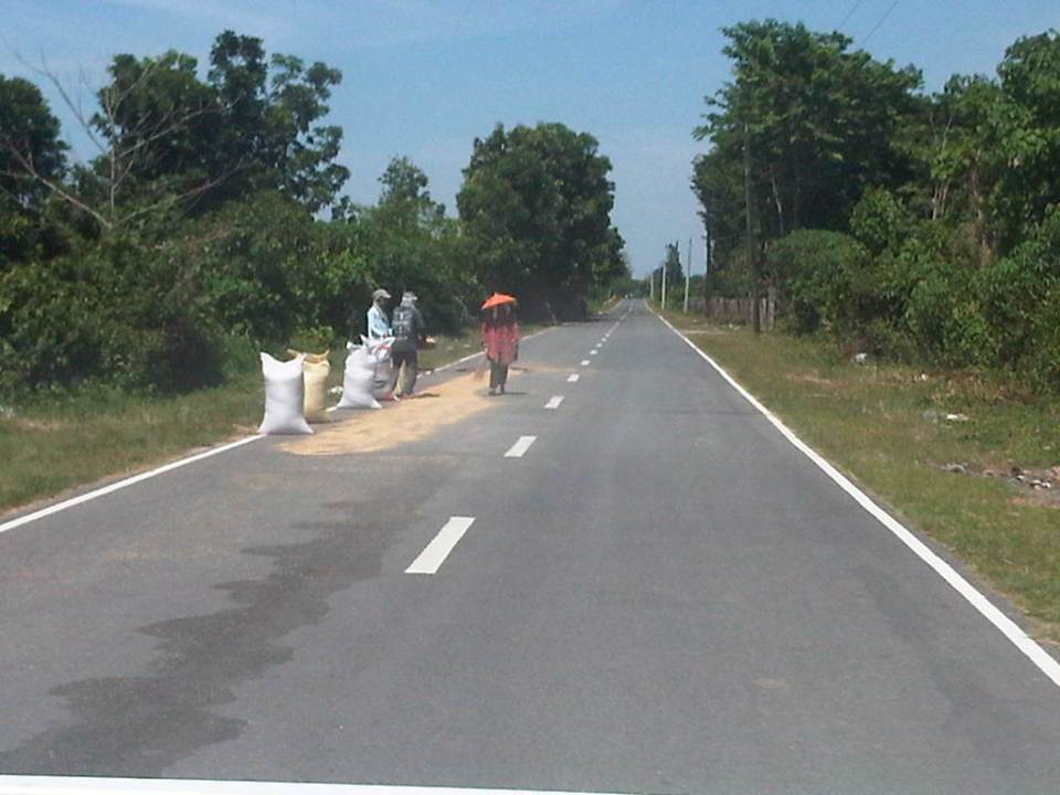
We are currently undertaking a project for the Province of Tarlac that looks into the safety along its rural roads (both national and provincial roads) including those providing access to tourism areas in the province. Along many rural roads are agricultural lands producing rice, corn, fruits, vegetables and other products. Often, travellers will encounter roads that serve another purpose other than transport – as solar dryers. Before rice is milled, it needs to be dried first so that it would be easier to remove the husk (i.e., separate the bigas from the ipa – together they are called palay). While it is possible to do this drying on mats (banig) spread over the land/soil this takes time. Meanwhile, portland cement concrete roads offer what seems to be the perfect surface for drying. As such, certain roads have been known to get justification for concreting despite low traffic volumes as they double as solar dryers. There are similar cases for basketball courts or village plazas receiving funding for concreting for the same reasons. Obviously, laying out rice on the roads have implications on the quality of the rice later on as vehicles will inevitably (even inadvertently) pass through the roads. I guess its even worse in cases when the road surface is of asphalt concrete. Following are photos I took along rural roads in Bamban, Capas and San Jose towns of Tarlac.
 1
1
 2
2
 3
3
 4
4
 5
5
 6
6
 7
7
 8
8
 9
9
 10
10
Other items that are usually dried on the roads include tingting (the stems of coconut leaves that are used to make brooms – walis tingting) barbecue and fish ball sticks. I have also seen fish being dried on the road one time during a trip to Northern Luzon. Obviously, among the risks are the rice being grinded by the tires of vehicles (resulting in durog na bigas more suitable for porridge), fuel or oil compromising the rice, and the prospects of animals doing their thing on the road near or on the rice!
More on these solar dryers in the next post!
–
Hang time
Traveling to the office one morning, I spotted a jeepney overloaded with passengers. Many were already hanging on to the jeepney at the rear and I could count eight people including 6 who were practically dangling from the jeepney. Such behaviour is common among males who do this just so they could get a ride to their workplaces. But this is also common among students who, with their bags (usually backpacks) face even greater risks when they hang on at the rear of jeepneys. This is actually illegal but poor traffic enforcement combined with the inadequacies of public transport force a lot of people to make sabit (hang-on) to the jeepney. Granted that some of these people have no intention of paying their fares but there is a real danger of lost lives if not serious injuries if one falls off the vehicles.
 Eight passengers hanging on to a jeepney as it is stopped at an intersection. Note the ones with backpacks that add to the degree of difficulty for this practice just to get a ride to work or school.
 The same jeepney with all 8 passengers dangling as the vehicle speeds up along Marcos Highway in Antipolo. These sabit passengers are actually lucky that their driver is not so reckless (e.g., changing lanes so often, making abrupt movements).
This practice is among a host of seemingly small but important items that can easily be addressed with strict enforcement of traffic rules and regulations. Prompt and timely apprehension and penalties will go a long way into influencing behaviour change among both drivers and passengers. I think the basic idea going on in the minds of both parties is that despite the practice, there’s seldom an incident when a passenger falls off from the jeepney. Such should not be the case and an acceptable reason if we are to prevent untoward incidents from happening, and it starts with sending a strong message through proper enforcement. Are the authorities up to the challenge though? Or is the ningas cogon attitude going to prevail all the time for such situations?
–
Anxious about the LRT Line 2 Extension
Among the overdue projects that have generated much attention and, quite recently, some excitement is the extension of the LRT Line 2 from the current end station at Santolan, Pasig to Masinag Junction in Antipolo. This is a 4 kilometer stretch that has been viable for quite a long time now but somehow has not been constructed for various reasons. It was among the low hanging fruits that the current administration should have picked that could have been completed and operating now if it were started sometime 2011 (i.e., factoring in the transition in government after the 2010 Presidential elections). For some reason, government officials had to get proof that there was passenger demand for the extension by considering having another study undertaken just for this purpose. As I’ve mentioned before, one only needs to observe the situation at Santolan Station and perhaps the Sta. Lucia/Robinsons Metro East area to understand just how many people will benefit from the extension to Masinag. I would even dare say that you can even justify extending the line further to Cogeo. Following are a few photos I recently took along Marcos Highway along with some comments pertaining to the Line 2 extension construction.
 Soil testing site along Marcos Highway in Pasig City – these activities preclude the designs for the superstructure, which include the elevated tracks and the stations (there will be 2) along the Line 2 extension.
 Another soil test site – each location roughly correspond to the location of the columns that will be constructed to support the elevated tracks and stations.
 Scenes of overloaded jeepneys should no longer be the norm once the Line 2 extension is completed. However, such would probably be common for jeepneys coming to or from the last station at Masinag. There are no other choices for people taking public transport beyond Masinag except jeepneys bound for destinations like Antipolo Simbahan, Cogeo, Tanay and Marikina.
 Pedestrian overpasses such as this relatively new one near the Filinvest East main gate would have to give way to the elevated Line 2. Another option is for this and other overpasses to be reconfigured with respect to the future line. I just hope this will be done with utmost care so we won’t have overpasses similar to those along EDSA that go above or below the elevated tracks of the MRT 3.
 This overpass will like be removed to give way to the future end station of the Line 2 extension. The overpass in front of SM Masinag will have to be integrated with the station to be located in this area.
–
“Pwede na yan” bikeways?
The recent clamor for bicycle facilities have led to several initiatives in Metro Manila and other Philippines cities (most notable recently is Iloilo) to support the demand for cycling facilities. While Marikina City already has a network of off-street bikeways segregated from motorised traffic, there are few other examples of such facilities elsewhere. The more recent initiatives in Metro Manila involved the Metropolitan Manila Development Authority (MMDA) establishing bikeways in several areas along major roads in the metropolis. I say establish because the MMDA did not construct new bikeways like the ones in Marikina or Iloilo. What the agency did was to designate sidewalks and other existing paths for cycling by painting these over. Unfortunately, these so-called bikeways did not take into consideration the needs of pedestrians with whom cyclists must share this limited space. And so few people use them despite a high profile launch that brought together government officials and NGOs including cycling and mobility advocates and enthusiasts. I guess the big test was really not whether advocates and enthusiasts would really use the bikeways (Don’t count on the officials to use them. They have chauffeur-driven vehicles.). Would the regular commuter use them instead of the roads, despite the risk or dangers posed by motor vehicles?
 Commuters waiting for a bus ride along EDSA with suspended bicycle racks behind them. The sidewalks along EDSA have been painted red, designating them for bicycle use. The big question now is how cyclists will interact with pedestrians given the very limited space they should be sharing.
 Bicycles hanging on racks attached to the perimeter wall of an exclusive subdivision along EDSA.
 Cyclist using the curb side lane of EDSA – these people run the risk of being sideswiped by buses operating along the yellow (bus) lanes of this busy thoroughfare. It is quite obvious in the photo that there is no space on the sidewalks to accommodate cyclists and even pedestrians. Column for the MRT-3 stations are right on the sidewalks and makes one wonder how this flawed design was approved in the first place. MMDA enforcers usually appear as if they are only bystanders and seem to be generally helpless when it comes to managing traffic.
 Workers cycling back to their homes after a day’s work. Many people have opted to take bicycles for their daily commutes even if they have to travel long distances in order to save money that would otherwise be paid as fares for buses, jeepneys, UV Express or tricycles. Note that the cyclists use the outermost lane of the road as the sidewalks pose many obstacles including pedestrians as shown in the photo. Some cyclists though want more than a share of the sidewalk or a lane of the road for their use regarding pedestrians and motor vehicles as nuisance for them. Surely, some pedestrians also regard cyclists as nuisance to walking and would prefer to have the sidewalks for themselves.
Cycling is in a way an emancipation from motorized transport commutes, and savings translate to money they could allocate for other needs of their families. While there are raw data for family expenditures from census surveys, there are few studies and publications focused on transport. It would be interesting to see how much a typical Filipino family spends for transport in absolute terms as well as a percentage of their total incomes. Such information would be essential for understanding the needs of travelers, especially for daily commutes for work and school (other trips include those for purposes of shopping, recreational, social and others). Long commutes are associated with higher expenses (e.g., in terms of fares or fuel costs) and reducing such costs through shorter commutes should free up money for necessities like food, housing and clothing. Ultimately, this would help solve issues relating to poverty and health, which can easily be related to commuting behavior and characteristics.
It is in that context that transport systems should be planned and implemented carefully along with the housing developments. This underlines the essence of the relationship between transport and land use that has been the topic of discussions for quite some time now that apparently, a lot of people in this country, especially officials and the private sector have chosen to ignore or apply selectively (i.e., according to their own advantage and not really for the general welfare of the public). A transport system is not cycling alone, or roads or railways alone. It is, by definition, a network, a set of interacting, integrated elements and each of these components of the system are essential for it to function well. It is the interaction and integration that are the key elements that we often forget as we advocate one transport mode over others as if they are independent from each other. They are not and we should complement rather than compete in our advocacies for transport so we can finally achieve an efficient, effective system for everyone.
–
Daang Bakal and Antipolo’s attractions
I recently wrote about the old railway line that used to run between Manila and Antipolo via a route passing through the town of Cainta that used what was probably the gentlest slope at the time – through what is now Valley Golf, Victoria Valley and Fairmont Subdivisions. Here are some more photos along Daang Bakal, the old Manila Rail Road line that is now a road.
 Daang Bakal is a scenic route and one can only imagine how this place looked like when it was still a railway line and the areas along it were still undeveloped.
 Hinulugang Taktak has been designated as a National Park and the areas along Daang Bakal at least have been preserved. Users of this road are quite limited to residents of exclusive subdivisions with gates along the road and trips generated by the Immaculate Heart Parish near the Fairmont gate. Public transportation is provided by tricycles that have a terminal at the intersection of Daang Bakal and Taktak Road.
 The temporary fence that was made out of tarpaulin material is now in tatters. There is road construction work ongoing though but mainly for the access roads connecting to Pinagmisahan. The concreted area at the right side of the road in the photo seems to be for parking rather than road widening. Traffic is low along Daang Bakal and will probably not require road widening for the foreseeable future.
 The main entrance and facilities for Hinulugang Taktak are still closed and there seems to be no activity to indicate that the rehabilitation project is not moving at all.
–
Traffic mayhem in Antipolo
I had written earlier about traffic management in Antipolo City. My daily commute allows me to observe transport and traffic in this pilgrimage city east of Metro Manila. For a highly urbanised city (HUC), its traffic management is quite rural or provincial at best with enforcers trying to do their thing based more on gut feel rather than sound knowledge of traffic principles. Intersection traffic management, for example, needs a lot of improvement as enforcers are pre-disposed to apply the buhos approach to dissipating queues that actually lead to longer queues, tremendous delays to travellers, and therefore low levels of service (LOS) at the intersections. The signalised Masinag Junction is probably one of the worst intersections outside of Metro Manila with queues along the south approach (Sumulong Highway from Antipolo) stretching to Mambugan (about 2 km) even on a Saturday. Along the east approach (Marcos Highway from Cogeo) the queues can stretch all the way to Cherry Foodarama supermarket (about 1 km).
Masinag, of course, is a big intersection with heavy traffic due its being the junction for 2 major highways (Marcos and Sumulong) that collect much of traffic from Rizal and Marikina bound for the general direction of Quezon City and Manila. Marcos Highway is the main alternative corridor to Ortigas Avenue, which is itself a very congested road, between the eastern towns and Metro Manila. There are many other problematic intersections in the city, which are mostly unsignalized where traffic is managed manually by enforcers. I’m sure there are some minor intersections that are manageable at most times of the day and may not actually require enforcers if motorists give way to each other. However, there are those intersections that require stricter and more systematic (if not scientific) methods to manage traffic. For example, along roads leading to the Antipolo cathedral where there are a lot of people posing as parking attendants going over to aggressively engage motorists at the intersection. Enforcers routinely turn a blind eye to these people who pose as safety risks along the roads.
 Tricycles occupying the outermost lane along Ortigas Ave. Ext. and Oliveros Street at the junction with Sumulong Memorial Circle and just across from the Rizal Provincial Capitol – to exacerbate the situation, jeepneys and UV Express vehicles usually stop in the middle of the road to load/unload passengers. Such informal terminals should not be allowed in these areas considering it is a chokepoint for traffic along these busy roads. So far, enforcers around the capitol seem oblivious to the mayhem caused by these terminals and turn a blind eye to the disruptive manoeuvres of tricycles in the area.
 Dangerous intersection along Sumulong Highway – there is road at the right (where a tricycle is coming from) that is used by trucks and other vehicles coming from Marcos Highway. Olalia Road connects to Marcos Highway and there are many residential subdivisions along this road that generate the traffic to and from Marcos and Sumulong Highways.
More on Antipolo traffic soon!
–
On road safety and courtesy
I spotted what apparently was a father and daughter riding tandem on a foldable bicycle along Katipunan and heading to the University of the Philippines campus in Diliman. Both were dressed quite appropriately for the weather and for cycling. It was good to see that they both at least have their helmets on; though ideally it would have been better if they wore elbow and knee pads and “reflective” clothing for them to be easily seen on the road.
 Waiting for a chance to cross – the cyclist was waiting for a chance to cross Katipunan towards the University of the Philippines’ Magsaysay gate. True to form, motorists along Katipunan’s southbound directions do not slow down to allow for others to make a left turn to UP. Motorists bound for the university have to inch their way and create gaps for themselves to cross. Often, one has to rely on the Katipunan jeepneys whose drivers are braver than others in forcing their way to be able to cross the road. The father and daughter tandem were able to cross safely, taking advantage of a screen of motor vehicles (including ours) that made a left turn to enter UP.
I have observed that jeepney and truck drivers are more likely to stop and give way than private car drivers and motorcyclists. Motorists generally don’t give way to others even in heavy traffic, often blocking intersections just because the green light is still on for them. Many do not give way to pedestrians and do not know how to share road space with cyclists. Worse are motorcyclists who use sidewalks and bully pedestrians to give way to them! Meanwhile, you have pedestrians who throw all caution to the wind to cross anywhere and anytime along roads like Commonwealth, commuters occupying the carriageway as they wait for their rides, and cyclists hogging the middle of the road when there are actually lanes designated for them. These are manifestations of how poorly people are trained for road use and often an indictment of a failed licensing system as well as traffic education in general.
 Pedalling along – after successfully crossing Katipunan, the father and daughter tandem finally enters the more friendly roads of the UP campus. UP Diliman already has bicycle lanes along its academic oval and the community is generally aware of the rights of pedestrians and cyclists as road users. I would like to think that people who have a connection with the University and those who are also advocates of walking, cycling and road safety respect each other’s rights. But as always there will be those irresponsible people (e.g., pasaway, barumbado, etc.) who will disregard traffic rules and put lives in danger with their behaviour on the road.
In many cases these days, we just need a little common sense and perhaps more of courtesy to make travel safer and better for everyone. Everybody needs to learn and practice respect for each other’s rights on the road and courtesy extends to everyone so we can have order in our streets. It doesn’t take a genius (or experts, international or local) to point out things that are basically common sense and require common courtesy if not decency.
–
Scenes by the roadside at the port area in Manila
Traveling along Radial Road 10, you get to see how life in Manila really is. It is not the glitzy new developments that people try to present as the face of the city. The real deal is in places like Tondo, the Baseco compound and Smokey Mountain. The areas along R-10 starting from across from the North Harbor to Smokey Mountain (yes, it is still there) provide us with a peek into everyday life in this part of Manila.
 Carpenters working on the body of what would become karaoke machines. The TV or screen will be installed at the upper shelf and the machine and controls will be installed in the lower part. These are popular around the country and are often rented out for parties. The quality varies but I would say that there are really good quality karaoke machines with digital quality equipment providing crisp music and the correct lyrics to karaoke lovers.
 As these are informal communities, houses do not have water or electricity connections. As such, people purchase water from nearby establishments or houses, and many have illegal water and power connections for them to have water and electricity. Such illegal connections have led high losses to utility companies that translate to costs passed on to legitimate customers.
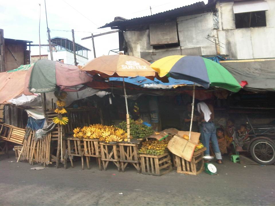 Many roadside stalls sell a variety of fruits like the bananas shown in the photo. It’s actually interesting to note that just across from the stalls is the port area whose walls don’t seem to be enough to discourage people from trying to pilfer the containers and crates containing various stuff shipped through the Port of Manila.
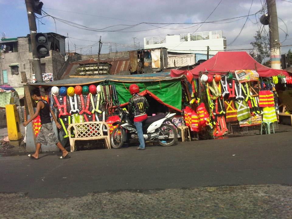 Roadside stalls selling practically anything and everything. This one is selling hard hats and reflective vests. These vests can be used by construction workers as well as traffic enforcers. Recently, motorcycle riders have been required to put on vests for them to be more visible to other road users.
 Shanties line up along the road, actually on the road as these were built on top of the space already allocated for R-10. Many sections have already been paved where shanties have been built. These shanties are now the subject of a program to remove them and open up the space for traffic to ease congestion along this road, which has much truck traffic.
 It seems that a lot of people have pedicabs as a means for livelihood. While there is nothing fundamentally wrong with this, the issue is mainly with regards to their excessive numbers and suitability as a public transport mode given their operations and propensity to go against traffic rules and regulations.
 The mass housing in the Smokey Mountain area are multi-storey apartments that look like they definitely have seen much better days. These buildings actually look like multi-storey shanties (similar buildings elsewhere including BLISS projects look much better or are better maintained). Many units have been extended and the structures now pose hazards (e.g., fire, earthquake, etc.). Alleys are not passable to emergency vehicles like fire trucks as residents have maximized occupancy of the spaces at the ground level. These look like the perfect cases for how NOT to develop mass housing.
–
