
Home » 2015 (Page 9)
Yearly Archives: 2015
NAIA Terminal 1 departures – some updates, Part 2
This is a continuation of the previous article providing updates on NAIA Terminal 1. The terminal is currently being renovated and what used to be the most maligned terminal in the country has improved both in terms of facilities (including the toilets!) and processes (immigration was efficient when I passed through). Here are more photos of the terminal from my recent trip.
 The same Duty Free shops were there. The lighting was basically the same but area seems cleaner than before.
 There are few Duty Free shops are T1 compared to other international terminals, which are like shopping malls in terms of selections (e.g., Changi, Hong Kong, etc.).
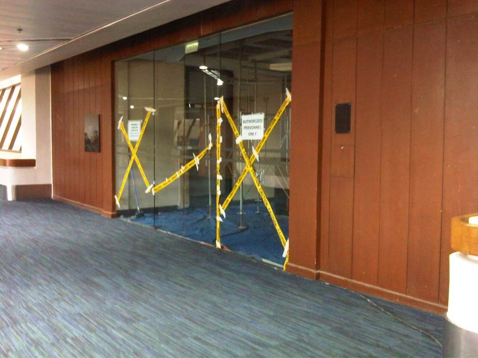
 Many areas have been cordoned off for the renovation works at the terminal.
 A welcome sight for many, especially those wanting to have a decent cup of coffee or tea would be the Starbucks at T1.
 One of the new concessionaires at Terminal 1 is a welcome sight to passengers who before had to make do with food and drink stands that weren’t as attractive.
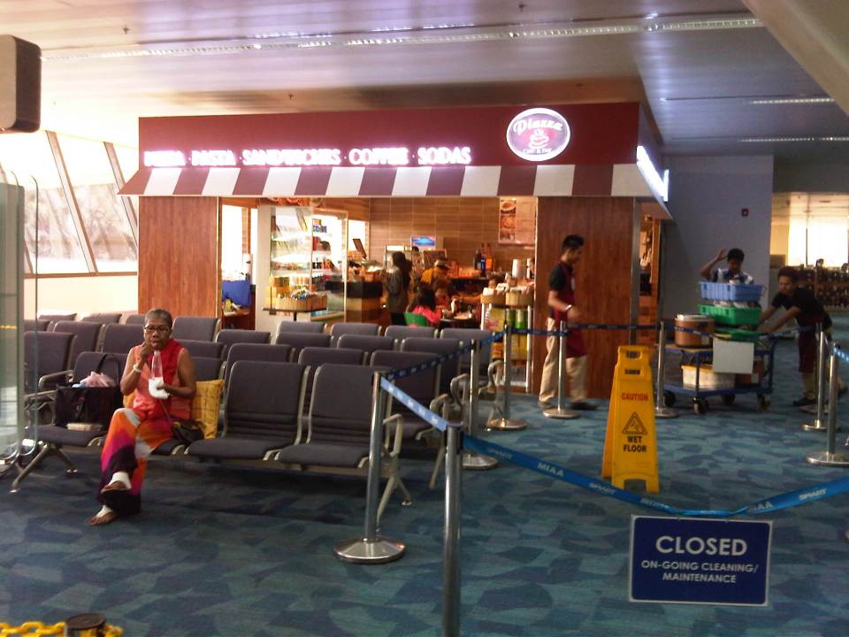 Another new concessionaire is this coffee shop at T1 offering what looked like fairly prices (for an airport) drinks, sandwiches and meals.
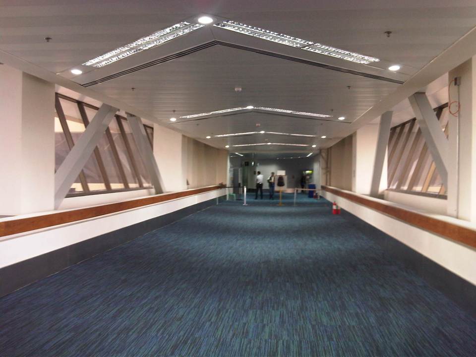
 The corridor to our boarding gate has been repaired and cleaned. The carpets no longer looked filthy and were not smelly.
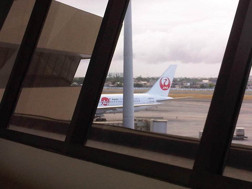 Japan Airlines aircraft docked at T1 sporting its original (retro) logo
 Vacant slot and available airbridge at T1
 Another look at the renovated and cleaned corridors to the boarding gates
 A China Southern Airlines plane at NAIA Terminal 1
 Passenger lounge under renovation
 Shared lounges for First Class and Business Class passengers of several airlines
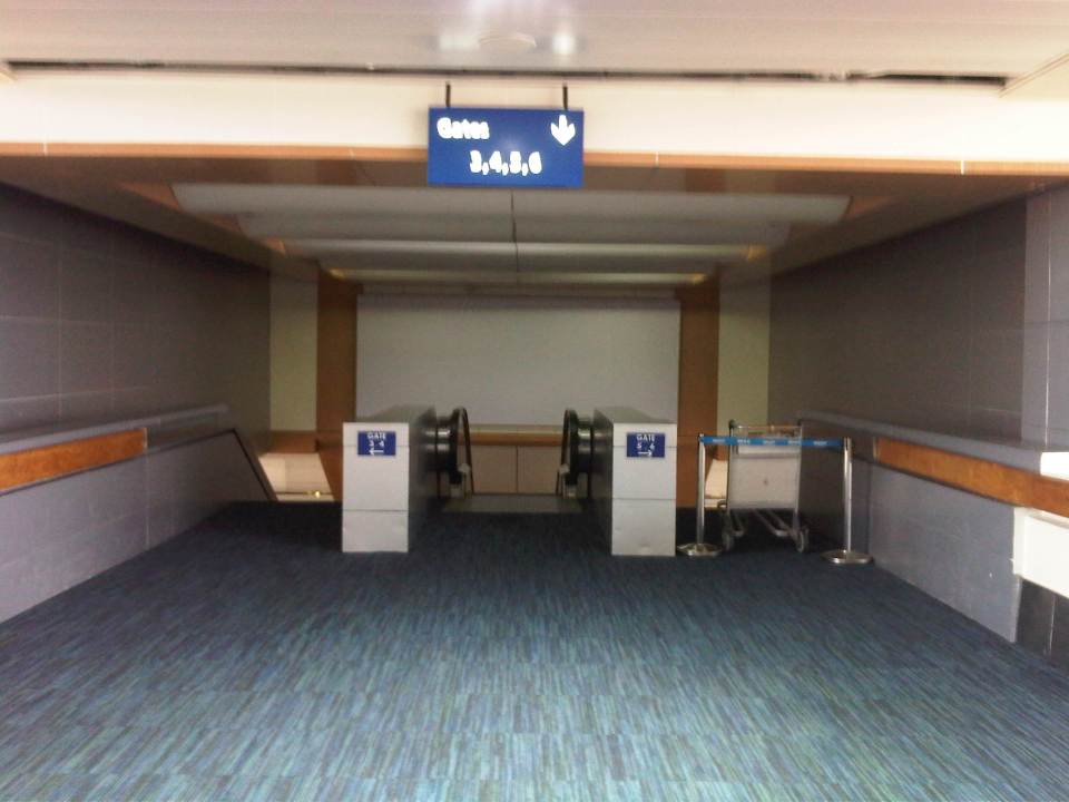 Stairs and escalators to the pre-departure area and boarding gates
 Souvenir shop at the pre departure area
 Final baggage inspection before the waiting area near the boarding gate
 Boarding gate for my flight
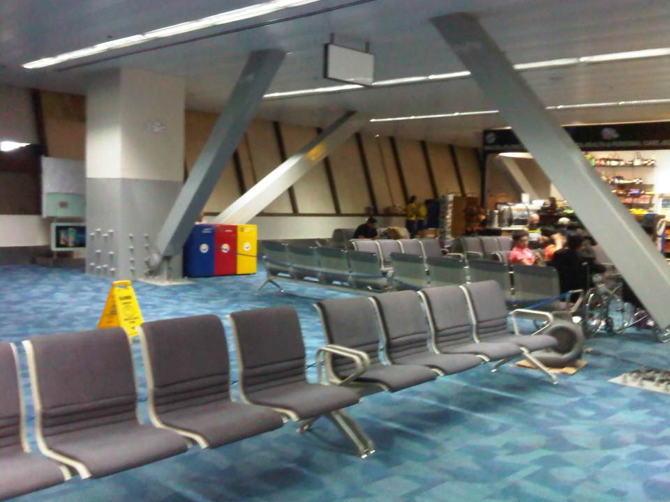
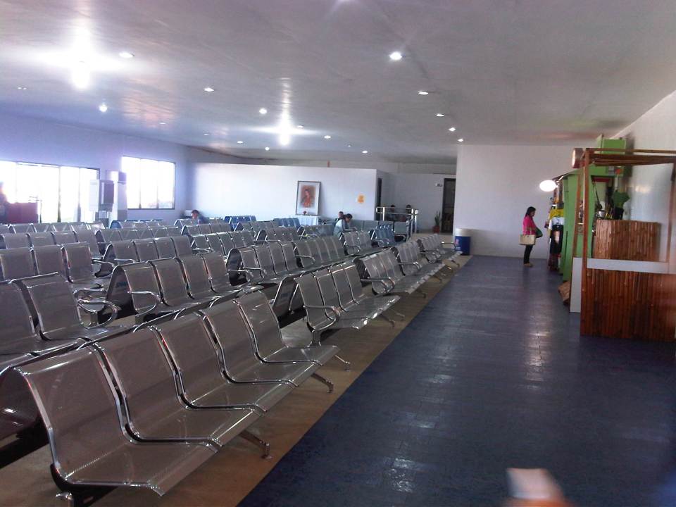
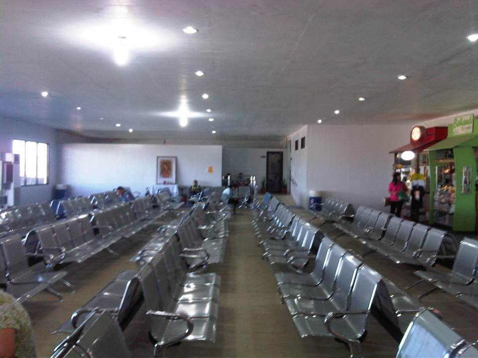
 There were plenty of available seats as passengers only started to arrive at the pre departure area. The seats were basically the same ones here when I last used T1. Though not needing to be reupholstered, these require proper and regular cleaning considering all the people who have gone through the airport.
I will post again soon on Terminal 1 but from the arrival perspective.
–
NAIA Terminal 1 departures – some updates, Part 1
The long-delayed renovations to the Manila’s Ninoy Aquino International Airport (NAIA) Terminal 1 was finally undertaken a few months ago. The much maligned airport terminal has been dubbed as the worst terminal in the world, with poorly maintained facilities including dirty toilets. It is certainly not the worst airport in the country but fails as a international gateway. Here are a few photo I took recently upon checking in for a flight.
 The main departure lobby seems so spacious with significantly fewer passengers now using the terminal. Many major airlines have transferred to Terminal 3 including Singapore Airlines, Cathay Pacific, Delta and Emirates.
 They must have changed the lighting as the area is not as gloomy as before.
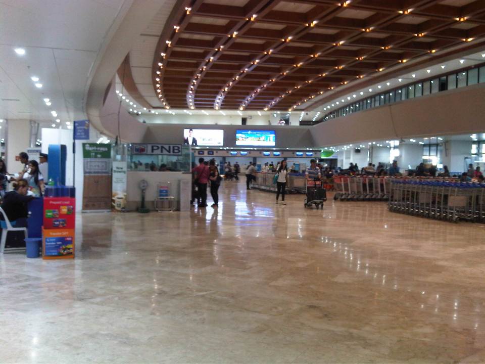 Proper illumination plus what looks like recently sanded and polished marble equals a more refined departure lobby.
 Even the check-in counters have been renovated.
 Other counters are vacant due to the transfer (temporary?) of other airlines to Terminal 3.
 Japan Airlines counters opened just in time and the queues were orderly.
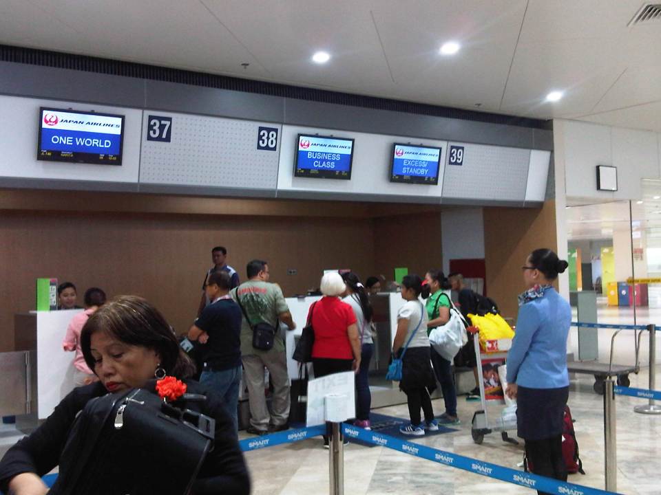 Business class counters accommodated economy passengers whenever they were available (not processing business class passengers).
More on the renovations in the next post!
–
Revisiting Tacloban Airport
The last time I was in Tacloban was in the summer before Typhoon Yolanda (International: Haiyan) laid waste to the city and many others along its path. Following are photos I took upon our arrival and departure from the city.
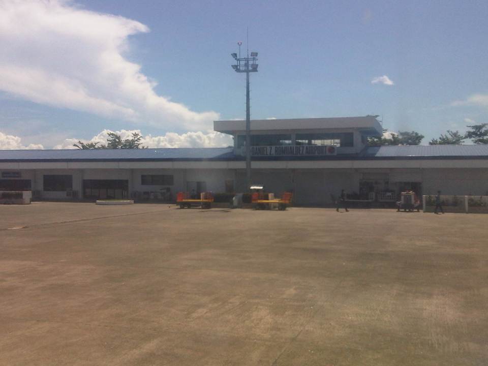 The Daniel Romualdez Airport as seen from our taxiing aircraft. The airport was almost completely destroyed by Yolanda in 2013 and was the scene of so much grief and desperation afterwards as people made their exodus of the devastated city and surrounding areas.
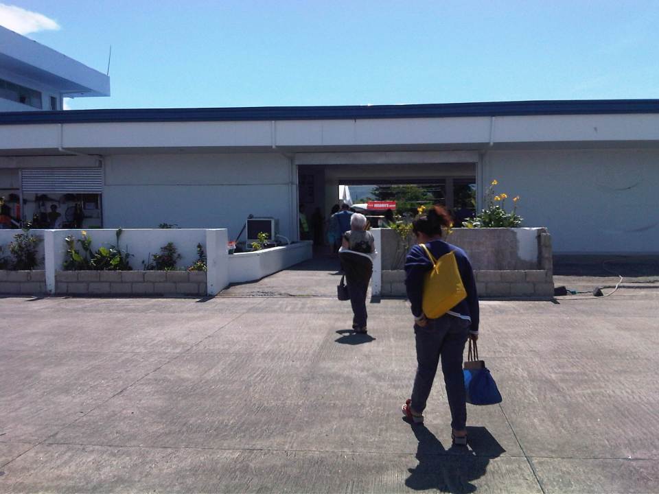 Arriving passengers deplane and walk on the tarmac towards the baggage claim area
 A photo of our plane and disembarking passengers – Tacloban airport was being served by turboprops as jet services were suspended because of the repairs being undertaken for th runway.
 Luggage carousel at the arrival area
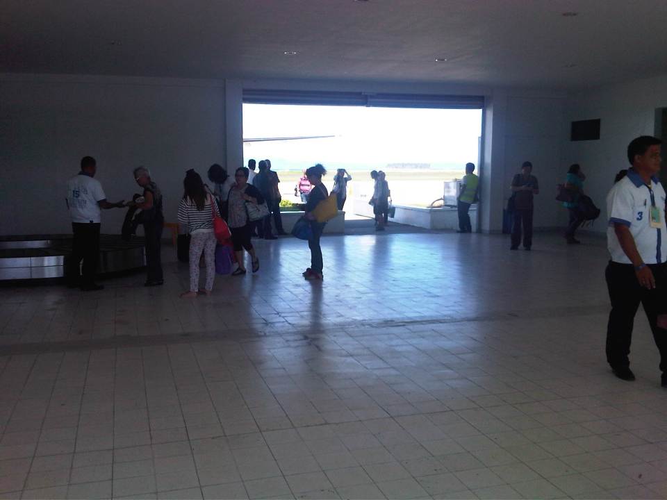 Passengers await their luggage
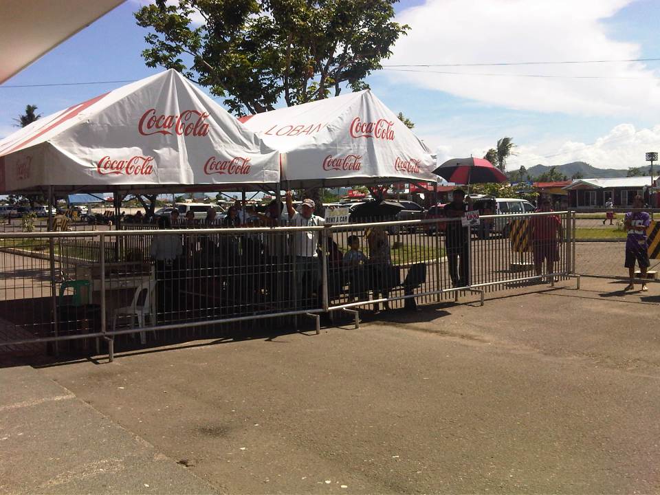 People outside included those picking up passengers and those offering transport services not just for Tacloban and Leyte but also for destinations in nearby Samar island. The two islands, of course, are connected by the San Juanico Bridge, the country’s longest.
 Passengers walk towards the well-wishers’ area and the parking lot
 Passengers claiming their luggage
 Airport control tower
 Philippine Airlines check-in counters
 Cebu Pacific check-in counters
 Concessionaire and passengers at the pre-departure area
 There were many new seats at the pre-departure area and the space can handle about 3 planeloads of passengers without being too congested.
 Another look at the relatively spacious pre-departure area
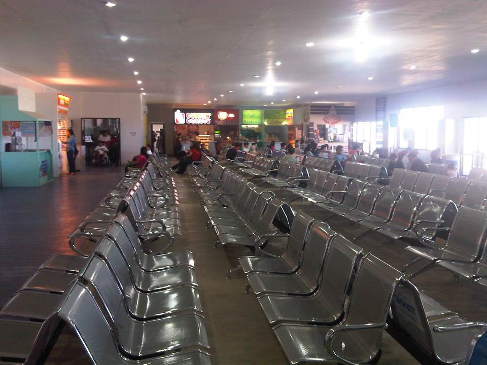 The pre-departure are as seen from the other end of the lounge
Tacloban is the regional capital of Eastern Visayas and deserves a modern airport to serve the area. Plans have been made for a new passenger terminal and the project was reportedly to be bid out before Yolanda destroyed the airport. The old terminal had to be rebuilt and the new terminal project seems to be behind schedule in terms of implementation. Hopefully, the reason for delay is that they had to re-design the terminal that was to be located in the area where Pope Francis held a Mass early this year when he visited Tacloban. The re-design is critical given the possibility of future super typhoons ravaging the area and the position of the airport along the path of most typhoons passing through the Philippines.
–
Habal-habal in Metro Manila
Motorcycle taxis, called habal-habal in the many parts of the Philippines, are usually associated with rural areas where 4- or even 3-wheeled vehicles would have a difficult time traveling. Meanwhile, larger vehicles probably won’t fit in narrow rural roads, which can be more like a trail than a road. I saw this habal-habal station along Circumferential Road 6 in the Pasig City part of the road. The area is part of a large relocation area for informal settlers. The settlement is basically unplanned, with homes/buildings a mix of shanties and other design-your-own structures with narrow streets and alleys. The latter is most suitable to walking, bicycles and yes, motorcycles.
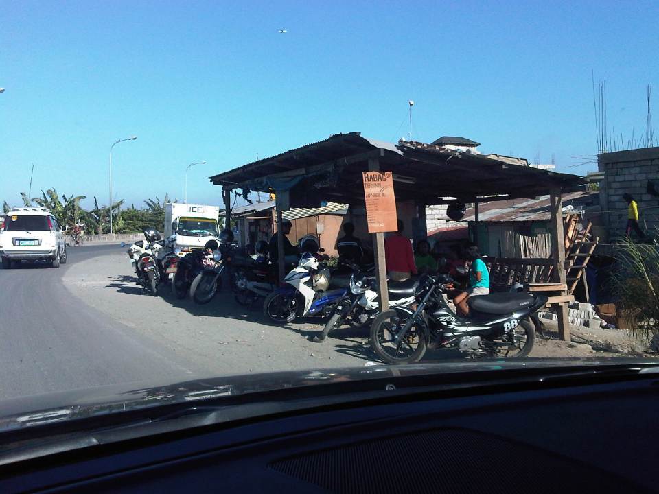 Habal-habal terminal along C-6 in Pasig City near the Napindan Channel
Despite the denial of many local governments including the MMDA, there are motorcycle taxis operating around Metro Manila. Many of these are in areas where there are no public transport services. Tricycles or pedicabs are not allowed or cannot access these areas (streets too narrow or in bad condition). Walking could have been an option but pedestrian facilities are probably even worse or walking distances are long and therefore inconvenient and uncomfortable to most. I don’t know about the fares for their services but I’m sure these are based on what people are willing to pay and established from what providers initially asked for such services. It is likely to that the operators of these services and their passengers know each other as the people in the communities served by habal-habal tend to know each other or another from other people (i.e., everyone knows everyone else).
–
On airport taxis at NAIA-Manila
Arriving at the Ninoy Aquino International Airport Terminal 3 from a domestic trip, we noticed the long lines of people needing to get a taxi to get to their homes or other destinations. NAIA has accredited a taxi company or companies as official airport taxis and travelers have a choice between metered and fixed rate taxis. Regular taxis were generally prohibited from picking up passengers at the airport terminals though they bring in passengers and could take passengers from the departure areas of the terminals; a common practice in other airports. I say ‘were’ because recently, in what seemed to be an effort to address the taxi supply issue, NAIA has allowed regular taxis to pick up passengers during ‘peak hours’. I say they should just assign a place for people to get regular taxis just like in Mactan Cebu and Davao.
 Long lines for the metered airport taxi cabs
 Long lines for the fixed rate taxis
 Another looks at the long lines – not exactly the greeting you’d like when arriving in a city
–
NAIA Terminal 1 Drop-off/ Hatid
I was at Ninoy Aquino International Airport Terminal 1 recently to drop off the wife who was going on a trip abroad. I already knew that the terminal was undergoing renovations and many airlines had already transferred to Terminal 3 including Cathay Pacific, Delta, Emirates and Singapore Airlines, which had a of flight between them in and out of Terminal 1. This meant that Terminal 1 would have much less people and that’s exactly what we saw from the departure level driveway.
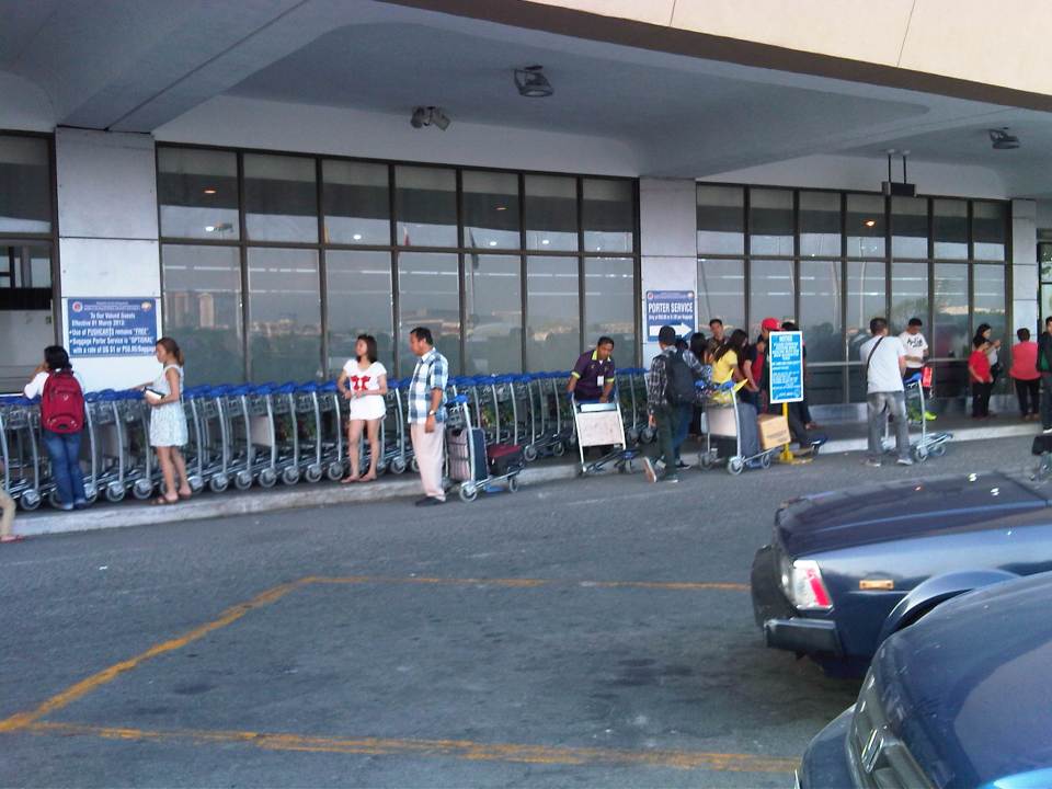 People getting carts for their luggage – and there are a lot of carts due to the drastically reduced number of passengers at T1.
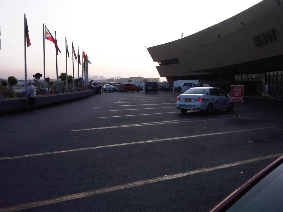 The departure level driveway had very few traffic. This area used to be so crowded with security directing drivers not to park too long so others could stop to drop-off their passengers.
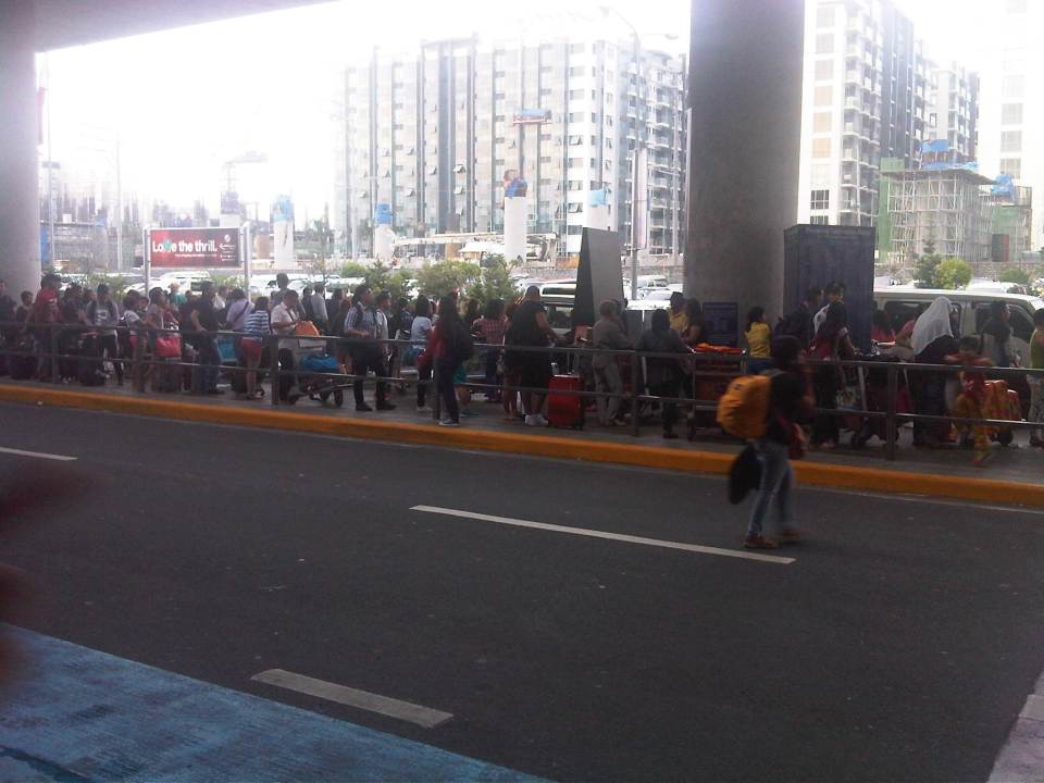
 Well-wishers crowd the very limited space near the entrances to the terminal. This is despite all the signs practically screaming for them to clear the area. Meanwhile, one airport security staff seems exasperated after probably telling people to leave the area so many times already. There is a waiting area just after the walled/boarded off section in the photo where people cold make their last minute face to face goodbyes.
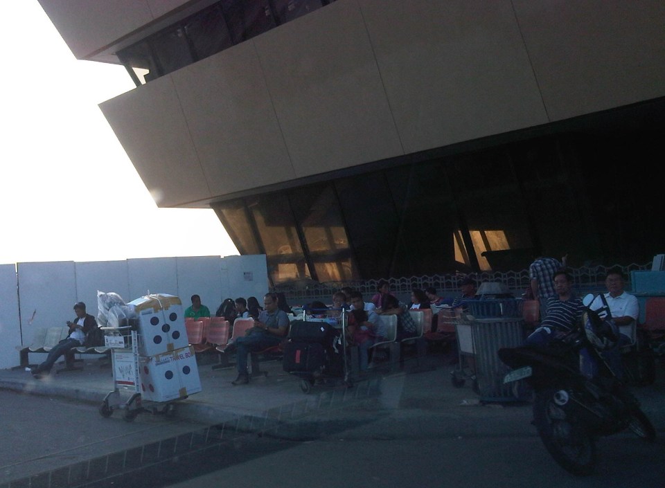 Waiting area for passengers and accompanying persons – I don’t recall they had this area before but then I probably didn’t notice because it was too crowded outside and I usually went inside the terminal immediately.
In a few days I will try posting about the renovations being undertaken at NAIA Terminal 1. These were necessary and long overdue for a terminal that’s been called one of the worst in the world. From what I saw outside, I don’t really expect to see much inside except perhaps some facelifts here and there. It’s better to manage expectations when it comes to such limited renovations.
–
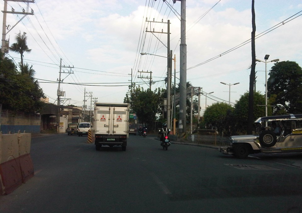
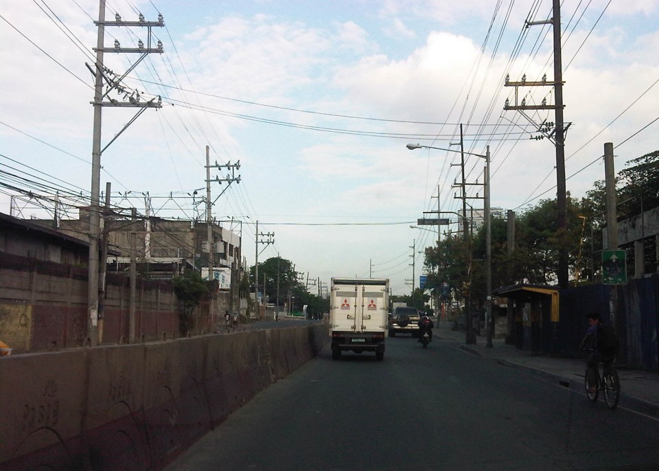
Alternative to Highway 2000, Taytay, Rizal – Part 2
The stretch of Don Hilario Cruz Avenue between Megawide and the Manila East Road is paved and generally wider than Highway 2000. While there are residential villages along this stretch as well as a significant traffic generator in Club Manila East, which is a resort, traffic is usually light. There are actually few establishments and informal settlements along the road, which retains its exclusive subdivision feel.
 Section in front of Club Manila East
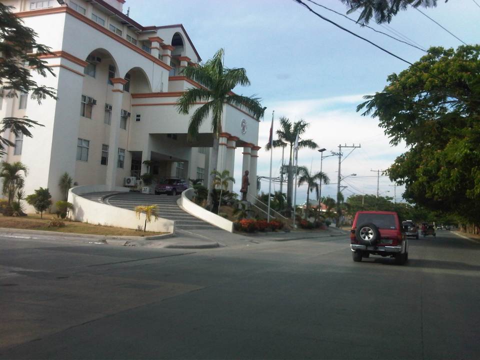 Taytay (Rizal) Municipal Hall – the Land Transport Franchising and Regulatory Board (LTFRB) office is just beside the municipal hall and often you could see taxis lined up along this road to have their meters calibrated and sealed.
 This entire area used to be an exclusive subdivision and Don Hilario Cruz Ave. was a private road. The old guardhouses are still there and heavy vehicles may not use this road without paying a toll fee.
 On-street parking is prevalent along the section connecting to the Manila East Road because of the clothes/garments market on either side of the road. Taytay, Rizal is well-known for its garments factories and tailors.
 Section approaching the Manila East Road
The only setback when traveling using this alternate route to Highway 2000 is that stretch beside Megawide. It very dusty during the dry season and muddy during the wet season. The road can be quite rough and will damage cars over time. You definitely cannot speed up along this section even if you are on an SUV and are familiar with the bumps along the road. Hopefully, the Taytay could address this issue and the Rizal Provincial government can also facilitate the paving of this section, which is used by many Rizalenos heading to work or school in Metro Manila.
–
Community road works
There have been a lot of roadworks recently at the subdivision where we reside. This is a good thing for the residents as many roads have deteriorated after so many years of non-maintenance. The rehabilitation of the main roads, I understand, were and are funded by public money through the City Government and the DPWH. This is made possible by the subdivision’s roads being already turned over to the city government and with the subdivision being also a barangay. In fact, the subdivision is the smallest of the city. Following are some photos of roadworks in our village.
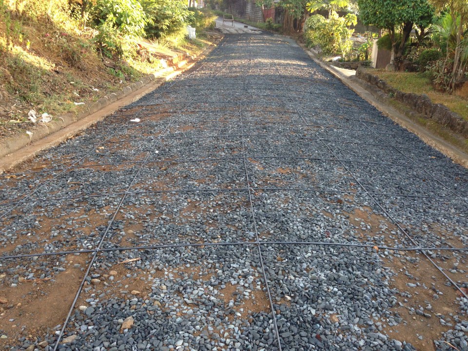 Base layer and steel reinforcement
 A close-up of the “ties that bind” the steel bars together
 Section for concreting
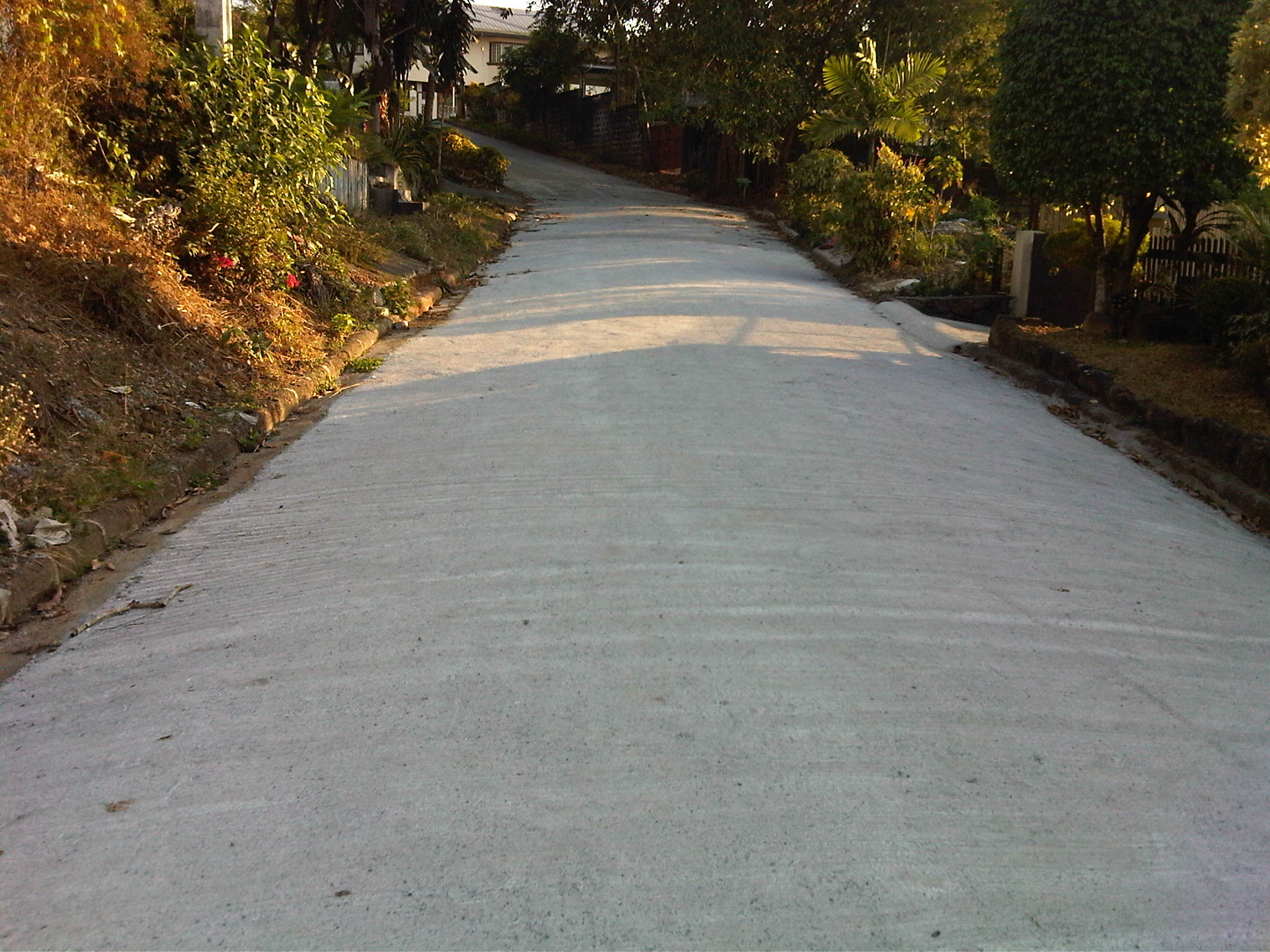 The finished product
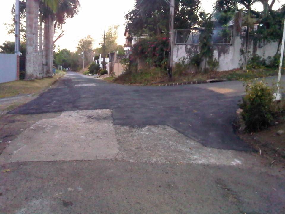 Asphalted pavement at an intersection near the homeowners’ association office
We are very appreciative of the efforts of our village homeowners association in improving the infrastructure in the subdivision. The current policy calls for the prioritization of road sections where residents are up to date in paying their dues. I think this is a fair approach to prioritizing community road works. In fact, there are more road works being implemented now. This is good timing considering it is the dry season. The only drawbacks of such projects are temporary road closures and re-routing of traffic.
–
Alternative to Highway 2000, Taytay, Rizal – Part 1
An alternate route to the poorly maintained Highway 2000 in Taytay, Rizal that leads to Barkadahan Bridge and Circumferential Road 6 (C-6) is via Don Hilario Cruz Avenue, along which is the new Taytay Municipal Hall, the Land Transportation Office in Taytay, and Club Manila East. While most of Don Hilario Cruz is paved, there is a significant section that remains unpaved. It is very dusty during the dry season and muddy during the wet season.
 The road section is unpaved but appears to be graded (probably by the tires of all the vehicles using it everyday). The wall on the right is Megawide’s. Megawide is a major contractor.
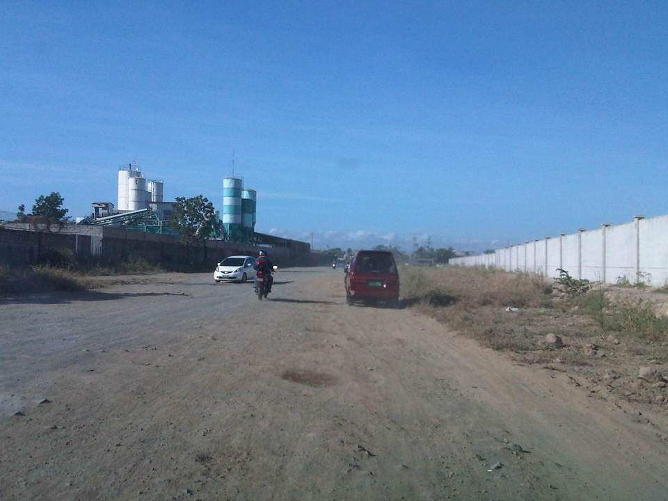 Motorcycles are the fastest along these types of roads. Other vehicles including trucks need to slow down so their suspensions will not be damaged by the rough road.
 I have wondered whether Megawide has considered contributing to paving the road considering their stature in the construction industry. This can be their CSR project and one where a lot of people will be very appreciative with the results.
 Intersection with Velasquez Street, which connects to the Manggahan East Service Road to the north and the Manila East Road to the south.
–
Ortigas Ave. Extension choke points
One alternative route for my daily commute is Ortigas Avenue. While there are several choke points along this road, I will focus on those between the Ever mall and Cainta Junction. Congestion is also usually experienced between the Manggahan Bridge and Ever but these are mostly due to traffic interruptions because of vehicles turning to and from the many subdivisions whose access/egress line up along Ortigas Ave.
The Ever mall is already a given as a significant traffic generator in the area. However, there is something about its circulation particularly the flow of vehicles in and out of the complex that detrimentally affects Ortigas Ave. traffic. While through traffic along the eastbound direction should use Ortigas Ave., many opt to go through the wide driveway of Ever in order to bypass the choke point that is the exit driveway of the mall. Many of these exiting vehicles are jeepneys turning left into Ortigas westbound (their routes terminate here and make their turnaround via Ever’s driveway). These effectively block the flow of traffic along Ortigas eastbound especially in cases when the westbound direction is also congested (i.e., due to sheer volume as well as stopping vehicles across the mall).
 Vehicles exiting from Ever and turning left to Ortigas westbound
Once eastbound vehicles are freed from the blockage of left-turning vehicles, they have to merge with significant right-turning traffic from Ever that includes buses and mostly through traffic vehicles whose drivers were ‘wise’ to have taken the driveway instead of Ortigas to get through the choke point. The situation results in another choke point right after the first one as the traffic along two lanes of Ortigas eastbound merge with the traffic equivalent to 2-3 lanes turning right from Ever. The total of 5 lanes of traffic squeezing into 2 lanes immediately after is a prime example of a bottleneck.
 Narrow eastbound two-lane section – additional space should be expropriated to widen Ortigas at this section
Right after the short 2-lane section is a sudden widening of Ortigas Ave. in front of BF Metals. I have heard it said that this is the ideal road width for Ortigas Ave. considering the volume of traffic passing through this major corridor connecting Rizal province with Metro Manila. There are practically 4 lanes for each direction at this short section so its easy to project these lanes on maps to see what properties would need to be expropriated if the objective is road widening. (Of course, the best option should still be to pursue a mass transit system along this corridor.)
 Ideal road width – Ortigas Avenue at its widest is the section across BF Metals. Vehicles here spread out along the many lanes suddenly available. But then people will eventually and immediately realize this is the mouth of a funnel. Note the sign indicating that vehicles are entering the Province of Rizal from this point.
 The eastbound section in front of BF Metals is usually parking lot in the evenings. This is due mainly to the 4 lanes almost abruptly constricting into 2 lanes just past BF Metals. Compounding things is the U-turn slot located here where many jeepneys whose routes end at Cainta Junction make their turnaround. Turning vehicles are assisted by “tambays” earning their money by blocking eastbound vehicles to make way for U-turning vehicles.
Finally, there is Cainta Junction itself, which is a signalized 4-leg intersection that handles a tremendous volume of traffic all-day. I am sure that there are efforts for the traffic signal settings to be optimized but more often there is human intervention for traffic management at the intersection. Whether this causes more severe congestion is quite obvious to many travelers going through this intersection. Queues along Imelda Ave./Felix Ave., for example, can reach way past Village East even reaching Vista Verde on a bad day. This only shows that the intersection is already severely saturated and conventional traffic management or signal settings can no longer handle the traffic. Perhaps the next stage of engineering intervention for this intersection is grade separation or the construction of a flyover or two at the intersection. Notably, such a project should including strategic widening along Ortigas Ave in order to balance the number of lanes feeding into and receiving traffic from the intersection.
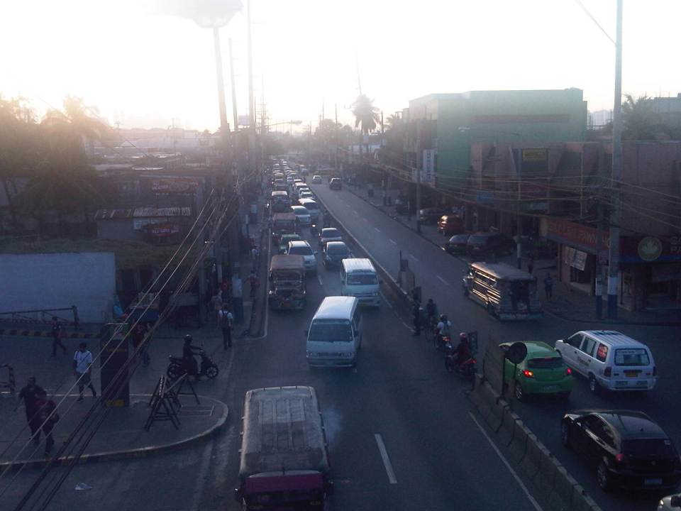 A view of the traffic approaching Cainta junction – there are only 2 lanes along the eastbound side of Ortigas and public utility vehicles stopping here only exacerbates the congestion along the road.
Is road widening the ultimate solution to Ortigas Ave congestion? I personally don’t think so. As I have mentioned earlier in this post and in previous posts the key is still to come up with a mass transit system to serve this eastern corridor. Yes, there will eventually be a Line 2 along Marcos Highway, the main alternate (or competing?) route to Ortigas but is is obvious that even with a railway line along Marcos Highway and connecting to Aurora Blvd., there will still be an urgent need for a similar capacity line along Ortigas. The buses and jeepneys can no longer handle the demand and their poor levels and qualities of service have given rise to a proliferation of UV Express and pushed people to purchase cars and motorcycles. Congestion can be reduced significantly with a mass transit system along Ortigas. Without this transit system, Ortigas will just continue to be congested even if the entire corridor is widened; except perhaps if it is widened like Commonwealth Ave. in Quezon City. I don’t think that is possible and practical.
–
