
Trip to Baler
I have yet to post a few more articles about my trip to Naga City,Camarines Sur and yet here I am traveling again, this time to Baler, Aurora. I have made it a point to travel to at least one new destination every year and this year it looks like I will be traveling to at least one new local destination and perhaps one new place overseas. So I will be concluding March by sharing this photo of two bancas (the type with the outriggers for balance) I took earlier this morning during my stroll along the beach.
 These boats are used by fishermen though they can also be used for transportation along the coast. These are the non-motorised type so it takes some skill and constitution to paddle these vessels especially when the waters are choppy.
I promise to post more about this trip soon including sharing photos of arches and the dam roads of the Canili River Reservoir and the Diayo River Reservoir in Maria Aurora town.
–
Some concerns about future rail ridership
Traveling along Commonwealth Avenue and Marcos Highway the past week, I both hopeful and worried about what happens after the Line 7 and Line 2 Extension finally becomes operational. Much has been said or reported about the potential of these two lines to change the way people commute; at least from the areas served by these two mass transit lines. However, how big an impact these would have in terms of actual reduction of private car use remains to be seen.
Will there be significant decreases in the volume of motor vehicles along Commonwealth Avenue, Marcos Highway and Aurora Boulevard? Or will there be just the same traffic along these roads? The worry is based on the likelihood that those who would be taking Lines 2 and 7 would be people who are already taking public transportation and not those who have chosen to leave their cars (or motorcycles) at home.
Our students have been studying ridesharing and P2P bus operations the past few years and the conclusion has so far been a shift from one mode of public transport to what’s perceived as a better one. It’s somewhat a difficult thing to accept for advocates of public transport especially those behind TNVS, P2P buses and railways but it is what it is, and its important to accept such findings in order for us to understand what’s going on and come up with better ways to promote public transport and convince car users to use PT.
 Traffic flows at the Masinag junction with the Line 2 Masinag Station and elevated tracks in the background
What is more intriguing is the proposed subway line for Metro Manila. The alignment is different from the ones identified in previous studies for the metropolis and from what I’ve gathered should have stations that serve a North-South corridor that should make for a more straightforward commute (i.e., less transfers) for those taking the subway.
 Probable MM Subway alignment (from the internet)
It is another line that has a big potential as a game-changer for commuters but we won’t be able to know for sure until perhaps 5 or 6 years from now. What we know really is that there was a lost opportunity back in the 1970s when government should have pushed for its first subway line instead of opting for the LRT Line 1.
–
On the traffic flow predicament at Tikling junction…again
During weekends, a constant frustration have been the incidence of severe traffic congestion along Ortigas Avenue Extension. Weekday evenings are usually better in terms of traffic compared to Saturdays. But last Monday, the congestion was so severe the congestion reached Valley Golf and vehicles had to crawl to Tikling. As mentioned in previous posts on this subject, part of the problem is the sheer volume of vehicles that make the roundabout set-up inappropriate for the junction. Then there is also the issue about the people who are supposed to manage traffic but end up mismanaging it. From what I usually observe, they tend to favour vehicles coming from Taytay via the Manila East Road leg and seem oblivious to the build-up of traffic along Ortigas Ave. Ext. eastbound.
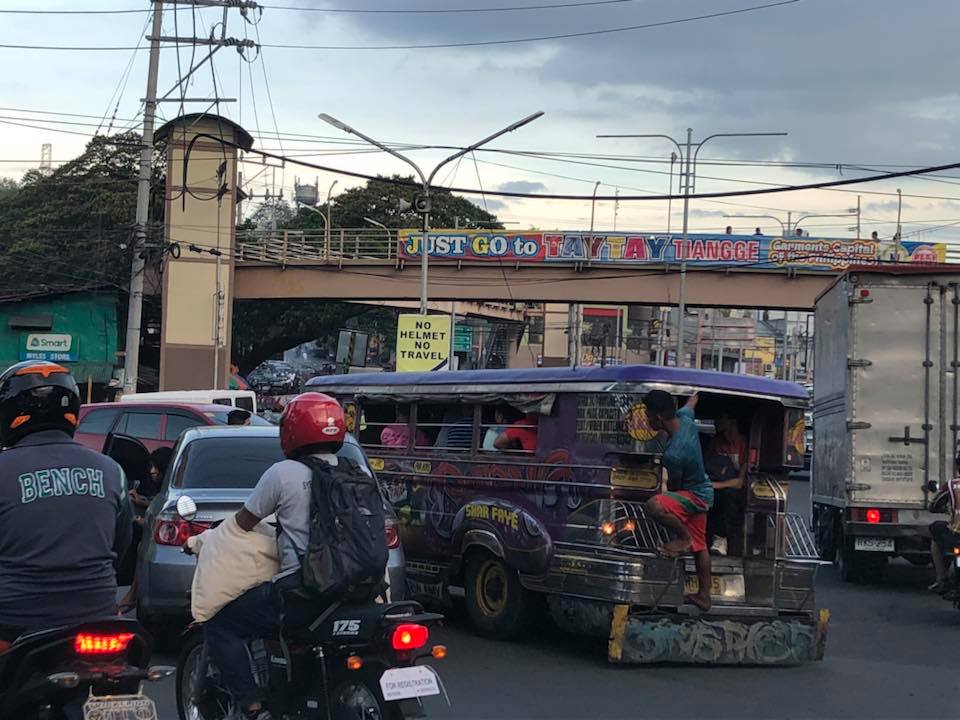 Typical heavy traffic at Tikling Junction
We might finally get a chance to have a solution for this. One of our students took on a topic that will require her to asses the traffic at the intersection to determine, for example, whether the roundabout is suitable or perhaps should be changed into a signalised traffic control. Both analytical approach and microsimulation (using Vissim or the homegrown LocalSim) will be employed. But we will have to wait by May to see some substantial results.
–
On the efficiency of transportation – a crash course on transportation engineering concepts
There is an excellent article on the efficiency of transportation systems:
Gleave, J. (2019) Space/Time and Transport Planning, Transport Futures, https://transportfutures.co/space-time-and-transport-planning-1aae891194e5 [Last accessed: February 25, 2019].
It is highly recommended not just for academics (including students) but also for anyone interested in transportation and traffic. It’s like a crash course in transportation engineering with a lot of basic concepts in traffic engineering and traffic flow theory being presented for easy understanding by anyone. Enjoy!
–
Reference on bike-focused street transformations
There’s an update to the “Rethinking Streets” guide with one that is focused on street transformation for bicycles. Here is the link to their site where they now have 2 guidebooks:
http://www.rethinkingstreets.com
You will have to click one of the guides to register (if you haven’t done so before) and download them.
–
On computer games for city planning
There’s another article on a very popular computer game that allows people to play city planner or mayor. I recall playing the game for the first time in the early 1990s. A friend got hold of a bootleg copy of the first version and we soon found ourselves addicted to the game. 🙂
Roy, J. (2019) From video game to day job: How ‘SimCity’ inspired a generation of city planners, Los Angeles Times, https://www.latimes.com/business/technology/la-fi-tn-simcity-inspired-urban-planners-20190305-story.html [Last accessed: 03/13/2019]
Of course, later on we tried experimenting on some concepts to see how the game will go for themes such as transit oriented development (TOD) and combinations of land uses. This allowed us to have an appreciation of how a city will grow and how networks perform given various scenarios. I still believe the game has a lot of value not just from the gaming perspective but also from an academic or practical view. City planning (and not just the transportation or traffic aspect) is a very complicated matter and requires a lot of know-how, wisdom and logic (also others) for a city to function well and for it to grow. Perhaps the newer versions of the game will be even more “realistic” and help develop future planners and administrators.
–
Lessons to be learned from experiences on public transport abroad
There’s this “old” article that came out last year that is very much relevant as it is timeless for its topic. The title is intriguing as the many if not most US cities are known to be car-dependent. Few have good public transportation in terms of the efficiencies or qualities we see in Singapore, Hong Kong, Seoul or Tokyo (just to mention Asian examples). Clearly, quality of service is the main reason why people are apprehensive about using public transportation. In fact, the attraction of ride shares, for example, are precisely because people want to have what they perceive as safe, comfortable and convenient modes of transport for their regular commutes. Only, for many people, their choice is also limited by the affordability of such modes of transport. Perhaps the same is applicable if you extend the discussion to include active transport. Cities and municipalities would need to provide the right infrastructure and environment for people to opt out of cars, take public transport, walk or cycle.
English, J. (2018) Why did America give up on mass transit? , http://www.medium.com/citylab, https://medium.com/citylab/why-did-america-give-up-on-mass-transit-dont-blame-cars-d637536e9a95 [Last accessed: 08 March 2019]
–
References linking transportation and health
The Institute of Transportation Engineers (ITE) features several resources discussing the linkage between transportation and health. Here is the link to the page where they list references like reports from various sources as well as tools.
This is definitely a topic that needs more attention and studies in the Philippines in order to have local evidence (there are already strong evidence abroad) supporting active transportation and how it helps make citizens healthier. Of course, that goes without saying that active transport should be integrated with an efficient public transport system. That is so that the increasing share of private transport can be checked (no thanks to Grab and Uber) and we can either retain or increase public and active transport shares.
–
Railway bridges along the PNR Main Line South
This is a continuation of the series of posts about my recent trip to Bicol where I was able to take some photos for items I generally label. These stock of photos are posted here for several reasons including convenience of access in case I need them for lectures or other presentations. Previously, I had posted on vertical curves along the Andaya Highway. This time around are some photos I took of railway bridges along the PNR’s Main Line South and particularly in Camarines Sur. It was quite challenging to look for or anticipate seeing these structures; many of which are quite old and in a state needing urgent maintenance. Most if not all are steel truss bridges and the ones in better conditions are shown in the following photos. All were taken within the Naga City boundaries.


–
Vertical curves along the Pan Philippine Highway
We start the month of March with a compilation of photos of vertical curves (mostly sags). These were taken along the Andaya Highway, which serves as the main bypass road in Camarines that allows travellers to bypass, for example, Daet.


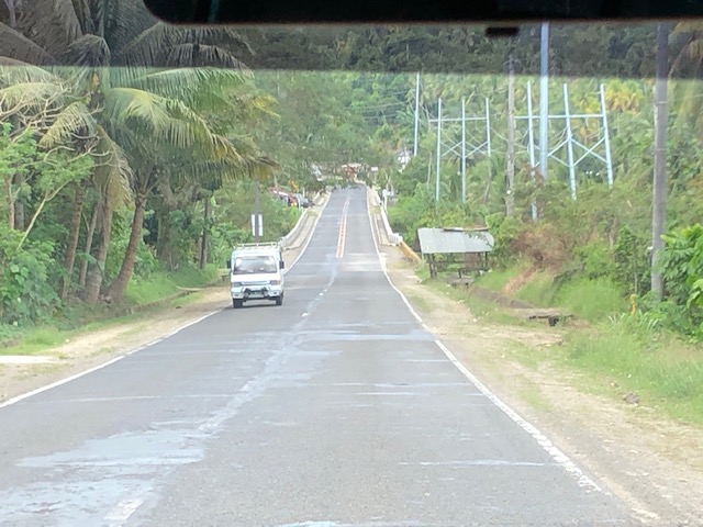


These photos do not have captions and I leave it to my readers to have an appreciation of the features of these sections. These include wide carriageways with paved shoulders. There are also sections that have no shoulders. For most photos, the pavement appears to be in good condition. However, the same cannot be said for much of the highway, sections of which are being rehabilitated along with several bridges.
–
