
Travel time maps for Antipolo City
Yesterday, we facilitated a workshop for Antipolo City where technical staff of the city presented on the outcomes of various activities related to the formulation of a Sustainable Urban Mobility Plan (SUMP) for the city. One interesting output from one of the groups is this map showing the travel times within selected driving times with the destination being the Antipolo Shrine (“Antipolo Simbahan” if you will refer to the PUV signboards of those plying routes to Antipolo). The maps are the equivalent of travel time contour maps that can be generated with travel speed or travel time data.
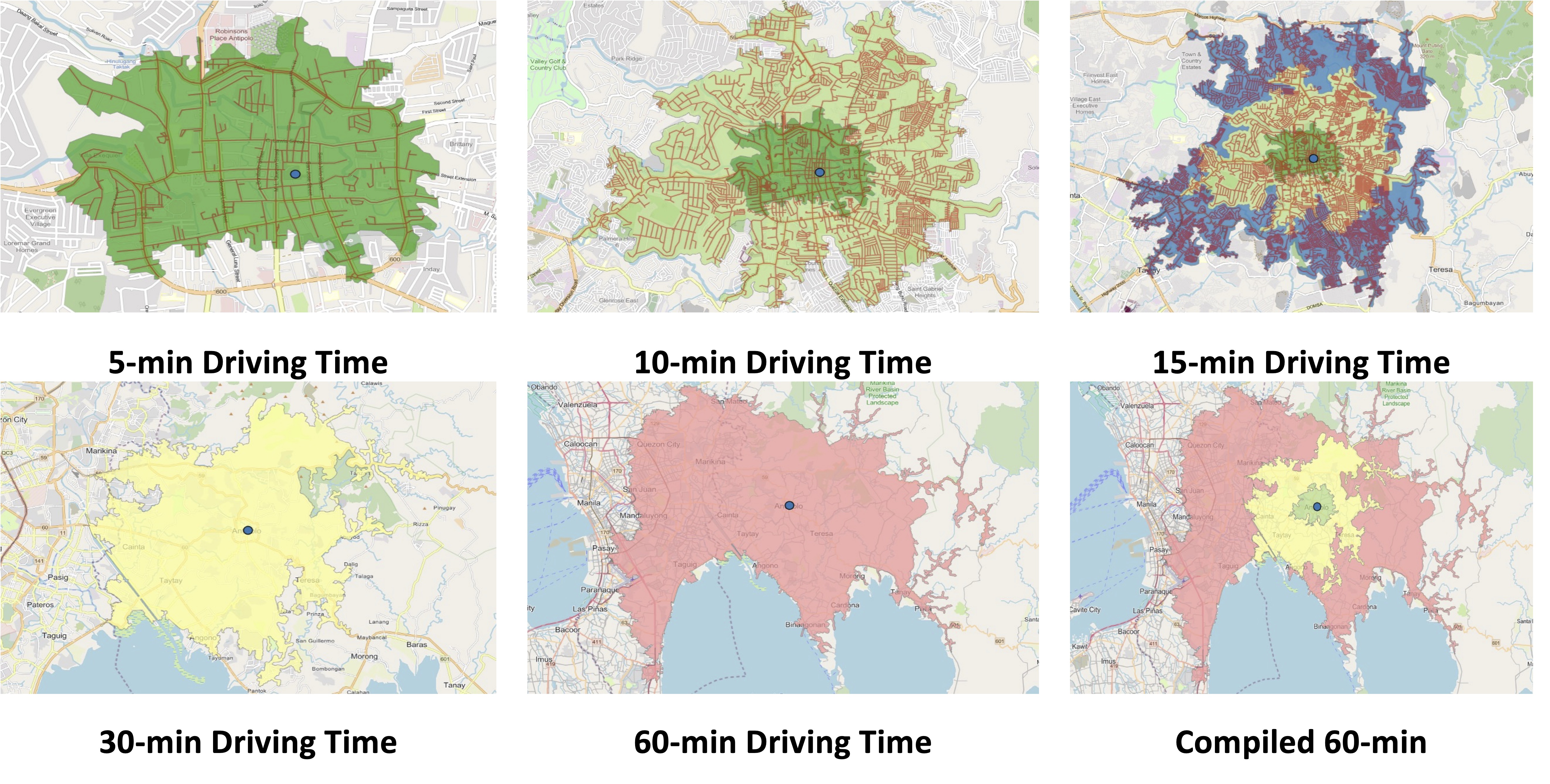
While shown are driving times and assuming car use, similar maps can be produced for public transportation, motorcycles, bicycles and even walking. It is just a matter of collecting the data and plotting them. Alternatively, the data can probably be obtained or derived from sources like Google Traffic or Waze. Some effort, of course, is required in order to have more accurate maps especially considering the road network and traffic circulation. Note that the travel times indicated are also centered on the Antipolo Shrine, which for presentation purposes was used to represent the center of the city. Other maps can be produced in aid of planning travel and transportation for the purposes of the city (e.g., how long it takes between Antipolo and Cubao for a regular commute, etc.).
–

