
Mactan Cebu airport arrival – Part 1
We were treated to a somewhat pleasant surprise upon arriving in Cebu’s Mactan International Airport a couple of weeks ago. The surprise was that our plane taxied to and berthed at the new Terminal 2, which was for international flights.
 A view of the MCIA Terminal 2 from our taxiing aircraft
 A closer look at MCIA T2 as our plane turned towards the apron
 Passengers deplaning via the T2 tube
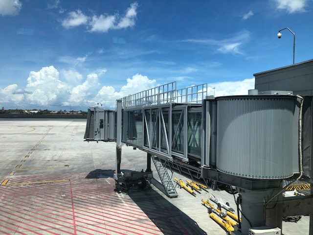
 A view of MCIA T2 from the airbridge
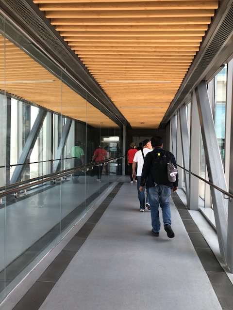
 View of the tarmac and one of the airbridges as we walked along the corridor lined along the terminal’s departure level that connected to another corridor for the old Terminal 1.
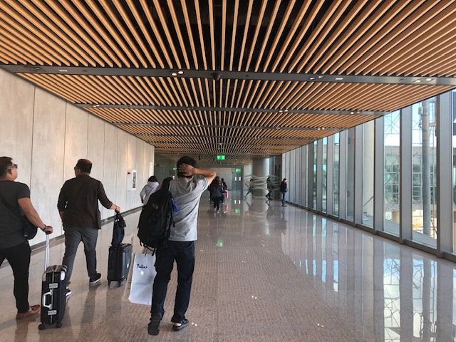
 Corridor along Terminal 2 connecting to Terminal 1
 A snapshot of the tarmac
 The interior design elements of MCIA Terminal 2 evoke a local, Asian flavour
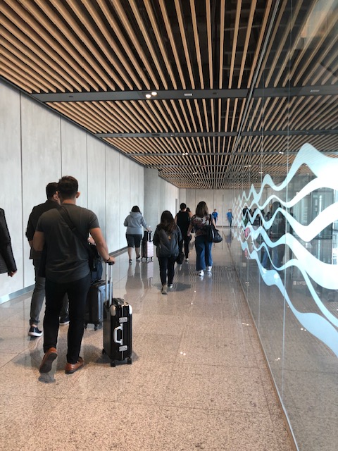
 Spacious corridor towards Terminal 1
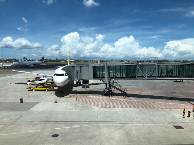 A look at an aircraft berthed at MICA T2
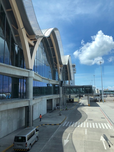
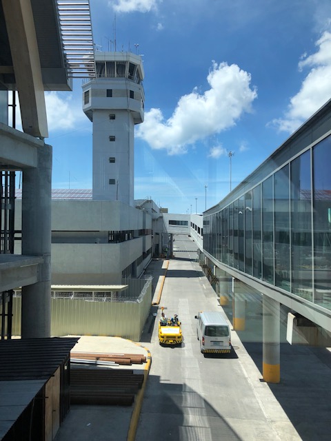 Bridge connecting Terminals 1 and 2 with a view of the air traffic control tower
 Passengers walking to T1
 Interphase of T2 with T1 at this point of the bridgeway
More on MCIA soon!
–
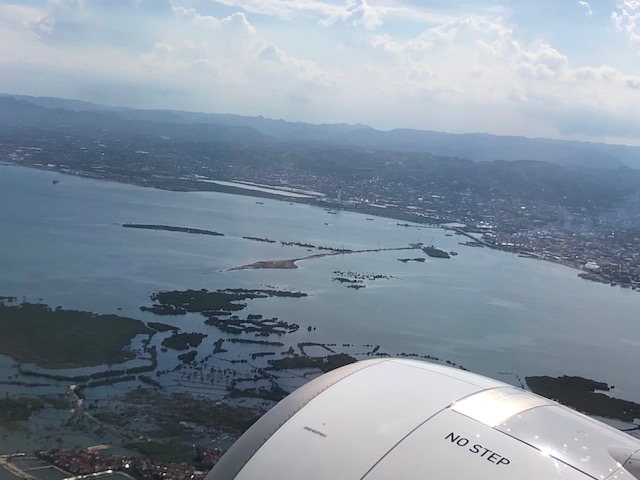
Aerial photos of Cebu and Mactan
I enjoy taking aerial photos when the opportunities present themselves. Leaving Cebu for Manila a couple of weeks ago, I was able to take some nice photos as or plane took off and cruised over Mactan Island. Here are some of the better photos:
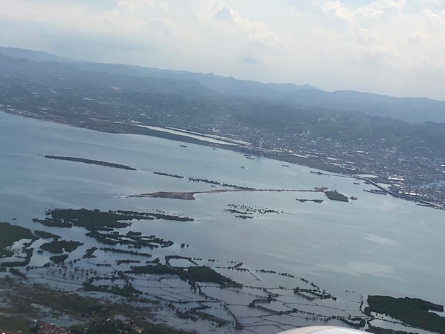
 A view of Mandaue and Cebu cities across from Mactan Island as our plane took off from the airport
 Here’s a first look (a bird’s eye view) of the ongoing construction of the third bridge connecting Cebu and Mactan Islands. This is part of the Cebi-Cordova Link Expressway (CCLEX) project.
 Here’s another view of the island with the airplane engine in the photo.
 Here is a close-up photo of the island where tall columns will be built to support the CCLEX bridge. The viaduct in the photo is the one connecting downtown Cebu City with the South Reclamation Project area that includes the SM Seaside development.
 The SM Seaside as seen from the air
 Here’s a view of the South Reclamation Project area with SM Seaside as our plane turned north towards Manila.
 Another view of Cebu City and the SRP
 Here’s my favourite shot of Cebu and Mactan Islands with the SRP on the foreground, the CCLEX bridge under construction and Mactan International Airport
–
Why more low capacity PUVs?
I’ve written about the recent additions of new (the government I think prefers to call them ‘modern’) model jitneys along corridors like Marcos Highway, C-5, Quezon Avenue, Espana Avenue, etc.). My main comment has always been about the capacities of these vehicles considering the high transport demand along these routes where the Department of Transportation (DOTr) and the Land Transportation Franchising and Regulatory Board (LTFRB) have authorised these so-called “experimental” routes. The services actually overlap with existing lines of other PUVs like jeepneys, UV Express and buses. Their value is apparently the single, direct ride they provide to commuters, who otherwise would have to transfer vehicles to get to their destinations. The popularity of these “experimental” services only underlines or emphasizes the need for rationalising transportation services especially in Metro Manila.
There are surely opportunities to improve the network including those taking advantage of the improvement of rail services. But rationalisation is not just about changing routes. It also means determining the right capacity vehicles for these routes. Thus, high demand corridors require higher capacity modes in terms of both vehicles and their frequencies. Perhaps authorities should look into the examples of P2P bus operations as a way of determining the type of vehicles to be deployed as part of the so-called experiment rather than appear to be just promoting these modern jitney models. PUV modernisation, after all, should also mean upgrading the existing vehicles servicing certain routes by replacing them with ones that are more efficient and with higher passenger capacities.
 This mini-bus lookalike has a capacity of 23 passengers. That’s practically the same as the newer model jeepneys that are generally longer and with some cleverness of the driver and conductor may seat more (i.e., Benches placed inside the jeepney increases their seating capacity. This set-up, however, is unsafe.)
–
Advisories and policies pertaining to EASTS 2019 in Colombo, Sri Lanka
The 13th International Conference of the Eastern Asia Society for Transportation Studies (EASTS) will be held from September 9-12, 2019 in Colombo, Sri Lanka. However, with the bombings last April 2019, a lot of people mainly prospective participants have worried about the security situation in the city. The local society in the Philippines, the Transportation Science Society of the Philippines (TSSP), also communicated its members’ concerns to the EASTS Secretariat. While TSSP received informal correspondence on the situation and assessment by the secretariat, only recently has the EASTS policy been released:
http://easts.info/policy-about-easts-2019-conference/
In addition to this, the organisers have sent the following email to assure prospective participants about the security situation in the city and country, which I quote below:
“Dear Author,
Thank you for submitting a paper for EASTS 2019, the 13th International Conference of the Eastern Asia Society for Transportation Studies hosted by Sri Lanka Society of Transport & Logistics (SLSTL). We are pleased that EASTS has decided to continue with hosting the conference in Sri Lanka, despite the unfortunate incident, that took place on the 21st of April 2019 taking into consideration the rapidly improving situation in Sri Lanka.
As the host institution I write to encourage your participation and wish to convey that the decision to continue was made based on the following facts and security measures currently in place.
Current Situation
· There have been no further terror attacks since 21st April the day of the Easter bombings.
· Security Forces have identified those responsible and arrests have been made both in SL and overseas.
· The attacked churches (St. Anthony’s Shrine, Kochchikade, St. Sebastian’s Church, Katuwapitiya and Zion Church, Batticaloa) and hotels (The Kingsbury, Shangri-La Colombo and Cinnamon Grand Hotel) are now restored, refurbished and opened to the public.
· Emergency has been lifted and the country is functioning normally.
· All schools, universities, Government and private workplaces, hotels, public places, etc. have implemented body and bag/luggage scanning.Travel Advisory
· UK relaxes travel advisory to Sri Lanka
https://economynext.com/UK_relaxes_travel_advisory_to_Sri_Lanka-3-14701.html
· India relaxes travel advisory to Sri Lanka
https://economynext.com/India_relaxes_travel_advisory_to_Sri_Lanka-3-14596-7.html
· Switzerland relaxes travel restrictions to Sri Lanka
http://www.colombopage.com/archive_19A/May28_1559020675CH.php
· China lifts travel advisory on Sri Lanka
https://www.newsfirst.lk/2019/05/26/china-lifts-travel-advisory-on-sri-lanka/
· Australia relaxes travel advisory on Sri Lanka
https://www.newsfirst.lk/2019/06/14/australia-relaxes-travel-advisory-on-sri-lanka/
· Italy relaxes travel advisory
http://www.dailynews.lk/2019/05/31/local/187125/italy-relaxes-travel-advisory
· Germany soften travel advisories on Sri Lanka
http://www.dailymirror.lk/business-news/India–Germany-and-Switzerland-soften-travel-advisories-on-Sri-Lanka/273-168105Hotel Security
Hotel security has been strengthened and meetings are held periodically. SLSTL is satisfied that all the nominated hotels and the Waters’ Edge, the site of the conference have made arrangement that allow a safe environment for the conference to be conducted. See below article in this regard The Kingsbury stands strong.
http://www.ft.lk/travel-tourism/The-Kingsbury-stands-strong/27-677814Government Support
In order to solicit the highest level of Government support for the conference, Prof. Tetsuo Yai, President, EASTS and Prof. Shinya Hanaoka, Deputy Secretary General, EASTS have also been invited to make a personal visit to Sri Lanka to meet the relevant Government Ministers and Heads of Security Establishments ahead of the conference to finalize arrangements.As such we are confident that Sri Lanka is now very much safer than before the incident and we encourage you to take part in the conference without fear.
lovesrilanka.org / #LoveSriLanka
http://lovesrilanka.org/We look forward to welcoming you in Sri Lanka for EASTS 2019.
Thank you.
Yours Sincerely,
Prof. Amal S. Kumarage
President – Sri Lanka Society of Transport and Logistics (SLSTL)
Senior Professor, Department of Transport & Logistics, University of Moratuwa”
Here is the link to the EASTS page providing information about the conference: http://easts.info/easts-conference/
I am among those looking forward to traveling to Sri Lanka this coming September. Sri Lanka is a beautiful country and I became familiar with it mainly through a close friend I met when we were students in Japan. We still keep in touch through email after he moved with his family. They are now residing in Australia.
Zamboanga airport departure
Before I post more about Mactan Cebu International Airport, here is the last of the recent series on Zamboanga’s airport. Here are some more photos of the airport terminal when we flew back to Manila earlier this month.
 Philippine Airlines check-in counter at Zamboanga Airport
 Cebu Pacific check-in counters at Zamboanga Airport
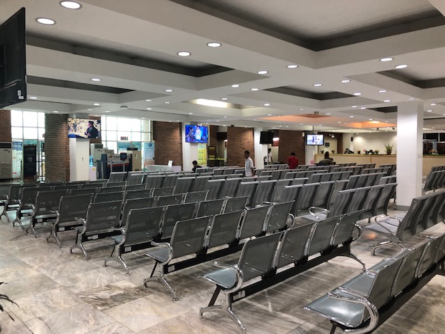 Pre-departure area
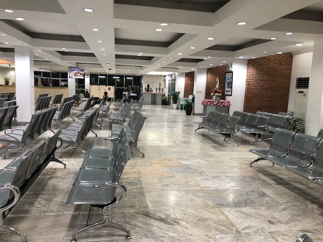 Pre-departure area
 Zamboanga Airport terminal – the architecture
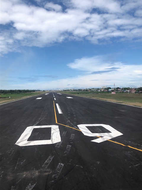 View of runway 09-27 as the plane turns in prior to taking off
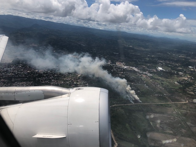 Fires as seen from the plane after we took off
Soon, I will be back in Zamboanga for some field work so that means probably some more photos of the airport and maybe street scenes or road conditions.
–
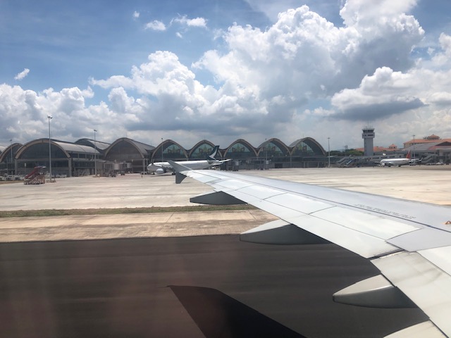
Back in Cebu
I am back in Cebu for a few meetings for a conference we are organising together with the University of San Jose-Recoletos. Upon landing, I snapped this photo of the Mactan Cebu International Airport’s second terminal, which is designated for international flights. The control tower is also in the photo as well as part of the old terminal that is used for domestic flights.
 View from our Cebu Pacific Airbus A320
I will post about the airport and some street scenes in Cebu in the next days. But before those, I think I still have one on Zamboanga airport that I have been procrastinating about. I will also post something about the conference we are organising later in July. Abangan!
–
Evidences of demand for Line 2 beyond Masinag (again)
My commute between my home and office usually takes me to Masinag where I make the choice between traveling via the typical Marcos Highway route or via the alternative Marikina/Tumana route. Here is a scene that I usually see whenever I pass by the informal UV Express terminal just past the Masinag junction along the westbound side of Marcos Highway and just before the Decathlon sports facility currently under construction.
 Passengers waiting for UV Express vans or AUVs to return around 8 AM. The latter serve the Cogeo – Makati (Greenbelt) route, which could take 2 or 3 rides using other modes of public transport (e.g., one ride to Cubao and another from Cubao to Makati)
Note how many people cannot get a ride around 8 AM. If only there were more efficient options then these people would likely take them but for now the obvious and practical choice for them is the UV Express. Others, of course, can just walk further to SM Masinag where there is a P2P bus service also heading to Makati. Recently, a new “experimental” route was opened between Cogeo and SM Aura in Taguig using modern jitneys.
Once completed, Line 2 should be able to provide an alternative for these commuters but there is still the issue of a seamless transfer in Cubao. There is no direct connection between the Line 2 and Line 3 stations with the former connected to the Gateway Mall while the latter is connected to Farmers. That is a significant walk between the two stations.
But where do the commuters in the photo come from (origin?)? Most likely don’t reside around Masinag Junction though there are many residential area around this location. Many are ferried here by tricycles, jeepneys or private vehicles. Many likely have their own cars but opt not to drive to/from Makati. That is actually a good thing and something that needs to be sustained rather than give a reason for these people to use cars for their commutes. And so there is a need to extend Line 2 perhaps to Cogeo, and a branch to Marikina. The Marikina branch, as I’ve mentioned before, could terminate at the Marikina Sports Center. Meanwhile the extension to Cogeo should not stop there but continue further towards Antipolo’s new government centre. This corridor’s population is steadily increasing and the transport demand must be addressed not by low capacity modes but by a mass transit system. The low to medium capacity modes should be in support or at most supplementary to the high capacity system with the Line 2 as backbone.
–
Snapshots on a Zamboanga trike
I like taking photos from the vehicle when I’m traveling. It doesn’t matter whether I am on a car, on a bus or even a motorcycle as long as it is safe and there’s no danger of dropping my camera or my phone. Here are a few photos taken as we were on a tricycle in Zamboanga.
 Old building on a corner of a street in Zamboanga showed how buildings in the downtown area were built. The ground floor is likely a shop, store or office while the upper one is likely to be a home. From the photo, it becomes obvious that pedestrians were protected against the elements (sun or rain) for this arcade type of development.
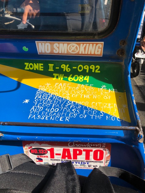 Inside the tricycle, the fare rates are printed on the side car. That includes the discounts that are supposed to be given for senior citizens and students.
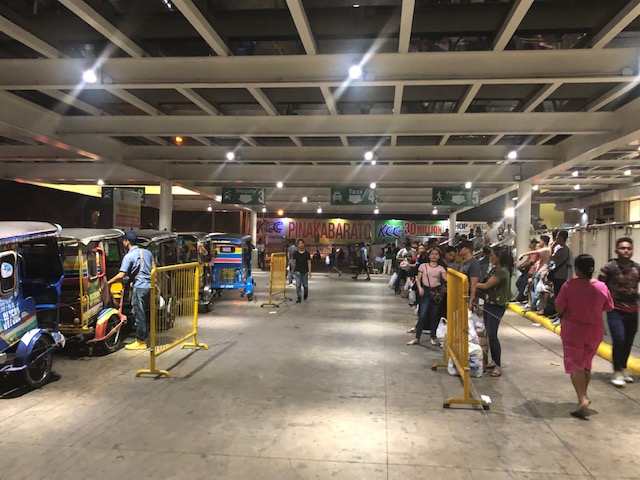 At the transport terminal of a major mall in the city, the lines are long for taxis. However, there are few taxis serving the city and the usual mode of transport that are basically 3-wheeler taxis (the tricycles) wait for passengers.
 Sign warning against abusive tricycle drivers who overcharge their passengers. There are penalties including a fine of 4,000 pesos (about 80 USD).
I will post more photos of Zamboanga scenes next month when we head to Zamboanga for some field work. That will give me the opportunity to take a lot of photos as we make an initial assessment of road safety around selected schools in the city.
–
Reservoir roads – Part 2
Previously, I posted about the reservoir roads we crossed when we traveled to Baler, Aurora last April 2019. It’s been a while since that post so before I forget, here are more photos of those reservoir roads taken during our return trip from Baler.
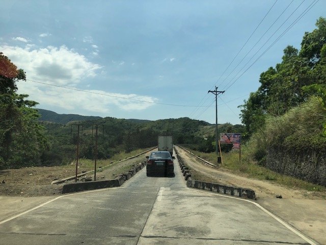 The two lane highway becomes a single lane section at the Diayo River Reservoir road
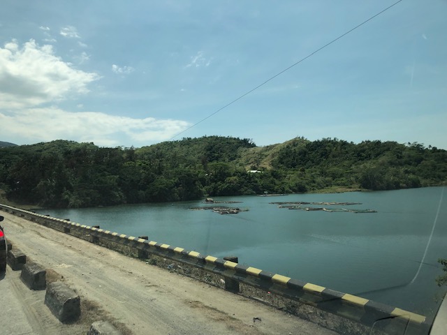
 A view of the fish pens at the Diayo River reservoir
 Pristine waters with the Sierra Madre mountain range in the background
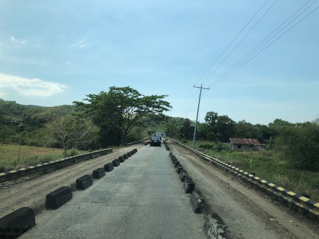 Approaching the end of the Diayo reservoir road
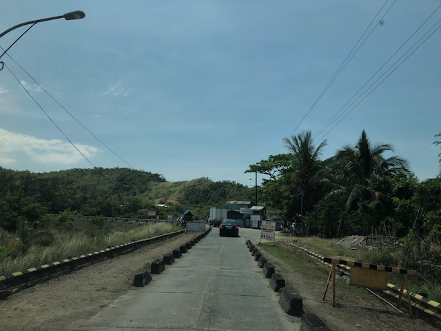 There is a checkpoint at the 2-lane section bridging the Diayo reservoir road with the Canili River reservoir road
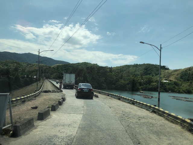 Vehicles entering the Canili reservoir road – this again is a one-lane, one-way section where vehicles from either direction would have to give way to either.
 Shoulder and fish pens
 Waters of the Canili River Reservoir with the Sierra Madre mountains in the background
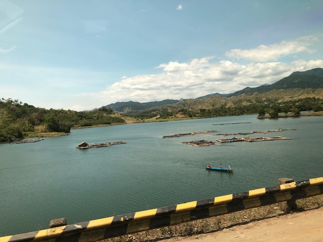 Fishermen on a banca – they looked like they were inspecting their fish pens
–
Alternate route via the Katipunan-Col. Bonny Serrano and C5-FVR Road intersection
I wrote previously about the alternate routes for eastbound vehicles given the ongoing rehabilitation of the Marcos Highway Bridge. In this post, I give some details on one alternative via C-5 and FVR Road (Riverbanks).
 The intersection of Katipunan Ave.-Col. Bonny Serrano Ave. now features a left turn signal for vehicles approaching from Blue Ridge. Previously, this was not allowed and vehicles would have had to go straight or take a right, and then make a U-turn if they wanted to head towards FVR Road. Otherwise, travellers would have to take the tunnel and make the U-turn at Eastwood.
 Vehicles queued along the C5 section approaching the intersection with FVR Road. The overpass in the photo is the section transitioning from the tunnel with an off-ramp past FVR Road.
 Vehicles approaching the now signalised C5-FVR Road intersection. Previously, too, this intersection did not have traffic signals. Vehicles coming down from Blue Ridge/White Plains could not go through to FVR Road but would have had to travel to the U-turn slot not far from here.
 The intersection of C5 and FVR Road – shown are vehicles turning from FVR Road to C5 southbound as well as those turning from C5 northbound to FVR Road.
–
