
Home » Bridges
Category Archives: Bridges
On at-grade crossings and footbridges
Here’s a quick share of an article on how at-grade crossings are generally better and preferred over footbridges:
When Footbridges Cost Lives and At-Grade Crossings Save Them
The article effectively articulates the case for at-grade crossings and presents the facts and references in support of these crossings. I will only add here that context is still important along with an appreciation or understanding of the volume of traffic and occupancy of vehicles along the roads. Commonwealth Avenue, for example, requires footbridges but there should be better designs for these footbridges than the current ones along this highway. I think we lack good designs that we can refer to and this leads to a summary dismissal of footbridges where they are actually most suitable.
–
Sentimental for Yokohama
A visit from a couple of professors from Yokohama National University (Yokohama Kokuritsu Daigaku) triggered the sentimental part of me. Among the materials presented were information about life on campus and in Yokohama, which is the second biggest city in Japan after Tokyo. There were also giveaways including a nice folder featuring a photo of Yokohama showing the campus on the foreground and many landmarks in the background.
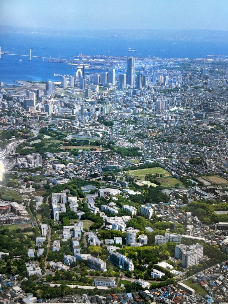
Landmarks in the photo include the Landmark Tower that used to be the tallest building in the country. There is also the Yokohama Bay Bridge that eventually connects to the Aqua Line. And, of course, the Port of Yokohama, which has long been one of the international gateways to Japan.
I have not been to Japan for more than a decade so I look forward to doing another sentimental journey to again visit familiar places and explore new ones.
–
On the collapse of a bridge in Isabela
A hot topic these days is the collapse of a span of a newly built bridge in Isabela. The alleged causes of the collapse included truck overloading, design flaws and inferior construction. Initial news reports and statements put the blame on the trucker and the designer with only a few suspicions thrown at the contractor. And then the current President of the country together with his DPWH Secretary inspected the site together. BBM was later quoted as saying the cause was a design flaw.
The bridge’s designer came out to state that it is not his fault. That could have been perceived as a self-serving statement until you delve into his explanation and check his credentials. The designer happens to be one if not the most experienced bridge engineer in the country. He obtained his Bachelor’s and Master’s degrees in reputable institutions (UP and Virginia Tech in the US, respectively). He taught bridge engineering in universities and is perhaps instrumental in civil engineers choosing to specialize in bridges. And he was a past president of the Association of Structural Engineers in the Philippines (ASEP). He knew what he was doing and the process requires for his design to be reviewed and approved by the DPWH prior to having the bridge constructed. If it passed the DPWH review and approval process, then it should be determined if the contractor was faithful to the execution of the design. Photos spreading over social media shows problems where the structure failed. And the quick assessment of many who are knowledgeable about structural engineering and construction is that apparently, the failure is due to the construction.
What happened? Wasn’t construction progress monitored? Were there inspections to determined whether the design was followed? One result of the suspicions being thrown at the people responsible for the bridge is the proliferation of ‘corruption’ as the root cause of the collapse. There are already clever memes of the bridge employing ‘steal design’ and ‘steal reinforcement’ obviously replacing ‘steel’ in the terms. While we inject humor into the situation, we cannot deny how serious the matter is and the implications of design specifications as well as the emergence of new truck types with higher payloads is to pavement engineering in general and bridge engineering in particular.
–
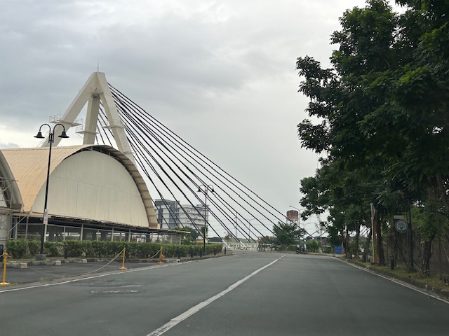
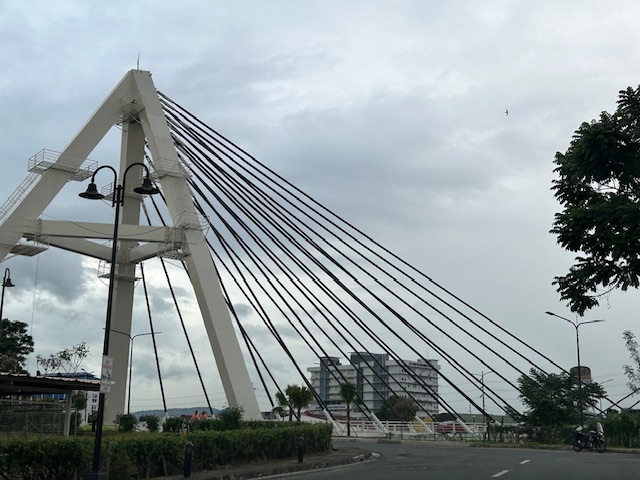
Another misplaced pedestrian footbridge?
There are soil tests currently being performed along L. Sumulong Memorial Circle across from Dela Paz National High School. This would probably be for the foundations of a pedestrian footbridge in the area that will, in theory, reduce if not eliminate pedestrian crossings in the area. On most days when there’s school, there are a lot of people, mostly students, crossing here. The result is traffic slowing down along both sides of the road that happens to be near the junction with Pinagmisahan Road. Is this enough reason to build a footbridge here? Probably and tempting enough for those who look for ‘easy’ solutions rather than come up with something that is less car-centric than a footbridge where the crossing is short and quick if done on the ground rather than via an overpass.
 Soil tests across from Dela Paz National High School.
There should be a solution here along the lines of complete streets rather than the usual pedestrian footbridge that’s a favorite of local and national government officials, planners and engineers who appear to be too lazy to come up with a more suitable treatment to improve safety in a high pedestrian and vehicle traffic area.
–
Bridges between Cebu and Mactan
Our route to the airport was via the Marcelo Fernan Bridge (the second bridge connecting Cebu and Mactan Islands). While on the bridge, I saw this opportunity to take a photo. That photo shows all three bridges currently connecting the two largest islands of Cebu Province.
 In the distance is the CCLEX Bridge (Cebu – Cordova Bridge) that connects Cebu City’s South Reclamation Project (SRP) and the town of Cordova in Mactan Island. CCLEX is a cable stayed bridge and the third to connect Cebu and Mactan. Closer is the first Mactan-Mandaue Bridge or simply First Bridge is a steel truss bridge. The bridge we were on, the Marcelo Fernan Bridge, is also a cable stayed bridge.
A fourth bridge is planned and should soon be constructed to the north of the second bridge.
–
Article share: on the collapse of a bridge in Baltimore
The recent incident of a container ship colliding with the bridge in Baltimore in the US has been trending and gone viral. There are also many articles now putting out their assessments of what happened, how the bridge collapsed, what troubled the ship, etc. There are also now articles discussing the implications or the impacts of this incident on logistics considering the collapsed bridge lies along a busy maritime route in the US. Here is an article that focuses on the former, providing analysis on how the ship caused the collapse of a major bridge.
Laris, M. Hassan, J. and Achenbach, J. (March 26, 2024) “How a cargo ship took down Baltimore’s Key Bridge,” The Washington Post, https://www.washingtonpost.com/dc-md-va/2024/03/26/how-key-bridge-collapsed-baltimore/ [Last accessed: 3/27/2024]
What also came to mind as I read reports about this incident is something similar that could happen to the CCLEX bridge connecting Cebu and Mactan Islands. Apparently, something similar already happened decades ago when a bulk carrier, Sanko Elegance, collided with the pier of the first Mactan Bridge. While the bridge did not collapse, it sustained damage that required it to be repaired and severely affected traffic between the two islands considering it was the only bridge at the time. It is important to note that the airport was on Mactan Island so it affected both passenger and freight flow for the province and others that connect and trade with it. While a former student who was much involved in the construction of the CCLEX bridge assured us in a briefing before that the bridge pier can withstand the collision of large vessels (perhaps the largest currently calling on Cebu ports), there may be larger and heavier ships in the future. The Key Bridge, after all, was hit by a container carrier that was larger than the ships transiting in the area when the bridge was designed and constructed.
–
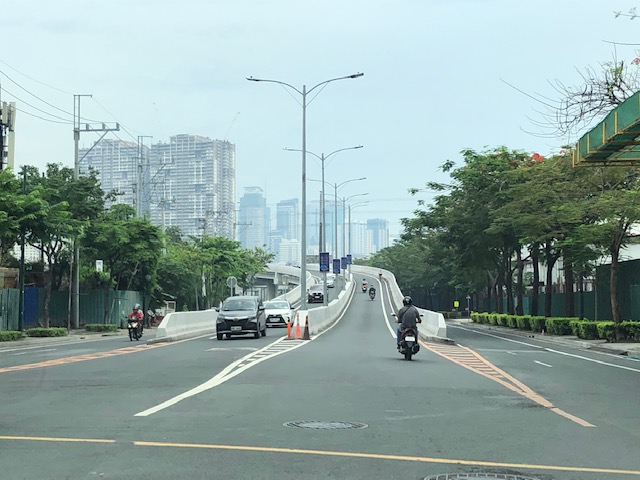
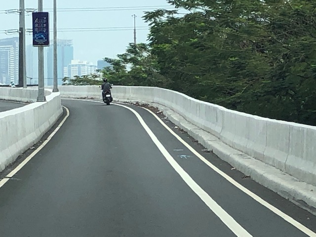
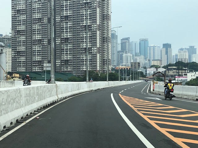
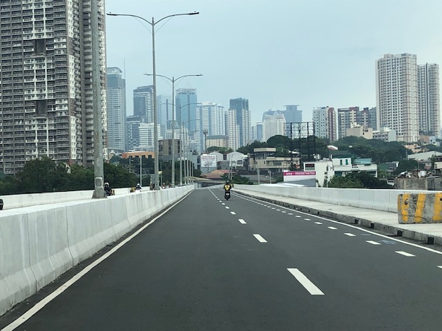
Circulo Verde Bridge
Many roads are quite congested these days during this Christmas season. I wouldn’t get into the causes of congestion but suffice it to say here that the seasonality of traffic would basically explain most of the congestion this time of the year. For a couple of times, I have been advised by Waze to take this alternate route going home via Eastwood City and Circulo Verde. This leads me to the East Bank Road of the Manggahan Floodway and the old De Castro Subdivision before eventually taking me to Ortigas Avenue Extension. Along this route is one of three new bridges crossing the Marikina River near where it connects to the Manggahan Floodway. You can see the floodgates as you cross the bridge. Here are photos of the Circulo Verde Bridge:
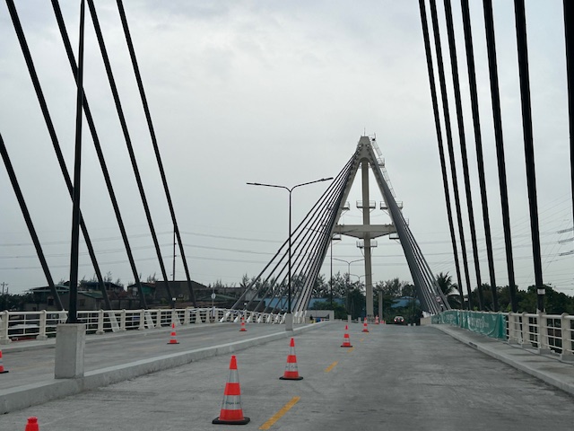
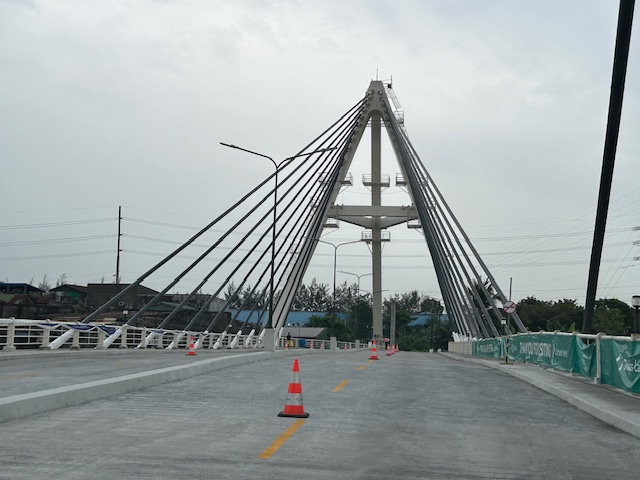
The bridge ends in an intersection with Amang Rodriguez Avenue. Going left eventually leads to Ligaya and Marcos Highway. Turning left immediately leads you to the intersection of Amang Rodriguez and the East Bank Road. Taking Among Rodriguez will lead to Rosario and eventually C5 while the East Bank Road takes you to Pasig and the Rizal towns of Cainta and Taytay. Further on leads to Angono and Binangonan. Not so many vehicles currently use this alternate route and Circulo Verde does not seem to be fully developed and occupied yet. Its a nice detour from the usually congested routes.
–
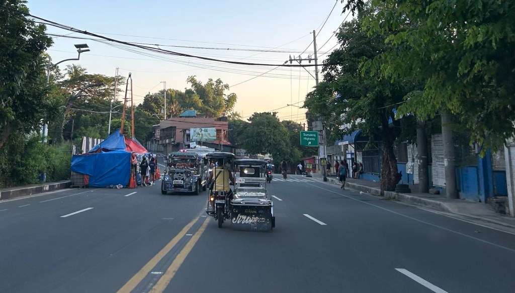
Footbridges along Sumulong Highway – Part 1
There are several new pedestrian footbridges along Sumulong Highway. The intent is simple – provide a safe crossing for people considering the high volume of traffic along the highway and the high risk of being hit by vehicles. Speed is an issue here considering the highway’s slopes and curves. Footbridges present a quick solution. However, it is not necessarily the most appropriate given the objective of improving safety. Perhaps slowing down or ‘calming’ traffic is a better approach?
 A new pedestrian footbridge near the San Pedro Calungsod Church. The intention is for people to use this footbridge to cross to or from the church. Considering the relatively narrow carriageway, crossing on road level is actually the shortest and most efficient way. However, the volume and speed of traffic is a major consideration here and elsewhere along Sumulong Highway.
 This pedestrian overpass or footbridge near Fatima University Hospital is intended for students and staff of the university and hospital. While many, even most, use the overpass, there are a significant number of people who prefer crossing directly on the highway. Before, there were school personnel, usually a guard, who helps people cross. I don’t see them anymore. Even Antipolo does not have traffic enforcers or aides in the area.
More on these pedestrian footbridges.
–
Kalayaan Bridge (BGC – Ortigas Center Link)
The Kalayaan Bridge, also known as the Bonifacio Global City (BGC) – Ortigas Center Link opened about a year ago and was supposed to ease traffic along the usual routes along EDSA and C5 that crossed the Pasig River. The new bridge is located between the EDSA and C5 bridges and is a more direct route to and from BGC if you reside in Pasig and choose the route to/from BGC via Pasig/Shaw Boulevard.
 The approach ramp to the bridge from the BGC side is in the vicinity of the Uptown part of BGC. The bridge goes over Kalayaan Avenue, which is one of the major access roads to BGC from C5 or EDSA, and J.P. Rizal Avenue Extension but there is access and egress to Kalayaan Avenue.
 The ramp is practically a single lane with painted bike lanes on either side of the bridge. There is noticeably no space for pedestrians on this bridge. That is only a curb on the right side. This lack of pedestrian provisions is a major flaw of this bridge.
 A lone cyclist traversing the bridge – the merge for traffic from BGC and vehicles from Kalayaan Avenue is seen downstream.
 Approaching the merging section (from this perspective; its diverging on the other side) of the bridge.
 A motorcycle merges with the traffic from BGC. Notice the chevron markings separating merging flows as well as the yield marking for vehicles coming from Kalayaan (i.e., priority is for vehicles coming from BGC). The bridge from this section becomes two lanes per direction. There is, however, a risky part for cyclists who will cross paths with vehicles coming from Kalayaan. Cyclists from BGC will have to cross a lane to get to the bike lane on the outer side of the bridge. There is no space for pedestrians along this bridge.
 There is only this part of the bridge where there appears to be a sidewalk. Was this really the design for this bridge? It is very obvious that many people failed in both design and implementation of this project.
 The view towards the Pasig side of the bridge. There are two lanes per direction and narrow bike lanes along the curbsides.
 There is an intersection at the end of the bridge but the road immediately at the right is closed to incoming traffic so right turns are currently prohibited despite the pavement markings that indicate they were allowed at one time.
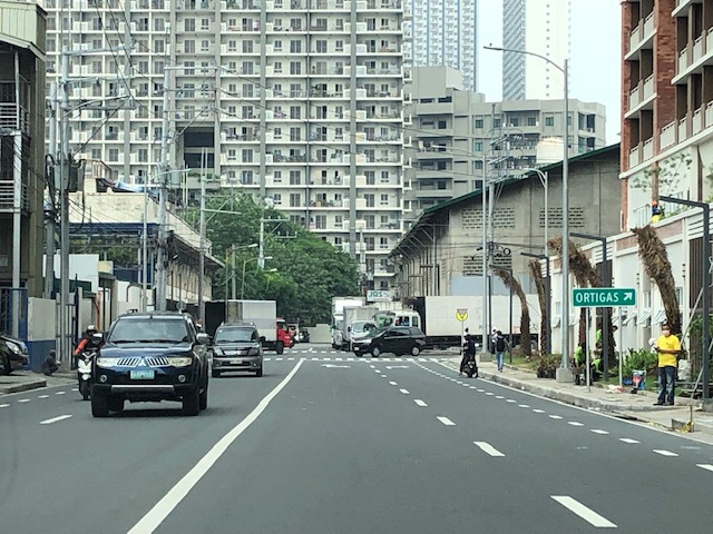 The road leads to this intersection which is in area generally referred to before as ‘Pioneer’. The area hosts many warehouses or storage buildings and I remember going here many years ago to check out the imported wood furniture and office surplus items. Turning right leads one to the area generally known as ‘Unilab’ because that was where United Laboratories had their plant and offices. It retained the property where now stands an events venue. Further on leads you to Kapitolyo and the Estancia Mall.
–
Inter-island bridges in the Philippines – Nice to have but not necessary at this time?
A news article came out yesterday, reporting on the shelving of several inter-island bridge projects as well as the progress of only 3 projects include the Panguil Bay Bridge. Many of these projects have been conceptualized a long time ago but were being fleshed out through various feasibility studies.
I’ve written before about these bridges, and had a healthy discussion among friends about the merits and demerits of such infrastructure when there are other, more urgent projects that would probably have higher impacts. One friend was involved in studying the connection between Panay and Negros islands, and had concluded that the cost can be justified by the economic benefits brought about by the bridge. I disagreed, stating the costs could cover modern urban transit systems at least in the major cities of Iloilo and Bacolod.
With limited resources and the likelihood of these projects being funded from various foreign loans make them unpalatable since these will mean more debt for the country. Also, these projects will benefit fewer people compared to other transport projects including modernizing public transportation and building bike lane networks. The latter kinds of projects are for daily commuters whereas the bridges are more for occasional travelers. What do you think?
–
