
Home » EST (Page 33)
Category Archives: EST
More quick wins for cycling
Metro Manila is basically not a cycling-friendly metropolis. Road space is practically devoted to motor vehicles and sidewalks are not wide enough to accommodate a lane for cycling or space that can be shared by pedestrians and cyclists. The latter observation on space is actually arguable considering that in Japan, narrow sidewalks and carriageways are usable for cyclists and people are generally respectful of others’ right-of-way and perhaps right to travel. As such, conflicts are minimized among pedestrian, cyclists and motorists.Such situations can also be achieved in Metro Manila and other Philippine cities as well. Key is to have a consciousness among people of everyone’s right to space. Also, there is a need to actively, persistently promote a safe interaction among road users such as what has been done by cycling advocates like the Firefly Brigade and what the MMDA is now doing with their initiatives promoting NMT.
Searching for some quick wins aside from the example of Marikina (where there are formal bikeways already in place), I’m featuring a few photos taken around Metro Manila that can be regarded as examples where there have been initiatives toward quick wins in promoting cycling. These include a couple of photos in the Malate, Manila area and couple along Marcos Highway in Pasig City.
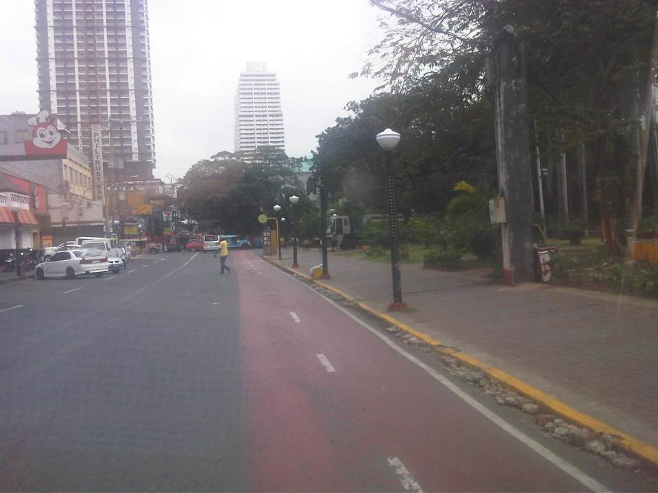 Bikeways in Malate
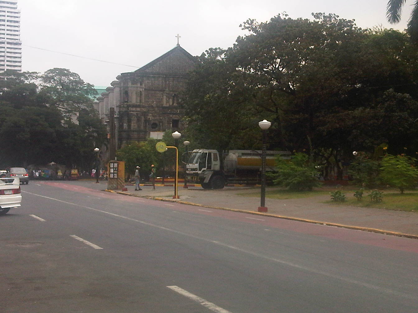 The Malate Church
 Segregated bicycle lane along Marcos Highway
 Cyclists along Katipunan Avenue (C-5)
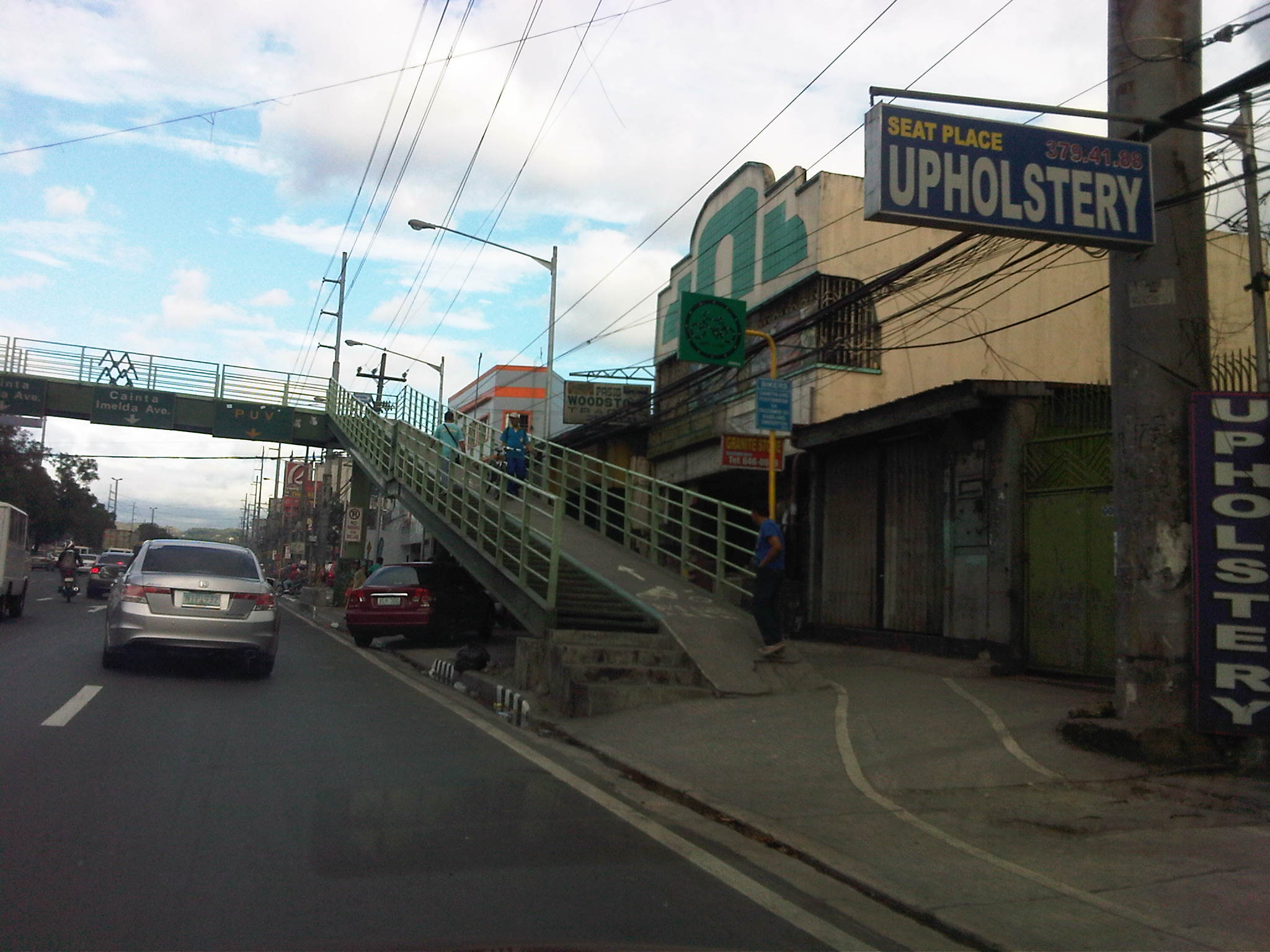 Segregated bikeway and overpass ramp along Marcos Highway
Except for the case of Katipunan, all the photos show space designated for cyclists. But Katipunan should be seen as a corridor that has a high potential for walking and cycling given the nature of the land use between Ateneo and UP Diliman. There are opportunities here to promote suitable non-motorized modes of transport while also working for a reduction in car use associated with the schools in the area. While there are still issues of encroachments (e.g., vehicles parked on the sidewalk, and depriving pedestrians and cyclists of their space) in the case of Marcos Highway, these are enforcement issues that LGUs like Antipolo City should address. I cite Antipolo because Marikina and Pasig are generally for cycling and have often reminded establishments to clear the space for pedestrians and cyclists.
–
“Make it easy!” – Encouraging cycling in the Philippines
The stretch between Magallanes and Ayala Ave. along EDSA is not exactly the most ideal of sections for a bicycle sharing program. However, its success would be symbolic of a small and quick win for cycling in a metropolitan area that’s been perceived to be unfriendly to walking and cycling. The Metropolitan Manila Development Authority (MMDA) could have chosen other sections like a longer one along Commonwealth Avenue or perhaps a section of Circumferential Road 5 (C-5)/Katipunan Avenue like the stretch from Aurora Boulevard to C.P. Garcia Ave. that connects three major academic institutions: Ateneo De Manila University, Miriam College and the University of the Philippines Diliman. Marcos Highway, which stretches from Masinag Junction in Antipolo City to Santolan in Pasig/Marikina, was rehabilitated and now has exclusive bicycle lanes along either side of the highway. And, of course, there is the bicycle network in Marikina City, which is the first city in the country to have bikeways.
A friend posted an article about “The Best Bike-Sharing Program in the United States.” It is a good read with lots of lessons for cities formulating their own bicycle-sharing programs. Such programs are made in part to encourage a shift from motorized transport to non-motorized modes like cycling and walking. With motorcycles becoming more popular in the Philippines, there should be strong efforts to promote bicycle use especially for short trips.
 Cyclists pedaling along UP Diliman’s Academic Oval where one lane has been designated for NMT.
Another perspective on promoting/encouraging cycling comes from Europe. I read an article that caught my fancy sometime last year and searched for it on the internet. The article appeared on the online version of the New York Times stating as its title: “To encourage biking, cities lose the helmets.” This is an interesting article because, for one, the author relates experiences in Europe that seem to be in contrast with those in the US. Particular mention is given to cyclists being required to wear helmets in US cities while many European cities are lax about this practice that is strongly associated with road safety.
There I said it. Road safety. A primary concern for many if not most road users including those using bicycles is safety. In the cities where cyclists share road space with motor vehicles, crashes involving NMT and motorized vehicles may result in fatalities. Studies in the US have linked fatalities and serious injuries to cyclists not wearing helmets. However, in European cities where there are more cyclists and drivers of motor vehicles are probably more aware and respectful of cyclists, the perception is that laxity in helmet use helps promote cycling.
In the Philippines, where mandatory helmet use for motorcyclists is a continuing enforcement challenge, strictly requiring helmet use for cyclists can also be a challenge and can be a turn-off for many would-be cyclists. Strict helmet-wearing requirements might be equated to cycling being a dangerous activity and therefore discourage a lot of people from using bicycles. Definitely, safety should not be sacrificed and where there are high risks but these sections need to be identified and enforcement along these should be firm. These include routes where bicycles and motor vehicles share the same road space. In routes, however, where there are exclusive space or lanes for cycling, perhaps the rule on helmets may be relaxed. Speed is one consideration here where those using bicycles for trips between their homes and workplaces or schools are not necessarily speedsters compared to those who cycle for recreation or for sport. Utilitarian cycling should be treated differently from recreational or sport cycling, which can be more risky and requires not only helmets but other safety gear as well.
–
Technical Papers on Sustainable Urban Transport
This is just a quick post to end this first month of the year. Following is a link to the website of the GIZ-supported Sustainable Urban Transport Project featuring the page with the latest technical papers. These represent some of the latest work on sustainable transport featuring good practices from developing and developed cities that can be used as guides or benchmarks for those dealing with transport issues in their respective cities or towns.
Link: Measuring Transport Efficiency
I’m sharing a recent article from Todd Litman of the Victoria Transport Policy Institute. The article is entitled Measuring Transport System Efficiency that appears in the Planetizen online journal. It’s a very good read for all, even those without planning or engineering backgrounds, who want to have an understanding of how to evaluate or assess transport systems according to the various aspects of a system (e.g., there’s a difference between conventional road planning and accessibility-based transport planning). Todd is as usual very good in discussing these topics given his experience and expertise, and is able to present it in a manner that is easily understood by any reader (well, except maybe the trolls we find anywhere online these days).
Happy reading!
–
Transport gaps
I first learned about the concept back in the 1990’s when I was a graduate student at UP majoring in transportation engineering. The concept on transport gaps was first mentioned in a lecture by a visiting Japanese professor as he was discussing about transport modes, particularly on which was suitable or preferable over certain travel distances and which could carry more passengers. Another time later and while in Japan, I heard about the concept during a presentation of a friend of his technical paper on public transport.
The figure below is one of many possible illustrations of the concept of transport gaps. In the figure, a distinction is made for mass transport and individual transport. As the original figure is likely taken from a textbook or a paper (probably from Japan), shown with a white background are the more conventional modes of transport including subways, urban and suburban railways, walking and a mention of the shinkansen (more popularly known as the bullet train). With a gray background in the original figure is a category on new urban transit systems that include monorails, AGTs and LRTs. If we attempt to qualify local transport modes such as jeepneys, UV Express, tricycles and pedicabs into the graph, the outcome can be like what is illustrated with different color backgrounds in the figure below.

The concept of transport gaps allow us to visualize which modes are suitable for certain conditions where other established modes of transport may not be available or viable. In the original figure, the gap in Japan is filled by new urban transit systems. In our case, gaps are filled by so-called indigenous transport modes such as jeepneys, multicabs, tricycles, pedicabs and even habal-habal (motorcycle taxis).
There are gaps in the Philippine case probably and partly because of the slow development of public transport systems such as the mass transport modes shown in the preceding figure. There was a significant gap right after World War 2 when the tranvia and other railways were destroyed during the war. That gap was filled by the jeepney. There was also a gap in the early 1990’s that was eventually filled by FX taxis. Such gaps can obviously be filled by more efficient modes of transport but intervention by regulating agencies would be required and rationalizing transport services can only be addressed with the provision of mass transport options complemented by facilities for walking and cycling that will complement these modes.
–
Parking issues in the Philippines
Saw this report from the GMA News YouTube channel that appeared in several of their news programs in Channels 7 and 11. It’s a good report as it is informative and the reporter did sufficient research on parking provisions stipulated in the Philippines’ National Building Code. I also found it interesting that one mall in Manila is already using an automated parking facility such as the one shown in the report. These multilevel parking facilities maximize the space required for slots and do not require much space for ramps or driveways. They are already found in cities in many other countries and should be considered in many other cities in the Philippines that are now facing parking problems.
Establishments such as shopping malls and other commercial areas are significant traffic generators. One aspect of trip generation is parking generation, and malls attract many people who tend to use private vehicles as their means for travel. This is especially true in Metro Manila and other major cities in the country where there are limited choices for public transport. For one, it is not so convenient nor comfortable for people taking public transport in Metro Manila. And so, a lot of people would bring their cars or motorcycles for shopping trips.
There is little information or data on parking generation characteristics in the country and it is unclear if the National Building Code’s provisions are sufficient. The NBC’s prescribes the number of minimum parking spaces for establishments but these are already being violated by many, which brings us to question the manner by which authorities approve designs for buildings given this requirement for parking.
–
Carbon footprint accounting tool development
The French Development Agency (AFD) is supporting the capacity and capability building for Greenhouse Gas accounting for transport projects in the Philippines through a project connected with the current initiatives on Bus Rapid Transit (BRT). Part of their engagement is the development of a tool for assessing carbon footprints of transport projects that can easily be used by officials and staff involved in evaluation work. Consultation seminars were conducted last July with various agencies and particularly the Department of Transportation and Communications (DOTC). And technology transfer is being undertaken through the National Center for Transportation Studies of the University of the Philippines Diliman, which will also be tasked with sharing the knowledge and providing training for the use of the tool for other users as well. A series of trainings were recently conducted by the consultant, Carbone 4, a Paris-based firm that was engaged by AFD for the project.
 Julien Blanc of Carbone 4, the firm appointed by AFD to develop the GHG accounting tool, explains the features of the software.
 NCTS Fellows, staff and graduate students participated in Day 1 of the training. Days 2 and 3 involved participants from various government agencies invited for the 1 day training.
 Everyone was required to have a computer to have hands-on experience on using the tool with exercises provided by Julien.
 In certain cases, Julien had to help out when some features did not work on some of the computers or when some participants had different results from what was expected from the exercises.
 The tool is MS Excel-based and employs macros for calculations and to produce the graphs illustrating outputs such as fuel efficiency profiles for vehicles.
The tool is not yet completed as there are still features to be included but it is already a working version that allowed us to input values and manipulate the tool for familiarity. The tool was developed using MS Excel and employs macros for calculations and the production of graphs to illustrate outputs such as comparative fuel efficiency profiles for vehicles having different engines. The tool should be compatible with computers running the Windows or OS-X (Mac) systems.
–
Mobility for all?
We chanced upon the fellow shown driving an electric vehicle below with what was apparently his wheelchair mounted behind the vehicle. And then I remembered seeing other people in wheelchairs traveling along the traffic lanes of similar streets, and exposed to the high risks of being sideswiped or bumped by motor vehicles. These and other persons with disabilities (PWDs) are among what we usually categorize as transportation poor or those who are marginalized when traveling. Marginalization comes in many forms including the lack of or inadequate infrastructure and facilities for PWDs. Sidewalks are usually narrow, making it difficult even for able people to use, and definitely inaccessible to persons needing the space to move about.

I remember that Tahanang Walang Hagdanan (translated Home without stairs or steps) is located in Cainta, Rizal. We used to see PWDs on their wheelchairs traveling along Bonifacio Avenue in the poblacion to go to church on Sundays. Often, jeepneys, buses and cars come very close to them that you might wince at the near misses of what could easily be a tragedy just waiting to happen given the odd mix of people on wheelchairs mixed with motorized traffic along the carriageway. The local government should have exerted more efforts to put up facilities adequate for the needs of pedestrians in general and PWDs in particular; the latter considering the significant number of constituents requiring such facilities. On a map, you can even see that Tahanang Walang Hagdanan is just beside the Cainta Local Government Complex. I believe the provision of basic facilities to enhance the safety and mobility of PWDs is just one example of what a city or town should be doing towards realizing inclusive transport or inclusive mobility at their level. It would definitely go far in promoting people friendly, sustainable transport for all.
–
Walking and parking in Quezon City: Tomas Morato
Continuing on the series featuring pedestrian and parking facilities in Quezon City, featured in this post is the case of Tomas Morato Ave. Like Visayas and West Avenues, the pedestrian sidewalks and off-street parking spaces along the avenue were constructed to address the lack of off-street parking facilities and sufficient pedestrian walkways along streets that had significant commercial development. It should be noted, however, that the lack of parking spaces is due likely to many establishments not complying with the minimum standards set under the National Building Code and City Hall’s approval of plans and construction despite this non-compliance (note: LGUs issue the building permit upon approval of plans including what is supposed to be a review of compliance to various standards.).
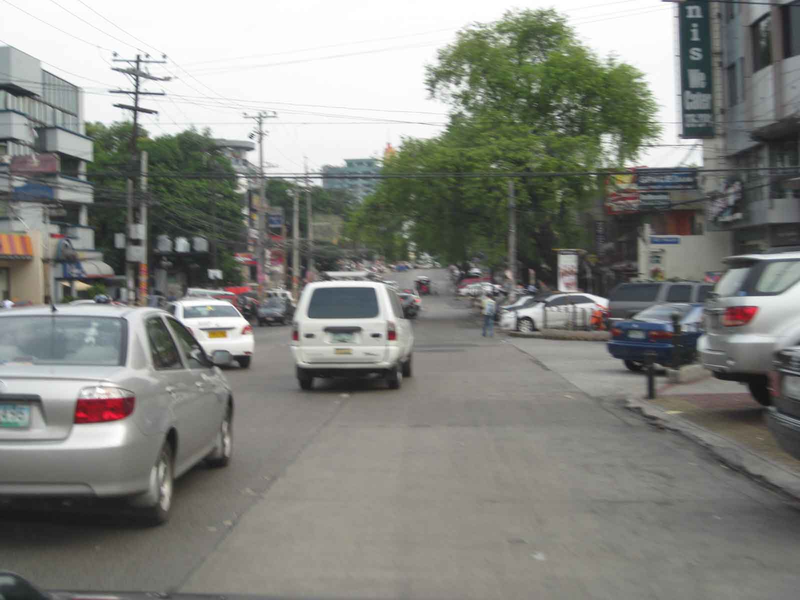 A view of a stretch of Tomas Morato Ave. – note the absence of or weathered pavement markings and the vehicles parked at spaces constructed by the Quezon City government. Space was relatively more limited along Morato and so much of the spaces available were allocated for parking. Pedestrians, thus end up walking along whatever remained or along the edge of the carriageway.
 Establishments such as the many restaurants along the street. From a purely transport planning perspective, one wonders how these establishments were able to get approval from City Hall without having enough parking slots for their customers. These are not your neighborhood turo-turo or karinderya types and so they will generate a lot of vehicle traffic and require more parking spaces in addition to the token slots they provide.
 Some of the larger and older establishments along Morato already have sufficient parking spaces and these were upgraded by the LGU to have uniformity along the road.
 The off-street parking spaces definitely benefited traffic as road capacity is not reduced by on-street parking. There are still problems though especially during noon and night time when the restaurants generate traffic resulting to some vehicles parked or standing along the street.
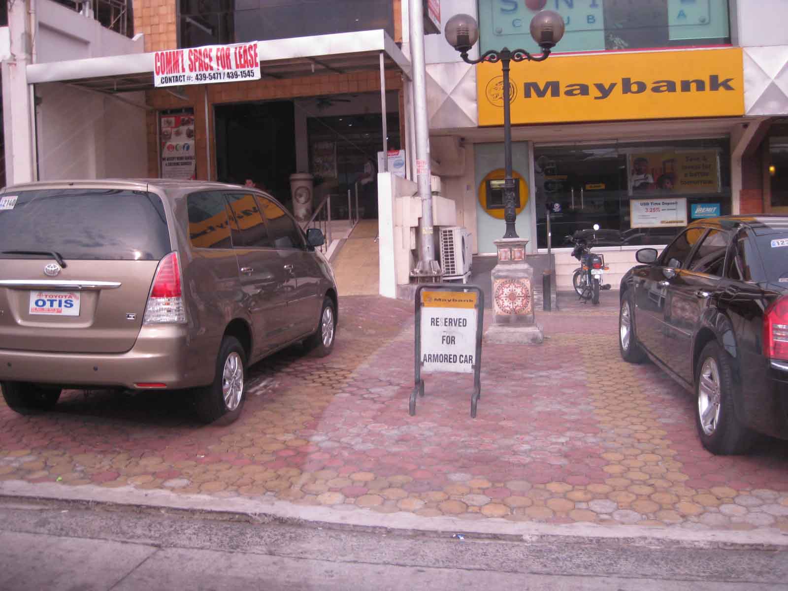 One issue along the street are public parking constructed using public funds being reserved by establishments such as this bank along Morato.
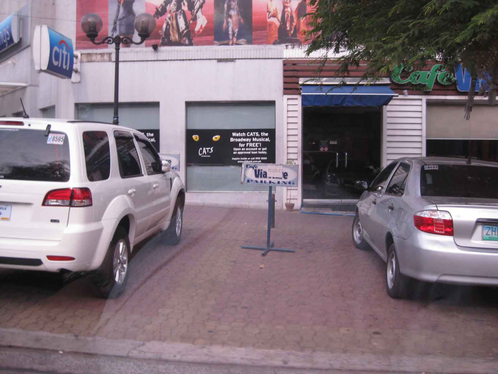 Another case concerns slots reserved by restaurants like this one.
There are still issues concerning the construction of parking spaces for establishments who have not complied with building standards (minimum parking spaces). These issues are rooted on the use of public funds that otherwise could have been used for other, perhaps more important purposes such as healthcare or classrooms. However, one should not lose sight of the fact that there are benefits derived from these parking spaces from the perspective of traffic flow. Moreover, the inclusion of pedestrian facilities definitely enhance safety. These are benefits which are often quite difficult to quantify in monetary terms but contribute to better quality of life for the general public. Such projects also show that the city is doing something to improve public facilities unlike the cases of other LGUs that have sufficient revenues but seem to be lacking in the provision of similar infrastructure.
–
Eastbound walk along Marcos Highway
I took a couple of photos of the walkway and bikeway along the eastbound side of Marcos Highway while traveling to Antipolo one weekend. This used to be a wide, open canal along the eastbound side of the highway, which forced pedestrians and cyclists to use the outermost lane of the carriageway. Such exposed people to a high risk of being sideswiped by motor vehicles that often speed along the sections shown in the following photos.
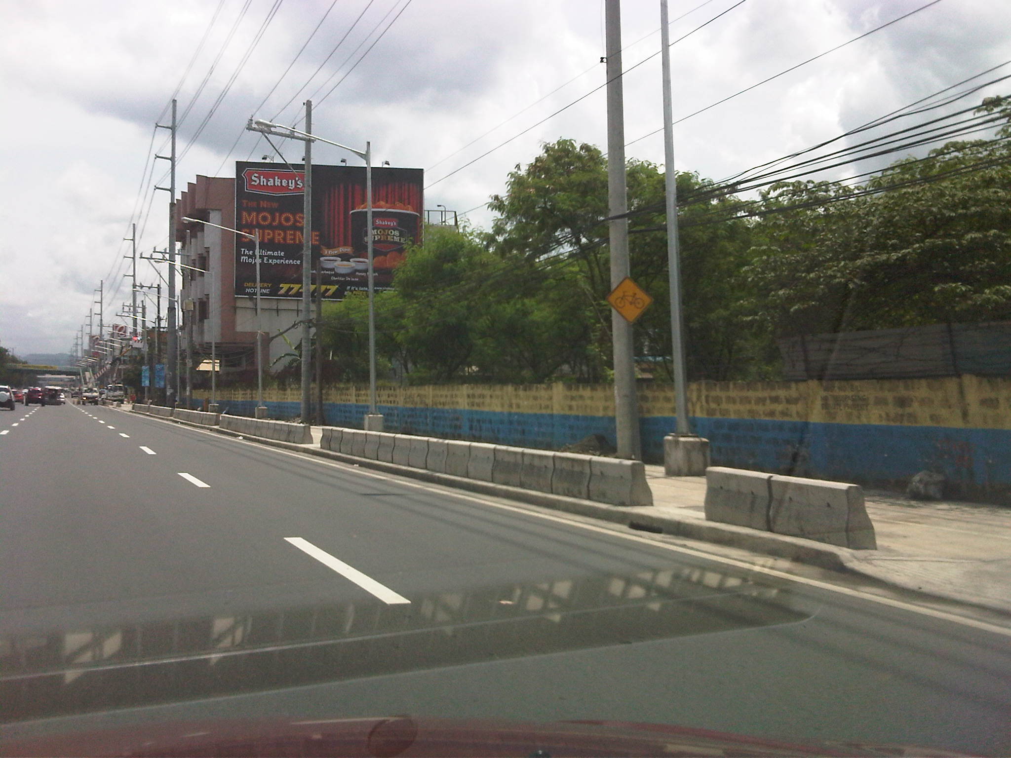 Sign indicating bicycle path along the eastbound side of Marcos Highway. The space is supposed to be shared with pedestrians. Concrete barriers are supposed to provide protection from wayward vehicles.
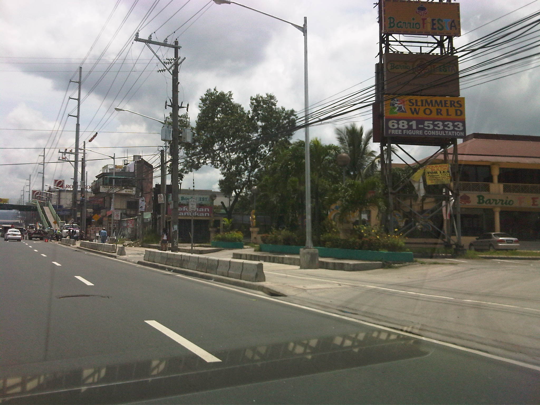 Treatment at driveways of establishments along Marcos Highway. Notice the white line delineating space for pedestrians and cyclists. The overpass at Dela Paz can be seen downstream in the photo. The overpass has a ramp for cyclists and persons with disabilities.
The pedestrian and cycle paths along both sides of Marcos Highway greatly enhance the safety features of the highway. These will especially be important come summer, particularly during the month of May, when many people take the Marcos Highway route to Antipolo Church in what is one of the most popular (if not the top) pilgrimages in the Philippines.
–

