
Home » EST (Page 32)
Category Archives: EST
U.P. Town Center
Passing along the University of the Philippines’ part of Katipunan, one will see a new development at the area where the UP Integrated School (UPIS) is currently located. The UP Town Center is being promoted as part of a university town center concept and is the second major Ayala development on UP land after the Technohub in the north side of the 493-hectare campus. The surrounding area to the newly built Town Center will most likely host business process outsourcing (BPO) including call centers that currently populate Technohub.
I learned that the development’s design was reviewed on the UP side by a team that included faculty members from UP Diliman’s College of Architecture and School of Urban and Regional Planning. I assume that they were able to cover most if not all the aspects of the design for this particular development and the rest that will follow once UPIS moves to the main campus and the entire lot is developed much like into what Technohub is at present. I would assume that they provided recommendations to Ayala and that these recommendations were used to improve on potential issues with the development. However, my worry is that the transport or traffic component of the design (i.e., transport impact assessment) was not sufficient for the traffic that will be generated by the development. While Technohub had no serious problems regarding traffic as it was along the wide Commonwealth Avenue, the Town Center was located in the narrower C-5 that is the route for much private traffic as well as trucks.
Let us look at the potential problems for the UP Town Center in relation to transport and traffic. For one, the development is close to a major intersection, the junction of Katipunan-CP Garcia. The current traffic signal cycle for the intersection allows for continuous through traffic for the northbound side of Katipunan. Thus, traffic in front of the development, which is along this same northbound side of C-5 will be continuous. Vehicles slowing down to enter the parking lots at either end of the building will likely slow down traffic along C-5. Meanwhile, there are no driveways or bays for transport to load/unload passengers in front of the building. Instead, the driveway is right after Katipunan-C.P. Garcia intersection and does not appear to be designed for jeepneys, taxis and cars will, instead, likely stop on the road and such will mean one lane of C-5 will be occupied, contributing to a decrease in the capacity of the roadway.
Another thing is the parking. Currently, there are limited spaces as understandably the area is still being developed and the lots are temporary facilities. I presume that there will be more spaces available soon considering the parking generation characteristics of such types of developments that tend to attract car-owning people though perhaps the target is a broader range of customers.
And then there are the issues regarding walking and cycling. One friend was asking if there were bicycle racks at the Town Center. I saw none (yet?) but perhaps there will be facilities for cyclists. As for walking, this section of Katipunan is more walkable compared to the segments in front of Ateneo and Miriam where cars seemed to be parked or standing everywhere and pedestrians are forced to walk on the road. Along the side of the U.P. Diliman campus, there are sidewalks where pedestrians can safely walk. On the Town Center’s side, there are also sidewalks and we hope these can still be improved once construction is at full swing. Perhaps what requires attention for both pedestrians and cyclists are crossings. With the increased traffic along C-5 due to the opening of the Luzon Avenue overpass crossing Commonwealth, it has become more dangerous to cross C-5. As such, there is a need to address such issues as surely there will be significant pedestrian traffic crossing to and from the Town Center.
 No driveways or bays for public transport? Construction work continues for the soon to open UP Town Center even as the fences are taken down to reveal a modern building that will host restaurants and shops.
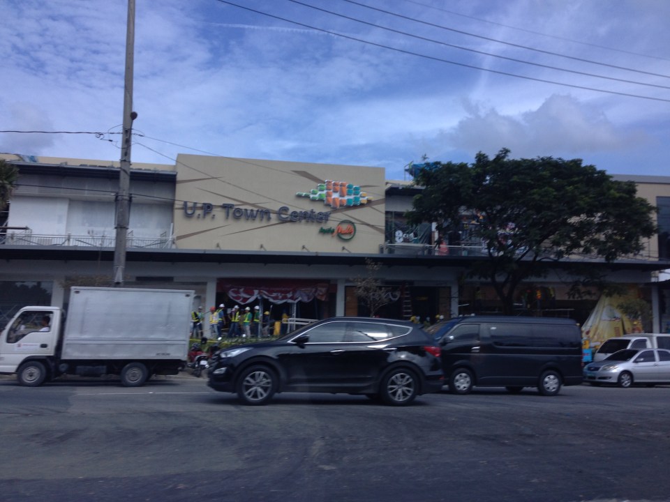 The UP Town Center is already attracting traffic as some restaurants and shops have already made “soft” openings.
A colleague once made the comment that the Town Center was not really for UP but, like the Alabang Town Center, was for the posh residential subdivisions in the area. These include nearby La Vista, Loyola Grand Villas and Ayala Heights subdivisions. Also, it will likely attract more car users than public transport users as locator restaurants and shops are mainly upper-middle to upper class. There are no Jollibees, Chowkings or McDos here. For now, the developer and UP Diliman deserves to be given the benefit of the doubt in as far as the development’s design is concerned. Perhaps the issues I mentioned above will be addressed once the entire area leased to Ayala would have been fully developed. And until then, there would be opportunities to check and ascertain if the development is indeed people friendly and something that can be called a university town center and not just another commercial development that attracts traffic.
–
Establishing an ITS society in the Philippines
The establishment of an ITS society in the Philippines is an idea that’s almost 2 decades old. I first learned about Intelligent Transportation Systems (ITS) while I was a graduate student at UP Diliman taking up transportation engineering in 1994. The interest was stoked by more exposure to ITS when I studied in Japan later and participated in the ITS World Congress held in Seoul, Korea in 1998. I presented a paper at the congress and was able to go around to look at the cutting edge in technology at the time that was applied to transportation. I also learned that there were three big ITS organizations at the time – one in the US (ITS America), in Europe (ERTICO) and in Asia (VERTIS).
I recall attending one meeting in 2002 when Dr. Ricardo Sigua, then on his second stint as Director of the National Center for Transportation Studies of the University of the Philippines Diliman presented the idea to a group that included then Department of Electrical and Electronics Engineering Chair Rowena Guevarra. The latter is now Executive Director of the Department of Science and Technology’s Philippine Council for Industry, Energy and Emerging Technology Research & Development (PCIEERD). At the time, the conclusion was that it was still premature for the Philippines to establish a formal ITS society considering that there were few who were actively involved in ITS research. I thought privately that people still had little understanding or appreciation of ITS and, at UP at least, we were not yet in an environment that enabled collaborative work among departments who are supposed to have the expertise to undertake ITS related research and perhaps be the core group for a society.
Flash forward to the present, there is an ITS program currently being funded by the DOST-PCIEERD and under it are several research projects. One project is already underway and is being implemented through a collaboration among civil engineering (transport), electrical and electronics engineering and computer science faculty and students of UP Diliman. There are also several projects in the pipeline from Ateneo, DLSU and Mapua. These researches combined with various ITS applications with the private sector (e.g., electronic toll collection, variable messages, apps for commuting, etc.) means there is much more awareness nowadays for ITS and its benefits. This may also mean that the time is right and ripe for an ITS society to be established to further its applications.
 Dr. Ricardo Sigua of the UP College of Engineering presenting on the proposal for the establishment of ITS Philippines.
On the forefront of the establishment of an ITS society in the Philippines is Dr. Ric Sigua, Professor at UP Diliman’s Institute of Civil Engineering and Fellow at the NCTS. He has been very active in ITS research and is currently project leader of the Philippines Manila Advanced Traffic Information System (PhilMATIS) project that is funded by the PCIEERD. Dr. Sigua has strong links with ITS Japan and is representing the country as observer in the regular ITS Congresses including the one to be held in Tokyo in October. During the ITS forum hosted by the NCTS in September 4, it was agreed that a core group will be established that will work towards forming a formal society. This will be led by the academe but will have the support of the private and government sectors. We look forward to what may be called ITS Pilipinas or ITS Philippines in the near future.
–
What is the context for electric tricycles in the Philippines?
The NEDA Board recently approved six projects that included one that will be promoting electric vehicles throughout the country. Entitled “Market Transformation through Introduction of Energy Efficient Electric Vehicles Project” (formerly Market Transformation through Introduction of Energy Efficient Electric Tricycle (E-Trike) Project), the endeavor seeks to replace thousands of existing conventional motorized 3-wheelers (tricycles) with e-trikes and to develop and deploy charging stations for these vehicles. While I have nothing against electric vehicles and have supported their promotion for use in public transport, I am a bit worried about the context by which electric tricycles are being peddled especially the part about equating “transformation” with “replacement.”
First, it is a technology push for an innovation that has not been fully and satisfactorily tested in Philippine conditions. The deployment of e-trikes in Bonifacio Global City is practically a failure and a mode that was not suitable from the start for the area it was supposed to serve (i.e., while there were already jeepneys serving the area, there were also the Fort Bus services and plans for a BRT linking the Ayala CBD and BGC. There are now few (rare sightings) of these e-trikes remaining at the Fort, as most of these vehicles are no longer functioning due to problems regarding the batteries, motors, and issues regarding maintenance. Meanwhile, the e-trikes in Mandaluyong, a more recent model, have also been difficult to maintain with one case reportedly needing the unit to be sent back to China for repairs.
Second, the e-trikes are a whole new animal (or mode of transport). I have pointed out in the past including in one ADB forum that the 6 to 8 seater e-trike model is basically a new type of paratransit. Their larger capacities mean one unit is not equivalent to one of the current models of conventional tricycles (i.e., the ones you find in most city and municipality around the country). Thus, replacement should not be “1 e-trike : 1 tricycle” but perhaps “1:2” (or even “1:3” in some cases). This issue has not been resolved as the e-trike units continue to be marketed as a one to one replacement for conventional trikes. There should be guidelines on this that local government units can use, particularly for adjusting the number of franchises or authorized tricycles in their respective jurisdictions. Will such come from the Department of Energy (DOE)? Or is this something that should emanate from Department of Transportation and Communications (DOTC)? Obviously, the last thing we like to see would be cities like Cabanatuan, Tarlac or Dagupan having so many e-trikes running around after they have replaced the conventional ones, and causing congestion in the cities. Emissions from the tricycle may have been reduced but emissions from other vehicles should be significant due to the congestion.
Third, the proliferation of e-trikes will tie our cities and municipalities to tricycles. Many cities already and definitely need to upgrade their public transport systems (e.g., tricycles to jeepneys or jeepneys to buses, and so on). Simply replacing tricycles with electric powered ones does not effect “true” transformation from the transport perspective. Is the objective of transformation mainly from the standpoint of energy? If so, then there is something amiss with the project as it does not and cannot address the transport, traffic and social aspects of the service provided by tricycles (and other modes of transport).
So what is the context for the e-trikes or conventional tricycles? They are not even under the purview of the Land Transportation Franchising and Regulatory Board (LTFRB) as they are regulated by LGUs. Shouldn’t the DOTC or the LTFRB be involved in this endeavor? Shouldn’t these agencies be consulted with the formulation of a framework or guidelines for rationalizing and optimizing transport in our cities? These are questions that should be answered by the proponents of this project and questions that should not be left to chance or uncertainty in so far as the ultimate objective is supposed to be to improve transport in the country. I have no doubt that the e-trikes have the potential to improve air quality and perhaps the also the commuting experience for many people. I have worries, however, that its promise will not be kept especially in light of energy supply issues that our country is still struggling with and deserves the attention of the DOE more than the e-trikes they are peddling.
–
Here’s to walking!
I was lucky to be able to take a couple of photos as our vehicle passed along Marcos Highway to be able to capture images of people walking along the sidewalks between Ligaya and De la Paz. The driver maintained his position along the right side of the road so I had a good view of the pedestrians and cyclists making their way from Ligaya in the general direction of De la Paz and the two shopping malls downstream (the signs of one mall are visible in the photo).
Ligaya is a transfer point for people traveling to and from Pasig, Pateros and Marikina who use the jeepneys connecting these towns. They typically get off at the junction of Marcos Highway and Amang Rodriguez. From here, one can take a jeepney to the towns of Rizal or perhaps to Quezon City (Cubao). These days, however, it is not so easy to get a ride at Ligaya and one cause of congestion emanating from the junction are people taking two lanes of the road as they position themselves to board stopping jeepneys. Instead of waiting for the jeepneys and whatever limited seats are available, many people have decided to walk towards the junction with Imelda Avenue. There located are commercial establishments including two shopping malls and the terminals of public transport whose routes terminate at the area. There, it is relatively easier to get a ride home though during the early evenings it can also be difficult to get a ride to the Masinag and Cogeo districts of Antipolo (And that’s part of the reasons why the LRT Line 2 extension is necessary!).
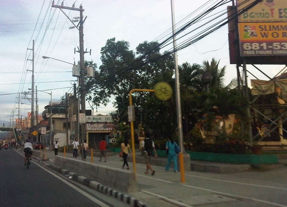 Pedestrians walking towards De la Paz or the shopping malls a little further on. There is actually a bicycle lane beside the pedestrian walk similar to how the Marikina Bikeways were designed but most cyclists opt to use the curbside lane of Marcos Highway.
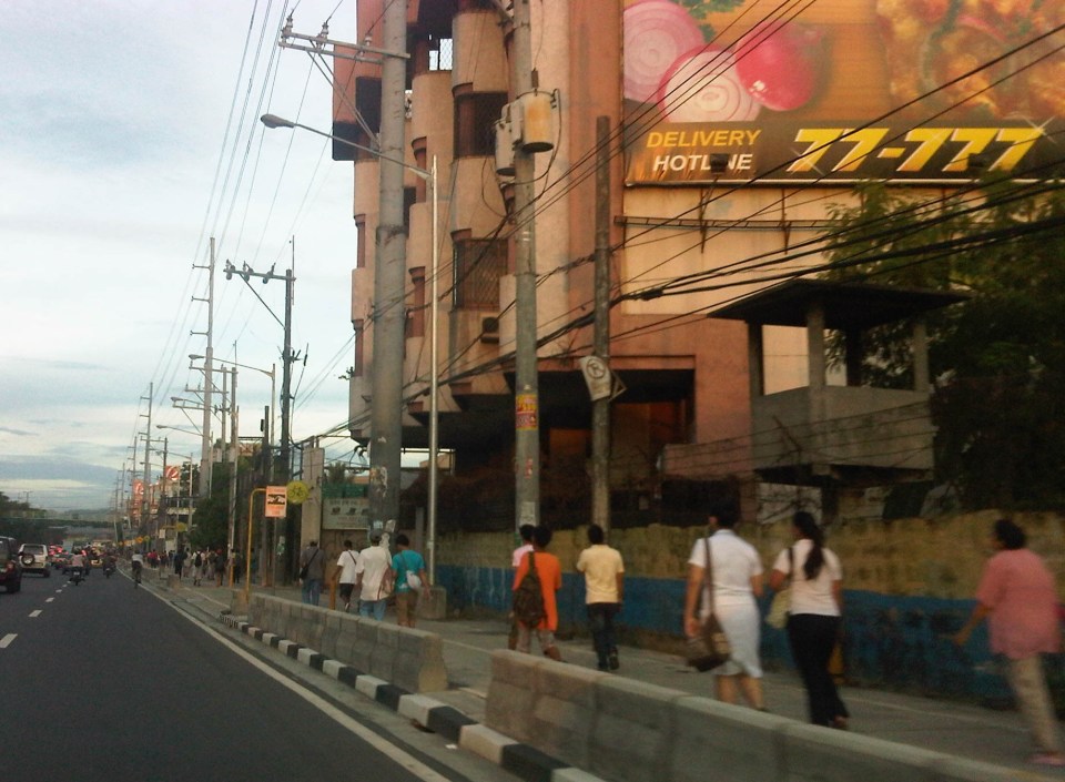 Pedestrians walking from Ligaya include workers and students.
The walkways are generally clean and well-lit during the night time, though I think portions are still quite dark. I also think the more people opting to walk means it can be safer to walk (strength in numbers?). The observation that many people walk encourages other people to do so, and is a deterrent for unlawful elements of society. Perhaps to further reinforce the safety and security aspect of walking, Pasig Police or the MMDA could have some of their personnel walk along this path. Police visibility here, especially at night, would help deter muggers and hold-uppers who might see the pedestrians as potential victims.
–
Other issues on second hand imported vehicles
Much of the discussions regarding imported second hand vehicles focus on issues of taxation (customs) or registration and allegations of smuggling. The entry of used vehicles and their significantly lower-priced sales have been issues particularly to the established automobile manufacturers and dealers in the country. Importers and dealers of vehicles coming from these special economic zones/free ports claim that they are serving people who want to own a vehicle but couldn’t afford brand new or even second hand vehicles. While this may be true for some cases where regular cars, vans or even SUVs are concerned, the perception is that these importers and dealers are mainly serving a demand for luxury vehicles like sports cars, limousines and high end SUVs from prominent brands such as Audi, BMW, Lexus, Mercedes Benz, Porsche, and Hummer, and even Ferrari and Lamborghini.
On the surface, the claimed benefits to people seem an acceptable and even noble intention. However, this is further from the truth and there is the strong opinion that all this is really just for money, plain and simple. It is also not enough justification for the negative impacts of these used vehicles, which do not go through a process of being tested for compliance with emission standards as well as for safety. The latter concern is for vehicles that undergo “conversion” from their original right hand drive set-up to become left hand drive vehicles, which are the norm in the Philippines. There is also the issue of fuel efficiency for these used vehicles and the maintenance required for these to stay in A-1 condition. All these concerns stack up and clearly show the folly of the importation of used vehicles through the economic zones.
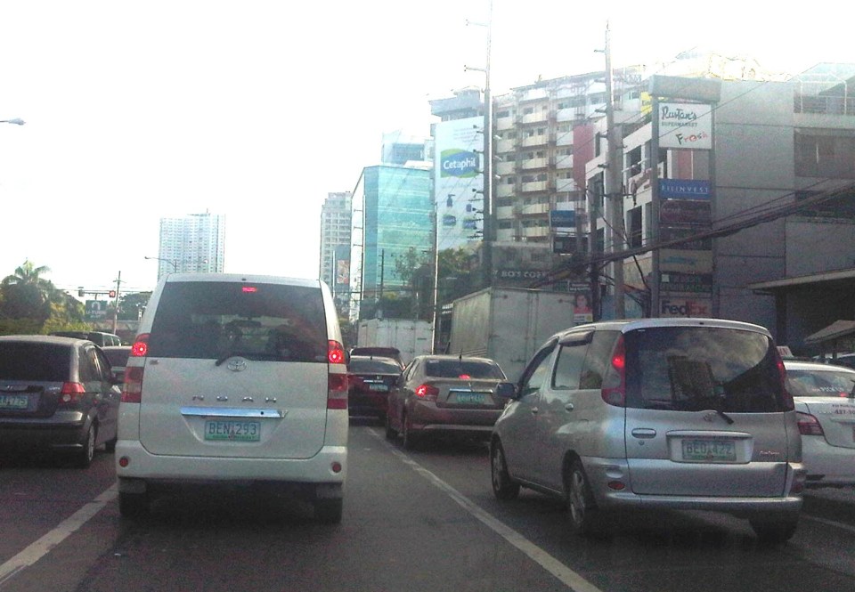 I saw these two vehicles along Katipunan as we were coming from a meeting one afternoon. Both models were not sold by Toyota Motor Philippines and conspicuously have license plates bearing the letter “B” as a first letter, indicative that they were registered in Region 2. Region 2 is where Port Irene, Cagayan is located and which is being alleged as the source of a lot of used vehicles linked to anomalies in taxes and registration. More serious are concerns pertaining to emissions, safety and fuel efficiency.
–
UP Village transformation
UP Teachers Village in Quezon City is a good example of a residential area that has been transformed over a few years. This transformation was enabled mainly by its streets, particularly Maginhawa Street, being open to general traffic. Teachers Village roads are often used as short cuts between major roads like Commonwealth Avenue and C-5/Katipunan (via C.P. Garcia Street), and Elliptical Avenue, Kalayaan Avenue and V. Luna. Due to both significant foot and vehicle traffic, what used to be homes along the streets have become restaurants, shops, offices, or even schools. There are many cases of homeowners who have found their houses less livable due to the noise and air pollution attributed to traffic (Note: There are so many tricycles in the area.). These have sold their property to people who used it instead for business. Unfortunately, despite the approval of the local government of the changes in land use, most establishments clearly have not satisfied basic building code requirements such as those for parking and pedestrian facilities.
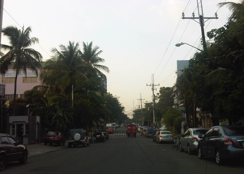 On-street parking along both sides of Maginhawa Street in Teachers Village
 Schools and commercial establishments like restaurants and shops are found along Maginhawa Street. Most do not have adequate parking spaces for customers.
Maginhawa Street has been widened to accommodate more vehicular traffic. Unfortunately, widening the road has only led to more on-street parking as shown in the preceding photos. People also are often forced to walk along the carriageway because because sidewalks are usually blocked, with some establishments using the space for al frresco set-ups. Developments need to be inspected to check if they comply with basic requirements such as parking and pedestrian facilities. Development and land use changes can be justified but proponents must be made to comply with the minimum requirements of the National Building Code in order to mitigate potential impacts to the community.
–
Streets of Olongapo: Rizal Avenue
Olongapo City is located in the Province of Zambales, the only city in that province, and beside the Subic Freeport. It is a pioneer in public transport service innovations in the form of the first initiative on the color-coding of jeepneys according to their routes. Despite what seemed to be forever being linked to the Freeport in terms of economic development, the city has enjoyed continued growth and is currently experiencing more challenges attributed to this growth. Among these challenges are those pertaining to traffic congestion and public transport services for the city. A Transportation and Traffic Management Plan Study was conducted by UP Diliman through the National Center for Transportation Studies and is up for formal adoption of the city.
Following are photos taken along the city’s main street, Rizal Avenue, where many of the city’s transport and traffic problems are manifested.
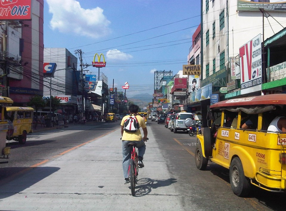 Cyclist pedaling along Rizal Avenue beside a yellow jeepney taking passengers at the designated stop at curbside. Downstream are parked vehicles along the road.
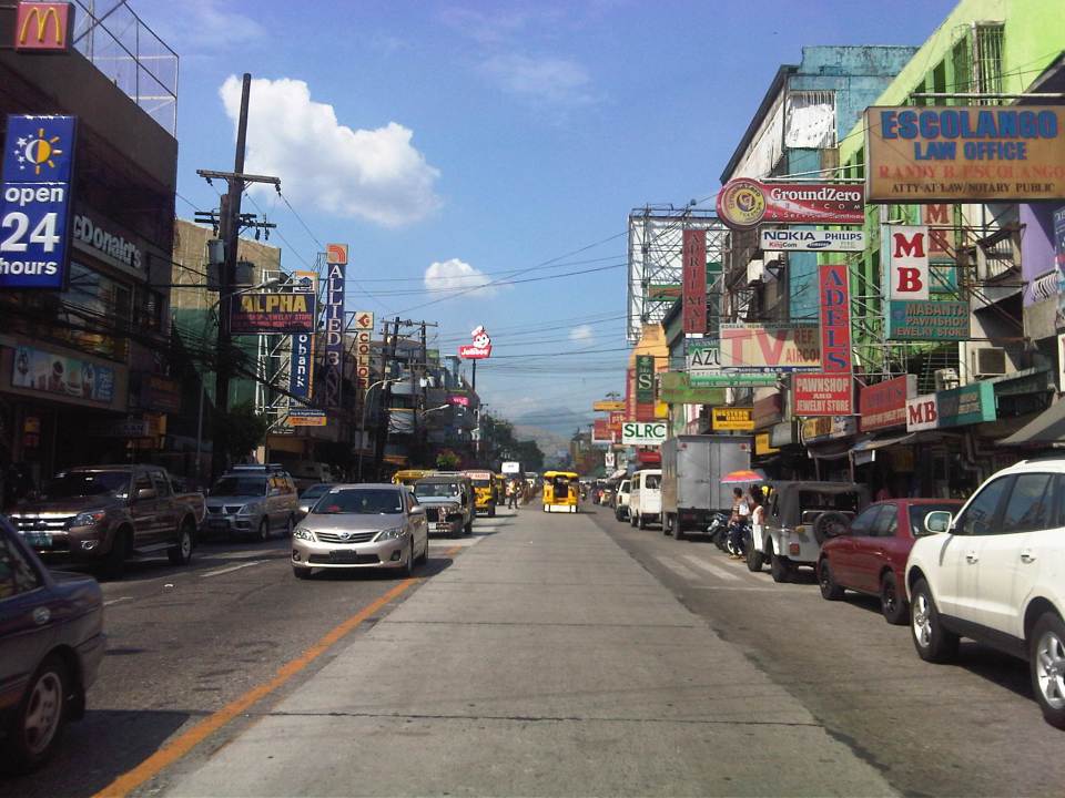 More parked vehicles at either side of Rizal Avenue effectively reducing road capacity for the 4-lane street.
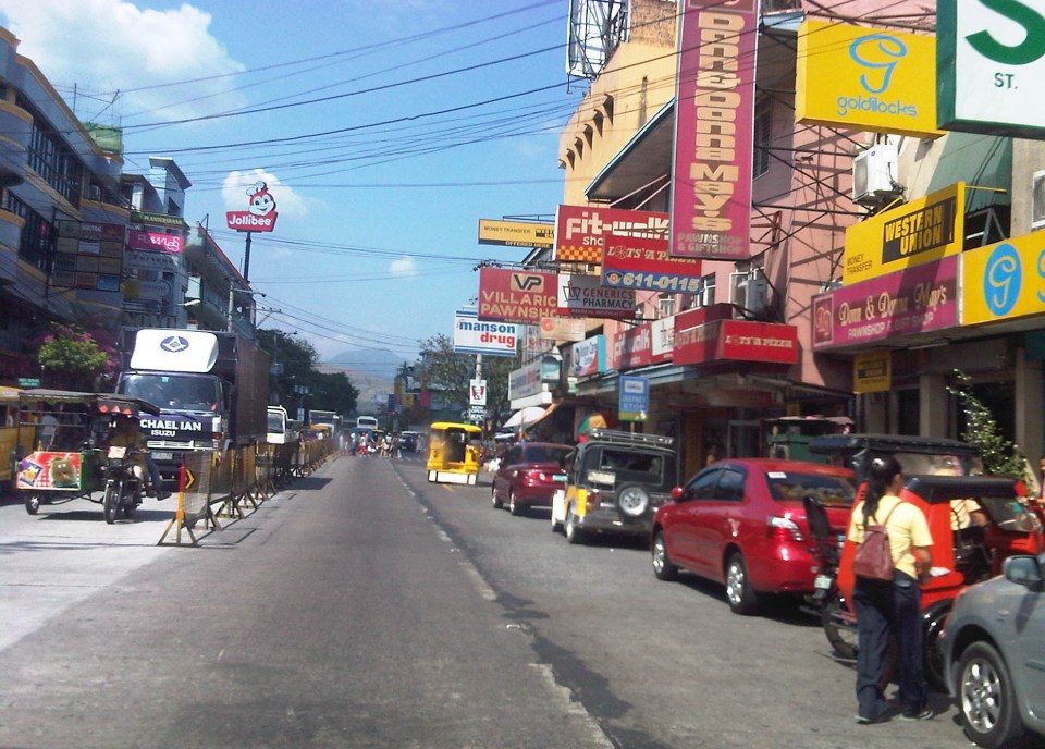 On-street parking is a problem for the city as there are few, if any, off-street parking facilities in the city. On-street parking turnover is quite low since many of the parked vehicles are not clients or customers but establishment owners or managers.
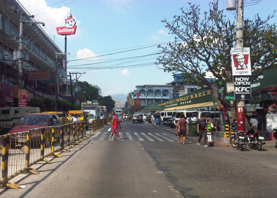 Most of Rizal Avenue is undivided but there are median barriers along the section in front of the public market to reduce jaywalking among pedestrians.
 The section in front of city hall – just across are many commercial establishments and on-street parking.
 Another view of the Rizal Avenue, this time along the westbound side, with the the market on the left side. The yellow jeepneys are quite conspicuous and remind me of the UP Ikot jeepneys.
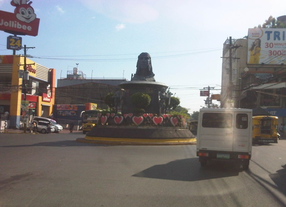 A monument to the Ulo ng Apo, from which the name of the city is said to be derived from, is right in the middle of a rotunda at a major intersection along Rizal Avenue. Around the rotunda are commercial establishments and a major provincial bus terminal.
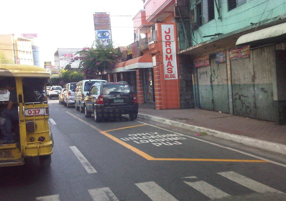 There are designated stops for jeepneys along the avenue but these are often crowded out by parked vehicles. As a result, jeepneys could not maneuver properly and end up unloading/loading passengers in the middle of the road.
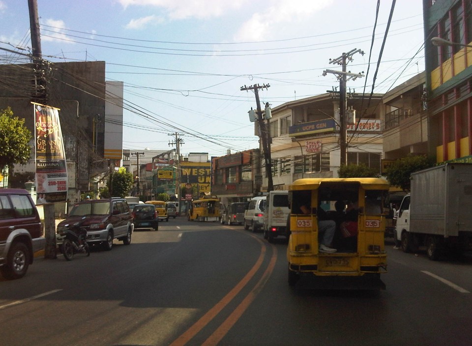 On-street parking along curves tend to impede the flow of traffic. There are also issues where electric posts like the one shown in the photo have not been transferred, posing risks to vehicular traffic.
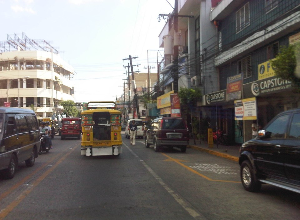 Another example of a designated jeepney stop along the avenue where parked vehicles constrict maneuvering space for jeepneys.
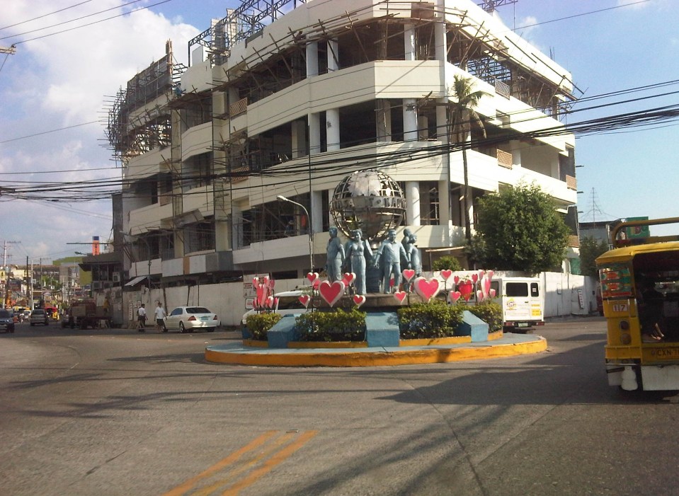 A monument to the volunteers of Olongapo during the Mt. Pinatubo episode after the closure of the U.S. Naval Base in what is now a Freeport. I wonder if the building under construction in the photo has enough parking spaces for the traffic it generates.
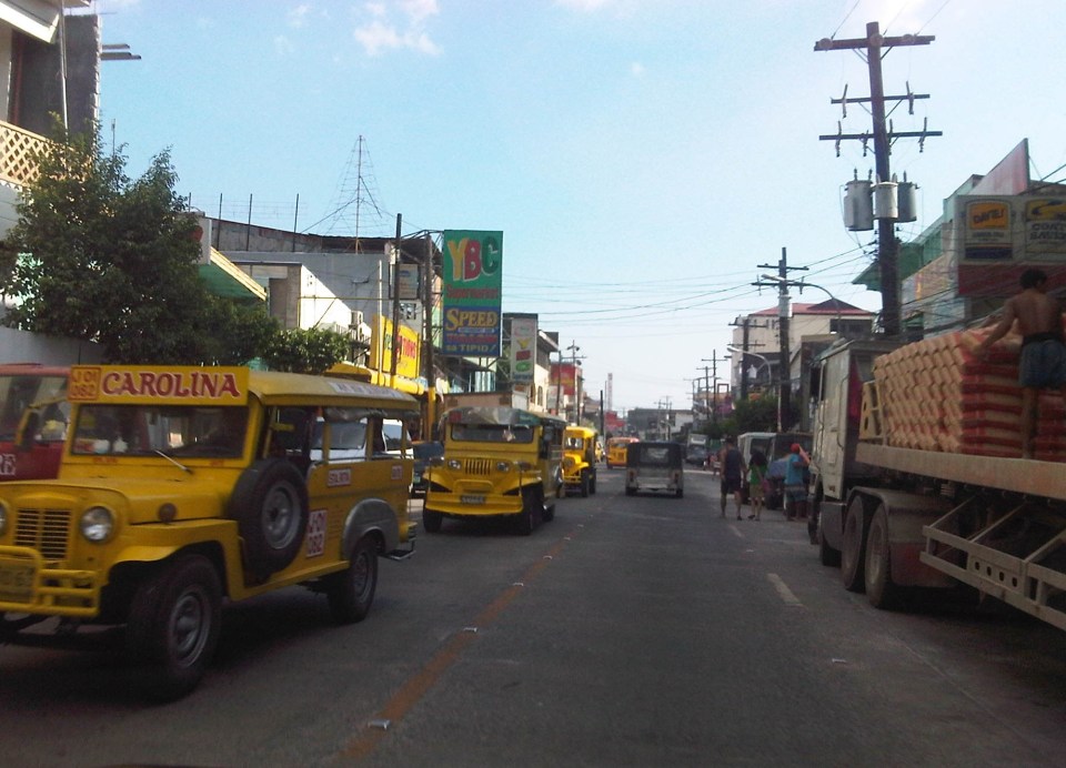 More jeepneys and more on-street parking – there is a perception that there are too many (oversupply) of jeepneys. Note though that most PUJs in Olongapo are not the bigger 20 to 24 seater jeepneys we see in Metro Manila but the older, 16 to 18 seaters like the ones shown in the photo.
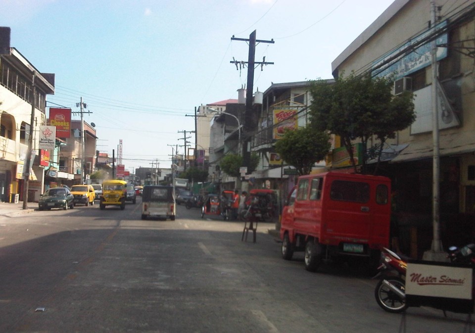 Some on-street parking spaces are “reserved” by establishments. I didn’t mention that on-street parking is free of charge and such situation probably encourages longer parking durations. Perhaps the city should seriously consider parking fees to reduce long-term parking and ensure smoother flow of traffic along its streets. There are examples of these parking schemes in other cities including Makati City that Olongapo can adopt and adjust.
–
The commute to the airport
Traveling from our home in Antipolo to the airport in Clark, I decided to take the MRT to the Quezon City Air Terminal (QCAT) from where I would be taking the Clark Airport Rail Express (CARE) to the sparkling new terminal at what is a fast growing aerotropolis north of Metro Manila. It was an easy commute from the station near my home and a convenient one considering the e-Pasahe integrated commute card that I could also use for the C5 subway line or the Quezon Avenue BRT. Soon, all the jeepneys and buses would be accepting the card for fares. 100% of taxis were already accepting the card for payments and the electric tricycles were surprisingly ahead with 90% accepting the e-Pasahe card. I made sure my card was topped up when I left the university yesterday so I could also use it to buy a drink or a meal while at the airport. The convenience of the card reminded me of the Suica and Pasmo cards I used while traveling in Japan.
Upon arriving at the QCAT, I proceeded to the check-in counters to drop-off my luggage. I had already checked-in online so I just had to leave my bag at the express lane. I was already excited about the direct trip to New York, on board Cebu Pacific’s newly delivered A380, where I would be meeting up with the wife who’s already there for a conference. Unfortunately, we won’t be on the same flight home as she was taking the PAL’s non-stop Dreamliner service to NAIA.
On-board the CARE train to the airport, I had a quick but good view of Metro Manila as the train emerged from the underground tunnel for its surface run from Bocaue, Bulacan. It was still early in the morning and the sun was just rising. It felt good to see that there was much less smog covering the metropolis. All those electric and hybrid vehicles have made a significant impact on reducing air pollution and improving air quality. I decided to have a power nap for the rest of the trip and awoke minutes later to find out everything was just a dream.
🙂
Happy April Fool’s Day!
Streets of Intramuros: Calle Real del Palacio
I haven’t had a good chance to take photos of the streets in Intramuros, Manila. The historic streets within what was for hundreds of years regarded as Manila deserves a more detailed treatment. Recently, I have been able to go around a little bit thanks to meetings at the DPWH and a lecture at the Mapua Institute of Technology. I took full advantage of the opportunity to take photos along some streets along the way to my meetings and am posting these in a few articles about what I think should be a good example for heritage conservation including the street names and old structures within the walled city.
The original name of Andres Soriano Jr. Avenue, the main road stretching from Plaza Mexico along the Pasig River to A. Bonifacio Drive in the Port Area, was Calle Real del Palacio. I believe they should have stuck with the original name in order to preserve this piece of history. Our politicians have a penchant for renaming streets after their kin, heroes, or for purposes like claiming that we should exorcise names associated with our colonial past. While the latter seems to be a basis for changing names elsewhere (not just in the Philippines), perhaps the remedy here is to still retain the original name under the new one.
 Ruins of the aduana or customs building, visible upon turning from the Muelle Del Rio at Plaza Mexico towards Andres Soriano Jr. Ave.
 The road is a four lane, two-way street. It is usually congested because of public transport loading and unloading operations (usually in the middle of the street) and roadside parking, which is tolerated. In fact, there are parking aides in charge of collecting fees from drivers parking along the streets. Intramuros is host to a lot of offices, commercial establishments and schools – all major traffic generators that attract so many vehicles thereby requiring a lot of parking space. The building to the left is the reconstructed building where the old ayuntamiento used to stand.
 The new building where the ayuntamiento was is now supposed to be the new offices of the Bureau of Treasury.
 The open space at left is the along which are many parked cars is the Plaza Roma, which is in front of the Manila Cathedral. The building right after the plaza is where the Palacio del Gobernador used to be. It is now the offices of the Bureau of Treasury.
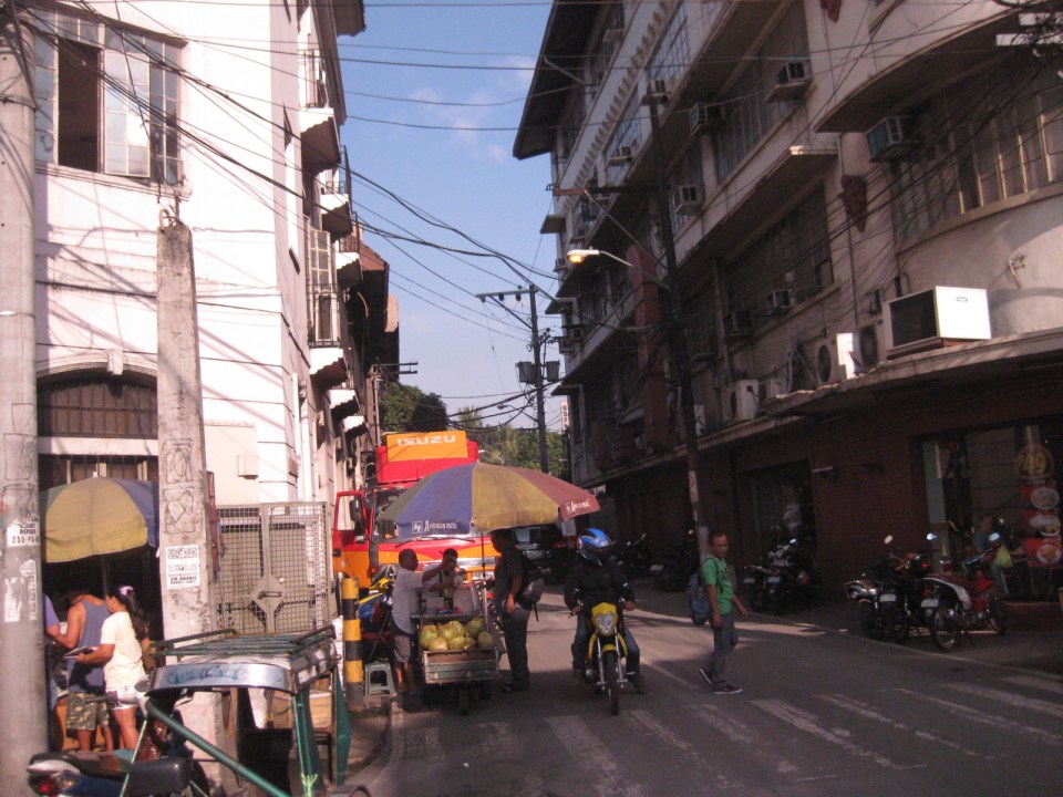 Cabildo Street, one of the side streets from across the Plaza Roma, which ultimately leads to Fort Santiago.
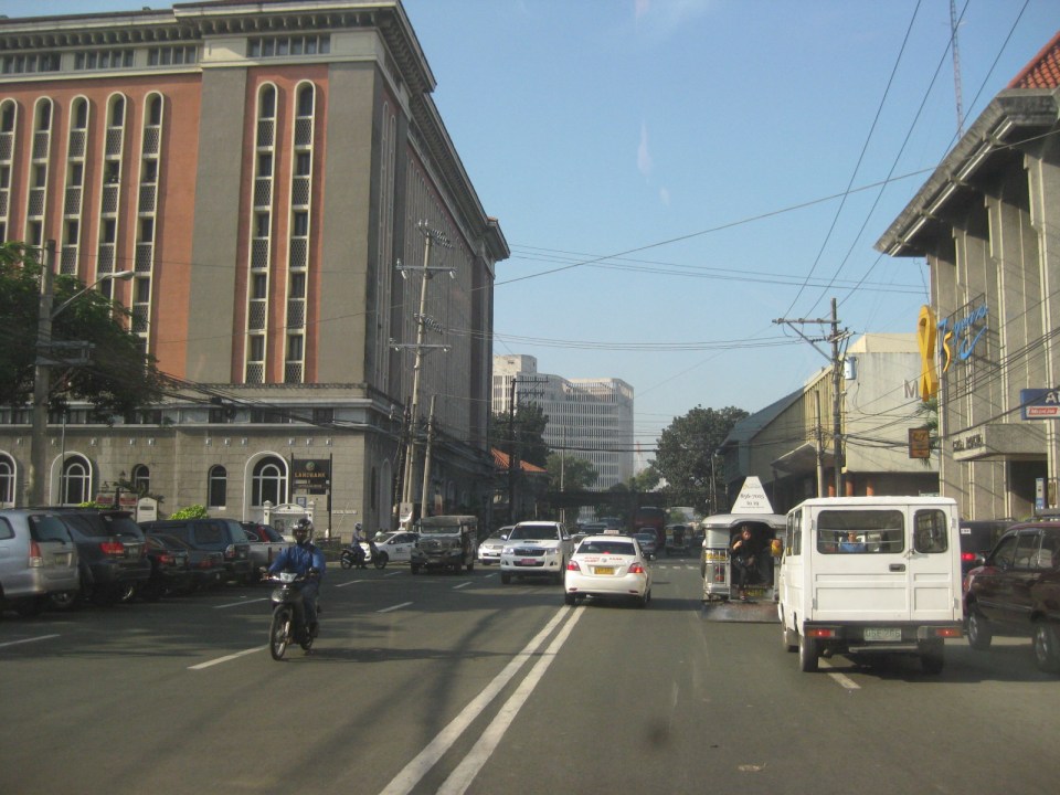 6Another look at the building where the old Governor’s Palace used to be. Visible downstream along the Soriano Ave. is the gate leading to the Simeon de Anda monument located at a roundabout along A. Bonifacio Drive.
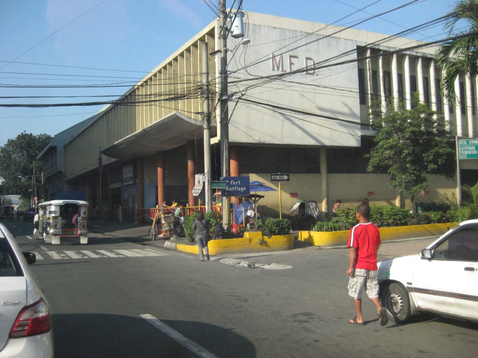 At right is Gen. Antonio Luna Street, which is another main road that has one end at Puerto Real, the southernmost gate of the Intramuros and the other at Fort Santiago. Curiously, this road was also called Calle Real del Palacio as it passed in front of the Palacio del Gobernador.
 A view along Gen. Antonio Luna Street towards Fort Santiago, which is a one-way street.
 Western entrance to Intramuros along Soriano Ave. leads to Bonifacio Drive and the Port Area.
 Arzobispo Street, which also leads to Fort Santiago but also passes along the Archbishop’s Palace, the office of the Archdiocese of Manila and with its southernmost end at San Agustin Church.
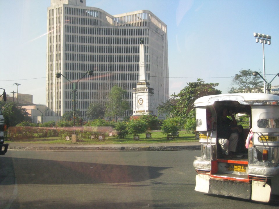 The Simeon de Anda monument at the Anda Circle along Bonifacio Drive.
–
The Streets of Bacolod: Around the Public Plaza
The streets surrounding the Bacolod Public Plaza are one-way streets following a counter-clockwise circulation around the plaza. Typical of plazas of old, the latter has around it the church (in this case San Sebastian Cathedral), the old city hall, commercial establishments, the police headquarters, and a major school (La Consolacion College). The following photos were actually taken a year ago in February 2012. I doubt if much has changed since then but the circulation and traffic situation should practically be the same give and take the normal traffic growth due to progress for the capital city of Negros Occidental.
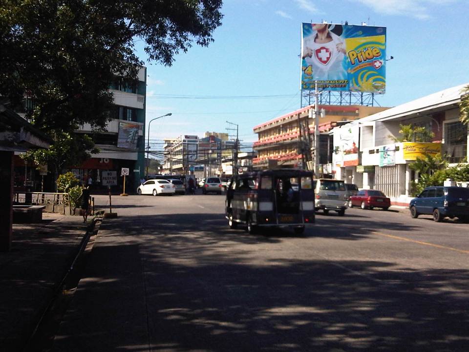 Intersection of San Juan St. and Gonzaga St. (view along San Juan St. towards southwest)
 Intersection of San Juan St. and Luzuriaga St. (view from east corner of intersection towards Westown Hotel)
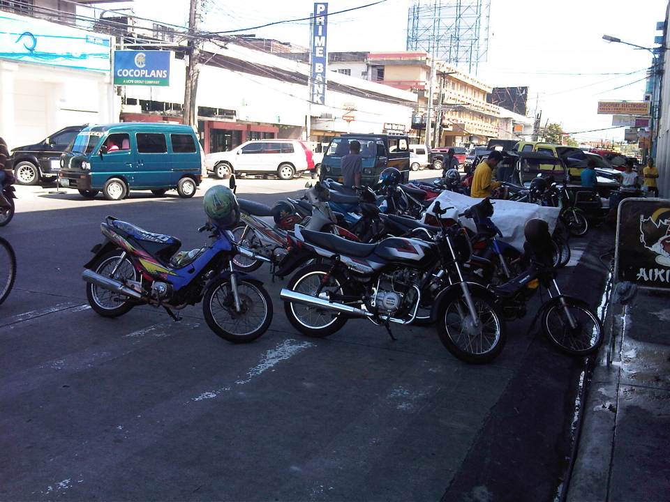 Roadside parking along San Juan St. Noticeable above are the motorcycle parked along the road, with some occupying pedestrian crossing space.
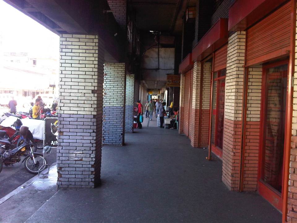 Old cities like Bacolod have buildings featuring arcades like this where pedestrians have the ROW and are sheltered from the elements. I was glad to see that the city basically cleared these facilities from obstacles. It is not entirely without impediments though as shown in the photo.
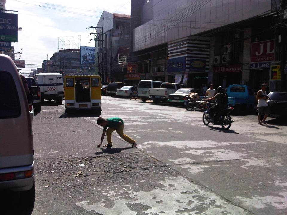 Luzuriaga Street (view towards southeast)
 Arcade of Plaza Mart building along Gonzaga Street and across from the Bacolod Public Plaza (view towards Araneta Ave. and Gatuslao Street)
 Another view of the arcade of Plaza Mart, this time along San Juan Street (towards Luzuriaga St.)
 San Juan Street (view from the corner at Gonzaga Street) – at right is the Plaza
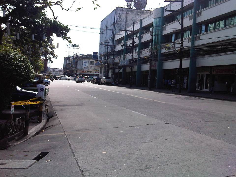 Gonzaga Street (view at corner of the Plaza along San Juan Street) – vehicles downstream are at the intersection of Gonzaga St. and Araneta Ave. Further downstream is Gatuslao Street
 Rizal Street taken from the plaza side and featuring San Sebastian Cathedral
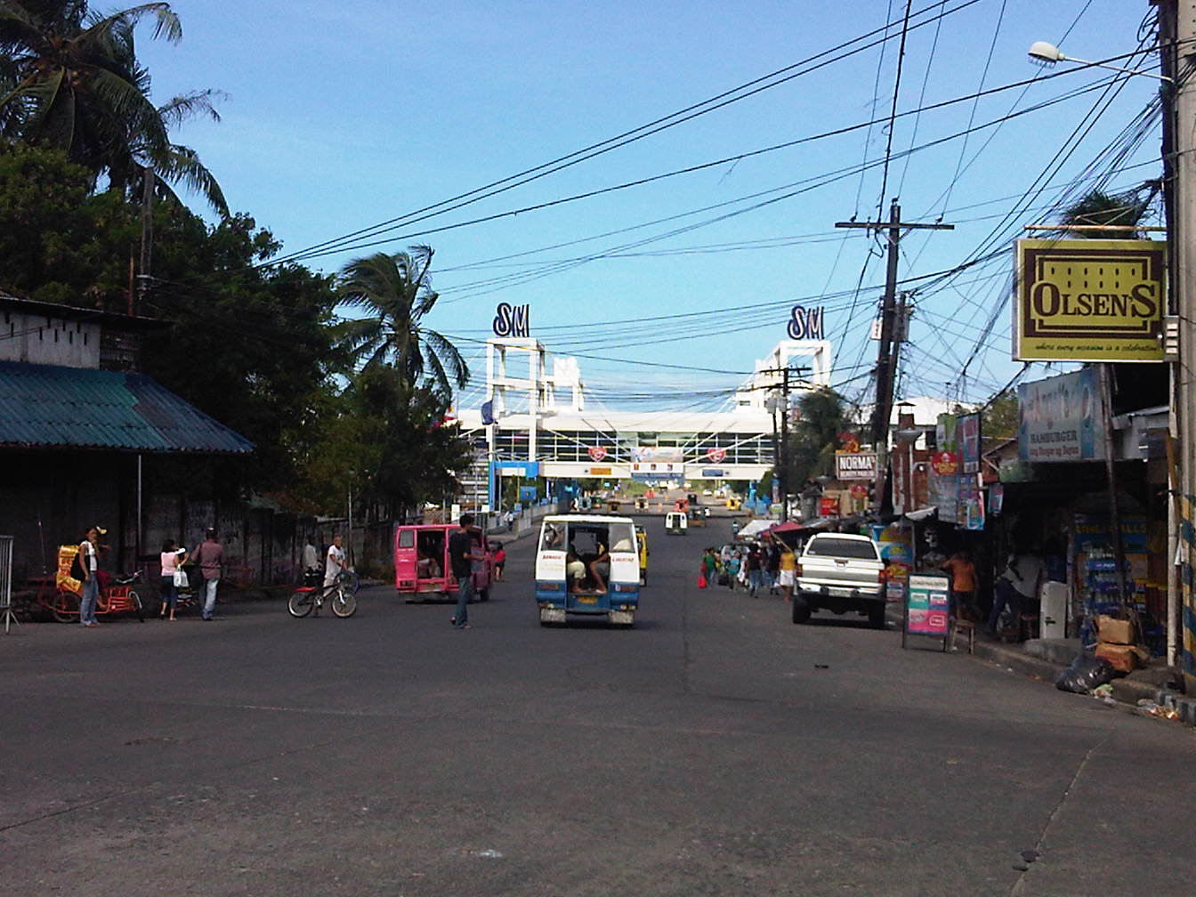 Rizal Street leads to SM City Bacolod, which is found in the reclamation area. (View from the intersection of Rizal St. with San Juan Street)
 Steel barriers along Rizal Street prevent vehicles crossing the street from the northeast side of San Juan St. All traffic must turn right towards SM. (view from the corner of San Juan and Rizal along San Juan towards the southwest direction) The PNP headquarters is the building on the opposite corner with the blue roof.
 Intersection of San Juan Street and Luzuriaga Street (view along San Juan St. towards southwest)
 San Juan-Luzuriaga intersection (view from Westown Hotel corner)
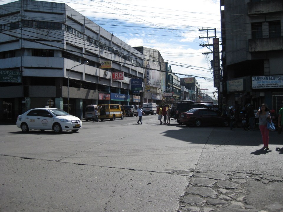 San Juan-Luzuriaga intersection (view along Luzuriaga St. towards southeast)
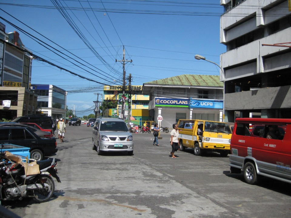 Luzuriaga Street is also a one-way street and with significant roadside parking as shown in the left side of the photo. View of traffic coming from the intersection with San Juan St. Westown Hotel is the building at left.
The circulation scheme at the plaza seems to be working out well at the time. This is despite the proliferation of roadside parking along the streets and around the plaza. The streets are relatively wide and so a one-way scheme works well in terms of taking advantage of the capacities of the streets while allowing for curbside parking that typically occupies one lane of road space as shown in the photos above. We didn’t see anyone charging parking fees for the vehicles and so we assume that these are practically free though we did see some informal “watch-your-car” boys who rely on tips from those parking along the road. Ultimately, though, the city should look into the provision off-street parking facilities as I can imagine traffic congestion, for example, in the vicinity of San Sebastian Cathedral on Sundays. Traffic in the area should be expected to increase as the city continues to experience economic growth and more developments ultimately locate at the reclamation area.
–


