
Home » Governance
Category Archives: Governance
Article share: On bike buses
Here’s a quick share of an article on bike buses. It’s a good idea that can probably be adopted by schools where most or many students live or reside within a ‘bikeable’ distance of the school.
Chudwin, E. (August 28, 2025) “Bike Bus Pedals in New Era of School Transportation,” Planning Magazine. American Planning Association.
I recall that there was an attempt to replicate this in Metro Manila (Quezon City?). However, there is no update on whether that was just a pilot or a one-timer or something that is now a regular thing for school commutes.
–
On transport strikes – are they still relevant or effective?
One of my students casually asked me about the effectiveness of transport strikes. I replied that while the strikes may and can raise awareness of the issues being protested, their effectiveness may have been diminished as people have become insensitive not just to them but to many of the issues we face these days. The latter includes the political mess we have that affects everyone regardless of who you side with.
Here is the series I wrote back in March 2023 – “A Brief History of Transport Strikes”:
Part 1: https://d0ctrine.com/2023/03/04/a-brief-history-of-transport-strikes-part-1/
Part 2: https://d0ctrine.com/2023/03/06/a-brief-history-of-transport-strikes-part-2-reasons-for-a-strike/
Part 3: https://d0ctrine.com/2023/03/08/a-brief-history-of-transport-strikes-part-3-advocacy-and-bandwagon/
And then this short piece in October of the same year:
What do you think?
–
Philippine Transportation Journal, Vol. 8, No. 1
The latest issue of the Philippine Transportation Journal is out. Volume 8, Number 1 includes five (5) papers derived from the Transportation Science Society’s 2025 conference held in December 2025. PTJ didn’t have a 2025 issue as last year was an EASTS Conference year and TSSP held its 31st Annual Conference in December instead of the usual September or October. Most if not all papers published in PTJ are from the best of the conference including the best paper and best presentation. Authors are given the chance to further refine their papers based on the feedback or comments in the conference sessions, which may be different from the comments received during the review process.
I reproduce below the list of papers in the latest PTJ issue. Three papers are associated with UP Diliman: #2 with the National College of Public Administration and Governance, #3 with the Asian Institute of Tourism, and #4 with the College of Engineering. One paper, #1 is from the University of Asia and the Pacific. The last but not the least, #5, is from UP Los Banos.
1. Empowering Local Government Units in Public Transport Service
Provision through Franchise Policy Reform – SUNIO, V., MANUEL, G., PACHECO, J.A.
2. Optimizing Route-based Fleet Size Computation through Network-Based Modeling for Puerto Princesa City, Philippines – Fajardo, A.C., SANCIANGCO, E., OLLERO, L.J., ALTEA, J.R., CASTILLO, C.A., TIGLAO, N.C., CUNANAN, P., SIPASIP, H.D., TOLENTINO, N.J.
3. Understanding Inland Water Transportation and Its Potential for Tourism: The Case of Navotas – Malabon River Boats in Metro Manila, Philippines – MASONG, G.R., AMIDAO, P.J.M., GUILLEN, M.D.V.
4. Measuring the Traffic Impacts of Tactical Urbanism: A Corridor and Intersection Analysis in Quezon City– MICIANO, M.L., HALIL, J., RAMILLANO, J., SIGUA, R.
5. Comparative Analysis of the Influence of Environmental Awareness on Transportation Mode Choice Between Students of UP Diliman and Ateneo de Manila University – SERIOSA, V.J., REYNOSO, C., LIM, M.B., SUNDO, M.
Here is the link to the PTJ Vol. 8, No. 1: https://ncts.upd.edu.ph/tssp/archives/3319
–
U-turn due to inclement weather
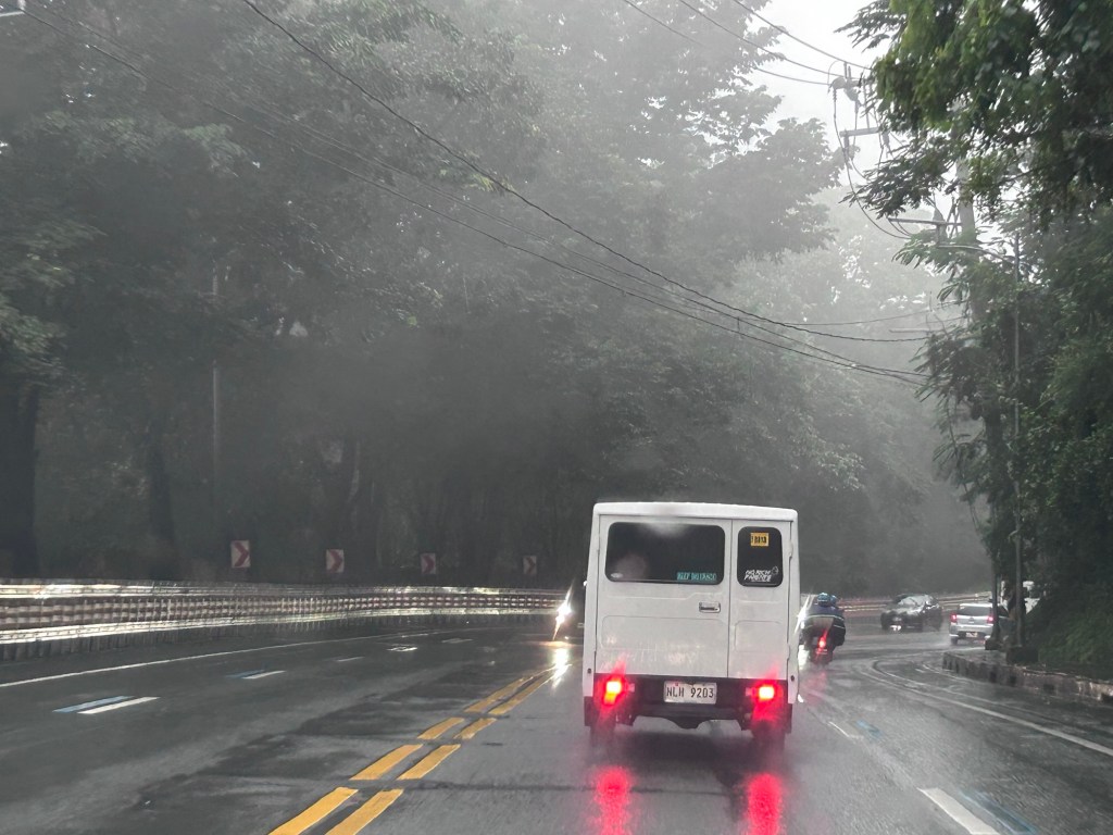
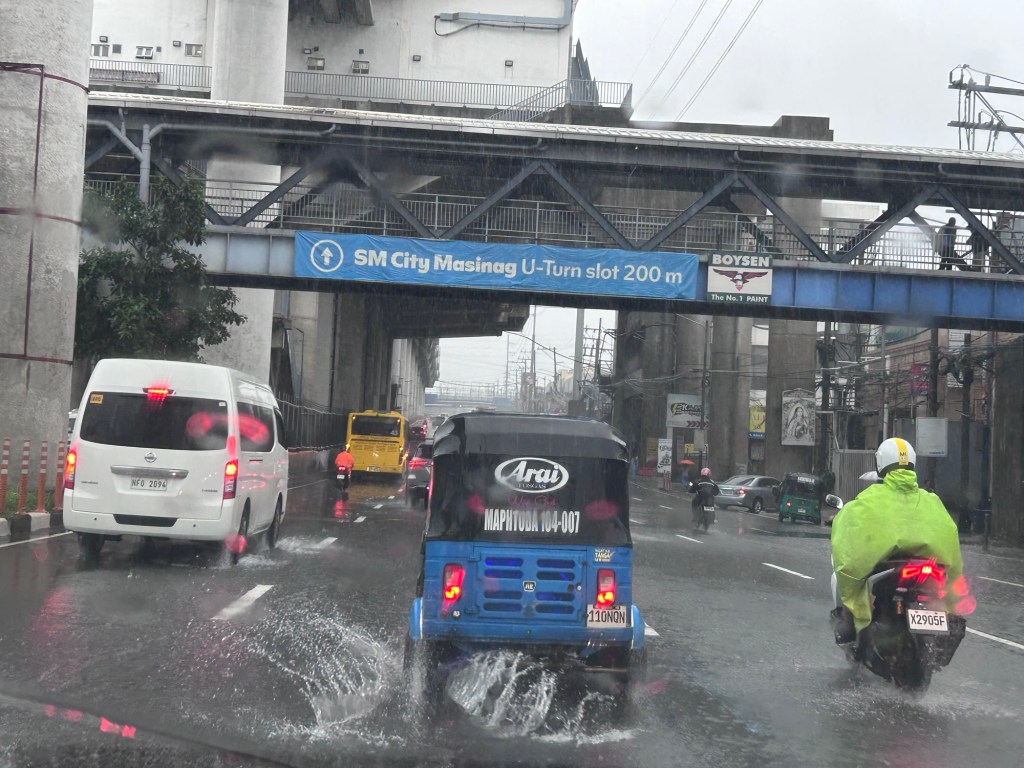
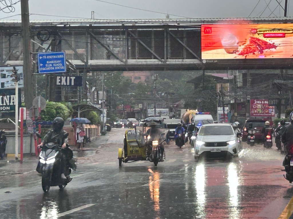
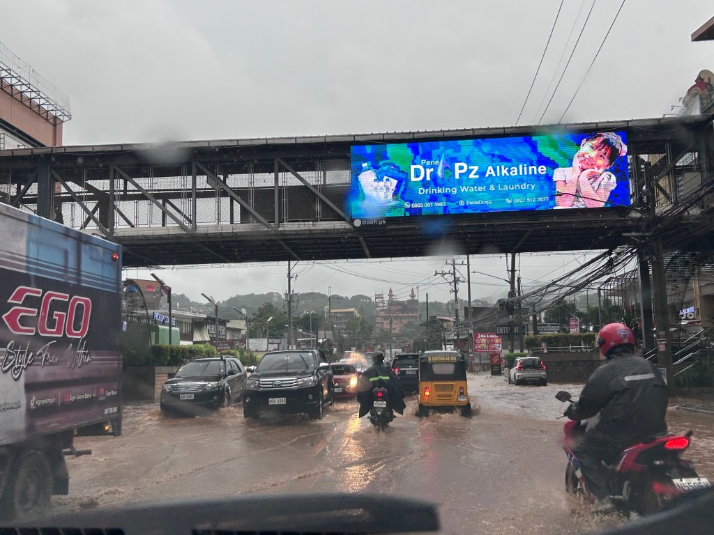
I was on my way to the office this morning to check on our buildings and get some lecture materials. I had to go back as the intense rains immediately flooded the roads along the way.
Here are some photos this morning on my way to UP and when we turned back:

Malacanang has again suspended F2F classes and government offices have been advised to be alternative modes of operations. Is this the new normal when we have inclement weather? Are we supposed to be adjusting again and expected to be resilient in these times?
–
Commuting through floods
Yesterday’s rains were catastrophic. Reports stated that a week’s rains fell over a period of 2 to 5 hours, depending on where you were in the Mega Manila area. The resulting floods provided misery to people in flood-prone areas as well as those who had to go through the floods on their commutes to their homes. Here are photos from my commute going home yesterday. I relied on Waze for the shortest travel time and the app took me to flooded areas in Cainta. Perhaps it assumed my vehicle can safety navigate the floodwaters?
 Flooded street in Gruar Subdivision in Cainta, Rizal
 Flooded A. Bonifacio Avenue in Cainta, Rizal towards Taytay, Rizal. This is the main avenue through the heart of Cainta.
 Flooded streets in the area leading to Hunters ROTC Street. These residential areas are prone to flooding and children commonly play in the floodwaters – certainly at risk from getting sick from whatever it is in the waters.
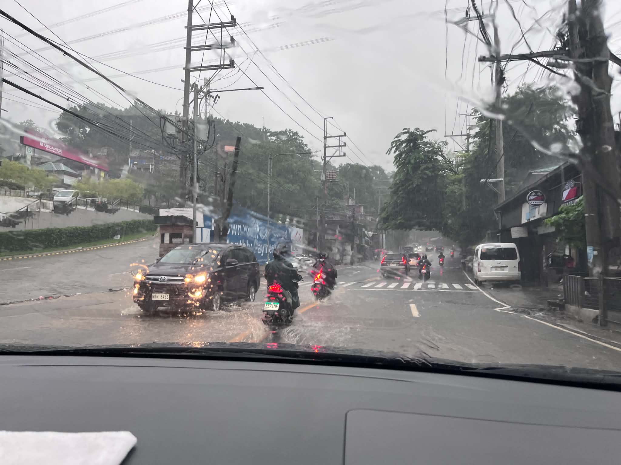 This is Ortigas Avenue Extension and on the way up to Antipolo. This area wasn’t flooded before and residents attribute the floods to the high-rise residential buildings and commercial development in the area. That’s actually a lot of run-off not absorbed by a drainage system that’s supposed to have been constructed with the developments. Did the local government of Taytay, Rizal make an evaluation of this before approving the projects?
Is there an end to this flood problem? Are the solutions really being implemented or, as we’ve learned the past so many months, are we being taken for a ride by our so-called leaders and agencies that are supposed to address these problems. People are supposed to be tired of the resilience story being peddled by politicians but the clamor seems to be in social media only and the real people who are lobbying for solutions have to contend with trolls who are also peddling their own narrative for their masters.
–
Congestion Costing Reality Check, Part 1: Congestion evaluation best practices
Here’s a quick share of an article from Todd Litman on congestion evaluation:
Widely cited studies claim that traffic congestion is a huge and growing problem. They exaggerate. Let’s examine how to correctly calculate congestion costs and roadway expansion benefits.
Source: Congestion Costing Reality Check, Part 1: Congestion evaluation best practices
Travel time maps for Antipolo City
Yesterday, we facilitated a workshop for Antipolo City where technical staff of the city presented on the outcomes of various activities related to the formulation of a Sustainable Urban Mobility Plan (SUMP) for the city. One interesting output from one of the groups is this map showing the travel times within selected driving times with the destination being the Antipolo Shrine (“Antipolo Simbahan” if you will refer to the PUV signboards of those plying routes to Antipolo). The maps are the equivalent of travel time contour maps that can be generated with travel speed or travel time data.
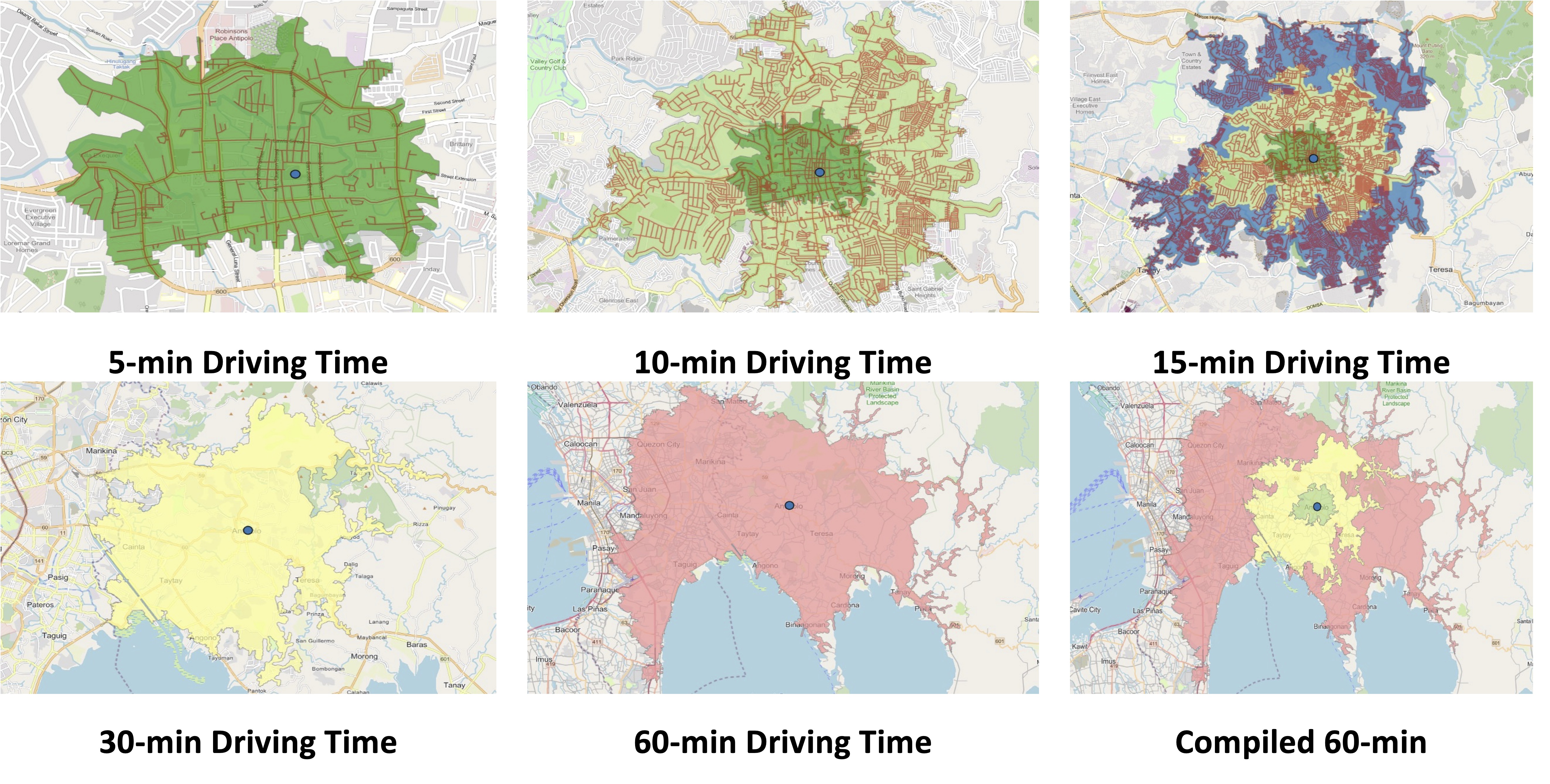
While shown are driving times and assuming car use, similar maps can be produced for public transportation, motorcycles, bicycles and even walking. It is just a matter of collecting the data and plotting them. Alternatively, the data can probably be obtained or derived from sources like Google Traffic or Waze. Some effort, of course, is required in order to have more accurate maps especially considering the road network and traffic circulation. Note that the travel times indicated are also centered on the Antipolo Shrine, which for presentation purposes was used to represent the center of the city. Other maps can be produced in aid of planning travel and transportation for the purposes of the city (e.g., how long it takes between Antipolo and Cubao for a regular commute, etc.).
–
On accountability, good governance and missed opportunities
Yesterday was the death anniversary of former President Benigno “Noynoy” Aquino III whom many fondly called PNoy. His administration saw many fiscal and policy reforms being implemented, resulting in perhaps the best economic performance of the country this century. Of course, they also benefitted from the developments of the previous administration but good sowing cannot result in a good harvest if what was planted was not nurtured to have a good yield in a timely manner. That goes without saying that there were also many low hanging fruits that were not picked for whatever reason the PNoy administration (his people, not necessarily PNoy) had. That included the Cebu BRT project that only recently was partly completed and operational.
Missed opportunities – I always wondered why there were no major infrastructure projects completed during the 6-year term of PNoy. I’m sure someone in the know can refute this but to most people, can we identify a major infra project completed during that time? Were there any new transportation projects like a rail or BRT line completed then? Were there new airports or terminals? Were there tollway projects completed (sections don’t count, we are talking about complete projects)? Any major bridges completed? What were completed mostly were policy and governance related items, particularly those intended to reform a system that was perceived as corrupt and inefficient. It was the same mistake the Cory administration did back in the late 1980s and early 1990s that led to energy and water crisis that the Ramos administration had to address. Of course, that administration had to deal with a lot of political destabilization attempts at the time. That administration had to deal with a lot of projects initiated or in the pipeline by the previous administration, which until now is being regarded as good examples of “what if” for transportation infrastructure. It took a long time, for example, before another mass transit line was constructed in Metro Manila. The reforms now currently being lobbied by various groups could have been done during the PNoy admin but were not. Hopefully, the current administration can catch up given some major players now including the DepDev Secretary were also involved back then.
–
New wide roads lead to more crashes?
I was in Tagaytay several times the past year and recently and couldn’t help but notice all the wide and widened roads in Cavite Province. Driving our vehicle, I also noticed how many were speeding along these roads and that many refuse to give way at intersections unless it’s signalized. We caught the terrifying images of a fresh crash this morning as we traveled home from Tagaytay. There were three wrecks at the intersection of the Crisanto Delos Reyes Road and the East West Road. It took quite some time for the rescue people to get there based on how long we got stuck in traffic just a few hundred meters from the crash site.
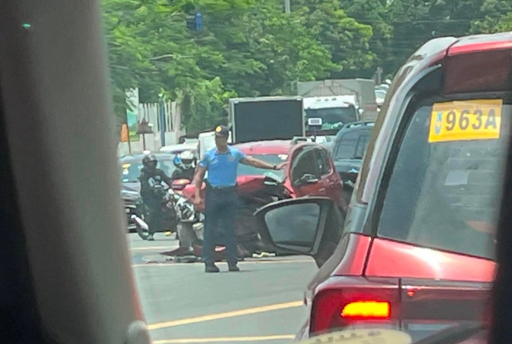
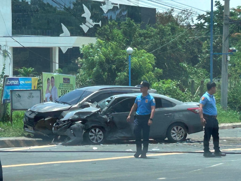
Wide roads and aggressive driving are just two major factors or contributors towards road crashes. I wonder what are the crash rates along these roads in Cavite Province. I also wonder how fast first responders, especially medical staff, could arrive on site for these crashes. The police were there first but looked helpless and couldn’t attend to those involved in the wrecked cars. Are they even trained for first aid? Or was this part of their training to just wait for competent medical staff to arrive?
–
Is it the wet season already?
It has been raining the past few days though it’s still quite hot especially from the morning til noontime. While the rains were not exactly downpours for most cases, today was probably the heaviest in terms of visibility (near zero), coverage (it was raining along my entire commute from Quezon City to Antipolo) and length (about an hour). This was what it looked like with the wipers off:
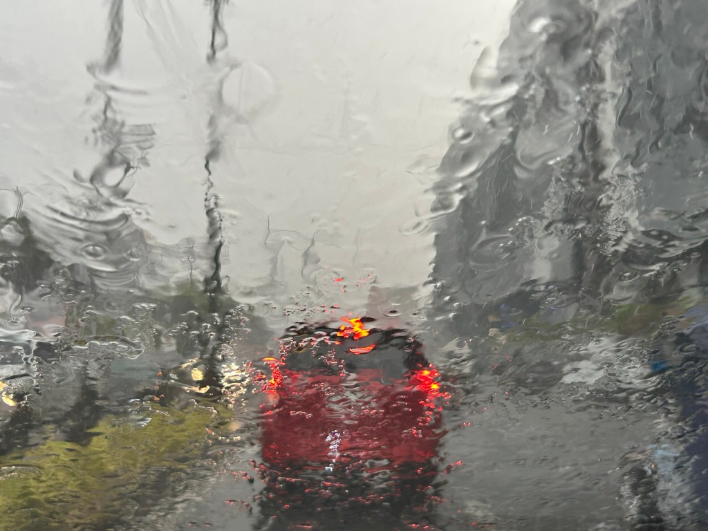
The rains are definitely welcome from the perspective of temperatures. It gives us cooler weather everywhere though short showers often lead to even hotter and humid conditions (singaw?). The flash floods also help us not to forget the anomalous and immoral actions of politicians and DPWH officials.
–

