
Home » Governance (Page 36)
Category Archives: Governance
The return of traffic signals at Katipunan
It’s been more than a decade since the MMDA implemented what was formally called the Grand Rotunda Scheme. To most, it will always be the U-turn scheme that was implemented all around Metro Manila. After seeing what seemed like success along roads like Commonwealth and Quezon Avenue, it was concluded that the U-turns were the answer to Metro Manila’s traffic woes or at least the part that’s blamed on signalized intersections. The perception by many at the time was that traffic signals were not working and caused so much congestion as evidenced by the long queues at intersections. This is not entirely false as intersections with in-optimal settings would definitely bring about congestion especially along corridors or networks where signals are not coordinated. It was, however, a generalization at a large scale and led to more experiments of opening and closing slots in order to determine which would be the most effective combinations. These experiments and their outcomes include drivers becoming more aggressive in order to maneuver ahead of others at the U-turn slots. Weaving has become the norm and in many cases have increased the risk of road crashes.
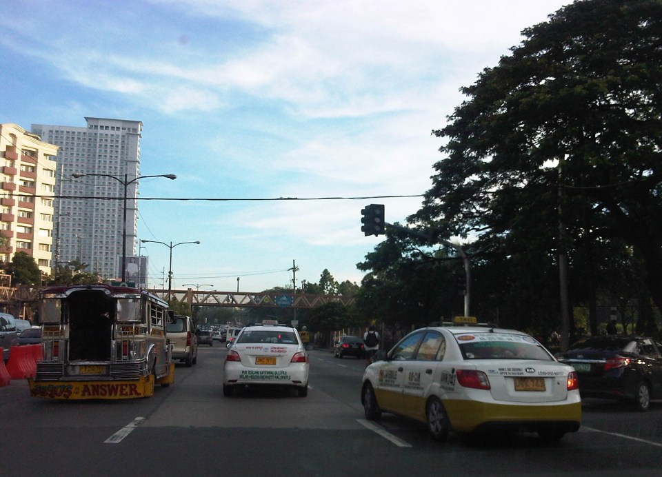 Traffic signals have been installed and the section of the median island has been removed across Ateneo’s Gate 3. This will become a three-leg intersections once again but I hope the signals will not favor Ateneo over through traffic along C5.
 Traffic lights are already installed along the southbound side of Katipunan at the approach to the junction with Miriam College’s Main Gate. This will be a four-leg intersection as across Miriam is B. Gonzales Street that connects to Esteban Abada.
The signals are supposed to be operational starting September 13, which is a Saturday. Perhaps this is to try it out first during that weekend and for the MMDA to do some tweaks before the real deal that is traffic on Monday. But then how can you simulate traffic generated by the two schools in the area except maybe if there is significant enough traffic on Saturday? Did the MMDA or its consultants do some simulation using their computers and the VISSIM software they acquired many years ago? Or will we see more of the experiments as signals are fine-tuned according to the conditions along Katipunan?
We are hopeful that the signals along Katipunan will help improve the traffic along this very busy corridor. The results for sections of C5 from Libis (QC) to Ugong (Pasig) are promising and many people I know have told me that traffic has improved. Of course, this may also be partly due to the one-lane policy the MMDA has implemented for trucks. It’s never just one scheme or measure that will work wonders for Metro Manila traffic. It will always be a combination that will alleviate traffic woes in the metropolis. We’ll soon know what will become of traffic along Katipunan. We should, however, temper expectations at least for the 6:30 – 7:30 AM period during weekdays when traffic peaks in the vicinity of Ateneo and Miriam. The sheer volume of vehicles generated by the schools will overwhelm any system that is put up in the area. Nevertheless, for the rest of the day at least traffic flow should improve when signals are operational once again for Katipunan.
–
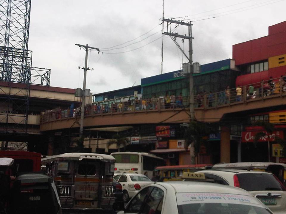
EDSA: Taft to Tramo
The EDSA-Taft Ave. intersection was in the news a few weeks ago due to the MRT3 train that derailed and overshot the end of the line along EDSA. Being a major intersection for roads as well as for rail (MRT3 and LRT1), it is a very crowded area. Nearby, too, is the Redemptorist church in Baclaran that attracts a lot of people especially during Wednesdays. Following are a few photos of the area showing the conditions on the pedestrian overpasses and at street level.
 The pedestrian overpass at EDSA-Taft is also a mall of sorts given the merchandise being sold at informal shops at the overpass.
 The overpass connects to the EDSA-MRT 3 Taft Ave. Station. This is the MRT 3’s end station and the overpass system connects the MRT 3 Taft Ave. Station with the LRT Line 1 EDSA Station. The connection was not and is still not a smooth one, which has been the subject of criticism from a lot of people.
 The overpass allows people to walk around this large intersection
 Pedicabs freely travel along this stretch of EDSA between Taft and Tramo on lanes designated for public utility buses and clearly violating regulations regarding what vehicles are allowed on EDSA. You can also see in the photo a cart full of merchandise being pushed along the curbside lane.
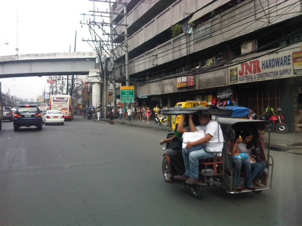 A motor tricycle ferrying passengers along EDSA just before Tramo (that’s the street above which is an overpass from EDSA southbound).
–
On logistics in the Philippines
I am not a logistics expert and will not pretend to be one. I have, however, been involved in several projects that included logistics as a major study component. These include a nationwide study on inter-regional passenger and freight flow and another for freight forwarders affected by vehicle restraint policies in Metro Manila. A more recent engagement has allowed me to take a look at logistics in the country from other perspectives including that of national agencies seeking to improve goods movement in the country and development agencies that have committed to help the country to do just that. There are local issues and there are regional ones. The regional ones often involve the need for infrastructure such as maritime ports and airports, highways and bridges, and other facilities such as those for storage and refrigeration.
For an archipelago like the Philippines, logistics is a bit more challenging than in countries whose territories are not separated by bodies of water. There is no lack for good practices though as there are other archipelagos that could provide good examples for connecting the islands such as Japan and the United Kingdom. Nearby, we share similar challenges with Indonesia and to a certain extent Malaysia. Of course, availability of resources is always an issue and particularly for the prioritization of infrastructure to be constructed aside from those that need to be maintained. The DOTC along with its attached agencies like the Philippine Ports Authority (PPA) and the Civil Aviation Authority of the Philippines (CAAP) are in the frontline when it comes to airports and ports planning, development, and maintenance are concerned. However, the DPWH plays a vital role for highways and bridges and the connections for these ports and airports including what is termed as “last-mile” connectivity that is often passed on as a responsibility of local governments. This is likely due to local roads often providing the connection between national roads (under the DPWH) and ports and airports. It is a good thing that the current DPWH has committed to a convergence program regarding national and local roads that has benefited a lot of sectors and industries like tourism and agriculture.
Rail transport is not mentioned here because there is practically none even for what remains of the once relatively extensive PNR main lines. The local issues are not simpler and can be a bit more complicated than the regional ones. The complications are usually due to more petty circumstances that may involve politics and local power plays. The basic ingredients though are related to traffic congestion and the damage to roads and bridges attributed to trucks.
Many cities and municipalities have implemented truck bans along their major roads. These are usually one or two routes in the smaller cities and towns, usually passing through the “bayan,” “poblacion” or central business district (CBD). These roads are usually national roads (e.g., McArthur Highway and the Pan Philippine Highway pass through many towns). As such, there are cases where bypass roads are constructed to alleviate congestion along these roads as well as to try to preserve the pavements in the town proper. Such traffic schemes targeting heavy vehicles are not new and are also a way to address the issue on overloading that is common in trucking in the Philippines. The bypass roads, however, generally invite development and unplanned development have often made these alternate routes more congested than the original ones.
Manila did a “power play” recently by implementing a more aggressive truck ban. This led to more severe congestion around the Port of Manila and a lot of delays that have cost a lot of money in part due to the limited alternative routes in the city and most roads are already constricted. The costs have repercussions on the economy in general as the movement of goods are affected by the impasse in Manila. Whether this was for more political or practical reasons is difficult to say because the mayor and vice mayor have invoked the very common issues of traffic congestion, road safety and pavement maintenance that got the attention, sentiment and agreement of a lot of people. Many of these people though do not understand the impacts of inefficient goods movement and likely are concerned only about passenger transportation.
More recently, a lot of containers were shipped from the Port of Manila to Subic. These are supposedly “overstaying” shipments or those that have not been claimed for a long time or have some issues regarding their release. This should ease congestion somehow but there remain the problems of shipping or logistics companies regarding freight transport in general that needs to be addressed. Both Subic and Batangas ports have been mentioned in many formal studies over the past few years including a more recent one supported by JICA. Still, there is a lot of hesitation if not confusion or uncertainty on how to go about with shifting goods movement to these ports, which are regarded to be underutilized. There are good roads connecting these ports with cities and towns but these might not be enough in the long run.
Perhaps there is a need to reconsider regional rail transport again especially for the islands of Luzon and Mindanao where long distance rail may have a tremendous impact for transporting goods over long distances. Of course, there are also issues pertaining to other ports and airports in the country including those in Mindanao (e.g., Davao, Cagayan de Oro, Phividec, Gen. Santos, etc.) and Visayas (e.g., Cebu, Iloilo, Tacloban, etc.). The RORO ports are among those that need attention as they are directly involve road transport aside from the ferries that carry them over the waters. These nautical highways are vital for goods movement around the country and require both national agencies and local governments cooperating for these facilities and services to function efficiently.
–
Sound opinions on transport and traffic
One of my favorite reads is the column by former NEDA Director General Cielito Habito on the Philippine Daily Inquirer (Inquirer.net). Regardless of whether he is writing about transport or any other topic, his articles are consistently clear and logical. Here are a couple of articles from his column “No Free Lunch” about the more recent transport and traffic issues.
Traffic dilemmas – which appeared August 12, 2014
More railways in our future – which appeared August 19, 2014
I’m not sure if those in-charge or responsible for planning and building our transportation system read his columns. They will learn a lot from these articles especially as the former NEDA DG is practically sharing his experience and wisdom – things badly needed these days especially at the DOTC.
–
Proof of concept
I recall a quote from the cold war era when Nikita Kruschev was supposed to have asked “how many divisions did the Pope had under his command?” This was basically a challenge to the Pope after the latter made some statements regarding the Soviet Union and its military action in Eastern Europe and elsewhere. A similar challenge could be made, albeit vastly reworded, for many advocates of various transport programs and projects to prove they had the numbers or the proof to support their calls for certain projects or programs to be implemented. Often, the proof comes in the form of examples or demonstrations of their proposals. Simplest perhaps would be to present examples of best or good practices in other countries (e.g., bicycle paths in Europe, transit in Singapore, walkways in Japan, etc.).
One that is still fresh in my mind is what has been said to be the “challenge” of Malacanan to the DOTC to present a “proof of concept” for BRT as a pre-requisite of the proposed project in Cebu to be approved. This “challenge” boggled the minds of many experts and advocates of public transportation as BRT is well established around the world and there are many cities with BRT systems worth emulating (To be accurate, there have also been failures but these were mainly due to compromises made that led to the systems not adhering to essential BRT requirements.). What’s stranger was the response from DOTC to do a demonstration via an experiment at Bonifacio Global City to simulate BRT operations. Obviously, this experiment could not be a really good approximation of BRT (something along Commonwealth would have been more suitable) given the conditions at the Fort.
With the recent approval of the Cebu BRT project, we now look forward to its construction and operation. I am aware of how much work was put into the non-technical aspects of this project (i.e., social and institutional) and so a lot of eyes will be on changes to Cebu City’s transport system once the BRT becomes operational and the expected rationalisation of the existing public transport routes and vehicles would take place. There will definitely be a transition period and it is not known how long this will be or how much opposition the change will encounter. Doing workshops and consultations, and getting commitments here and there is one thing. Having the BRT operational and actually affecting the operations (and revenues) of conventional road transport is another matter.
Many cities will look to Cebu’s experience and probably emulate it should the BRT be a success. Metro Manila is too complicated for other cities to identify with unlike Cebu, which likely has similar transport and traffic issues to cities like, for example, Iloilo, Bacolod, Cagayan De Oro or Legazpi. Of course, there will be exceptions and unique problems for each but density-wise, Cebu compares well with more cities in the country than Metro Manila. Here’s hoping that the BRT would finally have its true and actual “proof of concept” in Cebu and that this can demonstrate the benefits of such a system to other Philippine cities along with a necessary rationalisation of existing public transport modes.
–
Required reading on sprawl, transit and the poor
A friend recently posted an article on Facebook that I thought should be required reading for urban and transport planners in the Philippines whether they be with government or the private sector. There is a strong link between land use and transport, we need to be able to understand the complexities and subtleties in order to maximize the benefits to society. It is not a coincidence that the article specifically mentions the poor as it discusses opportunities lost due to flaws or inefficiencies in land use and transport. The article is found in the following link:
Suburban sprawl and bad transit can crush opportunity for the poor
I hope that this will be read and understood by officials at DOTC, LTFRB, LRTA and PNR, as well as those of the Housing and Urban Development Coordinating Council (HUDCC) and the Housing and Land Use Regulatory Board (HLURB). These agencies are responsible for planning and regulating transport and housing in the country. Of course, it is also important for local government units to be able to understand these challenges especially since they will be in the forefront of addressing issues on sprawl and the provision of suitable transport systems. Here’s a related article that I posted earlier this year on New Year’s Day:
Opportunities with the MRT-7 and LRT-1 Extension
–
What’s causing traffic congestion along Katipunan?
An article came out today on a popular online news site stating that the Metropolitan Manila Development Authority (MMDA) blames the Land Transportation Franchising and Regulatory Board (LTFRB) for the severe traffic congestion that is experienced daily along Katipunan Avenue (part of Circumferential Road 5). The article may be found in the following link:
MMDA: LTFRB to blame for Katipunan traffic
Reading the article, I would like to think that the MMDA likely misunderstood the advisory from the LTFRB extending the “non-apprehension policy” for trucks that have not renewed their franchises. This policy is not the same as the truck ban scheme being implemented in Metro Manila by the MMDA and LGUs. The trucks using Katipunan Avenue during the prescribed period that they are allowed travel along this and other roads are not violating any laws or regulations. Meanwhile, the increase in the volume of trucks can only be attributed to an increasing demand for goods that translate into freight movement. There are very limited alternatives to Katipunan Ave., which is a truck route (note: most of EDSA is not a truck route), and there are few wide roads that can accommodate the volume of trucks carried by C5.
I use Katipunan everyday as it is the main road between my home and my office. I can say that traffic has worsened along this stretch of C5 and one can always see the long queue of vehicles caught in traffic along the northbound side of Katipunan especially from the afternoon to night periods. There are many causes of traffic congestion along Katipunan Ave. and during times when trucks are banned from traveling, it is still congested due to the sheer number of private vehicles using the road. C5, after all, is a major road connecting Quezon City with Pasig, Makati and Taguig, which host major CBDs (Ortigas, Makati and Bonifacio Global City).
In the mornings, much private vehicle traffic is generated by the exclusive schools along Katipunan and the northbound side of the road is usually congested from C.P. Garcia all the way to Blue Ridge. Meanwhile the southbound side is full of vehicles from B. Gonzales (across Miriam College’s main gate) to Tandang Sora. In the afternoons and evenings, traffic congestion is caused mainly by traffic returning from Ortigas, Makati, BGC, etc. to Quezon City and elsewhere where their passengers reside. Road capacity is usually reduced by the parked and standing vehicles that usually occupy a couple or more lanes along Katipunan southbound.
I guess the MMDA would just have to do a better job of managing traffic along this corridor. However, they can only do so much given the sheer volume of private and freight traffic using Katipunan and the limited options for reducing traffic over the immediate to short terms. Only an efficient mass transit system (including walking and cycling for short trips) and a significant mode shift from private to public transport can provide a long term solution to traffic congestion along Katipunan. Until then, congestion along Katipunan will continue to worsen and this will further be exacerbated by the full development and operation of the U.P. Town Center and other high rise developments along the road. Good luck to all of us using Katipunan Ave.!
–
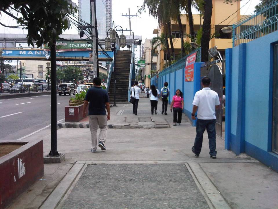
Discouraging walking?
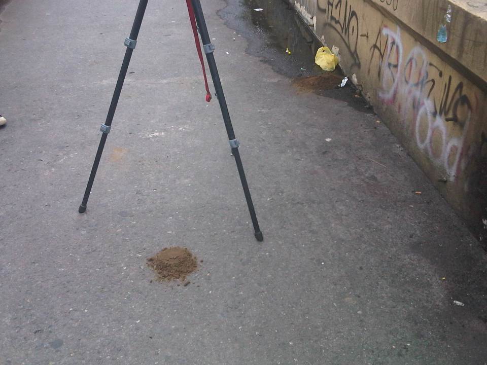
We were looking for suitable sites for a traffic survey along Espana the other day and had chosen the pedestrian overpass across Ramon Magsaysay High School as a possible site for a camera to record traffic flow along the avenue. Data from the video will be used to calibrate measurements from other cameras that are part of an intelligent system under development and supported by the DOST-PCIEERD. Those cameras are currently installed at a post at the junctions with Lacson Ave. and Vicente Cruz St. The system will also utilise data from the ASTI’s flood sensors near Lacson and San Diego. What we saw on the footbridge was not exactly a shocker to us as we anticipated the conditions on the overpass. However, we all agreed that the conditions of such pedestrian facilities need to be improved significantly and in such cases as this footbridge, immediately!
 Walking to the overpass in front of Ramon Magsaysay with the school on the right.
 The overpass was partly flooded from the rains the past few days. The roofing only had the frame so anyone using the overpass on a rainy day would have to use their umbrellas for cover. The MMDA had removed the roofs of many overpasses to discourage vendors and beggars to set up on the overpasses. Spared from the campaign were overpasses that were secured by establishments like those along Katipunan with Ateneo and along Espana with UST. While there are no vendors or beggars on this overpass, it’s quite obvious from the photo that vandals have been busy defacing the facility.
 Many open overpasses like this are stinky because they are (ab)used as urinals. Who knows about the composition of these puddles aside from the rainwater during this wet season.
 The overpass smelled of poop and that’s simply because there were poop scattered along the overpass. Neglected facilities like this, despite being used by many people (its right in front of a big public school) to cross busy streets like Espana, are often used by vagrants as toilets. Quick thinking and action by one of our staff reduced the stink when he got some soil from the (also neglected) plant boxes in the area to cover the feces that littered the overpass.
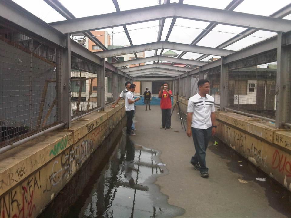 NCTS staff setting up a camera while also taking up the conditions at the footbridge.
 The stairways to/from the footbridge are quite steep. Such features need to be designed with senior citizens, children and PWDs in mind.
This overpass is located in Manila and is probably used by hundreds of students from the public school beside it aside from the other pedestrians that need to cross Espana Avenue. I think there is an opportunity here for the City of Manila and the specific barangay to improve the conditions of the facility and ultimately contribute to improving quality of life through the improvement of the quality of walking – the most basic of all modes of transport and certainly a strong indicator for a city’s health and vibrance.
–
Sunday smog
We were staying at a hotel over the weekend and our room afforded us a good view of the cityscape to the left and seascape to the right. We weren’t able to get a good view of the sunset as we were practically facing south-east and the orientation of the window prevented any, even slight view of what is always a nice Manila Bay sunset. We did expect to see the sunrise the following morning.
As the sun came up, we took this photo of the cityscape. Closer to us were buildings in Pasay City while those farther away were buildings in Bonifacio Global City. I remembered reading somewhere that what makes our sunsets so colourful or spectacular are the elements in our atmosphere. Air pollution tends to bring the most dramatic colors for sunsets and I believe that’s in a way also applicable to sunrises. I took a snapshot of the cityscape from our hotel window expecting the worst for what could be the equivalent of an exposed negative in the old days. Instead, I got the pretty decent photo below showing the sunlight reflecting off the haze around Metro Manila and giving the cityscape that eerie look on a Sunday morning.

There’s a joke that is often recycled concerning air pollution and air quality. According to this joke, the Philippines doesn’t need to worry about air pollution since every year it is visited by many typhoons. These typhoons passing through the country sweep away the pollution thereby making the air around us cleaner. This is actually true and one need only to get outdoors after a typhoon to smell the fresh air. Of course, it doesn’t take long before the smog returns and therein lies the punchline to the real joke. At the rate we are going in terms of vehicle emissions alone, we would probably need at least a typhoon every week for the entire year if we wanted clean air to breathe. The dry seasons would probably be the worst in terms of poor air quality. And so we must see that the joke is on us and air quality will only continue to deteriorate if we do not act now and do not pitch in for the fight for clean air.
–
The need for mass transit to the east of Metro Manila
I wanted to use a title stating “the demand for mass transit to the east of Metro Manila” but the word “demand” for me seemed a bit technical (I associated it with the supply and demand concepts for transport.) and would need some numbers to support it. So I settled for the word “need” instead of “demand” so I could be flexible (i.e., more qualitative) with the way I wrote this article. “Need” is a more pedestrian term that can easily be understood and imagined, and there is no lack for images of this need for more efficient and higher capacity modes along the main corridors to the east of Metro Manila. The main corridors are Ortigas Avenue and Marcos Highway, which have the highest road capacities among other roads (i.e., higher capacities than A. Bonifacio Avenue in Marikina, the Batasan-San Mateo Road, or C-6/Highway 2000). These are also the corridors along which most public transport services may be found. Such connects the eastern towns (e.g., Cainta, Taytay, Antipolo, etc.) to the transport hubs of Cubao and Crossing, which are major transfer points for many people taking public transport. Of course, there are UV Express services from these eastern towns that go directly to CBDs like Makati and Ortigas.
You can observe the crowds at Katipunan and Santolan Stations of the LRT Line 2 as well as the people waiting for their ride home along Marcos Highway. I have observed that there are also lots of people along Ortigas Avenue from Tikling Junction to C-5 who religiously and patiently wait for their rides to school, office or home. This happens everyday and this regularity seems to be a never-ending sacrifice of time and patience. These people do not have much of a choice except taking whatever public transport is available to them. Many probably can afford to have a car or already have a vehicle in their household. Unfortunately, that vehicle is not usually enough for their commuting needs and so they are captive users of an inefficient public transport system (there are some who question if what we have can really be called a system).
 People waiting for a ride in front of Robinsons Metro East along Marcos Highway in Pasig City – these have occupied 3 lanes of the highway as they position themselves for the next available jeepney. There is a UV Express terminal at the mall and another at the nearby Sta. Lucia mall but these are not for the destinations these people are going to.
News that the LRT Line 2 Extension from Santolan to Masinag would finally be constructed was initially met with speculation. Such news have been circulating for so many years but no actual work could be seen along Marcos Highway to convince people that the project was underway. Now, that the soil test samplings have been completed, people are anxious about the actual construction of the extension. I think this is a project long overdue and the question that needs to be answered is if the line needs to be extended further, perhaps until Cogeo. I believe there is a tremendous market for this mass transit system along this corridor where a lot of residential subdivisions and relocation sites have sprouted over the years. The DPWH recognised this as a high capacity corridor and is already widening the road from Masinag to Cogeo.
Hopefully, the Ortigas Ave.-Manila East Road corridor can also have its own mass transit line. The regular bus services along this corridor is no longer sufficient and operations are not so efficient despite what appears as competition among 2 bus lines. There had been a Bus Rapid Transit (BRT) Line proposed for this corridor but there seems to be no progress towards the realisation of that project. Whichever of rail or BRT would be the option for the corridor though, it doesn’t take a genius or too many consultants to determine the need for a good mass transit line along this corridor. When that will be is a question with an answer that is still up in the air. Perhaps the local governments of Rizal, especially the province, should push for such transit systems. The governor and mayors should champion such systems that will definitely benefit their constituents and translate into real revenues for their LGUs from the certain business that will come along these corridors.
–
