
Home » Heritage
Category Archives: Heritage
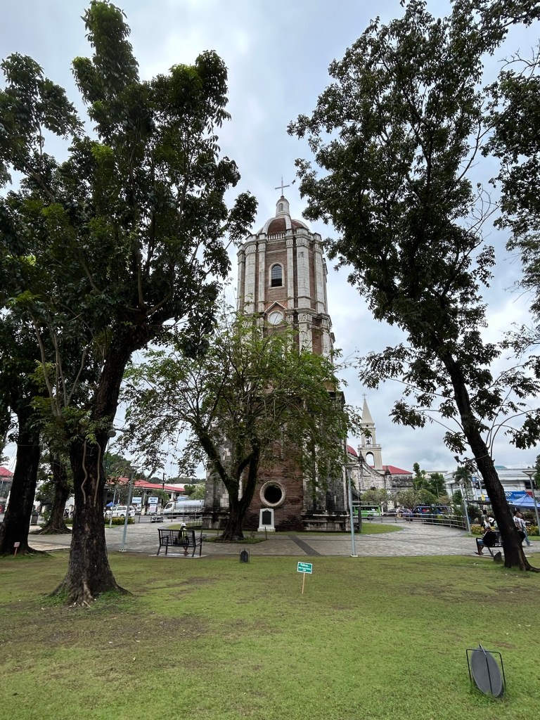
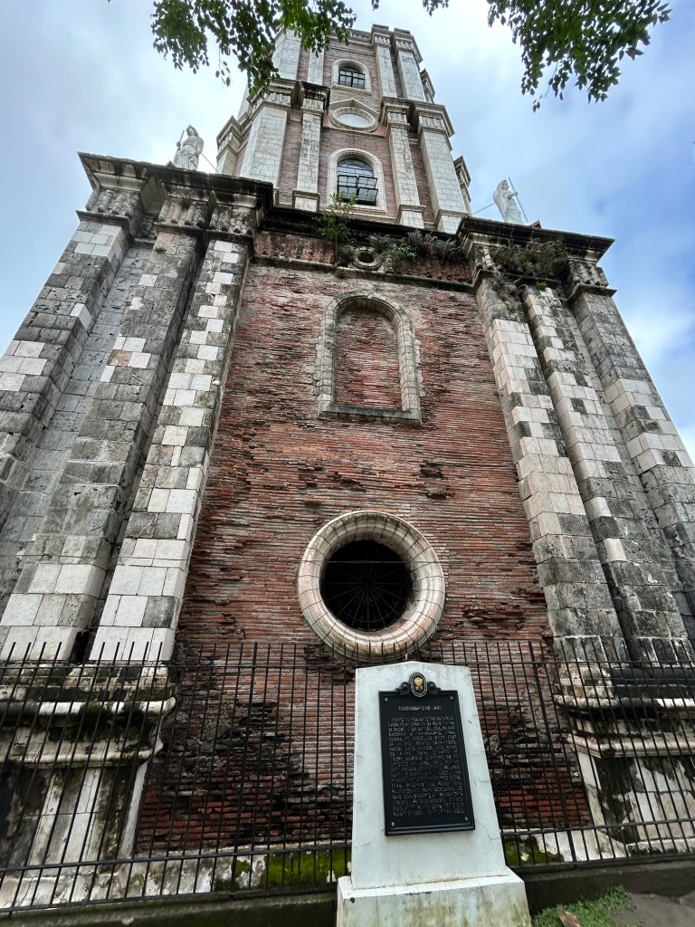
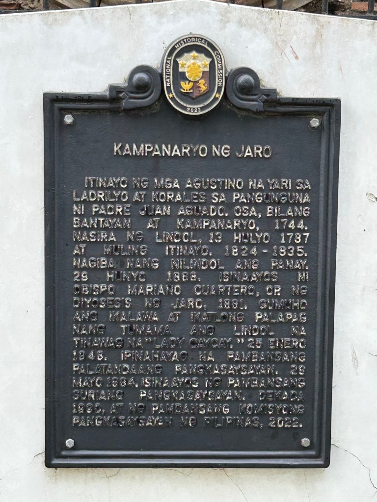
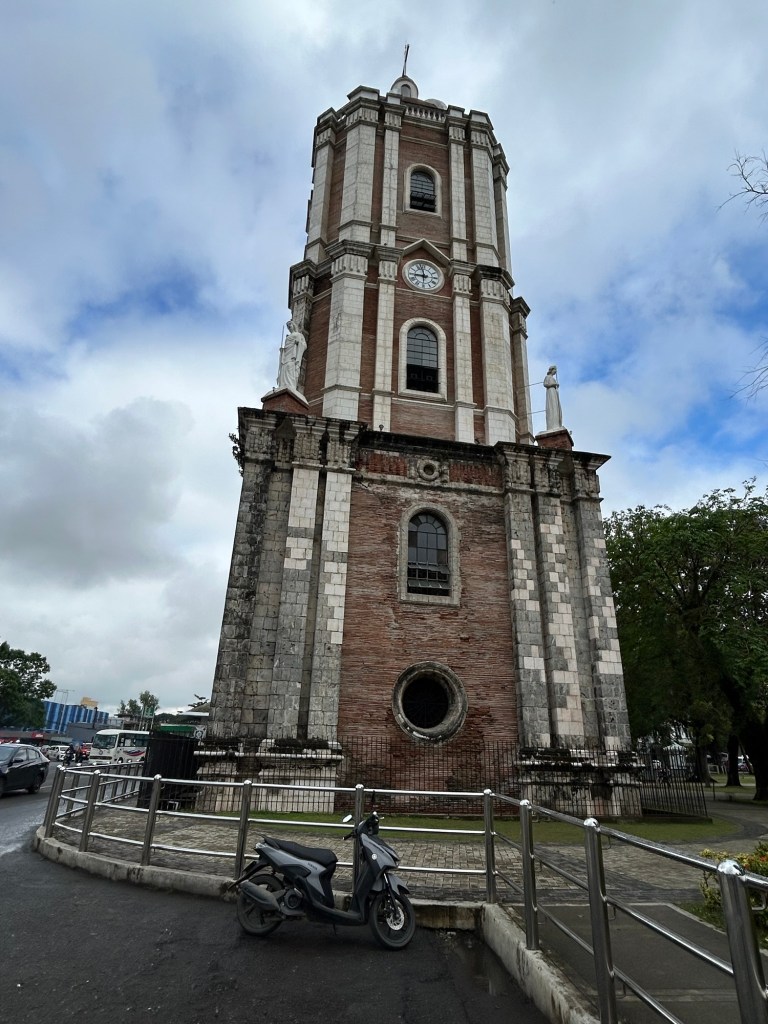
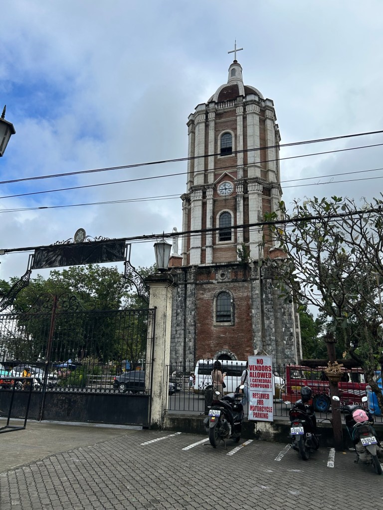
Landmarks: the Jaro Belltower
Here are some photos of a landmark in Iloilo that served as the reference for many jeepney routes. I recall from childhood that we rode the jeepney from Cabatuan and transferred here to another jeepney bound for city proper. Going home, we Di the reverse. We also hopped on a jeepney here to go to other towns like Leganes or farther districts of the city such as Molo or Arevalo. Of course, it’s different now after all the rerouting of public transport. Provincial jeepneys now terminate at the periphery of the city and no longer reach Jaro.
–
On the future of transportation – some history lessons
I found this interesting article that basically is a history lesson on transportation systems and infrastructure:
Dillard, G. (October 21, 2024) “Our infrastructure is Not Our Destiny,” Medium.com, https://medium.com/the-new-climate/our-infrastructure-is-not-our-destiny-6d7f8355144a [Last accessed: 11/17/2024]
To quote from the article:
“We’ll never build out a network of electric-car charging stations, they say, or How could we possibly replace all of these highways with mass transit? But the infrastructure that dominates our world today once seemed impossible, until it didn’t…
As we begin to imagine a new way of organizing our economy, let’s remember that infrastructure isn’t destiny, nor is it forever. Today, our fossil-fuel present may feel like the only “practical” way to do things — just as the canals, and then the railroads, once felt like the only possibility.
So the next time a transition away from cars, fossil fuels, and the other technologies that dominate our world seems impossible, think about Hermon Bronson and Robert Fulton, who surely thought that canals were the infrastructure of the future. They were wrong, and so are the people who tell us that it’s impossible or impractical to build a greener world.”
Perhaps we can take a look at our transportation infrastructure development history and the way it’s going now. It would be good to contextualize all those planned tollways and inter-island bridges against what is really most urgent these days (i.e., mass transit, active transport for our rapidly growing cities). I’ve always stated here about how some infra are nice to have but aren’t as urgent as others that need more push and support and will be utilized by and benefit more than fewer people.
–
Old maps of Rizal Province
I found these two old maps of the Province of Rizal. I was trying to trace their sources but couldn’t find them yet. These were shared from social media pages.
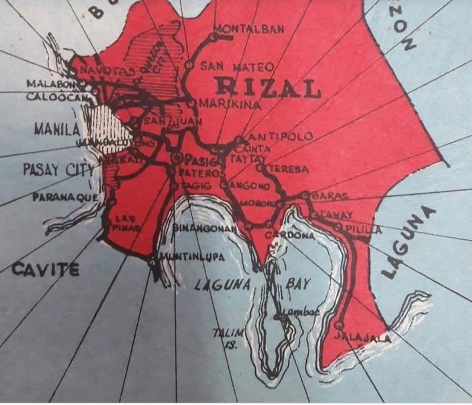
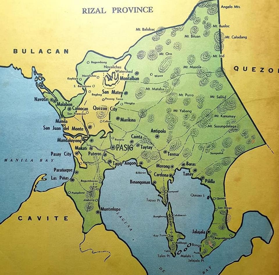
The second map clearly shows the Rizal towns that eventually became part of Metro Manila in the 1970s. These include Navotas, Malabon, Caloocan, Marikina, Pasig, Tagig, Mandaluyong, Makati, Pateros, Paranaque, Las Pinas and Muntinlupa. Pasig used to be the capital of the province; hence, Kapitolyo, which is still in Pasig. Note, too, that Caloocan was connected via a narrow strip between Quezon City and Bulacan. That part of Bulacan is the then town of Valenzuela that was also integrated with Metro Manila. I wrote about a ‘what if’ a while ago where politics would have been different in the province if it remained as it is before the creation of Metro Manila. History teaches us a lot of things including decisions made that led to how we are today. That certainly applies to transportation and definitely applies to politics if you come to think of it particularly for Rizal.
–
International Shrine of Our Lady of Peace and Good Voyage
It’s Maundy Thursday today and there will be the Alay Lakad later this afternoon. Here are photos I took yesterday morning at the shrine including the road closures sign or tarp posted at the intersection of P. Oliveros Street, Ortigas Avenue Extension and L. Sumulong Circle near the provincial capitol site.
 Access was already being limited as of yesterday morning. On regular days, there will be a queue of vehicles mostly new and to be blessed at the shrine. There’s limited parking at the shrine itself so visitors or pilgrims would have to find parking around the church including the nearby mall.
 View of the shrine from the entrance to the complex
 The main altar of the shrine
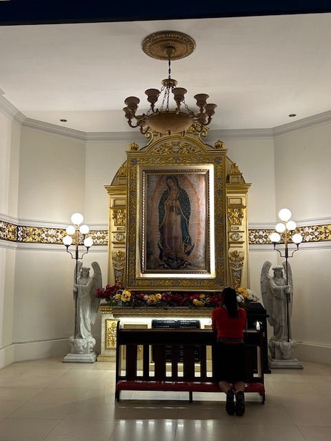 Retablo to Our Lady of Guadalupe
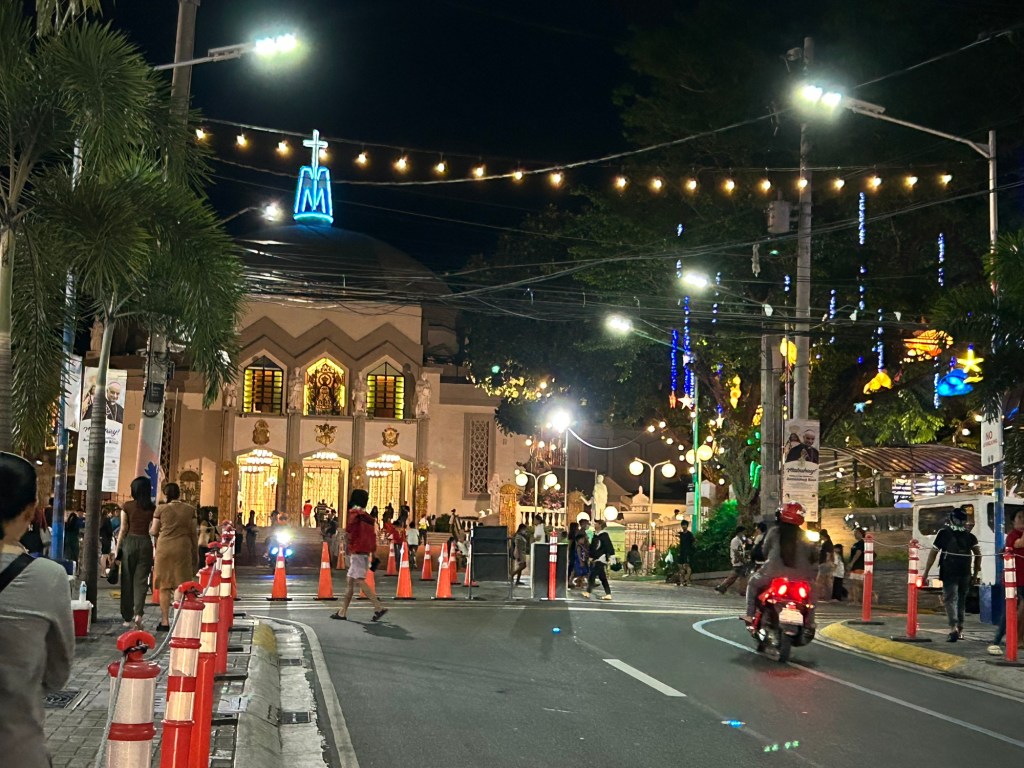
 The main road to the shrine, P. Oliveros Street, is an extension of Ortigas Avenue Extension from the Provincial Capitol site. This will be the main route to the shrine and will be filled with people later this afternoon and overnight.
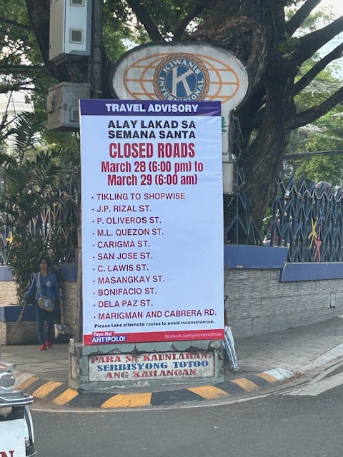 Road closures from 6:00 PM today until 6:00 AM tomorrow (Good Friday)
The Alay Lakad is a spectacle by itself and probably rivals if not exceeds the Traslacion of the Black Nazarene in Quiapo, Manila in terms of the number of participants.
–
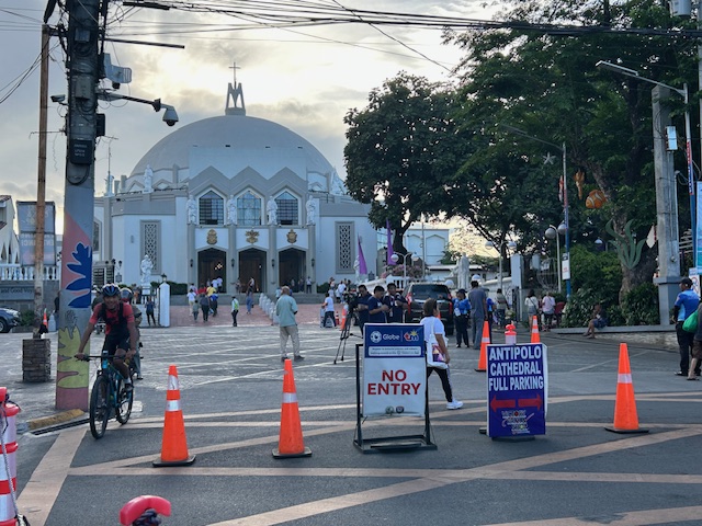
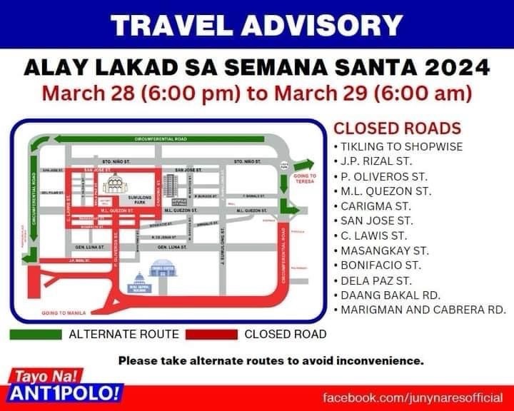
Alay Lakad 2024
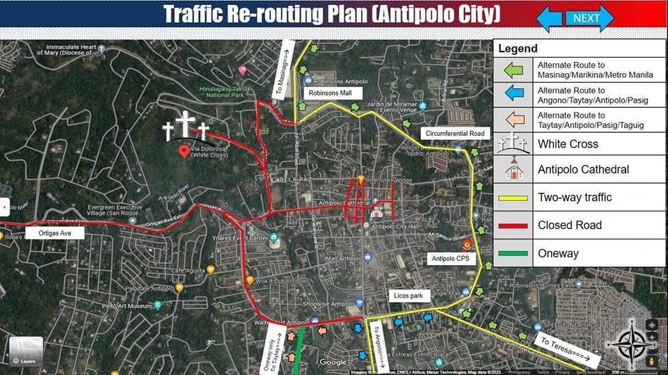
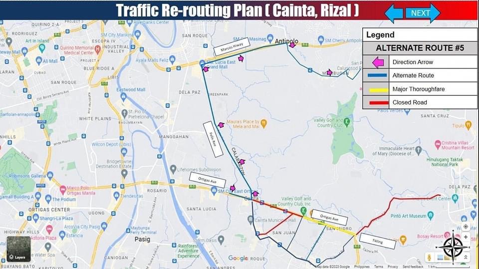
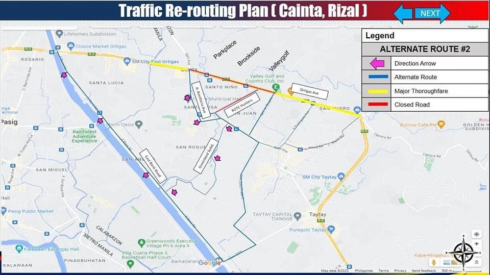
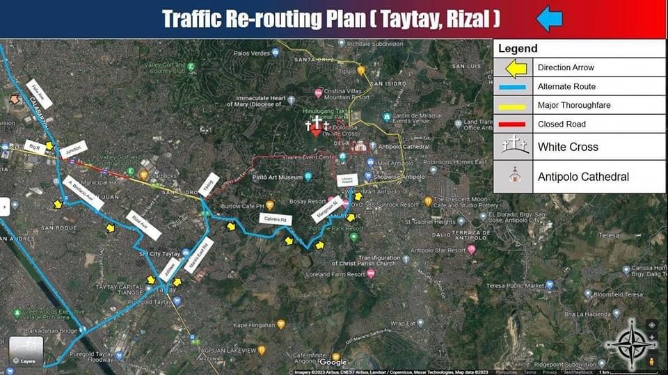
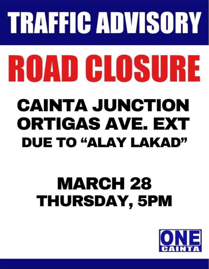
I’m sharing here the announcements and maps shared by Antipolo, Cainta and Taytay regarding road closures and alternative routes during the Alay Lakad this Holy Week. The roads leading to the Antipolo Shrine will be closed from 5pm of March 28 (Maundy Thursday) to 6am of March 29 (Good Friday). Expected are hundreds of thousands of people making the trek to the Shrine of Our Lady of Peace and Good Voyage, which is among the most popular pilgrimage sites in the country.
Many are probably walking as part of their panata or commitment in exchange for a favor they have prayed for. This may be healing for an illness or finding work or passing a licensure exam. Of course there are those who also pray for wants rather than needs like a new car, a big house or winning the lottery. And then there are those who are in it for the adventure, treating this as an excursion or a gig with the barkada.
Here are the maps and announcements posted in the official pages of the LGUs:
–
Lagusnilad now
The underpass across from the Manila City Hall is called Lagusnilad. The underpass is prone to flooding and had been neglected for a long time under several administrations spanning several Presidents, DPWH Secretaries and Manila Mayors. Kudos to the recent Mayor and DPWH officials who finally addressed the flooding problem as well as improved the pavement and lighting for Lagusnilad.
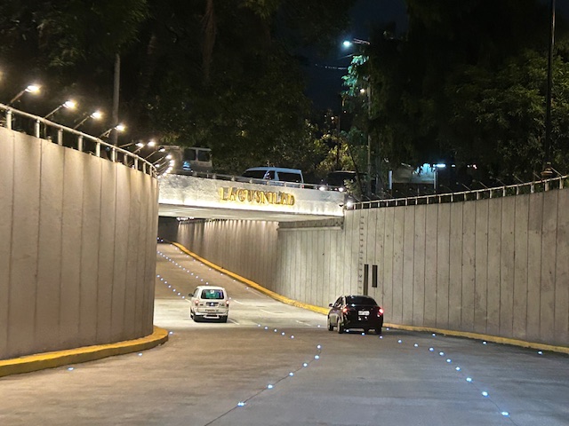 Approach to the lowest point of the underpass from Padre Burgos Avenue, one notes the now well-lit underpass and the solar studs marking the lanes.
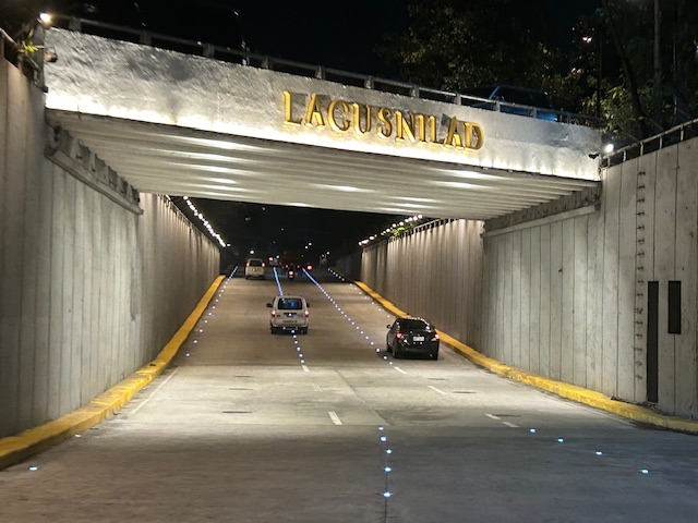 The lowest section of the underpass is prone to flooding but major rehab works to the drainage plus new pumps appear to have addressed the problem.
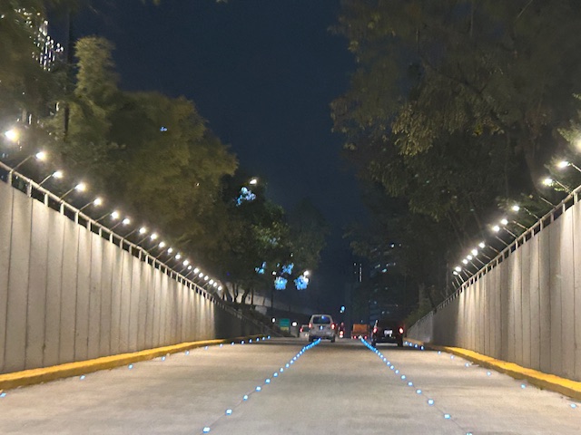 Emerging from the underpass towards Taft Avenue
I have memories of when this underpass was often flooded back in the 1990s including a time when vehicles braved the waters and got stuck after drivers discovered just how deep the waters can be. The joke then was that the underpass would be renamed ‘Langoynilad’, alluding to people and vehicles having to swim to traverse this section.
There is also a pedestrian underpass that is called Lagusnilad. This connects City Hall with Intramuros and used to be so dirty and stinky. Again, credit is due to recent officials who rehabilitated the underpass to what is now a tourist attraction but more importantly a good practice example for pedestrian facilities.
–
Heritage buildings in Makati City?
I noticed from last weekend’s view from our hotel room a couple of buildings that on their own could be considered landmarks in the city.
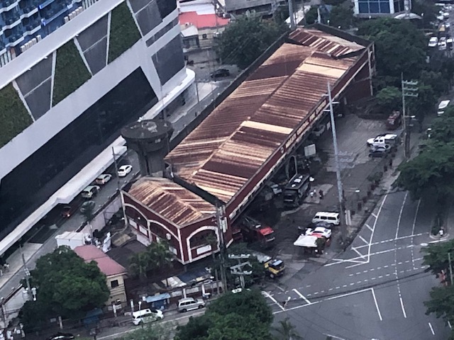 The Makati Central Fire Station could easily qualify as a heritage structure or building considering its architecture and age. If we were in Singapore, the building would already be declared as a heritage structure.
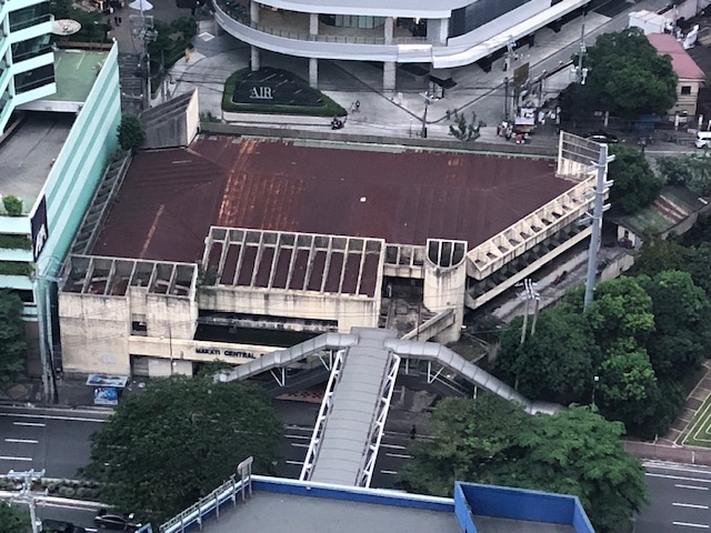 The Makati Central Post Office building is obviously newer but could be considered a landmark for the city.
If it was not obvious, these two are very much related to transportation. The fire station hosts fire engines or fire trucks that are the vehicles of firemen responding to emergencies, especially fires. The post office deploys mailmen and women on foot or vehicles to deliver the mail, parcels or packages. So its very much involved in logistics.
–
On San Francisco’s cable cars
Here a quick share of an article on San Francisco’s iconic cable cars:
Carren, D. (May 11, 2023) “Why SF cable cars are so iconic: a history,” The Bold Italic, https://thebolditalic.com/why-sf-cable-cars-are-so-iconic-a-history-895e30e50784 [Last accessed: 5/14/2023]
From the article:
“Though a scant remnant of what they once were, the three remaining lines are almost always packed with riders, running every 8 minutes for 16 hours a day, clanking along with a lurch’s awkward grace and an artful clattering. The crowd hangs tight to the handholds and the poles and their hats through hairpin turns, and a daring few lean out with one arm, wildly waving to signal all is still quite well.”
I have been to SF a few times and enjoyed using the cable cars among other modes to go around the city. In fact, in one of our stays in SF, we deliberately booked a hotel close to the end point of one of the lines so we can use it more frequently to go to downtown SF.
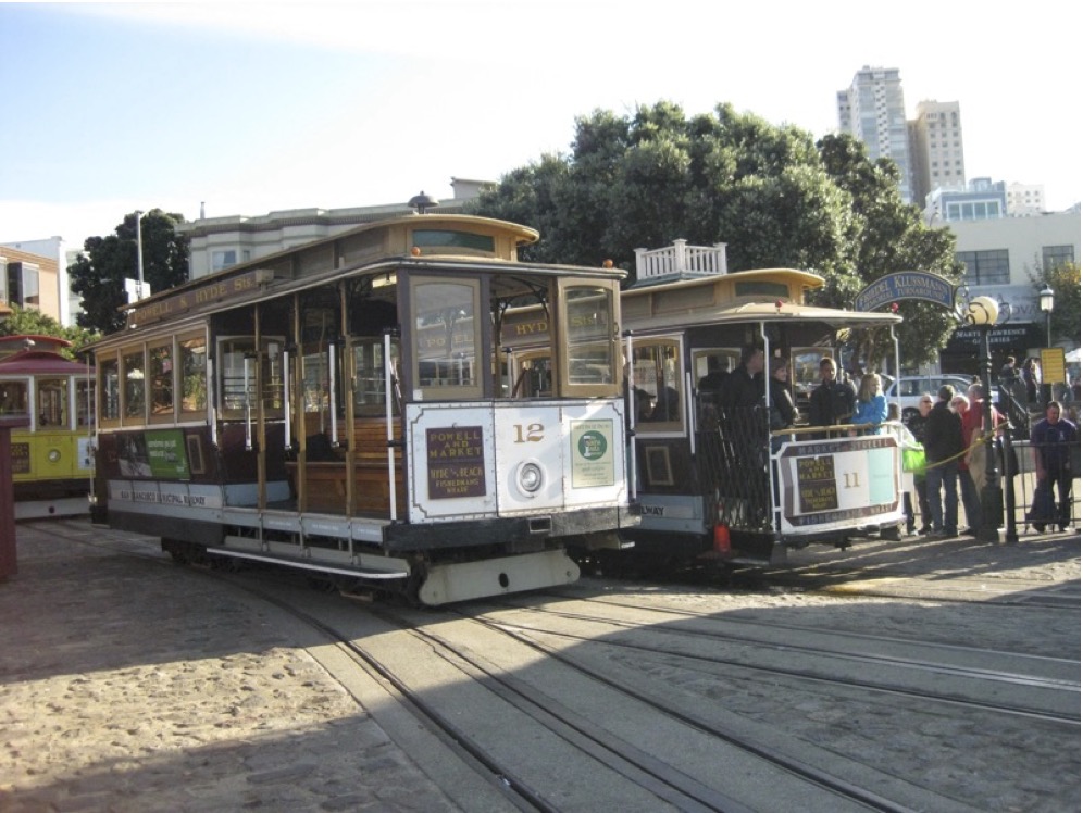 San Francisco’s cable cars at the Hyde Street turnabout ca. 2011.
–
A vintage US Army Jeep – the ancestor of the jeepney
We were visiting the studio of a friend last weekend and learned that he was a history buff. He did historical reenactments as well as researched on militaria including the uniforms worn by combatants in World War II. The latter was part of his work towards more accurate uniforms being used for period films. A surprise for us was that he also collected vintage cars that included two US Army Jeeps and a truck that were parked in their garage.
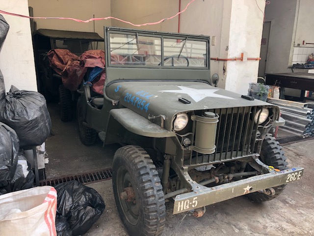 A US Army Jeep greeted us as we entered their studio premises
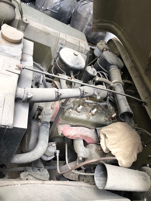 The 4-cylinder engine of the Jeep
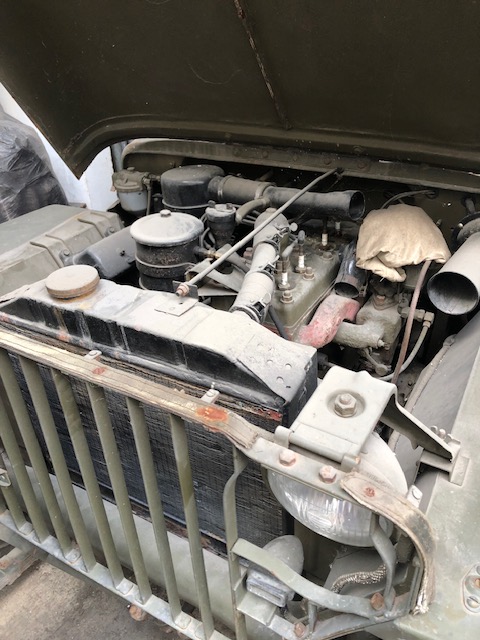 Another view of the engine. Notice, too, the front grill of the vehicle.
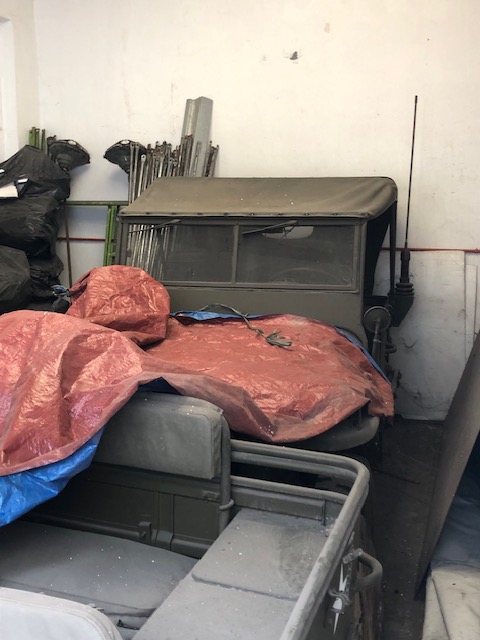 A second jeepney is parked behind the first. This second one had a canvass top on and a radio antenna that’s supposed to be original.
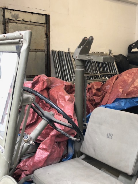 There’s the steering wheel and the machine gun mount.
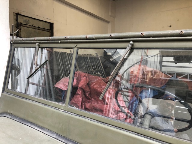 The wipers whose design was retained by the jeepneys
I had always wanted to see an intact specimen of this jeep. The surplus units eventually were modified or customized to become the first jeepneys that seated 4 to 6 passengers at the back (they were shorter back then. The designs were based on the auto calesa, which were cars that were modified to become public transport vehicles with bench seats at the back. The rest, as they say, is history and we now still have what are termed as conventional jeepneys that now seat 16 to 24 passengers at the back of the driver.
–
Old rail timetable to Antipolo
I found this on the internet – a timetable or schedule for trains bound for what are now destinations in Rizal (e.g., Antipolo, Taytay, San Mateo and Montalban). Pasig and Marikina used to be part of Rizal province with the capital at Pasig (thus, Kapitolyo).
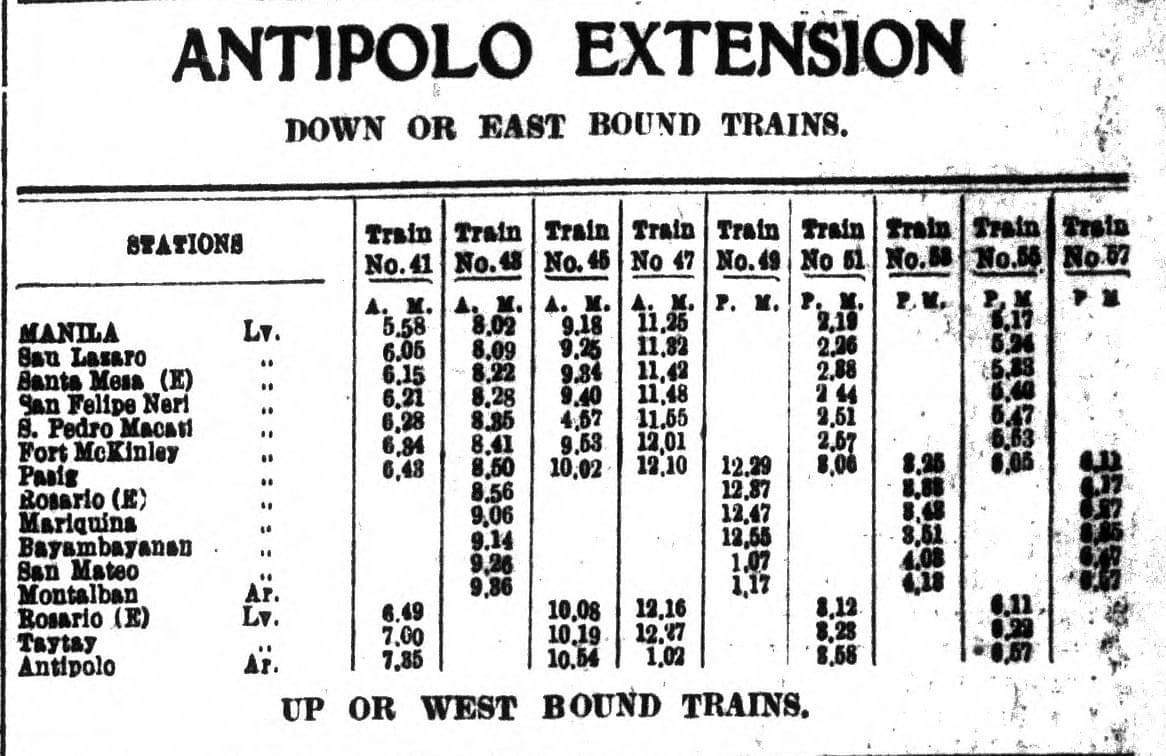
From the schedule, one can see that the main line was between Manila and Pasig (Rosario). From Rosarion, the line branched out towards either Antipolo or Montalban (now Rodriguez). Certain trains like Nos. 41, 45, 47, 51 and 56 terminated in Antipolo while others at Montalban. Again, one cannot help but wonder what if these lines were sustained and still operational (of course, upgraded) today. Commuting would have been different for many of us residing in Rizal and along these lines.
–
