
Home » Heritage (Page 2)
Category Archives: Heritage
Old rail timetable to Antipolo
I found this on the internet – a timetable or schedule for trains bound for what are now destinations in Rizal (e.g., Antipolo, Taytay, San Mateo and Montalban). Pasig and Marikina used to be part of Rizal province with the capital at Pasig (thus, Kapitolyo).

From the schedule, one can see that the main line was between Manila and Pasig (Rosario). From Rosarion, the line branched out towards either Antipolo or Montalban (now Rodriguez). Certain trains like Nos. 41, 45, 47, 51 and 56 terminated in Antipolo while others at Montalban. Again, one cannot help but wonder what if these lines were sustained and still operational (of course, upgraded) today. Commuting would have been different for many of us residing in Rizal and along these lines.
–
On “beautiful” train stations
Here’s another article I am sharing that presents a list of some of the world’s most beautiful train stations. I say some because in my opinion, there are many others that we can consider beautiful according to various criteria and preferences. After all and as they say, beauty is in the eyes of the beholder.
Funderburg, L., Cott, A. and Cherner, J. (August 1, 2022) “The 37 Most Beautiful Train Stations in the World,” Architectural Digest, https://www.architecturaldigest.com/gallery/best-train-station-architecture-slideshow?utm_source=nl&utm_brand=spotlight-nl&utm_campaign=aud-dev&utm_mailing=thematic_spotlight_080122_1&utm_medium=email&bxid=5bd6761b3f92a41245dde413&cndid=37243643&hasha=cf6c402001bc473063a8744033fe9be3&hashb=ec2bb753c2e6299f5107823241955221da67bd1f&hashc=09f65c608bfb62050199733de500e3cd82827631b36d537ce8386d41a3bd1ff7&esrc=FYL_SEG_APR18&sourcecode=thematic_spotlight&utm_term=Thematic_Spotlight [Last accessed: 8/2/2022]
I’ve seen many of these stations particularly the ones in the Netherlands, Australia and the US. The wife also sent me photos of other stations in her travels in Europe and the Americas. But there are many else to include in the list depending on your taste. Southeast Asia has many though perhaps for restoration. Japan definitely has many classic and contemporary/modern designs. And Central Asia should also have many that can be compiled into a list. I wonder what we can include or if there’s something in the future to look forward to in the Philippines.
Here are a couple in my list that aren’t in the article:
 Den Haag Station, The Netherlands
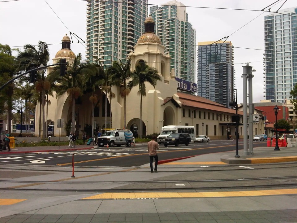 Santa Fe Station, San Diego, USA
–
On women and the railroads in Ukraine
Ukraine has been in the news lately due to what analysts think is an impending invasion by Russia. Ukraine, of course, used to be part of the Soviet Union. However, they have initiated what Russia thought was unacceptable, which is applying to be a member of the North Atlantic Treaty Organization (NATO). That constituted a threat to Russia right at its doorsteps. Russia, though appear to be egging for a fight ever since they snatched Crimea from Ukraine and covet resources in that country that would likely benefit the west more as Ukraine moves to closer ties with what Russian leadership still regard as enemies.
The article I am sharing though is not about conflict but of railways in a country rich in railways history and heritage. Ukraine’s railway system date back to pre-communist times, before their inclusion in what was the Union of Soviet Socialist Republics (USSR). Here’s a nice read on Ukrainian railroads and the women who help keep their trains running:
Mallonee, L. (May 31, 2020) “The Women of Ukraine’s Railroads Keep the Trains Running,” Wired, https://www.wired.com/story/women-ukraine-railroads/?utm_medium=social&utm_social-type=owned&mbid=social_twitter&utm_source=twitter&utm_brand=wired [Last accessed: 2/21/2022]
–
Farewell to the arch?
Arches (arko) were a common sight along national roads across the country. I have written about these arkos in previous posts including those with old photos that I took while on field work:
With all the road widening projects ongoing along many national roads, many arches have been demolished while new ones apparently have not been constructed (whether really new ones or those replacing the old ones). I still think these are good landmarks and an opportunity to feature products, traditions or whatever may represent or identify the city or municipality.
–
On preserving railways – an example in Bulgaria
Here’s a quick share of an article about saving Bulgaria’s last narrow gauge railroad:
The article is relevant as it discusses the plight of railways amidst shrinking ridership and escalating costs of operations and maintenance. The railways in the article is not a isolated case. It is quite common for many railway systems. The difference of this example from another similar service like those in Japan is that Japan Railways or private companies can probably absorb the costs and maintain the line not just as a service but to show their commitment. Historically, there are many railway lines, branches if you prefer, of the Manila Rail Road Company (later the Philippine National Railways) that had to be discontinued due in part to a combination of diminished ridership and escalating O&M costs. The Main Line South, for example, had several branches including an extension from Albay to Sorsogon that had to be discontinued. Nowadays though, the topic should also be considered as the railways in the country is being expanded again. There is still the issue of ridership and this will always be in competition with road-based transport as well as aviation.
–
Is it really a golden age for railways in the Philippines? Or is it just a great catch-up?
The government and many railway fans in the Philippines have dubbed the construction and rehabilitation of railway lines as a “golden age of railways in the Philippines.” Many, especially those who have aspired for railway development in the country agree with this monicker.
But is it really a golden age or are we just playing catch-up due to the backlog of railway projects in the country? Rehabilitation, after all, means there was a period of deterioration, even neglect by the government (i.e., across several administrations starting from Marcos) that led to poor or discontinued services.
A “golden age” is defined as “a period in a field of endeavor when great tasks were accomplished.” Indeed, by definition we can qualify the current one as such but let me point out the facts from history that railways development in the country (both long distance and urban transit) started in the late 1800s before the revolution that led to declaration of Philippine independence from Spain in 1898, and while many of our revolutionary leaders were abroad, mainly in Europe where I’m sure they took the trains and trams to move about. Here’s a link to the website developed by a research program in the University of the Philippines that focused on mass transit development in what is now the Metro Manila area:
Since railway development in the late 1800s started from scratch, perhaps the current development is more of a “second” golden age for railways, and not ‘The’ golden age for railways. This wouldn’t have happened or won’t be necessary if we rehabilitated the tranvia after WW2 or allocated resources to preserve and maintain the PNR and other lines like how our Southeast Asian neighbors did to their own railways. Indonesia, Malaysia, Thailand and Vietnam have enviable railways including preserved, operational steam locomotives that are now practically moving museum pieces. But since we are into catching-up and there’s been significant progress on this end, perhaps the right term shouldn’t be “Golden Age” but “Renaissance”. It’s actually quite a catchy phrase “Railway Renaissance,” if you bother to consider it.
–
On preserving old transit systems
Many old cities have either retained or phased out their old road-level transit systems. I am referring mainly to rail-based streetcars rather than road-based ones such as buses. Even the indigenous types of road-based public transport may be phased out and usually in the name of modernization. Some though, like Singapore’s rickshaws and Manila’s calesas are still existent but you will find them either during odd hours or in tourist areas.
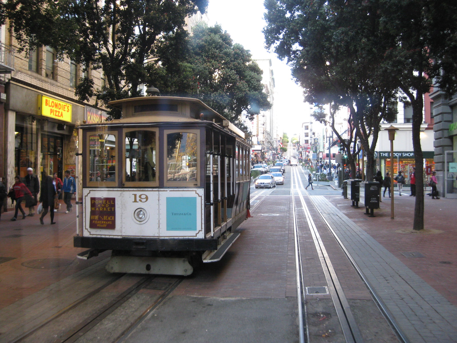
A good example of a city that has retained and preserved its transit system that is San Francisco in the US. The city still has a running cable car system, and its street cars maintained and operated by the San Francisco Municipal Railway (Muni). These are practically operational, traveling museums. The streetcars, for example, are of different models – a collection of streetcars from various cities around the world that have phased out this transit systems a long time ago. So it should not be surprising to see a different street car every time. And one could try to ride each one in operation while staying in city.
Here is an article about Kolkata’s (Calcutta’s) trams:
Schmall, E. (September 2, 2021) “Kolkata’s ‘Fairy Tale’ Trams, Once Essential, Are Now a Neglected Relic,” The New York Times, https://www.nytimes.com/2021/09/02/world/asia/kolkata-india-trams-calcutta.html?smid=url-share [Last accessed: ]
What are your thoughts about preserving or phasing out these transit systems?
–
Nostalgia: On old photos of transport in the Philippines
I like browsing old photos on the Philippines. Of particular interest are photos showing transportation during the Spanish and American periods. I came upon this photo of a tranvia station at Plaza Goiti in front of Sta. Cruz Church. The church is still there though it looks very different from the structure in the photo below. This is probably due to the reconstruction and renovations done over the years (it was seriously damaged during World War 2).
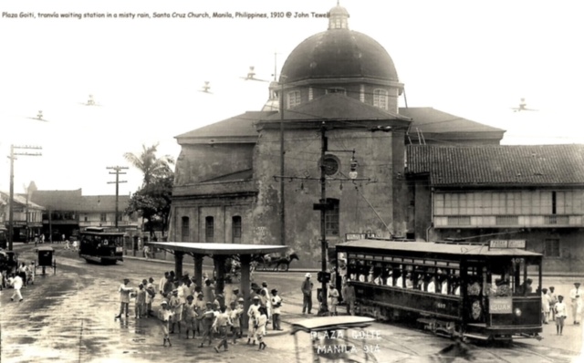
The source of the photo is a collection I found on the internet. Note that if you clicked the photo, you will be taken to another site where you can view other photos as well. Meanwhile, here is a screen capture of the area from Google Street View:
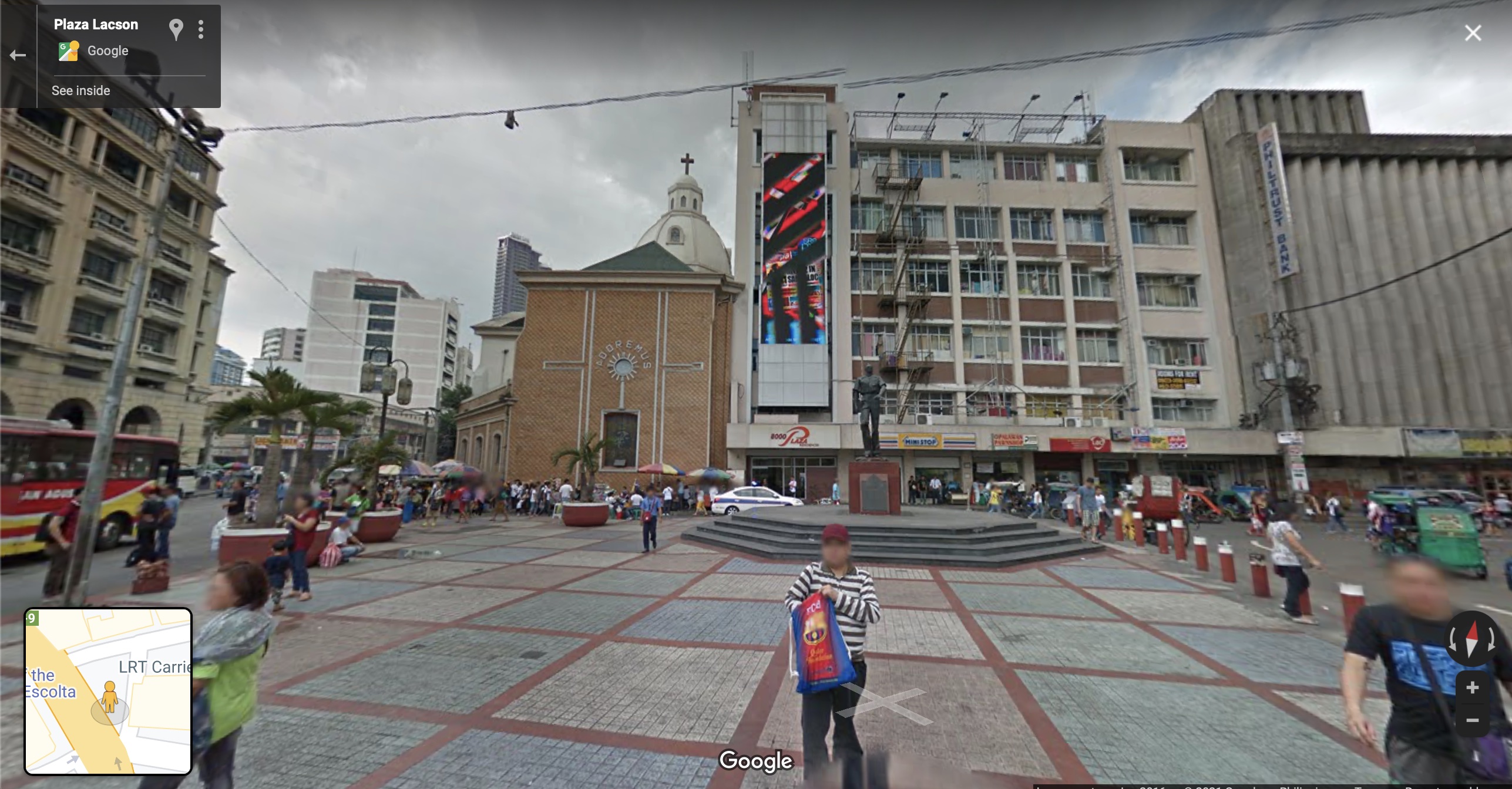 Plaza Lacson with Sta. Cruz Church in the background to the left of the statue of former Manila Mayor Arsenio Lacson
Plaza Goiti is now Plaza Lacson with a statue of the former Mayor of Manila standing in the open space. Of course, the tranvia is no longer there but there are buses and jeepneys as well as tricycles providing public transportation in the area. The population is also higher and denser than when the first photo was taken (ca. 1910) but it seems the Sta. Cruz district is still a walkable area. We hope it will remain to be so and more initiatives are taken to have more improvements or enhancements to encourage active transport as well as public transport use over private motor vehicles.
–
Visita Iglesia itinerary?
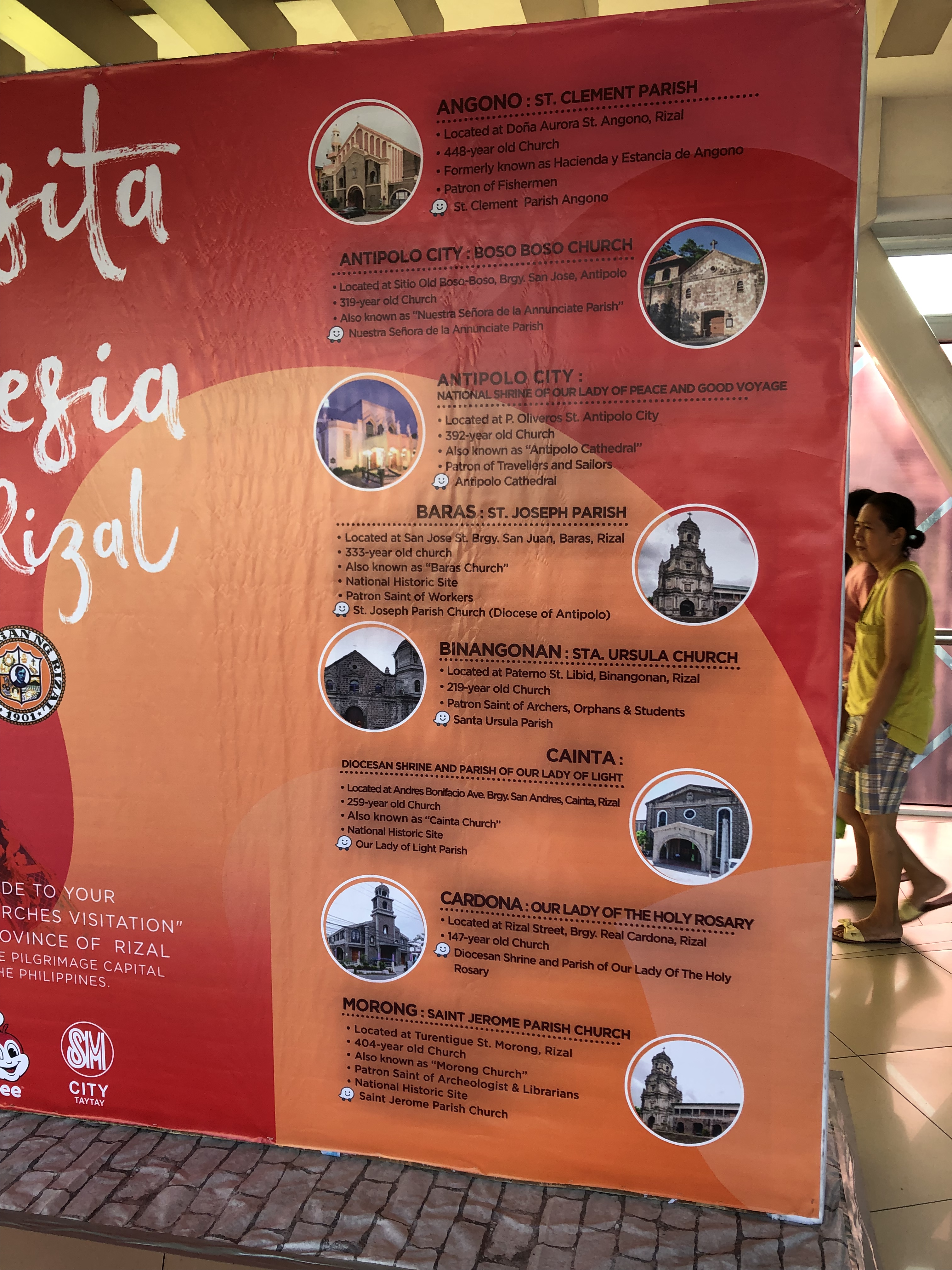
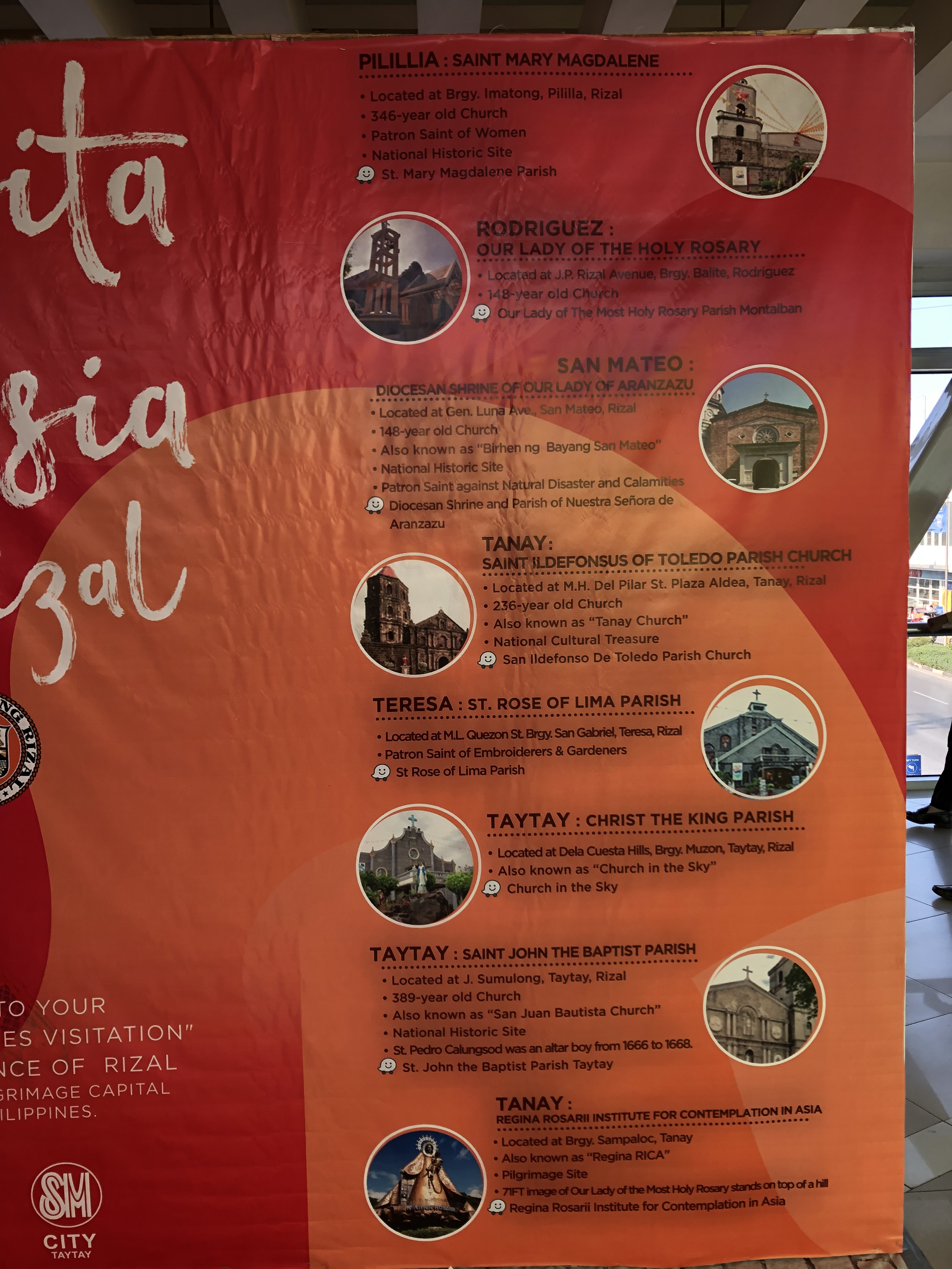
I spotted this ad at a nearby SM mall listing churches that can be part of a Visita Iglesia itinerary in the Province of Rizal. I took the following photos showing the major churches in the province. These include old churches found in the older towns including those in Morong (ca. 1620), Taytay (ca. 1630), Pililla (ca. 1672), Baras (ca. 1686), San Mateo (ca. 1716), Tanay (ca. 1783), and Binangonan (ca. 1800). Antipolo has one old church – Boso Boso Church (ca. 1669). The Shrine of Our Lady of Peace and Good Voyage while being the more famous of the two was completed in 1954. The first church though was completed in 1632 but was destroyed several times due to unrest, earthquakes and the Second World War. Cainta also had an old church (ca. 1707) that was destroyed several times including during WW2, and the new church was completed in 1968.
We’ve visited many of these churches before but are no longer into the Visita Iglesia considering our experiences of traffic congestion the past years when this tradition became more of a tourist thing or gig. We’d rather go to a nearby church to pray or stay at home to enjoy the peace and quiet; not to mention the comforts of being at home.
–
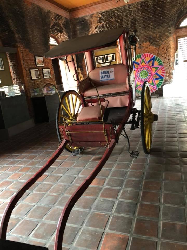
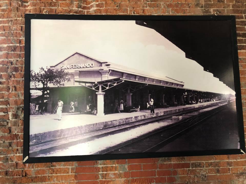
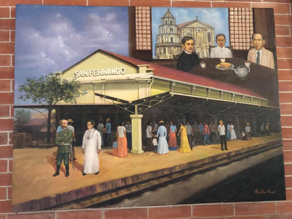
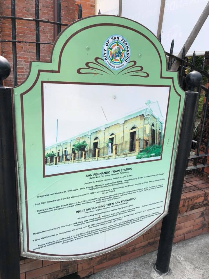
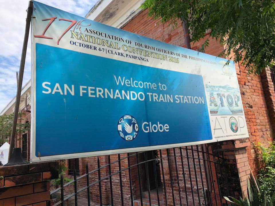
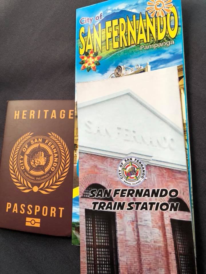
PNR San Fernando, Pampanga
It’s Araw ng Kalayaan (Independence Day) in the Philippines so I thought it was appropriate to feature something related to Philippine history and heritage. Railways in the Philippines played a part in its history being a mode of transport that connected the provinces of major islands like Luzon and Panay. The other railways were more for freight (e.g., agricultural goods) rather than for passengers so the railways in Luzon and Panay, especially the former, had more impact on socio-political events including the wars of independence from Spain and later, the United States. One station that probably figured in the actions during those times more than a 120 years ago is the PNR Station in San Fernando, Pampanga, which was along the main line north that was used by Philippine revolutionaries to transport troops and logistics.
Following are photos of the station, which has been converted into a museum. The proposed revival of this northern rail line will mean that a new station will have to be constructed but it would be good to integrate the old one with the new. Those responsible should work towards heritage preservation in this and other cases of railway stations.
–
