
Home » Highway Engineering (Page 9)
Category Archives: Highway Engineering
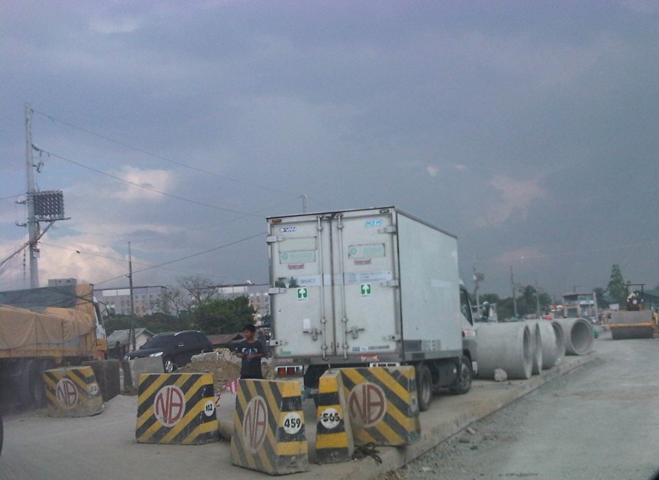
Ortigas Avenue Extension Roadworks
Causing much traffic congestion the past weeks and especially these days are sections of Ortigas Avenue Extension. This is basically caused by roadworks between Cainta Junction and Valley Golf. The section between Brookside and Valley Golf is being raised. The section is a low portion of the road and is almost always flooded whenever there are heavy rains due also in part to the creek in the area. The westbound side of that section is completed and the contractor is now working on the eastbound side. The section is a wider segment of Ortigas and it’s possible to close one lane at a time while having 2 lanes usable for traffic along either side of the road.
The more severe congestion is along the westbound side where another contractor is working on drainage between Junction and Brookside. The section in front of the RRCG bus depot only has one lane usable by traffic and so westbound traffic is regularly backed up for hundreds of meters. How bad is it on a weekday? It took me 30 minutes to pass the area between 5:15 and 6:00 AM last Monday.
 Eastbound traffic splits into two lanes separated by roadworks
 The left lane is part of an already elevated westbound side of Ortigas Ave. Ext. The inner eastbound land has already been graded and ready for concrete pouring. The base course layer is visible in the photo.
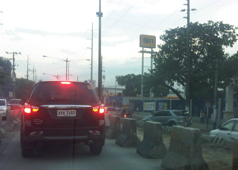 Section near Hunters ROTC Road (right where the grey SUV is coming from) and STI, and approaching Valley Golf.
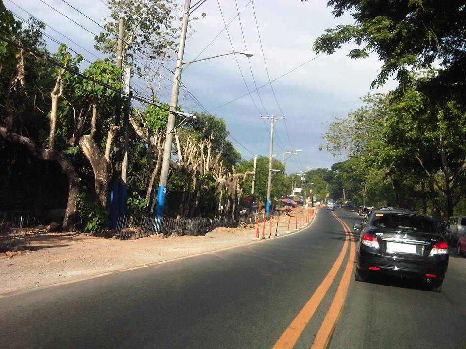
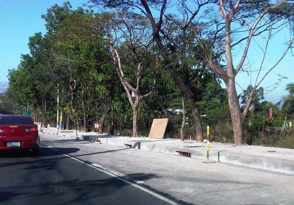
 Past STI, the traffic lanes go back to normal just before the intersection at Valley Golf.
Traffic is so severe along Ortigas Ave. Ext. that I am sure a lot of people are looking for alternate routes. Those from Antipolo, Taytay and towns along the Manila East Road would likely take the routes utilizing the floodway including Highway 2000 and C-6. Others would find the longer route via Sumulong Highway and/or Marcos Highway to be worth the time and fuel. Hopefully, work will be continuous along Ortigas and roadworks will be completed before we are deep into the typhoon season this year.
–
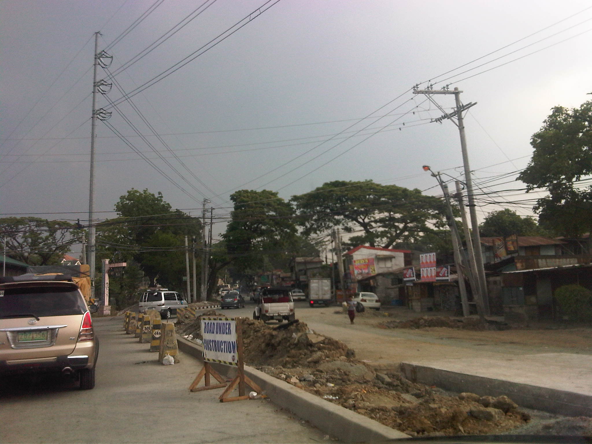
Road widening along Sumulong Highway
Sumulong Highway is the main road connecting Antipolo City with Marikina City and ultimately to Cainta, Pasig and Quezon City via Marcos Highway. It is basically a 4-lane, 2-way undivided road with several sections that have 3 lanes total probably due to ROW acquisition issues when the highway was widened from the original 2-lane road. I came back from a trip recently to find road works along my commute and took some photos of what would definitely be an improvement to the highway. The uneven number of lanes along several sections of Sumulong has led to road crashes and surely many near misses among motorists and cyclists using the highway. There is also a need to provide space for pedestrians and others on foot considering the highway is one of the major routes to the Shrine of Our Lady of Peace and Good Voyage – a major pilgrimage site for Filipinos.
 Road widening for an additional lane along the inbound lane approaching Sumulong’s intersection with Olalia Road
 Construction along the inbound direction of Sumulong Highway include drainage works aside from the construction of an additional lane to make the number of lanes even (2 per direction). At present, there are 2 lanes along the outbound direction and a single lane (shown clearly in the photo) along the inbound lane. The section shown is near the Garden of Gethsemane and Palos Verdes subdivision.
 Completed lane, drainage and sidewalk along the outbound direction of Sumulong Highway right after Metro View subdivision.
 Widening along the outbound direction between Metro View and Valley Golf includes drainage works. There will be a sidewalk on top of the drainage that should enhance safety for walking/trekking.
 There are many informal settlers as well as formal ones encroaching on the RROW. Part of the project is to remove these and other obstructions. I just hope that the sidewalks and the curbside lane will remain clear of obstructions.
The completion of the road widening project is expected to improve the flow of traffic along Sumulong Highway as there will be a continuous 2 lanes available along either direction for safe and effective passing. The additional lane also means public transport may stop along the roadside without blocking through traffic. Trucks and slow moving vehicles (tricycles?) may also be required to take a designated lane. Moreover, since there is a significant volume of bicycle users along Sumulong Highway, there will be enough safe space for them to travel. The current volume of motorised vehicle traffic along the highway requires only 1 lane per direction (2 lanes total) and these are the innermost lanes of the road. Traffic slows down usually because of trucks or tricycle operations/maneuvers. In theory, the 2 outer lanes can be used only for overtaking, stopping and cycling. These should be clear of parked vehicles particularly along areas where there are communities and businesses (e.g., vulcanising, auto repair shops, etc.) along the roadside.
–
The engineering blame game and a need for some re-education
A prominent architect was always posting on his social media account about how much of what’s wrong with our infrastructure (especially transport-related) are due to engineers. It was a sad commentary particularly because he wasn’t mentioning anything about the involvement and responsibility of architects in the planning and design of infrastructure. For most projects that fall under the category of ‘planned development’ including mixed use developments like the Eastwoods, BGCs, Nuvalis, MOAs, and other similar projects are planned and designed mainly by a team of architects. Highways and streets are part of these projects and often, engineers are given the task of detailing and in certain cases, analyzing and ending up with the responsibility to justify designs provided to them. So for those types of projects funded or led by the private sector, its probably the architects who have much say in the plans and designs and who should be scrutinized for their shortcomings in as far as sustainable or “green” criteria are involved.
It is a whole different story, however, for public roads, especially those that are classified as national roads. The reality is that many DPWH engineers need to re-tool, learn and practice principles of sustainable infrastructure design. This includes incorporating green or environment-friendly design principles, which includes consideration of the landscape. We met some DPWH engineers in one seminar before on sustainable transport who thought environmentally sustainable transport (EST) was simply environmental impact assessment (EIA) and who proudly claimed they already knew about the topic. I think many engineers and planners in government need to unlearn many things and dissociate their minds from a lot of what they have come to accept as standard, acceptable or correct that are actually sub-par, archaic or flawed. Kapag nakasanayan na at matagal nang ginagawa o ginagamit ay napagkakamalang tama at angkop kahit na sa katotohanan ay hindi.
A good appreciation of history and heritage also appear to be scarce these days whenever the DPWH is involved. Proof of this are the road widening projects in Leyte and Iloilo that now threaten many ancestral houses that are located along the national roads. Many contend that road widening is unnecessary because congestion has not set in along many of the sections that have been widened or are candidates for such projects. It can be seen along many widened roads along Tarlac and Pangasinan, for example, that the problem is not really congestion but poor enforcement of transport and traffic regulations. Such include tricycle operations, roadside parking, and encroachments on the road right of way (RROW).
In most cases its pure and simple analysis that needs to be conducted first. Are roads really congested and requiring additional lanes? The evidence does not seem to support many cases of road widening as data on congestion from the DPWH Atlas itself requires validation on the ground. A recent World Bank study, for example, found that for many national road sections reported as congested in the Atlas, the opposite is true when validated on the ground. Such issues with data that are used as basis for decisions whether sections need to be widened are serious and lead to a waste of funds as well as negative impacts on heritage or historical structures.
The DPWH still needs to do some re-inventing and should actually take the lead in many initiatives. Among these are those pertaining to what are being referred to as “complete streets.” Last week, there was an article in newspapers where the DENR called for pedestrian and bike lanes along roads. The call was not specific to national or local roads but it is something that the DPWH should have already anticipated and working at for roads under it jurisdiction given the outcomes of the International Road Assessment Program (iRAP) project that covered several thousand kilometers of national roads that pointed to the need to improve roads to improve safety for pedestrians and cyclists. It is a matter of having progressive or dynamic rather than reactive or static stance at the DPWH and this requires more than just the rudimentary engineering background for the agency to take road planning, design and construction to another level.
–
Innovations for cycling and walking
I usually browse the net for the wealth of information now readily available on transport facility designs that are pedestrian and/or cycling friendly. In the Philippines, there has been an increased awareness lately for people-oriented systems encouraging cycling and walking. These have extended to calls for more bikeways and walkways to enhance mobility, with several projects being implemented to further the advocacies for non-motorised transport (NMT). Of course, there are already existing examples of both good and bad practices around the country including ideal and undesirable cases in Marikina City, which is the first (and only?) city in the Philippines to have a comprehensive network of bikeways.
Recently, I found this article entitled “Urban Innovations That Could Turn Your City Into a Bicycling Paradise” on one of my favourite websites io9.com. It contains some of the more prominent examples of bicycle and pedestrian-friendly designs that have been implemented elsewhere that we could probably take note of as good practice references when we do plan and design similar facilities in our cities. I’m sure there are many people out there, and not just architects or engineers, who would have good ideas for people-friendly infrastructure design. We need to encourage them to come out and propose these ideas that can be adapted into sound design according to architectural and engineering principles (i.e., the designs would still have to follow standards or guidelines, e.g., seismic, wind, etc. in order for these to be safe for use and last long.
Government agencies especially the DPWH and local government units should be open to new ideas or innovative designs to help transform our transport system to become more people-oriented than vehicle-oriented. There should be initiatives from within these agencies to come up with innovative designs while keeping the details up to standards or following established guidelines. So far, there have been no notable push for updating road designs, for example, despite road safety assessment findings and recommendations that should resonate more within agencies and LGUs if they are not comfortable dealing with NGOs or civil society groups advocating for people-friendly infrastructure.
I believe government engineers are competent and have the talent to come up with innovative designs and guidelines but there is a lack of incentive for them to do so and to think out of the box. The bottom-line is still to create an enabling environment for such design ideas to come out and be implemented. Perhaps the academe could lend a hand here with their strong linkages with government planners, architects and engineers. The schools could provide the environment for encouraging new thinking in as far as transport infra is concerned and the leading universities would have the resources that can be harnessed towards innovative designs.
–
Food for thought – a few articles on transport and traffic
This will just be a quick post for now and I just wanted to share a few recent articles on transport and traffic from a favourite magazine – Wired:
What’s Up With That: Building Bigger Roads Actually Makes Traffic Worse
Why We’re Sad the Best Airport in the World Is Getting Even Better
The Hidden Genius and Influence of the Traffic Light
These are very well written, easy to understand articles on things we encounter everyday (traffic congestion, traffic signals at intersections) and when we travel long distance (airports). They show different perspectives of things we take for granted or assume we understand. An example of the latter includes notions that road widening or road construction will solve traffic congestion problems. Much of what goes around regarding road widening or road construction as solutions do not account for induced demand, which is basically additional traffic generated or encouraged by wider or new roads. The second article talks about Changi Airport, arguably the best in the world, and the high tech approaches they have employed or will employ in order to ensure efficient operations there. Such tools, I think, should be used in our airports especially NAIA where the long standing excuse is the limitations of the runway(s) and the airport terminals. Certainly, there are other issues that need to be addressed and going high tech and employing sophisticated methods for airport operations should alleviate problems until we ultimately build a new airport elsewhere. The third article takes a look into behaviour and mentions a “social contract” we have agreed to in order to reduce mayhem in our roads. This “social contract” as well as others related to it should be revisited and understood as they are very much a part of how we behave when we travel and have a significant effect on others around us.
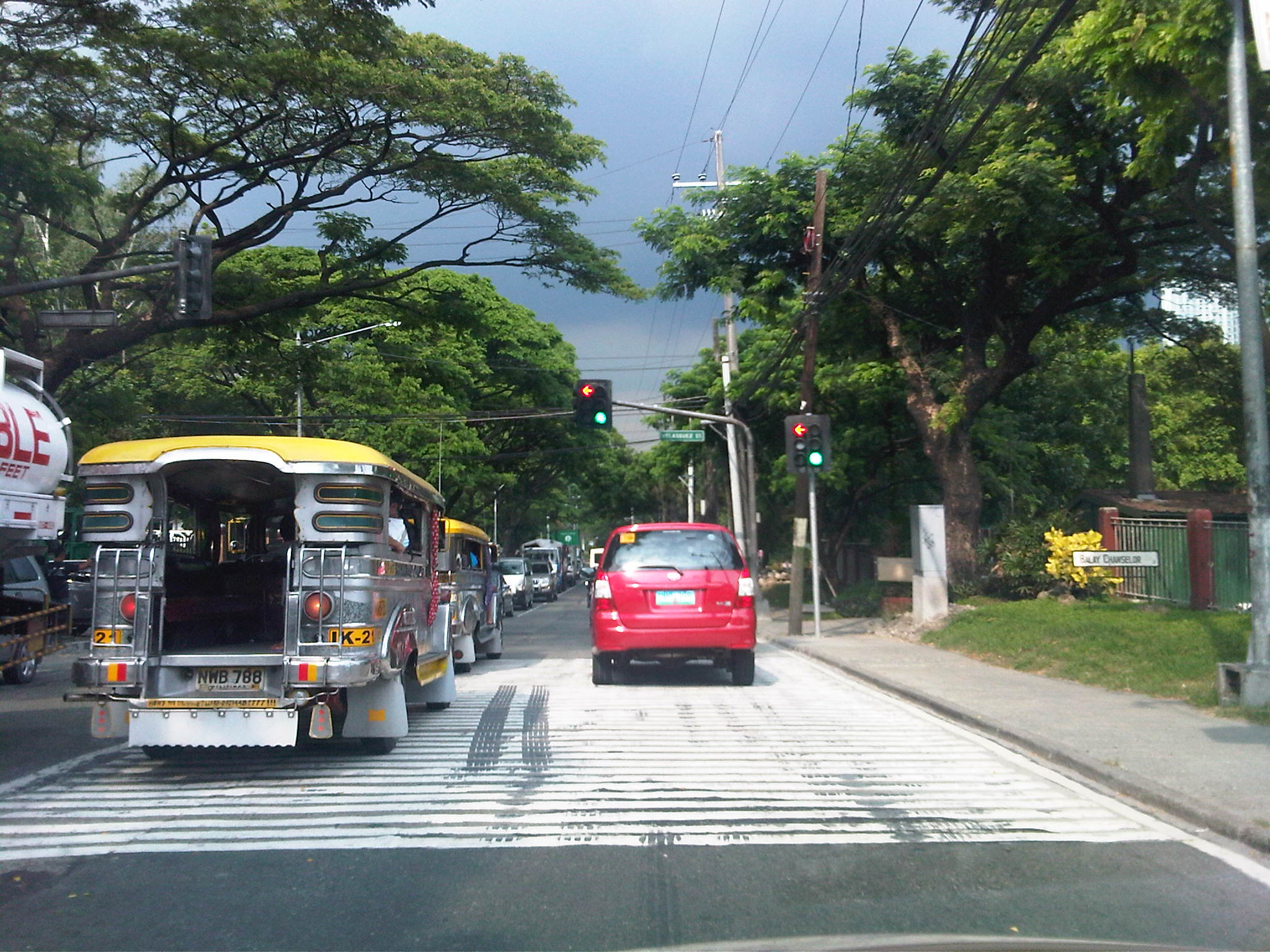 Traffic congestion and traffic signals along the 4-lane C.P. Garcia Avenue in UP Diliman
–
Tandang Sora Avenue road widening
The stretch of Tandang Sora Avenue between Commonwealth Avenue (Luzon Avenue Flyover) and Capitol Hills Drive is currently being widened as part of the Luzon Avenue project. Work here has been delayed by not a few glitches including the issues regarding the right-of-way acquisition. This area used to be home to a lot of informal settlers, including many who have lived in the area for decades as they were tolerated by the land owners. Many had to be relocated and were compensated to give way to the section of Tandang Sora that connects to the also unfinished Luzon Avenue.
The following photos were from a month ago when work was still ongoing along the southbound side of the road. This southbound side is actually the old 2-lane, 2-way section of Tandang Sora that was rehabilitated following completion of work on the expansion northbound lanes.
 Heavy equipment are everywhere along the section like the roller (pison) on the right side of the photo working on base layer of the pavement. The concrete barriers are used to prevent vehicles from entering the work zone.
 Both northbound and southbound traffic were using the northbound side of the road. The median island separating NB and SB sides of the the road is shown in the photo. The building on the right is actually a condemned structure.
 Concrete pavement has been laid out along the SB lanes but was still undergoing curing.
 Approach to the intersection with Capitol Hills Drive
Yesterday, I was able to take a few photos of the same section and found that the rehabilitated southbound lanes were already usable to traffic.
 Tandang Sora junction with Luzon Avenue
 Newly opened southbound lanes – 3 lanes are of PCCP but there are still construction work ongoing including drainage and sidewalk construction.
 Sidewalk and median barriers are in various stages of construction along the section. I think they built barriers to anticipate problems regarding jaywalking.
 Approach to the intersection with Capitol Hill Drive – one problem that needs to be solved along Tandang Sora is roadside parking. Informal settlers who own vehicles park these along the road. There are also stores, eateries and vehicle repair shops along the section that occupy sidewalks and encourage parking by customers.
Once the section is completed and with the future completion of Luzon Avenue, it is expected that traffic will increase along this section. The improved capacity of the road is also expected to ease traffic along the Capitol Hills Driver-Zuzuaregi Street route, which has become congested due to vehicles traveling between Commonwealth and C-5 whose drivers want to bypass the usually constricted Tandang Sora section.
–
Road right-of-way encroachments: Samar
Going around the country for projects, we always take a lot of photos about transportation including roads, bridges and transport modes. Thank goodness for digital cameras and cell phone cameras, and special mention to memory cards that have allowed us to take photos at will often only worrying about battery life. In a previous post, I wrote about encroachments to the RROW and featured some photos from field work we did in Palawan. This time, I was able to find a few choice photos taken from another project we did; this time in the island of Samar in the Eastern Visayas. In the following photos, one will see permanent structures already built along the roads – ones that are usually the most difficult to remove and the residents a challenge to be relocated.
 Houses built alongside the highway on what is supposed to be shoulder space. What looks like a booth in from tof the parked vehicle on the right is actually a guard post for the barangay. The barangay hall is located behind the fence visible at the right of the photo.
 Makeshift houses along the secondary national road also on space usually where the shoulders are. Some houses are located at a hazardous part of the road (i.e., right at the curve and just behind the chevron signs).
 More houses with their fences encroaching on the RROW along a secondary national road in Eastern Samar – the sign on the right, while not exactly obstructed, will blend with the structures and will probably be unseen or unnoticed by motorists.
 Souvenir? – I have seen signs being stolen and displayed in some homes as trophies (actually an illegal act that can get one jailed and fined a hefty sum if caught by authorities). Some souvenirs are harder to take but can be integrated with the house interior or, in this case, as part of a store. Imagine knowing the exact location of a store in the area not through GPS but simply by knowing the exact kilometer post where the store was put up.
There are many other examples of RROW encroachments along other roads. These seem to be common along all types of highways where development along the roads are generally not regulated by local governments but present future problems when space is needed to widen roads to accommodate traffic. Is it an issue of cooperation between the DPWH and the LGUs (including the DILG)? Or is it mainly a local issue that is largely the responsibility of local authorities? Perhaps it is both and something that needs to be addressed to enhance road safety as well as to ensure that future headaches will be avoided when it is time to access the RROW.
–
Road right-of-way encroachments: Palawan
Encroachments to the road right of way (RROW) is quite common along many roads in the Philippines including national roads. While the DPWH has jurisdiction over the latter roads in as far as construction and maintenance is concerned, the agency does not have the resources to secure these roads. Such responsibility lies in the hands of local government units (LGUs), which are tasked to regulate land use at the local level ahead of the Housing and Land Use Regulatory Board (HLURB). Following are a few photos I took in one trip to Palawan where we did a few road safety audits of a national highway.
 This RROW marker that doubles as a kilometer post along a highway in Palawan is located a few meters from the carriageway. While there are no developments or encroachments along this section, such markers could easily get lost.
 This one’s already behind the fence (and house) of a family encroaching on the RROW. Many of these people establish homes and even informal businesses (vulcanizing shops, makeshift stores, etc.) along the road with LGUs often turning a blind eye and in many cases even allowing people to register the lands as their own when in fact these have been reserved for future expansion of the road.
 Zooming in on the marker shows it to be behind a storage shed where grain, lumber, bamboo and various other materials are piled up.
For most of these people who have encroached on the RROW, their actions are not illegal given that in many cases, the LGUs let them do so in order to develop areas along the road. The problem comes later when these developments and residents begin constricting traffic along the highways and demanding compensation when they are asked to move out to give way to road widening projects. It seems that the best approach is still for LGUs to do their part in regulating settlements along roads so that most if not all will locate outside the RROW. In other cases where it is obvious that development will come much later, it should be clear to settlers that the property is not theirs and will not be theirs, and that they would have to go sometime in the future when the road needs to be widened. This is not an easy thing for LGUs to accomplish but they should have system in place for this since it will considerably be more difficult later when the roadside has been settled with more permanent structures.
–
Loop D Loop Bridge
One of the more interesting features of a highway that I have seen in the Philippines is a certain Loop D Loop Bridge section along a secondary national road between the towns of Wright (Paranas) in Samar Province and Taft in Eastern Samar.
Following is a video of the loop section, which is quite unique given the terrain in the mountains of Samar Island:
–
Payatas Road
We traveled along the section of Payatas Road from the junction with Montalban Highway to the intersection with the Manila Gravel Pit Road. A significant length of the road had the La Mesa watershed, Metro Manila’s main source of fresh water, along its right. This was an issue before and is still an issue today as more and more developments are made along the road with some already having impacts on the watershed due to encroachments, irresponsible waste disposal and other activities.
The following photos show various sections of the Payatas Road from its junction with Montalban Highway to the point it becomes the Gravel Pit Road (also known as Litex Road). The photos clearly show the road and roadside conditions of this important link between Metro Manila and Rizal Province.
 After turning left from the intersection with Montalban Highway, it is a two-lane road
 A few hundred meters away, travelers begin to climb towards Quezon City view a few picturesque areas along the road. The tarpaulin sign on the left indicates an ongoing roadworks project by the DPWH.
 The canal on the inner side of the road keeps water off the carriageway, making the surface safer for motorists. These though are not easily seen at night-time without proper pavement markings and lights.
 There were roadworks ongoing along the road as we ascended and heavy equipment like the one shown in the photo tend to constrict traffic flow.
 Going up the road, we became part of a platoon of vehicles whose speed was dictated by the road conditions.
 Trucks are usually the slower moving vehicles and will often dictate speeds on the ascent.
 Concrete barriers prevented vehicles from flying off the road in case the driver or rider loses control of the vehicle.
 View of the Marikina Valley, which is the catchment area for a lot of water (from rains) that comes from the surrounding mountains of the Sierra Madre range.
 There’s significant truck traffic along this road and many carry garbage or junk.
 But traffic is usually light as this and other photos show. Many sections had no pavement markings and traffic signs to guide motorists.
 At the edge of one of the curves is a house with modern style architecture. A good landmark to guide travelers using the road.
 Some sections seem narrow due to the walls built to keep people out of the watershed area and the encroachments on the other side of the road.
 There were no proper drainage along the road and many sections have poor pavement conditions.
 What appeared as drainage works were actually part of the concrete “re-blocking” for the road.
 There were also waterworks along the road when we passed through.
 Such waterworks being undertaken often lead to traffic congestion as road space is constricted.
 The road has poor drainage along many of its sections including this section near a gas station where muddy water pools in the middle of the road. Such instances induce drivers and riders to encroach upon the opposing lane as shown in the photo above.
 There are many junk shops along the road owing to its proximity to the Payatas open dumpsite.
 End of the road where Payatas Road ends and becomes the Manila Gravel Pit Road.
–
