
Home » Highways and Streets (Page 17)
Category Archives: Highways and Streets
Pinagmisahan Street, Antipolo City
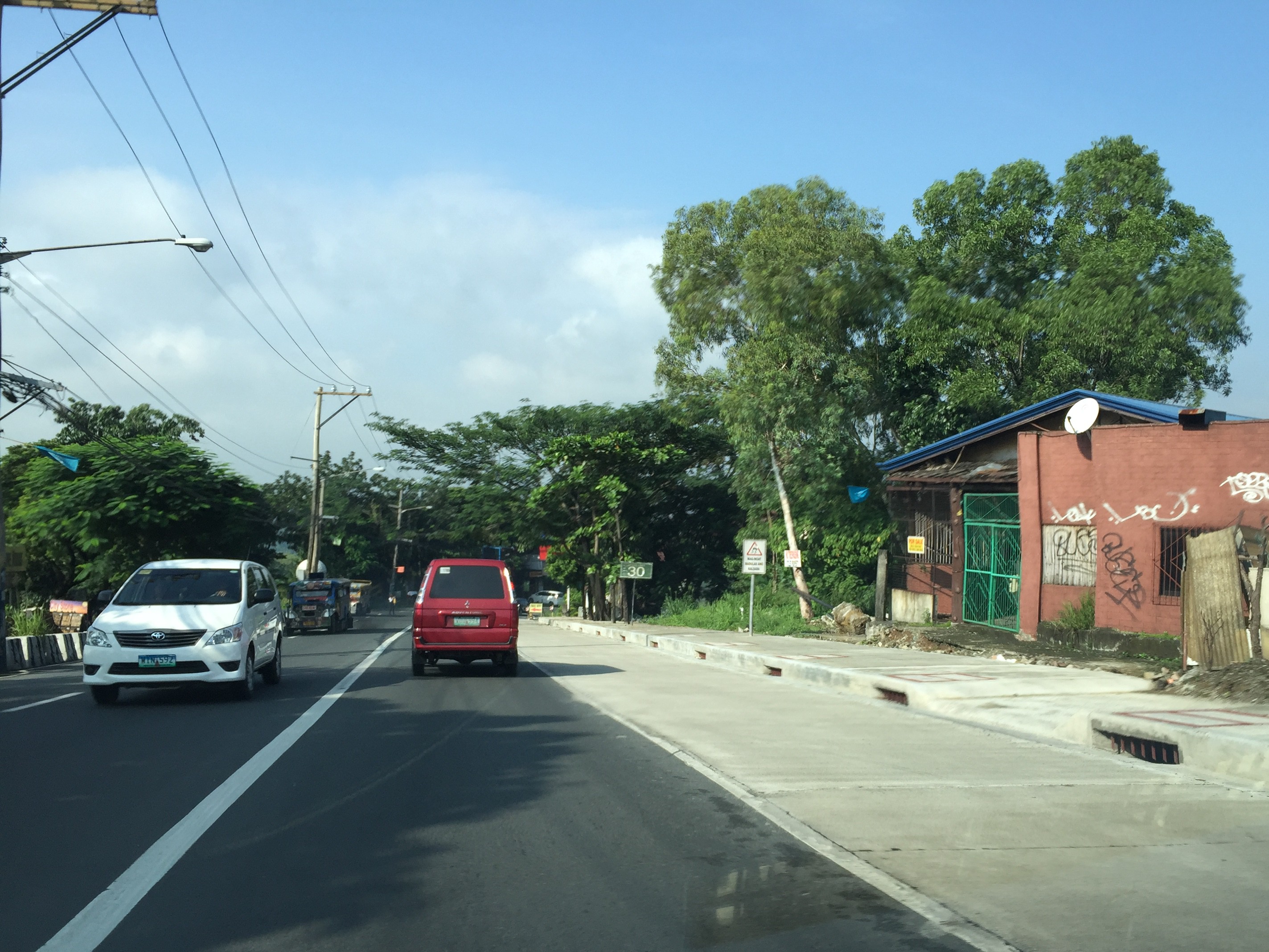
A couple of weeks ago, traffic had to be rerouted from a section of the city’s Circumferential Road (also known as the Sen. Lorenzo Sumulong Memorial Circle) between the intersection with Taktak Road and Pinagmisahan Street to Pinagmisahan Street. This was due to the preventive maintenance work that had to be done to the pavement. As such travelers including myself had to use Pinagmisahan to travel between Sumulong Highway and Ortigas Ave. Extension. It was not my first time along Pinagmisahan but it was my first to traverse the road from end to end. Following are photos showing sections of Pinagmisahan Street from the Clinica Antipolo end to the Daang Bakal end (i.e., northbound).
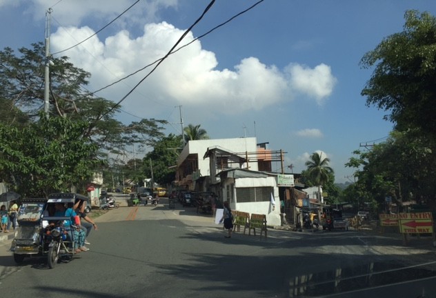 Pinagmisahan Street on the left with ‘No Entry’ signs for the Circumferential Road section being maintained.
 On a typical weekday, there are many school service vehicles parked along the road. Many of these are for the Montessori school across from Clinica Antipolo, which does not have sufficient parking for vehicles it attracts.
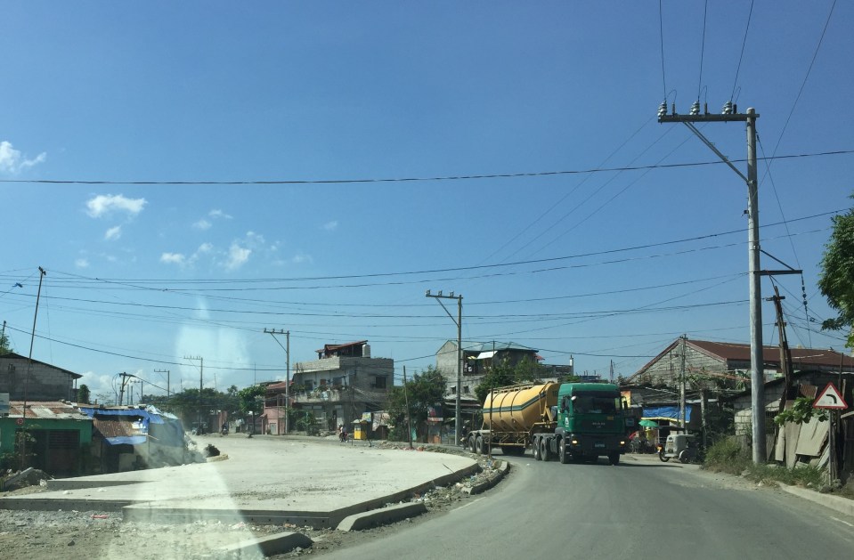
 Pinagmisahan used to be a narrow 2-lane road. It has been expanded recently into a 4-lane road with Portland Cement Concrete Pavement (PCCP).
 While the expansion included the construction of sidewalks, many electric posts remain in their original positions and pose safety hazards to motorists.
 White Cross, which is a popular destination during the Lenten Season and especially during the Holy Week is accessible via this road.
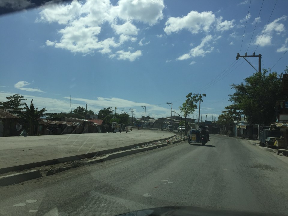
 There appears to be many informal settlers living in communities along the road. They have encroached on the RROW and hamper the completion of the expansion of the road.
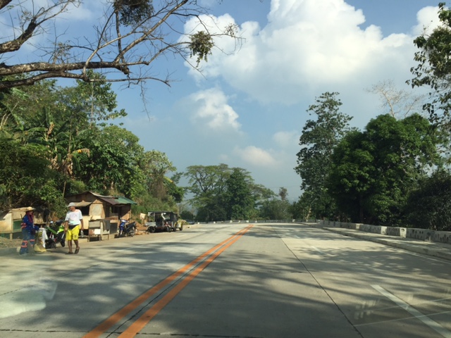 I think this part of the road is practically the highest in terms of elevation. There should be a good view of the surrounding areas including the city center and Hinulugang Taktak from this area.
 Another section of Pinagmisahan showing informal settlers
 Curved downward section towards Daang Bakal and Taktak Road – the fence on the left is for Fairmont Subdivision.
 Straight section approaching Daang Bakal
 Approach to intersection with Daang Bakal – the other lanes of the road is used as parking for visitors of Hinulugang Taktak
 Daang Bakal with Hinulugang Taktak on the left
I’m featuring Pinagmisahan here as I thought its timely given a lot of people will be using it this Holy Week to go to White Cross, which has life-size images for the Stations of the Cross.
–
The benefits of walking
I came across an old article on walking that appeared in The New Yorker in 2014. This was after reading another article my wife shared that also was about walking. One is about both the physical and intellectual benefits of walking while the other was about walking without a purpose. Both were about walking and thinking, and definitely about the benefits of even a short stroll to our physical and mental being.
Here’s the article from The New Yorker: Why walking helps us think
And the article from BBC: The slow death of purposeless walking
I highly recommend both articles as we ponder about making our cities safe for pedestrians/walking.
–
Some interesting (and required) readings on traffic engineering
Christmas breaks allow me to catch up on a lot of reading. The previous months comprising our university’s semester were spent preparing for lectures though I had to do some readings related to researches I am involved in. Browsing the net and social media, I came across 2 articles shared by an acquaintance. He is a very progressive planner who has extensively studied and written about the most relevant issues in urban planning, focusing on transport. A third article I found while reading one of the two. These were very interesting for me in part because they are thought provoking in as far as traffic engineering is concerned.
- What traffic engineers can learn from doctors
- As traffic deaths rise, blame engineering dogma
- The new science of traffic engineering
The author seems to call out traffic engineers in general but these articles should also be contextualized properly. The situations mentioned in the articles are to be found in cities in the United States and may not be applicable in other cities in other countries. Traffic engineers in Europe, for example, have been working on exactly the solutions being mentioned in the articles that would make streets inclusive and safe especially for pedestrians and cyclists. The same with Asian cities like Singapore and Tokyo.
In the Philippines, however, there is so much that we can learn from the articles. The mere mention of the design guidelines being used in the US betrays the flaws of highway and traffic engineering in the Philippines. The Philippines’ highway planning manual and other guidelines used by the Department of Public Works and Highways (DPWH) are heavily drawn from US references. Most highway and traffic engineers in the country are educated using curricula that use US textbooks and references. There are even civil engineering programs that use licensure exam review materials as their references! These exam materials are also known to be based on DPWH guidelines and manuals aside from problems “outsourced” or patterned after the Professional Engineer (PE) exams in the US. Few schools have progressive curricula that look to best practices that take into account the complexities of roads especially in the urban setting. Such ‘copying’ of American standards and practices in many cases do not consider Philippine (local) conditions and blind applications to our roads instead of proper adaptation often have lead to unsafe and inequitable roads.
–
Improvements to alternative route between Rizal and Makati
I finally got another look at the conditions along the alternate road to Highway 2000 and C-6 Extension a couple of weeks ago while en route to Bonifacio Global City. Traffic along Ortigas Ave. is usually terrible these days even during the weekends due to the road and drainage works between Cainta Junction and Brookside. I am glad to say that there have been significant improvements to the section of Don Hilario Cruz Ave nearest to the Manggahan Floodway and beside the Megawide plant. There have been significant developments, too, along C-6 Extension in the Lupang Arenda area of Taytay, Rizal. Here are some photos of the area.
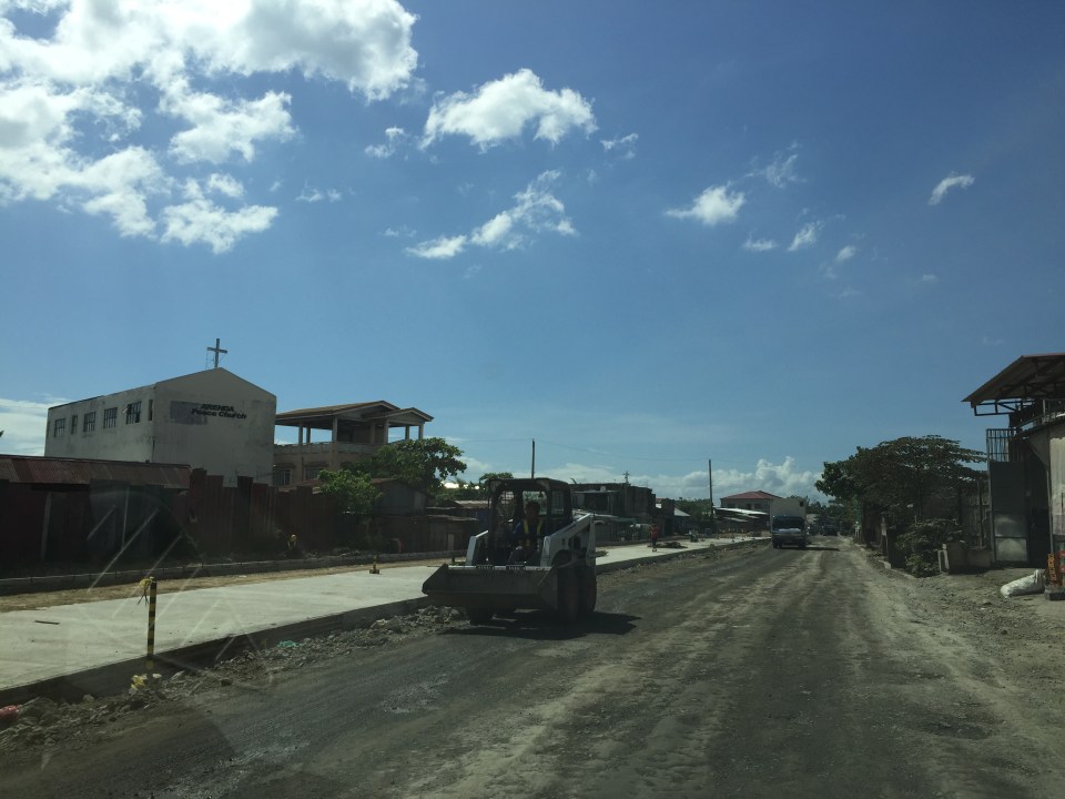
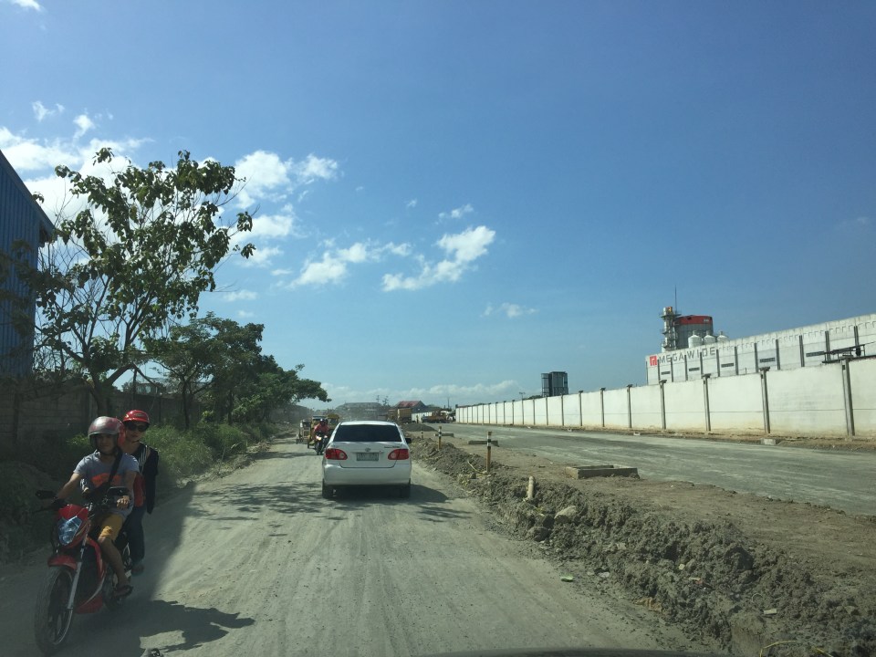 Don Hilario Cruz Ave., the road beside the Megawide plant and parallel to Highway 2000, is being improved with half the carriageway already prepared for paving. The other half appears to be graded is being used by vehicles.
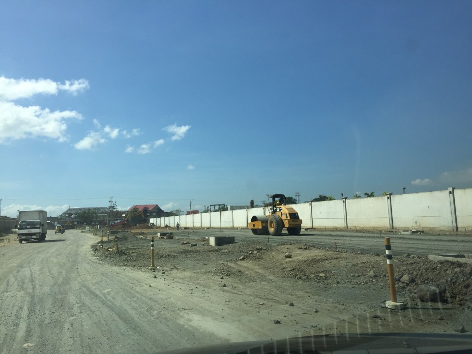 A roller runs along the base layer of the road that’s being paved. These sections were usually muddy and full of craters during the wet season and very dusty and still full of potholes during the dry season.
 Sections of C-6 Extension at the Lupang Arenda area have been widened and the expropriated lands are now being transformed into paved roads. The original sections have been overlayed with asphalt to improve their ride-ability.
 Another section in Lupang Arenda shows finished PCCP for the eastbound side of C-6.
 Another photo of C-6 extension. Once the finished lanes are usable, authorities will probably divert traffic there so they could also pave the rest of the road.
Travelers between Rizal and Makati/Taguig will benefit the most from the improvements along these roads. These will increase road capacity as well as travel speeds along this route. Now, if only authorities can also improve C-6 itself in Taguig…
–
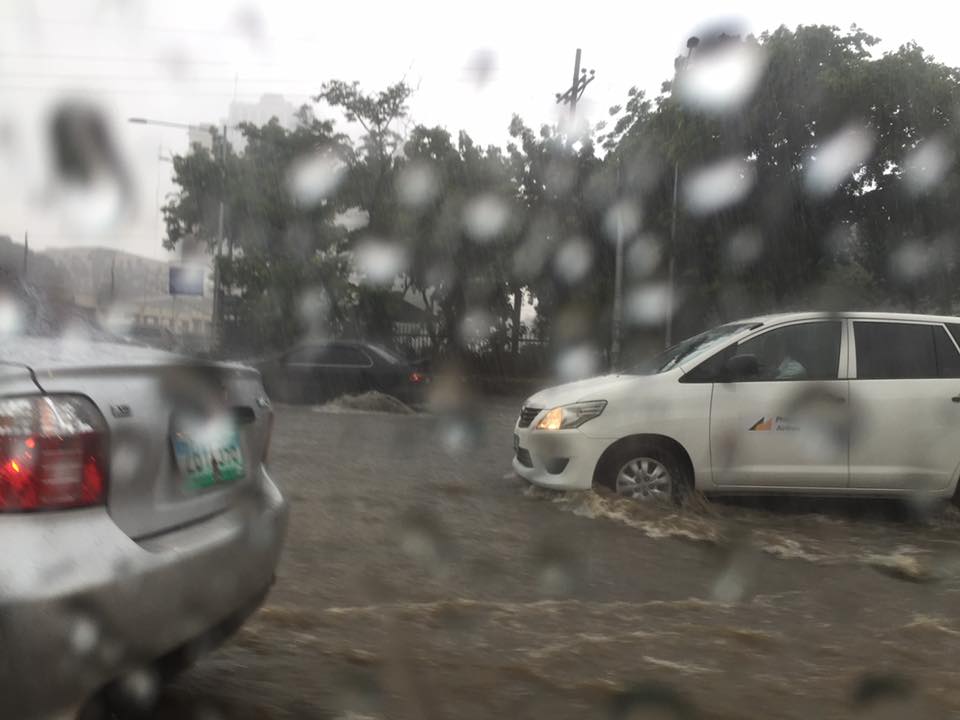
Improving road drainage to prevent flooding
Road drainage seems to be a most suitable topic given the heavy rains the past few days due to a powerful typhoon that hit the northern Philippines. With or without typhoons, however, the frequency of flash flooding has increased the past few years in part due to the heavier than usual monsoon rains but mainly due to the poor state of road drainage in our cities. The photos below show an example of flash flooding due to a sudden downpour in Cebu City.

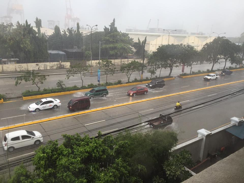
What is noticeable along the road is a lack of storm drains that could have prevented the accumulation of water on the carriageway. If there were storm drains at strategic points along the road, it is difficult to judge from the photo. I also suspect that road construction may have adversely affected the slopes required for the water to travel to the drains. These are surely stated in the road design but are somehow lost or deficient upon construction of the road. There are similar situations in other cities as well and especially in Metro Manila where flash floods often cripple road traffic around the metropolis as critical sections of major arterials like EDSA, C-5, Espana Blvd. and E. Rodriguez become flooded.
We were traveling back to Quezon City along Sumulong Highway after a meeting in Antipolo City. We noticed the road widening projects along the highway; effectively increasing the number of lanes and the capacity of the road. Included in the project are the construction of sidewalks and drainage along both sides of the road. Below is a photo of the section near the Sumulong gate of Valley Golf clearly showing the newly constructed lane and sidewalk along the Masinag-bound side of the highway.
Note in the photo the size and intervals of storm drains along the the highway. Compare this with what we have along most Metro Manila roads including overpasses and it shouldn’t be a surprise why there are frequent flash flooding in Metro Manila. Of course, the capacity of the culverts is a factor (and many are already clogged or barado with garbage and mud) but then it starts with the drains for water to go to the culverts. Many newly rehabilitated roads in Metro Manila have small drains spaced at long intervals. With heavy rainfall, these cannot take in the amount of water given the rate at which they drop from the skies. Perhaps a quick fix to address flash floods is to make these storm drains larger and spaced more closely like those shown in the photo of Sumulong Highway. And then, of course, there should be increased efforts to make sure these drains are not blocked/clogged and that garbage, dirt and other debris will not go straight into the culverts.
–
Roadside views of the Pillila, Rizal Wind Farm
A highlight of our recent road trip to and from Lucena, Quezon via the Rizal – Laguna – Quezon route is the impressive roadside views of the new Pillila Wind Farm. The array consists of 27 turbines, more than the number in Bangui, Ilocos Norte. Following are a few photos of the turbines of the farm which has a total capacity of 5.2 Megawatts. I noticed though that many of the turbines were not running so the capacity is likely not reached and the output highly varies depending on the season and time of day.


There are two access points from the national highway to the wind farm. Via these access roads, one can get near the wind turbines to get photos including ‘selfies’ with the turbines as background, just like those trending photos posted on social media taken at the Bangui Wind Farm.
The Philippines needs more of these clean energy sources. The promotion and spread of such types of energy generation should be able to reduce our dependence on fossil fuels. This would be good in the long run and also for transportation since there are already many initiatives for electric vehicles. E-vehicles are not necessarily zero contributors to air quality and ultimately to climate change if we consider the sources of electricity when these vehicles re-charge their batteries.
–
Proposals for EDSA and some alternate roads
The hellish traffic congestion along EDSA and other roads in Metro Manila spawned a bunch of ideas for alleviating congestion. Among those that were offered as solutions are the following:
- Odd-Even Scheme – suggested by the Philippines President himself in a speech delivered in Mandaluyong City
- Car-pooling (and HOV lanes) – suggested by the DPWH Secretary in another forum
- Bus Rapid Transit (BRT) and/or express bus – proposed and being studied by the DOTC
What seems to have been forgotten was a proposal to have two lanes of EDSA, one on either direction, devoted to bicycles. This proposal now seems to be the most viable compared to the above three and could have the potential for major behaviour change towards a departure from motor vehicle use. Cycling along with walking does not require fuel and these modes also promote healthy lifestyles. Also, this could become the ultimate example for road diets, which can also be applied along other roads as well. What sounds or reads like an outrageous idea (i.e., bicycle lanes along EDSA) might just be revolutionary and result in what could be a tipping point for sustainable transport in the midst of traffic mayhem.
EDSA has become the proverbial battleground representing the war with traffic congestion. However, EDSA is just one part of our arterial network comprised of circumferential and radial roads. There is also C-5 (also known for its sections – Katipunan, E. Rodriguez, C.P. Garcia), which is also a very congested road but along which there are few fixed route public transport services. It is a primary alternative route (to EDSA)for people traveling between the northern and southern halves of Metro Manila. It also serves as a collector and distributor, being connected with major radial roads like Aurora Boulevard, Ortigas Avenue and Shaw Boulevard as well as to the South Luzon Expressway. C-5 is a major truck route, however, and so carries a lot of heavy vehicles during the permitted times under the truck ban scheme being implemented in Metro Manila. C-5 is already ripe for a mass transit system and should have one along it. The quickest to put up would be a bus system on exclusive lanes. Strategically though, a rail transit line (likely elevated) should already be planned and implemented and with as seamless as possible connections to current and future lines along major corridors.
There are other routes that can be considered which I think have been overlooked (too much focus on EDSA?). C-6, for example, badly needs to be improved and this has started but is being implemented at a slow pace. This could have significant positive impacts on traffic coming from the east (towns of Rizal province) that are bound primarily for Makati and BGC. But then there also has to be a good road bypassing the narrow and already congested streets of Taguig and Pateros that are currently the only roads connecting C-5 and C-6. The roads on the Rizal side (attention: Cainta and Taytay) also need to be improved including Highway 2000 and the Barkadahan Bridge. Perhaps the Rizal Provincial Government should also get involved in this as such routes are in the best interest of Rizalenos. And then there is also the highly urbanized city of Antipolo that is a major destination and already is the 7th most populous city in the country, whose residents also use this route, which is often a faster option to Ortigas and C-5 despite the poor conditions of roads.
–
Rains, floods and traffic
The wet season is here and with it the now typically heavy rains in the afternoons. Last week, the heavy rains brought upon flash floods in Metro Manila and adjacent towns. There have been no typhoons yet so these are mainly monsoon rains (Habagat), which we expect to be daily occurrences. Many of these floods are along major roads including EDSA, C5, Espana, and Quezon Ave. that transformed these roads into parking lots as most light vehicles are unable to traverse flooded streets.
 Vehicles run along the flooded Elliptical Road in Quezon City
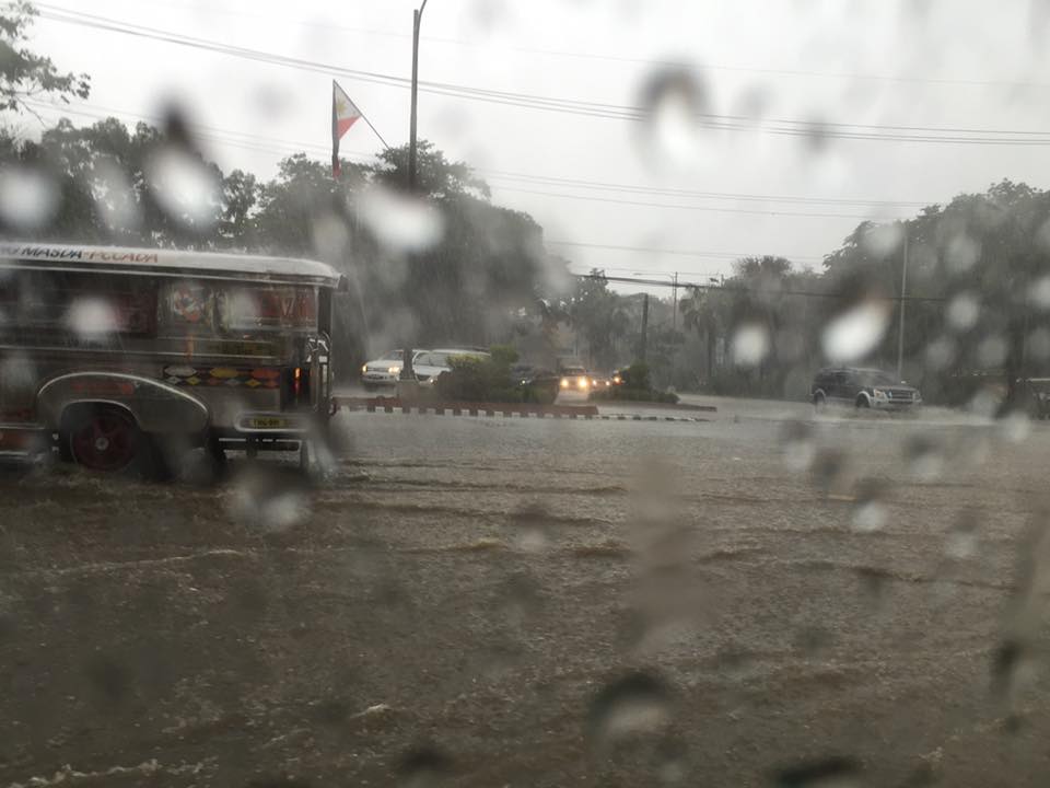 Jeepneys and SUVs (at right in the photo) take on the flooded Elliptical Road-Quezon Avenue intersection
Due to the traffic congestion resulting from the floods, many public utility vehicles especially jeepneys and UV Express vehicles were not able to go back and make their round trips.
 Cars risk the floods along Elliptical Road – the deepest waters are, ironically and curiously, along the section fronting Quezon City Hall where there is a pedestrian underpass connecting city hall with the Quezon Memorial Circle. Since the underpass is not flooded then it can be concluded that there’s something wrong with the drainage for Elliptical Road.
The weather is a very significant consideration for transport planning for cities in the Philippines. For Metro Manila it is almost everyone’s concern about how they can travel between their homes, offices, schools and other destinations without them and their things getting wet. This is what a lot of people advocating for road sharing seem to forget or choose to forget in their arguments for walking and cycling. A person residing in Fairview in Quezon City and working in Makati City will most likely not walk or cycle between his home and office because of the weather. This is a reality that could be solved by good public transportation, which, unfortunately, we also don’t have (yet) so people are ‘forced’ to do what they can to improve their plight. Unfortunately, too, what they are forced to do is purchase a car (or more). The proposal to build infrastructure to enable walking and cycling especially over medium to long distance is in the same dilemma as those for mass transit. And the latter is the more urgent matter needing action for the sheer volume of people they can carry and therefore benefit.
–
Ortigas Avenue Extension Roadworks
Causing much traffic congestion the past weeks and especially these days are sections of Ortigas Avenue Extension. This is basically caused by roadworks between Cainta Junction and Valley Golf. The section between Brookside and Valley Golf is being raised. The section is a low portion of the road and is almost always flooded whenever there are heavy rains due also in part to the creek in the area. The westbound side of that section is completed and the contractor is now working on the eastbound side. The section is a wider segment of Ortigas and it’s possible to close one lane at a time while having 2 lanes usable for traffic along either side of the road.
The more severe congestion is along the westbound side where another contractor is working on drainage between Junction and Brookside. The section in front of the RRCG bus depot only has one lane usable by traffic and so westbound traffic is regularly backed up for hundreds of meters. How bad is it on a weekday? It took me 30 minutes to pass the area between 5:15 and 6:00 AM last Monday.
 Eastbound traffic splits into two lanes separated by roadworks
 The left lane is part of an already elevated westbound side of Ortigas Ave. Ext. The inner eastbound land has already been graded and ready for concrete pouring. The base course layer is visible in the photo.
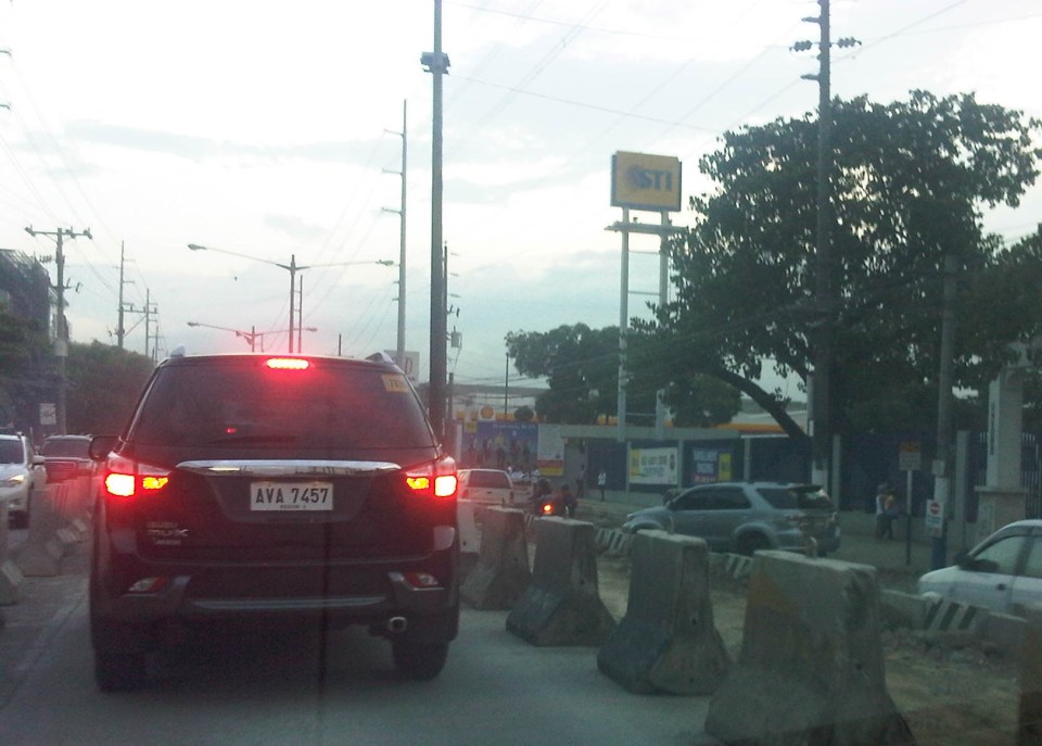 Section near Hunters ROTC Road (right where the grey SUV is coming from) and STI, and approaching Valley Golf.
 Past STI, the traffic lanes go back to normal just before the intersection at Valley Golf.
Traffic is so severe along Ortigas Ave. Ext. that I am sure a lot of people are looking for alternate routes. Those from Antipolo, Taytay and towns along the Manila East Road would likely take the routes utilizing the floodway including Highway 2000 and C-6. Others would find the longer route via Sumulong Highway and/or Marcos Highway to be worth the time and fuel. Hopefully, work will be continuous along Ortigas and roadworks will be completed before we are deep into the typhoon season this year.
–
Kilometer Zero
Kilometer Zero for the Philippines’ national road network is located at Rizal Park in Manila. Many people still think that this is designated at the flag pole in front of the Rizal monument at the park. The marker for kilometer zero is actually just across from the flagpole with an elegant kilometer post clearly showing it as KM 0.
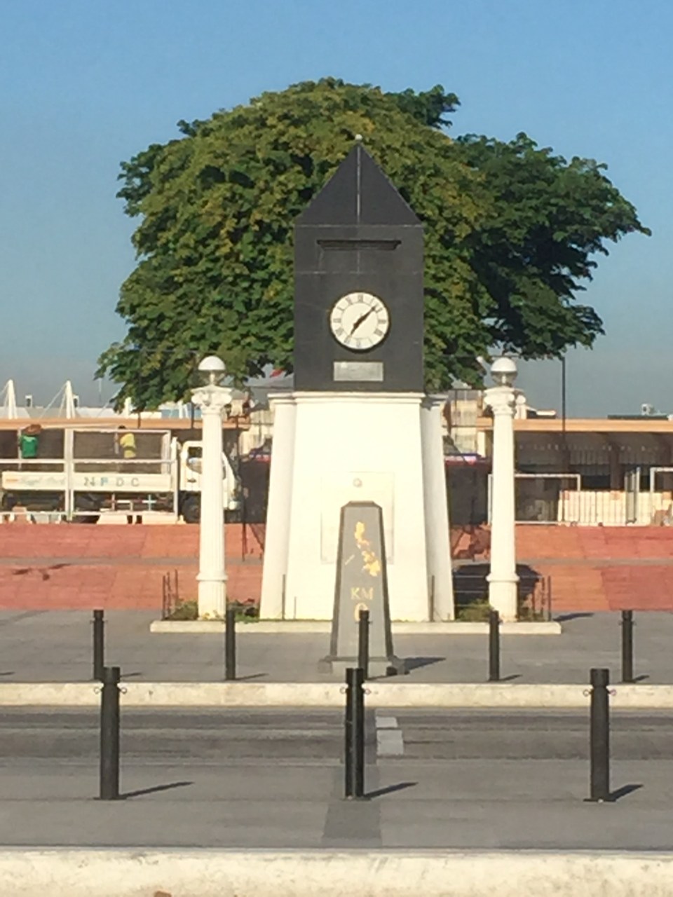 The KM 0 post in front of the another monument on the Quirino Grandstand (west) side of Rizal Park. There are many other markers in the park other than those associated with Rizal and other heroes (e.g., Gomburza). There is also a bronze statue of St. Lorenzo Ruiz (the first Philippine saint) in the middle of the grounds across from the grandstand that was dedicated by Pope John Paul II to the Filipino people to celebrate the saint’s beatification in the early 1980s when John Paul II visited the Philippines for the first time.
 Some people thought that the flagpole in front of the Rizal monument in Manila’s Rizal Park is the marker for kilometer zero. The flagpole is shown in the photo above with the Manila Hotel in the background.
 The marker up close.
–
