
Home » Highways and Streets (Page 3)
Category Archives: Highways and Streets
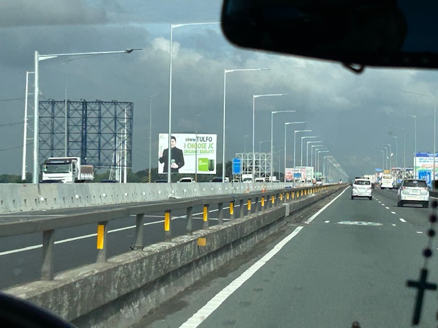
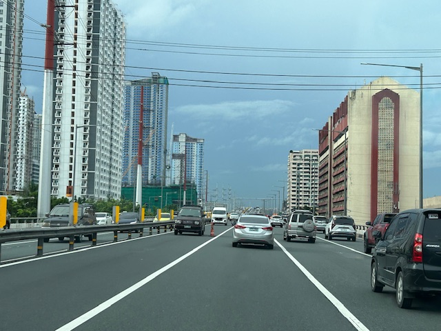
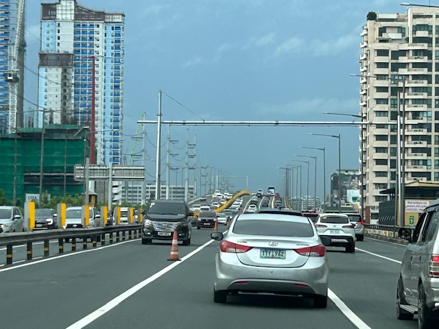
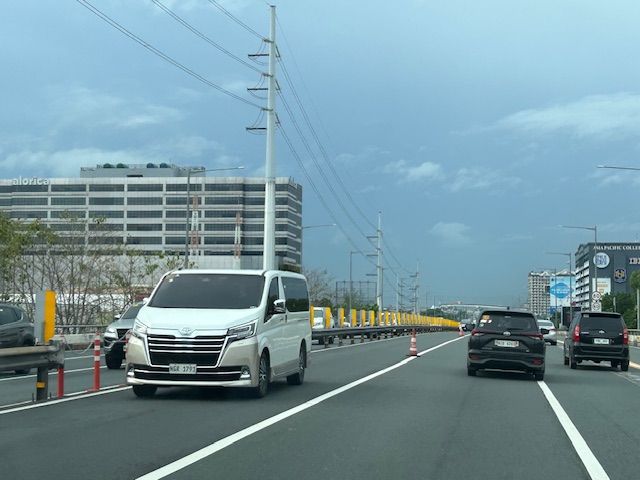
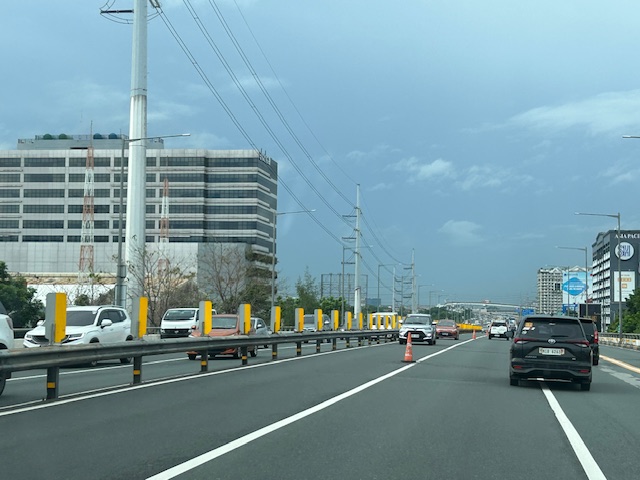
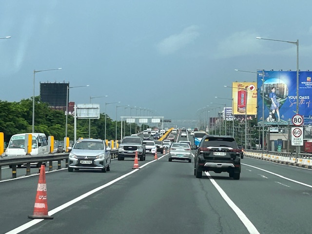
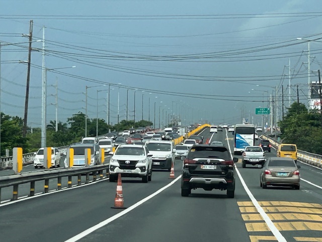
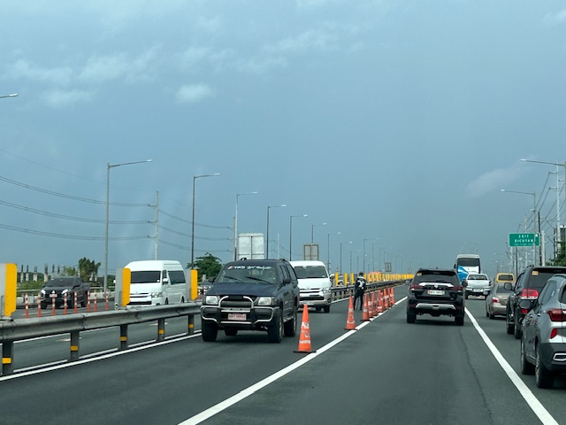
New lanes along the NLEX Candaba Viaduct
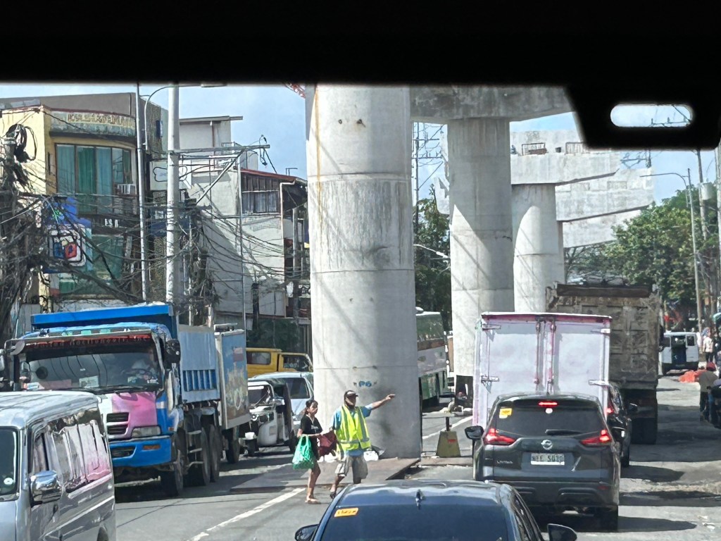
Heading to Baguio, I noticed the new lanes in the middle of the NLEX viaduct. The viaduct was actually two bridges constructed over the Candaba Swamp. The soil being too soft for a normal road, the viaduct allowed for two way traffic with each bridge carrying northbound or southbound vehicles. The recall that the original bridges each had 2 lanes plus a shoulder lane. Each now have 3 lanes plus shoulder after expansion years ago. The additional lanes in the middle probably required additional columns to be built with more modern foundations than the original viaduct. The new structures had to be integrated with the older viaducts. Here are photos of the completed sections:


You can go to Google Maps if you want to see what the lanes looked like under construction. Here is a screenshot:

Screenshot
The middle lanes look like they can be used as variable lanes. That is, all or some of the lanes may be used to serve the direction with the heavier traffic. The directions can change depending on the time of day, day of the week or the season. I don’t know at this time though how exactly this can or will be implemented as there are no signs to guide motorists for variable lanes. What signs am I referring to? Here are examples from Bangkok showing overhead signs assigning lanes for the direction with heavier traffic:
 A close up of the signs designating lanes for traffic
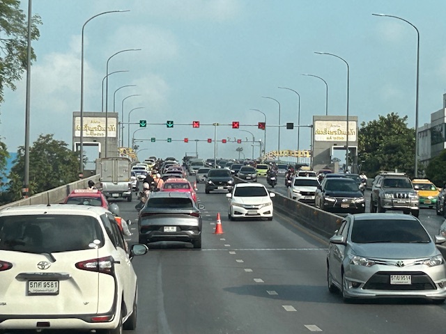 In the example above, 4 lanes including one counterflow lane are assigned to traffic along the southbound direction.
–
More political garbage along our roads
I was telling some friends who were planning to go to Antipolo this long weekend that they should not be distracted by the images of demonyos and demonyas they’ll see along the way to the Shrine of Our Lady of Peace and Good Voyage.
These are electioneering and those who vote for these clowns have no right to complain about their economic situation. You only perpetuate these scums in government.
–
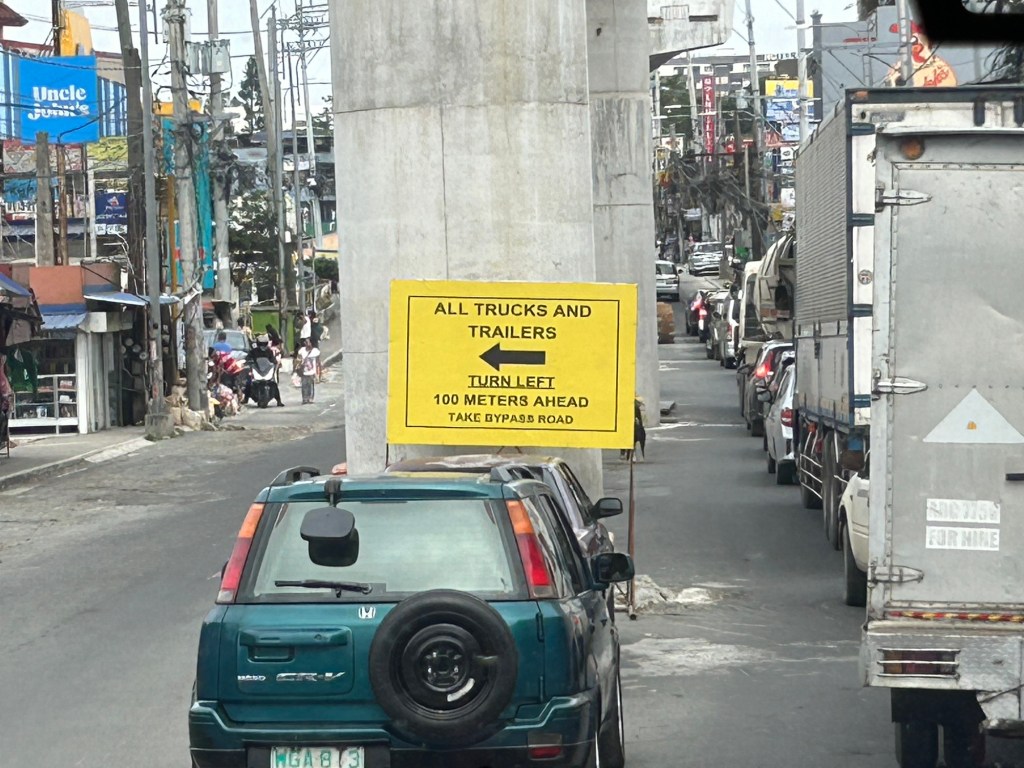
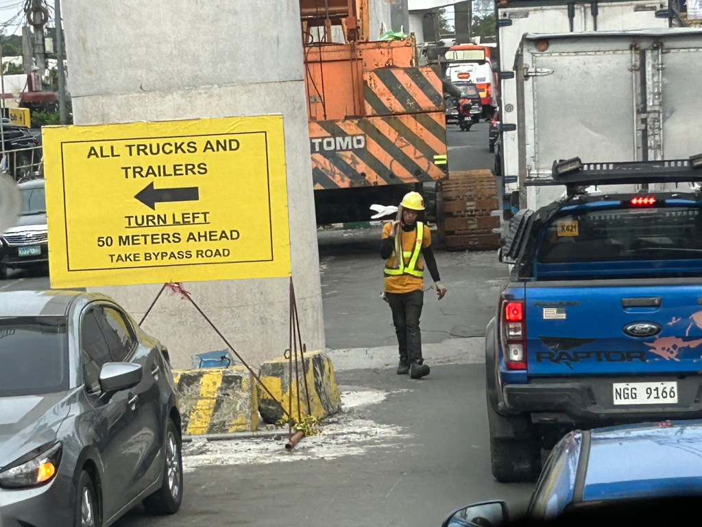
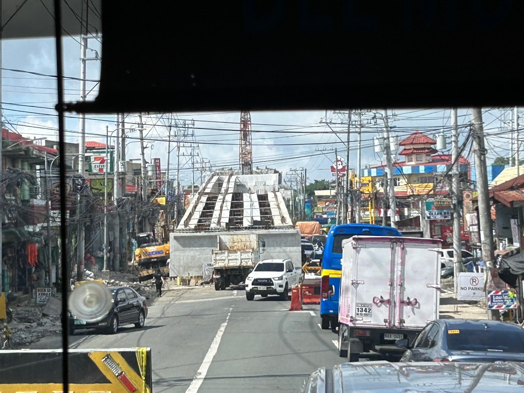
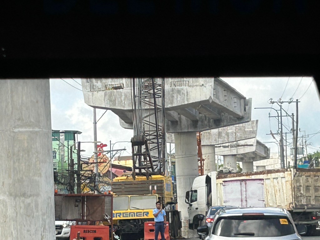
Congestion due to flyover construction: Tagaytay-Nasugbu Road – Part 2
I showed photos of the construction of an overpass along the Tagaytay-Nasugbu Highway coming from Tagaytay in the previous post. This time, here are some photos taken along the opposite direction.


–
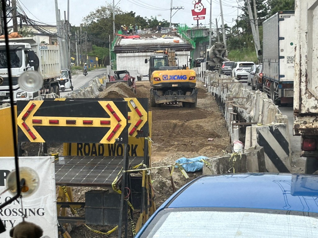
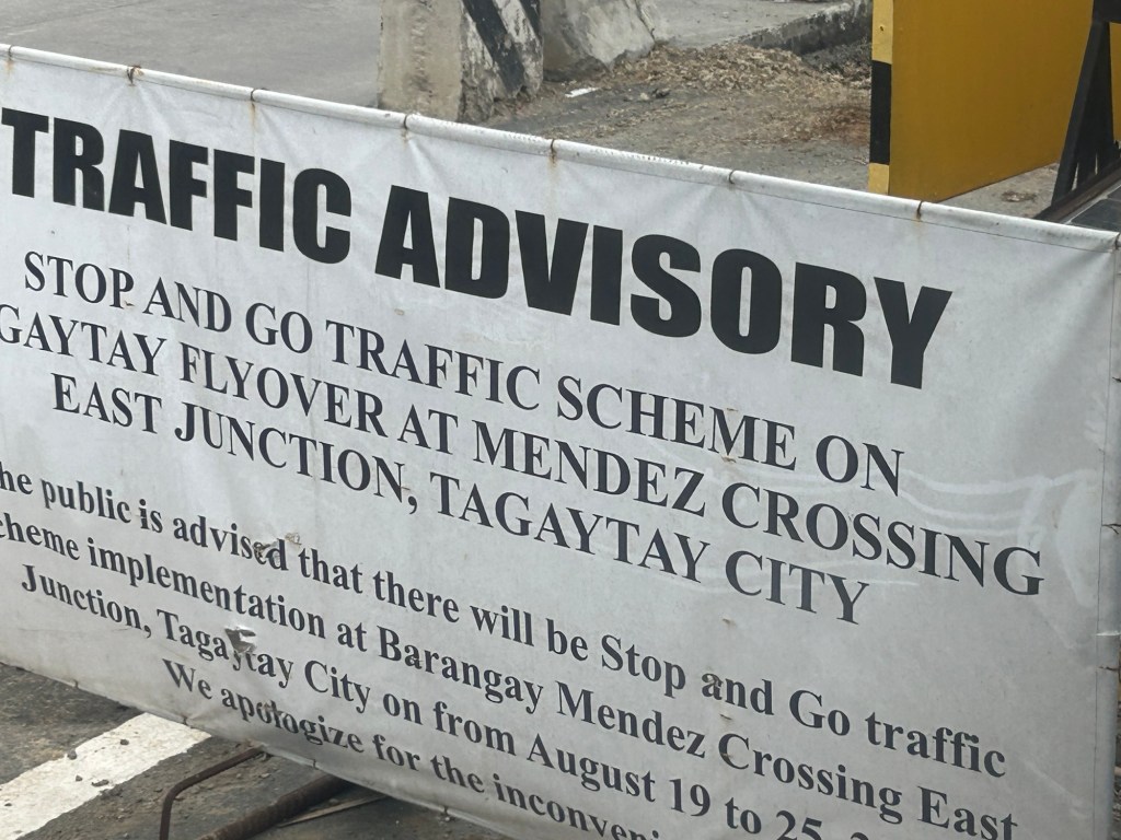
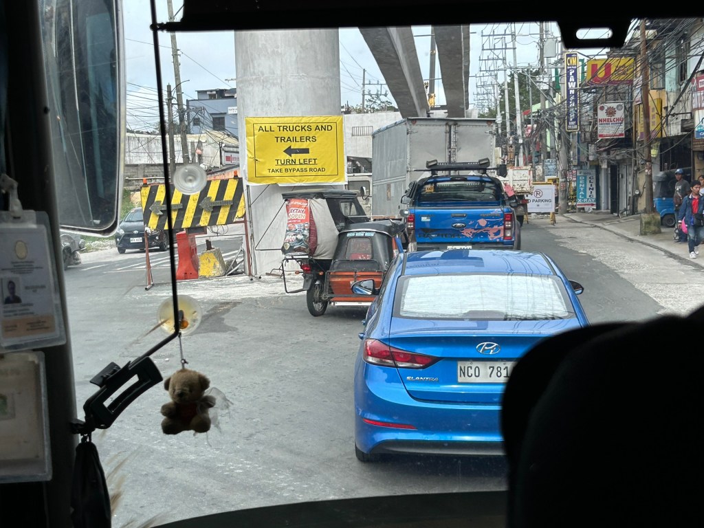
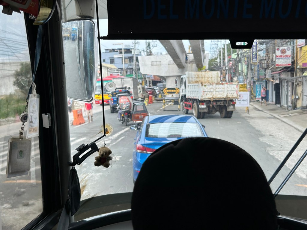
Congestion due to flyover construction: Tagaytay-Nasugbu Road – Part 1
There is significant traffic congestion along the Tagaytay – Nasugbu Highway due to the construction of an overpass along the highway at its junction with the Tagaytay – Mendez Highway.


Was there a need for a flyover here? Otherwise I would suggest instead a set of good old-fashioned traffic signals and geometric improvements to the intersection.
–
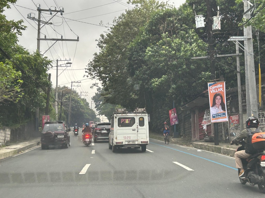
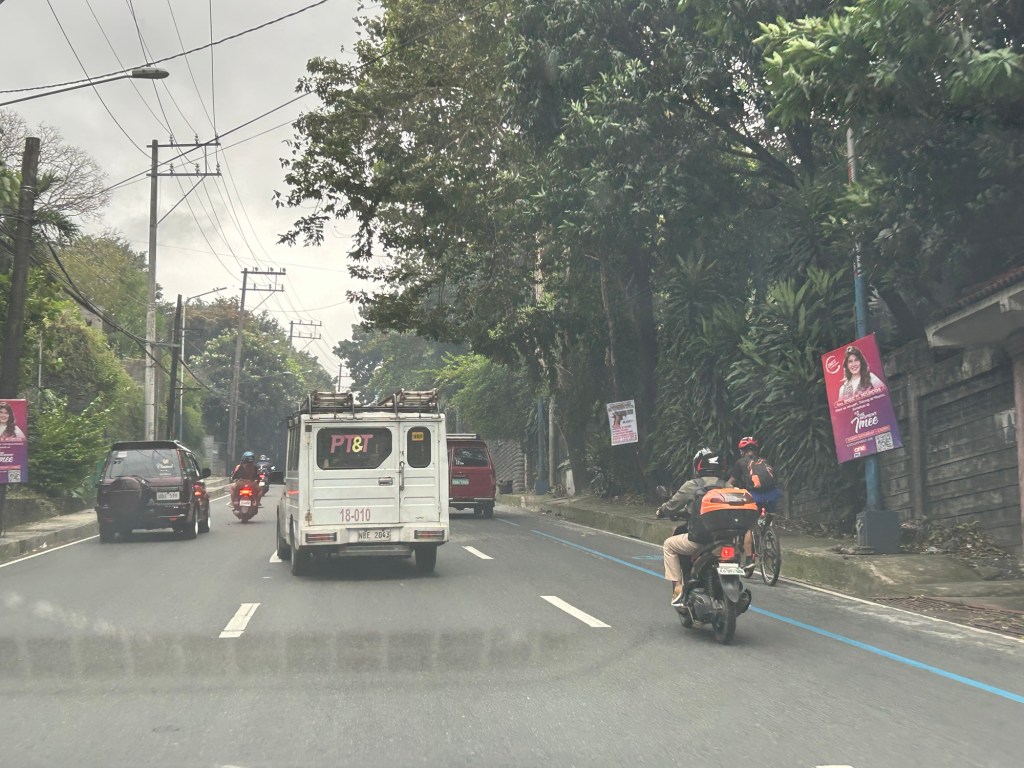
Political garbage along our roads
While it is not formally campaign season, you’ve probably seen all those ads, posters, tarps and other obviously campaign materials that have sprouted around the country. Even before the filing of COCs, there were already a lot of political garbage (as I refer to them) along our roads. Many that you see on large billboards promote their purported TV or radio shows. Others pretend to be concerned about your safety while traveling (e.g., “Ingat sa biyahe!”, “Ride safe!”, etc.).

The government, particularly the COMELEC, seems to be inutile and inept about these brazen, even flamboyant displays by politicians. And so we end up with a lot of literal and figurative garbage along our streets. These are the politicians that people continue to vote while stating they want changes and reforms in government and society. You vote for these clowns and you get exactly the misery and incompetence that dooms us especially during times of difficulties and calamities.
–
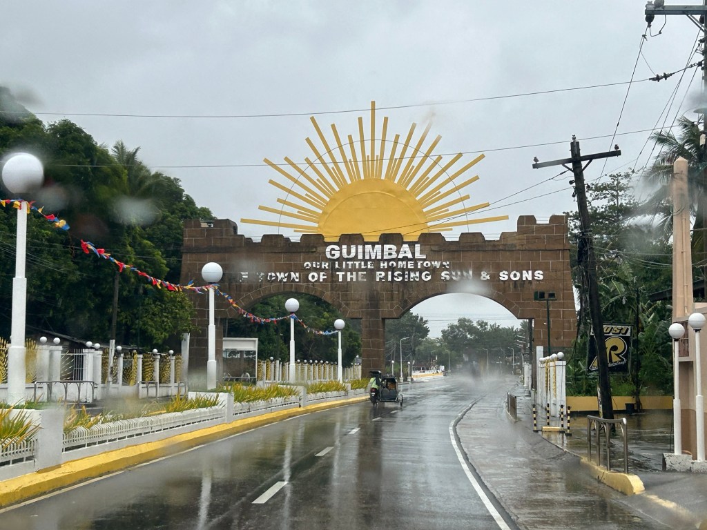
Welcome arch in Iloilo
We had a small adventure when we were in Iloilo last month. We traveled to the last town to the west just before the border with the Province of Antique. I was expecting to see welcome arches as we crossed one town after another. There was only one town that had this – Guimbal. And practically the whole stretch of the national highway had a signature of the town’s motto that had got something to do about it like a rising sun.
There’s another quite unusual landmark there that I will also be writing about soon. I will leave my readers in suspense for now.
–
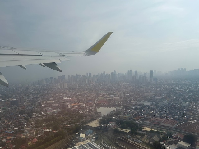
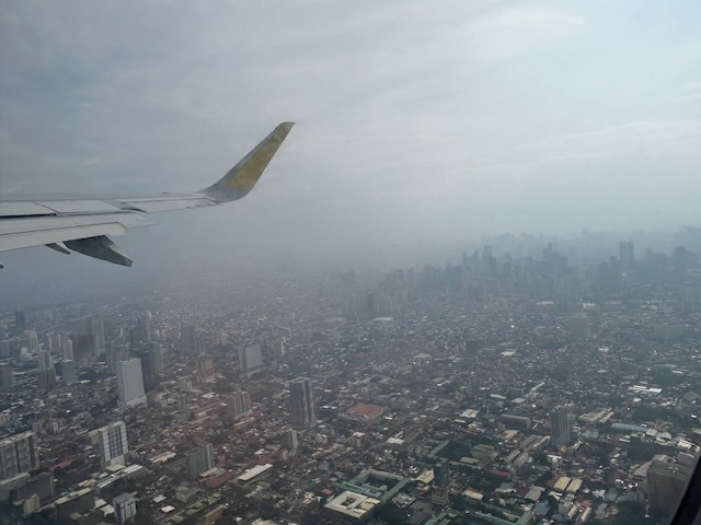
Post Habagat Aerial Photos
We flew to Iloilo just after the Habagat floods that ravaged much of Metro Manila and its surrounding provinces. As our plane took off from Runway 13-31, I figured there was an opportunity to take a few photos of Metro Manila especially as I was seated by the window of the plane.
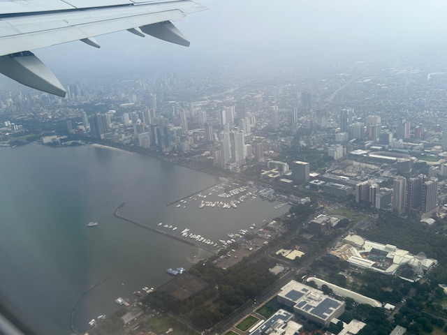
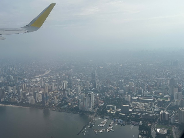
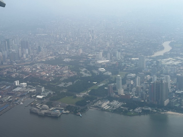
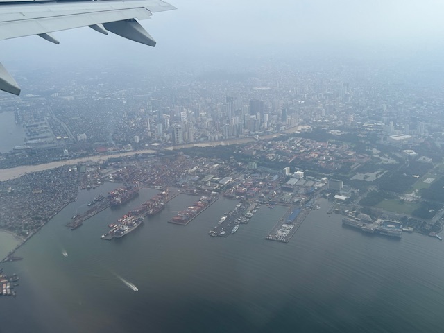
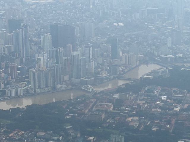
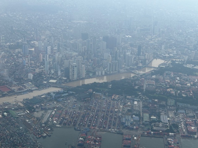
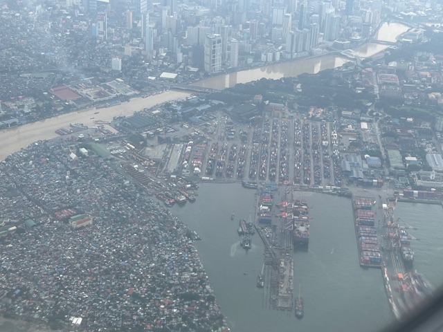
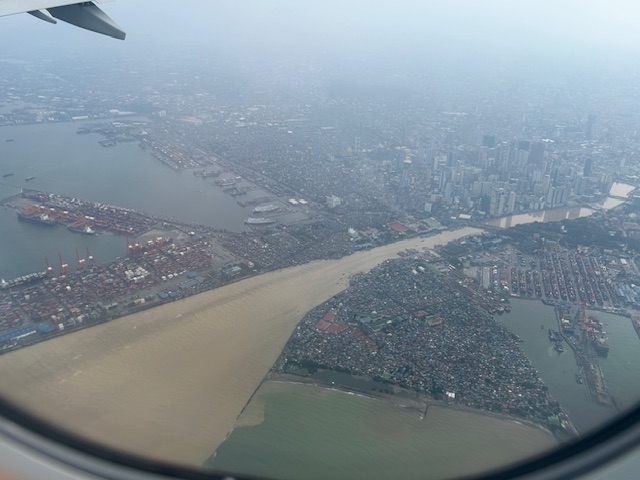
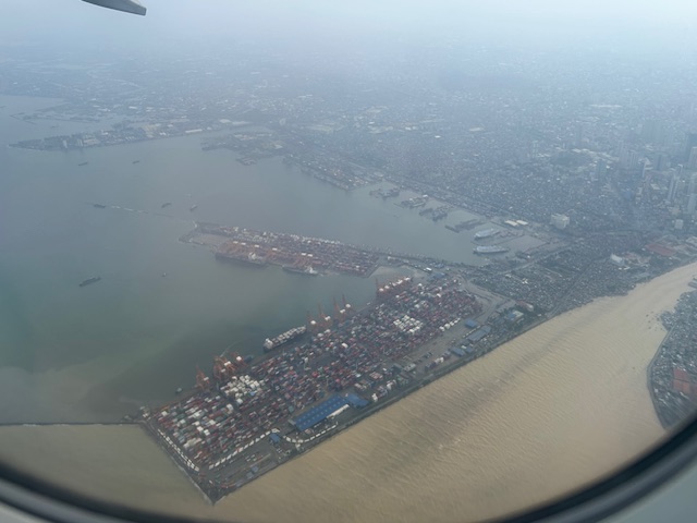
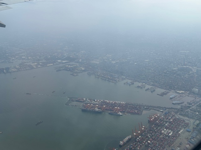
More aerial photos to be posted here soon!
–
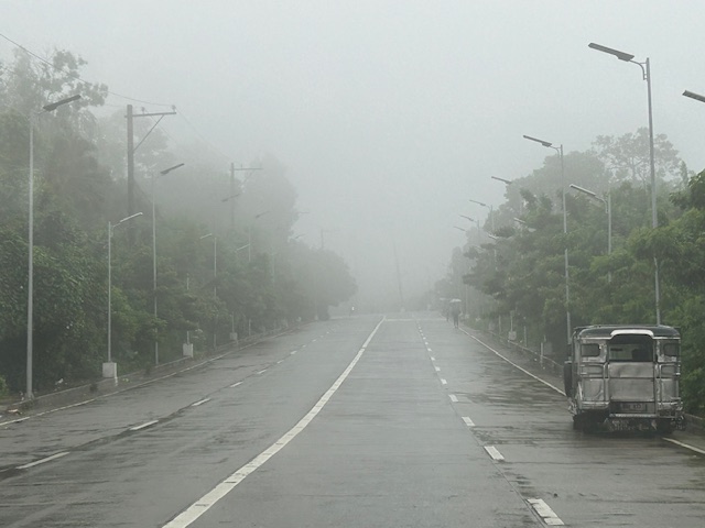
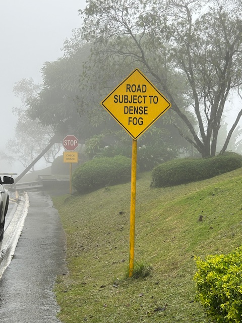
Foggy roads in Tagaytay – Part 1
It’s been a while since the last time I was in Tagaytay. We used to go there at least once a month. Eventually, we grew tired of the traffic and the city becoming quite crowded. Of course, our schedules also became more busy so the drives for a weekend getaway turned into trips for music lessons (for our daughter) and meet-ups with friends. It was a welcome return last July when I had to go to Tagaytay Highlands for a meeting and then join up with our college for a workshop on the other end of the city. Here are some photos of the foggy roads that reminded me of the Tagaytay of old.
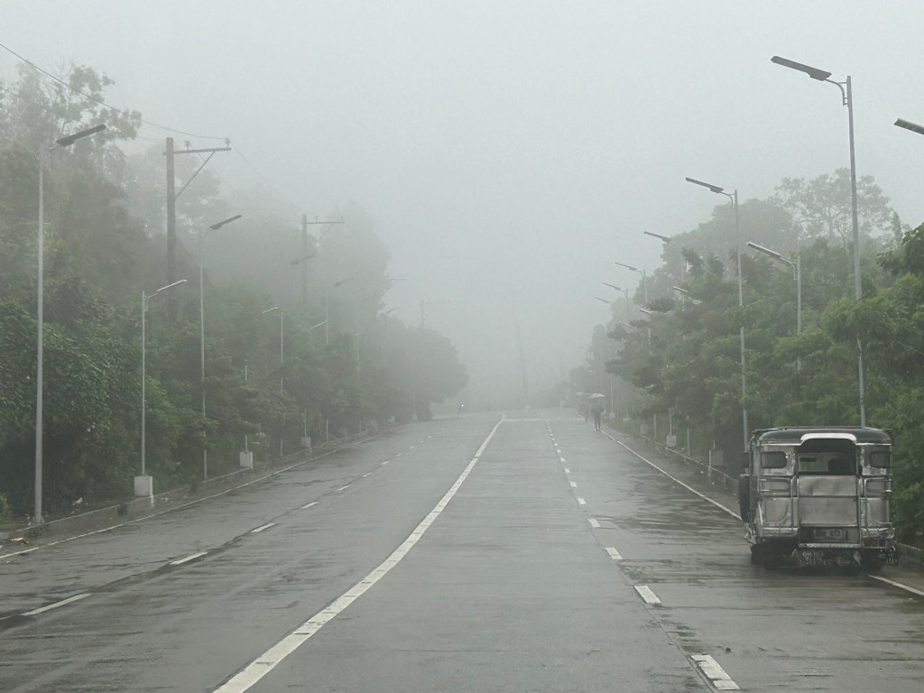
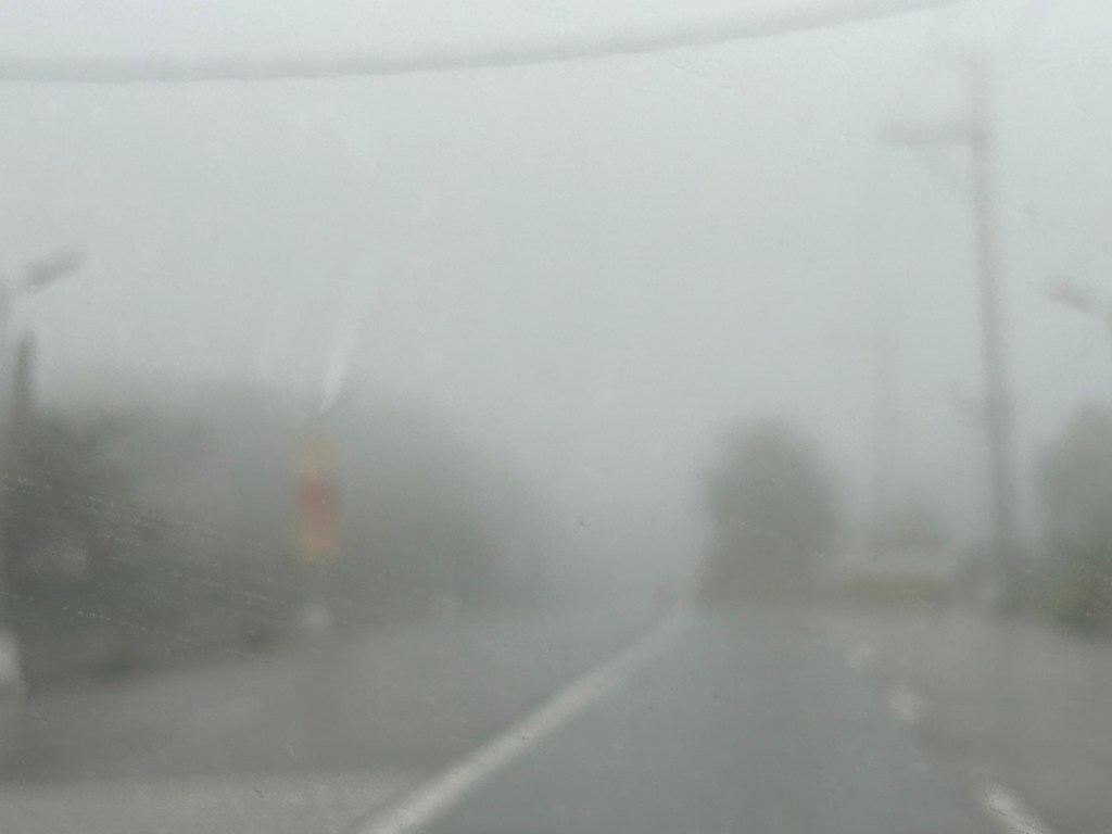
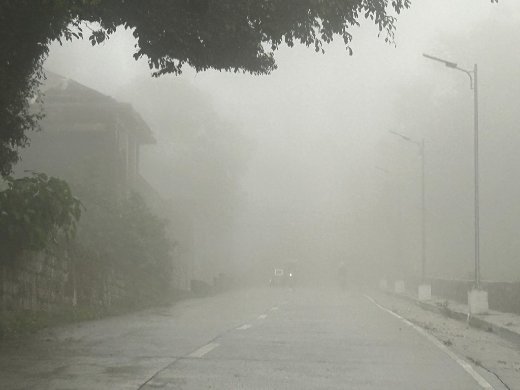
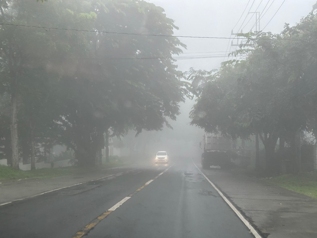
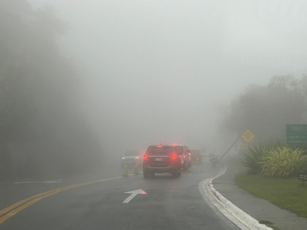
More photos of the foggy roads in the next post!
–
Skyway to the south
Instead of going via C5 and then SLEX en route to Tagaytay last week, we opted to take the Skyway via Quezon Avenue. The travel was smooth between 6:30 AM and 7:30 AM maybe because it was a Thursday and regular classes have not yet resumed (i.e., less trips). Note the counter flow lane adjacent to the median? This is implemented likely due to the experience of heavier traffic along the northbound (Metro Manila-bound) direction during the mornings. I wonder if the reverse is implemented in the afternoons/evenings.


Note that there was more traffic as we traveled between Makati and Muntinlupa. The traffic represented commuters residing in the south and traveling to Metro Manila for work purposes.
Back in Tagaytay
It’s been a while since I’ve been to Tagaytay. I think the last time was before the pandemic and with family. There used to be a time when we went there at least every month not counting the seminars and workshops we attended there. It was an easy drive from our home in Antipolo to Tagaytay via C6, SLEX and the Sta. Rosa-Tagaytay Road. We had our favorite stopovers with breakfasts usually at the Paseo de Sta. Rosa. Later, as Tagaytay became more crowded and congested, the trips became fewer. Of course, our schedules also became busier but then it wasn’t like we looked forward to the traffic and the crowded attractions there. I’m doing a project there now with my team at the office and that means I get to go there for work. Since we’ll be there anyway, we could have some side trips to eat some good meals (bulalo!) and maybe take some photos of Taal volcano.
The fog was a quick reminder of the Tagaytay of old that we frequented before. But what we noticed was that it wasn’t cool. It was still somewhat warm if there was no breeze or wind blowing. This was certainly not smog as you can smell the pollution if it was. We even joked that it probably wasn’t because of the volcano as the smell of sulphur would probably be strong. We were in Tagaytay during the weekdays so there were fewer people and traffic. We were told that it was worse on weekends. That was to be expected. And with CALAX, Tagaytay became more accessible to visitors. I will write about the developments there in the next post. I feel there’s just too many buildings and the intense development has made Tagaytay less attractive. I have similar memories and feelings about Baguio but that’s another story to tell or write about.
–
