
Home » Highways and Streets (Page 4)
Category Archives: Highways and Streets
Political garbage along our roads
While it is not formally campaign season, you’ve probably seen all those ads, posters, tarps and other obviously campaign materials that have sprouted around the country. Even before the filing of COCs, there were already a lot of political garbage (as I refer to them) along our roads. Many that you see on large billboards promote their purported TV or radio shows. Others pretend to be concerned about your safety while traveling (e.g., “Ingat sa biyahe!”, “Ride safe!”, etc.).

The government, particularly the COMELEC, seems to be inutile and inept about these brazen, even flamboyant displays by politicians. And so we end up with a lot of literal and figurative garbage along our streets. These are the politicians that people continue to vote while stating they want changes and reforms in government and society. You vote for these clowns and you get exactly the misery and incompetence that dooms us especially during times of difficulties and calamities.
–
Welcome arch in Iloilo
We had a small adventure when we were in Iloilo last month. We traveled to the last town to the west just before the border with the Province of Antique. I was expecting to see welcome arches as we crossed one town after another. There was only one town that had this – Guimbal. And practically the whole stretch of the national highway had a signature of the town’s motto that had got something to do about it like a rising sun.
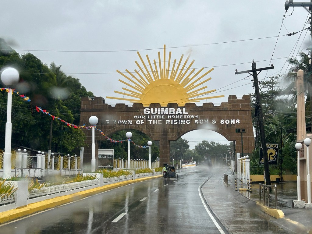
There’s another quite unusual landmark there that I will also be writing about soon. I will leave my readers in suspense for now.
–
Post Habagat Aerial Photos
We flew to Iloilo just after the Habagat floods that ravaged much of Metro Manila and its surrounding provinces. As our plane took off from Runway 13-31, I figured there was an opportunity to take a few photos of Metro Manila especially as I was seated by the window of the plane.
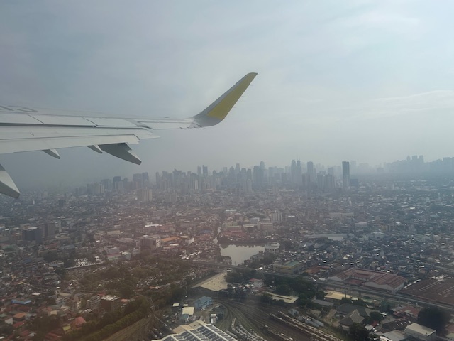
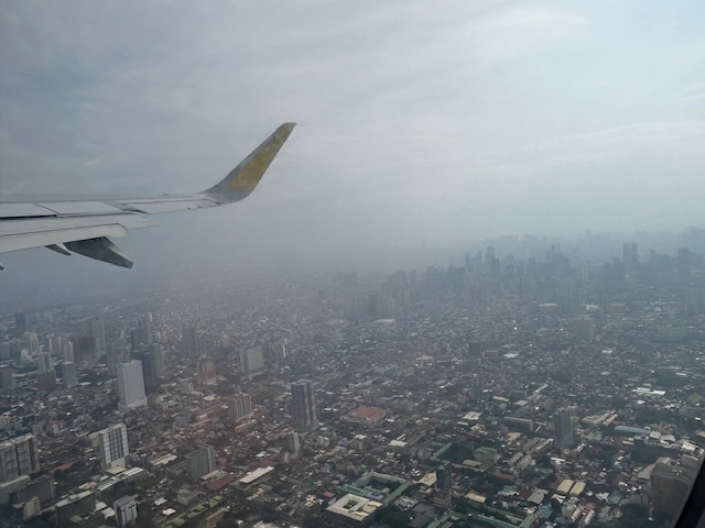
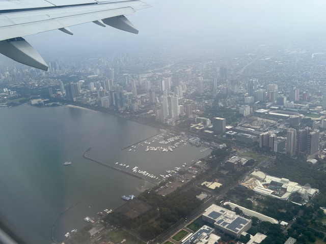
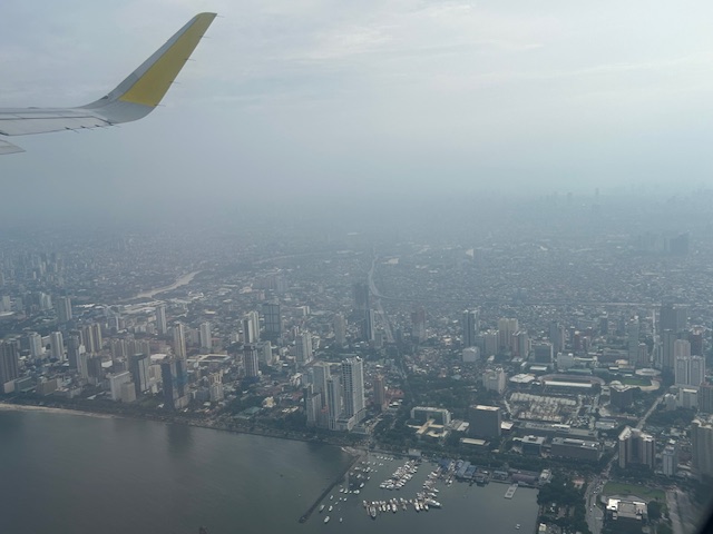
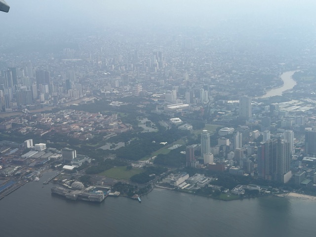
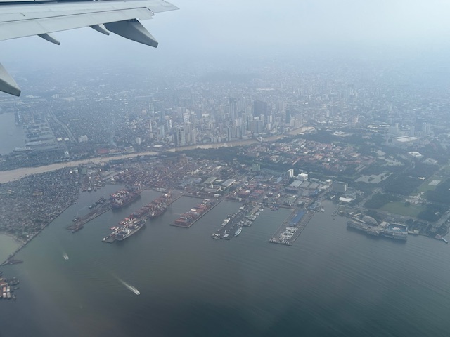
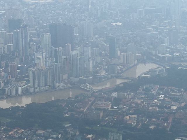
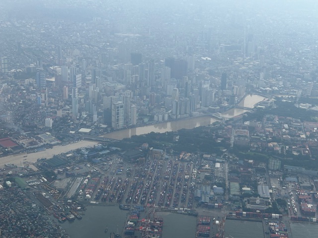
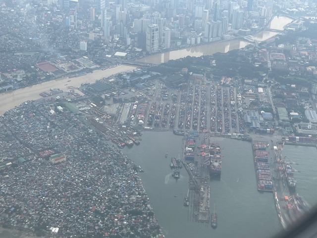
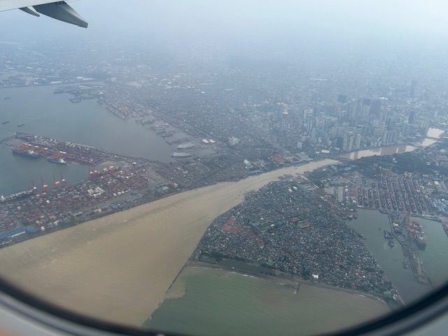
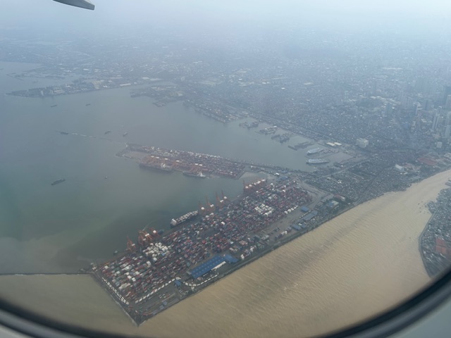
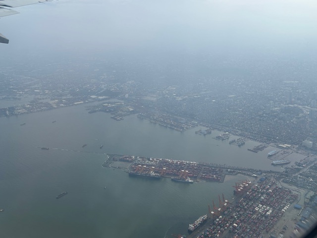
More aerial photos to be posted here soon!
–
Foggy roads in Tagaytay – Part 1
It’s been a while since the last time I was in Tagaytay. We used to go there at least once a month. Eventually, we grew tired of the traffic and the city becoming quite crowded. Of course, our schedules also became more busy so the drives for a weekend getaway turned into trips for music lessons (for our daughter) and meet-ups with friends. It was a welcome return last July when I had to go to Tagaytay Highlands for a meeting and then join up with our college for a workshop on the other end of the city. Here are some photos of the foggy roads that reminded me of the Tagaytay of old.
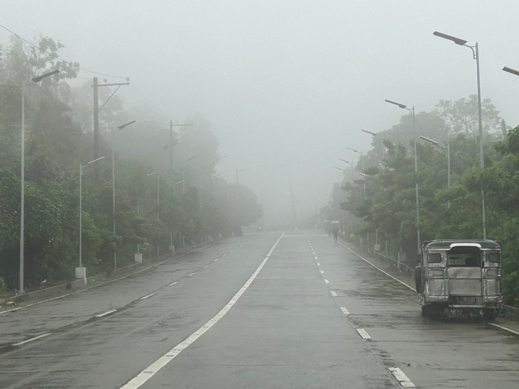

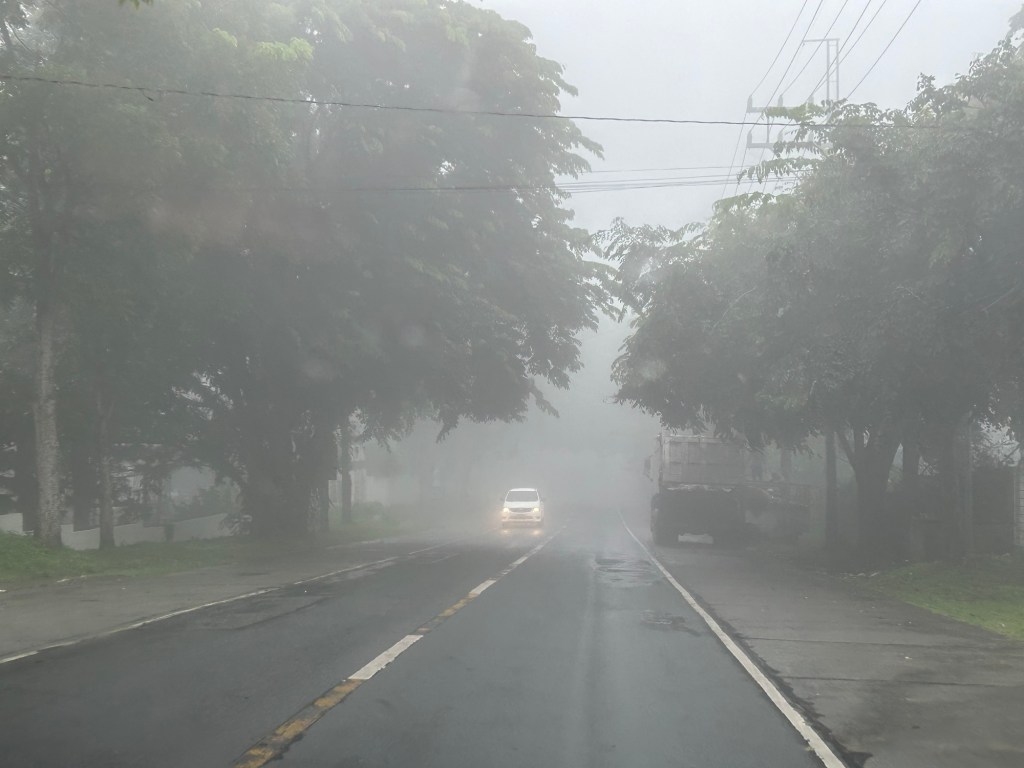
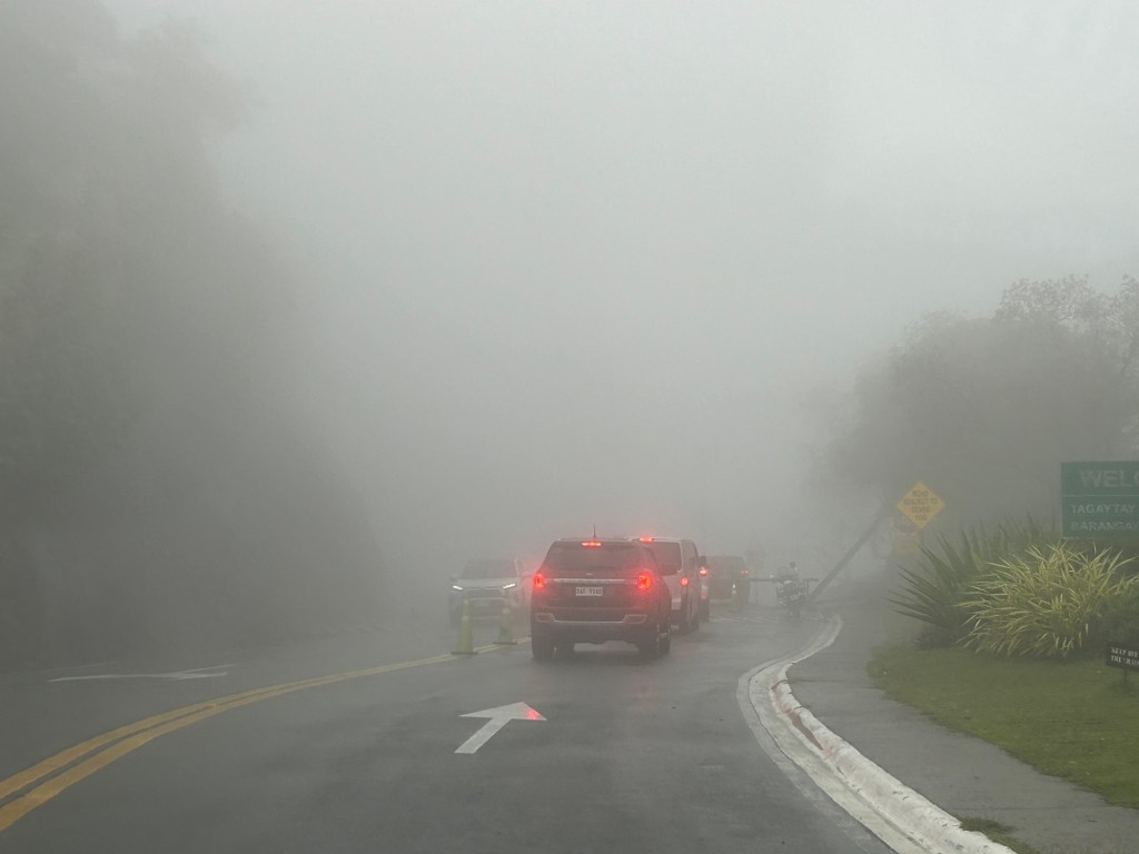
More photos of the foggy roads in the next post!
–
Skyway to the south
Instead of going via C5 and then SLEX en route to Tagaytay last week, we opted to take the Skyway via Quezon Avenue. The travel was smooth between 6:30 AM and 7:30 AM maybe because it was a Thursday and regular classes have not yet resumed (i.e., less trips). Note the counter flow lane adjacent to the median? This is implemented likely due to the experience of heavier traffic along the northbound (Metro Manila-bound) direction during the mornings. I wonder if the reverse is implemented in the afternoons/evenings.

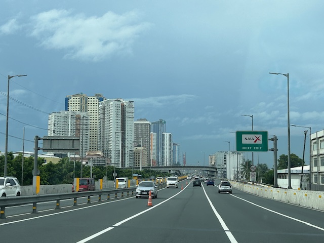
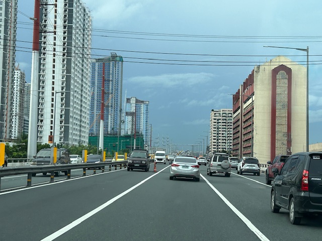
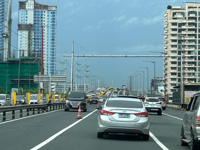
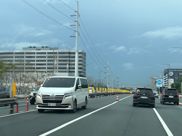
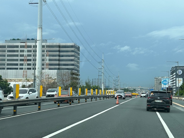


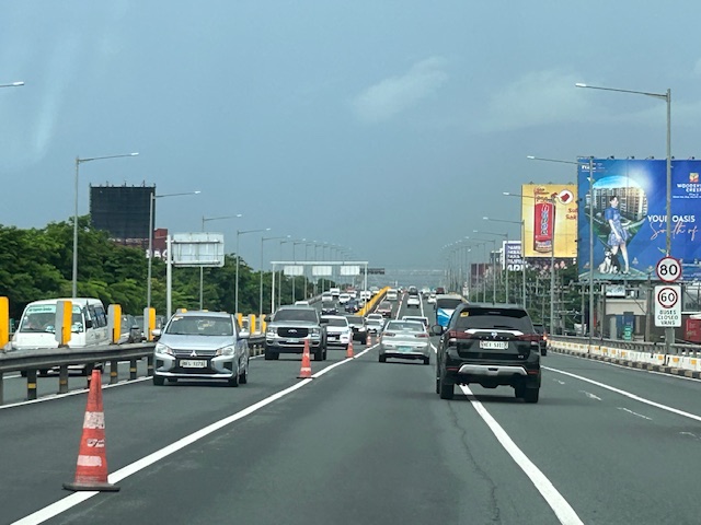
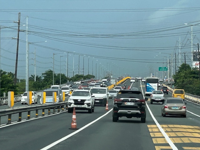
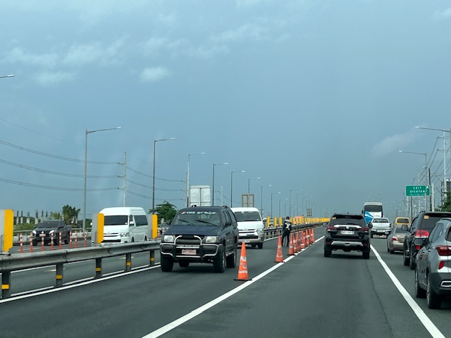
Note that there was more traffic as we traveled between Makati and Muntinlupa. The traffic represented commuters residing in the south and traveling to Metro Manila for work purposes.
Back in Tagaytay
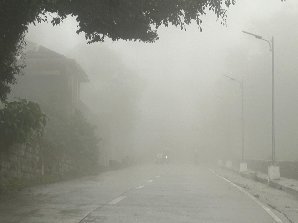
It’s been a while since I’ve been to Tagaytay. I think the last time was before the pandemic and with family. There used to be a time when we went there at least every month not counting the seminars and workshops we attended there. It was an easy drive from our home in Antipolo to Tagaytay via C6, SLEX and the Sta. Rosa-Tagaytay Road. We had our favorite stopovers with breakfasts usually at the Paseo de Sta. Rosa. Later, as Tagaytay became more crowded and congested, the trips became fewer. Of course, our schedules also became busier but then it wasn’t like we looked forward to the traffic and the crowded attractions there. I’m doing a project there now with my team at the office and that means I get to go there for work. Since we’ll be there anyway, we could have some side trips to eat some good meals (bulalo!) and maybe take some photos of Taal volcano.
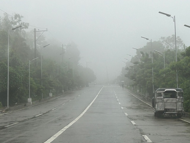
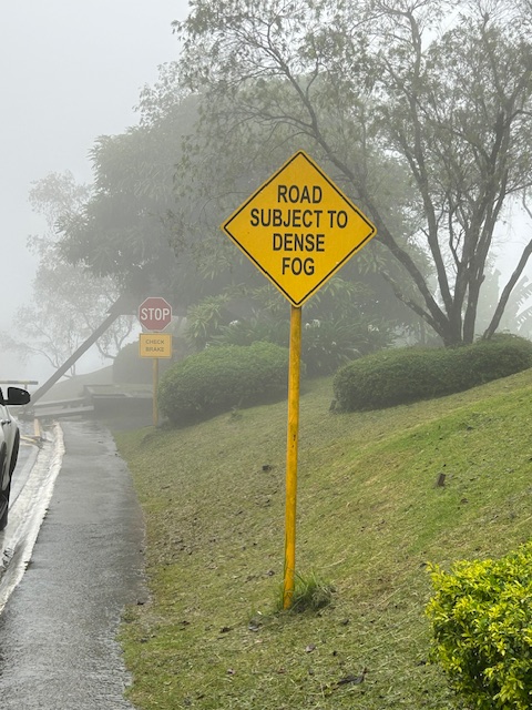
The fog was a quick reminder of the Tagaytay of old that we frequented before. But what we noticed was that it wasn’t cool. It was still somewhat warm if there was no breeze or wind blowing. This was certainly not smog as you can smell the pollution if it was. We even joked that it probably wasn’t because of the volcano as the smell of sulphur would probably be strong. We were in Tagaytay during the weekdays so there were fewer people and traffic. We were told that it was worse on weekends. That was to be expected. And with CALAX, Tagaytay became more accessible to visitors. I will write about the developments there in the next post. I feel there’s just too many buildings and the intense development has made Tagaytay less attractive. I have similar memories and feelings about Baguio but that’s another story to tell or write about.
–
SPRINT principles for bicycles
Here is the link to how to improve your city’s or municipality’s bicycle facilities based on scores guided by the SPRINT principles: https://cityratings.peopleforbikes.org/create-great-places
SPRINT stands for:
S -Safe Speeds
P-Protected Bike Lanes
R-Reallocated Space
I-Intersection Treatments
N-Network Connections
T-Trusted Data
The site provides links and examples of good practices of actual bike projects in the US. Many of these can be replicated or adapted to Philippine conditions. These are something that the active transport section of the Department of Transportation (DOTr) should look into and perhaps provide a reference for developing and improving bicycle facilities in the country.
–
Another roadblock for active transport?
The Metro Manila Development Authority (MMDA) recently released what they claim to be their counts of bicycle traffic along major roads in Metro Manila from 2020 to 2023.
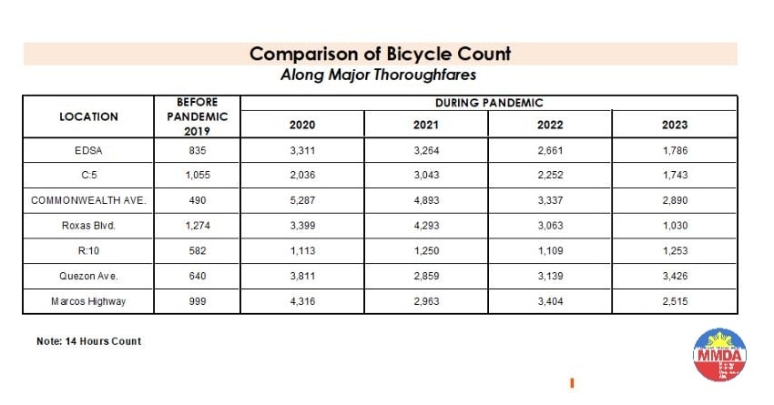
These are supposed to be official data as it is issued by the government agency in-charge of traffic management for Metro Manila roads (aside from its other functions and roles). What are not stated, and are actually very important details, are the locations of the counts and when the counts were conducted. The Traffic Engineering Center (TEC) that was under the DPWH and currently with the MMDA used to publish traffic volume maps for major roads in Metro Manila. So along EDSA, for example, the volume per section are shown on the map. The same for other major roads like Commonwealth, Quezon Avenue and SLEX. The thicker lines mean higher volumes along those sections, and vice versa. However, they did not consciously count bicycles (only motor vehicles) and perhaps MMDA only started counting during the pandemic (i.e., 2020). So there is no one value to represent a road. And counts vary over time of day, day of the week and even throughout the year (i.e., monthly variations).
There were many reactions to the MMDA’s posting of the data and most were critical and even derided the agency for what to them appeared to be inaccurate data. The problem is that it seems there are no other counts that can validate and perhaps refute the MMDA data. Previous bike counts were not conducted according to how the MMDA and DPWH count vehicles. That is, counts are typically done over a 14 or 16-hour period and ideally on several days in a year. Expansion and conversion factors are applied based on established stations along major roads that are supposed to have more frequent if not continuous counts. This methodology is how Annual Average Daily Traffic (AADT) is computed. Call it car-centric if you like but the methodology is very much applicable to bicycles as well. Peak hour counts for bikes are not enough and the peak hour factor for motor vehicles does not apply to bicycles (if this is to be used to expand/convert peak volumes to daily values). In fact, if you go into the math, there should be a peak hour factor for each type of vehicle considering each vehicle’s volume will vary differently over time. So yes, the solution here is to conduct bicycle counts according to how MMDA or DPWH counts vehicles and these should be done along several stations along major roads (e.g., those in the table above) to validate the MMDA counts.
More on this topic in the next post!
–
A widened Col. Bonny Serrano Avenue and opportunities for complete streets
Col. Bonny Serrano Avenue is one of the major roads directly connecting EDSA (C-4) and C.P. Garcia Avenue (C-5). The last time I used the road was before the pandemic. So it came as a surprise to pass by last weekend and see the avenue had been widened. I guess that pretty much “solved” the traffic along this usually busy thoroughfare that is part of jeepney routes to Cubao (via Murphy – referring to Camp Aguinaldo, which was formerly Camp Murphy). The avenue was renamed after a Korean War Hero (my uncle fought under him with the 10th Battalion Combat Team in the Korean War in the 1950s). It was called Santolan Road before.
 What used to be a 4-lane road is now an 8-lane road
The area used for road widening was carved out of Camp Aguinaldo. The headquarters of the Armed Forces of the Philippines (AFP) gave up quite a lot of square meters for this project and you can see from the photo the now very wide avenue. I thought perhaps they could have placed a median island where they could have also planted some trees (note how exposed to the sun the area is). They also could have designed protected bike lanes along either side of the road. These could have connected the EDSA and C5 bike lanes. And, of course, they should have also improved the pedestrian sidewalks. You can see how narrow the sidewalks are and how electric and light posts block pedestrians using the sidewalks. There were opportunities here for the application of complete streets and its not too late to do just that.
I assume there are many men in uniform who use bicycles for their commutes and recreation. Camp Crame is just across EDSA from Camp Aguinaldo and Bonny Serrano Avenue also passes along the headquarters of the Philippine National Police (PNP). Down the road towards Marikina City in Libis is another camp, Camp Atienza, which is home to the 51st Engineering Brigade of the Philippine Army. I mention these camps as I know many there regularly use Bonny Serrano for commuting and many use bicycles. A cousin-in-law (my wife’s first cousin) who is an army officer bikes a lot from Camp Atienza and Camp Aguinaldo and tells me there are many enlisted men who bike to work.
–
Article share: on making more affordable neighborhoods
I’ve been commenting about how transportation cannot be isolated and the need to relate it to other factors such as housing or home location choice. The latter though is also affected by other factors as well that affect the affordability of homes near the city centers or CBDs where workplaces and schools are located. The result of course is sprawl or the encouragement of sprawl. Private companies take advantage of this or contribute to this ‘encouragement’ by developing land farther away from the center. Thus, for Metro Manila’s case, many people reside in the peripheral provinces of Bulacan, Rizal, Laguna and Cavite. There are even those who choose to reside in Pampanga, Bataan and Batangas.
Kayatekin, C.S. and Sanmiguel, L.U. (April 16, 2024) ” ‘Urban form’ and the housing crisis: can streets and buildings make a neighborhood more affordable?” The Conversation, https://theconversation.com/urban-form-and-the-housing-crisis-can-streets-and-buildings-make-a-neighbourhood-more-affordable-224108 [Last accessed: 4/23/2024]
Quoting from the article:
“Our main finding was that the bottom-up districts we looked at had, overall, more small-scale apartments. The reason is simple: they had more small-scale buildings, built on small-scale plots. Once divided into apartments, this produces small apartments – homes in the bottom-up areas were 10% to 23.1% smaller than their top-down counterparts. This also made their real estate markets for small homes more competitive, and therefore more affordable.
However, our study showed there is nothing inherently magical about bottom-up areas. Their more intricate housing stock has little to do with the layout of streets and blocks, and a lot to do with how that land is built upon.
Plot size appears to be the deciding factor: the districts with greater numbers of small buildings built on small plots supported a denser and more affordable housing stock, regardless of whether they were top-down or bottom-up.
Older bottom-up areas seem to naturally lend themselves to having more small-scale plots. This is likely due to the incremental development of these areas, and the complex land ownership patterns that developed as a result. However, there is no reason why a top-down area cannot be designed to replicate these characteristics.”
–
