
Home » Highways and Streets (Page 3)
Category Archives: Highways and Streets
On understanding road diets
I’ve written and shared articles on road diets and complete streets before. Here is another article share on road diets
Johnson, R. (April 21, 2025) “Explainer: What is a Road Diet – And Why Should Cities Embrace It?,” Momentum Magazine, https://momentummag.com/explainer-what-is-a-road-diet-and-why-should-cities-embrace-it/ [Last accessed: 22/04/2025]
To quote from the article:
“The road diet isn’t about punishing drivers. It’s about creating streets that work better for everyone—from the parent pushing a stroller to the teenager biking to school, the delivery driver navigating a tight urban corridor, or the senior walking to the store.
As our cities continue to evolve, road diets offer a cost-effective, data-backed, and scalable way to make them safer, cleaner, and more livable. It’s not just about losing a lane—it’s about gaining a better future for urban mobility.”
Indeed, the first thing that usually comes to mind of motorists whenever road diets and complete streets are mentioned is that the road space (and consequently capacity) will be reduced. This reduction of capacity is actually from the perspective of the motor vehicle rather than the number of people traveling along a road as well as improving road safety for all. The article is spot on in its discussion on the resistance to road diets (and complete streets). Of course, context is very important here and it is important to identify which roads can be transformed for the transformation to be most effective.
–
More garbage along our streets
Election Day approaches in the Philippines and despite certain rules that are supposed to be in place and followed by candidates and their supporters. Enforcement from the COMELEC is really bad (and that’s the truth everywhere around the country). Otherwise, we’d have a lot of disqualifications every election and perhaps many incumbent politicians won’t be able to run for office. Here are a few examples in my home city of Antipolo in Rizal where a dynasty “rules” and also has connections with another family in Cavite.
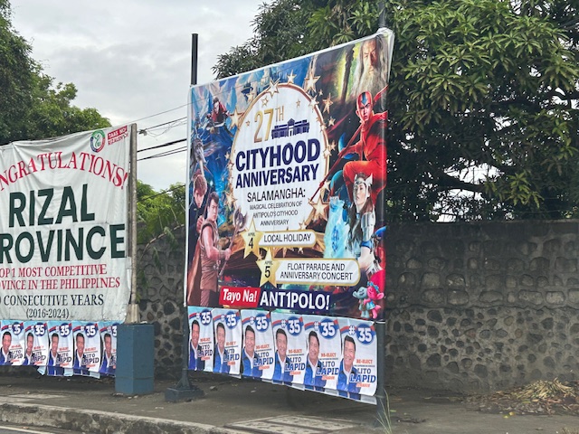 Antipolo’s city hood anniversary tarp features a Cavite politician who is closely related to the current leaders of the city and the Province of Rizal. Below the tarp are posters of a Pampanga politician who is also a movie actor like the other guy.
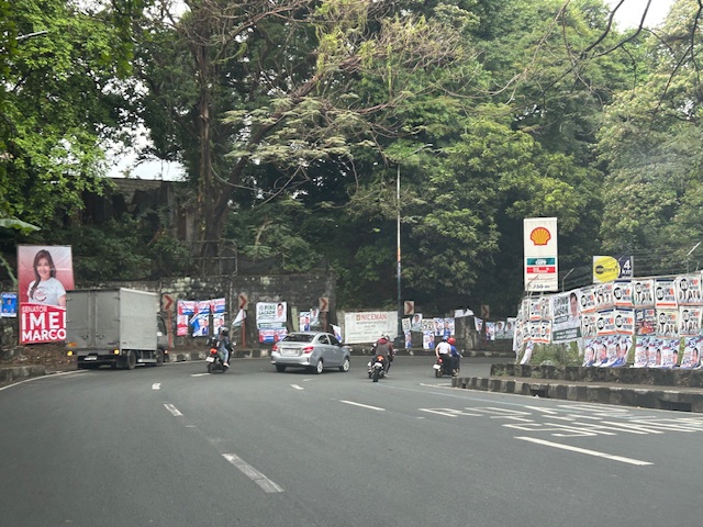 Antipolo roads are full of these campaign materials. Supporters have not spared private property of the garbage.
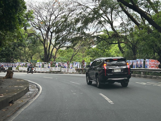 Perhaps those who will do the Alay Lakad to Antipolo this coming Maundy Thursday should each remove a poster, tarp or more as they journey to the Shrine of Our Lady of Peace and Good Voyage. This could be part of their penance and serve also as cleansing of minds in preparation for elections.
Try to explain again how these politicians are not overspending (and probably charging the costs to taxpayers). The math is pretty easy. You can check how much a politician’s monthly income is based on the salary grade of the position he/she is running for. Compare that to the amount spent for his/her campaign. You can’t recover the amount spent in one term. Are they billionaires willing to part with their money to get elected to positions that demand a lot in terms of the competence and dedication to good governance. Rather, the suspicion is that politicians will likely be corrupt and get his/her money back in a variety of ways to recover millions or even billions spent. It’s really a vicious cycle that doesn’t end well for the Filipino people in terms of the infrastructure and services we could have if only politicians moderated their greed.
–
On C-6 and the proposal for another expressway, Part 2
The recent announcement and launch of the Southeast Metro Manila Expressway (SEMME) included this map showing the (very) rough alignment for the proposed tollway. The map also shows the proposed locations of interchanges including one in Tikling and another in Masinag. There is also another in Tumana. From the looks of this, the SEMME will be a skyway or elevated expressway/tollway.
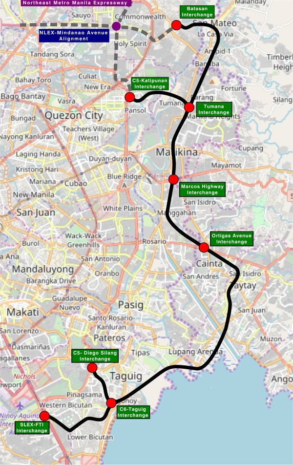
My first impression is that this elevated tollway will pass through predominantly residential areas with columns rising from private subdivisions. It doesn’t help that the topography also means the columns will be built along hilly or mountainous terrain, thereby making construction more challenging than the elevated tollways in Metro Manila.
Do we really need another circumferential road and particularly another tollway? I think that is a very important question that not only needs to be asked but also answered the right way. I, for my part, don’t believe we need another tollway, elevated or not, as this will not solve the so-called traffic problem. In fact, it creates more problems than what is supposed to be solved with the induced traffic this will generate and its promotion of car-centricity. For the price and effort of such an infrastructure, you will get more bang for your buck with a mass transit line or lines. Road congestion can only be solved by constructing the public transport system we needed decades ago.
–
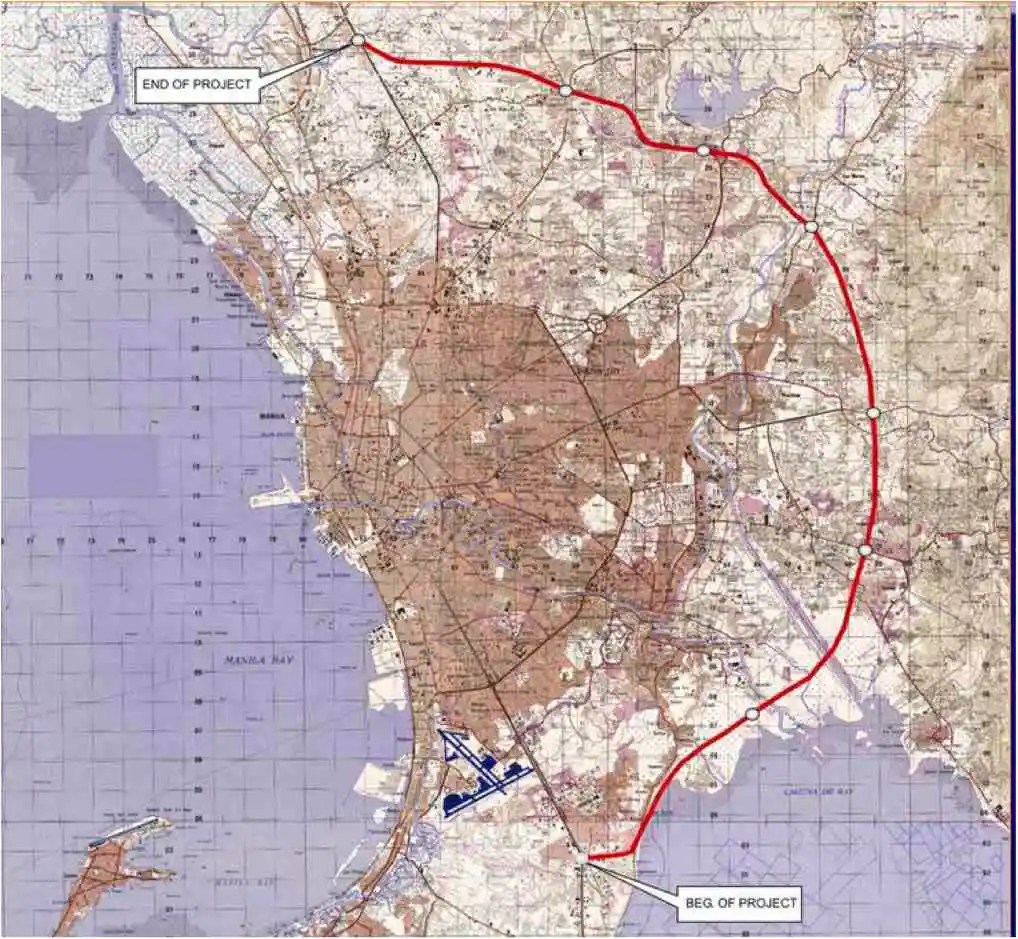
On C-6 and the proposal for another expressway, Part 1
I’ve written about Circumferential Road 6 many times in the blog. Mostly, these were about the existing sections along the Laguna de Bai in Taguig and Pasig cities of Metro Manila and Taytay in Rizal Province. I share below two maps showing different alignments of C-6. The first one is a rather old one from the 1990s that I recall was from a presentation of a friend at DPWH.
 An old map I got from the DPWH a long time ago that I have used in my lectures.
The second map is supposed to be more recent, perhaps in the last 5 to 10 years if not more recent. This shows a more realistic alignment composed of what looks like existing road sections that were connected to form a semblance of a circumferential alignment.
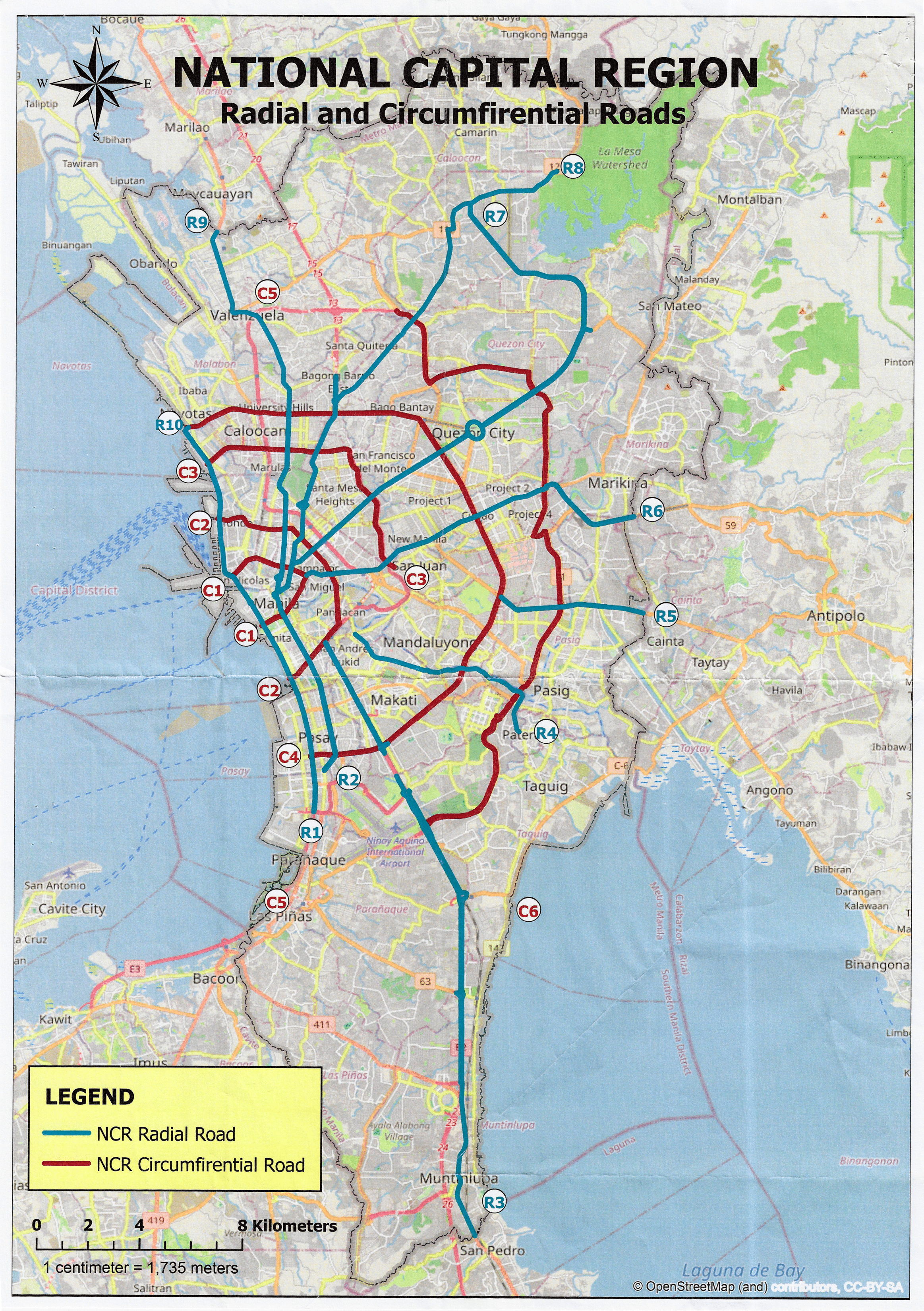 Here is a more recent map that’s also attributed to the DPWH.
In the first map, you will notice that the proposed alignment is more circular and smoother. This means that the road would have had a mostly new alignment instead of utilizing existing roads like Circumferential Road 5 before it. The newer sections for the latter were the ones connecting the existing roads. For the second map, noticeable is the somewhat forced connections of what looks like existing roads on the map. And while for Map 1 the alignment will be passing under the La Mesa reservoir, the alignment for Map 2 will circle the watershed like a coastal road. The alternative alignments presented an interesting exercise for students of highway engineering particularly for the topic of alignment design. Do you pick an entirely new alignment, sketch it out and determine the crossings and other constraints or do you try to make do of what roads are existing and perhaps improve (i.e., widen) these to produce an arterial?
The proposed alignment for what is now called the Southeast Metro Manila Expressway (SEMME) seems closer to the alignment in Map 1 than the one in Map 2. I will write about the proposed expressway that was recently launched in the next post.
–
To B(RT) or not to B(RT)?
I kind of expected questions or comments from my ‘students’ after my lecture last Wednesday about “Traffic Congestion.” Among my slides were those featuring solutions to transport and traffic problems. I presented both soft and hard approaches including travel demand management schemes and infrastructure that we should have built decades ago. The uniformed officers who were there had a very simple take on congestion – it’s basically because of a lack of discipline. While theirs may also be valid observations based on their experiences, ‘discipline’ is not the most critical problem that we have especially considering the ever increasing demand for travel. One government official present was very direct in his question about what I thought about the MMDA’s pronouncement that they plan to remove the EDSA Bus Carousel. I thought my reply and the following explanation was clear – it was a wrong move.
The EDSA Bus Carousel is simple. Bus lang sa bus lane (Only buses along the bus lane). Pag may private or pa-VIP, bawal at huli dapat (If there are private vehicles or those who regard themselves as VIPs using the lane, then they should be apprehended. An HOV (high occupancy vehicle) lane is more difficult to implement. Mas pahirapan ang pag monitor and enforce (It is very difficult to monitor and enforce). So this proposal to phase out the EDSA bus lanes don’t make sense from this perspective. In fact, I don’t agree with a couple of more senior transport experts who say that the MRT Line 3 is sufficient and that it hadn’t reached capacity yet. It has but in the time that the carousel has been operational, the carousel had absorbed much of the demand along the corridor. There is also the fact that it will take much time before Line 3 is upgraded. Are the new train sets here? Are the stations designed for these trains and more passengers? If the answers are no, then MRT3 will not have its capacity increased in such a short time. That also means the carousel is very much relevant not just to supplement MRT3 capacity but as a needed alternative mode for commuters.
–
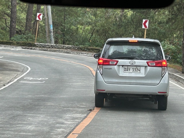
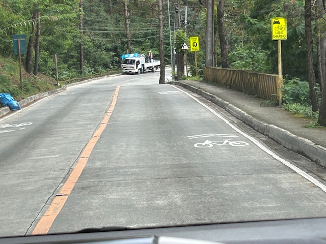
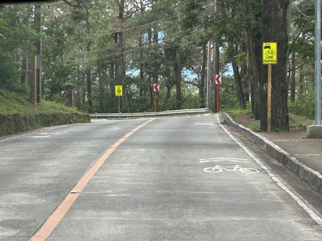
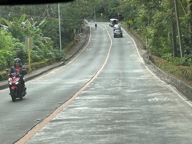
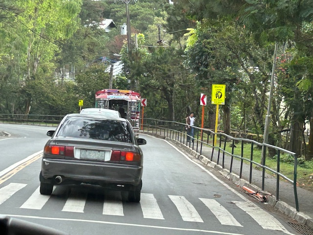
Shared lanes in Baguio City – Loakan Road
I have several drafts of articles about our recent travel to Baguio City. Those include write-ups about roads to/from and in Baguio City. Before I post about Kennon Road and Marcos Highway, I want to share some examples of shared lanes I was able to take photos of while going around the city. The following photos were taken along Loakan Road near Camp John Hay. It is the same road that takes you Baguio’s airport.
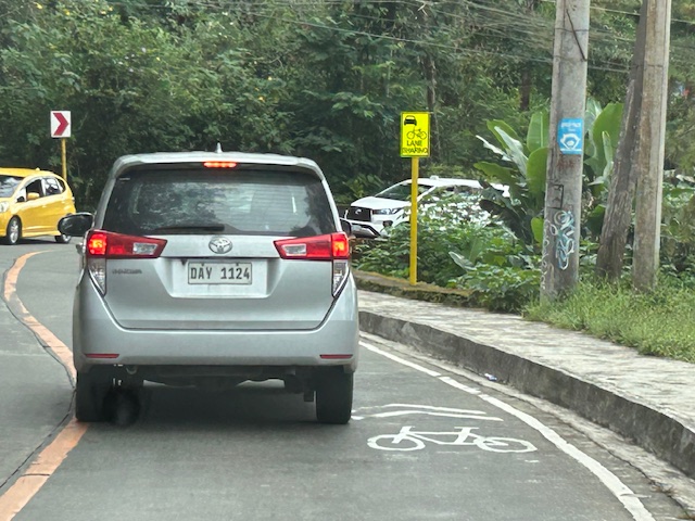 Note the use of the international standard for bicycle pavement marking. This is different from the rather odd bicycle marking in the DPWH guidelines that looks like a person on a treadmill (among other interpretations).
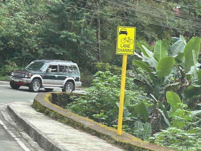 The signs are also not standard and somewhat small as you can probably see in the photos.
 Chevron signs for the curve
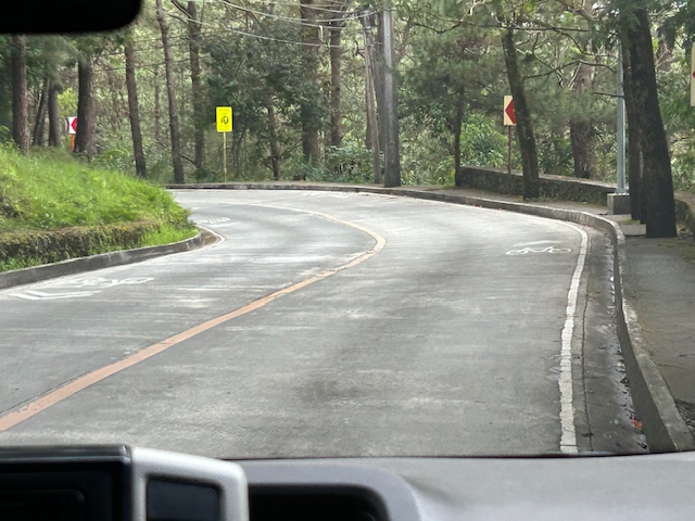 Another example of a curve section
 There are actually two types of signs installed along the road – both state lane sharing but with the other directing bicycles to keep right.
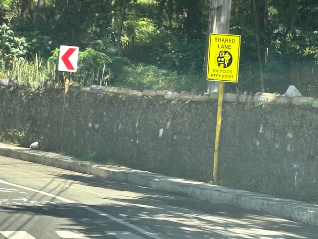 Two signs alternated along Loakan road. This one directs bicycles to keep right.
 Signs and pavement markings are closely spaced. Perhaps the intervals are less than 5 meters for the pavement markings?
 Section showing pavement markings for shared lanes
 Pedestrian crossing and fenced sidewalks
While shared rights of way (sharrows) or shared lanes is not preferred where there is space for bikes, these can be implemented for 2-lane roads with adequate lane widths such as Loakan Road. It is clear from the photos that there is ample if not generous space for cyclists and motorists to share a single lane. The premise for safety here is that motorists will not be hogging the road space, being mindful of cyclists, and will move at safe speeds.
–
Another look at the Candaba viaduct’s new lanes
I recently wrote about the new lanes along the Candaba viaduct and my thoughts about them being used as variable lanes (i.e., more lanes assigned along the peak or heavier traffic direction). Only this January 2, I observed that the lanes were being used instead for the southbound traffic as the older southbound viaduct appeared to be closed to traffic. Perhaps that side is up for rehabilitation or maintenance work?
 The new lanes between the two viaduct structures are now in use.
 These are assigned to southbound traffic while the original lanes appear to be closed off.
–
Landmarks – the Lion’s Head, Kennon Road
The main landmark along Kennon Road is the Lion’s Head. I think most people heading to or coming from Baguio have taken a photo of if not with the Lion. Here are photos I took as we descended from Baguio via Kennon Road last December 2024 after participating in a workshop.
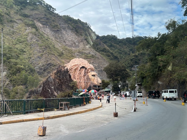 Approaching the Lion’s Head along Kennon Road, the monument appears to be under maintenance with scaffolding around the head.
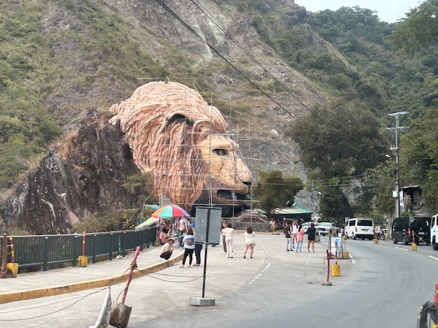 An entire section is cordoned off, likely for tourists or visitors. The lane though looks newly paved, perhaps part of a road widening project.
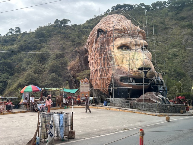 A closer look of the Lion’s Head and the touristy things in the area. Notice there weren’t too many tourists at the time and there weren’t so many shops and vendors set-up.
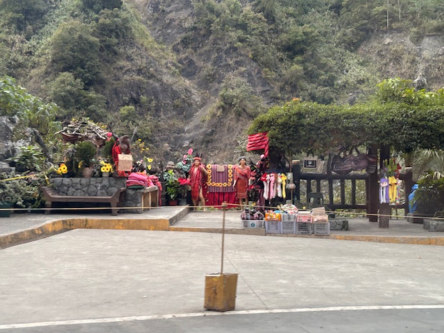 Among the activities are dressing up in local costume and taking photos wearing these with the mountains or the monument in the background.
–
–
New lanes along the NLEX Candaba Viaduct
Heading to Baguio, I noticed the new lanes in the middle of the NLEX viaduct. The viaduct was actually two bridges constructed over the Candaba Swamp. The soil being too soft for a normal road, the viaduct allowed for two way traffic with each bridge carrying northbound or southbound vehicles. The recall that the original bridges each had 2 lanes plus a shoulder lane. Each now have 3 lanes plus shoulder after expansion years ago. The additional lanes in the middle probably required additional columns to be built with more modern foundations than the original viaduct. The new structures had to be integrated with the older viaducts. Here are photos of the completed sections:


You can go to Google Maps if you want to see what the lanes looked like under construction. Here is a screenshot:

Screenshot
The middle lanes look like they can be used as variable lanes. That is, all or some of the lanes may be used to serve the direction with the heavier traffic. The directions can change depending on the time of day, day of the week or the season. I don’t know at this time though how exactly this can or will be implemented as there are no signs to guide motorists for variable lanes. What signs am I referring to? Here are examples from Bangkok showing overhead signs assigning lanes for the direction with heavier traffic:
 A close up of the signs designating lanes for traffic
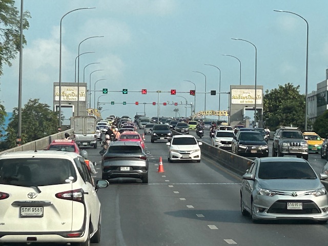 In the example above, 4 lanes including one counterflow lane are assigned to traffic along the southbound direction.
–
More political garbage along our roads
I was telling some friends who were planning to go to Antipolo this long weekend that they should not be distracted by the images of demonyos and demonyas they’ll see along the way to the Shrine of Our Lady of Peace and Good Voyage.
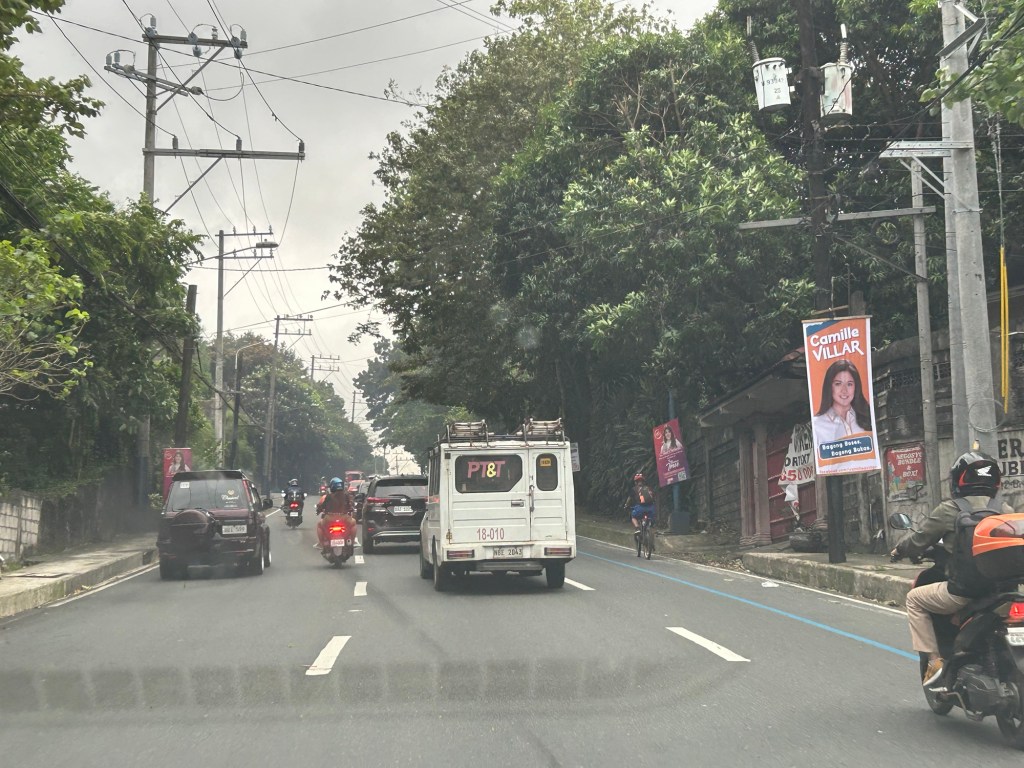
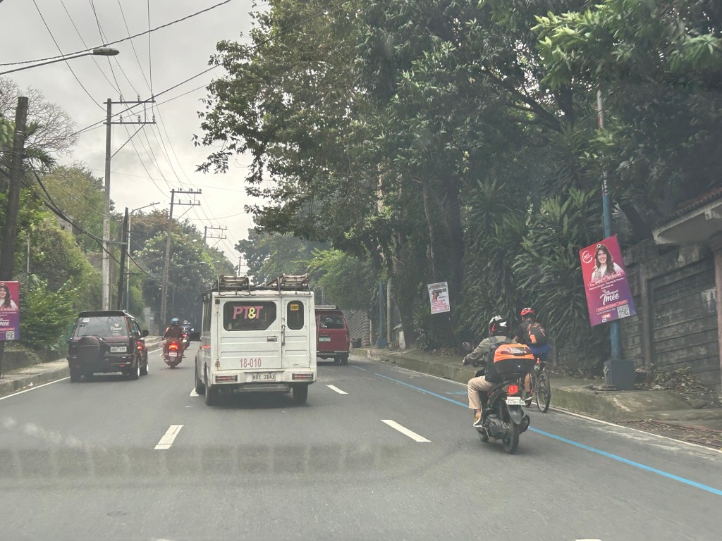
These are electioneering and those who vote for these clowns have no right to complain about their economic situation. You only perpetuate these scums in government.
–
