
Home » Highways and Streets (Page 5)
Category Archives: Highways and Streets
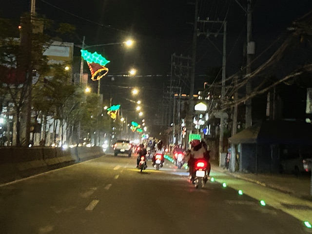
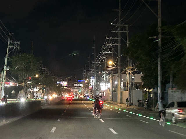
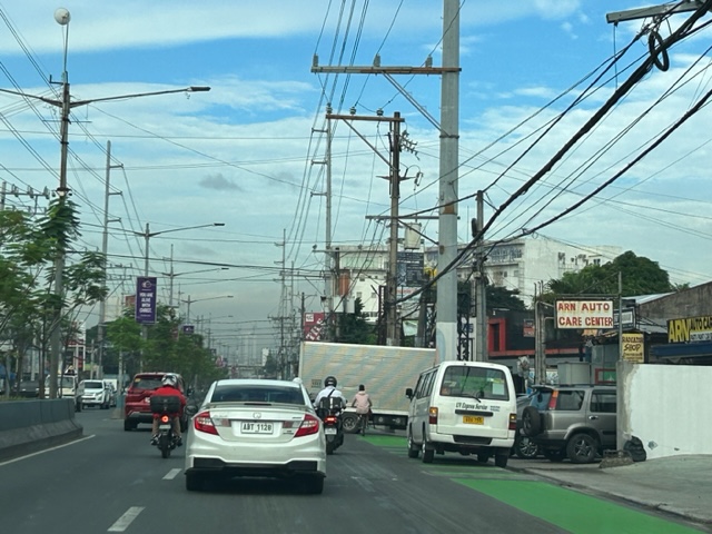
Solar road studs for Ortigas Avenue Extension bike lanes
The bike lanes along Ortigas Avenue Extension now have solar road studs for these to be more visible at night time or when it is dark. Following are photos of the bike lanes at night.
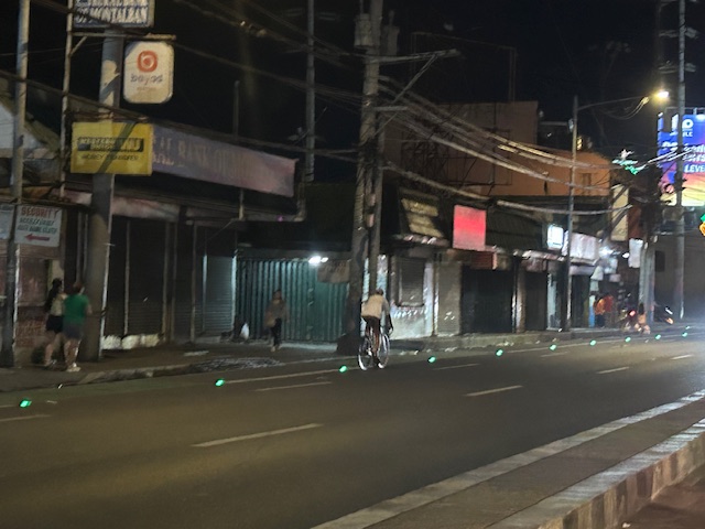
While the studs enhance the visibility of the bike lanes and perhaps also the safety of cyclists, the latter is not assured. The bike lanes are not protected and physical barriers like those installed along Quezon City roads are most effective in ensuring the safety of cyclists against motor vehicles. The solar studs do not deter motor vehicle drivers from encroaching on the bike lanes so they appear to have minimal impacts on safety.
–
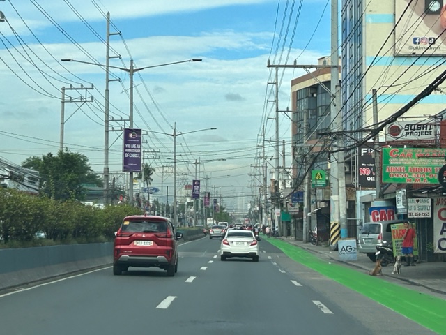
Westbound bike lane along Ortigas Avenue Extension, Cainta, Rizal
I was not able to post these photos of the westbound bike lane along Ortigas Avenue Extension immediately after I shared photos of the eastbound bike lane. The bike lanes, as can be seen from the photos, are painted green.
 Bike lane past Valley Golf and STI
 Bike lane approaching Brookside (Sunset Drive) with the CK Square as a landmark
 Still a big issue for bike lanes is the presence of electric and communication poles/posts that have not been relocated after so many years since Ortigas Avenue had been widened.
 Bike lane across from Tapsi ni Vivian
 These photos were taken before the solar studs were installed to delineate the bike lanes and make them more visible at night or when its dark.
 Also, challenges and concerns for cyclists are parked vehicles and those maneuvering from the various establishments along the road. This photo pretty much captures those two concerns – a parked UV Express van and a truck maneuvering out of a store occupying the bike lane.
 Cyclist pedaling along the bike lane approaching the Shell Gas Station (where there is also a McDonald’s)
 Bike lane in front of the Ortigas Hospital just outside the Brookside Gate 1 and near Cainta Junction
More photos of the bike lanes soon!
–
Article share: on making roads greener
I came upon this article on ‘greening’ roads:
Goldfarb, G. (December 23, 2023) “This Radical Plan to Make Roads Greener Actually Works,” Wired, https://www.wired.com/story/this-radical-plan-to-make-roads-greener-actually-works/?bxid=5bd6761b3f92a41245dde413&cndid=37243643&esrc=AUTO_OTHER&source=Email_0_EDT_WIR_NEWSLETTER_0_DAILY_ZZ&utm_brand=wired&utm_campaign=aud-dev&utm_content=WIR_Daily_010324&utm_mailing=WIR_Daily_010324&utm_medium=email&utm_source=nl&utm_term=P8 [Last accessed: 1/4/2024]
To quote from the article:
“The very notion that a road can be “green” seems oxymoronic: A vast body of scientific literature demonstrates that roads befoul air and water, fragment ecosystems, introduce non-native species, and obliterate wildlife.”
That was a pretty damning or severe statement about roads considering such infrastructure are necessities in today’s world. Perhaps we should revisit road planning and design to address these issues referred to. Aside from that quote, the article related a number of good examples worth replicating. In fact, I recall that many Philippine roads were envisioned, even designed, to have greenery along them. The tragedy is when the DPWH and LGUs departed or deviated from these plans. The road widening projects of the past years are examples on how national and local agencies have proven the article’s author right about green roads being oxymoronic.
–
Lagusnilad now
The underpass across from the Manila City Hall is called Lagusnilad. The underpass is prone to flooding and had been neglected for a long time under several administrations spanning several Presidents, DPWH Secretaries and Manila Mayors. Kudos to the recent Mayor and DPWH officials who finally addressed the flooding problem as well as improved the pavement and lighting for Lagusnilad.
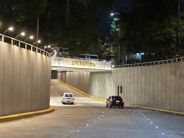 Approach to the lowest point of the underpass from Padre Burgos Avenue, one notes the now well-lit underpass and the solar studs marking the lanes.
 The lowest section of the underpass is prone to flooding but major rehab works to the drainage plus new pumps appear to have addressed the problem.
 Emerging from the underpass towards Taft Avenue
I have memories of when this underpass was often flooded back in the 1990s including a time when vehicles braved the waters and got stuck after drivers discovered just how deep the waters can be. The joke then was that the underpass would be renamed ‘Langoynilad’, alluding to people and vehicles having to swim to traverse this section.
There is also a pedestrian underpass that is called Lagusnilad. This connects City Hall with Intramuros and used to be so dirty and stinky. Again, credit is due to recent officials who rehabilitated the underpass to what is now a tourist attraction but more importantly a good practice example for pedestrian facilities.
–
On making intersections safe by ‘daylighting’
I came across this interesting article that introduced a somewhat new term to me – daylighting.
Abramson, B. (November 24, 2023) “How to Daylight Your City’s Intersections (and Why It Matters),” Strong Towns, https://www.strongtowns.org/journal/2023/11/24/how-to-daylight-your-citys-intersections-and-why-it-matters [Last accessed: 12/3/2023]
From the article:
“Daylighting is the technical term for a common-sense solution to traffic safety: By removing visual obstructions in approaching intersections, users can better see and more safely cross each other’s paths. “
There are certainly many intersections and even mid-block crossings in our cities and municipalities that could use ‘daylighting’ to improve safety. Many of these intersections and crossings are used by the most vulnerable road users like children, senior citizens and persons with disabilities. Interventions need not be expensive and may also involve the community. Examples are shown in the article, and these can easily be implemented formally or informally with the cooperation of stakeholders including the local government units and national agencies (i.e., DPWH) under whose jurisdiction many roads are.
–
On reimagining our streets
We start the last month of the year by sharing this article on complete streets:
Robertson, D. (November 15, 2023) “Safe streets are global—and it’s time for the U.S. to catch up,” Smart Growth America, https://smartgrowthamerica.org/safe-streets-are-global-and-its-time-for-the-u-s-to-catch-up/?eType=EmailBlastContent&eId=03b04320-4eeb-4bf5-9b12-71ec2a960421 [Last accessed: 12/1/2023]
To quote from the article:
“The examples mentioned here are exemplary cases, but demonstrate that the future of mobility need not follow the same dangerous status quo. They prove that with a combination of public and political will to the commitment of the prioritization of people over cars, we can produce the results we care all about.”
While the article is on complete streets, there is a very quotable section that referred to the situation in Japan:
“Anyone who wants to register a car in Japan today must prove that they have a private place to park it. This shifts the economic burden of providing parking from the public to drivers, and also ensures that supply of parking will not grossly outpace demand.”
There are many opportunities for the complete streets concept to be applied in the Philippines. A few have already been implemented but there should be more especially in light of the gains from the development of bike lanes networks in many LGUs that started during the COVID-19 pandemic. As for parking, perhaps the Japanese example should be adopted and implemented to curb car-dependence.
–
Arches along the Manila East Road
Last October, our office had our first out-of-town workshop since the onset of the COVID-19 pandemic. The venue was not so far – a resort in Baras, Rizal. Along the way, I was able to take a few photos of the arches along the Manila East Road, which is the main highway connecting the towns of Rizal Province.
 One side of the Morong, Rizal arch with the text stating the traveler is leaving the town. The other side is Baras, Rizal.
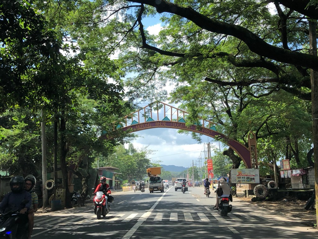 The other side with the text stating one is entering the town of Morong “where education comes first”.
 At the other end is another arch and the town of Teresa.
Many arches have been demolished, casualties of the DPWH’s road widening program. Many of these have not been replaced. These were landmarks to many travelers and the designs used to describe or highlight what a town was known for (e.g., there was a big bat at the center of the arch of Paniqui, Tarlac).
–
Incorporating bike lanes along local roads – an example in Taguig City
I have not used an old route that we usually take to go to BGC from our place in Antipolo. This is via the Manila East Road, Highway 2000, Barkadahan Bridge and C6. From C6, we usually take Ruhale instead of Seagull Avenue as the former provided a shorter route towards Levi Mariano Avenue and C5. So it was only last weekend that I was able to see the improvements along Ruhale Street and how bike lanes were incorporated along this road. I am sharing the following photos showing a two lane road and Class 2 bike lanes.
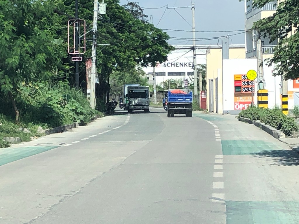 The green pavement markings indicate an intersection or driveway.
 Noticeable are the electric posts that remain along the bike lanes. These need to be transferred so they will not pose danger to all road users.
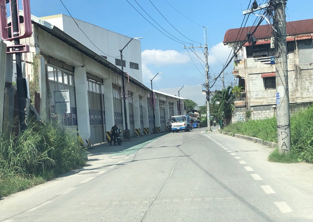 More electric posts along the bike lanes
 Bike lanes in front of an industrial establishment
 Close-up of a post in the middle of the bike lane.
 Bike lane across another industrial establishment. Again, note the green pavement marking across the driveway of the establishment.
 Bike lanes along a predominantly residential area along Ruhale.
I would consider this as a good practice example that can be replicated elsewhere. Of course, it is not perfect and as shown in the photos, there is much room for improvement including the transfer of electric posts that pose as hazards to all road users. The bike lanes are wide enough that installing bollards for the perception of physical protection vs. motor vehicles can be considered. Ruhale is generally a low speed, low volume road so perhaps the current state with no barriers would be enough for now. Also, we need to appreciate that these are already gains or wins in as far as active transport is concerned. A few years ago, this would not have been implemented by national or local governments.
–
A real battle of Katipunan – the search for a transportation solution
Is it obvious that I was alluding to the classic match-ups of the two major universities – Ateneo De Manila University and the University of the Philippines Diliman – that are located along Katipunan Avenue for the title of this article? That is deliberate on my part as there is a ‘real’ battle along Katipunan Avenue, and it does not involve sports.
Following is a recent article from the Philippine Collegian that reports on the current state of traffic along the corridor:
https://phkule.org/article/971/private-cars-mainly-to-blame-for-katipunan-traffic-transport-experts
I have written before and many times about transport and traffic along Katipunan Avenue. This road has been part of my daily commute since 1988 when I was admitted to UP Diliman as a B.S. Civil Engineering major. Back then Katipunan was not as wide as it is now, especially along the section between UP Diliman and the MWSS complex. That section only had 2 lanes then. What is not a wide center island with large, old acacia trees used to be the frontage of MWSS. So now you can probably imagine how much land was ceded by MWSS for road widening.
I also wanted to write about Katipunan in part as a sort of farewell to the former MMDA Chair and Marikina Mayor Bayani Fernando (BF), who recently passed away. Much of how Katipunan looks like and the traffic situation today can be traced to what transpired during his time at MMDA. I will refrain from writing about this and him for now. I am actually thinking of writing a series about BF and his time as Mayor in Marikina, as MMDA Chair, and his brief stint as DPWH Secretary. This short article will do for now.
Article share: On the benefits of sidewalk networks
Here is another quick share of an article by Todd Litman on Planetizen. The article contains a lot of information or data about why we should be investing in sidewalks or pedestrian facilities (i.e., for walking).
Litman, T. (August 6, 2023) “Completing Sidewalk Networks: Benefits and Costs,” Planetizen, https://www.planetizen.com/blogs/124999-completing-sidewalk-networks-benefits-and-costs?utm_source=newswire&utm_medium=email&utm_campaign=news-08142023&mc_cid=cd3b2e2ba5&mc_eid=9ccfe464b1 [Last accessed: 9/23/2023]
To quote from the article:
“Walking is the most basic and universal travel mode, and sidewalks are the most basic walking infrastructure, but they are often overlooked and undervalued in transportation planning. Completing and improving sidewalk networks can help achieve many economic, social and environmental goals.
Recent case studies indicate that typical North American communities spend $30 to $60 annually per capita on sidewalks, and would need to double or triple these spending levels to complete their networks. This is a large increase compared with current pedestrian spending but small compared with what governments and businesses spend on roads and parking facilities, and what motorists spend on their vehicles. Sidewalk funding increases are justified to satisfy ethical and legal requirements, and to achieve various economic, social and environmental goals. There are several possible ways to finance sidewalk improvements. These usually repay their costs thorough savings and benefits.”
–
