
Home » Highways and Streets (Page 9)
Category Archives: Highways and Streets
If you build the bike lanes, will people use them?
The obvious answer to this question is yes. It is not so clear, however, how many will really be using these bike lanes over time. That needs data. That requires counting. And such data will be useful in order to understand, among other things, why people choose to bike or why they don’t. The latter is important to determine what factors are being considered by people who can switch to cycling particularly for commuting. Of course, there are many references for this from other cities and countries but these still need to be contextualized from our (Philippine) perspective. Case in point is Marikina, which has the most comprehensive network of bike lanes in the country. What are the numbers and what are the constraints and misconceptions? Did the city do its part to promote and sustain cycling?
Here is an article discussing the experience in the US:
Penney, V. (April 1, 2021) “If You Build It, They Will Bike: Pop-Up Lanes Increased Cycling During Pandemic,” The New York Times, https://www.nytimes.com/2021/04/01/climate/bikes-climate-change.html?smid=url-share [Last accessed: 4/9/2021]
 Bike lane along Katipunan Avenue (C5) in Quezon City
Here is the link to the paper mentioned in the article:
https://www.pnas.org/content/118/15/e2024399118
–
On arches as border references or landmarks
Many people take it for granted when you talk about locations or places and the cities or towns where they are located. When ask where a certain place is, people may reply in the general though sometimes in the specific. When you ask where Robinsons Galeria is, the usual reply may be Ortigas Center or, more specifically, “sa kanto ng EDSA at Ortigas Ave.” The mall is actually
Where does Antipolo start and Taytay end? To many, the Tikling Junction might be the easy reference or landmark for this. It is usually assumed that you’re already in Antipolo as you start climbing from Tikling. The stretch from Tikling to the boundary with Antipolo is actually still part of Bgy. Dolores, Taytay. Here is Antipolo’s welcome arch along Ortigas Avenue Extension:
 “Tayo na sa Antipolo” is the city’s old tagline that you can find in a song relating its attractions
It may be somewhat unimportant or trivial for many but political delineations are subjects of many disputes among local government units. Cainta, Taytay and Pasig, for example, continue to dispute areas along the Manggahan floodway. Pasig, Marikina and Cainta are also wrestling about areas along Marcos Highway (e.g., Robinsons Metro East is Pasig but Sta. Lucia Mall is Cainta. Across from the two is Marikina territory. And the three lobbied to get the Line 2 Station to be associated with either of them (as of this writing, it seems Marikina’s got it and the station may have the alternate name “Marikina Station” to the original “Emerald Station”). The Feliz Mall is technically in Pasig though people seem to associate it with Marikina. Line 2 Santolan Station is Pasig’s. And do you know that along Sumulong Highway, Antipolo and Marikina are split by a barangay of Cainta? There are many other cases across the country that have these issues that have not been resolved or needs to be resolved especially as there are implications to elections in those areas, particularly at the local level.
–
Infanta, Quezon Arch
I was just writing about the arches you typically came across as you traveled by road around the Philippines. A former student of mine posted a photo of the arch welcoming travelers to Infanta, Quezon from Rizal province, and I asked to have a copy of the photo. He is an avid cyclist who goes on long rides. The arch bears the seal of the town but few other symbols (that I am familiar with) that could have represented the municipality. Here is a typical low-traffic highway with two lanes and dirt shoulders along either side of the road leading to something mysterious (see that fog/mist at the end of the road?).
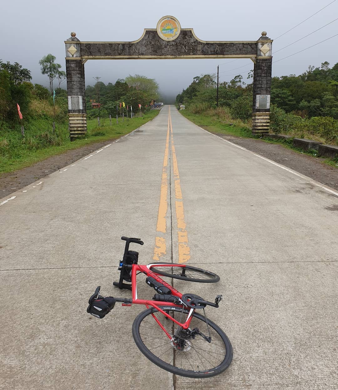 Road to Infanta, Quezon [Photo credit: Dexter Cuizon]
–
On the road again
A couple of weekends ago, I found myself doing my first long drive in months. I wasn’t a passenger but the driver when the wife and I went on an excursion with neighbors-friends, one of whom arranged for our lunch at Ugu Bigyan’s Potter’s Garden in Tiaong, Quezon. We had two options to get there – one via the scenic route through Rizal’s backdoor that takes one to Teresa, Tanay, Baras and Pililla in Rizal, Pakil, Pangil, Paete, Lumban, Pagsanjan, Sta. Cruz and San Pablo in Laguna, the other via C-6, SLEX and STAR Tollways taking us through southern Metro Manila, Laguna, and Batangas. We took the latter route as it was faster (shorter travel time by an hour) and it allowed us to test our newly installed Autosweep RFID’s for the two tollways we used along the way.
The photo below was taken by the wife upon my prodding. I had not seen an arch as we traversed Sto. Tomas (Batangas), and Alaminos and San Pablo (Laguna). These were all along Asian Highway 26 (AH 26) or the Pan Philippine Highway system. The arch marks entry/exit to/from (boundary) the Province of Quezon from the Province of Laguna. Laguna doesn’t have its own arch.
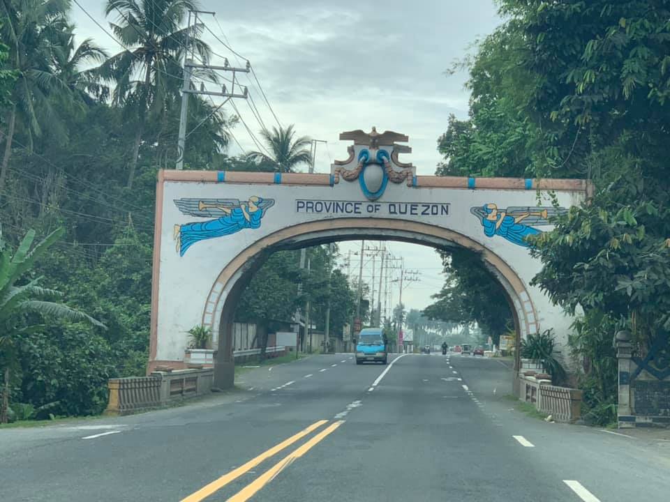
Arches like the one in the photo used to be the landmarks between towns and provinces. I wrote about these many years ago:
https://d0ctrine.com/2013/02/18/arches-in-la-union-and-ilocos-sur/
https://d0ctrine.com/2019/04/25/arko-along-the-highways/
I have other photos somewhere but have not scanned/digitized them. Others I think that I left at my parents’ home perished with the floods of Ondoy.
With DPWH’s road widening program, many of these arches around the country may have been demolished. Those that remain tend to constrict traffic as they have space for two lanes and perhaps narrow shoulders at either side like what is shown in the photo. Perhaps others will be reconstructed and even enhanced to reflect a town’s or province’s attractions or attributes?
–
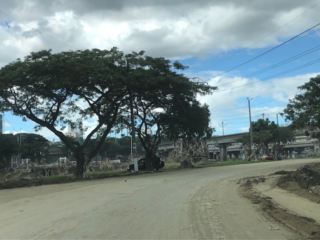
Post-typhoon BFCT and SM Marikina area
Still on the aftermath of Typhoon Ulysses (Vamco) though this is already a late post about it, here are some photos at the river banks level on the side of SM Marikina and the vicinity of the transport terminal constructed and operated by the former MMDA Chair and Marikina Mayor’s company. The area is basically a flood plain and in other countries would not have been suitable for building. Rather, these are often used as open spaces like parks, football fields or baseball diamonds, among other possible uses.
 There were garbage and mud everywhere. By the time I passed by, the mud had dried up and turned into fine dust that blanketed the area.
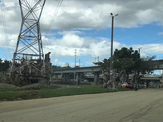 Trash were everywhere and you can see how deep the water was by the garbage still on the power line towers and the trees.
 Underpass leading to SM Marikina – bulldozers and payloaders were busy moving mud and garbage to clear the roads. There were no signs of the work in progress so I ended up making a U-turn seeing the way to SM’s parking was blocked by mud and debris.
 On the way back to Marcos Highway, you can see the large trees that were transferred to this area from Katipunan Avenue (when it was widened by way of removing the service road to give way to the MMDA’s U-turn scheme). It is heartening to know these survived the river’s onslaught.
–
More parks and trees = longer lives
Here is an article about a topic that seems unrelated to transportation but is actually strongly related to it. We already know about the benefits of tree-lined boulevards and parks as lungs of a town or city. The following article discusses the benefits and advantages of having more parks and trees.
Yanez, E. (November 19, 2020) “More Parks, Longer Lives,” Parks and Recreation, https://www.nrpa.org/parks-recreation-magazine/2020/december/more-parks-longer-lives/
I suddenly recall what were tree-lined national highways across the country. Many of these trees were cut down to give way to road-widening projects of the national government through the Department of Public Works and Highways (DPWH)., Nevermind that the widening was not really required in many if not most cases, and that the trees were never replaced or was there ever an effort to do so. The results have been disastrous in terms of the environments along these roads. Transport systems can also be developed with parks and trees in mind; especially if active transport were the focus of the development. Surely parks and trees will enhance the environment and encourage more people to walk or cycle. This should translate into better overall health and wellness for people.
–
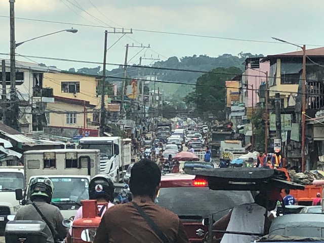
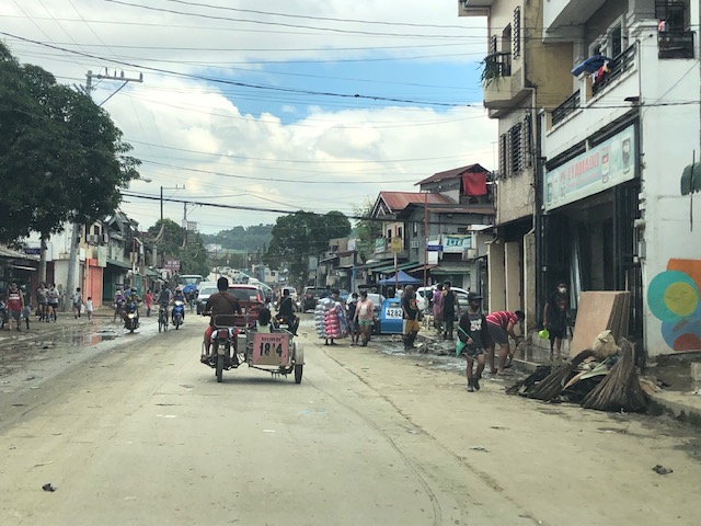
Tumana during and after the flood
I was heading to the office the Monday after Typhoon Ulysses had devastated wide areas in Luzon. I was aware of the congestion along my usual routes so I used Waze to guide my trip. Waze took me to Tumana instead of Marcos Highway, which I assumed would have been less congested. I took the following photos in the Tumana area:
 Congested main road due to heavy equipment like bulldozers, backhoes and dump trucks clearing the mud and trash in the area. There were also lots of parked vehicles along each side of the road including Marikina service and emergency vehicles.
 There was trash all around that included what looked like the belongings of people residing in the area. Many people were busy clearing their homes of items destroyed or damaged by the floodwaters.
 Despite being cleared for traffic, you can see the mud and water still in the area and signs of how deep the flood waters were by markings on the buildings.
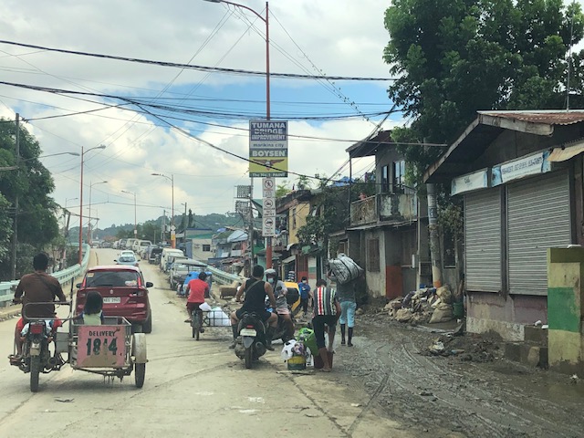 At the foot of the bridge connecting to Quezon City, you can see that there is still so much mud in many areas especially those closest to the river. Sidestreets were so narrow that the heavy equipment cannot enter them and cleaning the mud had to be done entirely manually.
 Here are what looks like the vehicles that survived the floods. I thought people must have rushed to get their vehicles on the best positions atop the bridge when they realized the waters were rising fast. It was likely few if anyone left their vehicles there during the height of the typhoon. That’s because the winds were so strong that perhaps people though it would be unsafe to leave their vehicles exposed to the winds.
The following photos from Facebook shows the extent of the flooding that reached the other side of the river – Loyola Grand Villas and another subdivision that’s directly along the banks of the Marikina River. The first photo shows the submerged end of the bridge from the LGV side in the foreground and Tumana in the background at the other end of the Tumana Bridge. The second photo is atop LGV and shows many submerged homes and cars.
 Only the cars on the bridge likely survived the floods.
 This was definitely at the level of the floods of Typhoon Andy (Ketsana) given the spread and depth of the floods.
One wonders what is now the return period for these typhoons. Ondoy was 11 years ago and the monsoon (Habagat) rains that also brought heavy rains and floods were in 2012 (8 years ago). Such floods cannot be solved by improving drainage systems alone but have to go to the root cause of flooding while also addressing how people could cope with these phenomena. Infrastructure alone cannot solve this and certainly will cost a lot for any initiative to provide some relief from such.
–
On sharrows
The term ‘sharrow’ basically short for shared right-of-way and refers to lanes or roads that are ‘designated’ for all modes of transport including and especially non-motorized ones such as bicycles. It also refers to the lane markings. There have been some mixed experiences and opinions about sharrows; particularly referring to whether they are effective. Here’s an article from the director of technology of Smart Design, which is a strategic design and innovation consulting firm in the US that gives another opinion (an evidence-based one) about sharrows:
Anderson, J. (September 30, 2020) “Safer with sharrows?”, World Highways, https://www.worldhighways.com/wh12/feature/safer-sharrows
I guess the experiences in different countries vary according to several factors. Perhaps these include cultural factors that also relate to human perceptions and behavior? Education is also definitely a factor here aside from awareness. And we have to work harder on these and together, rather than play the blame game on this matter that relates to safety. How many times has the observation that Filipinos tend to regard road signs and markings as merely suggestions rather than guides and regulations?
–
On the transformation from car-oriented to people-oriented streets
I saw this article shared by a friend on social media and share it here as an interesting piece providing ideas and the thinking or attitude required if we are to transform our streets:
Jaffe, E. (2020) “4 ways to go from “streets for traffic” to “streets for people”, Medium, https://medium.com/sidewalk-talk/4-ways-to-go-from-streets-for-traffic-to-streets-for-people-6b196db3aabe [Last accessed: 9/30/2020]
It is actually interesting to see how this plays out in Philippine cities. The ‘honeymoon’ or ‘grace’ period from the lockdown to the ‘normalization’ (read: going back to the old normal) of traffic might just have a window and this is closing for active transport. National and local officials, for example, who seemed enthusiastic and quickly put up facilities for active transport have slowed down efforts or even stopped or reneged on their supposed commitments. The next few weeks (even months) will show us where we are really headed even as there are private sector initiatives for active transport promotion and integration.
–
Paved paradise? On pollution due to asphalt roads and parking lots
Here’s another quick share of an article mainly about asphalt as a material used for roads, parking lots and roofs:
Pullano, N. (2020) “Sun-heated streets can lead to air pollution strikes – study”, Inverse, https://www.inverse.com/science/summer-streets-beat-the-heat?link_uid=15&utm_campaign=inverse-daily-2020-09-03&utm_medium=inverse&utm_source=newsletter [Last accessed: 9/6/2020]
While we have a significant number of roads with asphalt paving or surfacing, the majority of roads are of Portland cement concrete (PCC). Most lots are also PCC or gravel. And unlike in the US, most roofs here are made of galvanized iron (GI) sheets or even clay tiles.
–
