
I was heading to the office the Monday after Typhoon Ulysses had devastated wide areas in Luzon. I was aware of the congestion along my usual routes so I used Waze to guide my trip. Waze took me to Tumana instead of Marcos Highway, which I assumed would have been less congested. I took the following photos in the Tumana area:
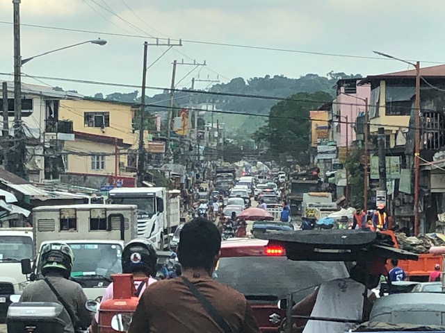 Congested main road due to heavy equipment like bulldozers, backhoes and dump trucks clearing the mud and trash in the area. There were also lots of parked vehicles along each side of the road including Marikina service and emergency vehicles.
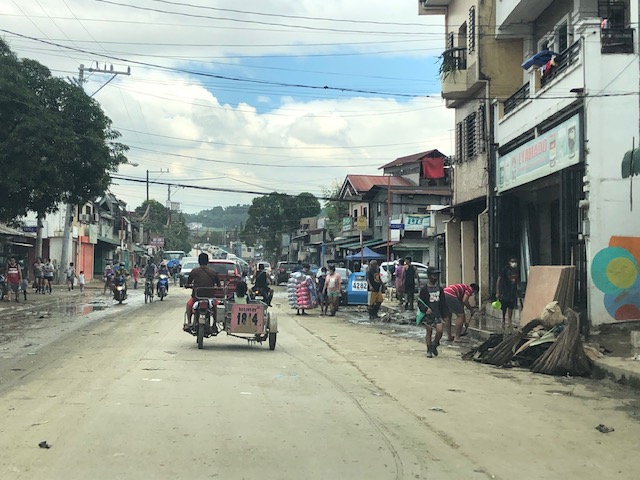
 There was trash all around that included what looked like the belongings of people residing in the area. Many people were busy clearing their homes of items destroyed or damaged by the floodwaters.
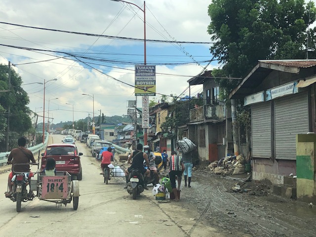
 Despite being cleared for traffic, you can see the mud and water still in the area and signs of how deep the flood waters were by markings on the buildings.
 At the foot of the bridge connecting to Quezon City, you can see that there is still so much mud in many areas especially those closest to the river. Sidestreets were so narrow that the heavy equipment cannot enter them and cleaning the mud had to be done entirely manually.
 Here are what looks like the vehicles that survived the floods. I thought people must have rushed to get their vehicles on the best positions atop the bridge when they realized the waters were rising fast. It was likely few if anyone left their vehicles there during the height of the typhoon. That’s because the winds were so strong that perhaps people though it would be unsafe to leave their vehicles exposed to the winds.
The following photos from Facebook shows the extent of the flooding that reached the other side of the river – Loyola Grand Villas and another subdivision that’s directly along the banks of the Marikina River. The first photo shows the submerged end of the bridge from the LGV side in the foreground and Tumana in the background at the other end of the Tumana Bridge. The second photo is atop LGV and shows many submerged homes and cars.
 Only the cars on the bridge likely survived the floods.
 This was definitely at the level of the floods of Typhoon Andy (Ketsana) given the spread and depth of the floods.
One wonders what is now the return period for these typhoons. Ondoy was 11 years ago and the monsoon (Habagat) rains that also brought heavy rains and floods were in 2012 (8 years ago). Such floods cannot be solved by improving drainage systems alone but have to go to the root cause of flooding while also addressing how people could cope with these phenomena. Infrastructure alone cannot solve this and certainly will cost a lot for any initiative to provide some relief from such.
–
