
Home » Infrastructure (Page 14)
Category Archives: Infrastructure
Is there really a transport or traffic crisis in Metro Manila?
I was interviewed recently for a research project by students enrolled in a journalism class. I was asked by one in the group if we indeed have a transport crisis in Metro Manila. The other quickly added “hindi transport, traffic” (not transport but traffic). And so I replied that both terms are valid but refer to different aspects of the daily travel we call “commuting”. “Traffic” generally refers to the flow of vehicles (and people if we are to be inclusive) while “transport” refers to the modes of travel available to us.
“Commuting” is actually not limited to those taking public transportation. The term refers to all regular travel between two locations. The most common pairs are home – office and home – school. The person traveling may use one or a combination of transport modes for the commute. Walking counts including when it is the only mode used. So if your residence is a building just across from your office then your commute probably would be that short walk crossing the street. In the Philippines, however, like “coke” and “Xerox”, which are brands by the way, we have come to associate “commute” with those taking public transportation.
And so we go back to the question or questions- Do we have a transport and traffic crises? My response was we do have a crisis on both aspects of travel. All indicators state so and it is a wonder many including top government transport officials deny this. Consider the following realities for most commuters at present:
- Longer travel times – what used to be 30-60 minutes one-way commutes have become 60 – 120 (even 180) minute one-way commutes. Many if not most people now have double, even triple, their previous travel times.
- It is more difficult to get a public transport ride – people wait longer to get their rides whether they are in lines at terminals or along the roadside. The latter is worse as you need to compete with others like you wanting to get a ride ahead of others.
- People have to wake up and get out of their homes earlier – it used to be that you can wake up at 6:00AM and be able to get a ride or drive to the workplace or school at 7:00/7:30 AM and get there by 8:00 or 9:00AM. Nowadays, you see a lot of people on the road at 5:30AM (even 4:30AM based on what I’ve seen). That means they are waking up earlier than 6:00 AM and its probably worse for school children who either will be fetched by a service vehicle (e.g., school van or bus) or taken by their parents to their schools before going to the workplaces themselves.
- People get home later at night – just when you think the mornings are bad, afternoons, evening and nighttimes might even be worse. Again, it’s hard to get a ride and when you drive, traffic congestion might be at its worst especially since most people leave at about the same time after 5:00PM. Coding people and others not wanting to spend time on the road (instead working overtime – with or without additional pay) leave for their homes later and arrive even later.
- Less trips for public transport vehicles – traffic congestion leads to this. What used to be 6 roundtrips may now be 4. That affect the bottomline of income for road public transport providers. Given the increased demand and reduced rolling stocks of existing rail lines that includes rail transport.
To be continued…
—
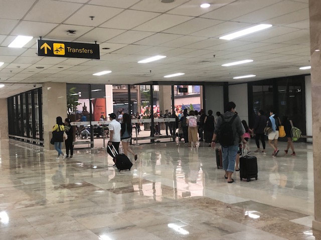
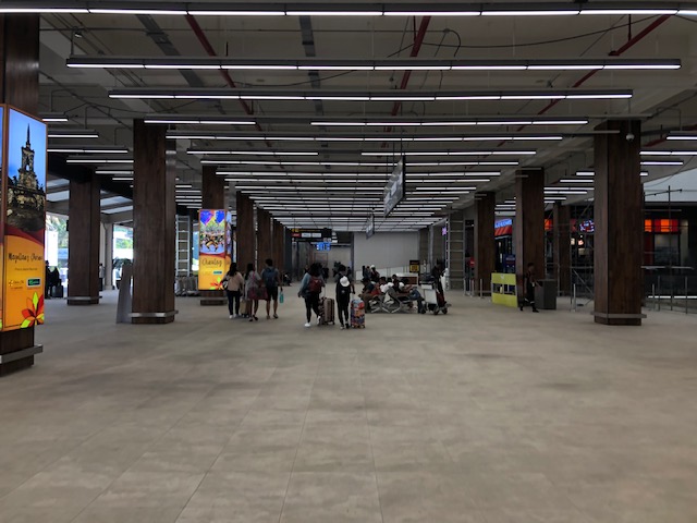
Mactan Cebu International Airport – newly opened lobby area at Terminal 1
Arriving in Cebu, I was pleasantly surprised to see that the airport’s Terminal 1 has a new lobby that is now open to the public. Here are photos taken during our recent trip to Cebu last month.
 View of the newly opened lobby from the baggage claim area
 Passengers and well-wishers (mostly people waiting to fetch arriving passengers) at the MCIA’s new lobby
 This is the arrival level and one can use the escalators or the stairs to get to the departure level
 Escalators at the MCIA’s new lobby
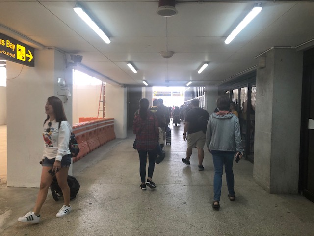
 The corridor to the transport terminal is unfinished but the path is spacious enough as shown in the photo.
 This is the area closer to the older exit from the arrival area of Terminal 1, which is actually closer to the transport terminal.
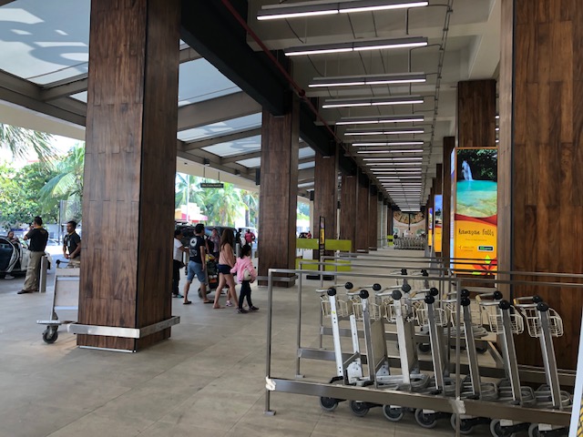
 A preview of a much more spacious area where a driveway used to be
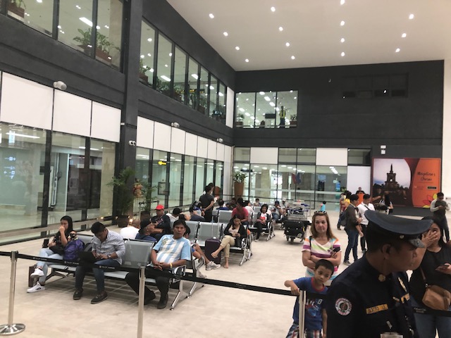
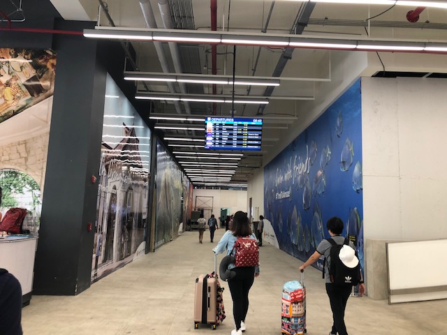
I made sure to take more photos of the lobby upon our departure from Cebu. Here are those photos:
 Workers walking along the newly completed pathways at the ground transport interphase for the departure area of the airport’s Terminal 1.
 A familiar scene: passengers saying their farewells to relatives at the airport terminal
 Carts neatly placed for use by travellers
 Information signs and columns are sleek and modern. These show the way to the check-in counters.
 A very spacious departure level lobby
 View towards the escalators to the arrival area, which is one level down from the departure area
 Shakey’s seem to be one of the first to establish a branch at the newly refurbished Terminal 1.
 Corridor to the terminal’s domestic flight check-in counters
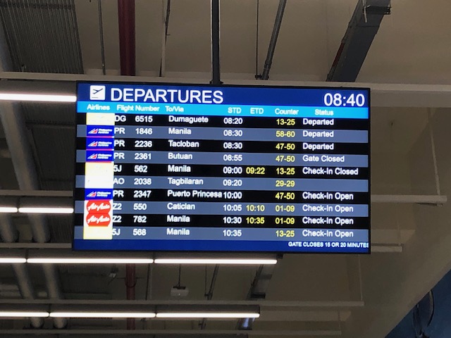 Newly installed information board showing scheduled departures and their status
More about Cebu’s airport soon!
–
A little bit of history – on how the US interstate highway system came to be
Here’s one of those quick shares that I usually post here. I am a bit of a history buff and mixing that with transport will likely lead to a post like this. Here is a short article about an event in the history of the US Army that happened 100 years ago:
editor@aashto.org (2019) Celebrating Highway History: The US Army’s 1919 Cross-Country Convoy, aashto.org, https://aashtojournal.org/2019/07/12/celebrating-highway-history-the-u-s-armys-1919-cross-country-convoy/ [Last accessed: July 12, 2019]
The article was particularly interesting for me because of two items: the road conditions and the man behind the US inter-state highway system. It took them a little over 2 months to cross the continental US because of poor road conditions. Many people have no sense of history and appreciation of what has been accomplished over the years and how difficult it was to travel at the time. I haven’t done the cross country trip but I have close friends who’ve done it and are thankful for the generally good roads they could use for the experiential road trip. Meanwhile, the person in the article – then Lt. Col. Dwight D. Eisenhower – is a man who made his mark in history at first as the Supreme Commander of the Allied forces in the European Theater in World War 2, who would later on become President of the US. I read elsewhere that the US interstate highway system was designed so aircraft may use them as runways in cases when the US were at war and the enemy had bombed their airports and airfields (just like what the Japanese did in the Pacific).
Do we have similar accounts for our roads and bridges in the Philippines? Were there key persons who may or may not be larger than life figures instrumental in developing our road infrastructure with their vision and leadership (Marcos doesn’t count because of his bogus military record and corrupt regime)? It would be nice to compile these and perhaps it should be a collaboration between the Department of Public Works and Highways (DPWH) and the National Historical Commission (NHC). They could even get the history departments of local universities involved for us to understand the evolution of transportation in this country.
–
Evidences of demand for Line 2 beyond Masinag (again)
My commute between my home and office usually takes me to Masinag where I make the choice between traveling via the typical Marcos Highway route or via the alternative Marikina/Tumana route. Here is a scene that I usually see whenever I pass by the informal UV Express terminal just past the Masinag junction along the westbound side of Marcos Highway and just before the Decathlon sports facility currently under construction.
 Passengers waiting for UV Express vans or AUVs to return around 8 AM. The latter serve the Cogeo – Makati (Greenbelt) route, which could take 2 or 3 rides using other modes of public transport (e.g., one ride to Cubao and another from Cubao to Makati)
Note how many people cannot get a ride around 8 AM. If only there were more efficient options then these people would likely take them but for now the obvious and practical choice for them is the UV Express. Others, of course, can just walk further to SM Masinag where there is a P2P bus service also heading to Makati. Recently, a new “experimental” route was opened between Cogeo and SM Aura in Taguig using modern jitneys.
Once completed, Line 2 should be able to provide an alternative for these commuters but there is still the issue of a seamless transfer in Cubao. There is no direct connection between the Line 2 and Line 3 stations with the former connected to the Gateway Mall while the latter is connected to Farmers. That is a significant walk between the two stations.
But where do the commuters in the photo come from (origin?)? Most likely don’t reside around Masinag Junction though there are many residential area around this location. Many are ferried here by tricycles, jeepneys or private vehicles. Many likely have their own cars but opt not to drive to/from Makati. That is actually a good thing and something that needs to be sustained rather than give a reason for these people to use cars for their commutes. And so there is a need to extend Line 2 perhaps to Cogeo, and a branch to Marikina. The Marikina branch, as I’ve mentioned before, could terminate at the Marikina Sports Center. Meanwhile the extension to Cogeo should not stop there but continue further towards Antipolo’s new government centre. This corridor’s population is steadily increasing and the transport demand must be addressed not by low capacity modes but by a mass transit system. The low to medium capacity modes should be in support or at most supplementary to the high capacity system with the Line 2 as backbone.
–
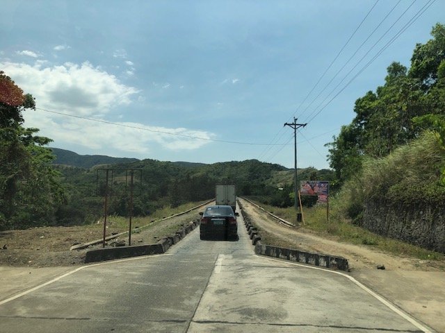
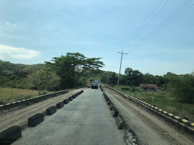
Reservoir roads – Part 2
Previously, I posted about the reservoir roads we crossed when we traveled to Baler, Aurora last April 2019. It’s been a while since that post so before I forget, here are more photos of those reservoir roads taken during our return trip from Baler.
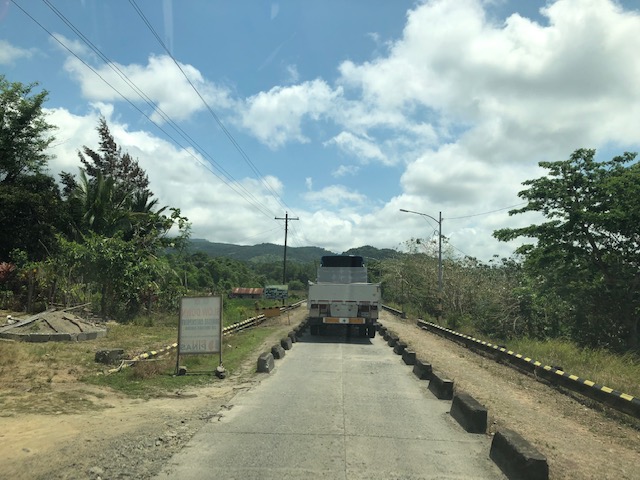
 The two lane highway becomes a single lane section at the Diayo River Reservoir road
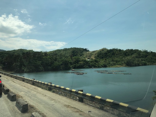
 A view of the fish pens at the Diayo River reservoir
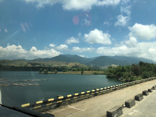
 Pristine waters with the Sierra Madre mountain range in the background
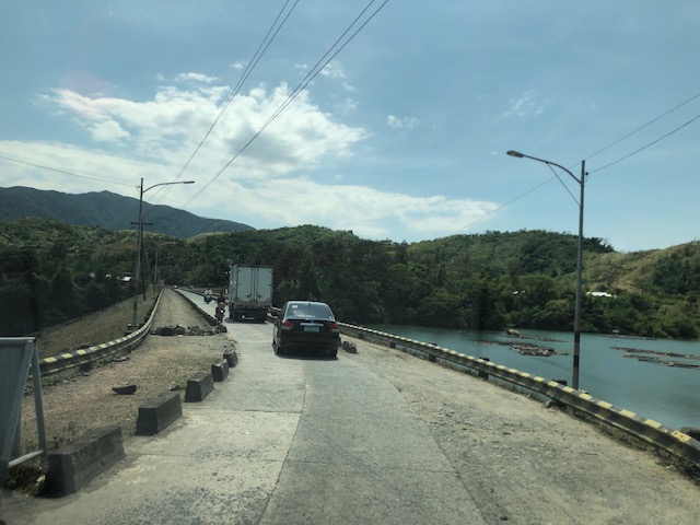
 Approaching the end of the Diayo reservoir road
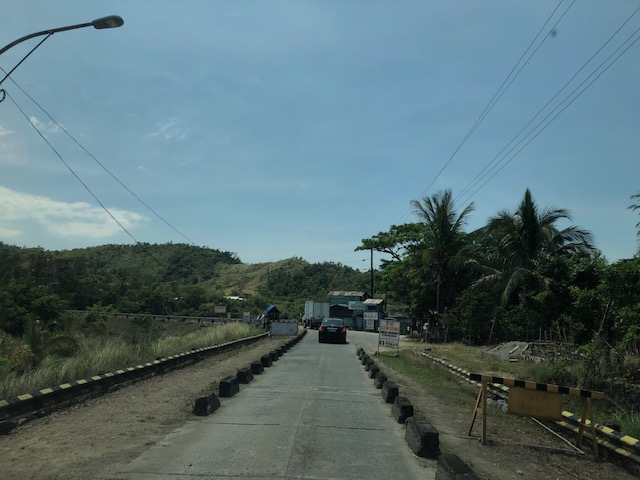 There is a checkpoint at the 2-lane section bridging the Diayo reservoir road with the Canili River reservoir road
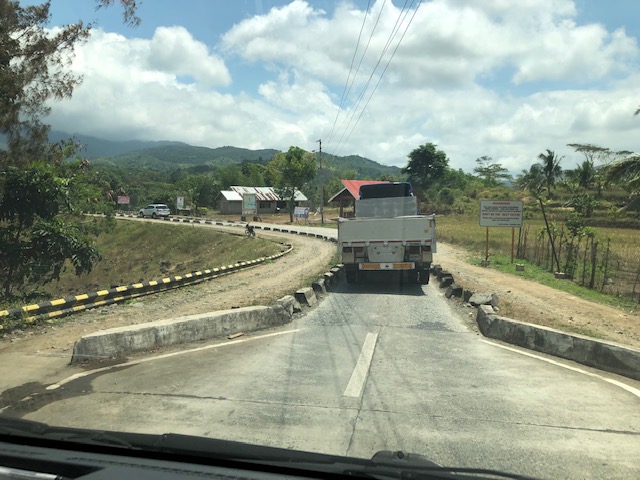
 Vehicles entering the Canili reservoir road – this again is a one-lane, one-way section where vehicles from either direction would have to give way to either.
 Shoulder and fish pens
 Waters of the Canili River Reservoir with the Sierra Madre mountains in the background
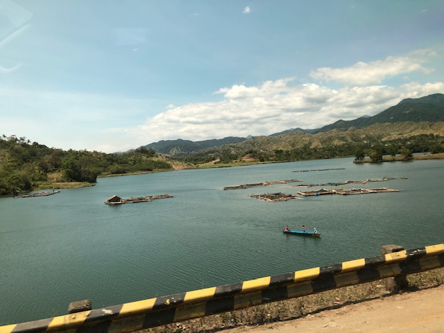 Fishermen on a banca – they looked like they were inspecting their fish pens
–
Reservoir roads – Part 1
I remember posting about “submersible bridges”, dike roads and the like. There were two roads atop 2 dams that were part of 2 reservoirs in : the Canili River Reservoir and the Diayo River Reservoir, which are dwarfed by the much larger Pantabangan reservoir and dam nearby. These two reservoirs are at the border of Nueva Vizcaya (Alfonso Castaneda) and Isabela (Maria Aurora), which also happens to be the border of Regions 2 and 3 (Cagayan Valley and Central Luzon, respectively). Here are photos of the roads atop the dams that are part of the Pantabangan-Baler Road.
 Vehicles may only pass a single lane with shoulders on either side of the lane. And so there are people posted at either ends of the sections to manage the one-way traffic.
 The reservoir is visible on the left side of the photo
 Forested area and ravine on the right side
 Some fish pens on the Canili reservoir side
 A view of the east end of the Canili reservoir road where westbound vehicles await their turn to traverse the section.
 The eastern end of the Canili reservoir road
 There’s a short two-lane segment between the Canili and Diayo reservoir roads
 Traveling along the Diayo reservoir road
 Fish pens at the Diayo Reservoir
 The other side of the dam
 The eastern end on the Diayo reservoir road where the single lane road transitions into a 2-lane road.
More photos in Part 2…soon.
–
On the efficiency of transportation – a crash course on transportation engineering concepts
There is an excellent article on the efficiency of transportation systems:
Gleave, J. (2019) Space/Time and Transport Planning, Transport Futures, https://transportfutures.co/space-time-and-transport-planning-1aae891194e5 [Last accessed: February 25, 2019].
It is highly recommended not just for academics (including students) but also for anyone interested in transportation and traffic. It’s like a crash course in transportation engineering with a lot of basic concepts in traffic engineering and traffic flow theory being presented for easy understanding by anyone. Enjoy!
–
Lessons to be learned from experiences on public transport abroad
There’s this “old” article that came out last year that is very much relevant as it is timeless for its topic. The title is intriguing as the many if not most US cities are known to be car-dependent. Few have good public transportation in terms of the efficiencies or qualities we see in Singapore, Hong Kong, Seoul or Tokyo (just to mention Asian examples). Clearly, quality of service is the main reason why people are apprehensive about using public transportation. In fact, the attraction of ride shares, for example, are precisely because people want to have what they perceive as safe, comfortable and convenient modes of transport for their regular commutes. Only, for many people, their choice is also limited by the affordability of such modes of transport. Perhaps the same is applicable if you extend the discussion to include active transport. Cities and municipalities would need to provide the right infrastructure and environment for people to opt out of cars, take public transport, walk or cycle.
English, J. (2018) Why did America give up on mass transit? , http://www.medium.com/citylab, https://medium.com/citylab/why-did-america-give-up-on-mass-transit-dont-blame-cars-d637536e9a95 [Last accessed: 08 March 2019]
–
On the Tandang Sora flyover’s closure
The signs announcing the closure of the Tandang Sora flyover along Commonwealth Avenue are doing the rounds of social media. So are the traffic management plans (i.e., the re-routing maps for the area) that are being shared by many and soliciting a variety of reactions. The reactions are often angry or sad for those likely affected by the closure and the re-routing via Luzon Avenue, Congressional Avenue and Philcoa. The demolition of the flyover to give way to the future MRT-7 station will definitely lead to traffic congestion and longer travel times to a lot of commuters, whether using public or private transportation. However, there are only few comments so far about the impacts on pedestrians. Will the pedestrian footbridges be demolished, too? Will they be redesigned or replaced considering the high volume of pedestrians crossing this major intersection? Following are photos taken underneath the Tandang Sora flyover as we waited to make a U-turn. These show the pedestrian footbridges in the area that allow people to safely cross the wide Commonwealth Avenue.
 View of the steel truss footbridge that goes underneath the Tandang Sora flyover
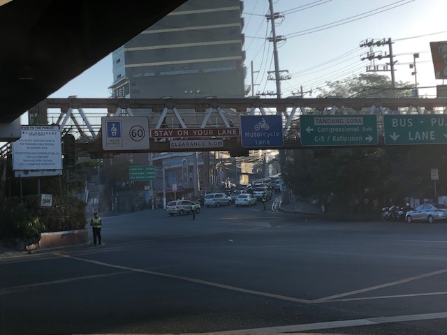 There are many signs installed on the footbridge including the speed limit for Commonwealth Avenue and a reminder to fasten seatbelts. Others are directional signs including those designating the lanes for public utility vehicles and motorcycles.
 There is another steel footbridge that is of more recent design and construction connecting to the old truss bridge. This allows pedestrians to continue on to cross Tandang Sora. This example is actually one that invites questions pertaining to design. Why have two distinct designs instead of building on the previous one? Another case of “pwede na iyan” ?
 Here’s another view of the two footbridges – one spanning Commonwealth and the other across Tandang Sora. Will these be demolished, too, to give way to the MRT-7 station? And will the MRT-7 Station design include a provision for non-passengers to cross Commonwealth and Tandang Sora? This seems to be the most logical way to design the station; integrating pedestrian (and cycling) needs to the infrastructure. But then again, that remains to be seen and perhaps someone can share the design of the Tandang Sora station for this to be scrutinized.
–
Simulating cities?
I found this nice article about some of the most popular simulation games; especially SimCity:
Baker, K.T. (201 ) Model Metropolis, Logic, https://logicmag.io/06-model-metropolis/?mbid=nl_021119_transportation_list_p [Last accessed: 2/13/2019]
While there are still those who dismiss these as merely games, they fail to appreciate the really complex algorithms and processes that could now mimic real world situations. That includes governance of cities that is a very important factor to its development. Land use planning or transport planning alone cannot provide the solutions for a city’s problems associated with, among others, its growth. The success reflects on the administration and leadership that should be able to anticipate and respond to issues while consolidating and rationalising resources, which are often limited.
–
