
Home » Infrastructure (Page 22)
Category Archives: Infrastructure
Differences: pro-walking vs. anti-car
I came across this article posted at the Planetizen site entitled Pro-Walking, or Anti-Car. It is a good article that heads-on addresses the the differences of being pro-walking to that of being anti-car in terms of transport policies in cities. I think these concepts including the “nuts to crack” list provided by the author is relevant not only to cities that want to promote walking and cycling over car use, but to individuals and groups as well who seem to be following a hard line when in comes to their advocacy to recover road space in favor of pedestrians and cyclists.
Unprepared and incomplete – realizations from the APEC transport experience
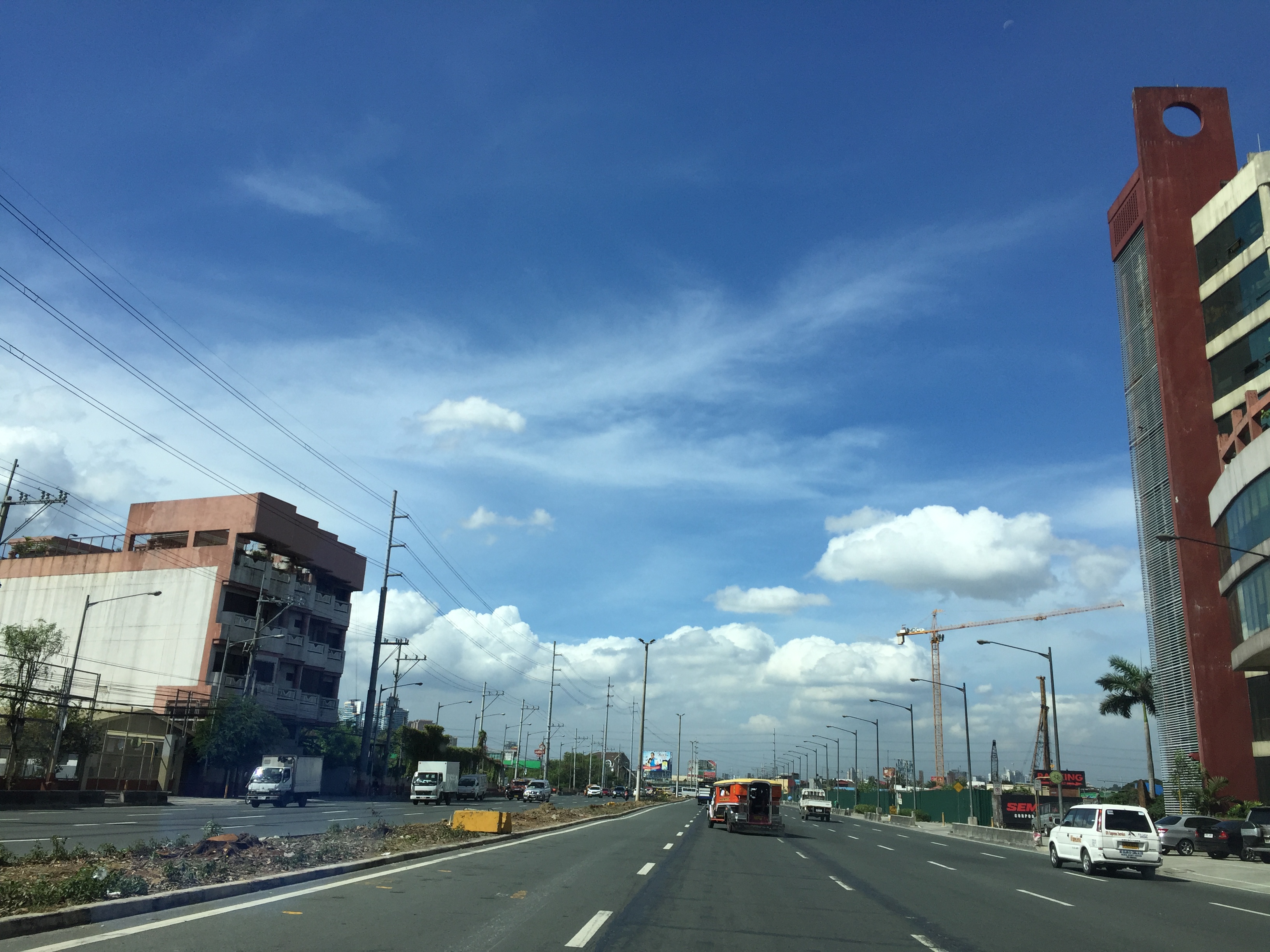
Before I forget about what transpired during the holding of APEC in Manila a week ago, here’s a couple of photos I found over the internet and shared via social media.
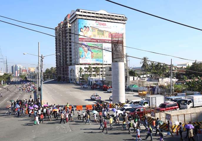 Commuters along Roxas Boulevard walk past a column of the unfinished NAIA Expressway, one of the transport infrastructure projects that has not been finished. [Photo from The Manila Bulletin]
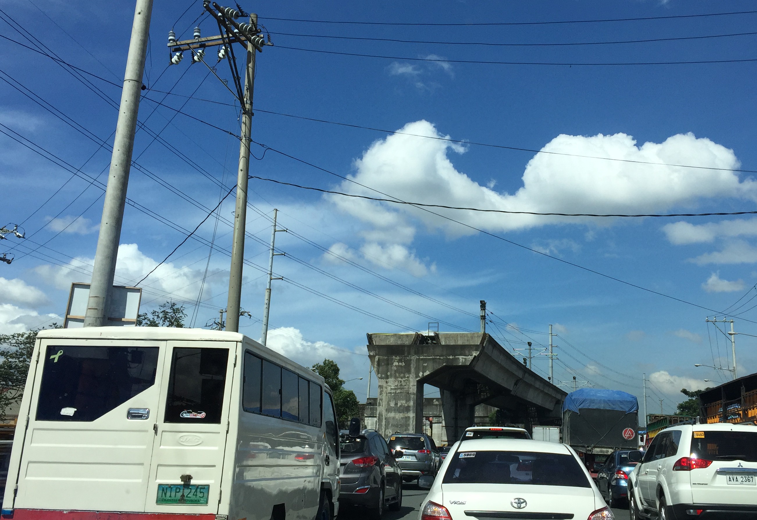
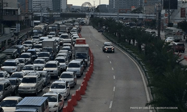 APEC lanes and severe traffic congestion along EDSA – there’s an opportunity here for a prrof of concept test for BRT. [Photo from Facebook]
I saw many memes and read some articles mentioning BRT specifically as one solution to Metro Manila’s transport problems. The second photo above was modified to replace the car travelling along the APEC lanes with a bus.
It is easy to imagine what could have been if the government decided to use the event and the lanes they allocated for APEC vehicles to do a ‘proof of concept’ run of BRT services or at least express bus services (what some DOTC people call high quality bus services). Perhaps what could have been done for part of the 10 billion PHP expended for APEC was to buy a fleet of brand new buses and provided these for free public transport for people who would need to commute during APEC. Services along two corridors would have sufficed – these two would have been EDSA and Roxas Boulevard. [The other option would have been to talk to bus operators and cooperate with them to organize express bus services along EDSA and Roxas Blvd.] Aggressively promoting these free services ahead of APEC would also have meant commuters, including those who usually used their own vehicles, could have opted for these transport services and not affected by the ‘carmageddon’ that ensued over that period. There should have been services to the airport terminals, too, but I will write about this in another article.
The dry run could have yielded essential data for assessing the feasibility of such bus services as an alternate to rail systems that would take much time to build. Incidentally, if the LRT Line 1 Extension to Cavite was built right after the current administration took over, that line could have already served tens of thousands of passengers from the south who regularly commuted to Metro Manila for work and school. The first photo above does not lie about just how many people could have benefited from that rail project. Meanwhile, MRT Line 3 remains dysfunctional and with its reduced capacity could not handle the demand for transport that it should have been able to carry if services had not deteriorated over the years.
–
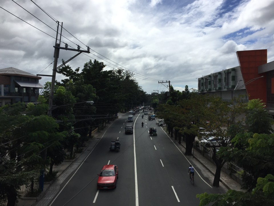
Antipolo public market pedestrian overpass
I took some photos atop the pedestrian overpass connecting the New Antipolo Public Market and the Robinson’s Place mall. The overpass is across Sumulong Highway, which terminates nearby at the intersection with Antipolo Circumferential Road (Daang Bakal), which is currently being widened.
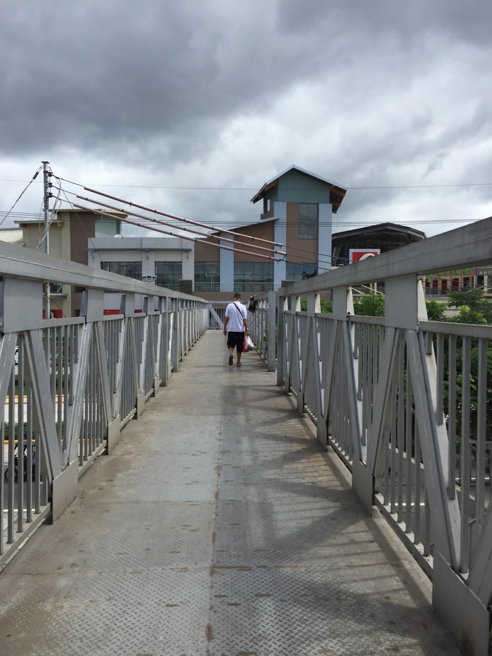 The overpass is a steel structure, including the flooring, which reminded me of factories. This industrial look is not new as there are other overpasses that have been constructed in Metro Manila similar to this.
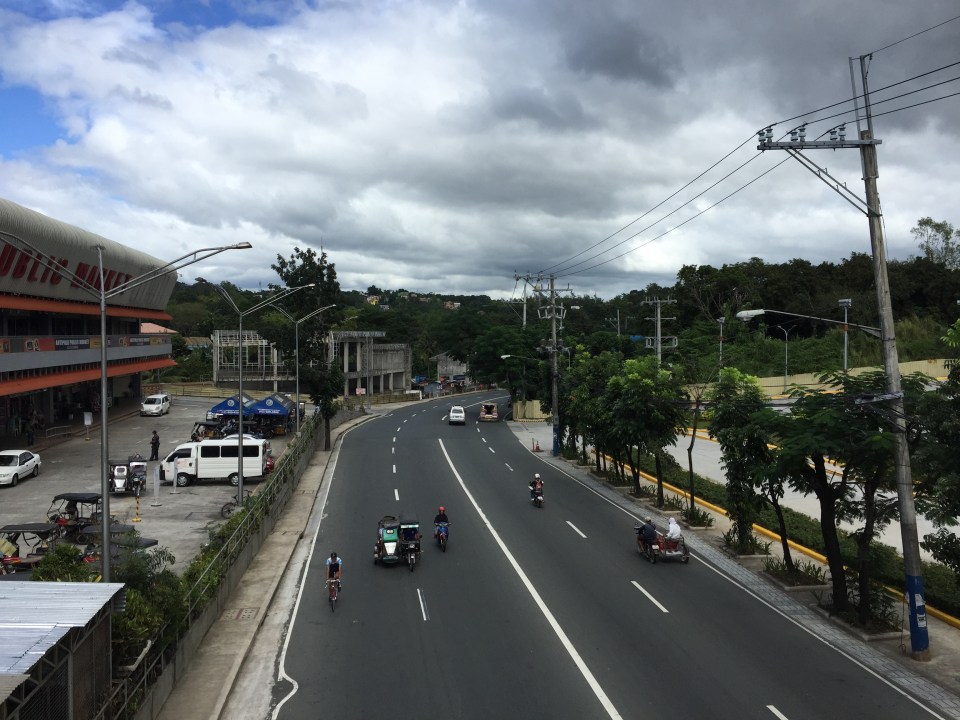 A look at Sumulong Highway towards Masinag. The highway has 4 lanes and at this section has sidewalks on either side of the road. There is no median island to separate opposing flows of traffic. The Antipolo Public Market is on the left side.
 A view of Sumulong Highway towards the Antipolo Shrine of Our Lady of Peace and Good Voyage. The Public Market is at the right and the mall is at the left.
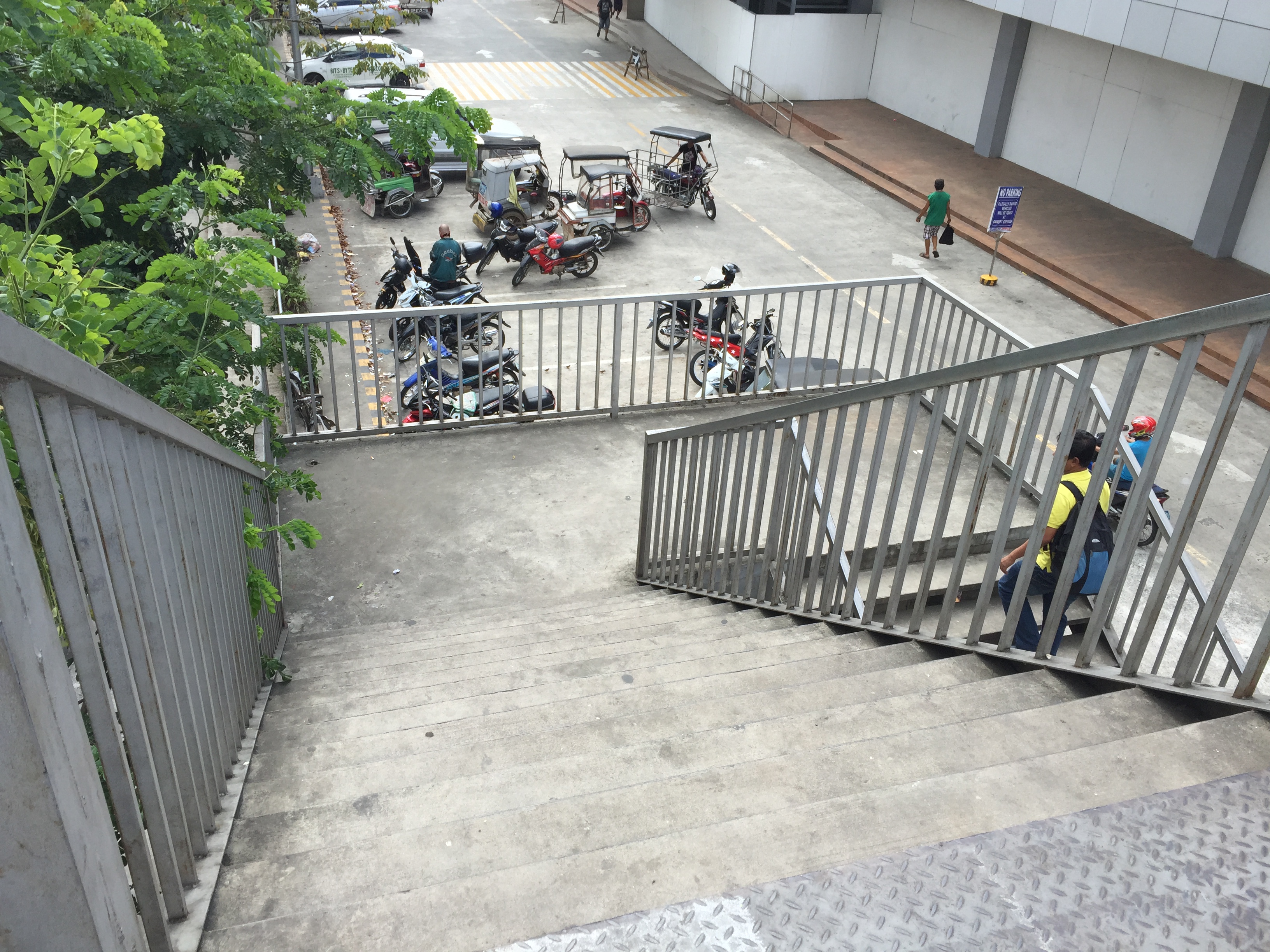 The overpass’ stairs are a bit steep and perhaps not so friendly to senior citizens. There should probably be a ramp for persons with disabilities or for cyclists to use as they carry their bicycles to cross using the overpass.
Despite calls from some advocacy groups for pedestrians to be prioritised and for them to cross at-grade, the reality is that we are still far from achieving safe roads for pedestrians given the way motorists run their vehicles. In the case of Antipolo, many jeepneys, UV Express and tricycles (freely roaming the city) are operated by reckless drivers. Private vehicle drivers are not so different and I have seen scenes of road crashes along Marcos Highway and Sumulong Highway where those involved are private vehicles including motorcycles. Clearly, many of these people should not have driver’s licenses in the first place given their mindset when driving. So until this improves, pedestrians are safer when they do use these overpasses. Of course, that goes without saying that the location and design of overpasses need to be thought over carefully so that these facilities will be used and not just become white elephants.
–
Updates on the LRT 2 Extension – no more trees!
It’s been a while since I last passed by along Marcos Highway. This morning, I was a bit surprised by what I saw (or perhaps, more appropriately, what I didn’t see). The median along the section between Imelda Avenue all the way to Santolan has been cleared of trees. This was already expected as the contractor was already clearing the median for the past weeks. The work entailed fencing off the inner lanes of Marcos Highway and has caused congestion with the highway’s capacity significantly reduced and many motorists slowing down to observe what was going on (usyoso). Following are a few photos of Marcos Highway taken this morning.
 DMCI removed the barriers securing the inner 2 lanes to reveal a median clear of trees. The median will be where the columns for the elevated LRT Line 2 extension to Masinag will be constructed.
 I wonder what will become of the pedestrian overpasses along Marcos Highway. These structures would have to be redesigned with respect to the elevated structure of the LRT Line 2.
 Here’s the conspicuously clear median along Marcos Highway approaching Ligaya. The Ayala development can be seen on the right side along the Quezon City bound side of the highway.
 Waiting – Line 2 currently terminates just after Santolan Station where trains make the switch for the return journey.
–
Railway network for the Philippines?
We start November with an article about railways. There seems to be a lot of buzz about rail these days including talks about the prospects of a subway line in Metro Manila and long distance north-south lines for Luzon Island. These projects, though, will take a lot of time to be constructed and operational, even if these projects started immediately (i.e., next year). That is perhaps one reason why these projects need to be implemented sooner rather than later. And the more these projects are delayed, they become more expensive and also difficult to build (e.g., there are other developments such as roads that may hamper rail and other mass transit projects).
I had a couple of students who did research a little over three years ago on the state and operations of the Philippine National Railways (PNR). Aside from the research manuscript, their work has not been published. The results, however, seems quite appropriate these days as the country and Metro Manila in particular grapples with problems pertaining to commuting that is dominated by road-based transport. I will write about their results here but only show some excerpts as we intend to have part of their work published.
As a first salvo, here’s a map that they were able to get from the Philippine National Railways (PNR). The map shows current and proposed railway lines throughout the country. These include the PNR Main Line South (MLS), which extended to Laguna, Batangas, Quezon, Camarines Norte, Camarines Sur and Albay. There is also what used to be the PNR Main Line North (MLN) that extended to Bulacan, Pampanga, Tarlac, Pangasinan and La Union. Panay Railways, the only other long distance railway system aside from the PNR as late as the late 1970s, is also in the map along with the proposed Mindanao Railways.
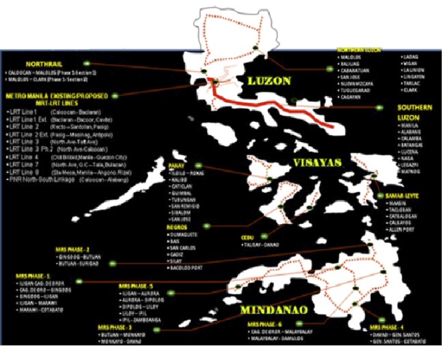
This map was provided by the PNR and likely includes data coming from the Rail Transport Planning Division of the Department of Transportation and Communications (DOTC). Contrary to the perception of many in the current administration, a lot of railway planning was conducted by past administration and many were sound ideas that justified feasibility studies. As usual, the main obstacle for railways would be the competition with road transport. It was road transport and the construction of expressways and other highways, after all, that dealt the PNR its decline (and death in the case of the MLN) to what remains today.
[Reference: Paragas, L.K.B. and Rañeses, M.K.Q. (2012) Assessment of the Philippine National Railways Commuter Line System, Undergraduate Research Final Report, April 2012.]
–
Improving road drainage to prevent flooding
Road drainage seems to be a most suitable topic given the heavy rains the past few days due to a powerful typhoon that hit the northern Philippines. With or without typhoons, however, the frequency of flash flooding has increased the past few years in part due to the heavier than usual monsoon rains but mainly due to the poor state of road drainage in our cities. The photos below show an example of flash flooding due to a sudden downpour in Cebu City.

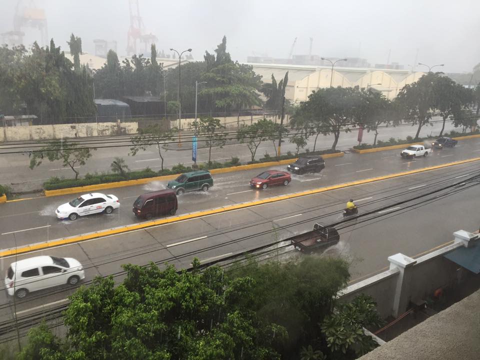
What is noticeable along the road is a lack of storm drains that could have prevented the accumulation of water on the carriageway. If there were storm drains at strategic points along the road, it is difficult to judge from the photo. I also suspect that road construction may have adversely affected the slopes required for the water to travel to the drains. These are surely stated in the road design but are somehow lost or deficient upon construction of the road. There are similar situations in other cities as well and especially in Metro Manila where flash floods often cripple road traffic around the metropolis as critical sections of major arterials like EDSA, C-5, Espana Blvd. and E. Rodriguez become flooded.
We were traveling back to Quezon City along Sumulong Highway after a meeting in Antipolo City. We noticed the road widening projects along the highway; effectively increasing the number of lanes and the capacity of the road. Included in the project are the construction of sidewalks and drainage along both sides of the road. Below is a photo of the section near the Sumulong gate of Valley Golf clearly showing the newly constructed lane and sidewalk along the Masinag-bound side of the highway.
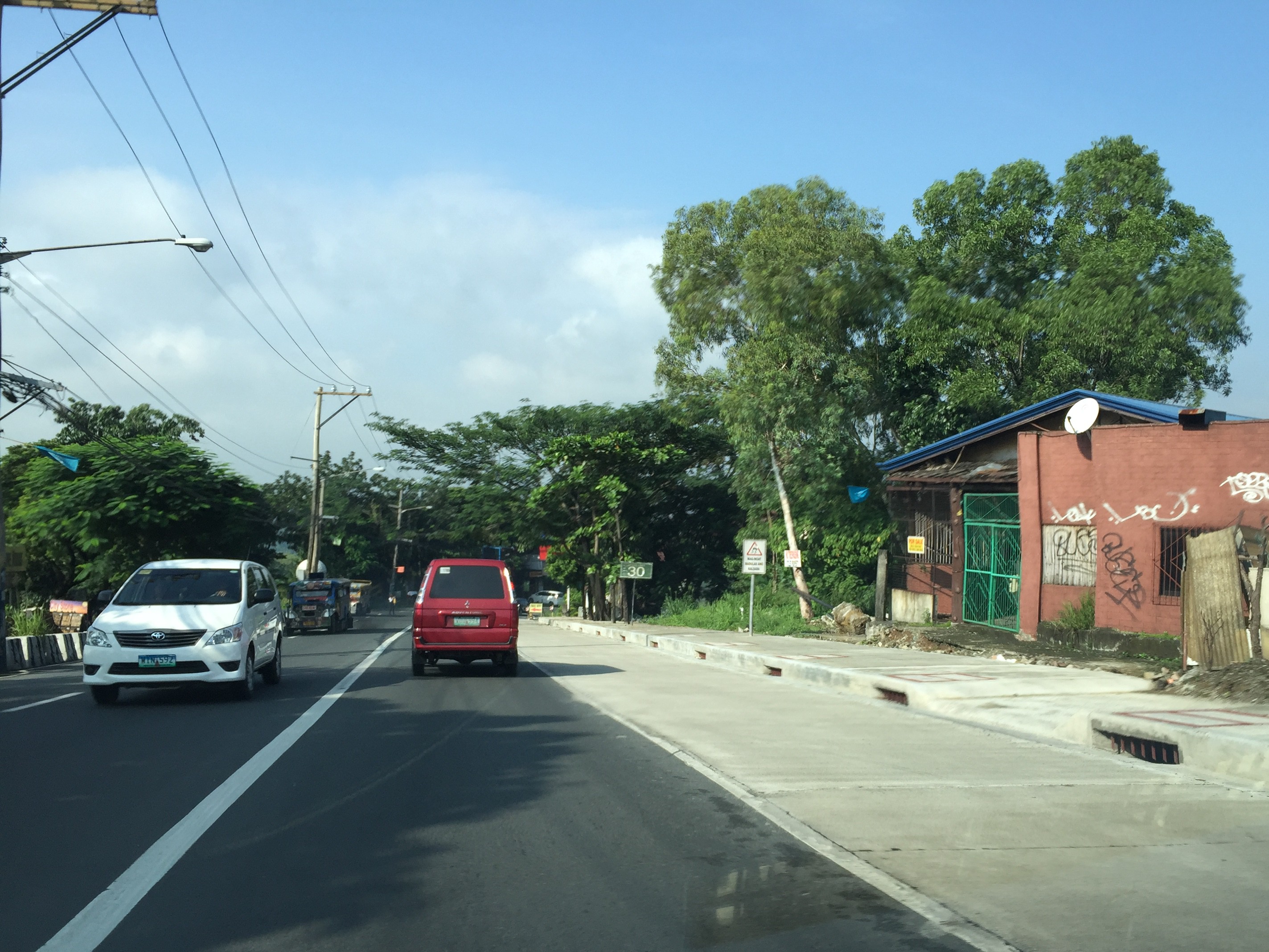
Note in the photo the size and intervals of storm drains along the the highway. Compare this with what we have along most Metro Manila roads including overpasses and it shouldn’t be a surprise why there are frequent flash flooding in Metro Manila. Of course, the capacity of the culverts is a factor (and many are already clogged or barado with garbage and mud) but then it starts with the drains for water to go to the culverts. Many newly rehabilitated roads in Metro Manila have small drains spaced at long intervals. With heavy rainfall, these cannot take in the amount of water given the rate at which they drop from the skies. Perhaps a quick fix to address flash floods is to make these storm drains larger and spaced more closely like those shown in the photo of Sumulong Highway. And then, of course, there should be increased efforts to make sure these drains are not blocked/clogged and that garbage, dirt and other debris will not go straight into the culverts.
–
Local papers presented at the EASTS 2015 conference – Xavier University
I almost forgot to post this article showing the technical papers coming out of Xavier University. Following is the list of papers from Xavier University. Xavier University is basically Ateneo de Cagayan De Oro and is a leading institution in Northern Mindanao in the southern part of the Philippines.
- Sustainable Paratransit: Best Practice Cases in Europe and the Philippines [Martin Smoliner & Anabel Abuzo]
- On-street Parking Evaluation Divisoria, Cagayan De Oro City [David Jorey Alfaro, Francis Camomot, Allison Cyril Escalante, Hipolito Bair & Anabel Abuzo]
- Pavement Distress Evaluation Using Pavement Condition Index around Agora Market, Barangay Lapasan, Cagayan de Oro City [Risa Gwen Martinez & Anabel Abuzo]
- An Analysis of Pedestrian Traffic Safety in Public School Zones in Cagayan de Oro City [Jefferson Vallente Jr., Ferven Cabugao & Anabel Abuzo]
- Agent-Based Mobility Simulation Model for Disaster Response Vehicles [Elvira Yaneza, Gerardo Doroja & Anabel Abuzo]
- A Traffic Congestion Study of Non-signalized Intersections along Yacapin-Capt. Vicente Roa, Yacapin-Osmena, J.R. Borja-Capt. Vicente Roa and J.R. Borja-Osmeña Streets in Cagayan de Oro City [Jude Añana, Kevin Calma, Carlo Flores, Dennis Tantoy & Anabele Abuzo]
Many of the papers are on local problems and very specific to certain streets or areas in Cagayan de Oro City with the exception of the first one in the list, which is on a comparative study of transport in the Philippines and in Europe. Transportation research in Xavier University basically is conducted through its Civil Engineering Department via Dr Anabele Abuzo who obtained her MSCE degree from the University of the Philippines Diliman and her doctorate from the Tokyo Institute of Technology.
–
Local papers presented at the EASTS 2015 conference – Mapua Institute of Technology
Mapua Institute of Technology (MIT) has a relatively young program under its School of Civil Engineering. This is led by their Dean, Dr Francis Aldrine Uy, who is also active with the Philippine Institute of Civil Engineers (PICE). Mapua has been aggressive the recent years in presenting and publishing papers in transportation engineering and planning. Following are the papers from the MIT:
- Integrated Non-Motorized Transportation System For A Sustainability Oriented Intramuros [Francis Aldrine Uy]
- A Study on the Effectiveness of Eco-Mobility Component: E-Jeepneys in Makati City [Francis Aldrine Uy]
- Comparative Study of the Effects of Fuel Sources (Diesel, Gasoline and Autogas) in Public Transportation in Metro Manila on Price, Emission and Health Issues [Francis Aldrine Uy]
- Determinants of Demands of Pasig River Ferry Service [Francis Aldrine Uy]
- Determination of Cost Impact using Mathematical Model Comprising City Logistics to Quick Service Restaurants in Metro Manila [Francis Aldrine Uy]
- Development of Evacuation Plan by Utilizing Transportation Modeling in the City of Borongan, Eastern Samar [Riches Bacero]
- Operational Performance Analysis of Median U-Turn Intersections as Traffic Control Facility in EDSA [Riches Bacero]
- Community Perception on Trans-operability of Intramuros [Riches Bacero]
- Paradigm Shift Strategy of Inclusive Mobility: The Applicability of Bus Rapid Transit along Commonwealth Avenue [Riches Bacero]
- Evaluation of Strontium Aluminate in Traffic Paint Pavement Marking for Rural and Unilluminated Roads [Riches Bacero]
- Study on the Impact of the Construction Activity of Skyway Stage 3 on Traffic Conditions along Osmeña Highway and San Andres Street [Geoffrey Cueto]
- A Design for Silver Star Integrated Green Bus Terminal [Geoffrey Cueto]
- Proposed Diversion Road to Improve Traffic Movement of Commercially Developed Areas in Bacoor, Cavite [Geoffrey Cueto]
- Establishing the City Logistic Concept in Improving the Freight Distribution in Metro Manila [Geoffrey Cueto]
- An Analysis on the Accessibility Level of Public Transit for Persons with Disability: In care of Light Rail Transit (LRT 1) [Geoffrey Cueto]
- Design and Development of the Puerto Princesa Airport Passenger Terminal [Jocelyn Buluran]
- Design and Development of Passenger Terminal at Batangas Port [Jocelyn Buluran]
- Design and Development of Passenger Terminal Extension of Clark International Airport [Jocelyn Buluran]
- Determinants of “Travel with Dignity” of Passengers of MRT3 [Jocelyn Buluran]
- Integrating Sustainable Non – Motorized Public Transport in the City of Manila, Philippines Through Analytic Hierarchy Process (AHP) [Jocelyn Buluran]
My only comment about certain papers in the list is that many do not seem to be research papers and definitely more on the practice (i.e., design) side than the academic. I can say this based on the presentations made that I was able to attend as well as the papers themselves in the proceedings of the conference that I was able to browse. Still, Mapua has very good potential to come up with good papers from the prolific Dr Uy and his young faculty members led by Engr. Riches Bacero.
The current President of Mapua, Dr Reynaldo Vea, is also the current President of the Transportation Science Society of the Philippines (TSSP). Dr Vea was formerly Dean of UP Diliman’s College of Engineering and Officer-in-charge of UP’s National Center for Transportation Studies (NCTS). His specialty is on maritime transport as he has a degree in naval architecture.
–
Local papers presented at the EASTS 2015 conference – University of the Philippines
There were a lot of technical papers from Philippine universities that were presented in the recently concluded 11th International Conference of the Eastern Asia Society for Transportation Studies (EASTS 2015). In the interest of dissemination, I will be featuring a list of papers produced by leading universities in the Philippines that are doing studies on transportation. Following is a list of papers from University of the Philippines Diliman that were presented at the EASTS 2015 held in Cebu City last Sept. 11-13, 2015:
- Innovative Collection of Road and Traffic Data for Road Safety Audit (Aileen Mappala & Ricardo Sigua)
- Study on Safety of Railway/Highway Grade Crossings in the Philippines (Albie Clarito, Beverly May Ramos & Ricardo Sigua)
- Instantaneous Fuel Consumption Models of Light Duty Vehicles and a Case Study on the Fuel Consumption at Different Traffic Conditions in Metro Manila using Shepard’s Interpolation Method (Ernesto Abaya, Karl Vergel, Ricardo Sigua, Edwin Quiros & Jose Bienvenido Biona)
- Development of Drive Cycles and Measurement of Fuel Economies of Light Duty Vehicles in Metro Manila (Ernesto Abaya, Karl Vergel, Ricardo Sigua & Edwin Quiros)
- Selection of Metro Manila BRT Corridors Using Multi- Criteria Assessment (Ricardo Sigua & Cresencio Montalbo, Jr.)
- An Assessment of Walkability in a Medium-Sized Philippine City (Hilario Sean Palmiano, Sheila Flor Javier & Jose Regin Regidor)
- Traffic Noise Measurement, Perception, and Modelling in a University Campus (Hilario Sean Palmiano, John Carlo Villar & Michelle Monelle Quilatan)
- Assessment of Metro Manila Bus Fare Computation (Sylvia Chavez & Hilario Sean Palmiano)
- Estimating Road Roughness Conditions Using Ubiquitous Smartphones and Geographic Information Systems and its Application to Road Network Planning in the Philippines (Joel Cruz & Jun Castro)
- Fuel Economy and Public Utility Jeepneys Using 2% and 5% Coco-Metyl Ester (CME)-Diesel Blends (Edwin Quiros & Karl Vergel)
- Comparison of Fuel Economy of Fuel and Operating Characteristics of Diesel and Auto-LPG Jeepneys through On-Road and Vehicle Tests (Edwin Quiros, Karl Vergel, Ernesto Abaya, Ervin Santos & Jose Gabriel Mercado)
- Challenges of Urban Transport Development in Metro Manila: A look back at the last 40 years (Maria Sheilah Napalang & Jose Regin Regidor)
- An Assessment of the Public Necessity Concept for Estimating the Requirements for Public Transport Vehicle (Arnel Manresa, Karl Vergel & Jose Regin Regidor)
- State of Pavement Engineering in the Philippines and Implications on the Economic Life of National Roads (Maria Sheilah Napalang, Jose Regin Regidor & Nathaniel Diola)
- Planning Metro Manila’s Mass Transit System (Ricardo Jose, Daniel Mabazza, Jose Regin Regidor, Marco Stefan Lagman & Jonathan Villasper)
- Evaluation of Compliance of Dimensions and Selected Systems and Components of Customized Local Road Vehicles (CLRV) with Vehicle Regulations and Standards (Karl Vergel, Rachel Habana, Nonilo Peña, Loreto Carasi, Albert Mariño & Alorna Abao)
- An O-D Approach of Estimating Energy Demand and CO2 Emission for the Luzon Road Transport using Inter- Regional Passenger and Freight Flow Data (Marloe Sundo & Karl Vergel)
- Dignity of Travel: BRT Development in the Philippines (Cresencio Montalbo Jr & Colin Brader)
- Mending a Metropolis – Understanding Passenger Demand Across Metro Manila To Improve Road Transit (Nicholas Greaves & Cresencio Montalbo Jr)
- Accident Hotspot Mapping in Quezon City: The case of Katipunan Avenue (Jerome Ballarta, Nelson Doroy, Ishtar Padao & Cecil Villanueva)
Not included in the list are papers coming out of International Research Groups (IRG) as well as those where involvement by UP faculty were incidental to projects. Many of these papers will soon be posted on the official site of the International Scientific Committee of EASTS as part of either Proceedings or Journal of EASTS. Some may be nominated for the Asian Transport Journal (ATS), which is also published by EASTS.
Transportation research in UP Diliman is the most developed among schools doing research on these topics in the country. Papers came from a variety of disciplines and academic units including Civil Engineering, Mechanical Engineering, Urban Planning, Geography and History. These mostly were and are undertaken through the National Center for Transportation Studies (NCTS), which is with UP Diliman.
Next up: De La Salle University
–
Technology push?
An acquaintance announced that his company is planning to sponsor an event aiming to attract developers to come up with apps that could help alleviate transport problems in Metro Manila (and probably and potentially, elsewhere). This reminded me of a similar event a few years ago that was sponsored by an international institution that sought to have people come up with applications (apps) that would enhance transport using transport data they have compiled. While the event attracted a healthy number of app developers and arguably came up with some useful software, the impact of such apps on commuting is at best marginal. For one, some apps attempted to reinvent the wheel, so to speak, as one app developed was too similar to the well-established Waze but with an inferior interface. Then there were those which probably could be useful if only most people had smart phones and were dependent on them for their trips.
Metro Manila is at the point when most major arterials are already saturated. Stricter traffic management (as it should be) can only do so much to address congestion along thoroughfares such as EDSA and Circumferential Road 5. Apps that are aimed at enhancing commuting would ultimately be limited as the transport infrastructure is lacking and those proposed or under construction would take time to complete. Yes, carpooling can probably help and an app enabling people to find travel/commuting companions would probably help. But it does not assure participants (both drivers and passengers) of their safety or security and so isn’t for everyone. Apps and similar or related technology pushes are categorized along with other stop-gap or band aid solutions. It might have some positive impact but these are short lived and eventually will not be productive. It definitely though will satisfy a lot of geek or nerdy egos in terms of what they can create that they think can help improve transport or traffic. And I suddenly recall a term used by one of my friends chiding others one night we were engaging in some academic discourse about transportation theory as applied to traffic problems in Metro Manila – “intellectual masturbation” – which seems an apt description for this (app development, etc.) type of exercise. One colleague even made the observation that such efforts only provide an excuse for government not to act on the urgent matter of traffic. Innovation may be welcome but it seems such a waste of time and talent to be solving the unsolvable through apps. (Can someone develop an app to fix MRT trains? Or perhaps solve contract issues of the PPP kind? I think you get my point.)
The main reason why people buy and drive their own vehicles is because these cars and motorcycles enable them from being dependent of public transport, which is generally perceived as having low service quality. While there is a need to manage the demand for private vehicles, restraint without the suitable public transport alternatives (think Singapore or Hong Kong for best practice examples) will not make sense as these punish people for something the government is not able to deliver in terms of transport services. This is a message I have seen in many papers that are the outputs of many studies presented at the recently concluded 11th International Conference of the Eastern Asia Society for Transportation Studies. In fact, this has been a message in past conferences as well. You can find the technical papers in their searchable site at the following link: www.east.info
–
