
Home » Infrastructure (Page 4)
Category Archives: Infrastructure
The journey to PHL’s railway renaissance
Here is a quick share of an article on railway development in the Philippines. It certainly took a while for railway development to get underway with considering rail transit would probably had a major impact on commuting particularly in Metro Manila and highly urbanized cities like Cebu and Davao that require mass transit systems to alleviate congestion.
Source: The journey to PHL’s railway renaissance
The article though doesn’t contain a narrative on the journey but rather only a summary of the rail projects that are currently being implemented as well as those in the pipeline. It would be a nice to have a more historical approach to this so-called journey so we can have an objective look at what happened to our railways from the 1970s when its decline began until the last few years when a so-called renaissance came to be.
–
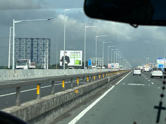
New lanes along the NLEX Candaba Viaduct
Heading to Baguio, I noticed the new lanes in the middle of the NLEX viaduct. The viaduct was actually two bridges constructed over the Candaba Swamp. The soil being too soft for a normal road, the viaduct allowed for two way traffic with each bridge carrying northbound or southbound vehicles. The recall that the original bridges each had 2 lanes plus a shoulder lane. Each now have 3 lanes plus shoulder after expansion years ago. The additional lanes in the middle probably required additional columns to be built with more modern foundations than the original viaduct. The new structures had to be integrated with the older viaducts. Here are photos of the completed sections:


You can go to Google Maps if you want to see what the lanes looked like under construction. Here is a screenshot:

Screenshot
The middle lanes look like they can be used as variable lanes. That is, all or some of the lanes may be used to serve the direction with the heavier traffic. The directions can change depending on the time of day, day of the week or the season. I don’t know at this time though how exactly this can or will be implemented as there are no signs to guide motorists for variable lanes. What signs am I referring to? Here are examples from Bangkok showing overhead signs assigning lanes for the direction with heavier traffic:
 A close up of the signs designating lanes for traffic
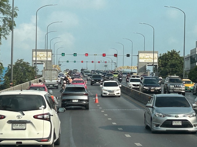 In the example above, 4 lanes including one counterflow lane are assigned to traffic along the southbound direction.
–
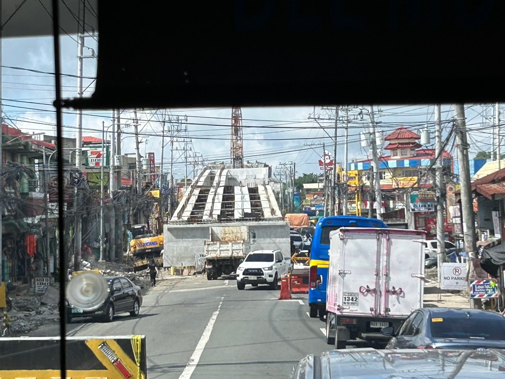
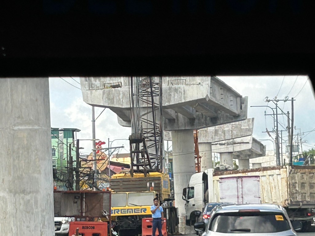
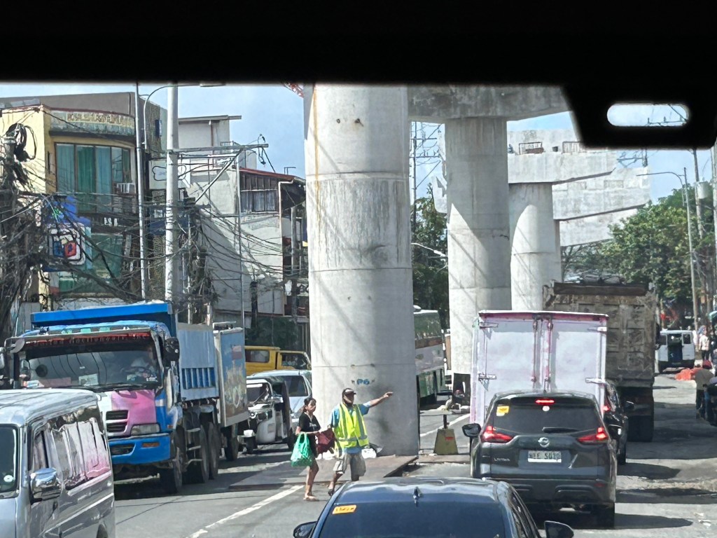
Railway construction at Clark
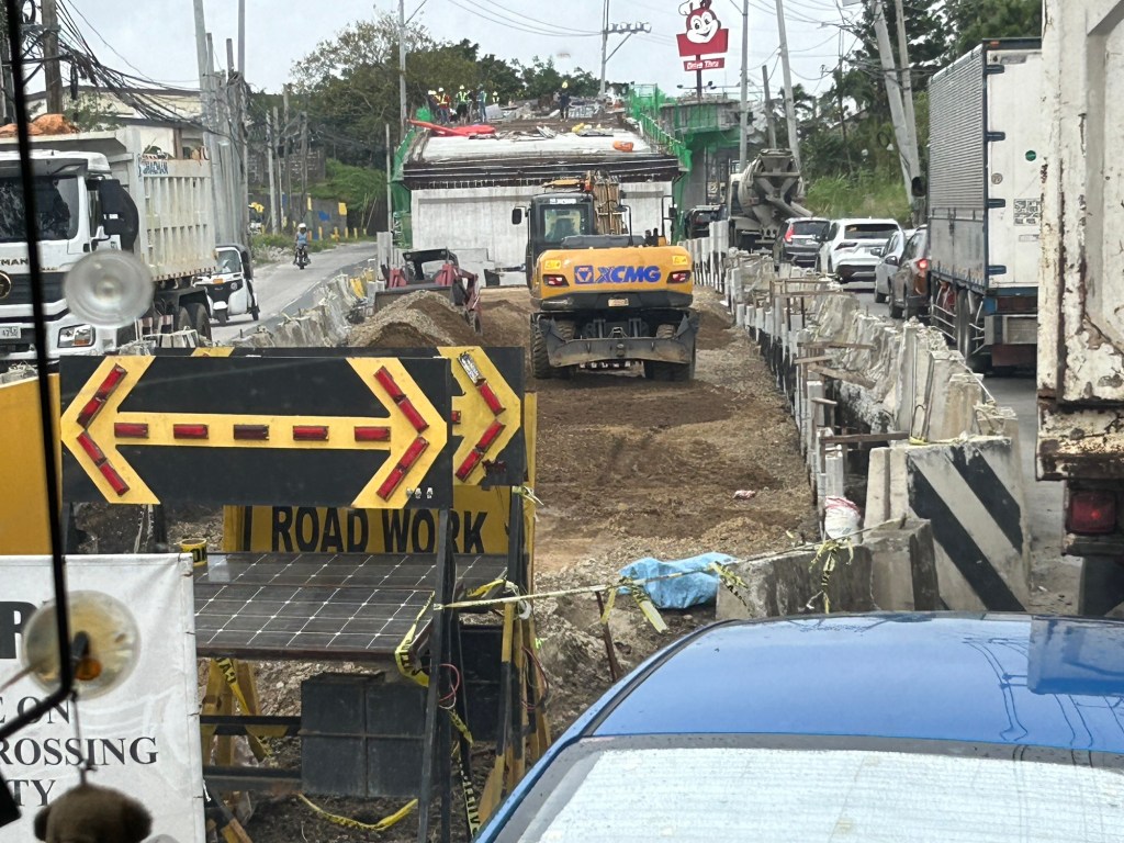
While at Clark, we also traveled along the perimeter road to see for ourselves the state of the railway construction there. The North South Commuter Railway (NSCR) is supposed to stretch from Clark in Pampanga to Calamba in Laguna once completed. Here are some photos I took along the Clark perimeter road.
 The NSCR construction is very visible from SM City Clark. So far, there is no work on the section that will cross Clark Freeport’s main gate.
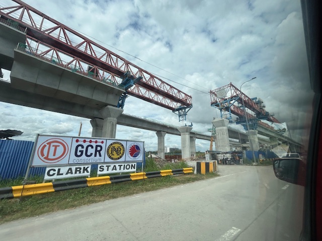 Construction of the future Clark Station
 A view of the construction along the Clark perimeter road from the direction of the Mabalacat gate.
 Project information including safety record
A lot of people are already looking forward to the completion and operation of the NSCR. This will be another game changer as the services have the potential to change the way people in Bulacan, Pampanga and Laguna commute especially those residing in these provinces and have work or school in Metro Manila. One can classify them as ‘super commuters’ considering the distances they need to travel between their home and their workplaces or schools.
–
Planning for True Transportation Affordability: Beyond Common Misconceptions
How much do we spend on transportation as part of our budgets? Is it 5% of your monthly budget? Is it 10%? Or is it eating up a substantial part of what you’re earning?
Source: Planning for True Transportation Affordability: Beyond Common Misconceptions
To quote from the article:
“This research indicates that many common policies favor expensive transportation and housing over lower-cost alternatives, which drives the cost of living beyond what is affordable, leaving too little money to purchase other necessities. The result is immiseration: growing stress, unhappiness, and discontent.
The solution is simple: planning should favor affordable over expensive modes and compact development over sprawl. This is not to suggest that automobile travel is bad and should be eliminated. Many people are justifiably proud of being able to afford a nice car, and automobiles are the most efficient option for some trips. However, automobile travel requires far more resources and is far more expensive than other modes, typically by an order of magnitude, so true affordability requires an efficient, multimodal transportation system that allows travelers to choose the options that truly reflect their needs and preferences.
Affordability requires a new economic paradigm; rather than trying to increase incomes or subsidies we need to increase affordability and efficiency so households can satisfy their basic needs consuming fewer resources and spending less money. Our planning should be guided by a new goal: how can we help families be poor but happy.”
I share this article because it provides a more complete narrative and assessment than those just focusing on transport. Home choice locations and affordable housing are part of the equation. Looking at transport alone can be myopic and leads us to think it is the only problem to solve.
–
Are transportation issues election issues in the Philippines?
Are transportation issues in the Philippines? Or are these issues at the local level? Here is an article about how transportation issues were brought to light and were actual topics in the ballot in Los Angele, California in the US:
Tu, M. (November 25, 2024 ) “Bike, Bus and Pedestrian Improvements Won the Vote in L.A. How Did Advocates Pull It Off? “ Next City, https://nextcity.org/urbanist-news/bike-bus-pedestrian-improvements-healthy-streets-los-angeles-ballot?utm_source=Next+City+Newsletter&utm_campaign=532838ef65-DailyNL_2024_11_18_COPY_01&utm_medium=email&utm_term=0_fcee5bf7a0-532838ef65-44383929 [Last accessed: 11/26/2024]
The three lessons in the article are:
- Build a coalition – “In the lead-up to the election in March, Streets For All successfully secured endorsements from unions, climate organizations and business groups that saw the vision for safer streets.”
- Safety wins – “We could make climate arguments, we could make equity arguments, but the thing that felt the most bulletproof to us and the most empathetic to the general Angeleno was just road safety,”
- Keep it simple – “…simple messages were the most effective. Vredevoogd fought for one billboard on Vermont Avenue that read “In 2022, more pedestrians died on Vermont Avenue than in the state of Vermont.”
Los Angeles or LA as many people fondly call the city is well known for being car-centric (as opposed to San Francisco to the north, which is more transit-oriented). Perhaps we can learn from this experience though I know there are already groups and coalitions lobbying for better transportation in the Philippines. Are they successful and to what extent are they succeeding? Granted there are different situations and conditions, even modalities, to engage politicians, there are also so-called party list groups claiming to represent the transport sector but none appear to be really standing up for issues like improving public transport or road safety. And so the challenge is still there for people to make transportation issues election issues in the country.
–
On the future of transportation – some history lessons
I found this interesting article that basically is a history lesson on transportation systems and infrastructure:
Dillard, G. (October 21, 2024) “Our infrastructure is Not Our Destiny,” Medium.com, https://medium.com/the-new-climate/our-infrastructure-is-not-our-destiny-6d7f8355144a [Last accessed: 11/17/2024]
To quote from the article:
“We’ll never build out a network of electric-car charging stations, they say, or How could we possibly replace all of these highways with mass transit? But the infrastructure that dominates our world today once seemed impossible, until it didn’t…
As we begin to imagine a new way of organizing our economy, let’s remember that infrastructure isn’t destiny, nor is it forever. Today, our fossil-fuel present may feel like the only “practical” way to do things — just as the canals, and then the railroads, once felt like the only possibility.
So the next time a transition away from cars, fossil fuels, and the other technologies that dominate our world seems impossible, think about Hermon Bronson and Robert Fulton, who surely thought that canals were the infrastructure of the future. They were wrong, and so are the people who tell us that it’s impossible or impractical to build a greener world.”
Perhaps we can take a look at our transportation infrastructure development history and the way it’s going now. It would be good to contextualize all those planned tollways and inter-island bridges against what is really most urgent these days (i.e., mass transit, active transport for our rapidly growing cities). I’ve always stated here about how some infra are nice to have but aren’t as urgent as others that need more push and support and will be utilized by and benefit more than fewer people.
–
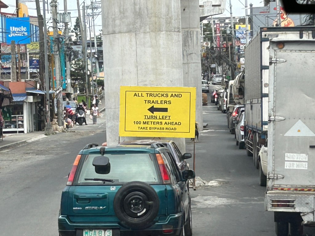
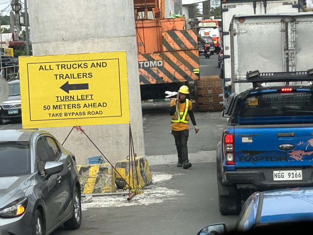
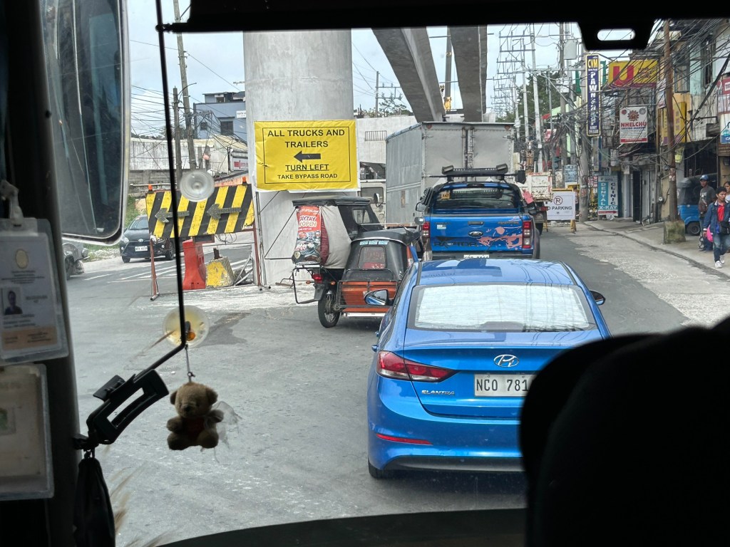
Congestion due to flyover construction: Tagaytay-Nasugbu Road – Part 2
I showed photos of the construction of an overpass along the Tagaytay-Nasugbu Highway coming from Tagaytay in the previous post. This time, here are some photos taken along the opposite direction.


–
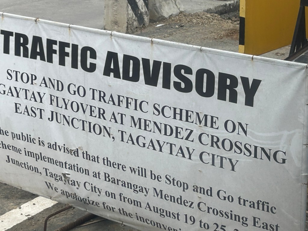
Congestion due to flyover construction: Tagaytay-Nasugbu Road – Part 1
There is significant traffic congestion along the Tagaytay – Nasugbu Highway due to the construction of an overpass along the highway at its junction with the Tagaytay – Mendez Highway.


Was there a need for a flyover here? Otherwise I would suggest instead a set of good old-fashioned traffic signals and geometric improvements to the intersection.
–
Increase in parking rates at NAIA
A friend shared this notice about the increase in parking rates at NAIA.
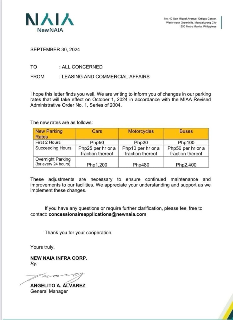
Parking at any of the terminals has been quite difficult if not horrendous. Everyone seems to be bringing their car to the airport for pick up and drop offs as well as leaving them for a night or more while traveling abroad or somewhere in the country. And then there are those who park there because the rates are supposed to be cheaper than the hotels and mall around the airport (e.g., the case of Terminal 3). Will the increase in the rates discourage unwanted or unnecessary parking? Perhaps not because people are still quite dependent on cars as their primary mode in and out of NAIA.
Access to the airport remains road-dependent. Granted there are many options like ride hailing, airport bus and taxis, these are all road based. They share the same roads that are often congested. The tollways are not enough to ease traffic in the area, which aside from airport generated trips include those from offices and industries in the area.
Too long has the need for a rail access for the terminals and government has failed to provide it. It would at least have engaged private sector for this provision but it took so long. Perhaps the Metro Manila subway will change that but we have to wait a long while to find out.
–
Initial thoughts on driverless cars
The wife is currently in San Francisco in the US. She sent me some photos and videos of the driverless car ahead of booked to get to their office there.
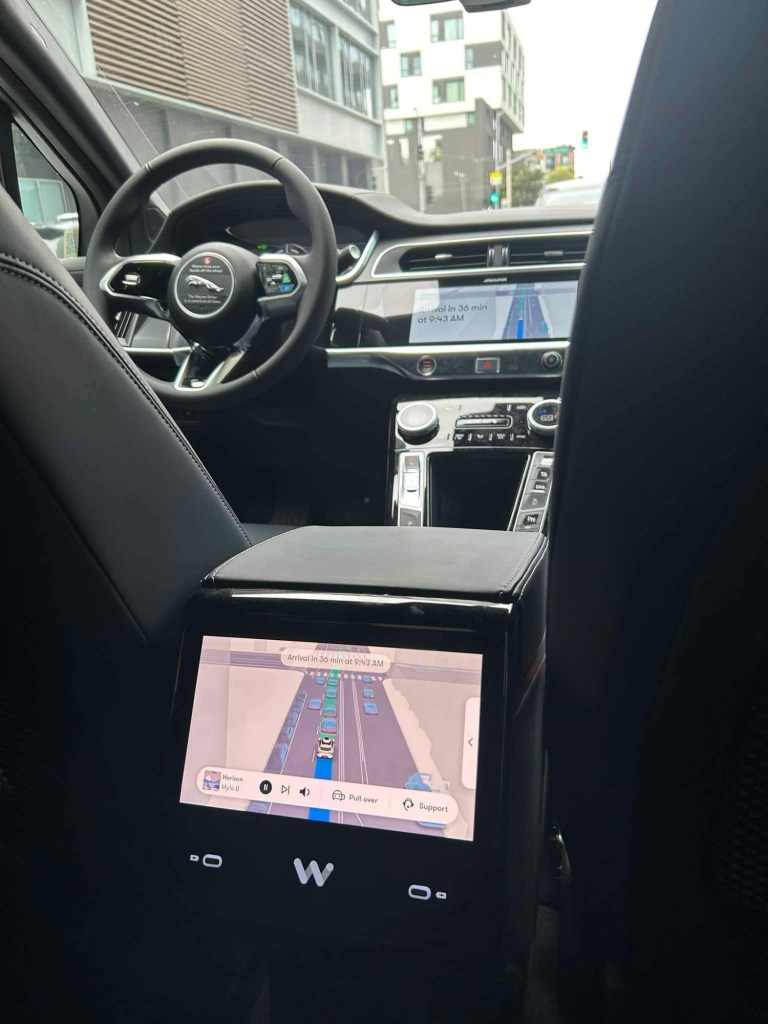
The first thing that came to mind seeing the photos and videos is “It’s cool!” Their creation and operation are indeed wonders from an engineering and technology standpoint. Unfortunately, these are not the solution to our transport problems. These will just replace the cars we already have and causing congestion and other concerns.
–
