
Home » Infrastructure (Page 8)
Category Archives: Infrastructure
On using advanced tools for infrastructure assessments
I came upon this article on how transportation departments in the US are using tools such as drones to assess critical infrastructure including roads and bridges. This is very relevant to us especially as many similar infra are aging and would need to be assessed to determine how to reinforce, retrofit or even rehabilitate certain infrastructure vs. naturally occurring phenomena like earthquakes and typhoons.
Reed, J. (August 2, 2022) “How Transportation Departments Are Using Advanced Drone Technology for Infrastructure Assessments,” Aviation Today, https://www.aviationtoday.com/2022/08/02/transportation-departments-using-advanced-drone-technology-infrastructure-inspections/ [Last accessed: 8/4/2022]
To quote from the article:
“The WVDOT may expand its drone programs to perform road safety assessments and to assist in designing new road routes by providing topographical maps.”
I recall that there have been road-based surveys involving Lidar to map the road and adjacent land surfaces about a decade ago (maybe less). This was a nationwide project funded by the Department of Science and Technology (DOST) and implemented by the University of the Philippines Diliman’s Department of Geodetic Engineering. I’m not sure where that data is stored or hosted but the DGE should have a back-up somewhere that can be used or further processed for road safety assessment applications. This could be an interesting and fruitful research area that can involve people from various disciplines.
–
On the benefits of developing and investing in active and public transportation
Here is another quick share of an article with a very relevant and timely topic – the business case for multimodal transport planning:
Litman, T. (July 2022) “The Business Case for Multimodal Transportation Planning,” Planetizen, https://www.planetizen.com/blogs/117697-business-case-multimodal-transportation-planning?utm_source=newswire&utm_medium=email&utm_campaign=news-07142022&mc_cid=03c159ebcf&mc_eid=9ccfe464b1 [Last accessed: 7/15/2022]
To quote from the article:
“Conventional planning tends to undervalue non-auto mode improvements by assuming that each additional mile of their travel can reduce, at best, one vehicle mile traveled. In fact, in many situations they can leverage much larger reductions in vehicle travel, meaning that each additional mile of walking, bicycling, or public transit can reduce more than one vehicle mile … As a result, walking, bicycling and public transit improvements can provide much larger vehicle travel reductions and benefits than is commonly recognized.”
There is a box referred to in the preceding quote. I will not reproduce it here so I leave it up to the reader to go to the original article by Litman to find out how active and public transport can leverage additional travel reductions. Understanding these and the extend by which we can be independent of car-use (referring to non-car travel demand) will allow for a better appreciation, travel-wise and economics or business-wise, of the advantages of developing and investing in active and public transportation infrastructure and services.
–
A Bike Master Plan for Metro Manila, Metro Cebu and Metro Davao
Before Active Transport Week concludes this weekend, I would just like to share this collage from one of our staff at the National Center for Transportation Studies of the University of the Philippines Diliman. It is about the Master Plan developed for the three metropolitan areas in the country – Metro Manila, Metro Cebu and Metro Davao. I will share more details about this soon including a link or links to where you can download a copy of the plan.

The project concluded recently with the submission of the Final Report but most important is the Master Plan document that can serve as a reference for further development of bike lanes in the metropolises. I’ve seen the Master Plan and many of its provisions and recommendations can easily be adopted or is replicable in other cities and municipalities in the country. Perhaps, there should be a National Master Plan?
–
Flashback: Transport Infrastructure Framework Plan for the Philippines
I was reading an article yesterday about the outgoing NEDA Director General stating that Philippines needing a long term strategy for infrastructure development that will address the shortcomings or gaps due to unsolicited proposals. There was already something like this drafted almost a decade ago and under the auspices of the returning NEDA DG. Unfortunately, while NEDA accepted the Final Report of the study, they never adopted it as a policy that could also be imposed on agencies like the DOTr (still DOTC back then) and the DPWH. So for a sort of Throwback Thursday and on the last day of the Duterte Administration, I am sharing the promotional video produced for the framework plan that was supported by The World Bank.
The study was conducted by Cambridge Systematics (not related to Cambridge Analytics as far as I know) and was implemented at the same time as the JICA Dream Plan study for Mega Manila. I recall there is also a video on the latter and it listed all the infrastructure projects needed to address the transport problems of the Greater Capital Region. The Infra Framework Plan for the country mentions the various infrastructure projects ongoing and proposed for the Philippines but focuses on the soft side (i.e., strategies) including the reforms and institutional set-up that need to be in place for everything to come together and produce the desired outcomes in the long term. Sadly, strategies and plans are not well appreciated despite their being essential as foundations. While the Build, Build, Build mantra of the outgoing administration is worth praising for attempting to do the catch-up needed in as far as certain transport infrastructure is concerned, it falls short of what are necessary and to be prioritized. Instead, it ended up accommodating projects that are “nice to have” but should not be prioritized considering our limited resources and the undesirable foreign debt racked up by government. Hopefully, the returning NEDA DG and other officials will be able to steer the country clear of the current and future crises that may end up bringing more hardships on Filipinos.
–
Star ratings for bicycles
I just wanted to do a quick share of a new method for evaluating road and bicycling infrastructure – cycleRAP. This was developed by the International Road Assessment Program (iRAP), which has established a star rating system as the international standard for road safety assessments. We currently use their Star Ratings for Schools (SR4S) to evaluate the school environment towards ensuring safe journeys for school children. Here’s the link to their website:
To quote from the site: “CycleRAP is an easy, affordable and fast method of evaluating road and bicycling infrastructure for safety. It aims to reduce crashes and improve safety specifically for bicyclists and other light mobility users by identifying high risk locations without the need for crash data.”
–
Tagbilaran – Panglao Airport Departure
With the recent popularity of my post on the Tagbilaran-Panglao Airport, I was encouraged to write this second part about the airport. Following are photos taken during our departure from Panglao. I took photos from the driveway, the check-in area and the pre-departure area and lounges. I hope this helps my readers including and especially travelers and tourists.
 Curbside at the new airport – the area is very spacious and should be able to handle the steadily increasing number of passengers and well-wishers at the airport.
 Passengers alight from their vehicles near the Philippine Airlines office at the terminal.
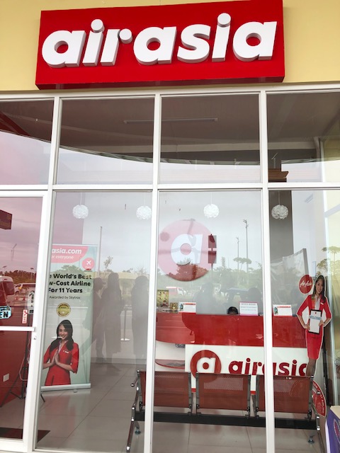 Air Asia ticket office near the terminal curbside
 Spacious check-in area – I was just discussing the requirements and standards for check-in counters and frontage to my students this last semester.
 Check-in counters for PAL
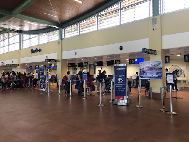
 The check-in counters for Cebu Pacific were crowded when we arrived at the terminal.
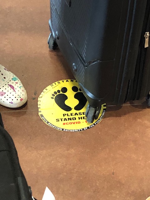 Stickers on the floor mark where passengers are supposed to position themselves to comply with health protocols (i.e., social distance).
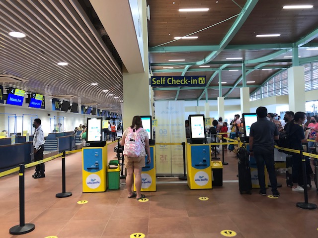 CebPac has their self check-out portals at the airport for those who have not done their online check-in and to facilitate and expedite check-in procedures.
 There’s a separate section for international departures. The airport used to service international flight (before the pandemic). I assume this is where immigration (i.e., passport and visa control) and customs would have been located for International travel.
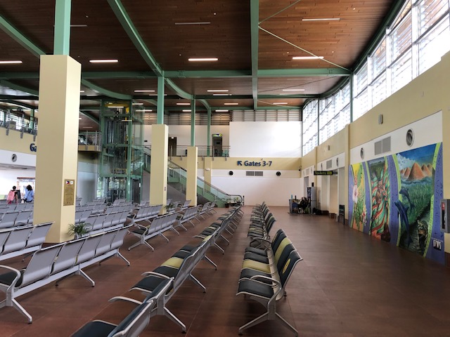 After checking-in, travelers are greeted by very spacious lounges
 This is the ground floor. Visible is the elevator and escalators to the second level pre-departure area for domestic flights. I assume this is a mirror image of the international departures wing.
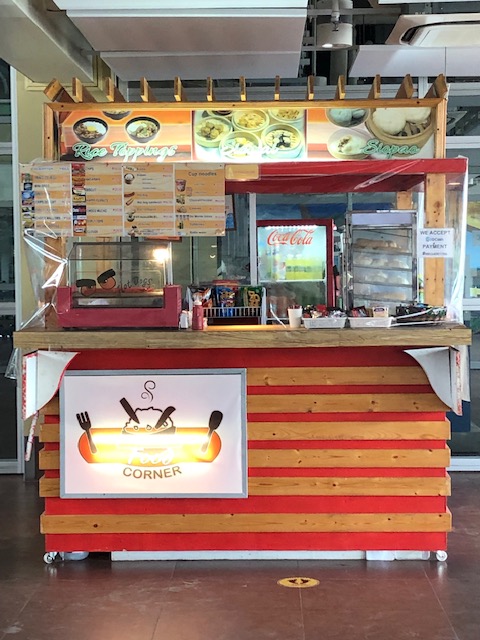
 Unfortunately, there are only two kiosks at the terminal when we were there. One is this stall that sells snacks, sandwiches, instant noodles, and soft drinks and water. There are no souvenir shops or stores for last minute pasalubong shopping.
 A view of the tarmac from the lounge
 The elevator to the second level lounges and boarding gates.
 Stairs and escalators to the second level
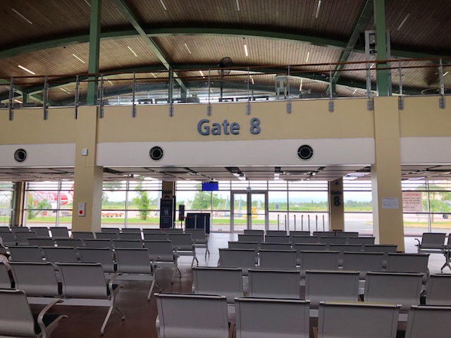
 One of the boarding gates at the second level
 The second level pre-departure area
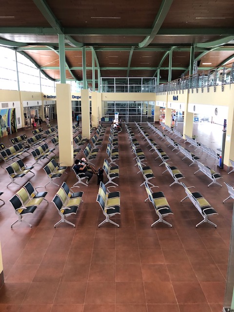 A look at the ground floor
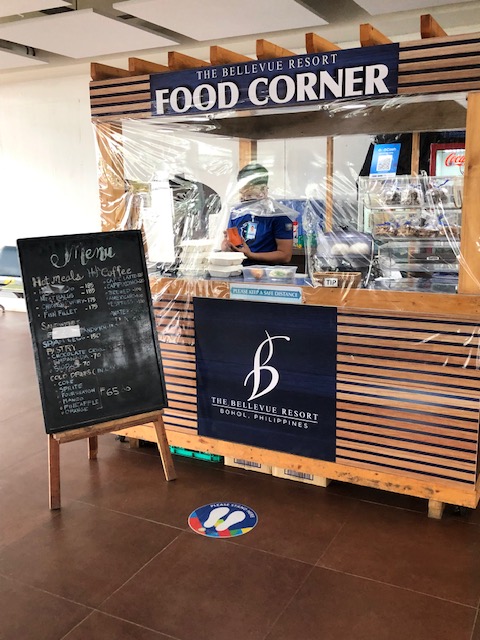 The other kiosk is by The Bellevue Resort. Their coffee is good but they ran out of food at the time we were there. We thought this was not good considering there were other flights scheduled for the rest of the day and passengers will end up with very limited or no options for meals before their flights.
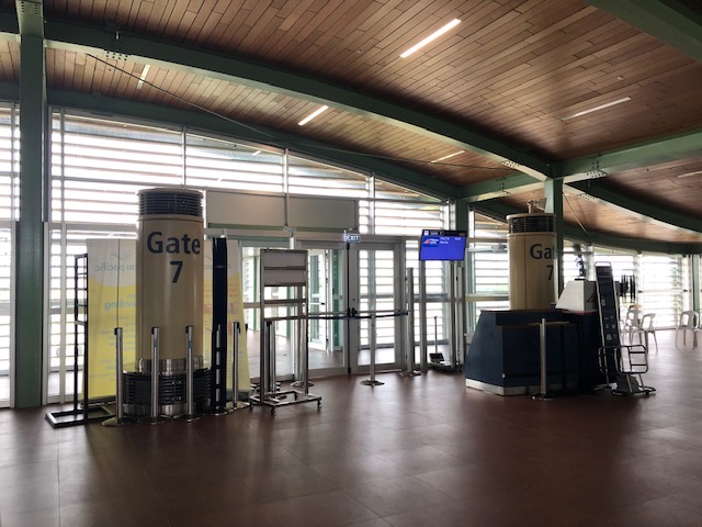
 Another look at the boarding gate and kiosk at the ground level
 Another look at the other kiosk at the pre-departure area that sells snacks, light meals and drinks.
 Passengers walk towards the tube connecting to aircraft
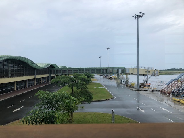
 Bridge connecting the terminal to the aircraft
 A PAL plan taking off
 The airport control tower
 Baggage being transport for loading unto the aircraft
 A family walks to board the awaiting aircraft bound for Manila.
 A view of an Air Asia plane that had just arrived and with its passengers just starting to deplane.
This airport is probably one of the better airports in the country now. There is a new airport in Bicol (replacing the old Legazpi Airport) that just started operations recently, which I have yet to visit but is likely better than Panglao in terms of shops and stores. Facilities-wise, this is a modern gateway that should serve the projected number of passengers for Bohol for the next so many years including the expected international operations for the terminal. We are still in the midst of the pandemic but the number of travelers is steadily increasing. And so I wonder how the airport will be once the ‘old normal’ number of visitors return.
They definitely need more shops and stores than the current two kiosks at the airport. They also would need to improve on the ventilation and air-conditioning (it was quite humid inside the airport when we were there – the aircon was not functioning). As a tourist, I am already looking forward to the next trip to Panglao. Hopefully, the airport will be even better on that next trip.
–
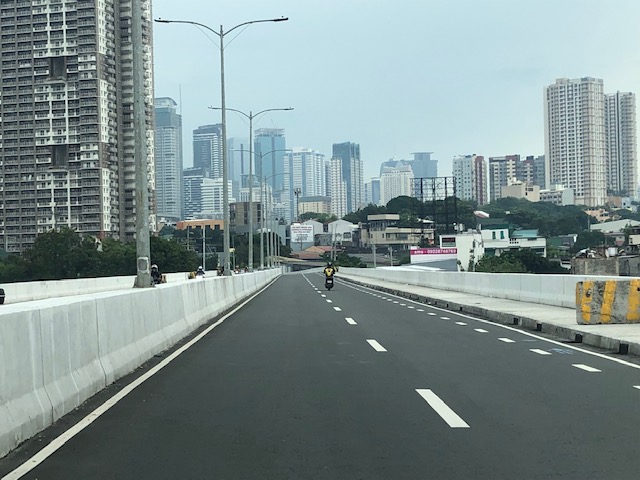
Kalayaan Bridge (BGC – Ortigas Center Link)
The Kalayaan Bridge, also known as the Bonifacio Global City (BGC) – Ortigas Center Link opened about a year ago and was supposed to ease traffic along the usual routes along EDSA and C5 that crossed the Pasig River. The new bridge is located between the EDSA and C5 bridges and is a more direct route to and from BGC if you reside in Pasig and choose the route to/from BGC via Pasig/Shaw Boulevard.
 The approach ramp to the bridge from the BGC side is in the vicinity of the Uptown part of BGC. The bridge goes over Kalayaan Avenue, which is one of the major access roads to BGC from C5 or EDSA, and J.P. Rizal Avenue Extension but there is access and egress to Kalayaan Avenue.
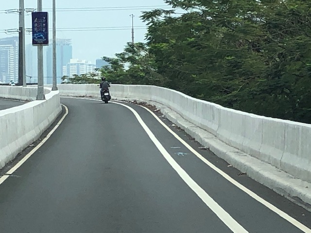 The ramp is practically a single lane with painted bike lanes on either side of the bridge. There is noticeably no space for pedestrians on this bridge. That is only a curb on the right side. This lack of pedestrian provisions is a major flaw of this bridge.
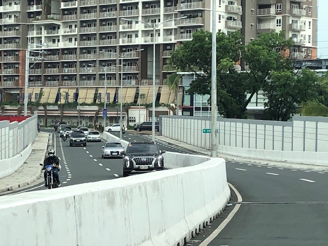
 A lone cyclist traversing the bridge – the merge for traffic from BGC and vehicles from Kalayaan Avenue is seen downstream.
 Approaching the merging section (from this perspective; its diverging on the other side) of the bridge.
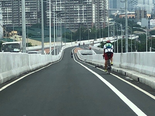
 A motorcycle merges with the traffic from BGC. Notice the chevron markings separating merging flows as well as the yield marking for vehicles coming from Kalayaan (i.e., priority is for vehicles coming from BGC). The bridge from this section becomes two lanes per direction. There is, however, a risky part for cyclists who will cross paths with vehicles coming from Kalayaan. Cyclists from BGC will have to cross a lane to get to the bike lane on the outer side of the bridge. There is no space for pedestrians along this bridge.
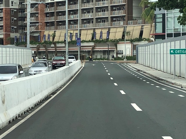
 There is only this part of the bridge where there appears to be a sidewalk. Was this really the design for this bridge? It is very obvious that many people failed in both design and implementation of this project.
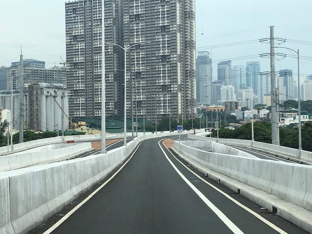
 The view towards the Pasig side of the bridge. There are two lanes per direction and narrow bike lanes along the curbsides.
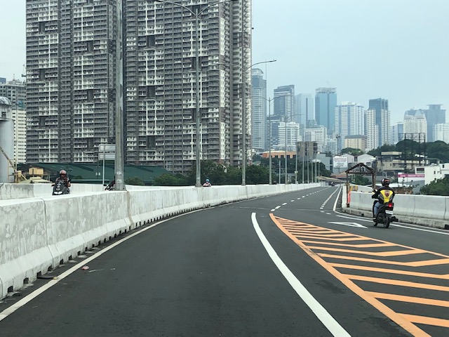
 There is an intersection at the end of the bridge but the road immediately at the right is closed to incoming traffic so right turns are currently prohibited despite the pavement markings that indicate they were allowed at one time.
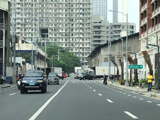 The road leads to this intersection which is in area generally referred to before as ‘Pioneer’. The area hosts many warehouses or storage buildings and I remember going here many years ago to check out the imported wood furniture and office surplus items. Turning right leads one to the area generally known as ‘Unilab’ because that was where United Laboratories had their plant and offices. It retained the property where now stands an events venue. Further on leads you to Kapitolyo and the Estancia Mall.
–
Articles on railway safety
I shared a link to a Medium writer who specialized on articles about air crashes. These were investigative articles that provide details about air crashes especially since these are all tragedies and include those that have remained mysteries like Malaysian Airline Flight 370.
I am sharing today another collection of articles pertaining to transport safety. This time they are about railway or rail safety. Here is the link to the collection of articles from Max Shroeder:
https://mx-schroeder.medium.com
And here is an example of what he writes:
https://mx-schroeder.medium.com/stressful-schedule-the-2005-amagasaki-japan-derailment-12156ddd488
Again, there is much to be learned about these incidents. The circumstances, factors and experiences need to be examined in order to draw lessons from these incidents and reduce the likelihood of them happening again. In the case of the Philippines, this is especially applicable as the country rebuilds its long distance railways infrastructure with a line connecting Manila and Clark, Pampanga along what used to be called the Main Line North (MLN) of the Philippine National Railways (PNR), and another currently being rehabbed and for upgrading to the south in what was called the Main Line South (MLS). Other rail projects are also underway like the Metro Manila Subway and the MRT Line 7. All pass through populous areas, and railway crashes may not just lead to passenger and crew fatalities and injuries but also the same for those residing or working along these rail lines.
–
Tagbilaran – Panglao Airport Arrival
The last time we were in Bohol, the airport was still in Tagbilaran City. One had to travel about 45+ minutes if you were staying at a resort in nearby Panglao Island that is part of the province. The old airport was closed (the runway though served as a venue for ) and replaced by a new airport. This one is located in Panglao Island and close to the resorts that are the main attraction of the province.
 We deplaned via tube/bridge at the new airport terminal
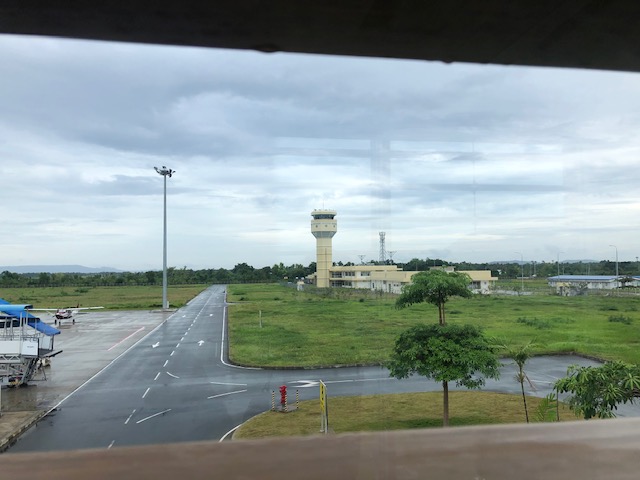 A photo of the control tower from the bridge
 Did the airport terminal architecture take inspiration from Bohol’s famous Chocolate Hills?
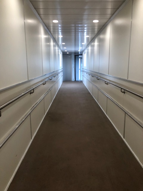
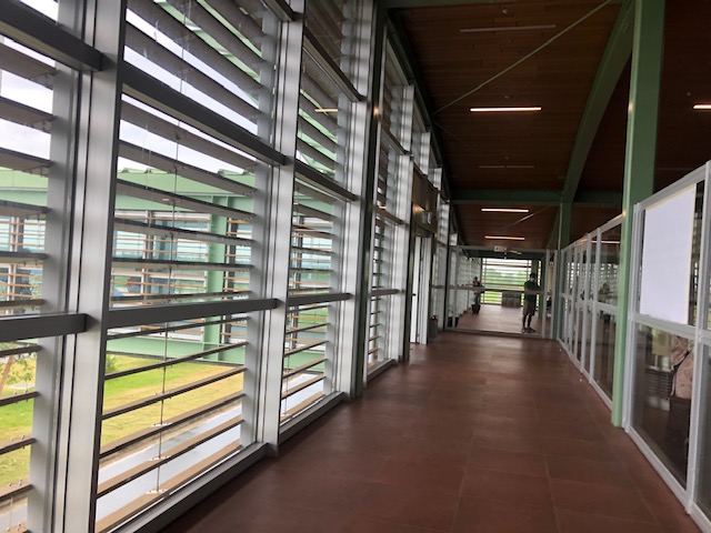 The corridors were well lighted, again thanks to the building design.
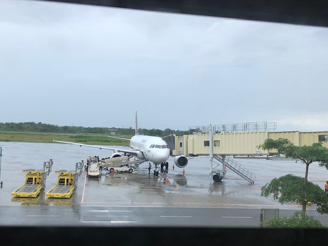 Our plane at the tarmac or apron unloading luggage and cargo
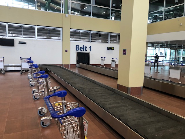 We arrived at the baggage claim area ahead of most people. The carts were already placed across the conveyor belt by airport staff.
 Belt 2 on the other side is for international arrivals. The airport already served international flights before the pandemic. These have yet to resume.
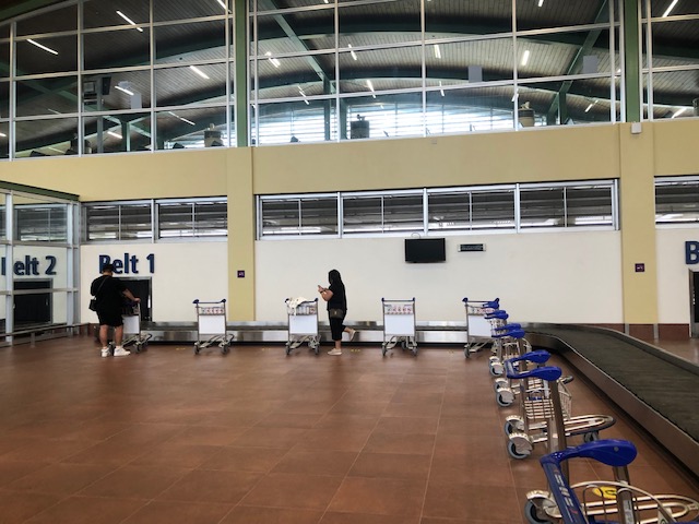
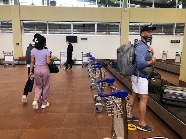 Passengers file unto the baggage claim area to pick up their luggage.
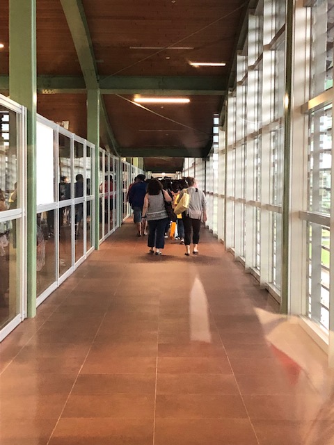
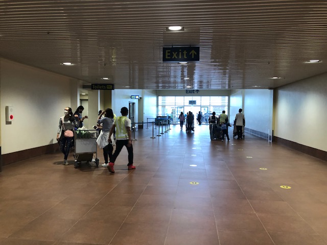 The hallway towards the terminal exit. The toilets are on the left side of the hallway.
 The sign indicates international arrivals. The airport currently does not serve international flights but these will likely resume once the pandemic threat is clearly contained. Other airports like Iloilo and Bacolod have also suspended international flights.
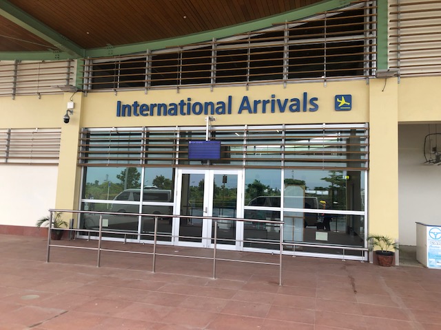 The international arrival area at Tagbilaran-Panglao Airport
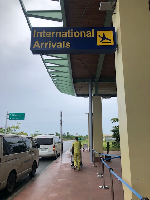
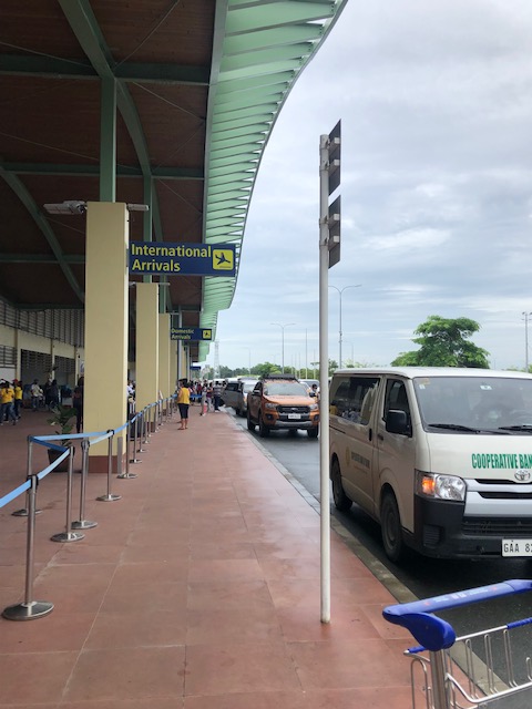 Airport driveway
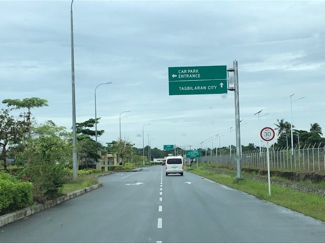 Exit towards our destination
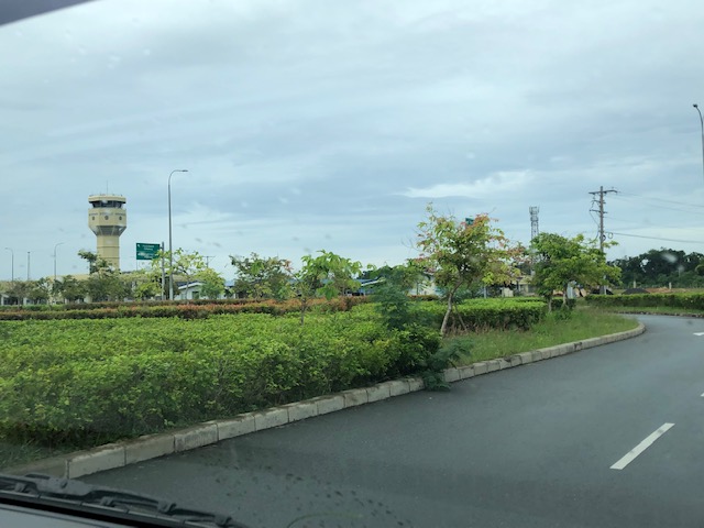 A view of the control tower as we headed towards the airport exit gate
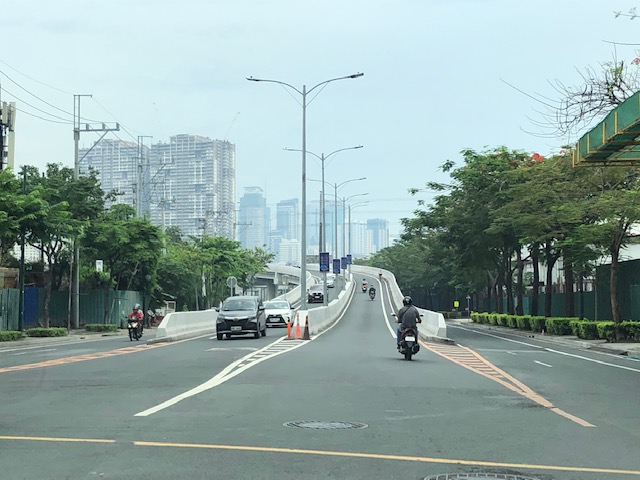
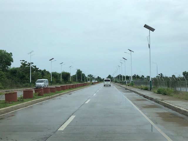 The new road connecting to the national road circling Panglao Island, which connects to the local roads leading to the resorts and towns in the island.
It now only takes something like 10 to 15 minutes to many of the resorts in Panglao Island. This is a convenience to tourists. However, the distance from the main island of Bohol (the rest and most of the province) means a longer travel time for Boholanons or Bol-anons to/from their hometowns from/to the airport. This looks to be a non-issue considering the pros of the new airport outweighs its cons.
More on this airport soon!
–
Bike-friendly fast food
While doing field work early this week, we decided to do a quick drive through for refreshments. As we queued for the drive through window, we came upon this recent addition to many fast food restaurants in light of the increasing popularity of cycling amidst the Covid-19 pandemic. Here are a few photos of the Bike & Dine at McDonald’s along Rodeo Drive in Alabang.
 Our first close look at the bike & dine section of a fast-food restaurant ironically was via the drive through of a restaurant.
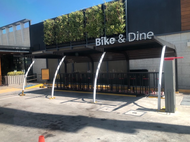 McDonald’s bike & dine facility – many if not most of their newer branches have allocated space for bikers. These clearly show that such facilities or features can be included in the space layout and design of such restaurants.
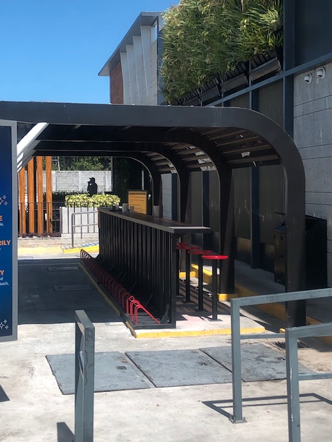 Cyclists may park and secure their bikes on one side (left with a slot for a wheel) and sit to eat and/or drink on the other side of the table.
 A close-up of the table, seats and bike slots
More and more establishments are now putting up bike facilities such as parking and bike & dine. We hope that these will help encourage more people to cycle while also proving that active transport is good for business.
–
