
Home » Land use (Page 10)
Category Archives: Land use
Urban Transport Study in Manila Metropolitan Area (UTSMMA, 1973)
[Important note: I have noticed that the material on this blog site has been used by certain people to further misinformation including revisionism to credit the Marcos dictatorship and put the blame on subsequent administrations (not that these also had failures of their own). This and other posts on past projects present the facts about the projects and contain minimal opinions, if any on the politics or political economy at the time and afterwards. Do your research and refrain from using the material on this page and others to promote misinformation. I suggest you go to the The Mass Transit System in Metro Manila site for more facts about railway development and history. I do not consent to the use of my articles for the purposes of misinformation and historical revisionism. 10/13/2019]
With the recent approval of JICA’s Dream Plan for Mega Manila, I thought it was timely to look back at similar plans developed for Metro Manila and its surrounding areas. At the time these plans were made, I guess they were all regarded as “dream plans” in their own ways. Let us start with what is probably the original dream plan, the Urban Transport Study in Manila Metropolitan Area (UTSMMA, 1973). The project was implemented from March 1971 to September 1973 with the assistance of the Government of Japan’s Overseas Technical Cooperation Agency (OTCA), the precursor of today’s Japan International Cooperation Agency (JICA). Being the first comprehensive study for a metropolitan area that was yet to be formally consolidated and called Metro Manila, UTSMMA set the stage for future transport studies for the metropolis. Among the study’s main recommendations is one proposing for a mass transit system restricted to railways. A Rapid Transit Railway (RTR) network was recommended in the form of subways in the inner area bound by EDSA, and elevated in the suburban areas. Brief descriptions of the proposed lines are as follows:
- Line 1 (27.1 km) – from Construction Hill to Talon via central Quezon Boulevard, Manila downtown and the International Airport
- Line 2 (36.0 km) – from Novaliches to Cainta via Manila downtown and Pasig
- Line 3 (24.3 km) – Along Highway 54 (C-4): half a circle route about 12 km from Manila downtown
- Line 4 (30.1 km) – From Marikina to Zapote via Cubao, Manila downtown and the Manila Bay area
- Line 5 (17.6 km) – From Meycauayan to Manila downtown running between Line No. 2 and PNR
- PNR improvement (56.4 km) – From Bocaue to Muntinglupa via Tutuban Station
The following that was posted here before in another article shows a map illustrating the recommended RTR network for the Manila Metropolitan area. (Note that the map was enhanced from the original black and white to clearly show the proposed lines back then.)  UTSMMA also recognized the important roles of buses and jeepneys in the future, and recommended that these be used for feeder services once the rail systems have been constructed and operational. As a result of the study, a Feasibility Study for the Manila Rapid Transit Railway Line No. 1 was conducted and completed in June 1976. The study, which was supported by JICA, noted that “the implementation should be initiated immediately” in light of the estimated heavy traffic demand along the corridor. This project could have been the first major transport project for Metro Manila if it had been implemented. Unfortunately, despite a favorable assessment in this study, the proposed RTR Line 1 was not implemented after a contrary assessment by a subsequent study, MMETROPLAN, which is discussed in the succeeding section of this report. The estimated costs of construction of recommended transport infrastructure were provided in the Final Report of the study including indicative costs and benefits of proposed urban expressways and urban rapid transit railways. [Reference: UTSMMA, 1973 – NCTS Library] Whenever I go back to UTSMMA and the network of proposed railway lines, I can’t help but wonder what could have been one of the more efficient transport systems in Asia or even in the world. What happened? Why was this plan not realised? The answer may be found in the next big study conducted for Metro Manila that also included in much detail its land use and development plans. Next: MMETROPLAN, 1977 –
Required reading on sprawl, transit and the poor
A friend recently posted an article on Facebook that I thought should be required reading for urban and transport planners in the Philippines whether they be with government or the private sector. There is a strong link between land use and transport, we need to be able to understand the complexities and subtleties in order to maximize the benefits to society. It is not a coincidence that the article specifically mentions the poor as it discusses opportunities lost due to flaws or inefficiencies in land use and transport. The article is found in the following link:
Suburban sprawl and bad transit can crush opportunity for the poor
I hope that this will be read and understood by officials at DOTC, LTFRB, LRTA and PNR, as well as those of the Housing and Urban Development Coordinating Council (HUDCC) and the Housing and Land Use Regulatory Board (HLURB). These agencies are responsible for planning and regulating transport and housing in the country. Of course, it is also important for local government units to be able to understand these challenges especially since they will be in the forefront of addressing issues on sprawl and the provision of suitable transport systems. Here’s a related article that I posted earlier this year on New Year’s Day:
Opportunities with the MRT-7 and LRT-1 Extension
–
The Philippines’ National EST Strategy – Final Report
Friends and some acquaintances have been asking about whether there is a master plan for sustainable transport in Philippines. There is none, but there is a national strategy that should serve as the basis for the development and implementation of a master plan, whether at the national or local level. This strategy was formulated with assistance of the United Nations Council for Regional Development (UNCRD) through the Philippines’ Department of Transportation and Communication (DOTC) and Department of Environment and Natural Resources (DENR), which served as the focal agencies for this endeavour. The formulation was conducted by the National Center for Transportation Studies (NCTS) of the University of the Philippines Diliman. For reference, you can go to the NCTS website for an electronic copy of the National Environmentally Sustainable Transport Strategy Final Report.
 Cover page for the National EST Strategy Final Report
–
Green light for the Cebu BRT
The NEDA Board chaired by the Philippines’ President approved last week a number of major infrastructure projects. One project is particularly important as it seeks to introduce an innovative public transport system in the Philippines. The Cebu Bus Rapid Transit (BRT) project was finally given the green light and is projected to be completed and operational by 2017. I remember that the Cebu BRT was conceptualised while we were doing a social marketing project for Environmentally Sustainable Transport (EST) that was supported by the UNDP. That was back in 2006-2007 and right before we embarked on the formulation of a national EST strategy that was supported by UNCRD. I remember, too, that sometime in 2009, Enrique Penalosa, the former mayor of Bogota, Colombia who has championed the BRT cause visited the Philippines to give some talks in Cebu and Metro Manila about public transport and pursuit of better quality of life through good transport systems. From that time onwards, a lot of work has been put into the studies to support this system including social marketing for stakeholders to understand what such a system will require including its impacts on existing transport modes. It took sometime for this project to be approved but that should no longer be an issue and focus should now be on the detailed design and implementation of the project.
There are many detractors of this BRT project. While I respect the value engineering work that was supposed to have been conducted by NEDA, I would like to speculate that perhaps it was unclear to them how important a functioning, operational BRT in Cebu is as a strategic accomplishment in transport in this country. For most people, the idea of bus transport is what they have seen along EDSA in Metro Manila. The impact on commuting behaviour of a high quality public transport system like a BRT would be very hard to quantify and the criteria and metrics used would be quite tricky considering the strategic and behavioural aspects of the system. Such evaluations can also be tricky depending on who were doing the study in the first place as the outcomes could easily be affected by the biases of those who undertook the evaluation. Thus, it is important that value engineering exercises be done by open-minded, flexible if not disinterested parties to the project of interest.
Many of those who have expressed skepticism about the BRT are likely pining for a rail transit system that was earlier proposed for the city but which has failed to gain the critical support. For one, the LRT that was proposed for Cebu City was simply too expensive and financing would have been difficult for a system that would have been less flexible in operations compared to an at-grade bus system. The numbers supporting the LRT were also in need of much updating as the study on that system was already quite dated and had not considered the major developments in Cebu and its surrounding cities that loosely or informally comprise what people refer to as Metro Cebu. These realities would need a new and more robust study that could surely result in a recommendation for a rail system but upon close comparison with a BRT option should lead to a conclusion that Cebu will be better off with BRT at this point and in the foreseeable future.
The truth is that while rail transport remains as an ultimate goal for high demand corridors in highly urbanised cities, it is an expensive proposition and ones that will take more time to build. We don’t have that time in our hands as our cities are rapidly growing both in terms of economy and population. We cannot sustain this progress if our transport system remains primitive. And strategically, too, a BRT system may just pave the way for a future rail system in Cebu. This model for transport system development can be replicated in other cities as well including Davao, Iloilo, Bacolod, and Cagayan de Oro, to name a few. But we should always not forget that building this system requires holistic development of complementing infrastructure such as pedestrian walkways and bikeways, and the rationalisation of jeepney and multi cab services with respect to the mass transit system. I believe those behind the Cebu BRT project have these covered and it is now a matter of time before the country’s first BRT becomes operational in the “Queen City of the South.”
–
Roads as solar dryers – Part 2
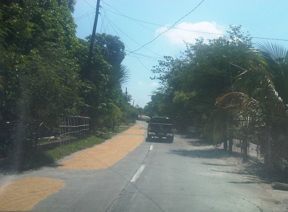
This is a continuation of an earlier post on roads being used as solar dryers. Our trip across Tarlac brought us to more of these facilities being used for agricultural purposes. The following photos are from San Jose and Mayantoc towns, which are obviously predominantly agricultural. The photos show lands devoted to agricultural as far as the eye could see and most are planted with rice.
A friend commented that something should be done to reduce if not eliminate such practices along roads. I replied that this is basically the responsibility of local government units including barangay officials who should be educated about the dangers posed to travellers as well as the deterioration in the quality of the rice as it gets compromised from the waste and grinding they get from vehicles. In terms of practicality and recognising the limitation in funds for solar dryers, roads seem to be the easier and versatile option. Basketball courts and other concreted spaces scattered around the countryside do not make sense where roads would have more use especially to address accessibility issues (e.g., farm to market roads).
Another friend commented on the earlier post that he almost had a collision with another motorcycle rider as the entire road was covered with rice being dried by farmers. I reasoned out that for rural roads with very low traffic, a single lane covered with rice could be tolerable but using the entire road width just is not right. Motorcycle can easily slip or skid along such rice-covered roads resulting in serious injuries if not fatalities. For most cases of what I’ve seen recently, the roads quality as having low traffic and rice is being dried only along one lane so we know at least that people are aware that one lane should at least be free of obstructions.
 1
1
 2
2
 3
3
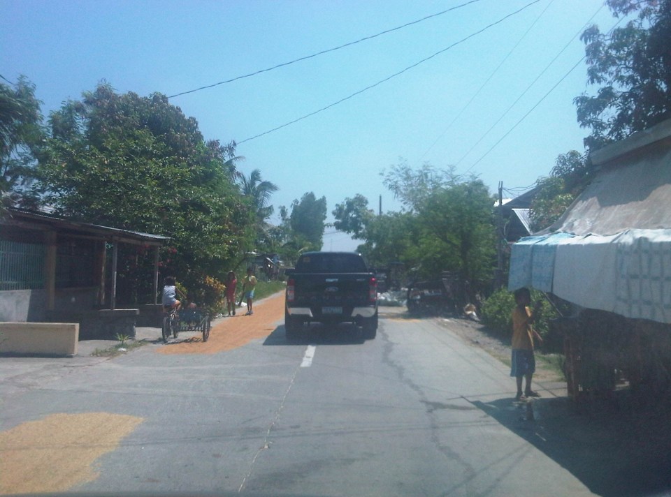 4 – That’s corn being dried just beside the pick-up truck in the photo.
 5
5
 6
6
 7
7
 8 – Bad practice of spreading the grains across the entire road carriageway
 9
9
The last photo is of corn kernels being dried on a basketball court. You can see the cobs piled near the stage, which shelters what looks like sacks of corn. As I mentioned earlier, it is possible to have such basketball courts or social facilities to be used as solar dryers. Even schools grounds can be used for this purpose but only for weekends or during the summer breaks. However, it would be impractical to have basketball courts and plazas scattered all over the countryside just for this purpose especially in places where there aren’t much people in the first place. Roads still offer the more flexible use (i.e., access/FMR and solar dryer) as long as traffic is not significant. Perhaps where traffic is significant (i.e., significantly populated areas) then such “off-road” facilities should be constructed. But again, the responsibility for making sure roads are clear of agricultural products would fall unto the LGUs.
–
Roads as solar dryers – Part 1
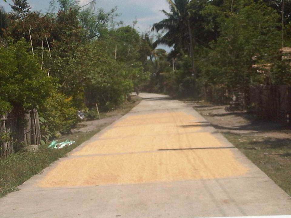
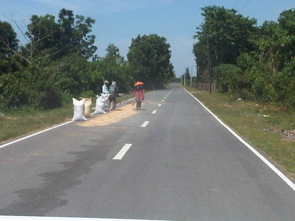
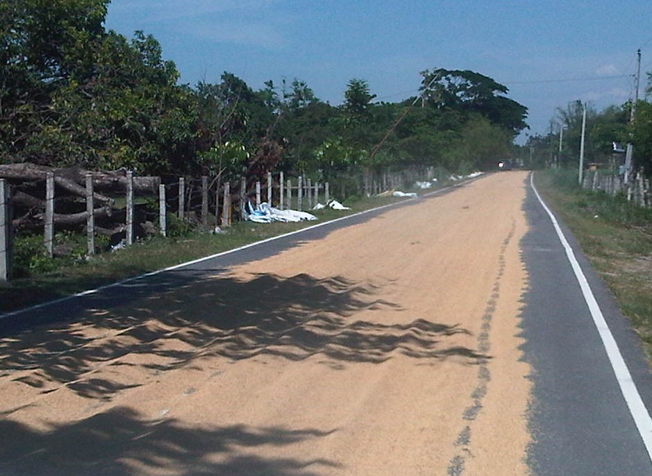
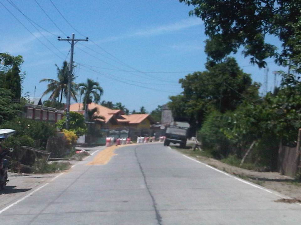
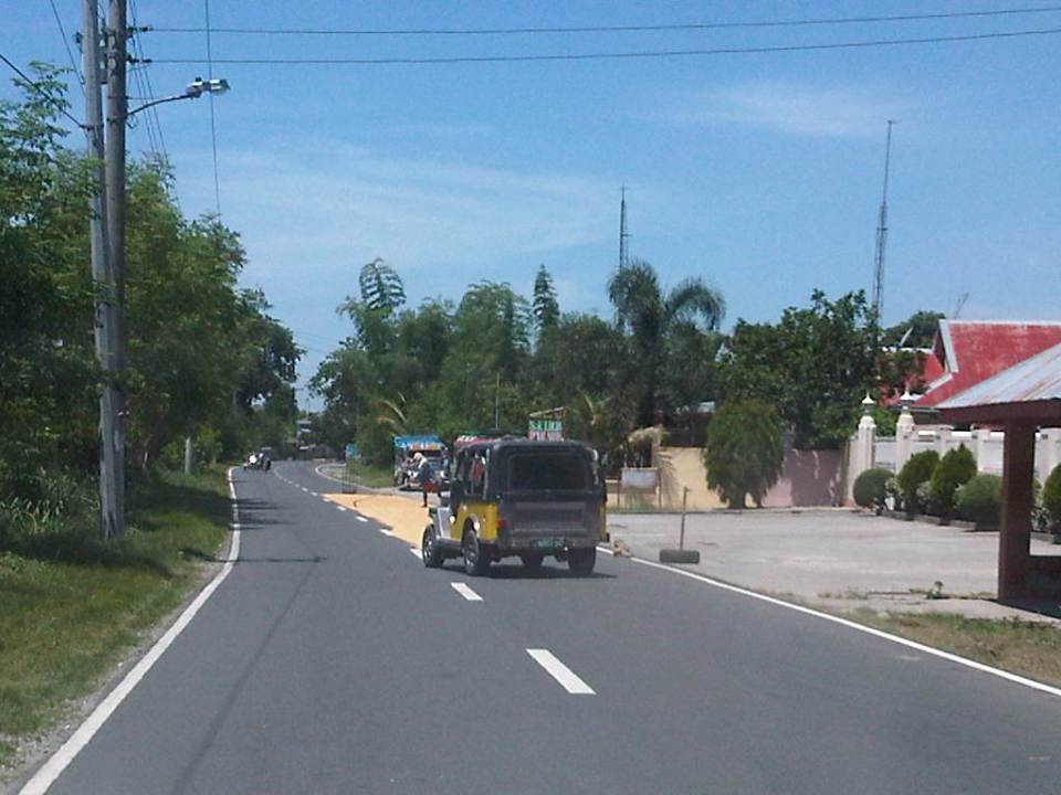
We are currently undertaking a project for the Province of Tarlac that looks into the safety along its rural roads (both national and provincial roads) including those providing access to tourism areas in the province. Along many rural roads are agricultural lands producing rice, corn, fruits, vegetables and other products. Often, travellers will encounter roads that serve another purpose other than transport – as solar dryers. Before rice is milled, it needs to be dried first so that it would be easier to remove the husk (i.e., separate the bigas from the ipa – together they are called palay). While it is possible to do this drying on mats (banig) spread over the land/soil this takes time. Meanwhile, portland cement concrete roads offer what seems to be the perfect surface for drying. As such, certain roads have been known to get justification for concreting despite low traffic volumes as they double as solar dryers. There are similar cases for basketball courts or village plazas receiving funding for concreting for the same reasons. Obviously, laying out rice on the roads have implications on the quality of the rice later on as vehicles will inevitably (even inadvertently) pass through the roads. I guess its even worse in cases when the road surface is of asphalt concrete. Following are photos I took along rural roads in Bamban, Capas and San Jose towns of Tarlac.
 1
1
 2
2
 3
3
 4
4
 5
5
 6
6
 7
7
 8
8
 9
9
 10
10
Other items that are usually dried on the roads include tingting (the stems of coconut leaves that are used to make brooms – walis tingting) barbecue and fish ball sticks. I have also seen fish being dried on the road one time during a trip to Northern Luzon. Obviously, among the risks are the rice being grinded by the tires of vehicles (resulting in durog na bigas more suitable for porridge), fuel or oil compromising the rice, and the prospects of animals doing their thing on the road near or on the rice!
More on these solar dryers in the next post!
–
Daang Bakal and Antipolo’s attractions
I recently wrote about the old railway line that used to run between Manila and Antipolo via a route passing through the town of Cainta that used what was probably the gentlest slope at the time – through what is now Valley Golf, Victoria Valley and Fairmont Subdivisions. Here are some more photos along Daang Bakal, the old Manila Rail Road line that is now a road.
 Daang Bakal is a scenic route and one can only imagine how this place looked like when it was still a railway line and the areas along it were still undeveloped.
 Hinulugang Taktak has been designated as a National Park and the areas along Daang Bakal at least have been preserved. Users of this road are quite limited to residents of exclusive subdivisions with gates along the road and trips generated by the Immaculate Heart Parish near the Fairmont gate. Public transportation is provided by tricycles that have a terminal at the intersection of Daang Bakal and Taktak Road.
 The temporary fence that was made out of tarpaulin material is now in tatters. There is road construction work ongoing though but mainly for the access roads connecting to Pinagmisahan. The concreted area at the right side of the road in the photo seems to be for parking rather than road widening. Traffic is low along Daang Bakal and will probably not require road widening for the foreseeable future.
 The main entrance and facilities for Hinulugang Taktak are still closed and there seems to be no activity to indicate that the rehabilitation project is not moving at all.
–
Scenes by the roadside at the port area in Manila
Traveling along Radial Road 10, you get to see how life in Manila really is. It is not the glitzy new developments that people try to present as the face of the city. The real deal is in places like Tondo, the Baseco compound and Smokey Mountain. The areas along R-10 starting from across from the North Harbor to Smokey Mountain (yes, it is still there) provide us with a peek into everyday life in this part of Manila.
 Carpenters working on the body of what would become karaoke machines. The TV or screen will be installed at the upper shelf and the machine and controls will be installed in the lower part. These are popular around the country and are often rented out for parties. The quality varies but I would say that there are really good quality karaoke machines with digital quality equipment providing crisp music and the correct lyrics to karaoke lovers.
 As these are informal communities, houses do not have water or electricity connections. As such, people purchase water from nearby establishments or houses, and many have illegal water and power connections for them to have water and electricity. Such illegal connections have led high losses to utility companies that translate to costs passed on to legitimate customers.
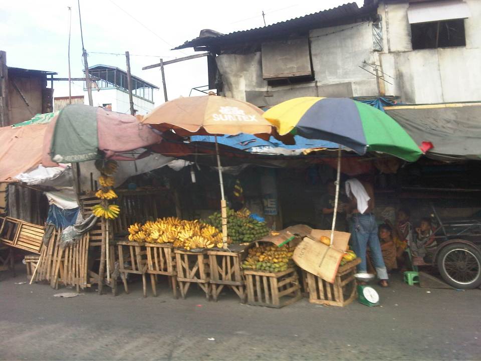 Many roadside stalls sell a variety of fruits like the bananas shown in the photo. It’s actually interesting to note that just across from the stalls is the port area whose walls don’t seem to be enough to discourage people from trying to pilfer the containers and crates containing various stuff shipped through the Port of Manila.
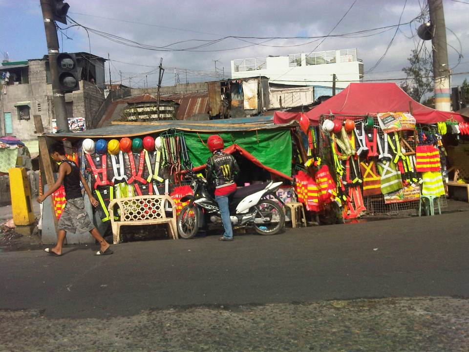 Roadside stalls selling practically anything and everything. This one is selling hard hats and reflective vests. These vests can be used by construction workers as well as traffic enforcers. Recently, motorcycle riders have been required to put on vests for them to be more visible to other road users.
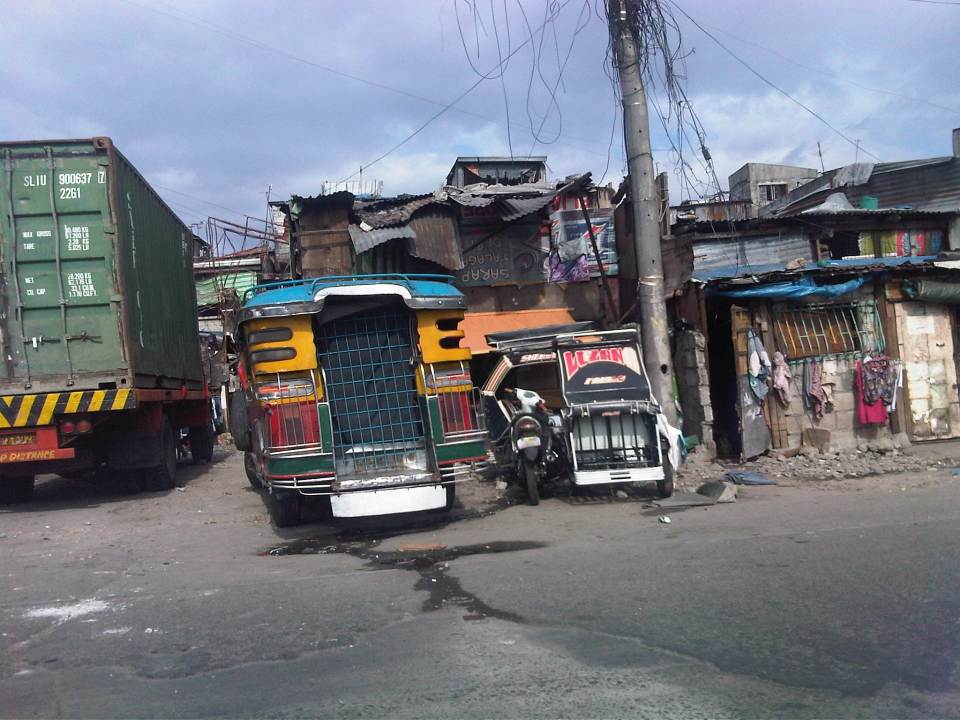 Shanties line up along the road, actually on the road as these were built on top of the space already allocated for R-10. Many sections have already been paved where shanties have been built. These shanties are now the subject of a program to remove them and open up the space for traffic to ease congestion along this road, which has much truck traffic.
 It seems that a lot of people have pedicabs as a means for livelihood. While there is nothing fundamentally wrong with this, the issue is mainly with regards to their excessive numbers and suitability as a public transport mode given their operations and propensity to go against traffic rules and regulations.
 The mass housing in the Smokey Mountain area are multi-storey apartments that look like they definitely have seen much better days. These buildings actually look like multi-storey shanties (similar buildings elsewhere including BLISS projects look much better or are better maintained). Many units have been extended and the structures now pose hazards (e.g., fire, earthquake, etc.). Alleys are not passable to emergency vehicles like fire trucks as residents have maximized occupancy of the spaces at the ground level. These look like the perfect cases for how NOT to develop mass housing.
–
Traffic consultants for Philippine cities?
I was driving to the office one morning, and as I was slowing down to stop at the Masinag junction I spotted a familiar face giving instructions to Antipolo traffic personnel. Robert Nacianceno was formerly the General Manager (Undersecretary level position) with the Metropolitan Manila Development Authority (MMDA) when it was chaired by Bayani Fernando, the first MMDA Chair to gain a cabinet level post (previously the MMDA Chair was not a Secretary level position). He was in an office barong while leading Antipolo staff in positioning orange traffic cones to mark the lanes for turning traffic along the Sumulong Highway approach from Antipolo.
Nacianceno is a cyclist so I would like to think that he can take that perspective in transport planning and traffic management for Antipolo. Unfortunately, his track record at the MMDA does not provide strong evidence as to his competence in transport planning or traffic management. Insiders say most policies and schemes during BF’s time was the latter’s ideas (e.g., U-turns, bike lanes, etc.) and he had his own consultant (and reportedly an inner circle) for various matters including traffic. In fairness to the man, Nacianceno probably has tremendous experience on the job but one has to note that there were other people with the MMDA who also dabbled in transport and traffic. Also, as GM he had other things to attend to during his stint including waste management and flood control.
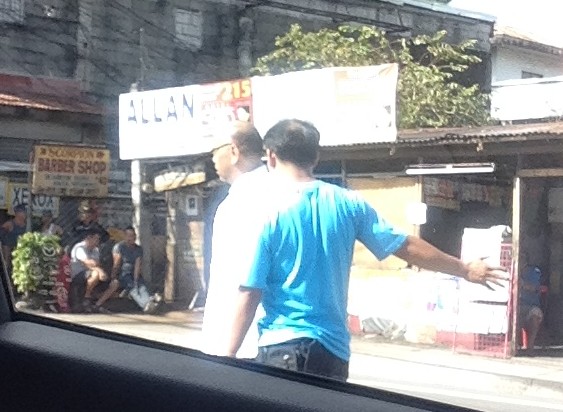 Remember this guy? He used to be the MMDA GM during BF’s stint at the agency.
I recall that the previous traffic consultant of Antipolo City was also a former MMDA official, Ernesto Camarillo. Unfortunately, I couldn’t say that Antipolo traffic improved during the last few years. Based on what I have seen in my daily commute, transport and traffic conditions have degenerated. Antipolo is overrun by tricycles and people generally do not follow rules and regulations. Informal terminals dot the city and you don’t have to go far to find inappropriate terminals as these are in plain view and across from the Rizal Provincial Capitol. Antipolo has a new mayor in the former Rizal Governor and his mother now sits as governor of the province. I’m crossing my fingers as to how they will improve transport and traffic in Antipolo if there is really a desire to do so. For starters, is there a transport and traffic plan for this Highly Urbanized City (HUC)? There should be one as the city needs it badly together with a land use plan to bring some order in development.
Antipolo is rapidly developing but at the same time conditions (including traffic) are also rapidly deteriorating. Hopefully, the LGU will address these issues and eventually make this city a modern one and fit for its being an HUC as well as a popular pilgrimage site for decades if not centuries due to the Shrine of Our Lady of Peace and Good Voyage (Is there some irony here?). Nacianceno’s work has just started and I hope he is up to the challenge of bringing order to Antipolo’s chaotic transport and traffic situation. I hope, too, that he will take note of good practices in other cities (Philippine or foreign) and won’t be relying purely on his experiences in Metro Manila. And hopefully, whatever improvements from the traffic schemes he will be introducing and implementing will be felt immediately by travellers. Good luck!
–
Quiapo traffic
Fridays in Manila are associated with Quiapo and the devotion to the Black Nazarene. People flock to Quiapo Church to hear Mass or pray at the Basilica, which is arguably among the most popular for Roman Catholics. Fridays are regarded as feast days dedicated to the Black Nazarene and since many people go to Quiapo Church throughout the day, there is almost always traffic congestion in the area. These days, however, any weekday is a congested day in that area what with more vehicles and more people coming to this area or just passing through.
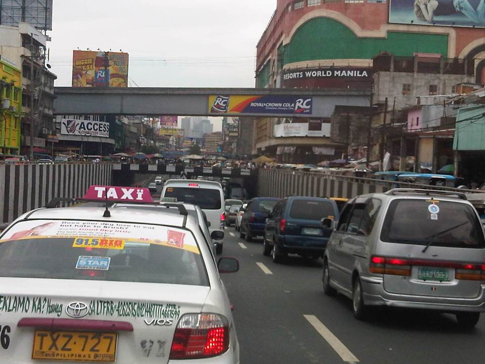 Espana Avenue ends at its junction with Quezon Boulevard and turning left leads the traveler to the Quiapo District. The photo shows heavy traffic along the underpass and the elevated LRT Line 2.
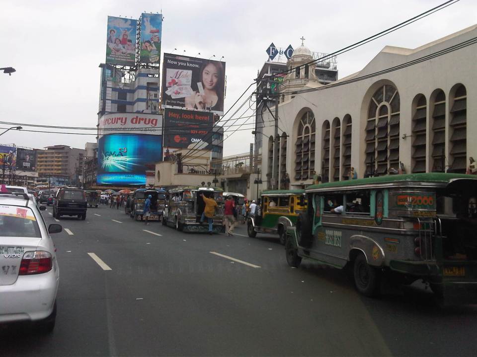 Quiapo Church is just beside Quezon Boulevard and jeepneys loading and unloading passengers occupy up to 3 lanes nearest to the church.
 There is a door at the side of the church along Quezon Boulevard and people seem to be everywhere even the middle of the road as they walk or wait to ride a jeepney.
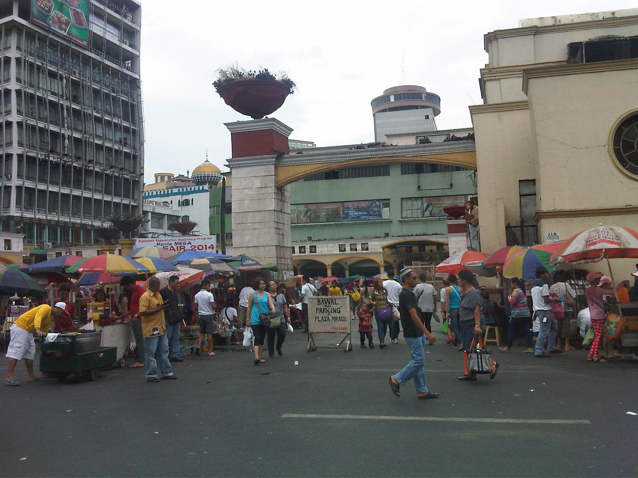 Historic Plaza Miranda in front of the church is witness not only to a lot of the frenzied processions during the feast day of the Black Nazarene every January. Plaza Miranda has also been a venue for many political rallies including the infamous one in the early 1970s that was among the triggers for Martial Law. On “normal” days, the plaza is home to vendors, fortune tellers and other denizens of this area.
There are other popular churches around Metro Manila that attract a lot of people throughout the year and not just during feast days. Among these are Baclaran in Pasay City (Our Lady of Perpetual Help), St. Jude in Manila, Sto. Domingo in Quezon City, San Agustin and the Manila Cathedral in Intramuros, Manila. Nearby in Antipolo is the Shrine to Our Lady of Peace and Good Voyage. These churches are among the busiest especially on certain days of the week (e.g., Wednesdays are for Baclaran, etc.) and with the coming Holy Week, a lot of people are again expected to flock to these churches for the Visita Iglesia tradition. Hopefully, these devotions are really a manifestation of faith rather than the pretentious kind where the road trip is more touristy than religious or prayerful.
–

