
Home » NMT (Page 3)
Category Archives: NMT
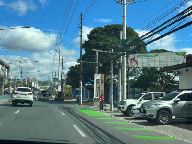
Westbound bike lane along Ortigas Avenue Extension, Cainta, Rizal
I was not able to post these photos of the westbound bike lane along Ortigas Avenue Extension immediately after I shared photos of the eastbound bike lane. The bike lanes, as can be seen from the photos, are painted green.
 Bike lane past Valley Golf and STI
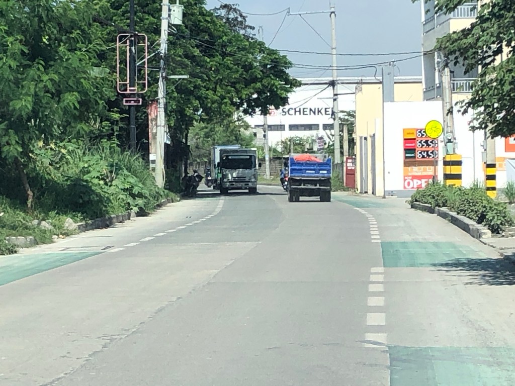
 Bike lane approaching Brookside (Sunset Drive) with the CK Square as a landmark
 Still a big issue for bike lanes is the presence of electric and communication poles/posts that have not been relocated after so many years since Ortigas Avenue had been widened.
 Bike lane across from Tapsi ni Vivian
 These photos were taken before the solar studs were installed to delineate the bike lanes and make them more visible at night or when its dark.
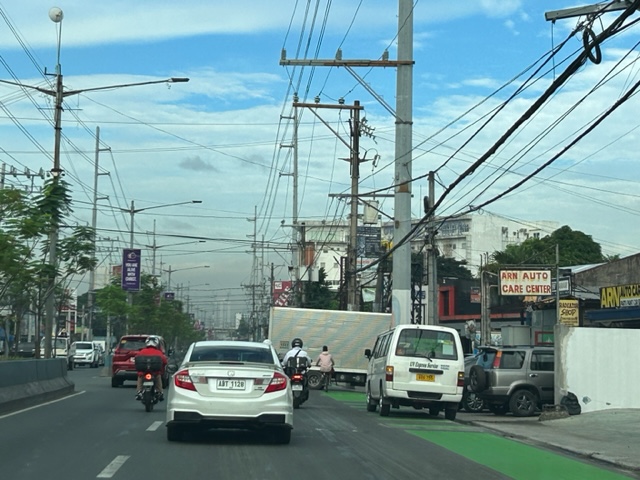 Also, challenges and concerns for cyclists are parked vehicles and those maneuvering from the various establishments along the road. This photo pretty much captures those two concerns – a parked UV Express van and a truck maneuvering out of a store occupying the bike lane.
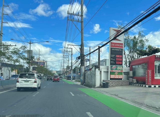
 Cyclist pedaling along the bike lane approaching the Shell Gas Station (where there is also a McDonald’s)
 Bike lane in front of the Ortigas Hospital just outside the Brookside Gate 1 and near Cainta Junction
More photos of the bike lanes soon!
–
Quezon City’s bike lane barriers
Here’s a first look at Quezon City’s new bike lane barriers along Katipunan Avenue (C-5). I took these photos while crawling towards Ateneo Gate 3 on my way to the office.


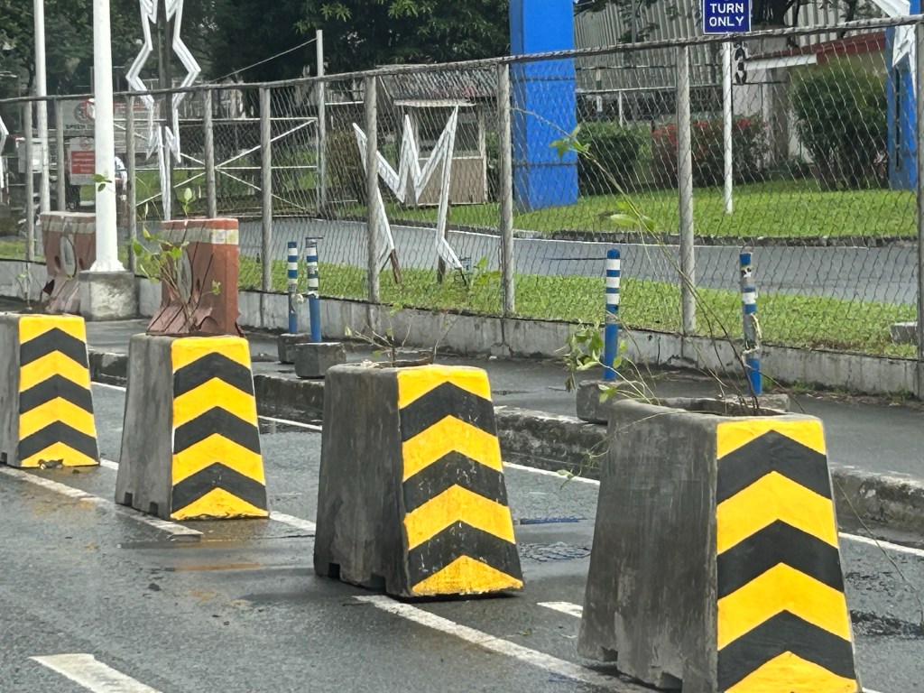

The same or similar barriers/planters have been installed along other major roads including Commonwealth Avenue. This is part of Quezon City’s commitment to building a bikeway/bike lane network and a worthy investment to encourage more people to take up cycling especially for work and school trips. The barriers serve to protect cyclists from motor vehicles thereby enhancing safety along these roads. Hopefully, other LGUs will follow suit and invest in active transport facilities.
–
On walking and running for health
Here is a quick share of an article on walking and running from the New York Times:
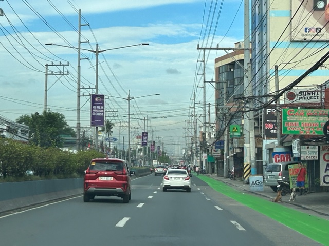
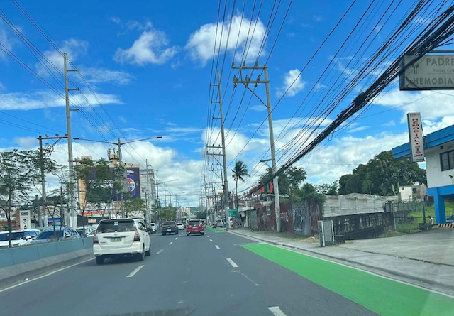
Eastbound bike lane along Ortigas Avenue Extension, Cainta, Rizal
I recently posted about the newly painted bike lanes along Ortigas Avenue Extension between Cainta Junction and Valley Golf in Cainta, Rizal. Here are more photos of the bike lanes along the eastbound direction of the avenue.
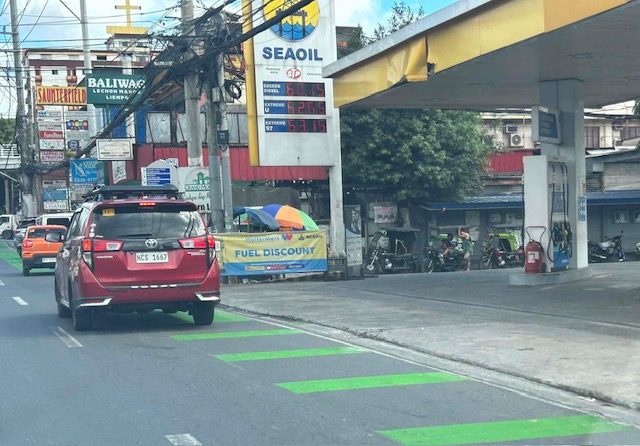
 Just past Cainta Junction and across from a gas station. The bike lane marking here though should have been for a driveway due to the service station.
 Bike lane approaching the Ford dealership
 Bike lane in front of the Ford dealership along Ortigas Ave. Ext.
 An unusual discontinuity in front of a vacant lot
 Another discontinuity
 The broken lane markings are supposed to be for driveways and approaches to intersections like this section at a gas station. This was the appropriate marking for the station in the first photo.
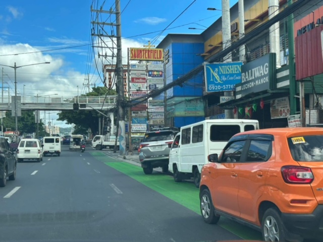 Car parking are a concern for cyclists as they often encroach on the bike lane.
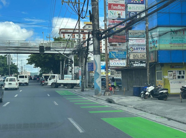 Approach to an intersection (J.G. Garcia Street) across from Brookside Subdivision gate
 Approach to intersection with Huners ROTC Street and just before STI.
I will share photos on the westbound bike lane along the same section in the next post.
–
Bike lanes along Ortigas Avenue Extension, Cainta, Rizal
The bike lanes along Ortigas Avenue end at the border of Pasig City and Cainta (or Metro Manila and the Province of Rizal). This is just after SM East Ortigas if you are eastbound, headed towards Cainta Junction. Last Friday, I was able to take a photo of the newly painted bike lane along Ortigas Avenue Extension’s eastbound side but which starts just after Cainta Junction across from the main gate of Brookside Hills Subdivision.
 The new bike lane along Ortigas Avenue Extension used luminous paint, which makes it glow at night especially when exposed to vehicle headlights.
There have been bike lanes in Rizal prior to this development. Marcos Highway and Sumulong Highway have painted bike lanes. The Manila East Road from Tikling Junction also has bike lanes. This ‘missing link’ between the boundary of NCR and Rizal and Tikling is long overdue. Hopefully, this will encourage more active transport users particularly from “bike to work” and “bike to school” trips.
–
On walking and taking the stairs
With the increasing popularity of active transport, people still forget that biking is not the only mode being referred to by the term. Walking is the most basic form of transport for us and there are many creative ways to encourage walking even if it is indoors like in an office building, a school building or a shopping mall. Here is a photo of the stairs at one mall with encouraging words for those taking the stairs instead of the escalators or elevators. It only takes 30 minutes of walking everyday to gain the benefits of a more active lifestyle.

My daily walks take me up and down the hilly roads in our neighborhood. I attribute to these walks my relatively effortless climbs to the 4th floor of our school building where my office is. Our elevator has been out of commission for some time now so we are all forced to take the stairs to our lecture rooms and offices. These I refer to as ‘stairmaster’ exercises, which is included in my daily routine so it adds to my step count as well as being recorded for the flights of stairs I take each day. I attest to this routine to improving my health and well-being, and highly recommend this to those who are able to do so.
–
Incorporating bike lanes along local roads – an example in Taguig City
I have not used an old route that we usually take to go to BGC from our place in Antipolo. This is via the Manila East Road, Highway 2000, Barkadahan Bridge and C6. From C6, we usually take Ruhale instead of Seagull Avenue as the former provided a shorter route towards Levi Mariano Avenue and C5. So it was only last weekend that I was able to see the improvements along Ruhale Street and how bike lanes were incorporated along this road. I am sharing the following photos showing a two lane road and Class 2 bike lanes.
 The green pavement markings indicate an intersection or driveway.
 Noticeable are the electric posts that remain along the bike lanes. These need to be transferred so they will not pose danger to all road users.
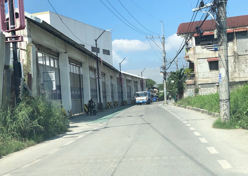 More electric posts along the bike lanes
 Bike lanes in front of an industrial establishment
 Close-up of a post in the middle of the bike lane.
 Bike lane across another industrial establishment. Again, note the green pavement marking across the driveway of the establishment.
 Bike lanes along a predominantly residential area along Ruhale.
I would consider this as a good practice example that can be replicated elsewhere. Of course, it is not perfect and as shown in the photos, there is much room for improvement including the transfer of electric posts that pose as hazards to all road users. The bike lanes are wide enough that installing bollards for the perception of physical protection vs. motor vehicles can be considered. Ruhale is generally a low speed, low volume road so perhaps the current state with no barriers would be enough for now. Also, we need to appreciate that these are already gains or wins in as far as active transport is concerned. A few years ago, this would not have been implemented by national or local governments.
–
Article share: On the benefits of sidewalk networks
Here is another quick share of an article by Todd Litman on Planetizen. The article contains a lot of information or data about why we should be investing in sidewalks or pedestrian facilities (i.e., for walking).
Litman, T. (August 6, 2023) “Completing Sidewalk Networks: Benefits and Costs,” Planetizen, https://www.planetizen.com/blogs/124999-completing-sidewalk-networks-benefits-and-costs?utm_source=newswire&utm_medium=email&utm_campaign=news-08142023&mc_cid=cd3b2e2ba5&mc_eid=9ccfe464b1 [Last accessed: 9/23/2023]
To quote from the article:
“Walking is the most basic and universal travel mode, and sidewalks are the most basic walking infrastructure, but they are often overlooked and undervalued in transportation planning. Completing and improving sidewalk networks can help achieve many economic, social and environmental goals.
Recent case studies indicate that typical North American communities spend $30 to $60 annually per capita on sidewalks, and would need to double or triple these spending levels to complete their networks. This is a large increase compared with current pedestrian spending but small compared with what governments and businesses spend on roads and parking facilities, and what motorists spend on their vehicles. Sidewalk funding increases are justified to satisfy ethical and legal requirements, and to achieve various economic, social and environmental goals. There are several possible ways to finance sidewalk improvements. These usually repay their costs thorough savings and benefits.”
–
Bike lane master plan for Metro Manila, Metro Cebu and Metro Davao
The Department of Transportation (DOTr) with support from the United Nations Development Program (UNDP) yesterday formally launched the Bike Lane Master Plan for Metro Manila, Metro Cebu and Metro Davao. Yesterday’s event was actually the third and last leg of presentations, which were also made in Cebu and Davao. Here are a few photos I got from the DOTr Facebook page (these are public):
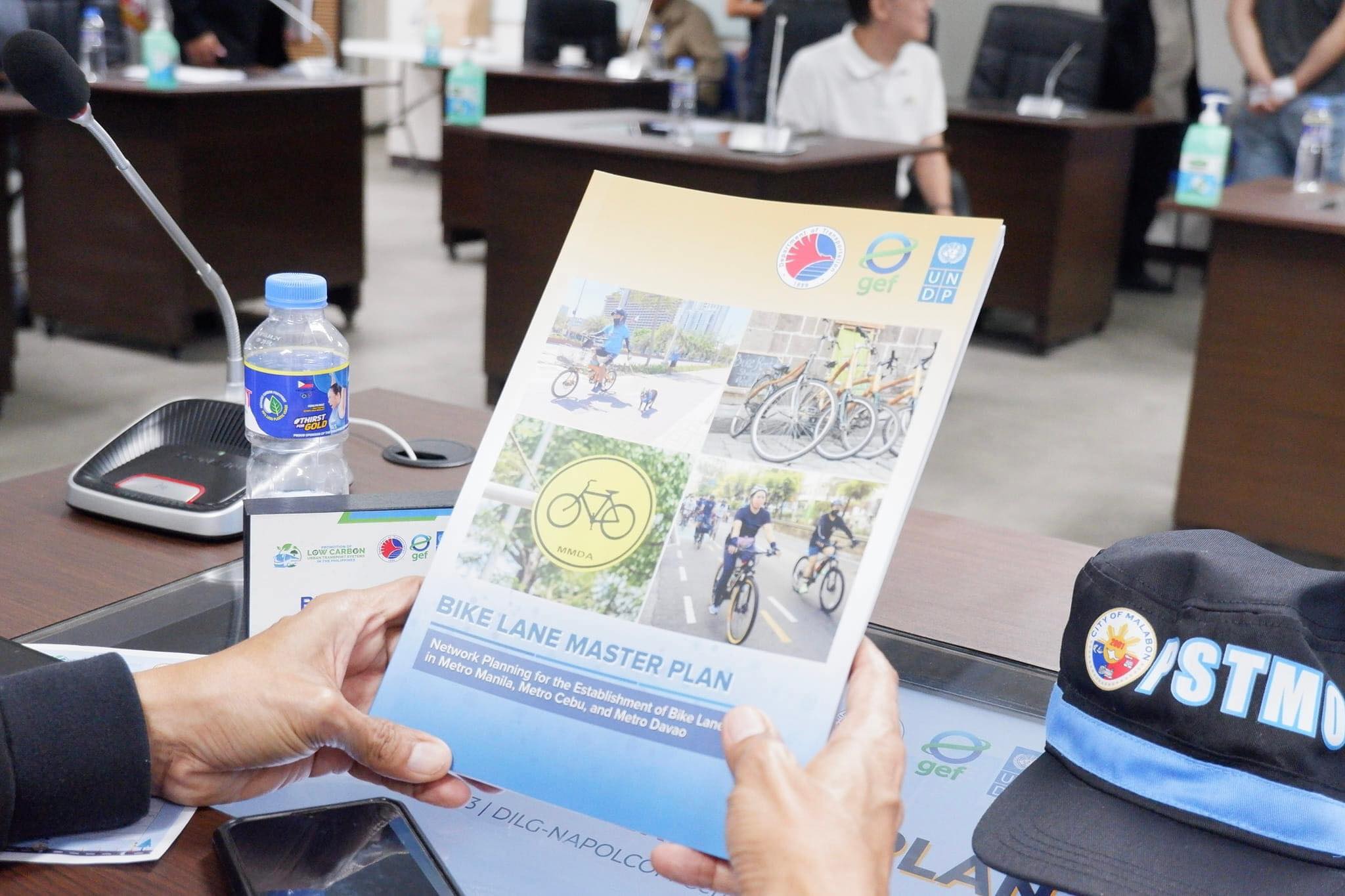 Printed copies of the master plan were distributed to attendees (Photo: DOTr Facebook page)
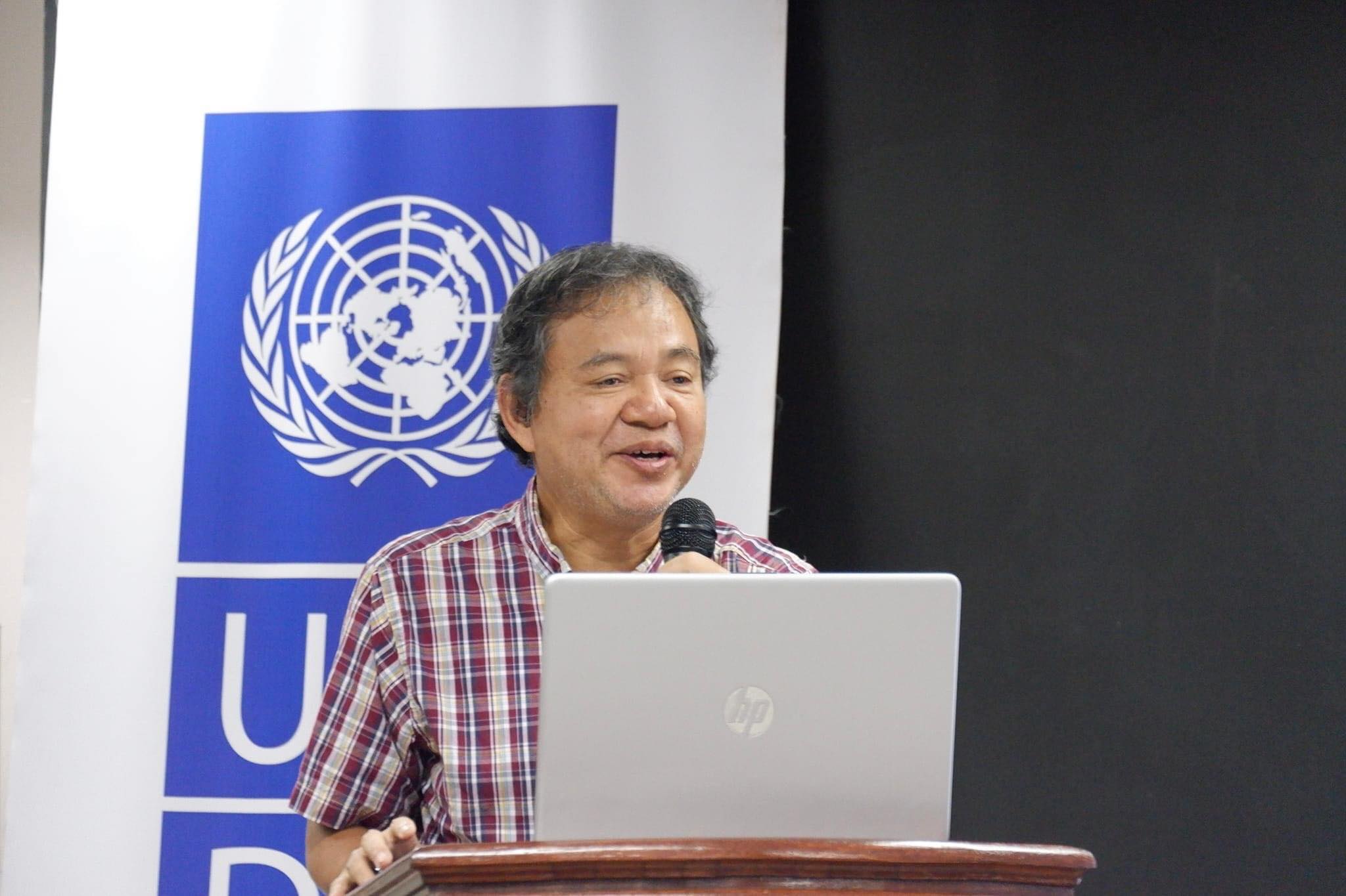 Dr. Ricardo Sigua of the National Center for Transportation Studies presented the highlights or key features of the master plan. The UNDP engaged NCTS to conduct the master planning project for DOTr. (Photo: DOTr Facebook page)
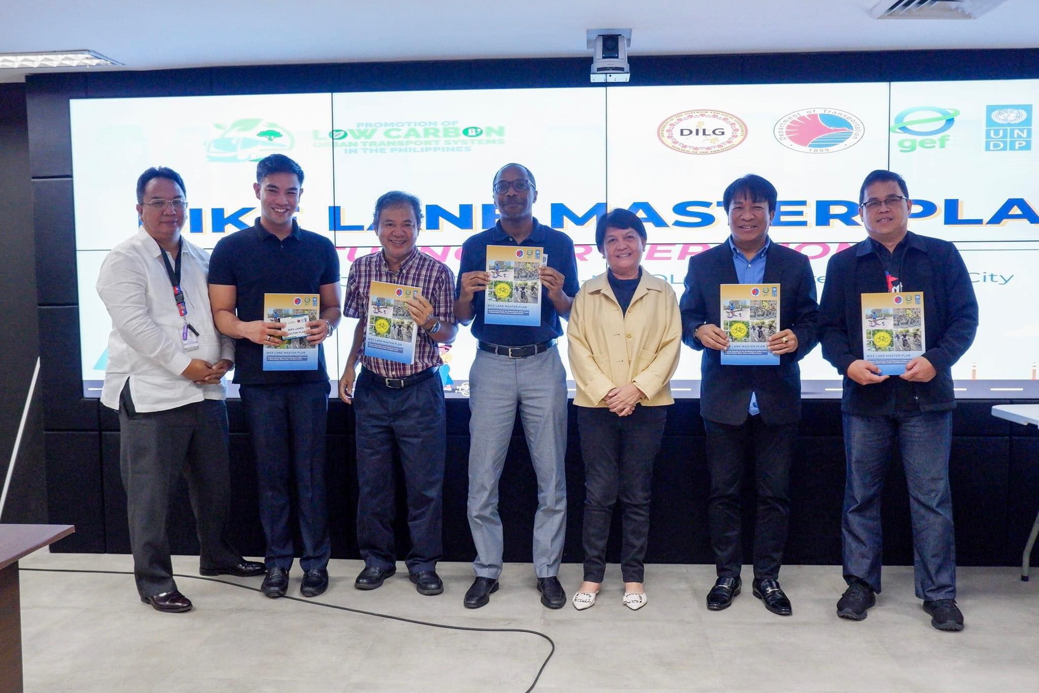 Photo op with participants from the MMDA (Photo: DOTr Facebook page)
While the master plan is most welcome as the country continues to build infrastructure for active transport (mainly walking and cycling), the launch is actually one year late. The project was actually completed last year and though most of the recommendations have yet to be carried out, many items including the inventories are already dated. These master plans though should not be static documents but dynamic in these sense that it would have to be updated regularly. For one, updates would provide the opportunity to reinforce or improve certain aspects of the plan. Updates also provide an opportunity to check whether progress is being made on the targets set in the plan. Also, since the master plan is for three metropolitan areas perhaps it can be part of the foundation for a nationwide plan. However, many plans fail if there is not support or scarce resources allocated for the implementation. Thus, there is a need for resources or allotments especially coming from government to support the realization of the plan.
–
Article share: What’s Incomplete About Complete Streets?
The concept of road diets circulated in Metro Manila more than a decade ago. I recall the Metro Manila Development Authority (MMDA) picked up the concept and attempted to apply it in some parts of Metro Manila. Since there are no evidence of that endeavor surviving now, then we can assume that it was a failure. There is no wonder there as I also recall the effort to be half-hearted and more to get media mileage (cheap talk or lip service) out of it. Road diets eventually evolved into the complete streets (though the literature now will state road diets as part of complete streets). That experience and similar initiatives of varying success (or failure) rates are not unique to the Metro Manila but is actually happening elsewhere including cities in countries where the complete streets have been applied more comprehensively and yet somehow found to be lacking or not as effective a solution as expected. I am sharing an article here that discusses what seems to be lacking or ‘incomplete’ as it is referred to.
Source: What’s Incomplete About Complete Streets?
Quoting from the article:
“What’s missing? First of all, even the best Complete Streets policy can’t solve the problem of fiscal scarcity. Even in a city committed to Complete Streets, street redesign must fight for public dollars with other worthy goals such as education and public safety. As a result, Indianapolis’s improvements are a drop in the bucket. The city maintains 3,400 miles of streets and roads, so its 100 miles of bike lanes affect only 3 percent of the city. Similarly, 2,000 miles of the city’s roads still lack sidewalks.
Second, the quantitative benchmarks seem to focus on sidewalks and bike lanes (Sec. 431-806), and the policy doesn’t mention traffic calming or similar policies. So if the city had a six-lane road with traffic going 60 miles per hour, the Complete Streets policy would not affect that road except to the extent necessary to build a sidewalk or a bike lane.** Thus, even the best Complete Streets policies don’t really address some of the most dangerous features of American street design.”
—
