
Home » Pedestrian (Page 13)
Category Archives: Pedestrian
Vermont Royale pedestrian overpass
There was a comment on a previous article asking if the pedestrian overpass across Vermont Royale along Marcos Highway is already usable. The photo in that article showed a still-to-be modified overpass. Following are photos taken last Sunday of the overpass. It shows the lowered mid-section passing under the Line 2 extension structure.
 The modified pedestrian overpass across Vermont Royale along Marcos Highway
 That’s a pedestrian and a cyclist using the overpass
–
The Tagaytay transportation predicament
The title of this article is actually a bit tame and on the diplomatic side of trying to describe transportation and traffic in this city that was once relaxed a retreat for many. I had wanted to end February on a good note and so I decided to defer posting this until March.
We used to frequent Tagaytay and liked spending some rest and recreation time there to the tune of being there almost once a month at one time. Needless to say, at the time travel to Tagaytay from our home in Antipolo took us only about 2 to 2.5 hours excluding our usual stop at Paseo in Sta. Rosa, Laguna. We liked the city so much that we even considered making it a second home; even inquiring and looking at properties there.
Fast forward to the present and it has become an excruciating travel with the highways leading to the city already congested. It didn’t help that when you got there, you also had to deal with serious traffic congestion. This started not a few years ago when the city approved developments by major players including Robinsons, SM and Ayala. The developments by SM and Ayala proved to be the backbreakers with Ayala coming up with the first mall in the city and SM operating an amusement park beside its prime acquisition that is the Taal Vista Hotel. Now, there is another mall under construction by Filinvest and right at the corner of the rotonda where the Aguinaldo Highway terminates.
 Vehicles queue along the Tagaytay – Nasugbu Highway towards the Rotonda where Tagaytay traffic enforcers attempt to manage traffic but appear to create more congestion instead.
More on Tagaytay soon…
–
First call for papers for the TSSP 2017 conference
The first call for papers for the 24th Annual Conference of the Transportation Science Society of the Philippines came out last Wednesday, Feb. 15:
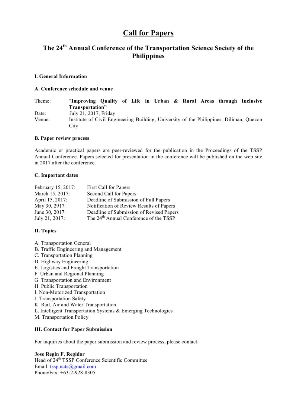
–
Commuting and stress
Here is another quick post but on a topic that’s related to health and therefore is something that I think many should be interested in and perhaps take important note of.
Commuting: “The Stress that Doesn’t Pay”
There are many links to various medical articles within the article. At the last part, there is also a list of references that the reader may want to look at. I’m also posting this for future reference. This would contribute to the formulation of topics for research especially the inter-disciplinary or collaborative kind.
–
Footpaths at the College of Engineering Complex, UP Diliman
There are newly constructed concrete footpaths connecting the buildings of the College of Engineering complex at the University of the Philippines Diliman. These are intended for pedestrians to be able to walk between buildings without worrying about weather-related concerns such as muddy paths during the wet season.
My colleague took the following photos while walking towards the Institute of Civil Engineering building from Velasquez Street where the university has a portal leading to its housing for faculty and staff.
 The concrete pathway is a significant improvement from the old dirt path that seemed to have been carved out of people’s trekking along this path over the last year or so.
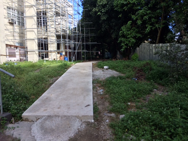 The path connects buildings at the area designated for the College of Engineering Complex. Many buildings such as the one above are under construction or to be constructed in this area.
 Much of the pathway goes through trees and other plants, preserving the greens already there that help provide a more enjoyable environment for walking.
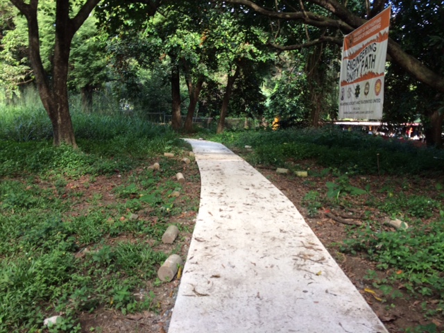 The pathway was dubbed the “Engineering Unity Path” as it connects buildings that are homes to individual institutes and departments that constitute the College of Engineering.
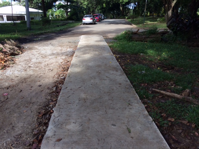 End of the road – one end of the foot path leads to Maramag Street and the driveway to the Executive House, the official residence of the UP President.
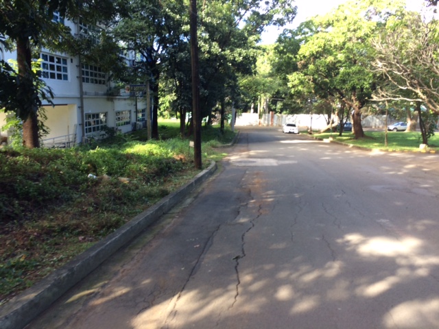 Maramag St. towards the Institute of Civil Engineering (ICE) complex with the ICE main building at left
While the pathway seems to be a permanent structure it is something I think is basically evolving just like the College of Engineering Complex. The complex already has a master plan but implementation towards a cohesive complex seem far from completion. For one, much of the complex covers a residential area in the university that has many (too many) informal settlers. And then there is the Executive House at the heart of the complex that probably needs to be moved elsewhere.
–
Another look at Marcos Highway overpasses – Part 3
The overpass at SM City Marikina is a bit more complex than what it looks like across the bridge. Here are some photos of the footbridge connecting the mall with the Santolan Station of Line 2:
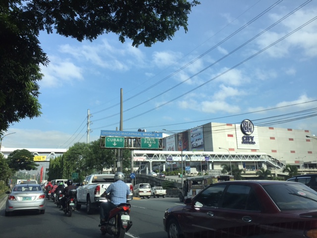 The overpass is a very long one and provides users with a partially covered walkway connecting to the LRT Line 2 Santolan Station. I say ‘partially’ because the roof over the overpass extends only across Marcos Highway.
 Note the covered bridge is only until the other side of Marcos Highway. From there it is an open overpass as shown at the left in the photo above.
 A closer look at the SM Marikina overpass shows just where the cover ends. There are stairs here leading to the loading/unloading bays across from the mall. There is also a path that leads to stairs to the public transport terminal under the bridge. There is a sign with a blue background in the photo stating the terminal is named after a former MMDA Chair who was also a mayor of Marikina and currently one of its congressmen.
–
Another look at Marcos Highway pedestrian overpasses – Part 2
I purposely didn’t include the overpasses at and near the Masinag Junction because I felt they deserved their own article. For one, the area will be the location of the future end station of the current LRT Line 2 Extension project. Here are a couple of photos of the overpasses in the area.
 Overpass at SM City Masinag – note the tall columns for the elevated tracks of Line 2. Will the Masinag Station be located that high or will it be at a lower level, perhaps closer to the SM City overpass?
The overpass at SM City Masinag is something that has been replicated in many other locations where an SM mall has been constructed. Note the similarity of the situation with the likes of SM City Iloilo, SM City Novaliches where SM built pedestrian facilities to allow for safe crossings between the mall and the area across from it along the highway. In many cases, it is the mall which provided the overpass in coordination with the local government unit and, I assume, the DPWH.
 Overpasses at Masinag Junction – there are actually 4 bridges here, each spanning one leg of the junction.
One of the intents for these is to eliminate at-grade pedestrian crossings at the junction. While crossing have been reduced significantly, there are still many “pasaway” who cross even when there is a green light for vehicular traffic along the leg they are crossing. Traffic enforcers here are quite lax about this and don’t seem to put in an effort to inform people about the overpass. There is no excuse for those who might claim they are too old or weak to climb the steps since the overpass has 4 working elevators for those unable to make the stairs. I noticed though that most of those using the elevators are able bodied people who probably are just too lay to take the stairs.
–
Another look at Marcos Highway pedestrian overpasses – Part 1
My daily commute allows me to have a look at the progress of the LRT Line 2 Extension construction. I also became curious about the situation of the pedestrian facilities along Marcos Highway particularly the crossings since many at first seemed to be affected by the elevated rail structure that was to be built. Now, we already have a good idea of the fates of these pedestrian overpasses. This article shows the conditions/situation of pedestrian overpasses (also called footbridges) along Marcos Highway. Most overpasses are not covered; exposing pedestrians to the elements. Most are also made of steel, which can be traced to the MMDA’s (and later the DPWH’s) preference for these structures.
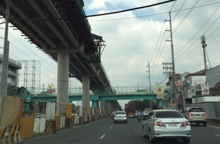 Overpass near Filinvest East-Vermont Park gates – the overpass actually is between a technical college and the commercial building across from it.
 The overpass across from Vermont Royale in front of a new Shell service station was actually among the newest facilities along Marcos Highway. Apparently though, it was built without considering the impending construction and design of the Line 2 extension. As such, the overpass needs to be modified or would have to be reconstructed elsewhere near the area.
 Overpass at Town & Country Executive Village that is also near the San Benildo School
 Overpass at Marcos Highway-Felix Avenue-Gil Fernando Avenue intersection – is probably the busiest among the pedestrian overpasses as it is at a busy junction where there are major commercial establishments (i.e., malls) and where many public transport routes converge.
 Robinsons Metro East overpass – this one also survived the clearance requirements with respect to the elevated superstructure for the Line 2 extension. However, since one of the two stations to be built will be nearby if not right across (part of the station at least) from the mall, then the station itself may function as an overpass.
 Overpass at De la Paz – note the ramp for bicycles and wheelchairs. This is one of the more bike- and PWD-friendly facilities along Marcos Highway. The slope is gentle enough for pedestrians, too, especially senior citizens who might have difficulty with steps.
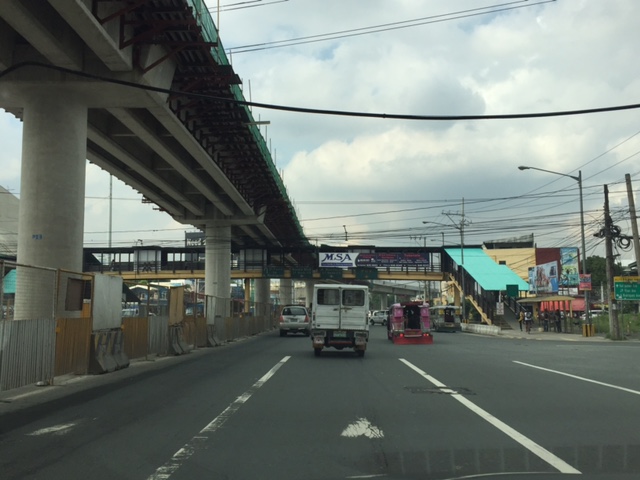 Overpass at Ligaya – this one also has ramps that make it easier for people to use to cross the busy highway. This will eventually be the closest overpass to the huge Ayala mall (Feliz) currently under construction at the Marikina side of Ligaya. I suspect that there might be a need for another overpass to be built with respect to the mall for one to directly serve the mall’s customers.
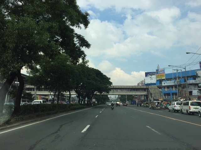 Line 2 Santolan Station overpass connects the Marcos Highway westbound public transport stop with the rail station along the eastbound side of the highway.
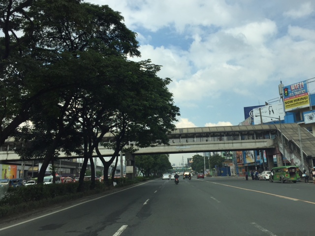 A closer look at the Santolan Station overpass, which is used by a lot of Line 2 passengers who cross the highway to continue on their journeys/commutes via train from their origins in Rizal, Marikina and Pasig. During the mornings, the observer will see a lot of jeepneys and UV Express vehicles emptying of passengers who cross the bridge to get to the station.
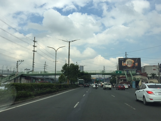 Santolan footbridge – this is actually more complicated than what is seems in the photo because the steel footbridge also connects to the SM City Marikina overpass (which is not included in this compilation but is visible in the photo). The footbridge branches to provide and almost direct connection between the mall and the Line 2 Santolan Station. That structure is shown at
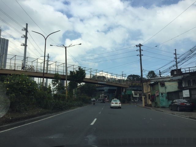 Monte Vista footbridge allows people to cross Marcos Highway (at its Marikina/Quezon City end) to and from A. Bonifacio Avenue, which is in Marikina City (Barangka)
More on pedestrian overpasses in the next post!
–
Mobilizing sustainable transport for development
The United Nations (UN) has recently published a new report on “Mobilizing sustainable transport for development” authored by a High Level Advisory Group on Sustainable Transport formed by the UN. The report and other resources may be found at the following website:
Secretary General’s High Level Advisory Group on Sustainable Transport
This is under the UN’s Sustainable Development Knowledge Platform. You can check out the other materials at the website. The UN has many initiatives on sustainable transport and has been very active in promoting or advocating for sustainable transport for a long time now. It is through the UN Centre for Regional Development (UNCRD), for example, that the Philippines and other ASEAN countries were able to formulate their national EST strategies. The new report continues on the UN’s commitment to promote sustainable transport to improve people’s lives around the world.
–
Global Street Design Guide
Here’s another quick post. I just wanted to share this article with a link to a Global Street Design Guide that was developed by the National Association of City Transport Officials (NACTO) in the United States (US). It’s a nice guide that’s based on the experiences of many cities in the US including transformations that have made commuting more efficient, enhanced mobility and, most important of all, improved safety. Following is the link to a more direct link to the guide:
NACTO and the Global Designing Cities Initiative Release Global Street Design Guide
This will be a good reference in the Philippines where many cities are in need of transformation to address current and future challenges in transportation. Planners, engineers and students should read this and use it to make our streets safer and more efficient in terms of mobility for all. It would be nice to see fresh ideas on how we can improve our streets not just in Metro Manila but elsewhere across the country. Of course, it would be nice if city planners of local government units (LGUs) can adopt this design guide parallel with efforts to improve public transport services. It should be understood that simply imposing lane allocations and traffic flow policies (one way?), for example, will not solve problems but may create more. The approach should always be integrated, inclusive. In other words, complete.
–

