
Home » Pedestrian (Page 15)
Category Archives: Pedestrian
Some interesting (and required) readings on traffic engineering
Christmas breaks allow me to catch up on a lot of reading. The previous months comprising our university’s semester were spent preparing for lectures though I had to do some readings related to researches I am involved in. Browsing the net and social media, I came across 2 articles shared by an acquaintance. He is a very progressive planner who has extensively studied and written about the most relevant issues in urban planning, focusing on transport. A third article I found while reading one of the two. These were very interesting for me in part because they are thought provoking in as far as traffic engineering is concerned.
- What traffic engineers can learn from doctors
- As traffic deaths rise, blame engineering dogma
- The new science of traffic engineering
The author seems to call out traffic engineers in general but these articles should also be contextualized properly. The situations mentioned in the articles are to be found in cities in the United States and may not be applicable in other cities in other countries. Traffic engineers in Europe, for example, have been working on exactly the solutions being mentioned in the articles that would make streets inclusive and safe especially for pedestrians and cyclists. The same with Asian cities like Singapore and Tokyo.
In the Philippines, however, there is so much that we can learn from the articles. The mere mention of the design guidelines being used in the US betrays the flaws of highway and traffic engineering in the Philippines. The Philippines’ highway planning manual and other guidelines used by the Department of Public Works and Highways (DPWH) are heavily drawn from US references. Most highway and traffic engineers in the country are educated using curricula that use US textbooks and references. There are even civil engineering programs that use licensure exam review materials as their references! These exam materials are also known to be based on DPWH guidelines and manuals aside from problems “outsourced” or patterned after the Professional Engineer (PE) exams in the US. Few schools have progressive curricula that look to best practices that take into account the complexities of roads especially in the urban setting. Such ‘copying’ of American standards and practices in many cases do not consider Philippine (local) conditions and blind applications to our roads instead of proper adaptation often have lead to unsafe and inequitable roads.
–
Another look at Iloilo’s main bikeway
Much has been written and said about Iloilo’s bikeways and particularly about the grander one built along the main highway that is Ninoy Aquino Avenue. This bikeway is already usable but is being extended along with the road widening works for the national road that connects major towns in central Iloilo province including Sta. Barbara and Cabatuan, which host the international airport. Here are some photos and commentaries on the bikeway.
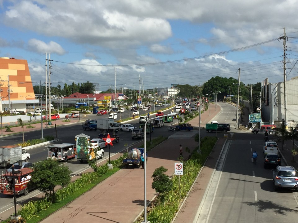 Iloilo City’s wide bikeway along Ninoy Aquino Ave (formerly the Iloilo Diversion Road) – the building on the left is SM City’s recently opened expansion. The photos were taken from the pedestrian overpass across the diversion road.
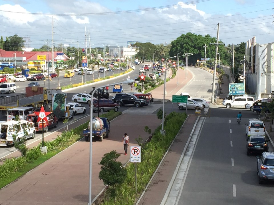 A closer look of the traffic conflicts at the intersection with Jalandoni Street – the 3-leg intersection is not as simple as it initially looks because of traffic coming from/going to the service road on the right. It is quite obvious in the photo that the alignment of the service road changes abruptly, affecting the trajectory of flow along the road.
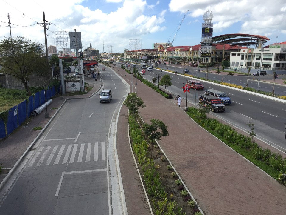 The photos were taken around 9:30 AM and there was practically no bicycle traffic to be seen. To be fair, perhaps there is significant bicycle traffic, particularly the commuting kind, earlier in the morning and later in the afternoon. Bicycle volumes need to be measured and monitored to determine if the bikeways indeed have encouraged more people to take up cycling as a mode for their regular commutes. That’s the Plazuela in the background on the right.
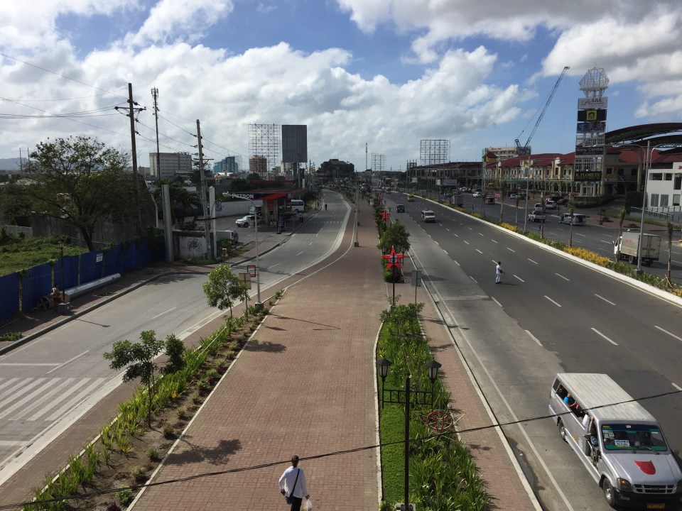 Another look at the bikeway shows it emanating from Iloilo City proper where it ultimately connects to the bikeways at the Promenade along Iloilo River. There are no bikeways within Iloilo’s CBD itself.
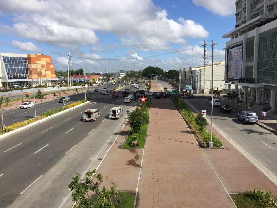 The photo above shows the bikeway and beyond (towards Jaro and Pavia) with the new SM annex at left and the Injap Tower Hotel on the right.
–
Differences: pro-walking vs. anti-car
I came across this article posted at the Planetizen site entitled Pro-Walking, or Anti-Car. It is a good article that heads-on addresses the the differences of being pro-walking to that of being anti-car in terms of transport policies in cities. I think these concepts including the “nuts to crack” list provided by the author is relevant not only to cities that want to promote walking and cycling over car use, but to individuals and groups as well who seem to be following a hard line when in comes to their advocacy to recover road space in favor of pedestrians and cyclists.
Encouraging and providing incentives for walking
A friend based in Singapore posted a photo showing a poster promoting a ‘National Steps Challenge’. The objective apparently and obviously is for Singaporeans and foreign nationals living there to get into walking. The target, according to the poster, is 10,000 steps per day. There are even illustrations in the poster showing estimates of how many steps you can do at the home, the office or during your regular commute.
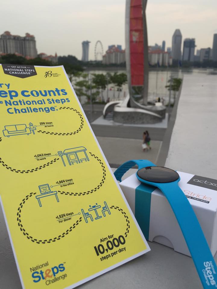 [Photo courtesy of Engr. Joy Garcia]
Such programs are exemplary and are aimed at boosting citizen’s health and welfare. Of course, Singapore can do this and many will respond even without rewards because Singapore has excellent transport infrastructure including an extensive public transport system and suitably designed pedestrian facilities.
Can cities in the Philippines come up with a similar challenge? Are there cities with good enough pedestrian facilities that can lead the way and become good practice examples in promoting walking; not just for the reason of commuting but also as a means to achieve better health among its citizens? Authorities can even include infographics on promotions showing the number of calories you can burn for typical walking trips as well as the health benefits one can derive from walking regularly. I think there are many cities that have decent infrastructure and attractive routes to promote walking. Among them are Vigan City, Marikina City, Legazpi City, Iloilo City and Davao City. Hopefully, these cities can take the cue from Singapore in promoting walking and perhaps, too, a national agency like the Department of Health can pitch in to promote this worthwhile cause for healthier lifestyles.
–
Unprepared and incomplete – realizations from the APEC transport experience
Before I forget about what transpired during the holding of APEC in Manila a week ago, here’s a couple of photos I found over the internet and shared via social media.
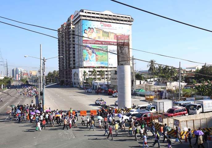 Commuters along Roxas Boulevard walk past a column of the unfinished NAIA Expressway, one of the transport infrastructure projects that has not been finished. [Photo from The Manila Bulletin]
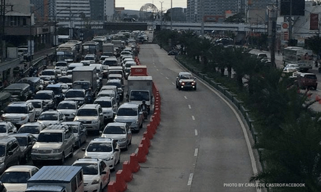 APEC lanes and severe traffic congestion along EDSA – there’s an opportunity here for a prrof of concept test for BRT. [Photo from Facebook]
I saw many memes and read some articles mentioning BRT specifically as one solution to Metro Manila’s transport problems. The second photo above was modified to replace the car travelling along the APEC lanes with a bus.
It is easy to imagine what could have been if the government decided to use the event and the lanes they allocated for APEC vehicles to do a ‘proof of concept’ run of BRT services or at least express bus services (what some DOTC people call high quality bus services). Perhaps what could have been done for part of the 10 billion PHP expended for APEC was to buy a fleet of brand new buses and provided these for free public transport for people who would need to commute during APEC. Services along two corridors would have sufficed – these two would have been EDSA and Roxas Boulevard. [The other option would have been to talk to bus operators and cooperate with them to organize express bus services along EDSA and Roxas Blvd.] Aggressively promoting these free services ahead of APEC would also have meant commuters, including those who usually used their own vehicles, could have opted for these transport services and not affected by the ‘carmageddon’ that ensued over that period. There should have been services to the airport terminals, too, but I will write about this in another article.
The dry run could have yielded essential data for assessing the feasibility of such bus services as an alternate to rail systems that would take much time to build. Incidentally, if the LRT Line 1 Extension to Cavite was built right after the current administration took over, that line could have already served tens of thousands of passengers from the south who regularly commuted to Metro Manila for work and school. The first photo above does not lie about just how many people could have benefited from that rail project. Meanwhile, MRT Line 3 remains dysfunctional and with its reduced capacity could not handle the demand for transport that it should have been able to carry if services had not deteriorated over the years.
–
Working with big data on transportation
There have been a few initiatives working on big data from government agencies whose responsibilities are primarily on transportation. Among them are past projects implemented by the University of the Philippines Diliman (UPD) and current projects being implemented by UPD, Ateneo de Manila University (ADMU) and De La Salle University (DLSU) with support from the Department of Science and Technology (DOST). While these projects are more oriented towards some specific objectives often linked to research & development (mandates of DOST and these academic institutions), there are still a lot of data out there that needs to be digitized, processed and analyzed. UPD has done this to some extent through its National Center for Transportation Studies (NCTS), which had been a repository for data and reports from DOTC and DPWH. However, the center does not have a funded program to undertake that repository or archival function it is expected to do. Despite much lip service from DOTC, DPWH and NEDA, no support has been extend by these agencies in the past many years.
I recently came upon this excellent work from a private firm specializing in data science. Here’s a link to one of their recent ‘stories’ showing us relevant statistics on road safety in Metro Manila:
http://stories.thinkingmachin.es/road-danger-pedestrians/
Their website says the data set the stats and graphs are based from are from the Metropolitan Manila Development Authority (MMDA), which maintains the Metro Manila Accident Reporting and Analysis System (MMARAS). This is good work and something road safety experts can use to be able to come up with programs and projects to improve safety in Metro Manila. I hope they could also get a hand of the DPWH’s Traffic Accident Reporting and Analysis System (TARAS) data that covers national roads. Unfortunately, the DPWH has stopped encoding TARAS data recently (the PNP still collects data though) so I am not sure how recent their data set is.
We need more of such work on a lot of data our agencies are producing including data from the Land Transportation Office (LTO) and the Land Transportation Franchising and Regulatory Board (LTFRB). Such information could be used to understand our transport systems including determining how to optimise supply and demand when combined with other data sets such as geographical information systems (GIS) and socio-economic data from the census.
–
Caught up in trAPEC
It’s a corny title to this post and perhaps is practically what people would call ‘click bait’. But then it is a very appropriate one considering it describes what happened last Monday and is still happening today and for the rest of the week affected by the Asia Pacific Economic Cooperation (APEC) forum hosted by the Philippines and held in Metro Manila. Yes, Metro Manila. And many people have been asking loudly or in their mind why the capital city when the government was supposed to be promoting and bragging about growth in other cities (inclusive growth anyone?). I would have thought and preferred to have APEC in either Subic or Clark, which have been touted as rapidly growing areas and as international gateways. In fact, Clark is being pitched as the location of a potential new city in the Clark Green City project as well as the aerotropolis currently being developed (slowly) near the airport and the SCTEX Clark South interchange.
Instead, we have the APEC forum and all its attendant activities in Metro Manila. And it seems that the forum has maximized its detrimental impacts on the economy as it practically shut (some people even say shat) down the capital because of severe traffic congestion and a lack of public transport infrastructure and services to carry commuters safely and efficiently between their homes and work places. The Manila Bulletin posted the following photo last Monday:
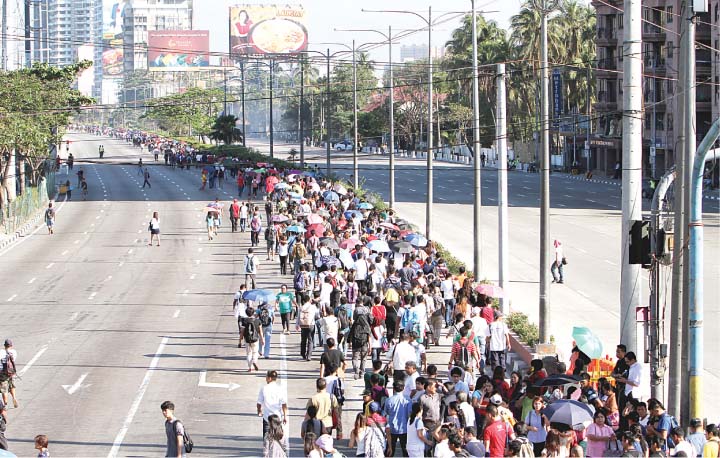 Commuters were forced to walk along Roxas Boulevard just to get to work.
Here are a few more photos courtesy of an old friend from high school:
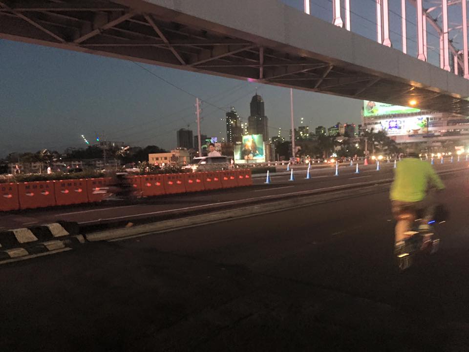 A lone cyclist pedaling along a practically empty section of EDSA (photo credit: Bong Isaac)
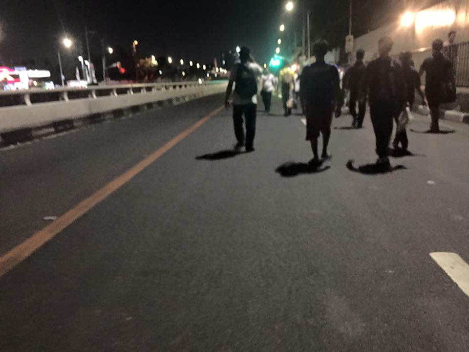 Walkers? – commuters took to walking along EDSA, one of the country’s busiest and most congested thoroughfares. I was amused of the memes about the ‘Walking Deadsa’ referring to people seemingly walking like zombies after a hard day’s work just to get home. (photo credit: Bong Isaac)
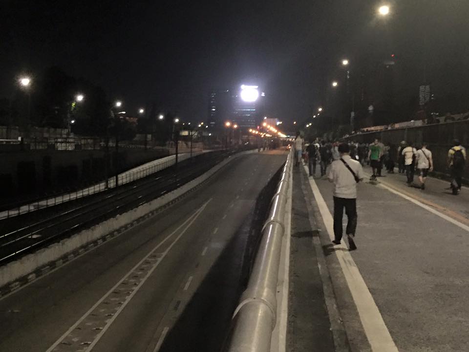 Commuters walking along a vehicle-less EDSA. The MRT 3 line at the left in the photo also seems to be ‘lifeless’ at the time (evening I was told) the photo was taken. (photo credit: Bong Isaac)
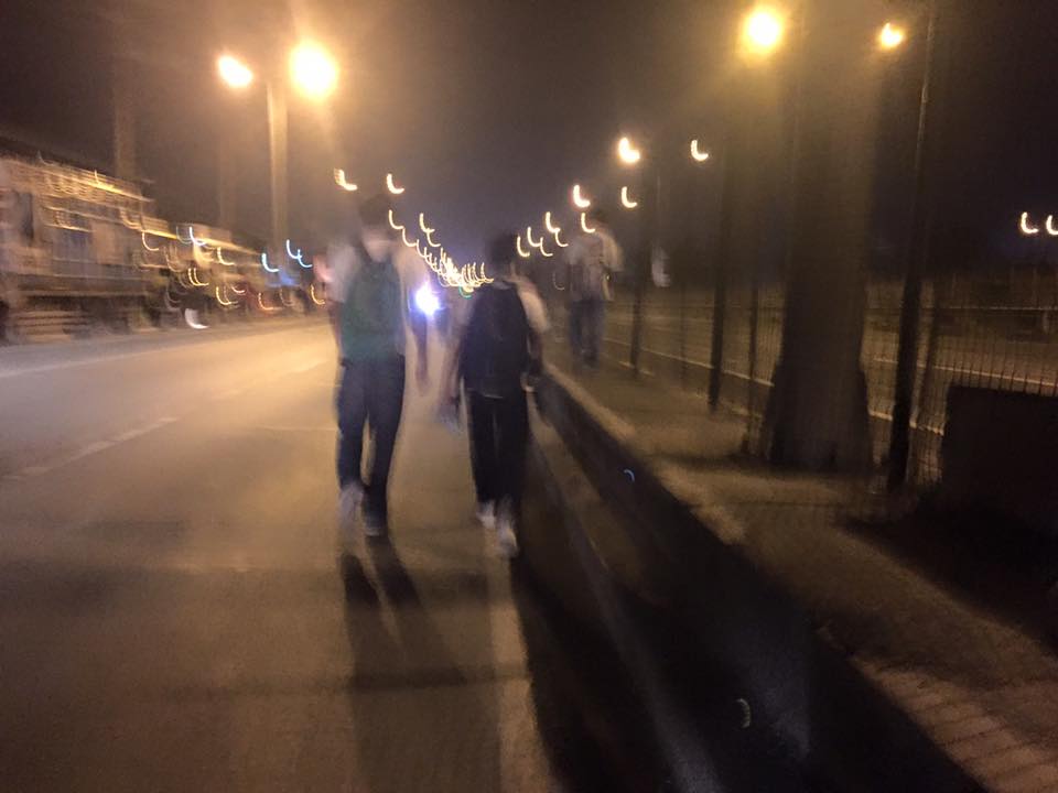 People walking along the service road along the SLEX – most affected of the road closures were people from the southern parts of Metro Manila including those from Laguna and Cavite. (photo credit: Bong Isaac)
I remember being asked once during an interview if it was possible to determine the cost of congestion due to a single event such as a road crash or perhaps a rally. I replied that it is possible given the available tools and expertise in making such assessments. What could be the cost of such a week-long event? Would the holidays for Metro Manila have lessened the economic impacts on traffic of the APEC? Or was it assumed that agreements and the media mileage we got from APEC more than enough to cover economic losses?
Could this disastrous traffic mess have been averted or at least mitigated despite APEC in Manila? Yes, perhaps, if the transport infrastructure particularly the LRT Line 1 Extension to Cavite, the upgrading of the MRT Line 3 and an airport access transit system were completed prior to APEC. These along with other major projects for Metro Manila were promised years ago and yet have not been realized. Add to this the apparent lack of contingencies (BRT-like express buses? bicycles?) that could have eased the pain of hundreds of thousands of commuters affected by APEC traffic schemes. Government has no right to tell people “I told you so” when government efforts for the benefit of its own commuting citizens have been deficient these past years.
–
Antipolo public market pedestrian overpass
I took some photos atop the pedestrian overpass connecting the New Antipolo Public Market and the Robinson’s Place mall. The overpass is across Sumulong Highway, which terminates nearby at the intersection with Antipolo Circumferential Road (Daang Bakal), which is currently being widened.
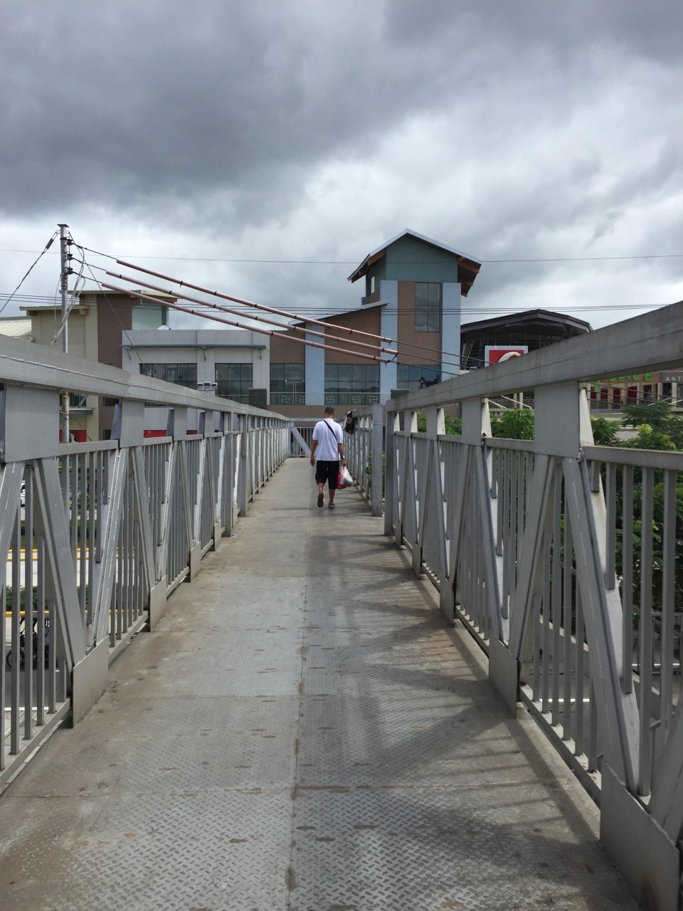 The overpass is a steel structure, including the flooring, which reminded me of factories. This industrial look is not new as there are other overpasses that have been constructed in Metro Manila similar to this.
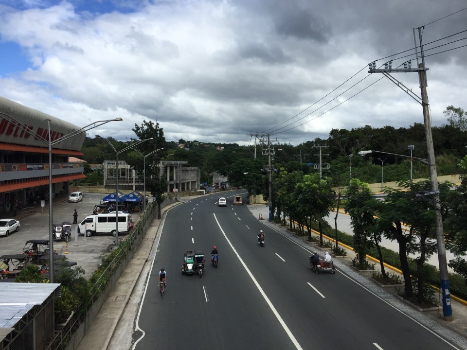 A look at Sumulong Highway towards Masinag. The highway has 4 lanes and at this section has sidewalks on either side of the road. There is no median island to separate opposing flows of traffic. The Antipolo Public Market is on the left side.
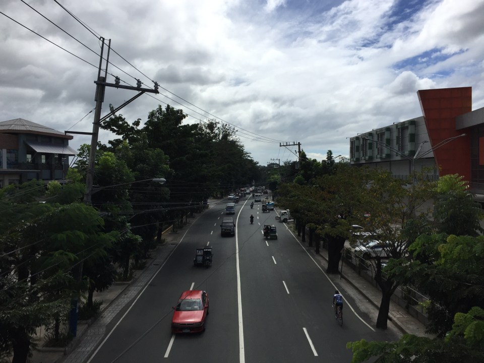 A view of Sumulong Highway towards the Antipolo Shrine of Our Lady of Peace and Good Voyage. The Public Market is at the right and the mall is at the left.
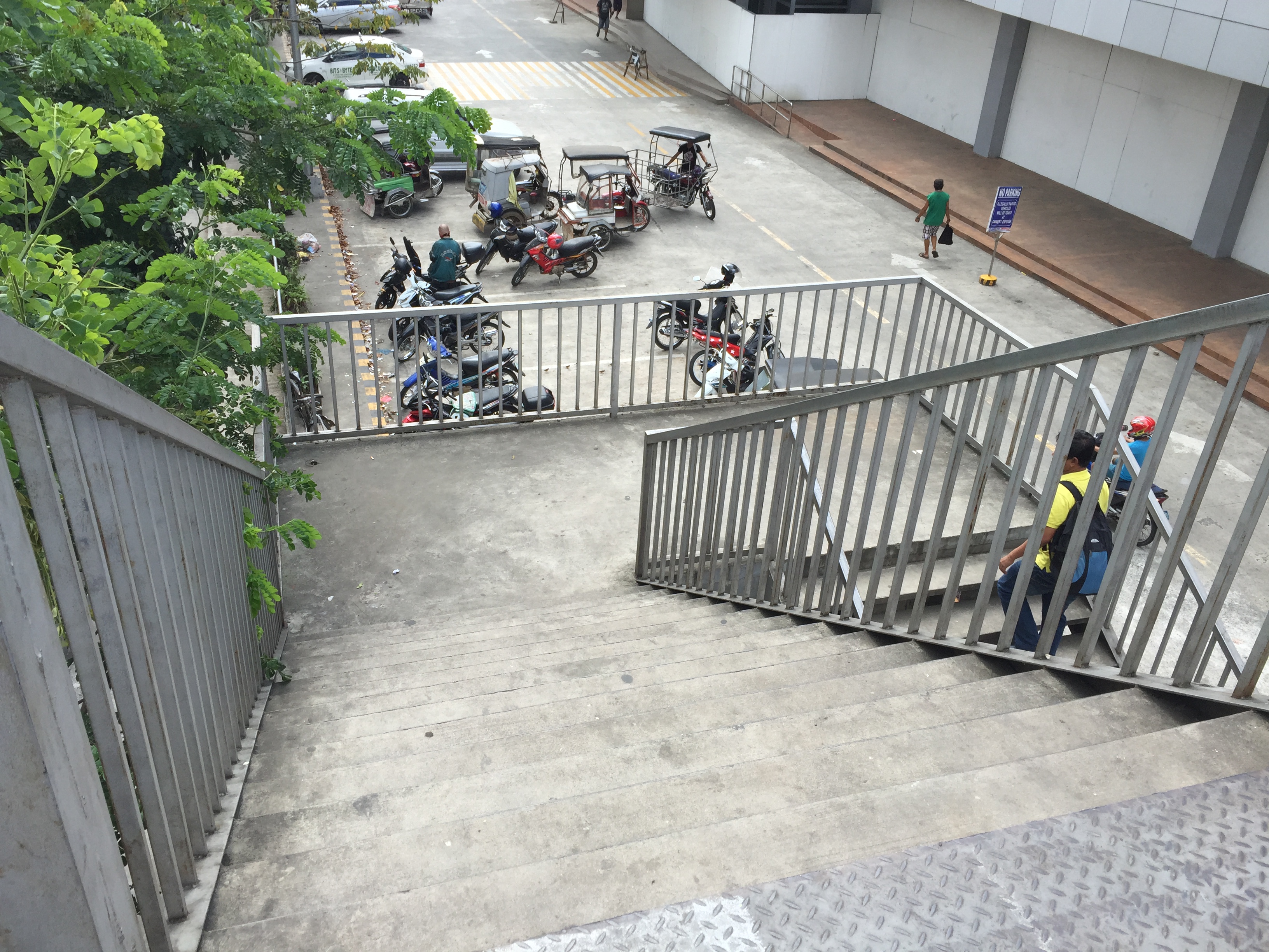 The overpass’ stairs are a bit steep and perhaps not so friendly to senior citizens. There should probably be a ramp for persons with disabilities or for cyclists to use as they carry their bicycles to cross using the overpass.
Despite calls from some advocacy groups for pedestrians to be prioritised and for them to cross at-grade, the reality is that we are still far from achieving safe roads for pedestrians given the way motorists run their vehicles. In the case of Antipolo, many jeepneys, UV Express and tricycles (freely roaming the city) are operated by reckless drivers. Private vehicle drivers are not so different and I have seen scenes of road crashes along Marcos Highway and Sumulong Highway where those involved are private vehicles including motorcycles. Clearly, many of these people should not have driver’s licenses in the first place given their mindset when driving. So until this improves, pedestrians are safer when they do use these overpasses. Of course, that goes without saying that the location and design of overpasses need to be thought over carefully so that these facilities will be used and not just become white elephants.
–
Local papers presented at the EASTS 2015 conference – University of the Philippines
There were a lot of technical papers from Philippine universities that were presented in the recently concluded 11th International Conference of the Eastern Asia Society for Transportation Studies (EASTS 2015). In the interest of dissemination, I will be featuring a list of papers produced by leading universities in the Philippines that are doing studies on transportation. Following is a list of papers from University of the Philippines Diliman that were presented at the EASTS 2015 held in Cebu City last Sept. 11-13, 2015:
- Innovative Collection of Road and Traffic Data for Road Safety Audit (Aileen Mappala & Ricardo Sigua)
- Study on Safety of Railway/Highway Grade Crossings in the Philippines (Albie Clarito, Beverly May Ramos & Ricardo Sigua)
- Instantaneous Fuel Consumption Models of Light Duty Vehicles and a Case Study on the Fuel Consumption at Different Traffic Conditions in Metro Manila using Shepard’s Interpolation Method (Ernesto Abaya, Karl Vergel, Ricardo Sigua, Edwin Quiros & Jose Bienvenido Biona)
- Development of Drive Cycles and Measurement of Fuel Economies of Light Duty Vehicles in Metro Manila (Ernesto Abaya, Karl Vergel, Ricardo Sigua & Edwin Quiros)
- Selection of Metro Manila BRT Corridors Using Multi- Criteria Assessment (Ricardo Sigua & Cresencio Montalbo, Jr.)
- An Assessment of Walkability in a Medium-Sized Philippine City (Hilario Sean Palmiano, Sheila Flor Javier & Jose Regin Regidor)
- Traffic Noise Measurement, Perception, and Modelling in a University Campus (Hilario Sean Palmiano, John Carlo Villar & Michelle Monelle Quilatan)
- Assessment of Metro Manila Bus Fare Computation (Sylvia Chavez & Hilario Sean Palmiano)
- Estimating Road Roughness Conditions Using Ubiquitous Smartphones and Geographic Information Systems and its Application to Road Network Planning in the Philippines (Joel Cruz & Jun Castro)
- Fuel Economy and Public Utility Jeepneys Using 2% and 5% Coco-Metyl Ester (CME)-Diesel Blends (Edwin Quiros & Karl Vergel)
- Comparison of Fuel Economy of Fuel and Operating Characteristics of Diesel and Auto-LPG Jeepneys through On-Road and Vehicle Tests (Edwin Quiros, Karl Vergel, Ernesto Abaya, Ervin Santos & Jose Gabriel Mercado)
- Challenges of Urban Transport Development in Metro Manila: A look back at the last 40 years (Maria Sheilah Napalang & Jose Regin Regidor)
- An Assessment of the Public Necessity Concept for Estimating the Requirements for Public Transport Vehicle (Arnel Manresa, Karl Vergel & Jose Regin Regidor)
- State of Pavement Engineering in the Philippines and Implications on the Economic Life of National Roads (Maria Sheilah Napalang, Jose Regin Regidor & Nathaniel Diola)
- Planning Metro Manila’s Mass Transit System (Ricardo Jose, Daniel Mabazza, Jose Regin Regidor, Marco Stefan Lagman & Jonathan Villasper)
- Evaluation of Compliance of Dimensions and Selected Systems and Components of Customized Local Road Vehicles (CLRV) with Vehicle Regulations and Standards (Karl Vergel, Rachel Habana, Nonilo Peña, Loreto Carasi, Albert Mariño & Alorna Abao)
- An O-D Approach of Estimating Energy Demand and CO2 Emission for the Luzon Road Transport using Inter- Regional Passenger and Freight Flow Data (Marloe Sundo & Karl Vergel)
- Dignity of Travel: BRT Development in the Philippines (Cresencio Montalbo Jr & Colin Brader)
- Mending a Metropolis – Understanding Passenger Demand Across Metro Manila To Improve Road Transit (Nicholas Greaves & Cresencio Montalbo Jr)
- Accident Hotspot Mapping in Quezon City: The case of Katipunan Avenue (Jerome Ballarta, Nelson Doroy, Ishtar Padao & Cecil Villanueva)
Not included in the list are papers coming out of International Research Groups (IRG) as well as those where involvement by UP faculty were incidental to projects. Many of these papers will soon be posted on the official site of the International Scientific Committee of EASTS as part of either Proceedings or Journal of EASTS. Some may be nominated for the Asian Transport Journal (ATS), which is also published by EASTS.
Transportation research in UP Diliman is the most developed among schools doing research on these topics in the country. Papers came from a variety of disciplines and academic units including Civil Engineering, Mechanical Engineering, Urban Planning, Geography and History. These mostly were and are undertaken through the National Center for Transportation Studies (NCTS), which is with UP Diliman.
Next up: De La Salle University
–
EASTS 2015 – Cebu City, September 11-13, 2015
The 11th International Conference of the Eastern Asia Society for Transportation Studies (EASTS 2015) will be held in Cebu City this September 11-13, 2015. For information on the conference and program, check out their website here:
You can also download a brochure about EASTS here:
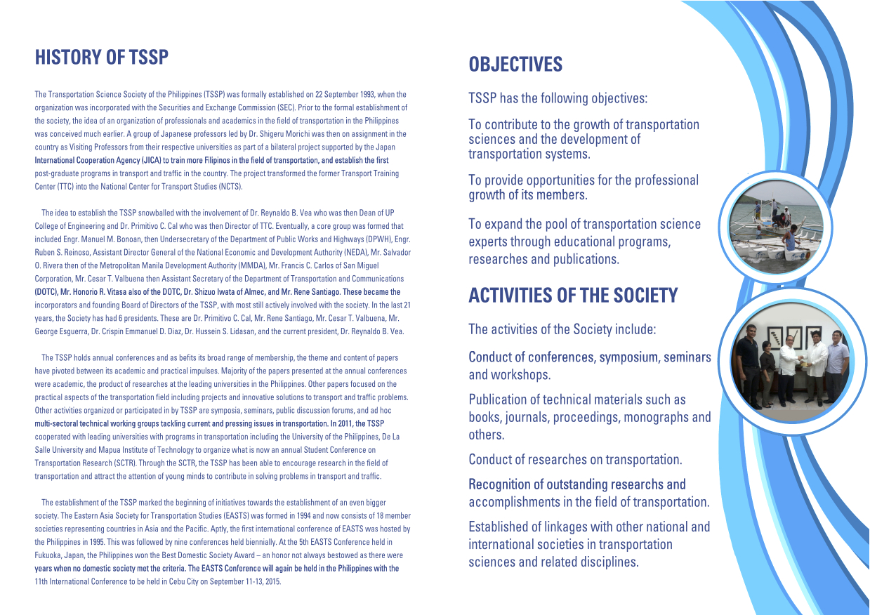
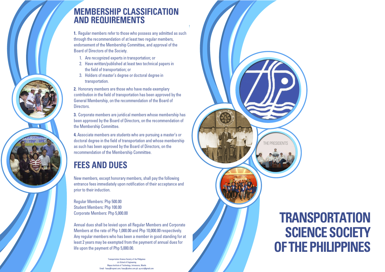
The conference is hosted by the Transportation Science Society of the Philippines (TSSP), which is the local affiliate of the EASTS. More information on the TSSP are found below:
–

