
Home » Pedestrian (Page 21)
Category Archives: Pedestrian
Morayta Street and some thoughts on reviving Manila
The University Belt in Manila is called such because of the proliferation of schools, particularly universities and colleges, in the area. Most recognizable are institutions such as the University of Sto. Tomas, University of the East, Far Eastern University, Polytechnic University of the Philippines, Centro Escolar University, Manuel L. Quezon University, San Beda College, San Sebastian College, La Consolacion College, National Teachers College and College of the Holy Spirit. The U-belt, as it is also known, stretches all the way to Intramuros and Padre Faura where many other institutions like UP Manila, Mapua, Letran, Lyceum, PNU and Sta. Isabel College are located.
The streets in the area are very familiar to many as they are usually indicated in the sign boards of jeepneys and buses plying routes in the area. These include Recto, Lerma, Espana, Legarda, Mendiola and Quezon Blvd. An ubiquitous street in the area is currently named Nicanor Reyes Sr., in honor of the founder of the Far Eastern University, the main gates of which are located along the street. Nicanor Reyes, of course, is more popularly known as Morayta for most people even the younger generation who picked up the old name of the street, which is more familiar with public transport drivers (jeepneys and taxis). Morayta connects Espana with Recto.
 Morayta Street (Nicanor Reyes St.) – Recto bound traffic with the FEU on the right side. There is practically two lanes per direction but one lane is usually occupied by parked or waiting vehicles. Add to this the operations of public utility vehicles as the street is along jeepney routes.
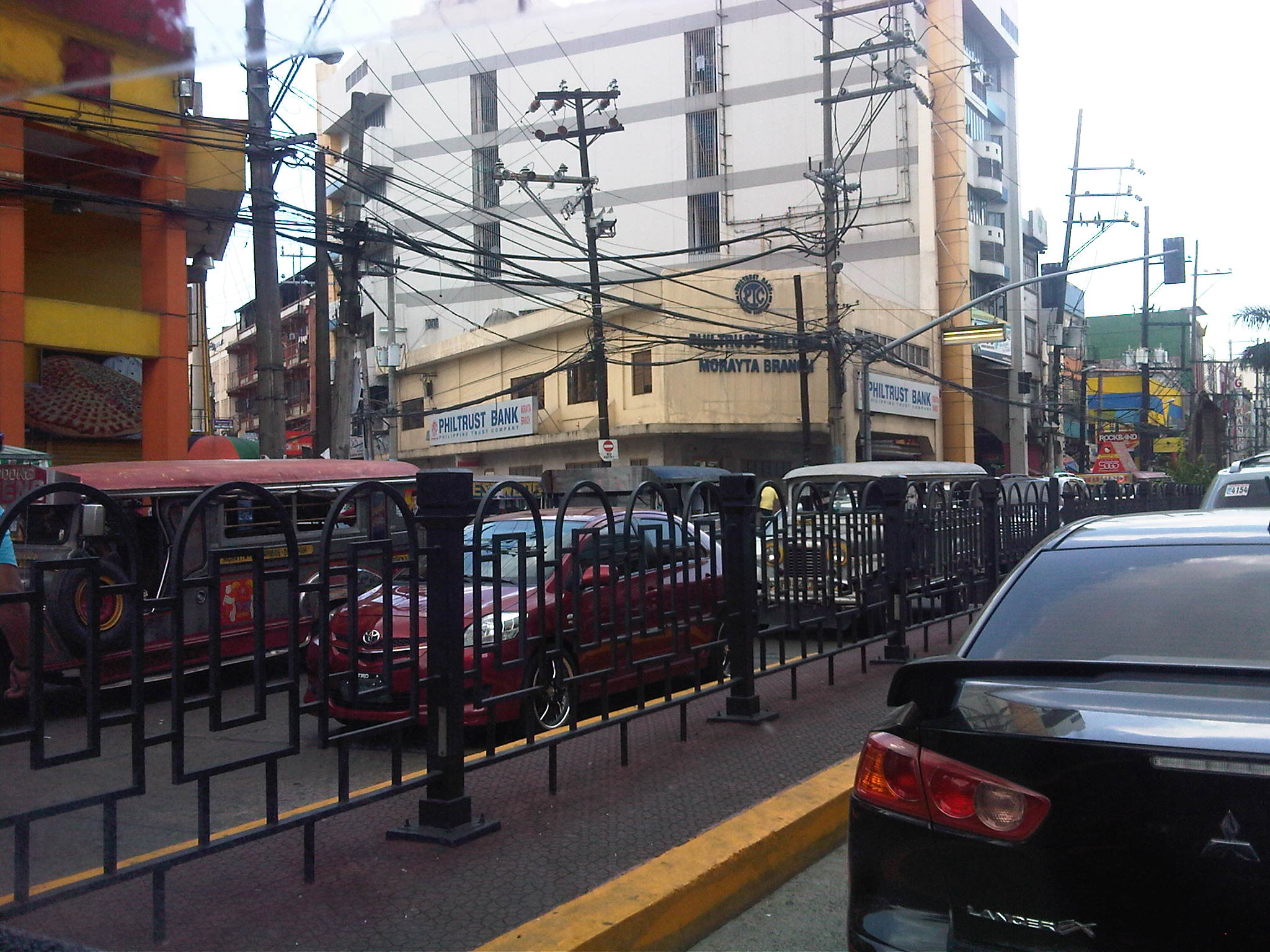 Railings – street railings on the median island along Morayta help minimize jaywalking along the busy street. There are no median openings for vehicles along the street though there are junctions like the one with R. Papa Street shown in the photo.
 Pedestrian traffic signal – there is a traffic signal along Morayta for pedestrians crossing the street in front of the FEU main gate. Such signals may be equipped with a button for on-demand green indications.
 Pedestrian flow – because of the schools, there are many students (generally in uniform) in the area. Each school would usually have a distinct uniform for females though some are generally in white with their school logos or IDs the only distinguishing aspects. Meanwhile, male students usually wear white polos and black pants. The photo above shows students crossing in front of the FEU gate. The photo also shows the typical commercial establishments in the area that include fast food and book shops.
 FEU main gate – the university has several access/egress points along Morayta including those for people only and this gate where vehicles may pass. Many universities (with only few exceptions) in the University Belt have very limited space with some having practically no campuses to speak of but only buildings where they conduct their activities.
 Parking and standing – parked and standing (waiting) vehicles occupy significant road space. While standing vehicles have their drivers and could be made to move, the parked vehicles generally take up a lane that could otherwise be used by pedestrians. I am not aware of any pay parking regulations along Morayta. There are no signs indicating pay parking schedules and rates, and have not seen parking attendants like the ones in Makati.
 Approach to Recto – the intersection with Recto Ave. is signalized and the median island is tapered to accommodate vehicles queuing to turn left towards Mendiola or Legarda. The LRT Line 2 superstructure is also visible in the photo above Recto. Pedestrians walk along the building arcades that are typical of most older buildings in Manila, which are similar to those in other old cities in the Philippines.
 Entry from Recto – the photo shows Morayta as our vehicle turned right from Recto. Taken during an April afternoon, there is very light traffic between Recto and R. Papa, and not so many students as those shown in the previous photos, which were incidentally taken during the morning of the same day. Note the vehicles parked on the curbside.
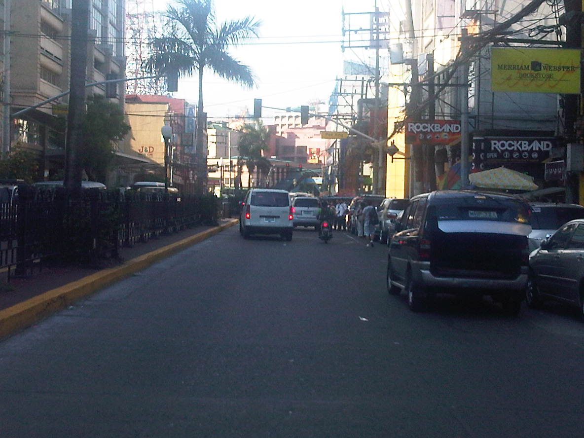 Build-up – approaching the signalized pedestrian crossing, we noticed some congestion due to the stopped vehicles and the presence of pedestrians. The section between R. Papa and Espana is usually congested due to several reasons including the presence of an informal jeepney terminal at the corner of Espana and Morayta.
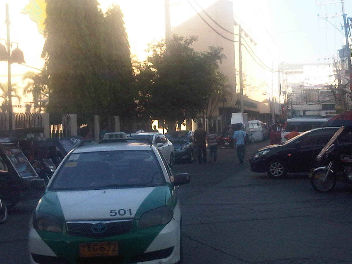 Junction with Paredes – a peek at Paredes St. shows more parked vehicles and tricycles lined up and waiting for passengers. Public transport demand along Manila’s side streets are served by tricycles and pedicabs, and until a few months ago by what were called “kuligligs.” The latter were also paratransit modes that were the motorized versions of pedicabs fitted with motors or generators much like the ones used in farm equipment or motorized bancas in seaside towns. These are called tricyboats in Davao. Meanwhile, the term “kuliglig” is used in many parts of Luzon for farm tractors used as public transport in the rural areas. Paredes St. is quite busy as the Professional Regulations Commission (PRC) is located along the street.
 Informal terminal – the approach to Espana is usually congested in part due to the informal jeepney terminal from the corner of the junction. Some jeepneys even tend to bypass the line and pick-up passengers right at the corner and often blocking turning traffic.
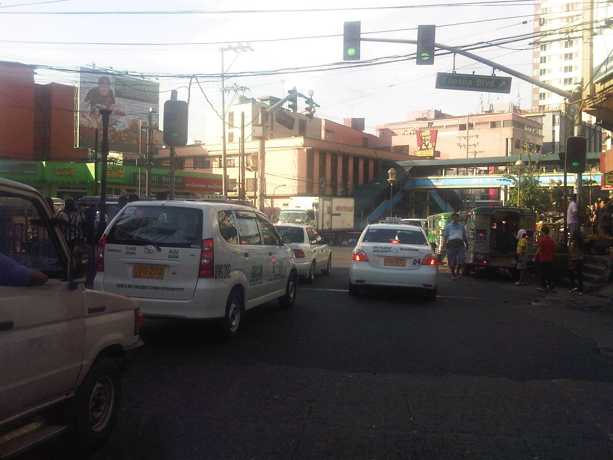 Approach to Espana – the intersection is signalized but there are jeepneys usually camped out at the corner, effectively reducing throughput along the intersection.
There are many streets like Morayta in Manila that can actually be evaluated and considered for pedestrianization if not for road diets. Careful studies and perhaps an experiment here and there should show the feasibility and practicality of generally closing some streets to motor vehicles including tricycles and jeepneys. For some streets, public transport access may be maintained but there should be genuine effort to improve pedestrian facilities to enhance the experience of walking in what are supposed to be historic streets in Manila. Considering the volume of foot traffic in the area, one would assume that the City of Manila should be thinking about how to bring down motor vehicle traffic while providing for public transport and walking needs in the city. Perhaps some radical plans need to be formulated including out of the box ideas to revive Manila streets such as Morayta? I would like to see the schools come up with these plans and perhaps be instrumental in implementing the same and not just for the sake of their students and staff who are exposed to pollution, congestion and safety risks on a daily basis. It can be done if people and institutions will collaborate to make it happen.
–
San Fernando, Pampanga Poblacion
I had the opportunity to do a project in San Fernando, Pampanga and went around the poblacion taking photos showing transport and traffic conditions in the old city center. To many travelers, perhaps the San Fernando they know is associated with what they see along the Gapan-San Fernando-Olongapo Road (also known as Jose Abad Santos Ave along this stretch in the city) after exiting the NLEX. There is much commercial development along the stretch of the highway between NLEX and McArthur Highway and of course, around the exit itself as mall giants SM and Robinsons have branches there. The “real” San Fernando is located only a few kilometers south from GSO via McArthur and the poblacion reveals a lot about the heritage or old character of the city and perhaps its potential for restoration as an example of urban development during the Spanish times.
Following are a collection of photographs from field work that we did in the city. We took a walk around the principal roads including McArthur, Tiomico, Consunji, Gen. Hizon., Abad Santos and Limjoco. Tiomico eventually becomes the Capitol Blvd. as it leads to the provincial capitol complex while Consunji becomes Sto. Nino Viejo when traversed westbound. The latter becomes Lazatin Blvd, which crosses GSO towards the north. Gen. Hizon appears to be the original alignment of the Manila North Road (McArthur), which passed through the heart of the city. Sometime in the not so distant past, a bypass road was constructed as traffic became constricted in the poblacion and many travelers not bound for San Fernando were inconvenienced by the congestion. This is clear from the maps of the area.
 Poblacion preview – The San Fernando cathedral as seen from the approach of the bridge along Gen. Hizon Ave. The bridge itself appears to be an old one. It is a two-lane structure and its lamp posts reminded me of a similar bridge in Melaka, Malaysia I saw only this year.
 The cathedral as seen from the bridge – the junction immediately after the bridge is Gen. Hizon’s intersection with Consunji Ave. The latter is one way eastbound so left turns are prohibited at the junction. Vehicles may go through towards Tiomico (the next junction right after the cathedral) or right where travelers will immediately see city hall on the right side of the road and just across from the cathedral; the typical set-up of most old towns in the Philippines.
 Gen. Hizon Ave. towards Tiomico – the commercial establishments around the cathedral are very similar to those you would in many other old cities and towns around the country. Pedestrians are supposed to take the arcade sidewalks just in front of the ground floors of the buildings on the left and underneath their second floors. These seem to be blocked by merchandise or stalls so some pedestrians take the street instead. The photo also shows typical on-street parking in the poblacion.
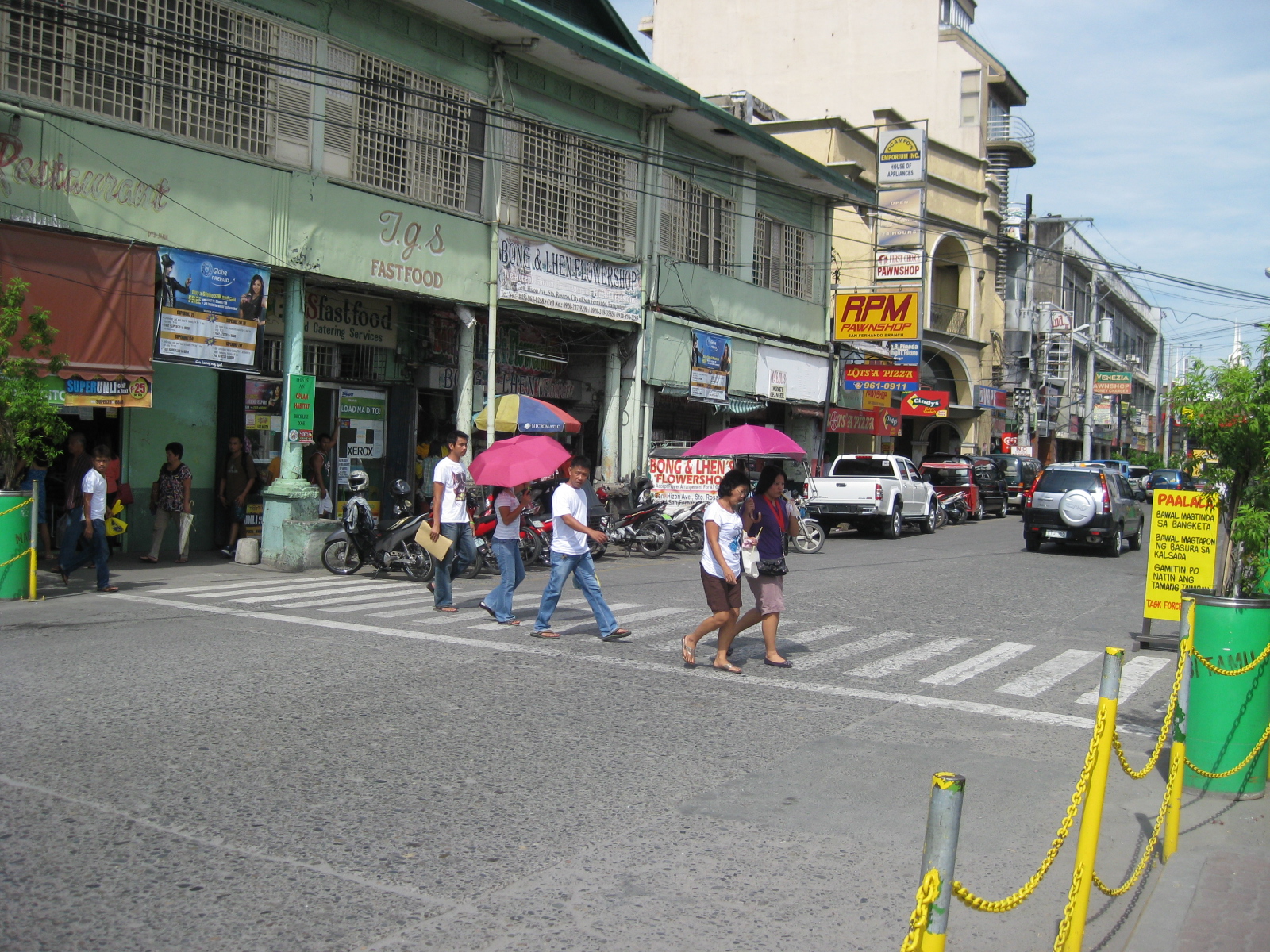 Pedestrian flow – the photo shows pedestrians crossing Gen. Hizon from the commercial establishments on the left towards the cathedral. The photo also shows people using the walkways integrated with the buildings (arcade), providing shelters against the elements, in this case the scorching sun.
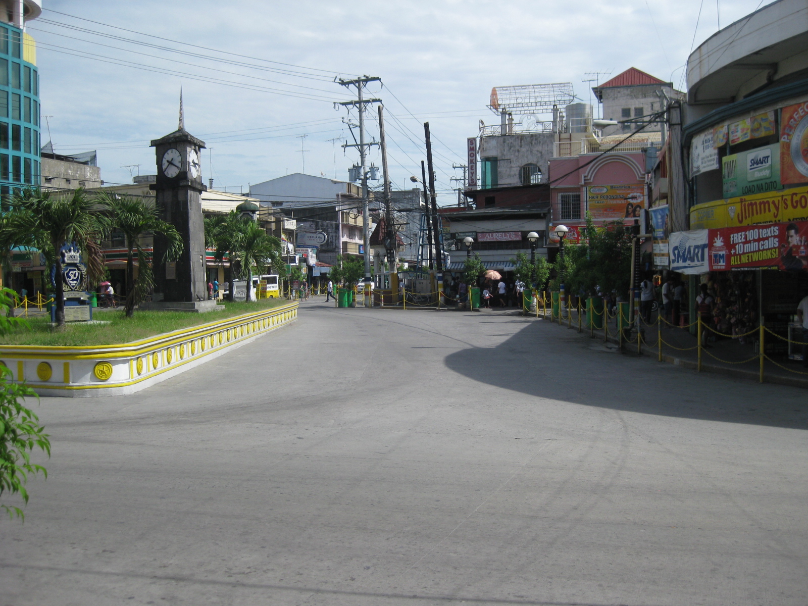 Rotonda? – at what seems to be the end of Gen. Hizon is a curious set-up which functions as a rotonda. Tiomico is also a one way street (westbound) and there is another intersection just ahead in the photo after turning right from Gen. Hizon.
 Off-set intersection – Gen. Hizon actually continues as B. Mendoza Ave. (which eventually leads to a junction with McArthur to the north) from the junction that is identified by the 7-Eleven on one of its corners that is visible in the photo. The public market is just across from the building housing the convenience store.
 City hall – the building is just across from the cathedral and the parking problems in the city are clear from this photo alone. City halls generate a lot of traffic due to the transactions, meetings and other activities associated with the institution. On weekdays, most parking in front of the building and across at the cathedral are probably by people with business at city hall. During Sundays, parking would be for church-goers.
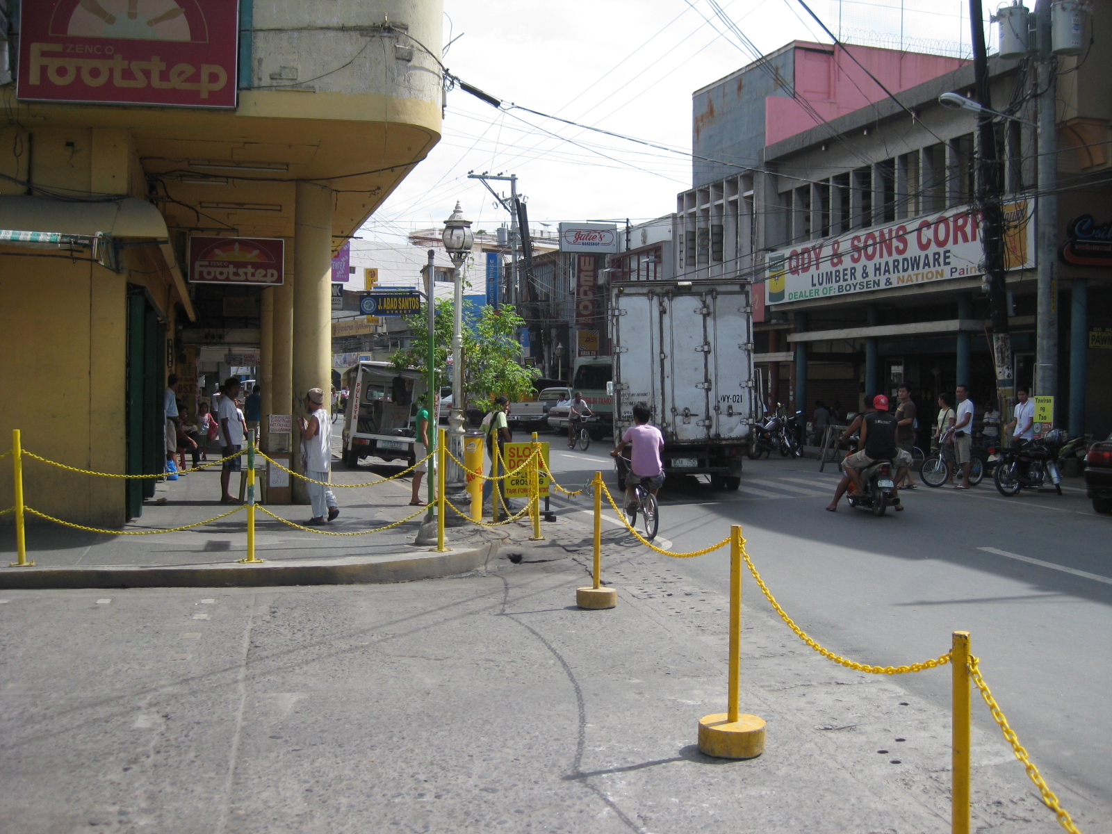 Walkways – the arcade/pedestrian walkways I were referring to earlier are much like the one shown in the left of the photo in front of a shoe store. The set-up allows for pedestrians to be shielded from the elements as they should be able to walk comfortably without getting wet during the rainy season or exposed directly to the sun during the summer. The street on the right is Consunji and leads to the public market, part of which is just behind the yellow building.
 Jose Abad Santos Street – the stretch was closed to motor vehicles at the time we walked around the poblacion. There was a sports event at the time and the street was being used for races – note the writing along the zebra crossing indicating the starting line for the race.
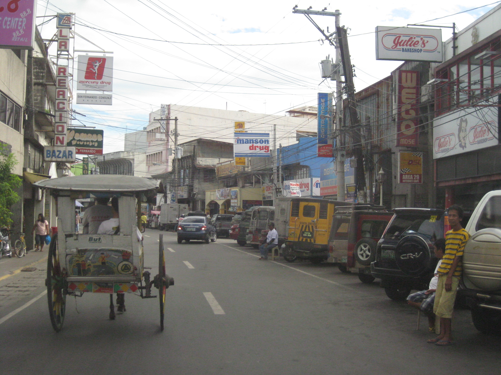 Consunji by the market – the one-way street is lined with commercial establishments and part of the street is used as parking, a common problem in other poblacions in similar cities.
 Prohibition? – this is Tiomico Street in the public market area. The sign on the lower left says 3-wheelers are not allowed along this stretch of the street and yet we found most of the vehicles to be exactly what is supposed to be prohibited – tricycles and pedicabs. The stretch could have been nice if it were developed into a pedestrian street instead with limited access to motor vehicles (perhaps for deliveries only?) much like those market streets in Japan.
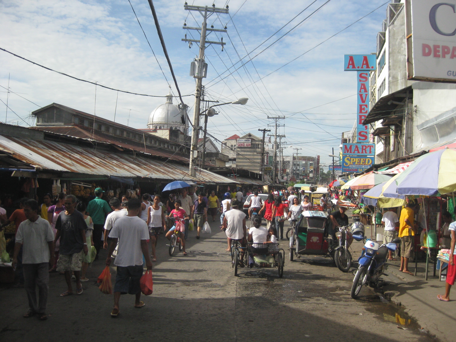 Typical mayhem – further down the street is a mix of people, bicycles, pedicabs, tricycles, and other motor vehicles. There’s potential here for re-development or transformation that would enable the revival of this commercial district that includes the public market.
 Blast from the past – aside from the typical tricycles and pedicabs providing for local public transport, we were a bit surprised that there were still calesas, or two-wheelers pulled by horses. At the time (2010), the kutseros or drivers charged PhP 10 to 20 (about 20 to 50 US cents) per passenger depending on the destination. These calesas are all registered with the local government, and they have license plates indicating their registration.
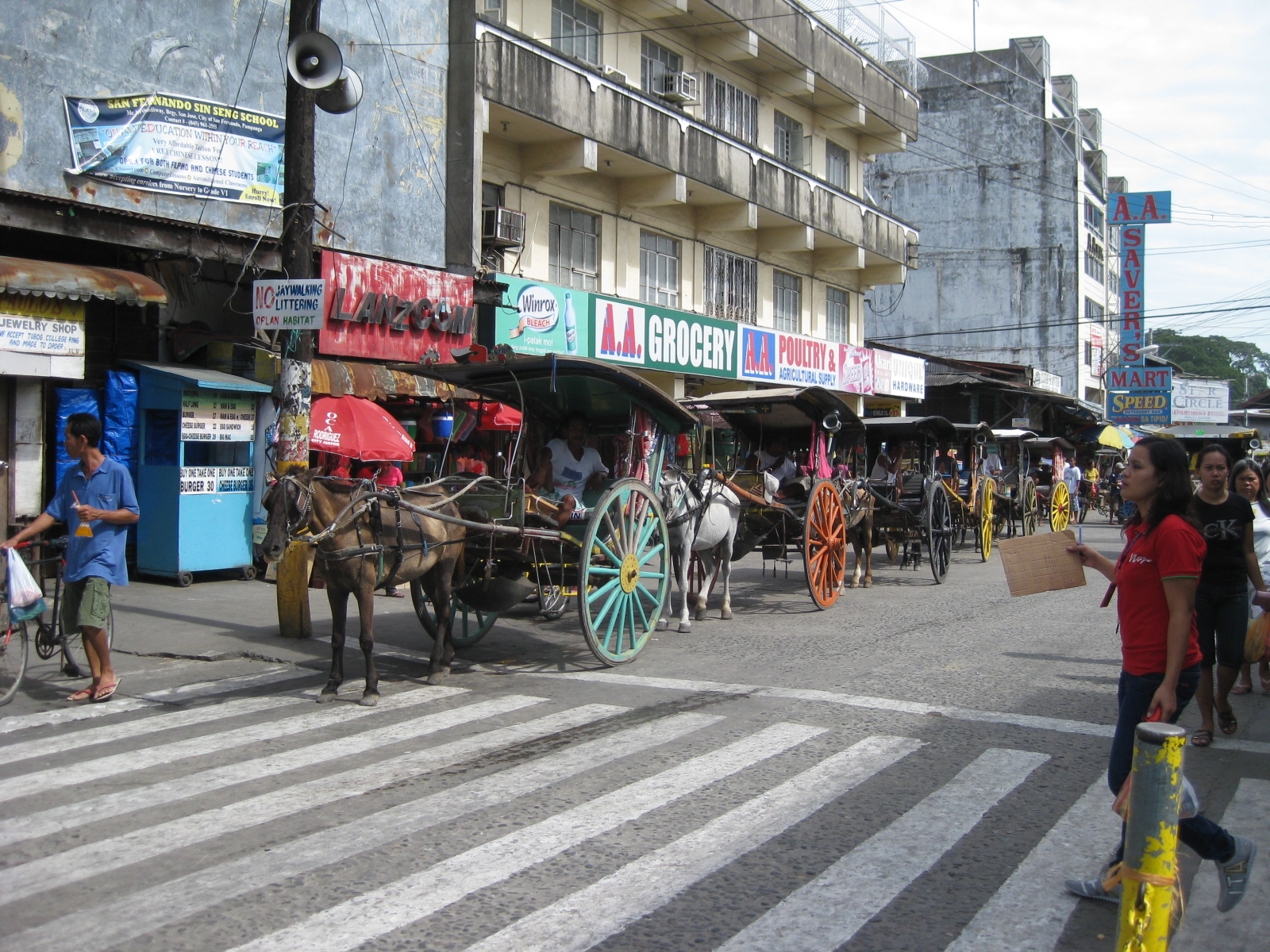 Queue – most of the horses pulling the calesas looked healthy enough and well-cared for. The kutseros were kind enough to answer our inquiries about their operations. I think the city should carefully consider how to take advantage of its heritage/character to promote sustainable transport including walking, NMT and the calesas for moving around the poblacion and its immediate environs.
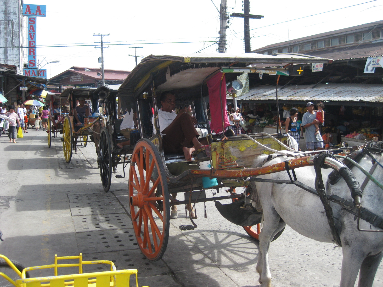 Two-seaters – the passenger capacity for the calesas is two. To address the poop issue, there is a contraption just behind the horse and hanging under the carriage that catches dung and prevents it from being spilled unto the roads. I assume these are disposed of properly.
 Alternative design – the pedicabs in San Fernando are different from the conventional ones we see in other cities or towns. Noticeable from the photo is that this is not your regular bicycle with a sidecar set-up. These are fabricated 3-wheelers that seem to be sleeker if not more stable than the usual pedicabs we’ve seen.
 Tiomico Street – just after Gen. Hizon, one gets an idea of the challenges for transport and traffic in San Fernando. The one-way street has no pavement markings, obstructed signs (if any at all), no pedestrian sidewalks and vehicles each doing their own thing along the road (e.g., motorcycle zigzagging through traffic, jeepneys stopping anywhere, etc.).
 Walkability – people generally walk along the carriageway, as shown in the photo, due to a lack of proper facilities like sidewalks. Though there are remnants of zebra crossings, people also generally cross anywhere and so contribute to the mayhem along the streets. There was a proposal for a pedestrian overpass but such is so inappropriate given the narrow streets. No one will use such an overpass as it would be more an inconvenience to pedestrians. A more appropriate treatment would probably be traffic calming or other approaches that would prioritize pedestrians over motor vehicles in the poblacion area. The lot where jeepney terminal mentioned on the left side of the photo is now an SM mall.
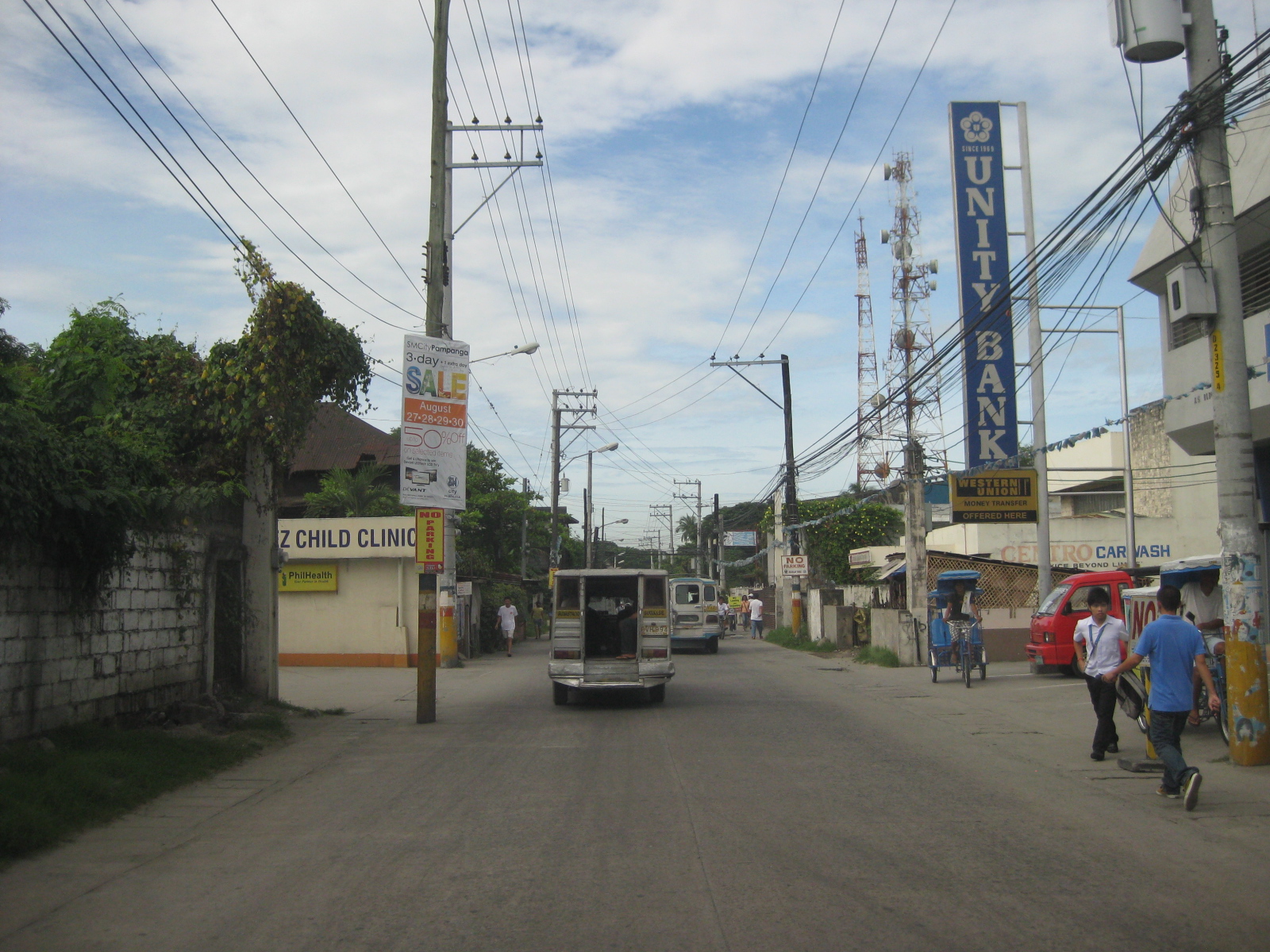 Hazards – the relocation of electric poles seem to have been an afterthought when they re-paved Tiomico. These are not easily seen at night and could lead to crashes should vehicles miscalculate their locations. The road drainage may be found beneath concrete covers on either side of the road such as those along which the people in the photo are walking over. These are supposed to be easier to maintain as crews can just lift the covers to remove blocks such as garbage.
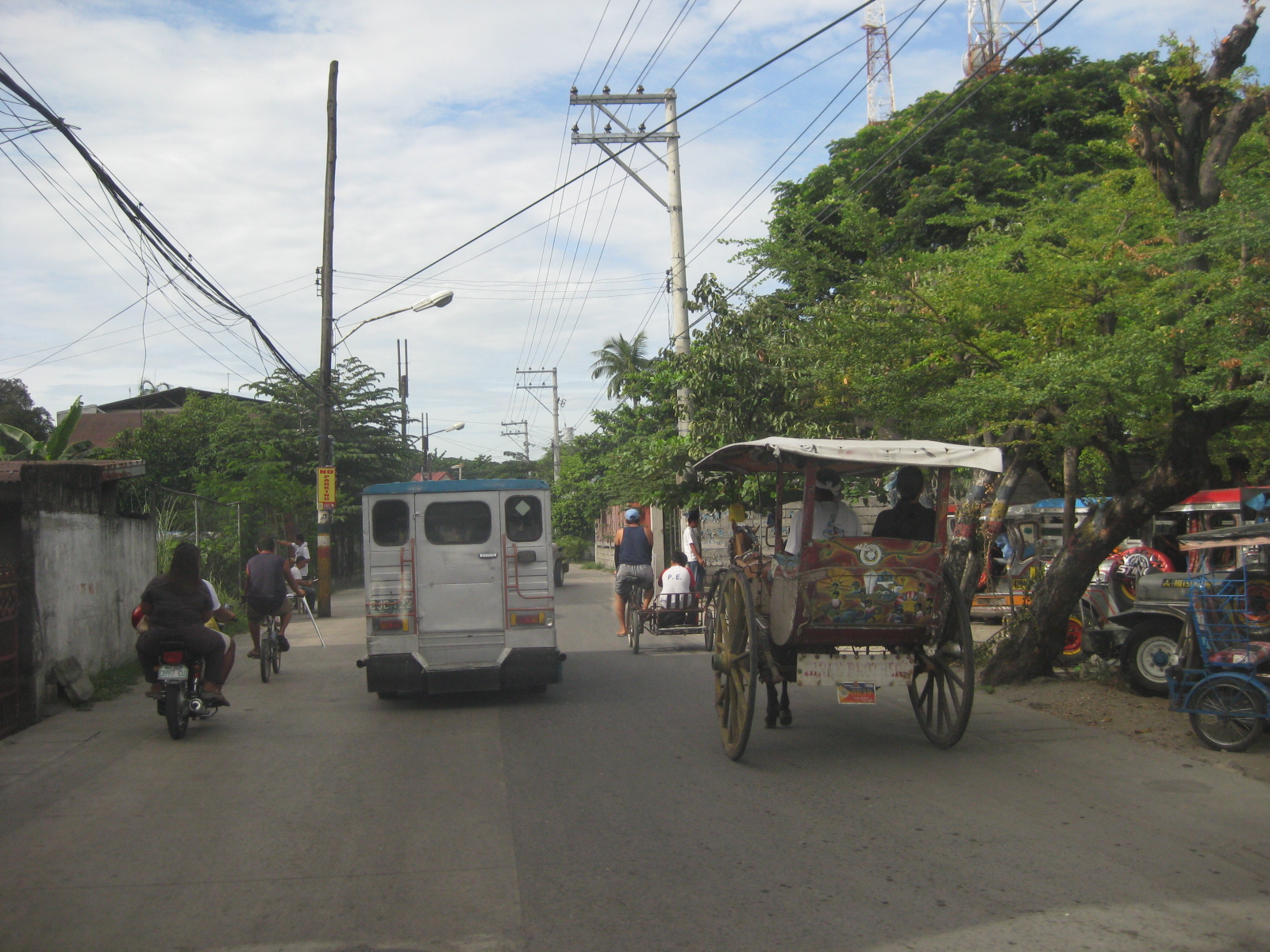 Traffic mix – I like this photo because it shows almost all modes of transport operating in the poblacion: calesas, pedicabs, bicycles, motorcycles, and jeepneys. Its a good thing trucks are banned from using these roads. Otherwise, traffic would be worse.
 Junction – approach to the junction of Tiomico, Lazatin Street (left) and Capitol Boulevard (right). There were no signs to indicate the approach to the intersection as well as for traffic control (e.g., stop or yield signs). There are also no pavement markings.
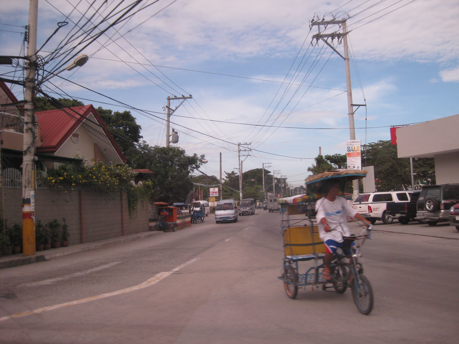 Capitol – the photo shows vehicles approaching from Capitol Boulevard, which comprise generous (wide) two lanes. Sidewalks were on either side of the boulevard except where there were driveways and parking spaces.
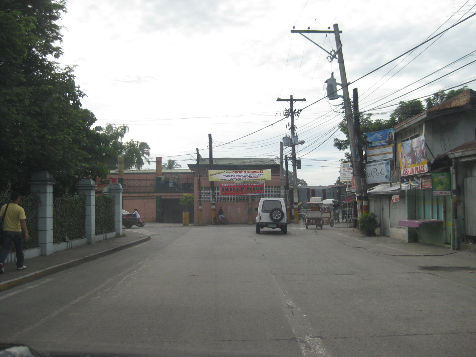 Junction – approach to the junction of Lazatin St., Consunji Street (left) and Sto. Nino Viejo Road (right). Again, there are no signs and pavement markings are already weathered.
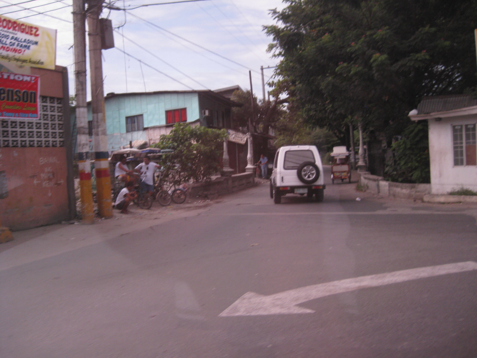 Old bridge – there is a short, old bridge just after the junction. The bridge is over a creek connecting to the main river and has 4 lamp posts that are similar to the main bridge along Gen. Hizon, and perhaps the inspiration for the lamp posts along Consunji Street.
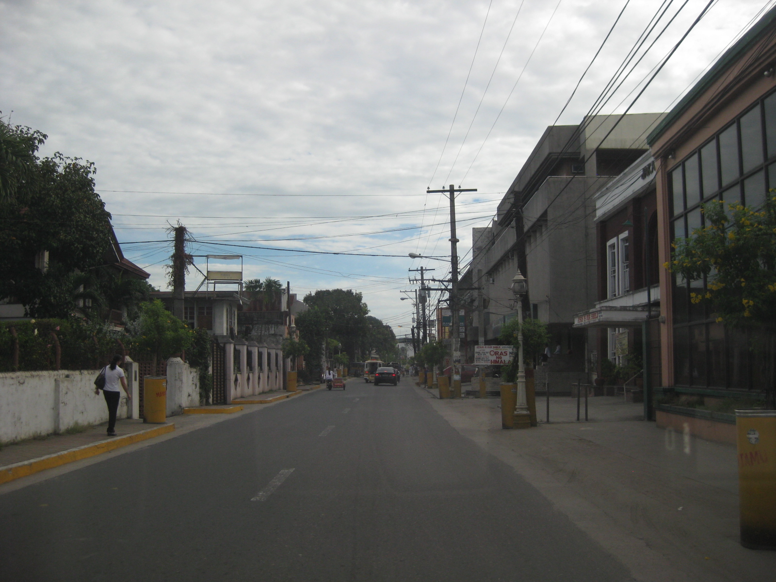 Consunji Street – is also a two-lane, one way street. Some sections have pedestrian facilities like the sidewalk on the left. The pavement markings were already weathered but still visible during the daytime. There are also less electric poles along this street and the lamp posts are appropriate in design.
 Heritage House – the structure on the left is an ancestral house, of which there are many in the province of Pampanga and especially around San Fernando, which is one of the oldest towns in the province.
 Recognition – the marker by the National Historical Institute recognizes the structure as a Heritage House. The smaller plaque provides a description of the house and those who lived or used it, highlighting its significance. There are other heritage houses as well as old houses that have not been given such a distinction (family not prominent enough?) but which deserve preservation.
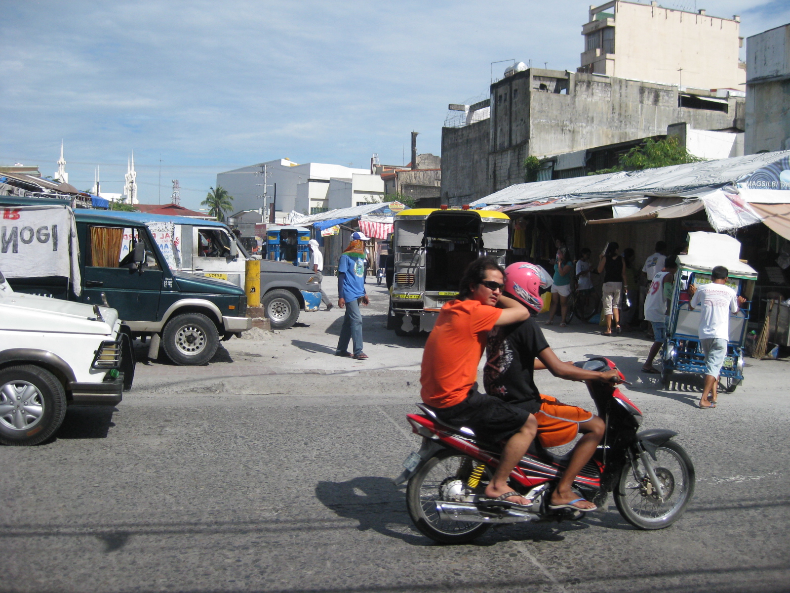 Future and present site – this lot was being used by jeepneys as their terminal at the time of our field work. The lot is bounded by Tiomico St. in the northwest and Consunji St. in the southeast, and is where the recently opened SM City San Fernando is situated.
 Approach from Consunji – there are no pavement markings (yellow box) defining the intersection and no signs to help in traffic control.
–
But seriously…recognizing walking as a mode of transport
There is a general observation that urban planning in the Philippines, including planning and design for transport, revolves around motor vehicles. In fact, much of what we think are sound policies and guidelines, even rules of thumb, are car-oriented rather than people-oriented. Our love for the car is often traced to our being a colony of the United States and our orientation to cars have been reinforced over the years by policies, plans and projects that seem to be biased for car users while detrimental to commuters in general. In fact, we have been used to having roads built and widened that these types of projects seem automatic, no brainer solutions to the traffic problems we encounter everyday. Not that this is a bad thing, considering that we do have many missing links to complete and infrastructure to build where they are needed. Yet, for many of our highly urbanized cities, public transport infrastructure has been too slow to address the demand for movement.
Metro Manila is already choking in as far as traffic is concerned and our proposed solutions still are road widening and the call for elevated expressways. Meanwhile, we have poor road public transport services and a limited rail or mass transit network. It seems that most of the plans for trains and BRTs have never left the proverbial pipeline and as such, we continue to languish in I would like to think that a lot of people would want to take public transport if only the quality of service is similar to systems in Singapore, Hongkong, Kuala Lumpur or even Bangkok or Jakarta. We have to deliver on this end, which will also see our streets begin to become decongested as vehicles will naturally decrease with people choosing PT over their cars, especially in this period of increasing fuel prices.
Of course, these public transport infrastructure carry hefty price tags. And so to complete the picture and solve the puzzle of transport in cities like Metro Manila, Cebu and Davao, we would need to address what is perhaps the most basic for of transport that is often forgotten when talks center on highways and mass transit – walking. It is a fact that walking is the mode with the highest share for transport; dwarfing all other modes since we all walk at some point of our trips (e.g., Car users still have to walk to and from the parking spaces.) Unfortunately, we seem to have become lazy, preferring to ride than to walk and making so many excuses even when the facilities for walking are already provided and conditions favor walking over motorized transport. Of course, the main challenges for ensuring the safety and comfort of those who choose to walk remain and investments are required for more infrastructure to encourage walking. There are good practice examples like the walkways connecting buildings at the Makati CDB and the sidewalks of Quezon City. These are, however, more the exception than the rule and so there is still a need to actually “formalize” walking as a mode of transport and one that could probably save us a lot of fuel, reduce emissions and, most importantly, improve our health and well-being.
Following are excellent articles for reading, and for consideration when we re-think what we are doing to improve transport and mobility in our cities. A re-orientation is in order for us to address
(Note: the sources and links to the online articles are shown below and in the files. These are made downloadable here only to facilitate access to the articles. There is no intent for any copyright infringements.)
Why don’t Americans walk more? The crisis of pedestrianism:
What scientists know about how pedestrians really behave:
Walking_in_America__What_scientists_know_about_how_pedestrians_really_behave_
How walk score puts a number on walkability:
Walking_in_America__How_Walk_Score_puts_a_number_on_walkability_
With America and the rest of the world taking a second and perhaps critical look into how they are planning their transport systems and focusing on encouraging people to walk, we should perhaps take this as our cue to also re-think how we are planning and designing our systems. We should, and not be too dependent on the recommendations of studies past and present that seemingly try to simplify our plights as something that can be solved by roads and cars alone.
–
Pedestrianizing Session Road
When visiting Baguio City, one should never fail to go to Session Road whether to have a meal or just to take walk along the street. It is perhaps the city’s most famous street and a landmark itself where it used to be that a lot about Baguio is going about along Session Road. Here you will find shops, restaurants, bars and other establishments. Since my first time to go to Baguio in 1995, I have seen the city become more crowded and Session Road become more congested. There have been proposals for the street to be pedestrianized but I am unaware of any detailed study concerning pedestrianization and its implications on traffic and commerce in the area. This, I think, should now be among the things Baguio City should look into with more urgency and perhaps a study can be initiated among the universities there, together with the local chapters of planning, architecture and civil engineering societies.
The following article is from the Business Mirror entitled Road Revolution, which appeared in the newspaper’s February 4, 2012 issue:
BAGUIO CITY—Architect Joseph Alabanza keeps a long-held dream: to see Session Road pedestrianized.
As early as 1972, when Alabanza, former head of National Economic and Development Authoriy-Cordillera Administrative Region (Neda-CAR) was head of the city planning office, policies then had pointed out strongly that something had to be done about Session Road as it was predicted to soon become polluted and congested, and lose it aesthetic heritage, being at the heart of the city’s central business district.
A scene that is exactly what Session Road has become.
Then there were not too many cars and the population was much lower than the almost 400,000 mark today, and there was a lack of urgency to control the traffic situation in the city.
In more recent years, as lecturer and consultant of the architecture department of the St. Louis University, his class drafted, as their theses, a layout plan for the streets of the city. The central blueprint was that of Session Road pedestrianized.
Some consultations were made, but this was strongly opposed by business establishments around.
The yearly “Session Road in Bloom,” a market event for Panagbenga (meaning a season of blooming in the Igorot Kankanaey dialect) on Session Road, which stayed closed for a week, was used as a vehicle to test the plan. But it proved to be too hectic and the pedestrian is too heavy to be desirable for a longer period of time.
Even if it seemed that Alabanza’s dream was far from becoming a reality, the glimmer of hope remains as he continuously lamented the continuing deterioration of Session Road—the heavy pollution, the unkempt façades, the heavy traffic, crimes, the insane cat-and-dog chase of the police with sidewalk vendors. Life in the heart of the city was in shambles, but business thrived as usual.
Road Revo
THEN a group of environmental advocates heard of this dream. Something that was a success in Cebu. They came to tell the people of Baguio about their winning game plan in a forum on January 27.
It is called Road Revo—a revolution to change the way people think about the way they transport themselves.
Road Revo is a concept developed by lawyer and environmental activist, Antonio Oposa, a 2009 Ramon Magsaysay awardee in environment.
“We cannot have a Hollywood kind of transportation system, one of individual and expensive mobility. They have eight-lane highways and their roads are like moving parking lots,” he said.
Our insistence at individual mobility has resulted in serious collective mobility, he said.
“Kanya-kanyang galaw kaya lahat di makagalaw [Everybody wants his own way to move that’s why all could not move],” he said, referring to the traffic congestion that has also resulted in serious air and noise pollution.
The road is supposed to be for everyone, that is why Road Revo is for making road use fair. This would mean a turn-around in priorities.
“There’s a need to change mindsets. Road use and policies must have a bias for people, not for cars,” he said.
A World Bank study shows that only 300 out of a thousand own a car in the country. Oposa pointed out that only 3 percent own cars, and they occupy 97 percent of the road, while showing an image of a street jammed with cars in chaos, while people walked on narrow sidewalks.
He said Executive Order 774 specifically cites the new paradigm that the movement of men and cars must follow the principle that “those who have less in wheels must have more in roads,” and that the system must favor nonmotorized transportation and collective transportation.
EO 774 also ordered the Department of Transportation and Communications and the Department of Public Works and Highways to follow the same principle in transforming the road system.
Oposa said that ideally a good public transport system provides 30 percent for all-weather walkways, 30 percent for bicycle lanes, and 30 percent for a greenbelt and what remains would be for cars.
EO 774 also directs all public open spaces along sidewalks and roads no longer needed to be devoted to urban agriculture, something that has been done in Cebu.
“If we could do it in Cebu, so can you,” Oposa said.
Alabanza said that the city has lost its sense of space, referring to walking and open spaces.
“People used to have a sense of belonging here. Now we feel like strangers in our own place,” he said.
Session Road closed: Music, dining on road, sidewalks
AS an experiment, one side of Session Road was closed from 3 p.m. to midnight the day Oposa and his group of environmental activists were in the city on January 27.
And it did happen. Families dined on tables set on the road and sidewalks. Young people were seen just hanging out with one another. Lovers strolled leisurely. Musicians and poets drew a crowd as they beat on their percussions and read poems. Passersby even stopped to do a few dance steps.
For those few hours, the spirit of community was palpable, one of the aims for pedestrianizing Session Road.
Alabanza said that minimizing pollution was one of the first objectives of the proposed road closure as Session Road has become but a passageway for cars and people between the market and the SM Mall on opposite ends. The safety of pedestrians is also compromised as the sidewalks have become too narrow for the crowd who had to walk on parts of the road.
Oposa showed some examples of the ingenious Filipinos’ inventions of environment-friendly modes of transportation. There is the blueprint for a rail bus. There is already a carousel where people pedal to make it run. There is the idea of giving discounts to volunteers who pedal trolleys on train rails. A prototype for a wind-powered bamboo train is on the works, which can run both with an electric motor or the option for pedaling.
“We are a unique place and we cannot but just copy the transportation systems and models of other places,” Alabanza said. The transportation crisis can give rise to opportunities, something that will serve the city well, he said.
Change attitudes
OPOSA pointed out that the world is now experiencing so much disasters because of climate change and it becomes everybody’s responsibility to change attitudes about transportation systems, as this is the sector that emits one of the highest volume of carbon dioxide to the atmosphere.
He reminded that people need to think out of the box and to get out from the inertia of collective insanity, of doing the same thing because everybody else is doing it, no matter how senseless it has become. To illustrate, he said that the bicycle runs on fat and saves you money, while the car runs on money and makes you fat. But all the cars suffering the cost of insurance, stress and productivity lost to traffic jams, loss of a healthier lifestyle indicate that habits are hard to break.
Road Revo will help decrease man’s dependence on oil, restore sense of community, reduce criminality as this allows visibility of one another and, most of all, give people a sense of belonging and owning the space which is a secret tip to keeping it clean.
Oposa is on a nationwide campaign to promote Road Revo. Pasig City opened a road for a day on July 8 last year and Ongpin Street in Binondo became a festival road for the Chinese New Year celebration. After Baguio, Oposa will do the rounds in Subic, Dumaguete, Marikina, Davao and Puerto Princesa.
Alabanza’s dream may not even happen in his lifetime, but the wisdom of keeping the air clean, of enlivening the spirit of community and giving importance to people rather than cars has been sown in the few hours of not closing Session Road but opening it for people.
Perhaps pedestrianization will be more beneficial to the stakeholders of Session Road. It would not be an easy task to convince people that a car-free session road will be the way to go. There probably would also be other options, even a middle ground between status quo and pedestrianization. But doing nothing and letting Session deteriorate further is surely unacceptable to most people.
–
Pedestrian facilities around Saitama Shintoshin Station
I have found many examples of excellent pedestrian facilities during my visits to Japan. Among the best are those integrated with the Saitama Shintoshin Station along the JR Keihin Tohoku Line. I had the good fortune of staying at a hotel near the station, from where I could easily catch a train to go to Saitama University via Kita Urawa Station where I transfer for a short bus ride to the university. Following are photos taken in September 2008 showing the walkways connecting my hotel with the JR station. Along the way the walkway connects other buildings such as those hosting government offices and the Saitama Super Arena, a major venue for indoor sports events like the Asian basketball tournaments that determine the continent’s representatives to the Olympics and World Championships.
 Tiled walkways with provisions for the blind (the yellow tiles) and protection from the elements
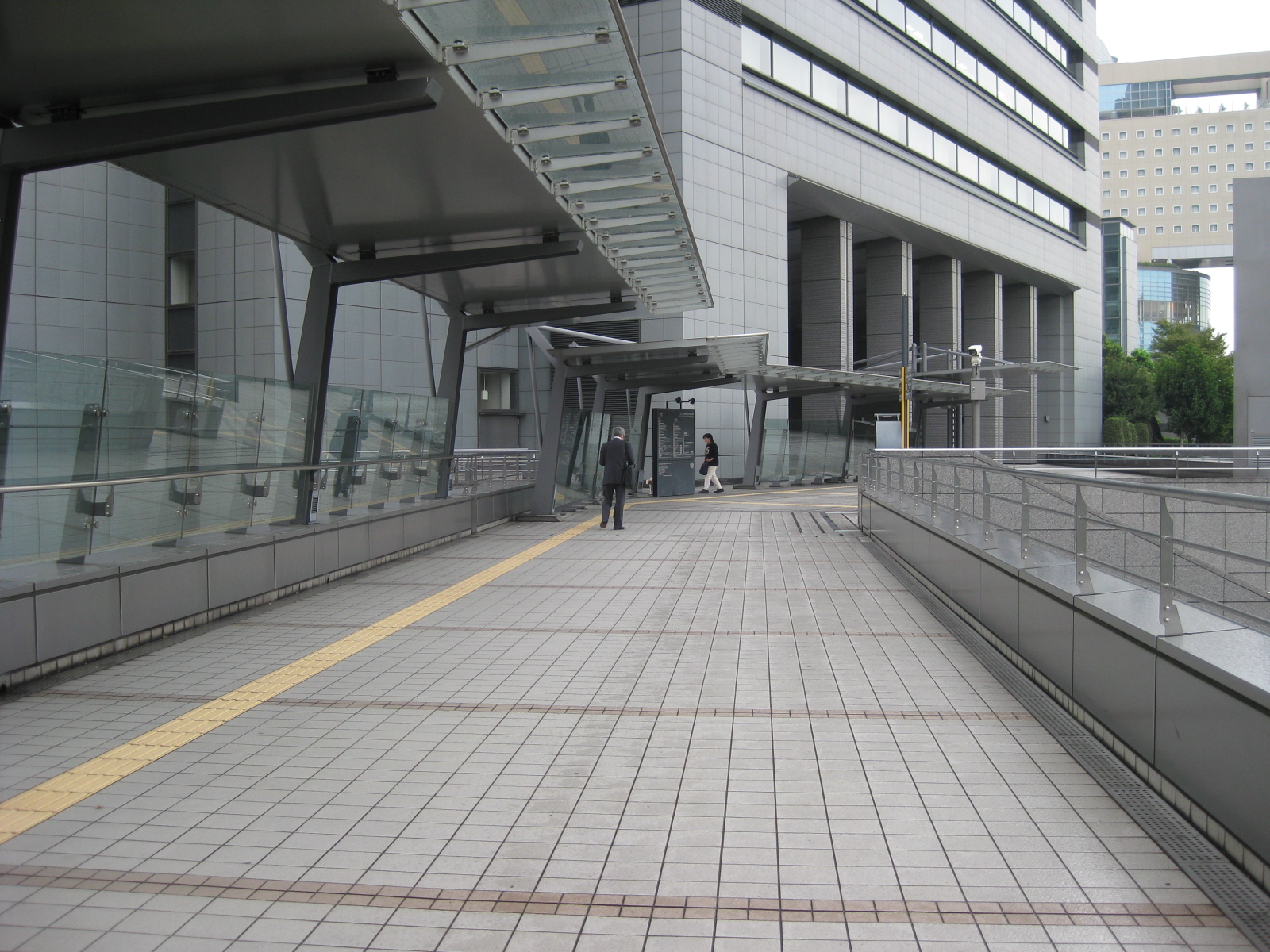 The walkways are wide and should be able to accommodate a high volume of pedestrian traffic. This section leads to the Saitama prefectural government offices located in the building on the background.
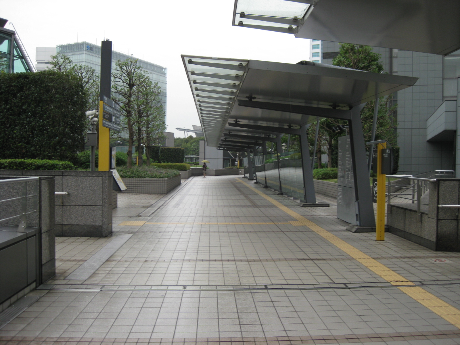 The yellow tiles forming the paths for blind pedestrians are designed to be under the shed and extends to the stairs from which the pedestrian could access the sidewalks and establishments at the ground level of the complex/area.
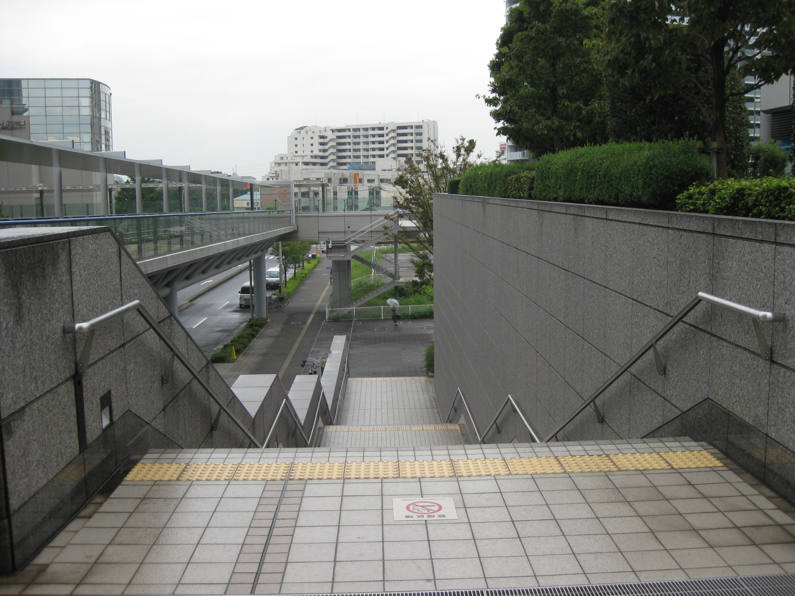 Stairs are designed with hand rails to support physically challenged people including the elderly. Note the yellow strips prior to the first step down the stairs.
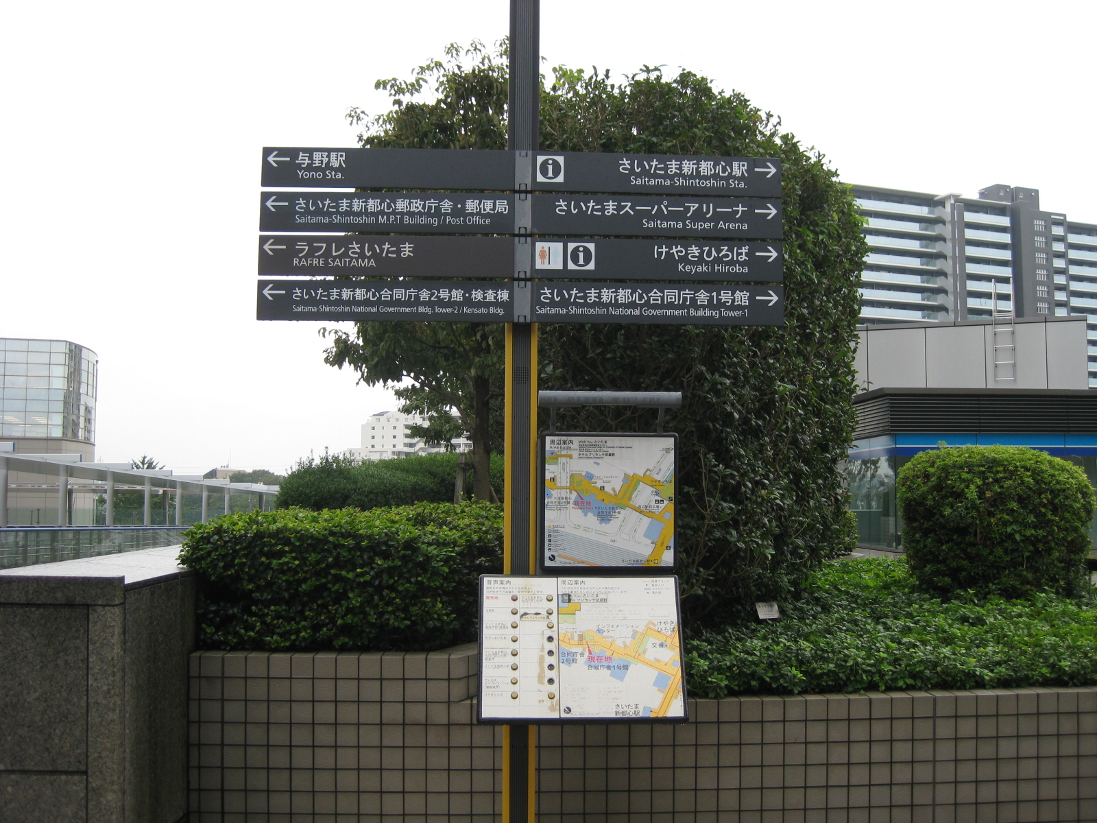 Pedestrian need to have access to information and maps and directional signs provide guidance for people especially those unfamiliar with the area (e.g., visitors or tourists). Most signs in the urban areas of Japan have English translations like what is shown beneath the Japanese in the signs above.
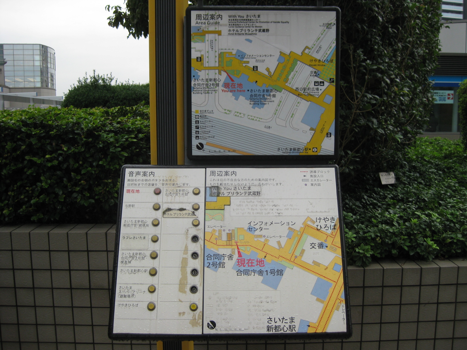 Some maps have interactive features. In this case, there are buttons that provide audio description of places of interest on the map. Today, there are already touchscreen maps in malls and there should be outdoor versions of such facilities.
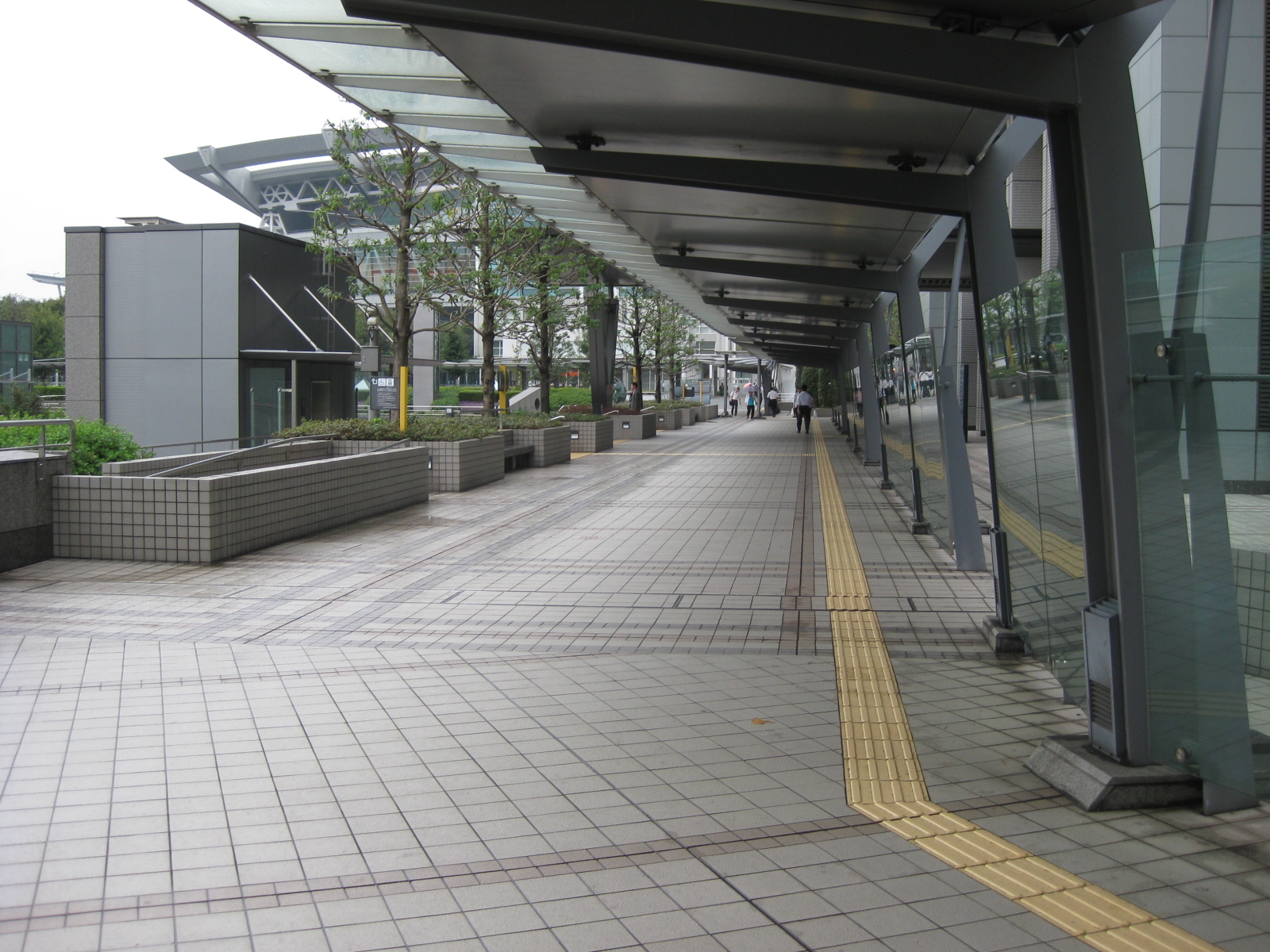 Another photo of the spacious walkways in the Saitama Shintoshin area. One could see the roof of the Saitama Super Arena on the upper left part of the photo and the building housing the elevators for those using wheelchairs or carrying heavy items.
 Closer to the station and the arena.
 There are plant boxes containing brushes and trees along the walkways, providing a more relaxing environment for pedestrians.
 The walkways eventually lead to the complex where located is the Super Arena on one side to the train station in the middle and the commercial complex on the other side.
 Walking from the station to the commercial establishments and office after the Super Arena (at right in the photo), there is a wide space for visitors (e.g., fans, spectators, etc.). There are many coffee shops and restaurants in the area where people could meet up for coffee or tea aside from grab a quick or leisurely meal.
 This the view of a pedestrian approaching the Saitama Shintoshin JR station. Shops are located along the right side of the promenade while the arches form the roof structure of the station, reflecting the modern architecture of the transit station.
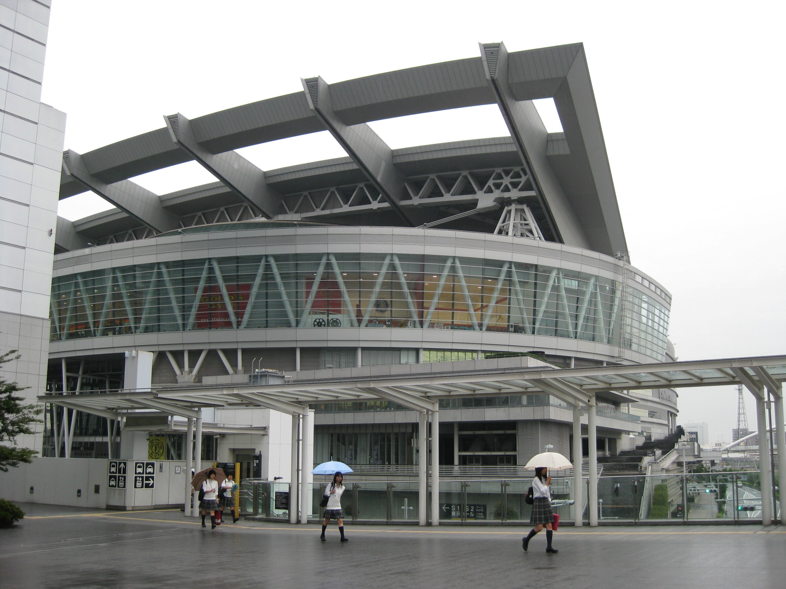 The Saitama Super Arena is also host to a museum dedicated to the late Beatle John Lennon.
 Inside the JR station plaza with kiosks on the left side and ticket machine to the right. Further on are more commercial establishments located in an upscale mall.
–
SM Marikina-Santolan Station pedestrian walkway
A good example of providing for pedestrian access for development is the walkway connecting LRT Line 2’s Santolan Station with SM City Marikina. Of course there’s an even better example in Makati City where the walkways at the Ayala CBD connect office buildings and the commercial center comprising Greenbelt and Glorietta. That system of walkways is probably the first of its kind in the country and has not been replicated elsewhere, at least as far as I know. The significance of the walkway that practically connects to points in two cities (SM is in Marikina while the LRT station is in Pasig) is that it is a good example of a facility that provides access to a transit station. Not too long ago and before Typhoon Ketsana laid waste to the area beneath the bridge and overpass, there was even a proposal for a public transport terminal to be developed here. If this was realized, then the area would have been a very busy hub similar to Crossing or Market!Market! but maybe not at the level of Cubao.
 The elevated walkway across the bridge along Marcos Highway is wide and obviously designed to be able to handle the potential number of people generated by the mall.
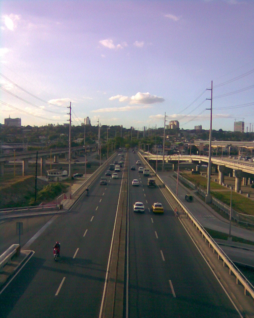 The walkway provides a perfect position for observing traffic along the bridge. This is probably an ideal location for a station for conducting screenline traffic counts for Metro Manila. The driveway on the left side of the photo is for public transport loading and unloading bays commonly used by jeepneys bound for the towns of Rizal Province.
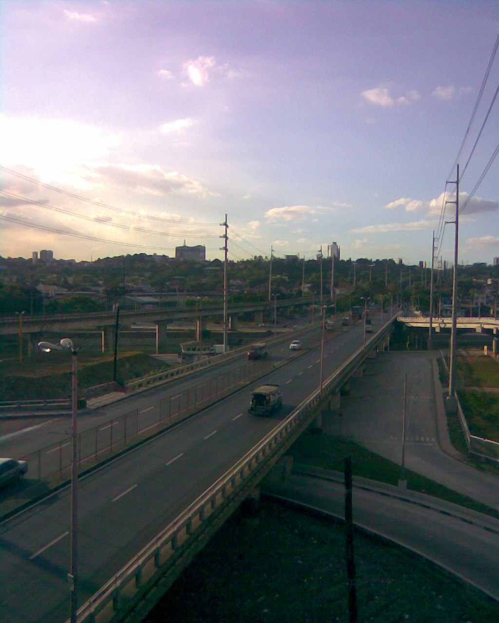 Another view from the walkway with a good perspective of the underpass connecting to a bridge to C5. Visible from this position is the area under the bridge that was proposed to be an eastern bus terminal during a previous dispensation at the MMDA.
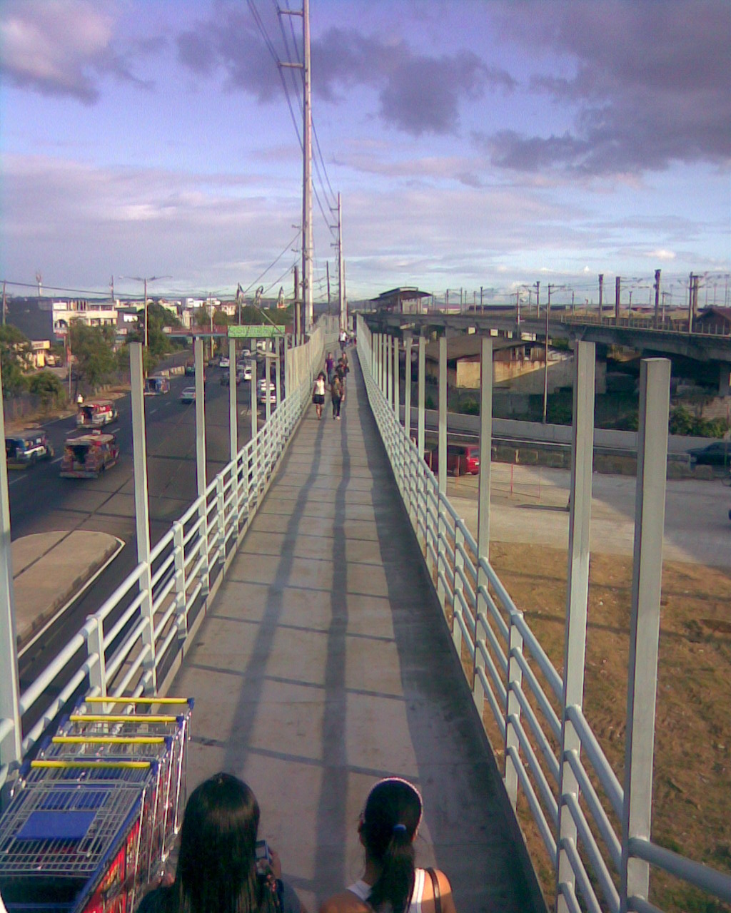 The long walk to the MRT station – from this perspective, it seems the walkway connects directly and almost level with the station platform. It is not at all connected directly with the station. Instead, one has to walk towards the end of this path and then down the stairs that end at the sidewalk near the PUV loading/unloading area. To get to the station, one has to walk some more. The posts appear to be provisions for the installation of a roof over the walkway to shield people from the elements.
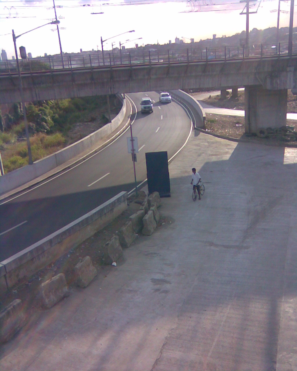 That’s the branch of the bridge emanating from C5 via the Riverbanks Road that was constructed on land expropriated from Camp Atienza, headquarters of the 51st Engineering Brigade of the Philippine Army. The curved section carries traffic from C5 that feeds into eastbound lanes of Marcos Highway.
–
Pedestrian overpasses along Ortigas Extension
This post is a continuation of recent ones featuring pedestrian overpasses along major roads. These past posts include facilities along Commonwealth Avenue and Espana Boulevard. This time we take a look at similar facilities along Ortigas Avenue Extension, which stretches from C5 to Kaytikling Junction in Taytay, Rizal. Following is a photo journal of overpasses from Rosario until Cainta Junction.
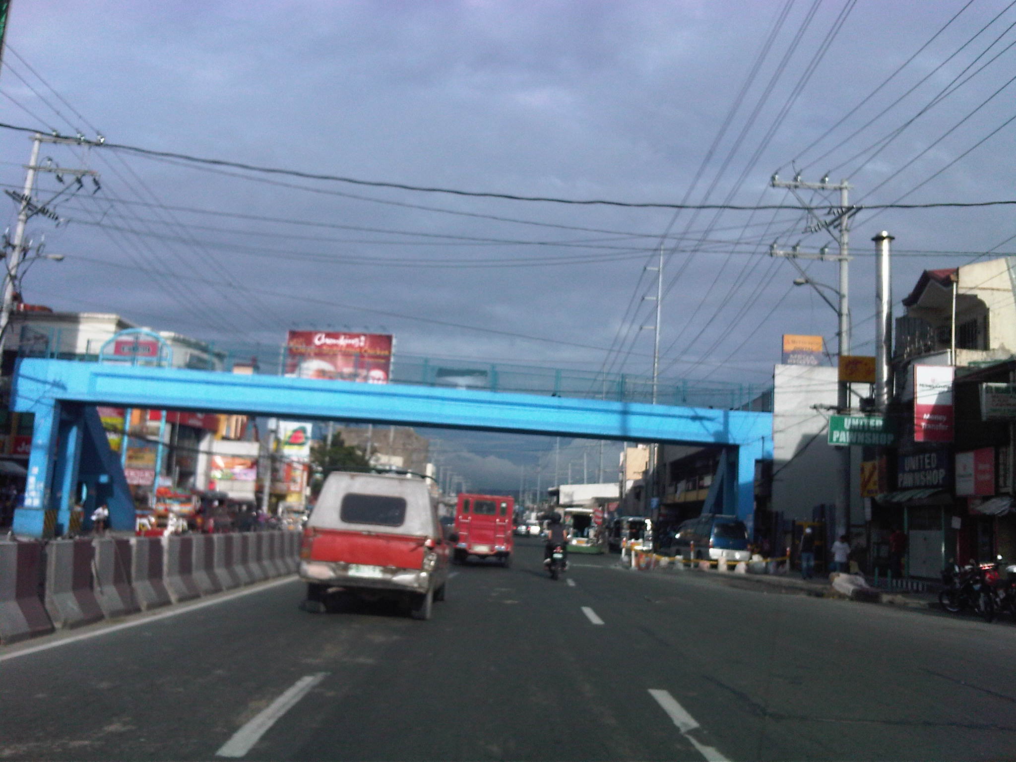 Concrete overpass at Rosario as viewed along Ortigas Ave. eastbound – it appears to be newly repainted but the design suggests it is an older structure of the more traditional design. There used to be no overpass here despite the volume of pedestrians crossing the street due in part to the Sto. Rosario Church on the left side of the road. At-grade crossings are still common with many jaywalkers hurdling/jumping over the concrete barriers.
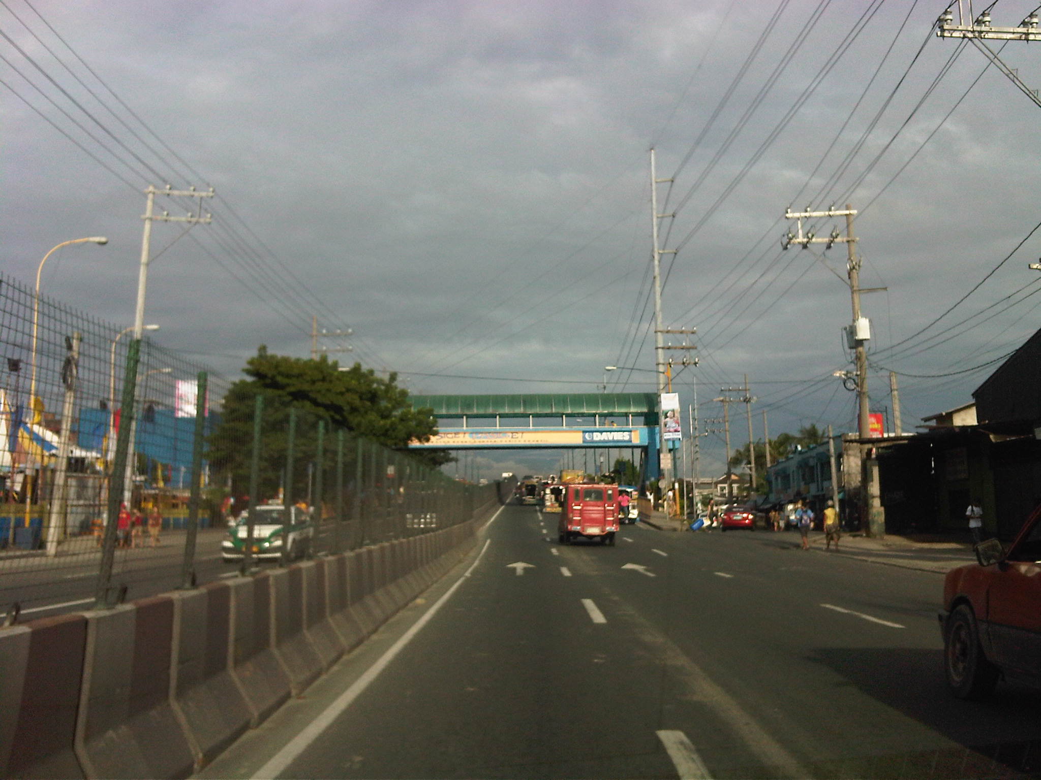 Overpass at the approach ramp to the Manggahan Bridge – seen from Ortigas eastbound, this is one of two overpasses found at either ends of the bridge crossing the Manggahan Floodway. There is a service road on either side Ortigas just beside the overpass that serves as access to the the West Service Road along the floodway.
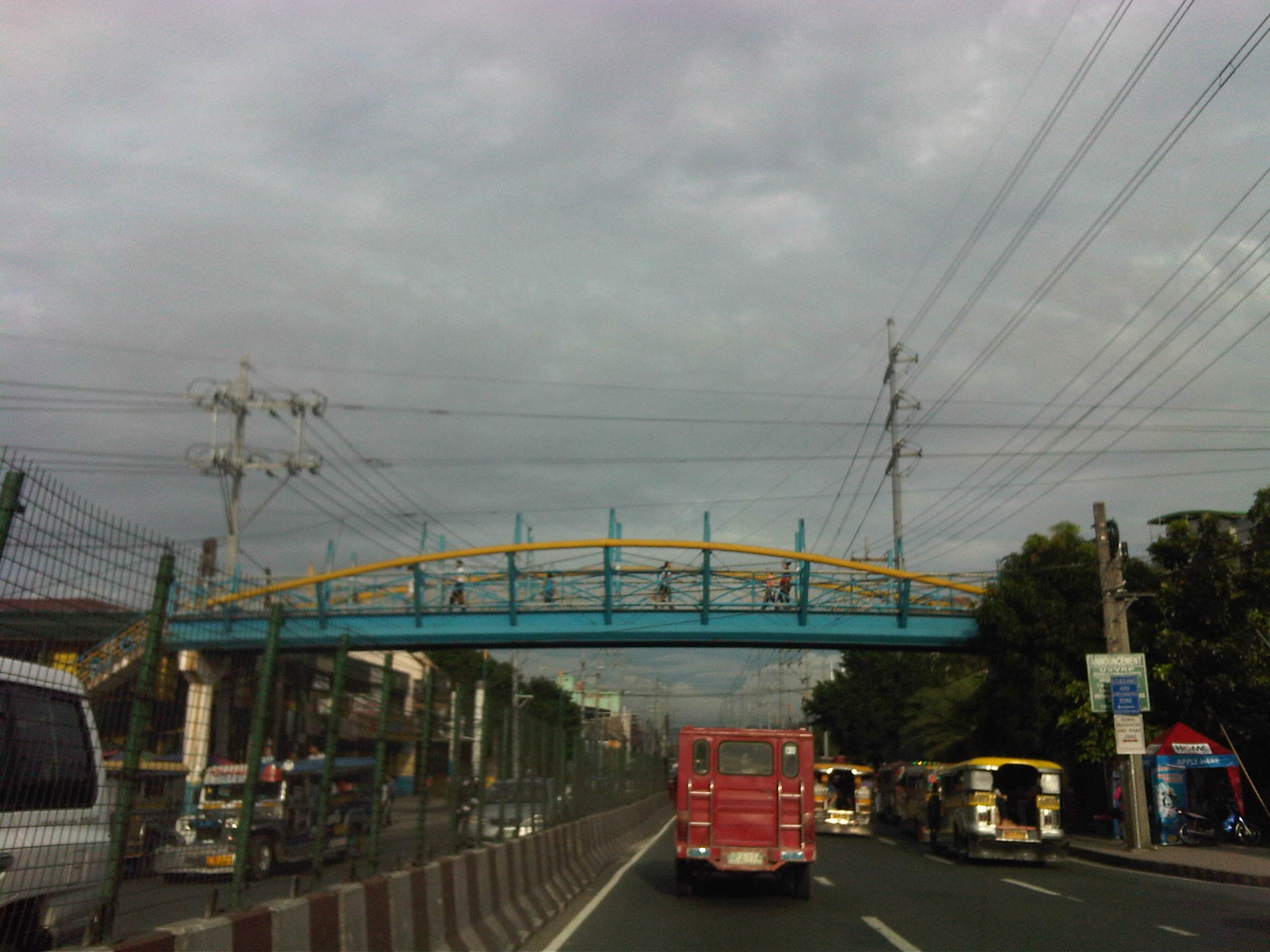 Second overpass at the exit ramp right after the Manggahan bridge – as viewed from Ortigas eastbound, the facility is similar to one found along C5. The steel structure comes across as a rather odd design that I’m sure my architect friends would have their own opinions about. As far as I am concerned, I think there’s just too much steel and is unnecessary though it can be claimed for aesthetics by the designer. Perhaps I am too concerned with functionality and safety rather than beauty?
 Overpass across Ever mall – the covered section of the overpass is concrete and similar to the Rosario overpass. The extension of the overpass is visible from this photo at the right side just above the minivan, and has the distinctive mark of the MMDA (the double M seen in the photo). The extension is a steel structure like most of the newer facilities constructed during the time of BF that allows pedestrians to walk overhead and straight to the mall. This section of Ortigas is quite unusual as outbound (MM-bound) traffic occupy all lanes of Ortigas at this area. Inbound (Rizal-bound) traffic are diverted towards a stretch fronting the mall that appears like a bypass road. Traffic eventually re-enters Ortigas right after the mall.
 Overpass across Cainta Public Market and Robinsons Cainta – this is a concrete structure that is covered and, surprisingly, is clear of vendors thanks to the efforts of Cainta enforcers and the mall security. The public market side (left side of the photo) is too crowded with the pedestrian immediately encountering informal vendors’ stalls upon descending the stairs. While there are no vendors atop the overpass, there are many tambays loitering about and the usual beggar sitting anywhere about the structure (usually at stairs along the public market side). The facility extends all the way towards the mall, which can be accessed via its second level.
Pedestrian overpasses along Espana Blvd., Manila
I took some photos of pedestrian overpasses along Espana Avenue in Manila while en route to a meeting in Malacanang. I was hoping to capture the conditions along such facilities and maybe compare them with my observations along Commonwealth Avenue. Following are photos taken from my trusty Blackberry. I ask my readers to excuse the reflections due to the sun bearing down on the windshield of our vehicle.
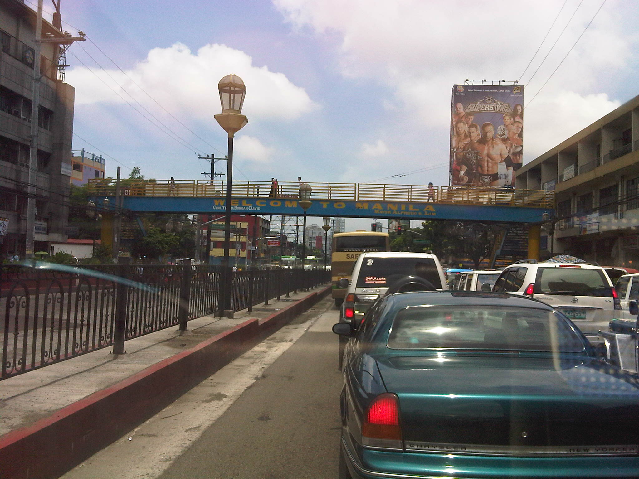 Steel overpass built during the last MMDA administration. Many pedestrian overpasses were constructed out of steel by the MMDA and this was attributed (allegedly) to the previous Chair having a construction and steel manufacturing outfit. True enough, many of these structures bear his initials that is also the name of his corporation. Many of these structures were criticized by the DPWH for not following standards (e.g., one can feel the deflection of the overpass while traversing its length) but the same agency seemed helpless in their case against such facilities.
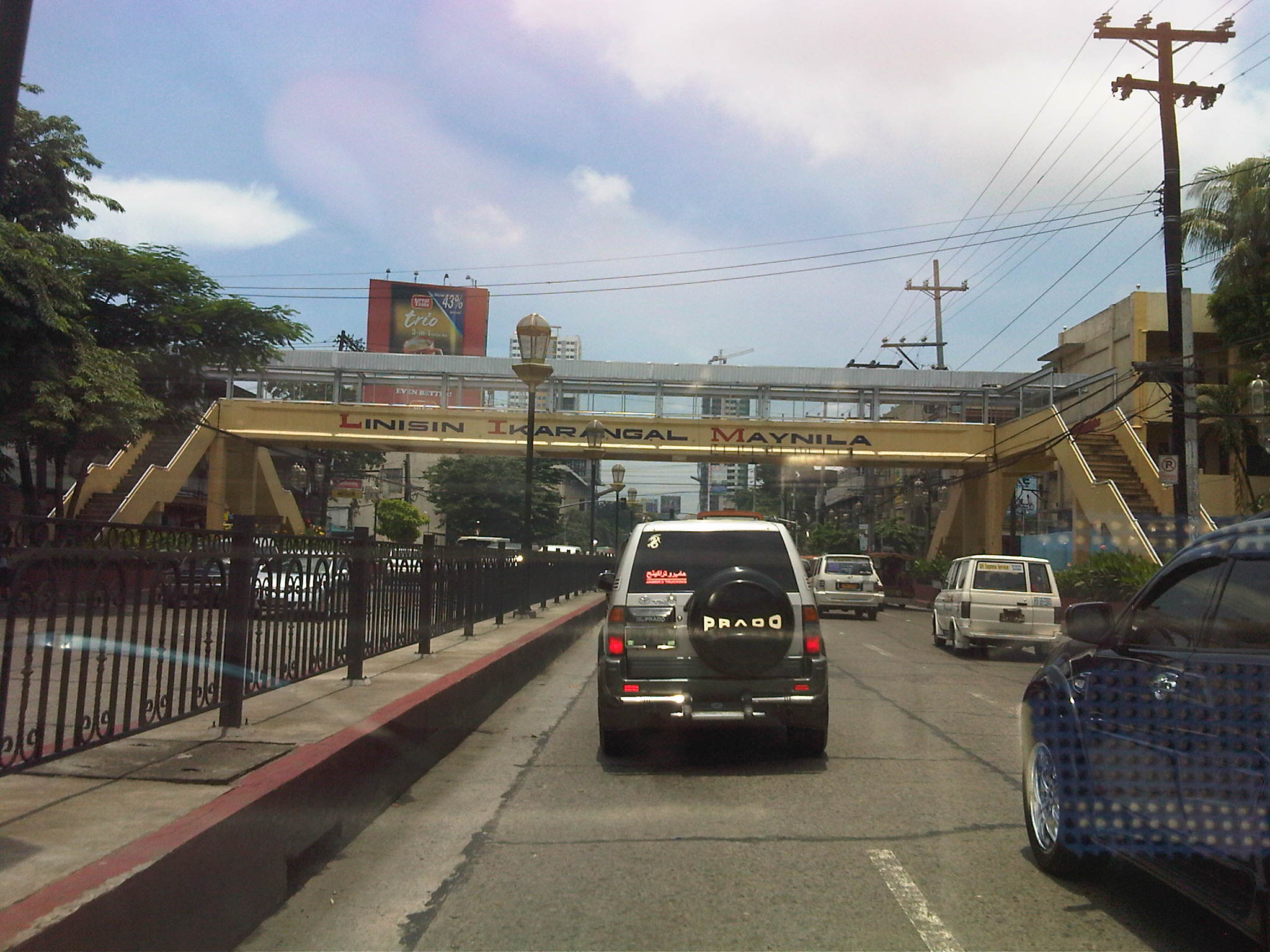 Older concrete overpass across Ramon Magsaysay School. This appeared to be clear of vendors while the roof structure is unfinished giving users no protection from the elements.
 Overpass across UST. This is one of the older and larger (widest?) pedestrian facilities along Espana considering it serves the students of one of the largest (in terms of population) universities in the country. There are vendors on this overpass but mostly those selling candies and cigarettes(!). I am not sure if UST has posted a guard along this overpass considering the safety and security interests of its constituents. Similarly situated overpasses along Katipunan Avenue are secured by personnel provided by Ateneo De Manila University and Miriam College. I would like to see this overpass retrofitted and re-designed to match UST’s heritage. The institution, after all, just celebrated its 400th anniversary.
 Overpass at P. Noval Street. It is not so clear from the photo but one can easily see vendors with their wares set-up along the overpass and clogging the flow of people. This is another relatively old structure as this is a major crossing point for people in studying or working in the University Belt.
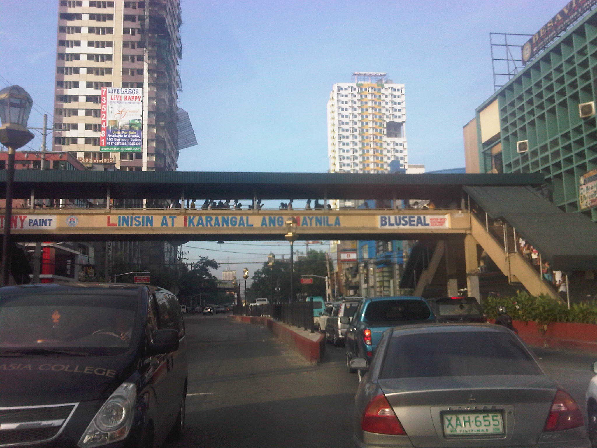 Another look at the P. Noval overpass from the Quezon City-bound side of Espana. Notice the high volume of pedestrians using the overpass? Most of these are students studying at one of the universities at U-belt or graduates reviewing for their respective licensure exams in one of the many review centers located in the area. There are many nursing and engineering review schools in the area.
If we are to encourage walking as a mode of transport and especially applicable to short distance trips, we would need to invest and build the necessary pedestrian facilities. Such facilities need to be structurally sound and therefore compliant with the standards set by the DPWH and properly located to encourage their use. Design, of course, includes capacity considerations since they should be able to accommodate volumes of pedestrians during peak periods. As such, overpasses would have to be clear of vendors or others that constrict flow. Ideally, pedestrian facilities should also be designed according to a criteria that includes aesthetics that adheres with the character of the area where it is located. It is understandable that construction of such facilities may have been rushed due to the urgency of the situation (i.e., like in the case of Commonwealth). Nevertheless, while the intent is good, the execution of the solution should still adhere with standards considering that these are often long-term investments for public infrastructure.
Pedestrian overpasses along Commonwealth Avenue
Commonwealth Avenue is still regarded as a “killer” highway despite the efforts to reduce road crash incidence along this thoroughfare. Many of these crashes involve pedestrians who continue to cross the highway on at-grade or on ground level at many points of the highway despite this being prohibited or discouraged. To cross the avenue, pedestrian overpasses have been constructed at strategic locations along the highway including those at Fairview Market, at Ever/Shopwise and at Tandang Sora, at U.P. (2 overpasses – one at AIT/CHK and another at Technohub), and at Philcoa. Despite these facilities being constructed and possibly with a few more to be constructed in the future, many people still choose to jaywalk. Among the reasons cited are stairs being too steep and the long distances they have to walk to and from the overpasses.
Following are photos taken on a Sunday drive from Novaliches to UP showing the conditions on and around overpasses along Commonwealth Avenue. Noticeable are overpasses across Fairview Market and Ever/Don Antonio where vendors have set up shop and impede the flow of pedestrian traffic.
 Pedestrian overpass across Commonwealth at Litex and before Fairview Market (section is at Commonwealth southbound) – the overpass is surprisingly free of vendors despite its being well within the influence area of the market.
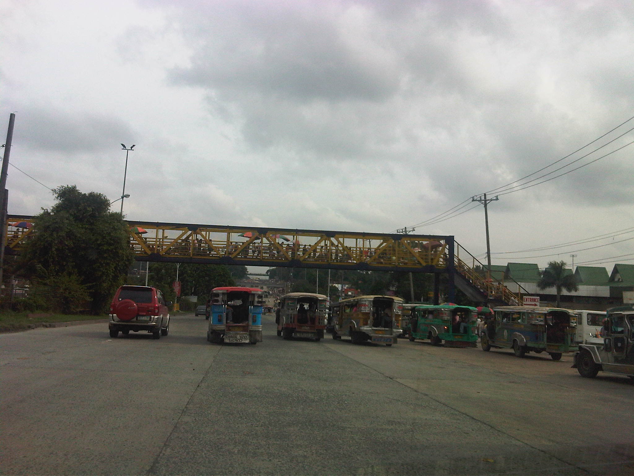 Overpass across Fairview Market (section is across Commonwealth southbound) where vendors have set up to sell various merchandise. Notice the umbrellas to shield vendors from the elements. Note, too, the jeepneys congregating under the overpass and taking up 2, 3 or even 4 lanes of road space and thereby causing congestion along the wide avenue.
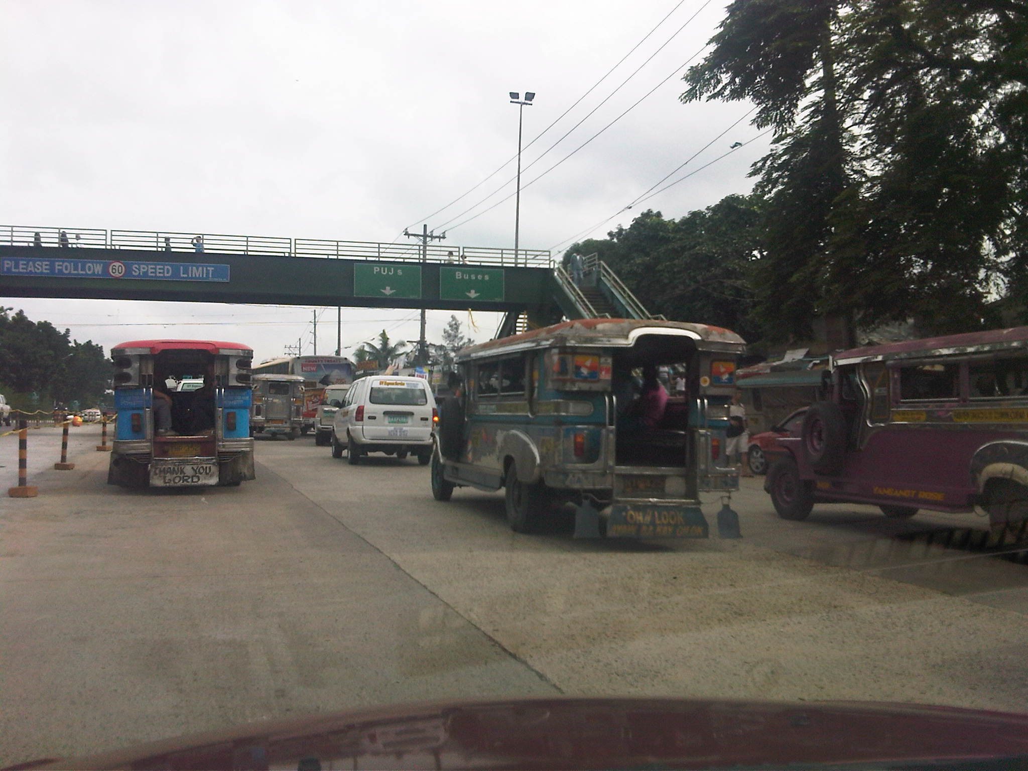 Overpass after Fairview Market and across densely populated areas that are mostly informal settlements. Jeepneys and buses usually congregate under this overpass and another downstream which is across from the Sandiganbayan. The bollards to the left are to segregate a lane with recently laid concrete (re-blocking of certain lanes along Commonwealth).
 Overpass across Ever Commonwealth where vendors have also set up to sell merchandise. The design evokes those of old steel truss bridges in Manila across the Pasig River like the Quezon and Ayala Bridges. Notice the congestion at the overpass at the left portion of the photo.
 Overpass across Tandang Sora where the middle portion descends under the T. Sora flyover in an unusual design that calls to mind the adjustments made for pedestrian facilities constructed across EDSA, and above or below the MRT3 alignment. Notice the countdown timer for the signals at this major intersection.
 Overpass across AIT and CHK of UP Diliman. The canopy is one of two set up atop the overpass for MMDA personnel taking random speed samples to enforce the 60 kph speed limits along Commonwealth. On most days I travel along Commonwealth, there is usually no one taking measuring speed along the NB direction of the highway.
The overpass across the UP Technohub is relatively new but it is free from vendors. In fact, the two overpasses across UP are free from vendors and are regarded as safe and secure because of guards (and even MMDA enforcers) posted at the overpasses to ensure the safety of users of the facilities, especially students and employees of UP and of the Technohub. However, the Philcoa overpass continues to be occupied by vendors despite its roof being removed by the MMDA a few years ago with reasoning that this would deter vendors from setting up atop the overpass.
The problem of vendors on the overpasses is an enduring issue and one that is quite easy to solve if authorities are serious about addressing it. In fact, it is so easy for enforcers or police to prevent or even apprehend/accost vendors as frequent as the latter attempt to set up on the overpass. The continued presence of vendors suggest that there is no sustained effort against these vendors. There are those who even suspect (and are perhaps correct in certain cases) that enforcers or police are being paid to turn a blind eye to these vendors. This is a story that is replicated in many parts of Metro Manila as well as in other cities across the country where overpasses become small time malls or shopping streets, thereby defeating the purpose of having these facilities in the first place. The challenge is for local government units to do what is right in such cases if only to ensure that facilities for pedestrians are safe, secure and unimpeded for efficient flow.
Some issues on walkability in the Philippines
I have written about walking in the past (No Car? No Problem!), and it was mainly about a personal experience I had commuting home one evening. At the time, I had already made the observation that we are generally lacking for pedestrian facilities. We do have sidewalks but most are too narrow for the typically high volume of pedestrian traffic. In cases where there are sufficient width or space, sidewalks are often occupied by vendors. In commercial areas, establishments also have a tendency to encroach on pedestrian space thereby constricting the walkways. This is the predicament in most, if not all, Philippine cities and the result is often that pedestrians are forced to walk along the carriageway, using space that is supposed to be for motor vehicles and effectively causing congestion due to the reduced road capacity. Such are issues pertaining to walkability that touches mainly on the safety, mobility and accessibility aspects of walking.
In rural areas and particularly along national highways, there are practically no pedestrian facilities unless one considers highway shoulders as appropriate for walking. As such, one will most likely find people walking along the shoulders or, should it be the wet season and these shoulders happen to be muddy, along the carriageway. It is not uncommon also to see children walking along the highways since many schools are located along the roads. Such situations often put children at risk, thereby magnifying their vulnerability to becoming victims of road crashes.
Another vulnerable group are senior citizens, who, despite their age, can still be very active and are entitled to mobility just like any person. They, too, deserve facilities that will keep them safe from risks such as wayward public transportation or reckless drivers and riders. Then there are also those who are physically-challenged, people with disabilities who, despite their physical limitations, also have the right to move about. In fact, there are laws with provisions requiring public facilities to be designed according to the needs of persons with disabilities (PWDs). Sadly, pedestrian facilities in Philippine cities generally do not incorporate ramps, guides and other devices that would allow for efficient movement of PWDs.
Crossings are also a big issue considering the statistics of pedestrian involvement in road crashes. Of course, there are two sides of the coin here where, on one hand, hard-headed people still cross at inappropriate locations or say at street-level when there is an overpass or underpass nearby. Such incidences of jaywalking are quite prevalent in urban areas, betraying a lack of discipline that is often in combination with weak traffic enforcement. On the other hand, there are pedestrians crossing along designated locations like zebra crossings but are placed in harm’s way as motorists do not give way.
Heading to the airport last Maundy Thursday to fetch my wife, I took Marcos Highway and saw the many people walking to Antipolo Church, a popular pilgrimage site for Filipino Roman Catholics during the Holy Week as well as the month of May when the feast of Our Lady of Peace and Good Voyage is celebrated. They came from all over Metro Manila but mostly from Pasig, Cainta, Marikina and Quezon City. It was around 10:00 PM and due to the Holy Week, there were very few public transport (and vehicles in general) along the highway, which is a major corridor to the east. Most of them had to walk along the carriageway considering the ongoing construction work along Marcos Highway for a major drainage and pavement project. Considering the volume of people, they has practically occupied one lane (the outermost) of the highway. Fortunately, because there were few vehicles, the people didn’t have to worry much about being sideswiped as they walked.
I could imagine a similar case along Ortigas Avenue, which is along the original way to Antipolo Church. Perhaps there were even more people walking along that road considering that it passes through densely populated areas of Mandaluyong, Pasig, Cainta and Antipolo as well as the avenue being most accessible to people coming from Taguig, Makati, San Juan and Manila. The Way of the Cross along Ortigas Avenue has been enhanced with the construction of stations along the route that can be used as guides, especially by those who are unfamiliar with the pilgrimage. That way is also wanting for pedestrian facilities and often sidewalks are ill-designed and may even have electric posts impeding the flow of traffic.
To me, the solution to such issues on walkability is quite clear and does not require more than common sense. Obstacles along walkways, for example, need to be removed to ensure that there will be space for walking and ensuring smooth traffic flow. The MMDA deserves a lot of credit for waging an aggressive campaign during the time of Bayani Fernando, when he implemented a “sidewalk clearing” program that effectively returned space to pedestrians that were taken from them by vendors and establishments. The latter mostly did so in violation of the building code that is quite common in most downtown areas. Electric posts also need to be relocated and such may be coordinated with power/utility companies who are responsible for their installation.
On the technical side, there is a need to revisit design guidelines, if any, pertaining to pedestrian facilities. The National Building Code actually has provisions for designing sidewalks but there are none, to my knowledge, about designing overpasses and underpasses. There are no criteria currently being used to determine, for example, the suitable locations for overpasses and to estimate their capacities based on the principles of traffic flow. This, considering that there are actually level of service (LOS) criteria for walkways and other facilities catering to pedestrians. These design guidelines should clearly incorporate safety and accessibility so that the resulting facilities will be for the inclusive use of all.
On the enforcement side, there is nothing new and no surprises that the recommendation would be to have firm, consistent and aggressive enforcement of traffic rules and regulations. For this I may sound like a broken record but it only goes to show that we have not progressed much in this aspect of traffic management. The ningas cogon approach must go and programs should also be directed against those impeding pedestrian flow (e.g., vendors setting up on overpasses) as well as those whose behavior endanger pedestrians (e.g., reckless, undisciplined drivers).
I am optimistic, though, that with the combined efforts of many advocates for road safety, we may eventually be able to improve walkability in most cities in this country. For one, there are already several LGUs who have programs with a vision for them to be a walkable city. Among these are Marikina and Makati in Metro Manila, and San Fernando in La Union. More will hopefully follow the examples of these cities and, who knows, one day perhaps we can walk safely wherever and whenever we wish to do so.

