
Home » Public Transport (Page 49)
Category Archives: Public Transport
What’s wrong with Marcos Highway?
Traffic along the eastbound direction of Marcos Highway in the late afternoons to evenings have worsened particularly for the section stretching from Aurora Boulevard in Quezon City to Imelda Avenue in Cainta. It takes me at least 45 minutes just to traverse that section and then just under 30 minutes the rest of the way to my home in Antipolo. In addition, there is the traffic along Katipunan, which can be quite unpredictable despite the traffic signals now installed at two major intersections near Ateneo and Miriam. The congestion along Marcos Highway is usually due to several factors:
- Rush hour(s) traffic – the sheer number of vehicles during the afternoon/evening peak is enough to cause traffic congestion along Marcos Highway. This is no longer for an hour but for a period usually spanning about 4 hours (5 to 9 PM). It’s become so bad that I am no longer surprised when I go home late some nights to find out it’s still congested at certain points (usually Santolan and Ligaya) past 9 PM.
- People occupying the road – commuters waiting for a ride along Santolan, Ligaya and Metro East/Sta.Lucia often occupy not just one but 2 to 3 lanes of Marcos Highway. This drastically reduces road capacity. For some reason, the MMDA and LGU traffic enforcers could not persuade them to clear the carriageway or at least encroach only on the outermost lane.
- Errant road public transport – loading and unloading operations of jeepneys and UV express happen in the middle of the road. This is partly due to the fact that people already occupy 1 to 3 of the outermost lanes of the road. It is also partly due to driver behaviour as many PUV drivers are unruly. These are also maybe because the enforcers are not doing their jobs managing traffic and apprehending those violating rules and regulations whether driver or pedestrian.
- Major trip generators – there are already 4 malls along Marcos Highway (SM Marikina, Robinsons Metro East, Sta. Lucia East Grand Mall, and SM Masinag) and a 5th is already under way with Ayala constructing a mall at Ligaya. These will attract and produce significant traffic with vehicles generally contributing to congestion in the direct vicinity of the malls but spreading along all major roads. Unfortunately, Marcos Highway is one if not the only access road that these malls have.
A lot of people using their own vehicles live in areas served by Marcos Highway including those beyond Masinag and Cogeo. There are so many subdivisions and other residential areas in these parts east of Metro Manila that vehicles from these residential areas alone can cause sever congestion at Masinag Junction. But this should not come as a surprise given that there is no efficient mass transport system in these areas, which are served primarily by jeepneys and tricycles. Obviously, the quality of service of existing road public transport encourages people to get their own vehicle. And obviously, too, the solution is in a project that is considered “bitin” – LRT Line 2, which currently terminates at Santolan. The extension project has long been delayed and could have a significant impact on transport and traffic once it is constructed and becomes operational.
The past two weeks, I have proceeded to take C-5 and turned to Ortigas Avenue Extension on my way home. Surprisingly, traffic has not been bad at Cainta junction and I have only occasionally encountered congestion at the section in front of the BF Metals plant where jeepneys turning around tend to block traffic during their maneuvers. I estimate that I average just under an hour on this route, a savings of 30+ minutes from my original home-bound route via Marcos Highway and Sumulong Highway. I figure that I will most likely keep using this route as traffic will continue to worsen along Marcos Highway in the run-up to Christmas.
–
Some questions on a gloomy Saturday morning
On gloomy Saturdays like today, I often tend to sort of contemplate on some questions coming from events and articles the past few days. I don’t really want to answer these questions right now and immediately but would rather let these and the follow-ups play around in my mind. I would rather not do some shout outs on social media about these questions as some friends tend to be sensitive and I don’t really want to make a lot of effort carefully framing posts on FB just so they won’t appear to be offending certain persons who might be over-zealous about their advocacies or who would be so defensive of their organizations. Here are some questions running around in my brain right now:
1. Does DENR have the mandate to require sidewalks and bikeways along all roads? Design and implementation-wise, isn’t this supposed to be under the DPWH (for national roads) and the LGUs (for local roads)? Is this more a policy statement? But then shouldn’t this come from DOTC?
2. Is going out of your way really the way to get noticed and be awarded? Are there no points for people doing a great job at what they are supposed to be doing?
3. Shouldn’t an agency first check if they are doing what they are supposed to do and the outcomes reflect their objectives? Are emissions testings and monitoring successful or do we still have a lot of smoke-belchers on our roads? If they already have their hands full with their tasks according to their mandate, shouldn’t they first mind their business before even encroaching into another agency’s tasks?
4. Does media have to give so much airtime to a driver of a luxury vehicle who assaulted a traffic enforcer?
5. Why does it seem to be so much fuzz about Uber? Is it just on social media? Do most other commuters give a damn about it when they really can’t afford availing such services?
6. Are government engineers bereft of an appreciation for the arts, culture and heritage? Are they too mechanical or dumb to understand what planning and design really is all about?
–
Compromising on the common station(s) for the Metro Manila rail lines
It seems that the issue regarding the common station for Line 1, Line 3 and the future Line 7 in the North EDSA area has not yet been resolved. The interested private sector parties, Ayala and SM, will not back down on their arguments support each’s proposal for the common station to be located at either of the giant malls that each corporation owns. Ayala’s claim is that the contract for the Line Extension to Cavite stipulates that the common station with Line 3 should be at Trinoma. Meanwhile, SM is claiming the validity of an agreement it made with DOTC on a grand central station to be located across their SM City North EDSA mall. The last one is consistent with an even earlier agreement with the proponents of the future Line 7 for an end station in front of SM.
A compromise solution to the impasse should be in the works and is the responsibility of the DOTC. What if instead of one common station, two stations are made into common ones? There will be no grand central station in the sense that all three lines will terminate as presented in SM’s version nor will there be a common station for Lines 1 and 3 at Trinoma that incorporates a very long walkway to a Line 7 station near Mindanao Avenue. Instead there can be two common stations – one at SM North for Line 1 and Line 7, and another at Trinoma for Line 1 and Line 3. Line 1 will still terminate at Trinoma but can have another stop at SM North where there can be a smooth transfer between Line 1 and Line 7, which terminates at this station. Perhaps there should still be a walkway connecting the two common stations in the interest of pedestrians although seamless fare collection systems and platform design can easily allow Line 7 or Line 3 passengers to ride Line 1 trains between stations to transfer to Line 3 or Line 7.
The common station or stations (depending on what will finally come out of this) should be designed thinking of the best interests of the public who will be using the transit systems and stations. Lost in the discussions are the plight of commuters. Parties claim that their designs are in the best interest of commuters (actually SM has the better set-up of all three lines terminating at one central station) and yet the bottomline for their arguments are very much revenue oriented – not for the transit lines but for their own commercial developments. Its basically one mall vs. another, leaving out the public as incidentals in the discussions. This is why government must intervene and this is where DOTC should show it has a spine after all and is promoting the public good and not favoring one private company over another. And so we’ll wait and see what will eventually come out of this although a lot of people continue to suffer with their inefficient commutes and are definitely becoming more impatient about mass transit systems that should have been constructed a long time ago.
–
The Metro Manila Urban Transportation Strategy and Planning Project (MMUTSTRAP, 1983)
I continue on my feature on past studies on transport in Metro Manila. The Metro Manila Urban Transportation Strategy and Planning Project (MMUTSTRAP) was conducted from November 1982 to April 1983, with support from the Australian Development Assistance Bureau – the precursor of AusAID. The study was conceptualized by a Metro Manila Transportation Policy Committee that consisted of the Ministers of the then Ministry of Transportation and Communications (now DOTC) and Ministry of Public Works and Highways (now DPWH), the Vice Governor of what was the Metro Manila Commission (now MMDA), and the Chief of the Philippine Constabulary/Integrated National Police (now PNP). The Philippine Government-funded study examined alternative futures on Metro Manila’s development and used these as the basis for formulating alternative futures for public transport modes. These futures did not mention UTSMMA and its the recommendations for an RTR but presented pessimistic, most likely and optimistic scenarios for PNR, LRT bus and jeepneys.
The study examined recommendations of past studies, most specifically the more recent MMETROPLAN and MMUTIP. MMUTSTRAP seem to contradict MMETROPLAN’s recommendations to encourage the entry of new bus and jeepney operators rather than restricting or controlling these as it (MMUTSTRAP) concluded that “deregulation is not a viable alternative for urban public transportation in Metro Manila.” It further explained that deregulation is justified on the assumption that the main objective in urban public transport is simply to make it a profitable business. To the contrary, the study pointed out that there are other objectives such as adequate service to the public and safety, which should be placed above profitability. This last statement reverberates over the decades to the present when it seems to many that the objective of urban public transport is more on the “profit side” rather than the “adequate and safe aspect” of something that it supposed to be a public service.
The study explored strategies for traffic management and various travel demand management (TDM) measures including area traffic restraint similar to what Singapore had already implemented at the time. A significant output of MMUTSTRAP was a prioritization plan for transport projects and policies for Metro Manila. This included the ranking of projects for implementation in Metro Manila such as:
- Pending road projects
- Potential road projects
- Urgent traffic signals
- Potential pedestrian projects
- Potential transit projects
- Terminal projects
Examples of the transport projects ranked by MMUTSTRAP are shown in Tables A and B for pending road projects, and potential transit projects. An index was developed based on perceived importance of the project and the associated costs.
Table A – Ranking of pending road projects identified in MMUTSTRAP (1983)
| Brief description | Rank | Index |
| Visayas Avenue extension: Elliptical Road to C-6 | 1 | 66.4 |
| Mindanao Avenue Extension: North Avenue to C-6 | 2 | 66.1 |
| C-5 construction: MacArthur Highway to North Expressway | 3 | 64.0 |
| Makati-Mandaluyong Link Road | 4 | 61.4 |
| Loop Road: from Bicutan to Alabang | 5 | 61.2 |
| C-6 construction: North Expressway to M. Marcos Avenue | 6 | 61.1 |
| Widen R-10: C-1 to Dagat-dagatan Spine | 7 | 60.7 |
| C-3 construction: Rizal Avenue to G. Araneta Extension | 8 | 60.5 |
| C-3 improvement: G. Araneta to Aurora Boulevard | 9 | 59.5 |
| Widen South Superhighway | 10 | 58.7 |
| C-4 interchange with Boni Avenue | 11 | 58.6 |
| C-5 construction: R-4 to Pasig Boulevard to Aurora Boulevard | 12 | 58.5 |
| R-4 construction: EDSA to Pasig/Pateros | 13 | 57.9 |
| R-5 construction: Kapasigan to Taytay Diversion | 14 | 57.7 |
| C-5 construction: North Expressway to Aurora Boulevard | 15 | 56.2 |
| C-3 works: Ayala Avenue to Tripa de Gallina | 16 | 55.9 |
| C-3 construction: N. Domingo to Ayala Avenue | 17 | 55.7 |
| Widen Domestic Road: MIA Road to Airport Road | 18 | 55.5 |
| C-4 extension: Taft Avenue to Roxas Boulevard | 19 | 55.3 |
| C-4 interchange with Roosevelt Avenue | 20 | 55.2 |
| C-4 interchange with Ortigas Avenue | 21 | 54.7 |
| C-4 interchanges with Ayala Avenue and Pasay Road | 22 | 54.1 |
| C-4 interchange with Santolan Road | 23 | 53.7 |
| C-4 interchange with Kamias/East Avenue | 24 | 53.2 |
| C-4 interchange with Buendia Avenue | 25 | 52.2 |
| C-5 construction: R-4 to South Superhighway | 26 | 52.1 |
| Widen Parañaque to Sucat Road | 27 | 51.8 |
| Re-align western 1.6 km of Zapote-Alabang Road | 28 | 49.3 |
| R-10 Construction | 29 | 49.1 |
Notes: The codes C and R stand for Circumferential and Radial, respectively, and refer to the main road network of Metro Manila. These roads are more commonly known by other names such as, for example, EDSA (C-4), Aurora Boulevard (R-6) and España Boulevard (R-7).
Table B – Ranking of potential transit projects identified in MMUTSTRAP (1983)
| Brief description | Ranking based on assessment by project team | Ranking based on evaluation from selected MOTC panel | Index |
| Bus replacementa | 1 | 1 | 55.6 |
| PNR Commuter additional coaches and upgrade | 2 | 2 | 50.8 |
| LRT Line #2 – EDSA | 3 | 3 | 44.4 |
| Surface tramway – Radial road along Españab | – | 4 | 43.9 |
| LRT Line #3 – Radial along España | 4 | 5 | 43.0 |
aAssumed that additional bus units will not be needed in the next 5 years with replacements likely after 1987.
bProject proposed by one of the members of the MOTC panel. This was treated as an alternative (on a mutually exclusive basis) to LRT Line #3, rather than an independent project for ranking.
[Reference: MMUTSTRAP, 1983 – NCTS Library]
Earlier studies recommended projects but did not show lists ranking projects in terms of an objective index or criteria. MMUTSTRAP did a good job in coming up with this idea or basis that was transparent and objective in evaluating projects. The criteria, however, is based mainly on perception of those involved in the study and, arguably, such perceptions may vary according to the knowledge and experiences of those involved in the evaluation. This is where the biases lie in as far as project prioritisation was concerned for this project. Perhaps a more participatory approach could have been conducted? Of course, it can be argued that at this time, both capacity and capability of local governments and national agencies were quite limited and so these have to be dependent on consultants (i.e., the study team) for their assessment and recommendations.
–
To regulate or not to regulate: Uber vs taxis
To regulate or not to regulate. That seems to be the issue here in the case of Uber. One respected former top government official, offered his opinion on the matter through his newspaper column where he mentions a “regulatory overreach” by the Land Transport Franchising and Regulatory Board (LTFRB). Perhaps the agency did not exert all efforts or go the extra mile to assess the situation regarding Uber? Perhaps the agency acted in favor of taxi operators who have complained about Uber services? The information available states the affirmative. The LTFRB itself confirmed that it acted on the complaint filed by a group of taxi operators but they memo alone is unclear of how the board ended up with their decision. Maybe they did not really have a more exhaustive deliberation, looking at the Uber case from other (more progressive) perspectives.
One lawyer friend of ours gave an opinion that Uber should not be treated as a regular taxi whose services are available to everyone and therefore requires a franchise being a public utility. Rather, Uber can be seen instead as an exclusive club with members providing and/or availing of services. Membership in the club is not automatic but has to go through an application process with certain criteria to be satisfied by applicants just like any other exclusive organizations. In Uber’s case, the application process as well as the means to avail of services are facilitated by an app, a software available now through smartphones or tablets. Being an exclusive club, it can also charge for services rendered and fees can be agreed upon by members just like what is done in other clubs. This is an acceptable interpretation of how Uber can be seen though it still does not address liability issues in case a vehicle and its occupants are involved in a crash. However, this last concern is precisely what the LTFRB should be discussing with Uber and perhaps insisting for the service to address immediately. This would be the more progressive and proactive approach in handling this case.
I agree that there is a need to review many of our laws, not just on transport, in order to address the many changes that has happened over the years and especially in light of the rapid developments enabled by technological advances and innovations. Many years ago, we have worked with the DOTC to come up with an initiative to review road transport laws and regulations in order to determine, for example, which are outdated and which are conflicting with others. Unfortunately, this initiative seems to have evaporated with the change in the administrations of involved transport agencies back in 2010. So far, what we have read and heard are calls for reviewing laws and regulations specifically related to public utility vehicles in relation to taxis and consequently, Uber.
Meanwhile, taxi services in the country and especially in Metro Manila continue to be found wanting in terms of quality of service. Many continue to be shunned or turned down by taxi cab drivers who tend to be selective of their passengers’ destinations. The most common reason for this is perceived (or imagined) traffic congestion along streets leading to the destination. Then there are the more serious cases of swindling, holdups, abductions, and even murder. Modus operandi include taxi drivers collaborating with criminals to rob or kidnap passengers. News and social media are full of these horror stories that make one think twice about riding a cab, especially at night. Of course, not all taxi services are like this and there are examples of good taxi services in Metro Manila and other cities. On top of my very short list is a certain taxi company that’s popular in Iloilo City, Light of Glory. However, these examples are not enough to convince many that they should not have a more comfortable, more secure and perhaps safer option for transport, which is what Uber is claiming it provides. Ultimately, though, public transport services in Metro Manila and elsewhere in the country need to be improved and fast in the interest of most people who take public transportation everyday. That way, many people won’t really need to avail of other, more exclusive services, for their transport needs.
–
The curious case of Uber in the Philippines
Before anything else, I must first state that I have not used Uber in the Philippines nor have I used it elsewhere. Its probably because I have not found a use for it…yet. In cities in other countries that I have traveled to, I often use public transport and cities with good mass transit systems have very high marks for me. There are taxi services in these cities and I have had mixed experiences with taxis in Bangkok and even Singapore. I think Japan’s taxis are excellent and locally, Iloilo’s taxis particularly that of one company should be the model for city taxi services in the country.
The services offered by Uber reminds me of the evolution of UV Express or FX services. Back in the 1990s, private vehicle owners/drivers saw an opportunity to “earn a few pesos” by offering a ride to people waiting along the road. An AUV driver, for example, bound for Makati from Quezon City would take in a few passengers for an agreed fee and the collection would help him defray costs of fuel as well as of maintenance for a trip that he would likely make alone if he didn’t offer rides to others. He had no coverage for his passengers should they be involved in a crash and they even conspired to claim they were carpooling or were friends if accosted by authorities (i.e., when suspected to be running a colorum vehicle). This is practically the same service offered through Uber. The only difference being that Uber employs an app to facilitate “service contract” between driver and passenger. The app basically makes the agreement discrete and unknown to regulators of transport services.
Like the predecessors of UV Express services, Uber service providers serve a segment of commuters who have difficulties getting a public transport ride and are likely also to be frustrated or disgruntled about the poor quality of public transport services. This is not limited to taxi services but encompass bus, jeepney, UV Express, tricycle and rail transport that a majority of commuters regularly take to go to their offices, schools or other destinations. I purposely omitted walking and cycling here as everybody essentially walks and cycling is not really a transport service along the lines of public utility vehicles.
Very recently, the Land Transport Franchising and Regulatory Board (LTFRB) ruled that Uber is illegal, basically classifying it as colorum – terminology for vehicles illegally operating as public transport. Is the agency totally wrong about their ruling against Uber? While I haven’t seen the decision or read any memos regarding this, I would assume that the board had its reasons and some of these are reasonable, sound bases for such a memo. For one, regular public transport services require insurance for carrying passengers. Regular insurance taken by private car owners covers the driver and the passengers who ride for free but public transport carry passengers for a fee (fares) and thus drivers and the operators have a bigger responsibility particularly with regard to safety. This question on liability is perhaps the biggest question for Uber and the people behind it. I think this will be a good topic for law schools to take up and perhaps a good subject for debates for and against the service.
However, the bigger question perhaps, and especially to netizens who vented their anger at the LTFRB for the decision against Uber, is: Are you really angry because of the LTFRB decision against Uber or because you are unhappy about transport services in Metro Manila (and elsewhere in the country general)? Online articles have become a feast for trolls as they typed in their scorchers for the agency but I am willing to bet most of these haven’t even taken an Uber vehicle prior to their posting their opinions online. Most know about Uber as a concept or as an app but haven’t read or learned about experiences elsewhere and why it has become popular or notorious depending on the conditions where it is operating. While people I know have used it and benefited from the service, there should still be safeguards for users who essentially do not know who will drive up to pick them up for their trip. Definitely, there are security and safety concerns that need to be clarified here. Also, would this lead to people who would take this up as a full-time job rather than as something more like a “for-hire” car or van-pool? And lastly, we should not be distracted and lose sight of the ultimate goal. That is, we should push for better transport systems and services so that Uber and other similar services would not be essential for our commutes. –
Undergraduate research topics on transportation for AY2014-2015
The Transportation Engineering Group (TEG) of the Institute of Civil Engineering (ICE) recently finalised the researches to be implemented by undergraduate students assigned to the group.
- Calibrating car-following and lane-changing models for local traffic micro-simulators
- Effects of clear yielding rules at weaving sections
- Evaluation of re-opening of traffic signals along Katipunan Avenue
- Shuttle service for University of the Philippines Diliman employees
- Analysing trip-cutting behaviour of jeepneys and UV express with respect tot he LRT Line 2 Santolan and Katipunan Stations
- Assessment of pedestrian facilities along Ortigas Avenue Extension and Marcos Highway
- Study on satellite parking system for UP Diliman
- Road safety audit checklist for expressways
- Study on Philippine National Railways (PNR) station congestion
- Using drones for analysis of weaving sections, and traffic circulation in roundabouts
- Air quality assessment at the Centennial Dormitory along C.P. Garcia Avenue
- Estimating bus passenger demand between UP Diliman and UP Los Banos
- Mode choice modelling of new transport systems
- On-road energy efficiency of alternative fuel vehicles
Note that several topics in the list are focused on issues concerning the UP Diliman campus. These are a continuation of studies geared at providing solutions to transport or traffic problems at UP’s flagship campus sprawled over an area of 493 hectares. The above are working titles at best as students taking up the topics are supposed to develop their research proposals (complete with literature review, methodology and budget) this semester and then implement these in the next semester. Since UP has already adjusted its academic calendar, research implementation will be undertaken from January to May 2015.
–
COMET – just another jitney?
The COMET (City Optimized Managed Electric Transport) is a 20-seater vehicle designed along the lines of the jeepneys operating along many streets in Philippine cities and towns. More information on the vehicle, its operations and the organisation behind it may be found in their website. The COMET has been in experimental operation for a few weeks now but has been a rare sighting considering only 20 units are operating along a relatively long route that happens to be have congested sections depending on the time of day (e.g., Katipunan Ave. can be very congested during the day and Congressional Ave. is not necessarily a free flowing corridor given jeepney and tricycle operations along the road).
A good feature of the COMET is the GETPass, which is a card that is used to pay for fares. The card is something that should have been available many years ago and for use in most if not all transport modes (LRT, bus, jeepney, taxi, etc.). At present, it can be reloaded via COMET staff who are assigned to each vehicle or stationed at the designated stops. They help promote the transport as they sell the tap cards to passengers and other potential users of the mode. Here are photos showing the GETPass and the brochure that comes with it.
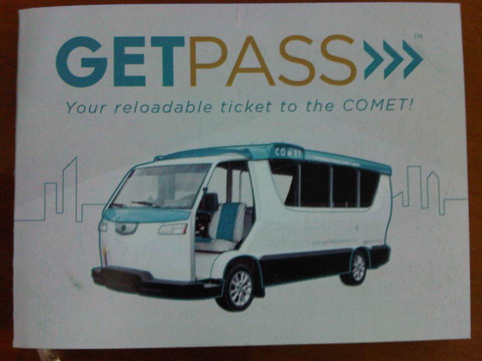 The GETPass card comes with a brochure on the COMET and how to use the card.
 Basic information on the GETPass card.
 Illustrative example of how to use the card.
 The GETPass card
 Instructions at the back of the card.
 More information on Global Electric Transport.
 Southbound designated stops for the COMET.
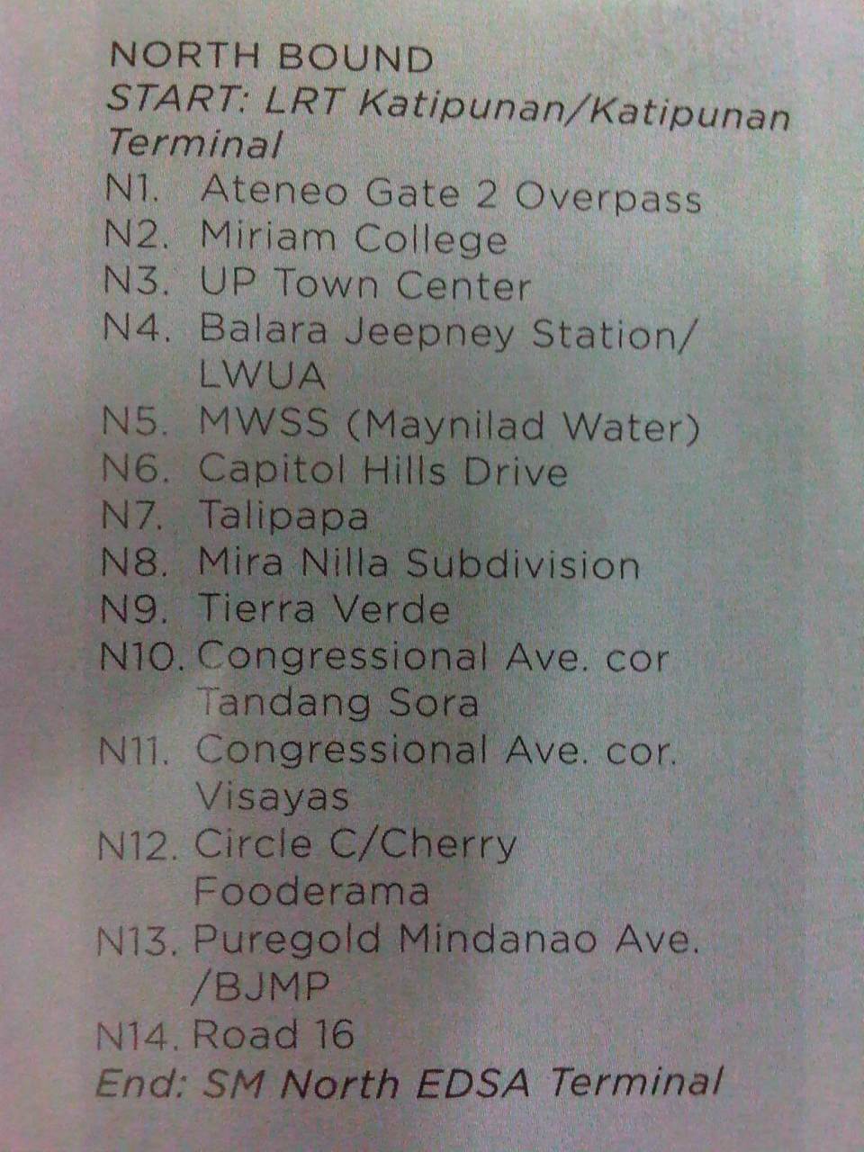 Northbound designated stops for the COMET.
 Route map included with the tap card brochure.
 COMET in operation along the southbound side of Katipunan Avenue (C-5).
The current experimental route of the COMET overlaps with several jeepney routes including Katipunan and Tandang Sora jeepneys. If the objective is simply to demonstrate vehicle performance (and reliability) using this route and with actual traffic conditions, then this would be a very fruitful exercise. However, more suitable routes should be considered for the COMET including possibly new routes like missionary routes or feeder routes that are not yet served by any formal public transport. This is one way for the COMET to be mainstreamed and for the low emission vehicle to have a significant impact on transport and environment. Another way that would certainly be the more challenging one is the prospect of the vehicle replacing conventional jeepneys along established routes. I say this is a challenge because there has been a need to retire or phase out conventional jeepneys in favor of higher capacity modes (i.e., bus) and the jeepney sector (operators and drivers) have always been somewhat averse to proposals modernizing jeepneys due in part to financial implications of transitioning to low emission options like the e-jeepney or the COMET. If these are not considered, the COMET will just be an additional vehicle along Metro Manila’s streets, contributing to the chaotic road public transport, and its hyped benefits will not be realised.
I do hope that the COMET will not be just another paratransit mode that is integrated with all the other land transport modes currently in operation throughout the country. I believe there is a big potential for the vehicle and similar other models like it for cities and towns that are not yet as highly urbanized as Metro Manila or perhaps Cebu. There are corridors or areas where buses are not or will not be viable within the foreseeable future (next 5 to 10 years?) given the demand for this period. These are where jeepneys thrive (assuming tricycle operations are restricted or strictly regulated) and where the COMET would be most suitable.
–
Metro Manila Urban Transport Improvement Project (MMUTIP, 1981)
[Important note: I have noticed that the material on this blog site has been used by certain people to further misinformation including revisionism to credit the Marcos dictatorship and put the blame on subsequent administrations (not that these also had failures of their own). This and other posts on past projects present the facts about the projects and contain minimal opinions, if any on the politics or political economy at the time and afterwards. Do your research and refrain from using the material on this page and others to promote misinformation. I suggest you go to the The Mass Transit System in Metro Manila site for more facts about railway development and history. I do not consent to the use of my articles for the purposes of misinformation and historical revisionism. 10/13/2019]
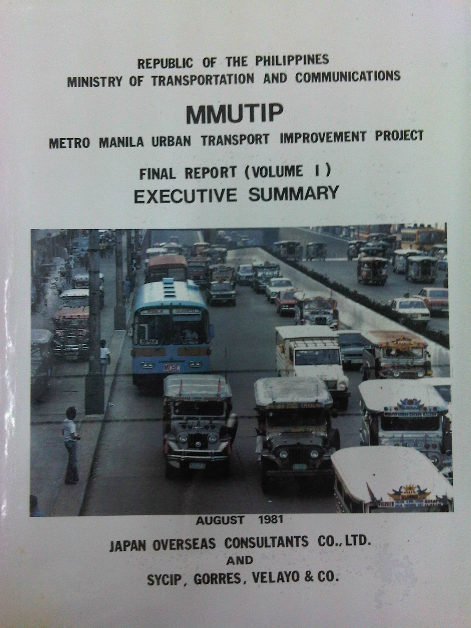
We continue with our historical features on transport with the Metro Manila Urban Transport Improvement Project (MMUTIP). MMUTIP was implemented from July 1980 to August 1981 with funding from the Overseas Economic Cooperation Fund (OECF) of Japan. MMUTIP recommended for a new franchising system to be adopted by the then Board of Transportation (BOT), with standards covering citizenship, route opening, operating performance and financial capability. It also called for the adoption of measures that will safeguard the integrity of franchise records and the speedy processing and better control of franchise applications. The BOT is the precursor of the Land Transportation Franchising and Regulatory Board (LTFRB).
Additional bus routes were identified by the study and recommended for 5,900 units for daily operations. The study estimated that as much as 1,870 additional units were required for Metro Manila. Meanwhile, the study found the operations of the Metro Manila Transit Corporation (MMTC), the government owned bus company, unprofitable and stated that the government-run company has failed to define objectives and policies particularly in specifying the extent to which MMTC will render public service at the sacrifice of profit (note that MMTC was losing money in part because it was serving missionary routes so as to reduce direct competition with the private companies). I think looking back now, this was perhaps the beginning of the end for MMTC. Some people say that we could probably have used something like the MMTC today to keep public transport operators honest in their operations and also to continue providing services for missionary routes rather than letting these be served by tricycles and jeepneys that will eventually would have to be granted franchises. As it is, such situations often lead to poorly planned transport services including the (mis)determination of the number of PUV units required to serve an area or corridor.
MMUTIP recommended for the control of entry and operation of jeepneys along major bus routes while at the same time calling for a deregulation of entry and operations outside major thoroughfares, which were served or are more suitable for buses. Further, the study called for encouraging tricycle services where bus and jeepney routes are scarce while also stating that these should be limited to local or feeder services. Then as now, tricycles are restricted from national roads.
[Note: A copy of MMUTIP may be found at the National Center for Transportation Studies (NCTS) Library located at their building along Apacible Street at the University of the Philippines Diliman. This is not a public library so access is limited to UP staff and students. Researchers and others from outside UP would have to write to the Director for permission to use the library and its holdings.]
–
Bad P.R. for road sharing
A few articles came out of Sun Star Cebu recently regarding an activity over the weekend that was supposed to promote road sharing. I read four articles by different opinion writers. These may be found in the following links:
- A crazy exercise [Bobby Nalzaro, September 28, 2014]
- Sharing narrow roads [Opinion, September 29, 2014]
- Road sharing, road rage [Eddie Barrita, September 30, 2014]
- Green Loop’s faulty premises [Bong Wenceslao, September 30, 2014]
The first three articles seem to be more like reactions of motorists to activities that seek to promote road sharing and cycling in particular. The writers missed the point in so far as road sharing is concerned and are definitely biased towards the status quo in terms of road usage. However, some of their observations need to be qualified as certain roads seem to have been closed with little advise to the general public, many of whom take public transport. The last article is the more grounded one and explains the perspective of non-bikers who are public transport users. This is the calmer opinion among the four and expresses his points in a more objective manner.
I was not there and I haven’t read yet any articles from the organizers or participants to the activity. I would like to give them the benefit of the doubt in so far as their advocacy is concerned. But then one also has to consider the valid points raised by other road users whenever road sharing is equated to cycling rather than a more balanced mix that is focused towards maximising the number of people or amount of goods transported. It is not only a question of space but of efficiency of movement. Bicycles might be efficient in energy but unfortunately it is not the most efficient in terms of the number of people carried between origins and destinations. And we can never decongest our streets in order to make more space for cyclists and pedestrians if we cannot come up with efficient public transport systems that will encourage people to leave their cars or not to buy one in the first place. It can be argued that people are actually opting for motorcycles than bicycles for commuting – another trend that needs to be understood from the perspective of people making these choices for their transport needs.
–

