
Home » Railways (Page 11)
Category Archives: Railways
Line 2 Extension construction at full swing
The construction of the LRT Line 2 Extension from Santolan, Pasig City to Masinag, Antipolo City is now in full swing. The contractor, DM Consunji, Inc., has occupied several lanes of Marcos Highway and the reduced capacity of the highway has led to moderate to severe congestion along sections from Ligaya to Masinag. At certain times, construction work required more space than the 2 lanes usually occupied by construction equipment and materials. Following are a few photos of the project showing various stages in the construction of the Line 2 extension.
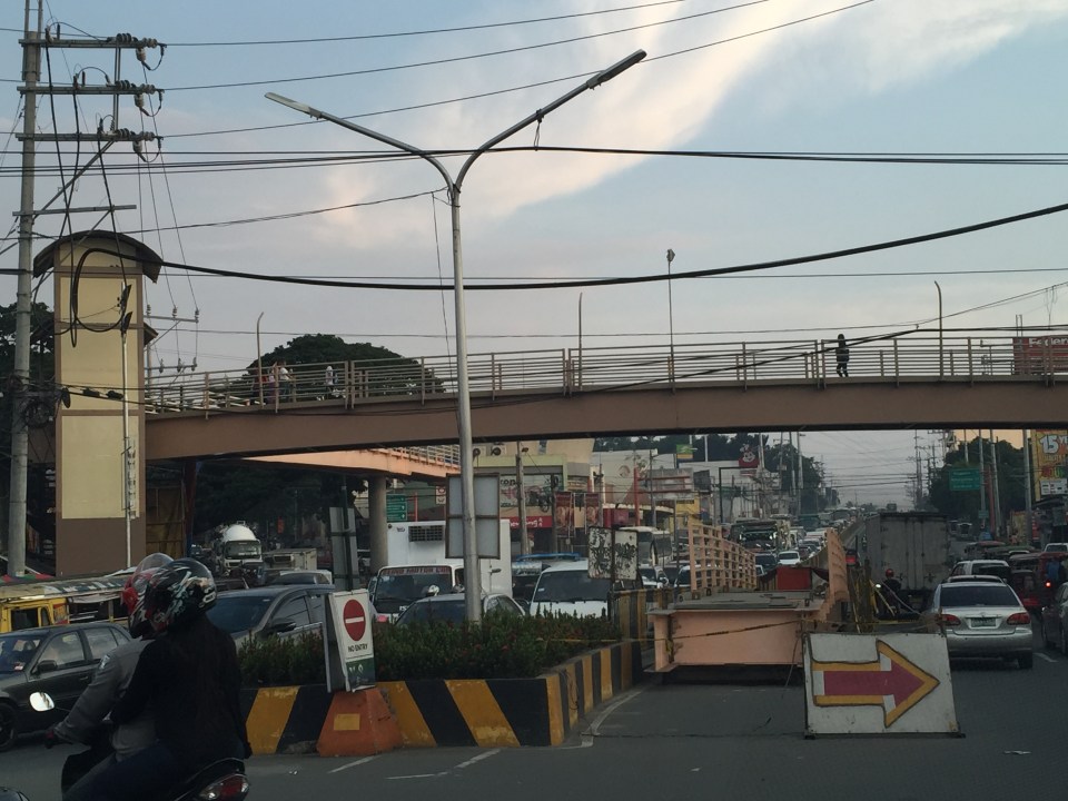
 Section in front of SM Masinag also showing the pedestrian overpass across Marcos Highway
 Section in front of Vermont Royal Executive Village also showing a newly constructed pedestrian overpass that looks like it will be cleared by the elevated tracks.
 Columns under construction along Marcos Highway across from Golden Meadows Subdivision.
 Columns completed and under construction across Town & Country Executive Village – the photo also shows another pedestrian overpass but from the completed column its clear that modifications aren’t needed for the overpass.
 Construction at the current end of the elevated tracks at Santolan, Pasig City
Construction works are expected to go on for at least a year before the trains can start test runs along the new tracks. This is definitely going to be a game changer in terms of commuting along this corridor once the extension becomes operational and hopefully DOTC is already planning an extension further towards Cogeo or perhaps branch out to Marikina via Sumulong Highway.
–
EDSA MRT 3 chronicles
A friend referred an article to me today and I thought it would be a very good read to a lot of people interested in what has happened and what is happening to the EDSA MRT 3. I think that this article is so far the most comprehensive, not-necessary-legal treatment of events leading to what we now have as a mass transit system along arguably the country’s busiest thoroughfare:
On a clear day you can see the MRT
It’s a must read for a lot of people who want to know about the dealings related to MRT 3 and perhaps understand how complex this has become. I would also recommend people read the very good discussions in the comment section of the article. It’s good to see the healthy exchange of opinions rather than have trolls ruin them.
–
Some advantages of rail over road transport
In my previous article, I mentioned how rail transport is important as part of a country’s transport system, particularly on land. I also mentioned a study conducted by our undergraduate students that was completed back in April 2012.
Our students conducted a simple survey, as part of their research, to determine the travel times and costs for public transportation between several origin-destination pairs. These O-D pairs were selected to simulate costs and travel times of commutes using either primarily rail or all road transport. Note the choices of either ‘school’ or ‘office’ paired with ‘home’ somewhere in the south of Metro Manila.
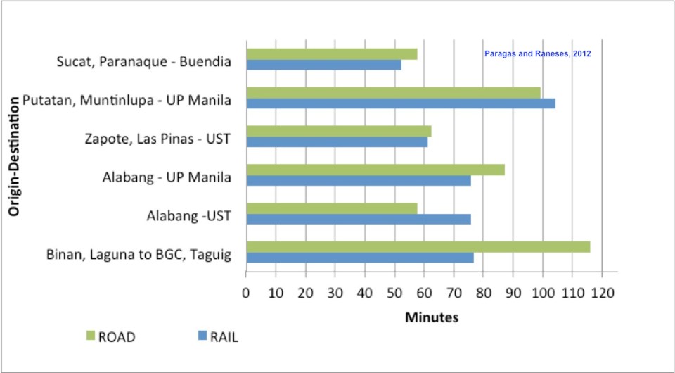 Travel time comparisons for commutes using road and rail public transportation – ‘Road’ refers to the entire commute using road-based transport (i.e., buses and jeepneys) while ‘Rail’ refers to commutes utilizing mainly the PNR but with road transport used in the end parts of the journeys (e.g., jeepney ride from near the PNR Espana Station to UST).
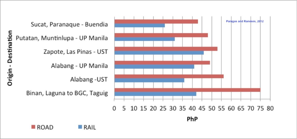 Travel cost comparisons for commutes using road and rail public transportation
Relevant to understanding the above are the following
- Fare rates have changed since 2012. However, this presents a constant change over the fares that are being compared so the basic differences will remain the same across origin-destination pairs.
- PNR services had to be discontinued for some time due to derailments because of poor conditions of tracks.
- Road traffic has worsened since 2012 with several “carmaggedon” episodes showing how vulnerable commuters are when using solely road transport.
- Road public transport services are frequent and practically 24/7. PNR services are of very limited frequency. Waiting times for the trains typically add to travel times in the form of delays, which make commuting by rail an unattractive option due to their unreliability of service.
–
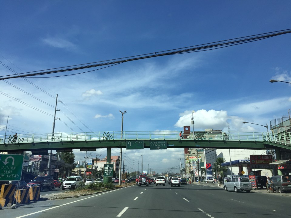
On the severity of traffic congestion along Ortigas Avenue and the necessity of a mass transit line
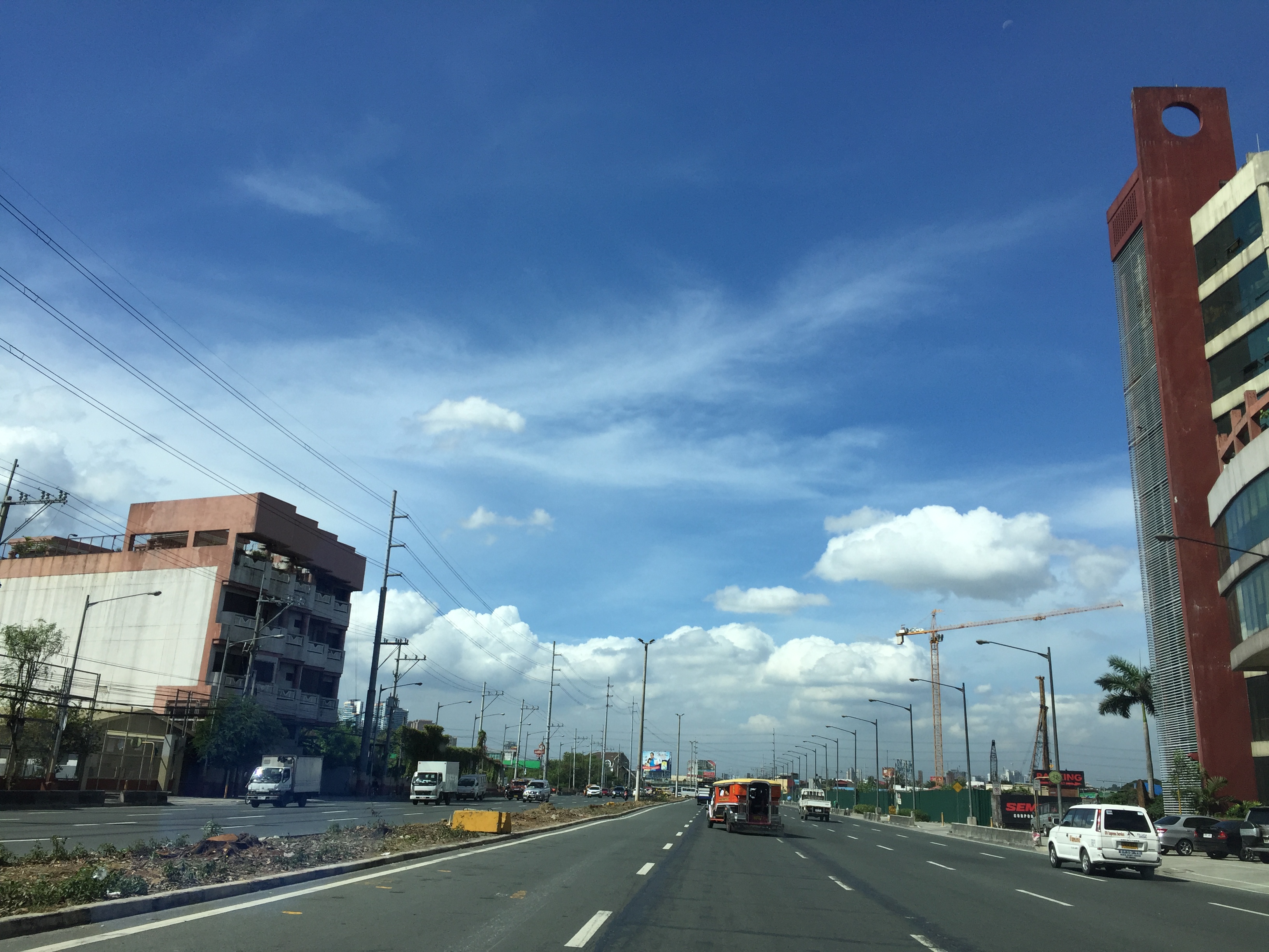
With the worsening congestion along Marcos Highway due to the construction of the LRT Line 2 Extension to Masinag, I have been using Ortigas Avenue as an alternate route to go home. Granted, the stretch from the Park Place gate near Cainta Junction and Brookside is currently undergoing roadworks elevating that entire section (which is prone to flooding), and this is the main cause of much congestion as fewer lanes are usable to traffic. However, what is perceived to be relief from traffic once the project is completed will eventually and surely revert to a very congested Ortigas Avenue.
Traffic congestion along Ortigas Extension is primarily due to a dependence on road transport, particularly private vehicles, by people living along Ortigas Ave. and the roads feeding into it. The Manila East Road, for example, passes through the most populous towns of Rizal outside of Antipolo City. The dependence on road transport (especially private vehicles) is due to limited options for public transport. There are buses, jeepneys and UV Express but these, too, contribute to congestion due to their increased numbers and limited capacities given the high demand for public transport. Among the infrastructure proposed along this corridor is an overpass along Ortigas Ave. at Cainta Junction. A mass transit system has also been required along this corridor for a very long time but for some reason, such infrastructure has not been provided.
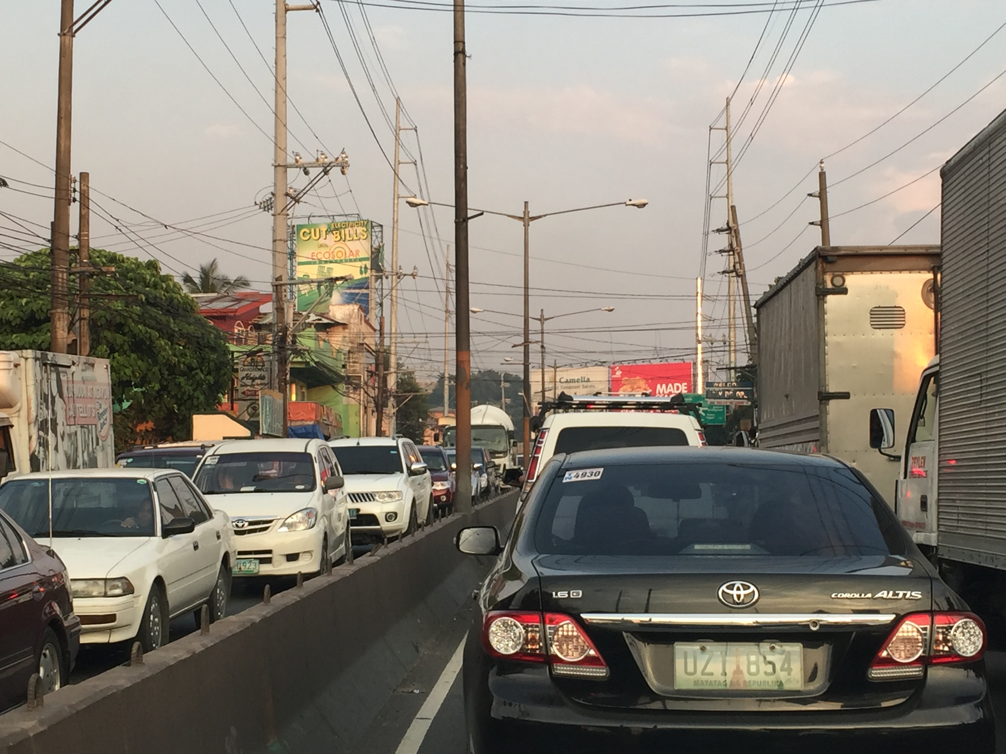 Severe traffic congestion along both directions of Ortigas Avenue Extension
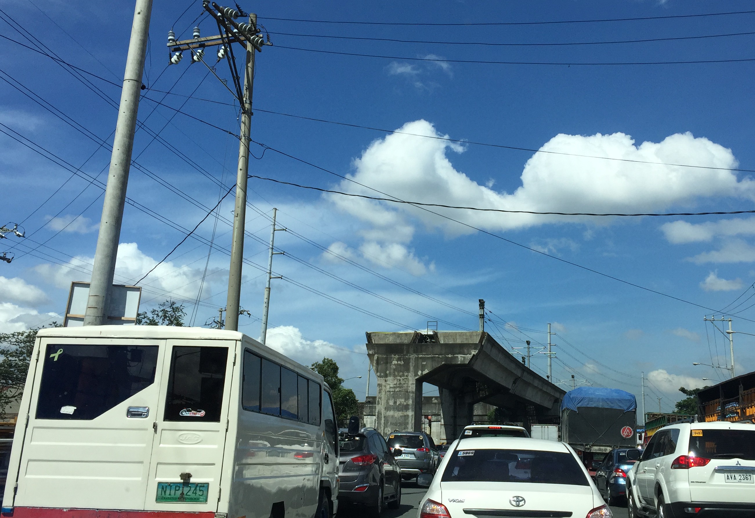
 Congestion stretches all the way along the Manila East Road
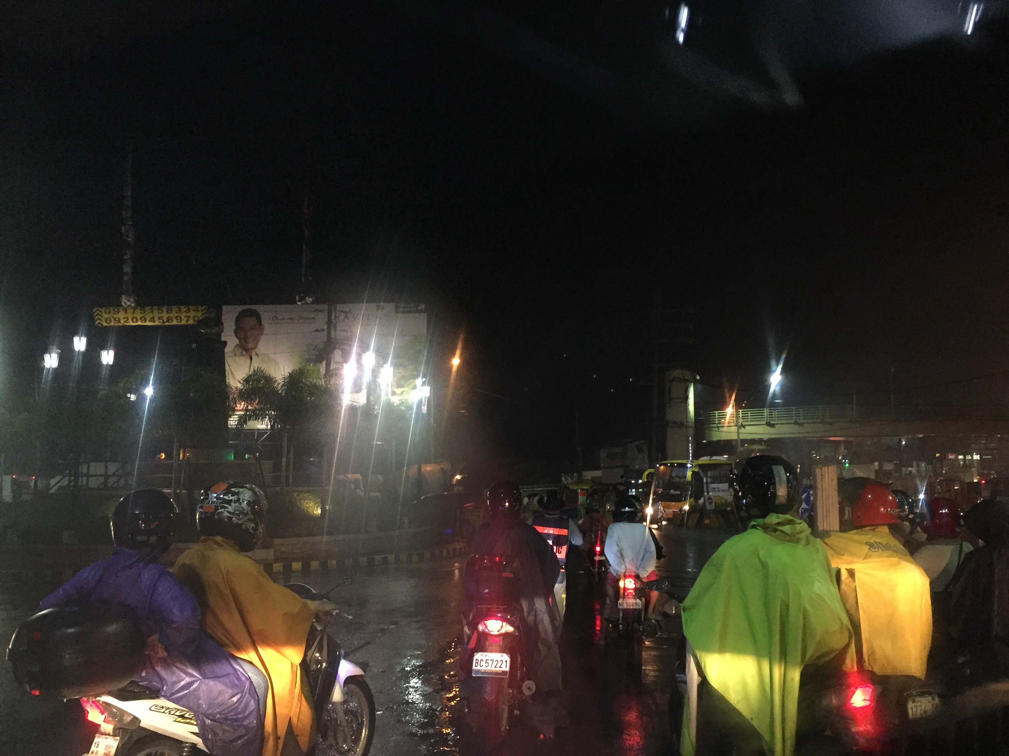 Night-time traffic congestion at the Tikling Junction
There is a proposal for a mass transit system along this corridor. Following are references to the project:
From the PPP Centre: https://ppp.gov.ph/?ppp_projects=ortigas-taytay-lrt-line-4-project
From CNN Philippines: http://cnnphilippines.com/metro/2015/07/22/neda-approves-naia-lrt-ppp-projects.html
I found it quite odd that the stations are not referenced according to the more common place names for the locations. For example, ‘Bonifacio Avenue’ should be ‘Cainta Junction’ and ‘Leonard Wood’ should be ‘Kaytikling Junction’. Nevertheless, this is the least of our concerns pertaining to transport and traffic along this corridor.
Perhaps the conditions are ripe now to finally implement transport infrastructure projects along this corridor. The proposal and approval of a rail transit line by NEDA means the corridor has the national government’s attention. The local government leaders along this corridor are also more progressive and aggressive than their predecessors. These include a very dynamic mayor in Cainta and the former governor-turned mayor in Antipolo. A collaboration towards better transport among these two LGUs alone would be influential and instrumental to improving travel along Ortigas Avenue.
–
Updates on the LRT 2 Extension – no more trees!
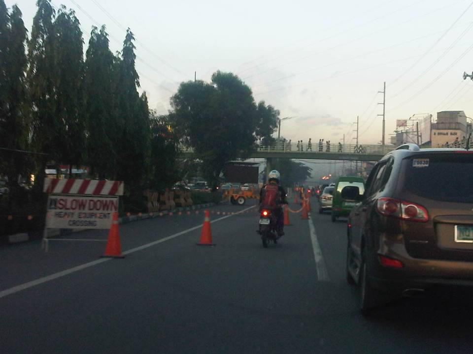
It’s been a while since I last passed by along Marcos Highway. This morning, I was a bit surprised by what I saw (or perhaps, more appropriately, what I didn’t see). The median along the section between Imelda Avenue all the way to Santolan has been cleared of trees. This was already expected as the contractor was already clearing the median for the past weeks. The work entailed fencing off the inner lanes of Marcos Highway and has caused congestion with the highway’s capacity significantly reduced and many motorists slowing down to observe what was going on (usyoso). Following are a few photos of Marcos Highway taken this morning.
 DMCI removed the barriers securing the inner 2 lanes to reveal a median clear of trees. The median will be where the columns for the elevated LRT Line 2 extension to Masinag will be constructed.
 I wonder what will become of the pedestrian overpasses along Marcos Highway. These structures would have to be redesigned with respect to the elevated structure of the LRT Line 2.
 Here’s the conspicuously clear median along Marcos Highway approaching Ligaya. The Ayala development can be seen on the right side along the Quezon City bound side of the highway.
 Waiting – Line 2 currently terminates just after Santolan Station where trains make the switch for the return journey.
–
Railway network for the Philippines?
We start November with an article about railways. There seems to be a lot of buzz about rail these days including talks about the prospects of a subway line in Metro Manila and long distance north-south lines for Luzon Island. These projects, though, will take a lot of time to be constructed and operational, even if these projects started immediately (i.e., next year). That is perhaps one reason why these projects need to be implemented sooner rather than later. And the more these projects are delayed, they become more expensive and also difficult to build (e.g., there are other developments such as roads that may hamper rail and other mass transit projects).
I had a couple of students who did research a little over three years ago on the state and operations of the Philippine National Railways (PNR). Aside from the research manuscript, their work has not been published. The results, however, seems quite appropriate these days as the country and Metro Manila in particular grapples with problems pertaining to commuting that is dominated by road-based transport. I will write about their results here but only show some excerpts as we intend to have part of their work published.
As a first salvo, here’s a map that they were able to get from the Philippine National Railways (PNR). The map shows current and proposed railway lines throughout the country. These include the PNR Main Line South (MLS), which extended to Laguna, Batangas, Quezon, Camarines Norte, Camarines Sur and Albay. There is also what used to be the PNR Main Line North (MLN) that extended to Bulacan, Pampanga, Tarlac, Pangasinan and La Union. Panay Railways, the only other long distance railway system aside from the PNR as late as the late 1970s, is also in the map along with the proposed Mindanao Railways.
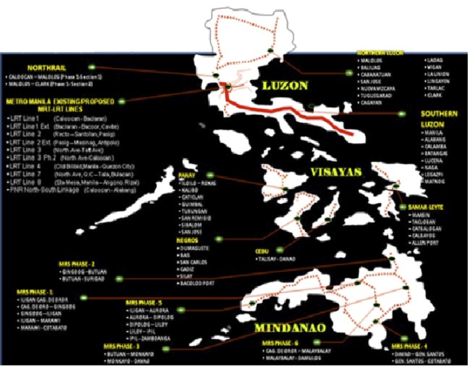
This map was provided by the PNR and likely includes data coming from the Rail Transport Planning Division of the Department of Transportation and Communications (DOTC). Contrary to the perception of many in the current administration, a lot of railway planning was conducted by past administration and many were sound ideas that justified feasibility studies. As usual, the main obstacle for railways would be the competition with road transport. It was road transport and the construction of expressways and other highways, after all, that dealt the PNR its decline (and death in the case of the MLN) to what remains today.
[Reference: Paragas, L.K.B. and Rañeses, M.K.Q. (2012) Assessment of the Philippine National Railways Commuter Line System, Undergraduate Research Final Report, April 2012.]
–
Local papers presented at the EASTS 2015 conference – De La Salle University
De La Salle University (DLSU) has a strong program in transportation engineering and planning. This program is under its Department of Civil Engineering and led by Dr Alexis Fillone. Following is a list of papers from DLSU:
- Mode Shift Behavior of Bus Passengers to Rail System under Improved Rail Conditions [Alexis Fillone & Germaine Ann Dilay]
- Evaluating Proposed Transportation infrastructure Projects in Metro Manila using the Transport Co-Benefit Analysis [Alexis Fillone]
- Inter-Island Travel Mode Choice Analysis: Western Visayas Region, Philippines [Nicanor Roxas Jr & Alexis Fillone]
- Revisiting Volume-Delay-Functions Used in Transport Studies in Metro Manila [Jiaan Regis Gesalem & Alexis Fillone]
- Characterizing Bus Passenger Demand along Epifanio de los Santos Avenue (EDSA), Metro Manila [Sean Johnlee Ting, Kervin Joshua Lucas & Alexis Fillone]
- Optimized Bus Schedules in Epifanio Delos Santos Avenue (EDSA), Metro Manila Using Fuzzy Rule-Based System [Alexis Fillone, Elmer Dadios & Ramon Intal]
- Opinion Survey about Pedestrianization of Heritage Sites in the City of Iloilo, Philippines [Alexis Fillone & Frederick Sosuan]
- Factors Influencing Footbridge Usage Along Epifanio Delos Santos Avenue (EDSA), Metro Manila [Aaron King, Rigel Cadag, Jireh Despabiladeras, Rei Tumambing & Alexis Fillone]
- A Compact Scheduling and Revenue Estimation Spreadsheet for Bus Operators [Raymund Abad & Alexis Fillone]
- Adaptive Driving Route of Busses along Epifanio de los Santos Avenue (EDSA), Metro Manila, using Fuzzy Logic [Alexis Fillone, Bernard Yasay & Elmer Dadios]
I thought DLSU could have published more papers in this conference. I was actually surprised that all the papers are practically attributed to Dr Fillone considering his co-authors are mostly his students. But then there are only 2 to 3 faculty members who are doing transport research in DLSU and Dr Fillone is the most involved and prolific among them in terms of published research outputs.
–
EASTS 2015 – Cebu City, September 11-13, 2015
The 11th International Conference of the Eastern Asia Society for Transportation Studies (EASTS 2015) will be held in Cebu City this September 11-13, 2015. For information on the conference and program, check out their website here:
You can also download a brochure about EASTS here:
The conference is hosted by the Transportation Science Society of the Philippines (TSSP), which is the local affiliate of the EASTS. More information on the TSSP are found below:

–
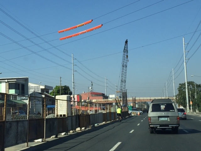
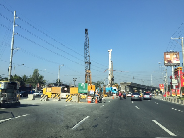
The LRT Line 2 Extension gets underway
A lot of people have been waiting to see the construction of the LRT Line 2 extension from Santolan in Pasig City to Masinag in Antipolo City. Right after the groundbreaking ceremony last June, there seemed to be no activity along the alingment that was the center of Marcos Highway. Actually, there were already activities as the contractor already deployed personnel to do some surveys including marking the locations of the columns that will support the elevated tracks.
The past week saw the contractor setting up a work zone in the middle of Marcos Highway and stretching from across Robinsons Metro East and McDonalds. The work area included what was the opening for the Felix Avenue-Marcos Highway intersection. This is probably one of the busiest if not the busiest stretches of Marcos Highway so the reduction by one lane for either direction of the highway immediately had a negative impact on traffic. Added to the highway capacity reduction in terms of the remaining available lanes is the further reduction due to the ‘usyoso’ behavor of motorists ‘inspecting’ the work zone as they pass by.
 Work zone across from Robinsons Metro East – direction of traffic to Masinag (eastbound)
 Work zone at the junction of Imelda Ave. (formerly Felix Avenue formerly Imelda Ave.), Gil Fernando Ave. (formerly A. Tuazon Ave.) and Marcos Highway
 Work zone near McDonald’s (on the other side -westbound – of Marcos Highway) and also near a major U-turn slot used by vehicles coming from Imelda Ave that are westbound
Traffic will definitely be heavy along this section and the rest of Marcos Highway once construction is at full swing. I am tempted to say that it might be worse than the NAIA expressway construction site of which the contractor is the same. I just hope the appropriate traffic management measures are implemented and that road users will be cooperative. This will likely be a couple of years’ sacrifice for anyone living along this corridor and the major roads connecting to it. Will there be a light at the end of the proverbial tunnel? There should be as LRT Line 2 will finally be able to serve an area wanting of efficient and reliable public transport.
–
Health and commuting
Why is good public transportation especially transit important? Perhaps transport engineers and planners often get lost in trying to explain this from the perspectives of travel efficiency (e.g., reduced travel times, fuel efficiency, more capacity in terms of people carried, etc.) and environmental concerns (e.g., reduced emissions, reduced noise, etc.). Perhaps, too, there’s a need to articulate the importance of good public transport from the perspective of health. How many people do running, jogging or walking in the mornings, afternoons or evenings just to lose weight? How many go to gyms to workout? Perhaps the key to health lies in just walking everyday and integrating that healthy walk in your daily commutes. Here is a nice article from the Wall Street Journal on the link between the way you commute and a healthy life:
Your Commute Could Help You Lose Weight
Somethings I miss from living in Japan and Singapore are my regular walks to and from the transit station. I recall really good walks between the Transport Laboratory in YNU to the Soetetsu Line Kami Hoshikawa Station. You have to walk up a small mountain almost everyday from the station to the university. I also had good walking buddies back then during my 3 years in Yokohama. Later, I also enjoyed walking or cycling between the Transport Lab at Saitama University and the International House. Often, too, I would walk or cycle to the supermarket, the transit station or just around the neighborhood during free times. In Singapore, our home and the office were also near transit stations so we could take nice walks between them aside from the four flight of stairs to our apartment on the fourth floor. Such healthy commutes can be realized in Philippine cities if proper planning is undertaken and transit projects are implemented not just from the perspective of efficiency but, importantly, from the viewpoint of health. The current state of public transport is not healthy and many, especially those taking the EDSA MRT 3, will say that it is quite stressful to commute in Metro Manila. And stress is definitely not the way to lose weight. Is this true for other Philippine cities as well? Hopefully, we can work out transport solutions that include good public transport to promote healthy lifestyles.
–
