
Home » Railways (Page 12)
Category Archives: Railways
Some thoughts on the EDSA MRT 3 problem
A lot of people reacted when the current Philippine President practically absolved the Department of Transportation and Communications (DOTC) from any fault regarding the issues on the EDSA MRT Line 3 during his recent State of the Nation Address (SONA). The main message in some articles appearing on mainstream and social media is that the President should blame DOTC for the mess. I have the opinion that both DOTC and the private entities involved (MRT Corporation, MRT Holdings) are responsible for the problem and its being continuously unresolved.
A week ago, I got the following question in my email:
Who is it that we could blame for the current state of the rail system? What do you suggest that the government or the private partner do in order for them to improve the line?
Quite frankly, I thought the first question was too direct and blunt as to ask who we can blame for the MRT3 mess. It is also very awkward to answer the second question because it assumes that I am an expert on the legal issues on this matter. I am NOT a legal expert nor would I want to pretend to be one. Here was my reply:
That’s actually a very tricky question. We can’t really blame a specific person or persons but perhaps entire organizations that are supposed to be responsible for the mess that is MRT3. The main or root issue seems to be legal and not at all technical. The technical problems experienced are manifestations of a contract that is a textbook case for how NOT to do a PPP. I am not privy to the details of the discussions between the government and the people involved and behind MRTC so it is awkward to make comments specific to this matter of the contract and all its complexities. Perhaps the DOTC wants to follow “Daang Matuwid” by not budging to the terms laid out by MRTC? Perhaps MRTC is aware of the stakes (plight of the riding public) and is using this to force DOTC into a deal that is not favorable to government? We can only speculate on this without firsthand knowledge of their discussions.
However, from the perspective of transport as a service and as a public good, I would say that MRTC indeed is aware of the public’s clamor for improvement. This is all over the news and social media in the form of commentaries, images and even videos of the undesirable experiences of those taking the MRT3. In the end, DOTC must decide whether it is all worth it to maintain the stalemate with MRTC considering that the public interest is at stake here and things will just become worse with inaction. Perhaps the government should move towards the best compromise they can live with considering the urgency of addressing the problem at hand.
I would like to think that my reply was quite cautious. There have been many allegations and claims from both sides of the table regarding how to resolve the impasse and the conflicts that seem to be interwoven with the contract on the MRT3. Perhaps such cases test the limits of “Daang Matuwid”? Much was and is expected from DOTC considering its battery of lawyers including top officials of the department. Aren’t they supposed to have been involved in discussions and negotiations aside from strategic planning for our transportation in this country? I guess the general public especially those who take the MRT3 for their commutes already know who to blame for their plight…
–
San Diego’s Sta. Fe Train Depot
A highlight of my ‘do-it-yourself’ tour of San Diego, CA was the Sta. Fe Train Depot or Railway Station. The depot was celebrating is centennial and for me represented part of America’s railway heritage being part of a railway line stretching along the US’ Pacific coastline. Following are photos in and about the Sta. Fe depot.
 The historic Sta. Fe Train Depot building as seen from the San Diego MTS trolley station.
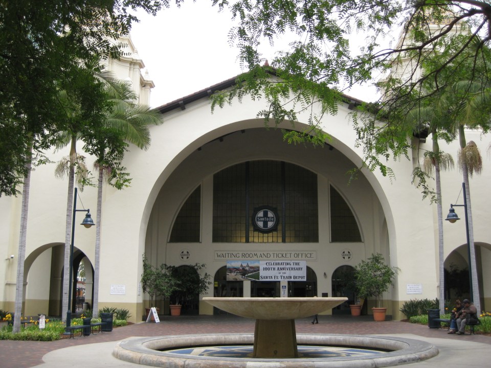 Front of the train deport showing a fountain and the main doors to the station building.
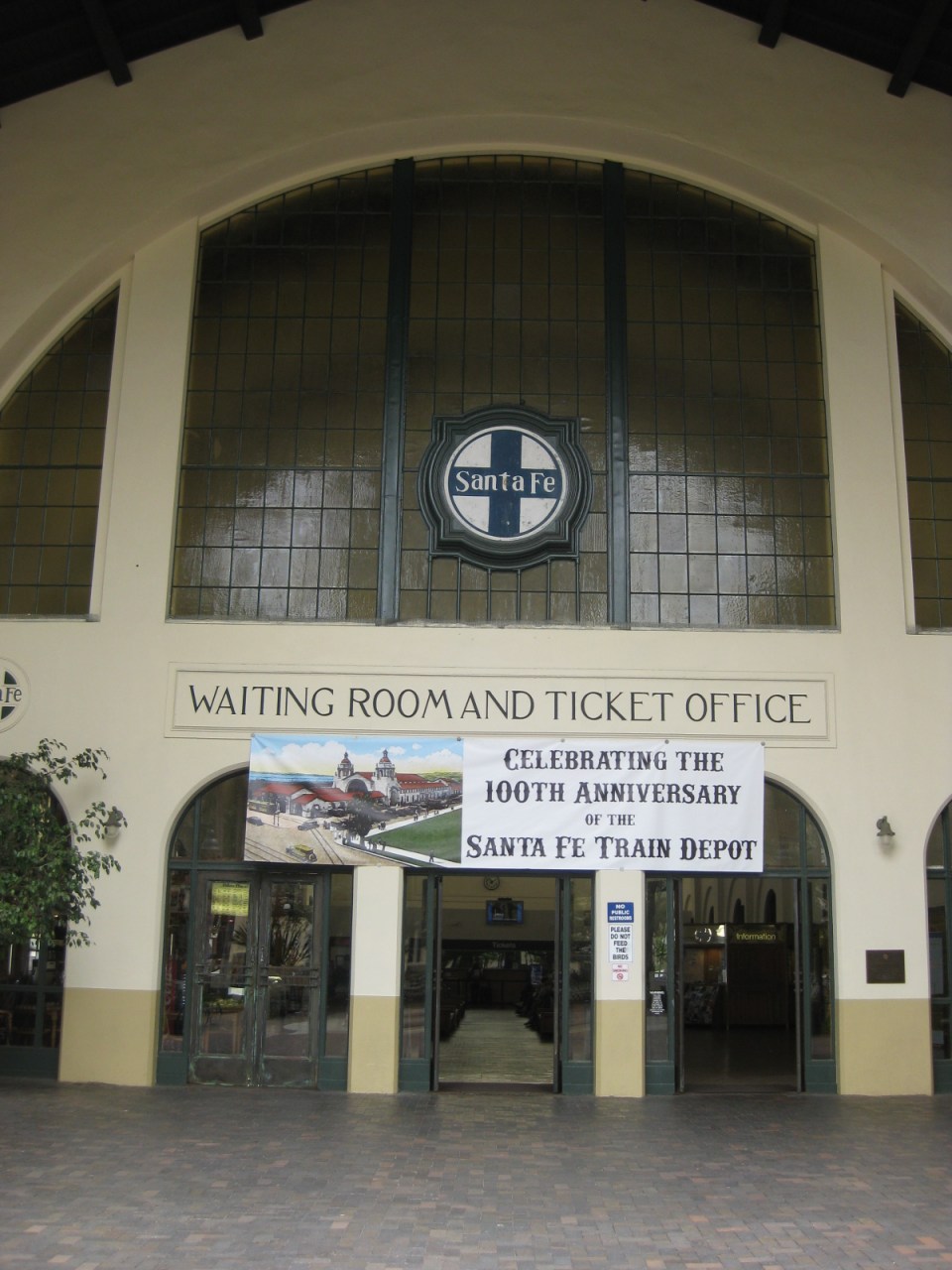 Entrance to the building, which contains the ticket office and waiting room for passengers and well-wishers.
 One is greeted by this splendid view of the building’s interior evoking a time when trains ruled in land transportation. An information booth is seen at the right while the food kiosk is at the left. The ticket windows are further at the center.
 The kiosk inside the station building provides sustenance to passengers, well-wishers and passers-by. Note, too, the mosaic designs on the columns of the building.
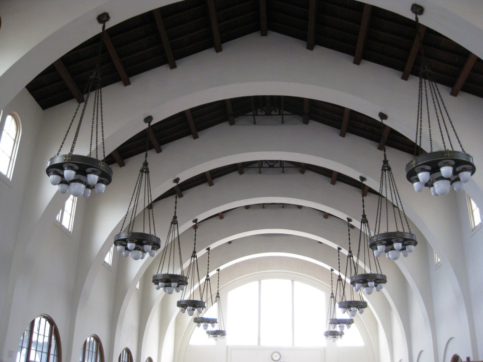 A closer look at the station’s ceiling and chandeliers shown arches emanating from the columns to support the roof. Such features are of earthquake resistant structures in this earthquake-prone region and particularly in the State of California.
 Pedicab, trolley and the Sta. Fe Train Depot
I took some refreshments at the kiosk in the station. The hotdog sandwich was good and the coffee was strong. I took the trolley from the station to explore San Diego along its commuter train lines. More on San Diego’s trains and stations in future posts.
–
Finally, the LRT Line 2 Extension begins construction
The groundbreaking ceremony for the extension of the LRT Line 2 from Santolan, Pasig City to Masinag Junction in Antipolo City was held last June 9, 2015. This marks the beginning of the construction of the much anticipated and much delayed extension of the line to what was supposed to be part of the first phase of Line 2. I say supposed because most experts believe the current line should have terminated at Masinag from the start instead of at Santolan where the depot is located. Masinag had much more sense many years ago as it was a good staging point for possible extensions to Cogeo, Antipolo City proper or Marikina City. The areas along the Marcos Highway corridor beyond Masinag alone have experienced tremendous growth especially after the floods of Ondoy (Typhoon Ketsana), which submerged much of the Marikina Valley including Pasig, Cainta and lower Antipolo.
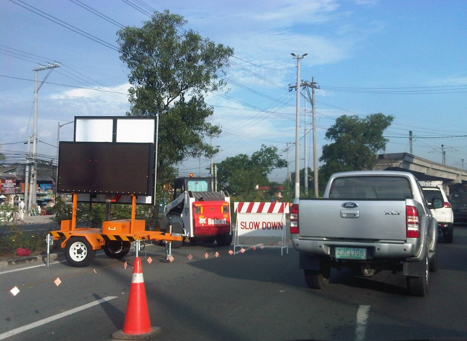 Traffic cones and signs guide motorists away from the inner lanes of Marcos Highway.
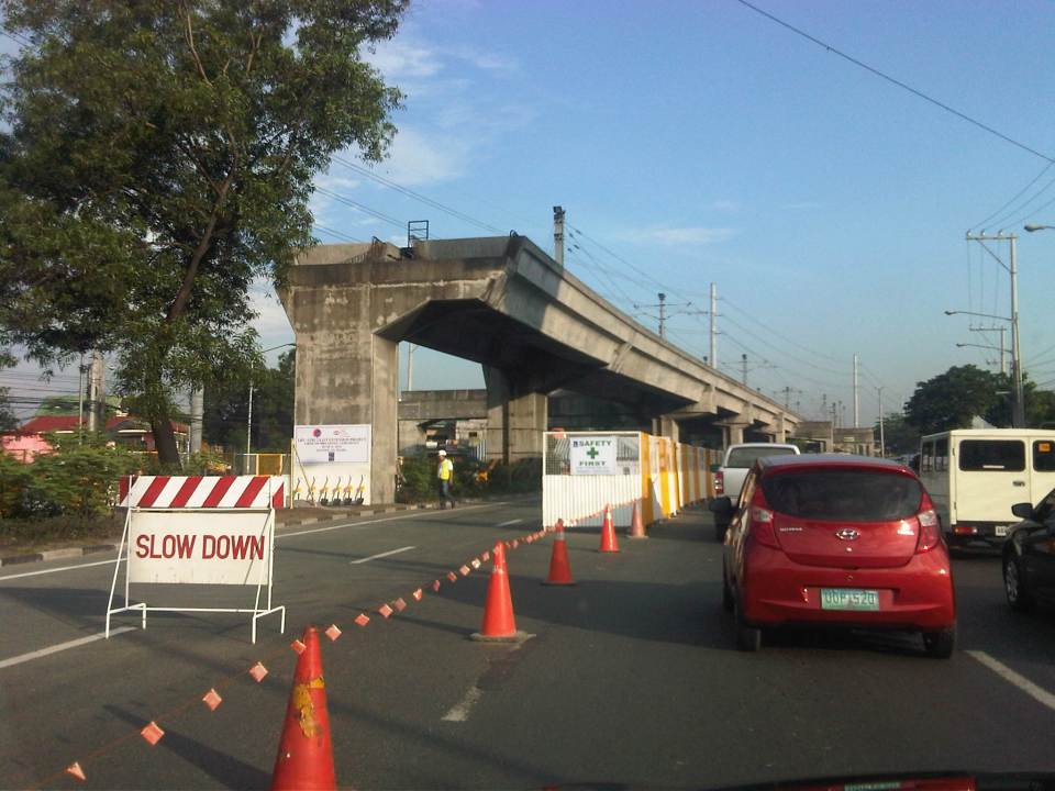 Two lanes from each side of Marcos Highway at the current end of the Line 2 were appropriated in addition to the median for the groundbreaking ceremony.
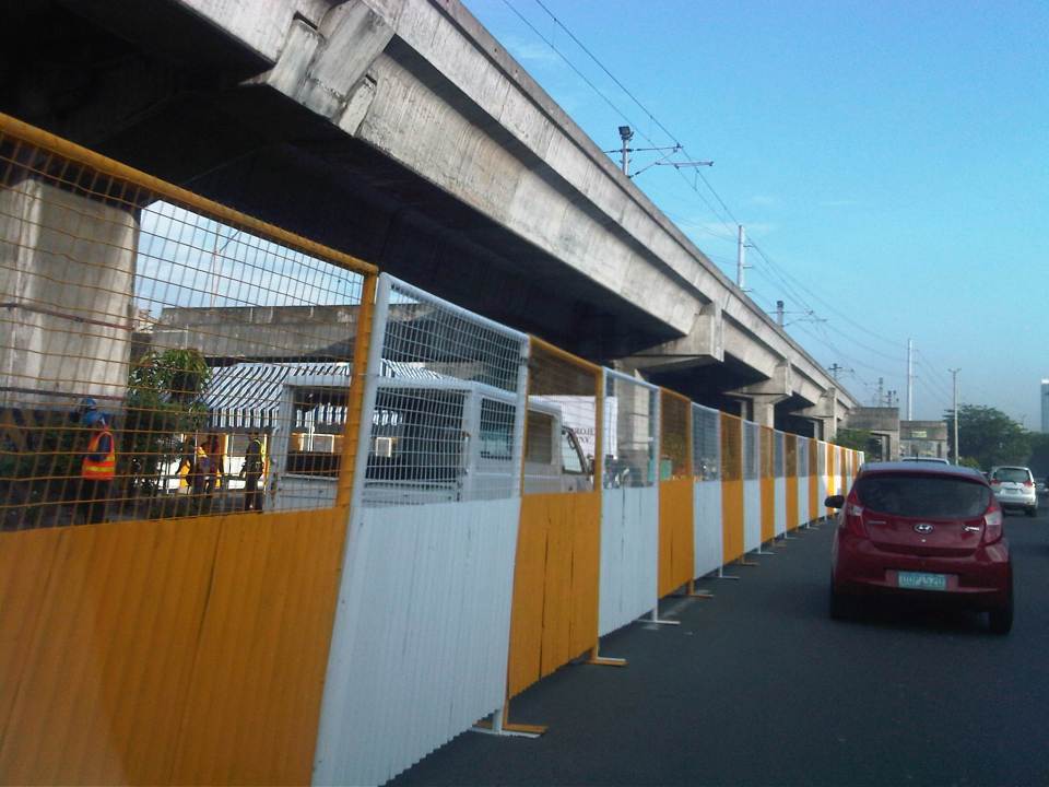 The stage is set – the stage for the ceremony is set under the viaduct with these barriers practically shielding the participants from curious passers-by (usyoso). Regardless, the event cause congestion along the highway.
Of course, that was the groundbreaking ceremony. As of today, there’s no sign yet of the contractor, DMCI, fully mobilizing and already reserving the inner lanes of Marcos Highway for the construction of the viaduct and stations. If the current works for the NAIA Expressway in the airport area is to be a reference, then severe traffic congestion is to be expected along the highway and this will extend beyond the actual construction site from Santolan to Masinag. As such, the public will experience inconvenience for the next so many months or perhaps couple of years (or more if there were delays). However, I believe that once the line is operating all the way to Masinag, it will help to ultimately decongest Marcos Highway and Aurora Boulevard and a lot of people will benefit from the improved travel times.
Incidentally, the term LRT is actually a misnomer here because among the 3 operational rail mass transit lines (I am excepting the PNR Commuter Line here.) in Metro Manila, Line 2 is actually a heavy rail system. Perhaps the government should already correct this by simply referring to Line 2 as ‘LRTA Line 2’ or renaming LRTA to reflect its nature as a transit authority that should not be limited to light rail only.
–
San Diego’s Compass Card
Whenever I am in a new city, I try to learn about their transport system. This includes finding out if they have some conveniences with respect to public transport like a transit card that you can use for various modes of public transport. Examples of these are cards in Singapore, Hong Kong and Japan that you can just reload (top up) and swipe or tap at terminals found in most if not all public transport. In Japan, you can even use their cards to purchase items at convenience stores or vending machines.
San Diego has what it calls the Compass Card, which you can use for the trolley and bus services. You can purchase a card from the Transit Store or at any of the machines located at the trolley stations. The Compass Card can be used to load day passes (instead of purchasing paper passes).
 Compass card vending and reloading machine – you can also purchase special tickets here like the 1-day Pass that basically allows you to have unlimited use of the trolley and buses within the day of purchase.
 Compass card front shows also the private sponsor/partner of the MTS – Albertsons
 At the back of the card are information on the use, care and expiration of the card.
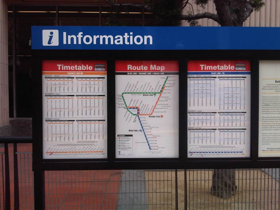 Timetable and route information for the San Diego trolley
 A close-up of the route map for the San Diego trolley’s three lines.
More detailed information on the Compass Card can be found in this link. I will write about the trolleys in succeeding posts.
–
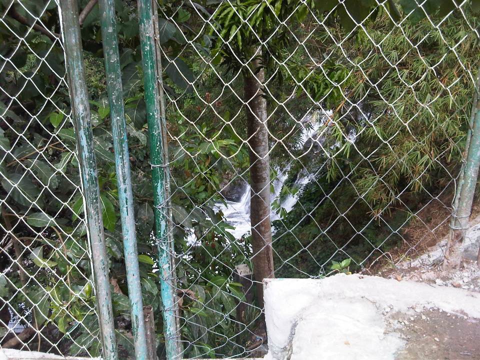
The old railway station at Hinulugang Taktak
The Antipolo City Government recently re-opened the Hinulugang Taktak park to the general public. The National Park and its famous waterfalls have seen better days and is part of Antipolo lore, immortalized in songs and stories about the pilgrimage city. It has been rehabilitated with various initiatives the past few years and with the water again flowing strongly compared to the trickles of dirty water over a decade ago.
Somewhat lost in the promotion of Hinulugang Taktak is a piece of transport history. I am referring to the old railway station located near the gate to the national park. The most convenient and probably most comfortable way to Antipolo and its two main attractions, the Shrine of Our Lady of Peace and Good Voyage and Hinulugang Taktak, many decades ago was by railway. Roads and road transport was not as good as today’s. There were no highways like Ortigas or Sumulong. There were no aircon buses, no jeepneys (yet) and cars and motorcycles were not affordable to most people.
 Old sign? There is no formal historical marker for the former railway station at Hinulugang Taktak. I think the National Historical Commission of the Philippines should recognize this as a local if not national heritage site.
 Trees notwithstanding, this is the view from what used to be the platform of the railway station.
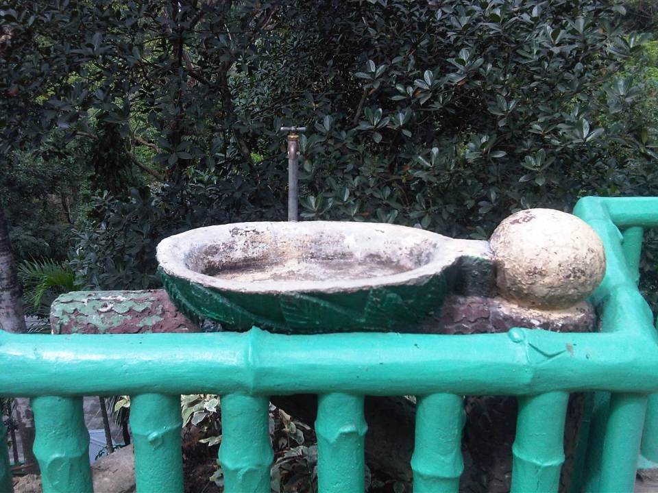 An old drinking fountain that’s probably survived the passing of time and witnessed a lot about the old railway station and Hinulugang Taktak.
 What’s left of the former railway station structure are the platform and columns.
 Taktak Road was the old Daang Bakal or railroad. Much have changed since the glory days of rail with a line that connected Antipolo with Manila.
 The view from the old entrance to Hinulugang Taktak in what also looked like the old railway station’s ticket office gives people (passengers?) a glimpse of the waterfalls.
 The old entrance to Hinulugang Taktak.
Someone asked me before if I thought it was possible for old railway lines to be revived. I replied honestly that I thought it was possible but immensely difficult. For one, a lot has changed in the lands on and along which the old railways used to be. The old Daang Bakal, for one, now passes through private residential subdivisions and industries and is now comprised of busy roads. While nothing is impossible, to rehabilitate the old railways will be a great challenge in the financial and social sense. It would be nice to see realized but requires so much from so many people, agencies and local governments who need to commit to such a project. And it requires leadership and a talent for convincing people that it is the right thing to do and that it needs to be done.
–
A tale of two consultants
I attended a seminar last November where there were two foreign consultants who gave talks about public transport and the reforms required for Metro Manila. One consultant had extensive experience in public transport, having worked in Hong Kong and Singapore, and is currently a consultant in Jakarta. The other appeared to have the more limited experience but claimed credit (I think partial at best) for public transport reforms in a major Asian city. I was impressed by the first in part because he was very honest with his statements especially as he explained a list of prerequisites for fixing public transport in Metro Manila (and other large cities). The bottomline from his presentation was that it was not possible to have a quick fix and there are no easy paths towards solving public transport problems in Metro Manila and elsewhere in the Philippines.
The second consultant was more on the patronizing side – promising a lot and a little too optimistic to be realistic or practical in his presentation on how to solve Metro Manila’s public transport woes. His material was hodge-podge at best with lots of visuals but not really getting to the point in terms of concrete solutions. It only betrayed his very limited if not unfamiliarity with transport and traffic in the metropolis despite his being a consultant with the office of the highest official of the transport department. There is a saying that if something seems to good to be true, it probably is. I think the same applies to what the second consultant presented to us that morning.
We need more of the first type of consultants who will tell us how it really is with regards to the “challenges” we face in solving transport and traffic problems in this country. The second type just lets us into a false sense of confidence or a feeling that the problems are not so big or complicated and that we are not in a big, deep hole that we need to climb out of. Its one thing to throw caution to the wind and another to have oneself firmly grounded in terms of the understanding of the problem at hand. Understanding the problem is the first step in the formulation of suitable alternatives and allows for the elimination or at least the minimisation of non-practical and non-realistic options.
–
Transport wish list for 2015
Last year, I opened with a very hopeful post on opportunities with certain mass transit projects that were hyped to be starting construction in 2014. The year 2014 went by and practically nothing really concrete happened (Yes, there were soil tests conducted for the LRT 2 extension but after that nothing else happened with the project.) with respect to these very critical mass transit projects that were already much delayed. It’s the same thing again this year so that same blog post from Jan. 1, 2014 applies this year.
I will not write down a list of New Year’s resolutions for the transport-related government agencies to adopt this 2015 though that stuff is quite tempting to do. Instead, I will just rattle of a wish list that includes very general and very specific programs and projects I would like to see realized or implemented (e.g., start construction) within the year; preferably from the first quarter and not the last. For brevity, I came up only with a list of 10 items. It is not necessarily a Top Ten list as it was difficult for me to rank these projects.
1. LRT Line 2 Extension from Santolan to Masinag
2. LRT Line 1 Extension to Cavite
3. MRT Line 7 from Quezon City to San Jose del Monte, Bulacan
4. Cebu BRT
5. People-friendly road designs
6. Integrated fare collection system for Metro Manila trains
7. Bikeways in major cities
8. Any mass transit project for Davao City or any other major city outside of Metro Manila or Cebu
9. Northrail or whatever it is that will connect Metro Manila with Clark
10. Protection of heritage homes and sites along highways and streets
The reader is free to agree or disagree with the list or to add to the list. I’m sure there are a lot of other projects out there that are also quite urgent that are not on my list but are likely to be equally important.
–
Some thoughts on transportation heritage in the Philippines
There have been a lot of buzz about heritage conservation and especially the past few weeks about certain buildings in Manila. A lot has been written about this in newspaper columns and blogs, and there have been features on television about heritage conservation focused on buildings, mostly houses, in Negros, Cebu and Panay. Of course, the most prominent heritage project has just been recognized as a wonder of the world in the city of Vigan, Ilocos Sur. I think another area for consideration in heritage discussions is transportation. We do have a lot of historical routes consisting of roads, railways and even trails that could be preserved or enhanced and not just for commercial purposes but more importantly for the current and coming generations to remember and learn about history and heritage.
The availability and accessibility of such tools like GIS, GPS and aerial photography using drones make it possible to do studies and documentation of transport routes such as the old rail line to Antipolo, the PNR’s Main Line North, the Bataan Death March, and even Aguinaldo’s retreat to Palanan, Isabela. There are also pilgrimage routes linked to the most popular shrines in the country like those in Baclaran, Quiapo, Antipolo, Cebu, Penafrancia and Manaoag.
The PNR and Panay Railway lines are good starting topics for transport heritage studies that may lead to some form of conservation. Following are a few photos taken back in 2006 when we surveyed the alignment for what was supposed to be Phase 1 of the Northrail project. The activities were preparatory for transport surveys that would have provided data that were to be used as inputs to estimating passenger demand for the railway line.
 Remaining structures of an old PNR bridge in Bulacan.
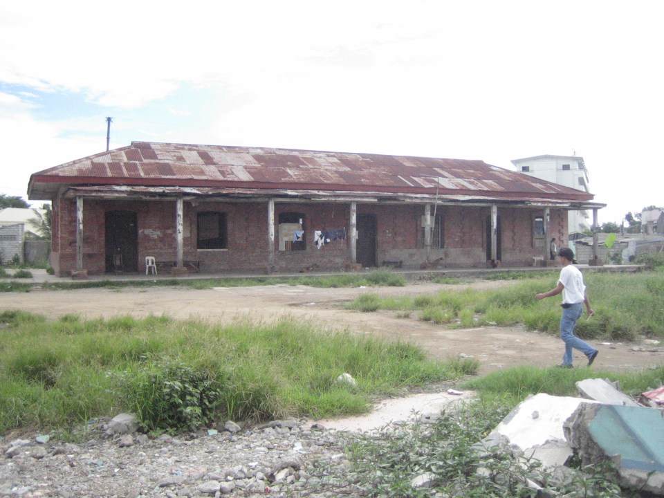
 Old PNR station in Bulacan – I can’t recall if this were in Marilao or Bocaue but the red brick building reminded me of similar rebuilt and preserved buildings in Japan such as Tokyo Station and the warehouses at Aka Renga in Yokohama.
 PNR Malolos Station back in 2006 – the building was occupied by informal settlers at the time.
A good reference for those interested in railway heritage and its conservation is a book entitled “The Colonial Iron Horse” by Arturo Corpuz and published by the University of the Philippines Press. There’s a lot of material in that book to get one started about rail history in the Philippines particularly for the island of Luzon and the two main lines of the PNR – the Main Line North and the Main Line South, which I have written about in previous posts. These could be good topics for interdisciplinary studies involving historians, sociologists, anthropologists, architects, engineers and specialist in other disciplines.
–
What’s wrong with Marcos Highway?
Traffic along the eastbound direction of Marcos Highway in the late afternoons to evenings have worsened particularly for the section stretching from Aurora Boulevard in Quezon City to Imelda Avenue in Cainta. It takes me at least 45 minutes just to traverse that section and then just under 30 minutes the rest of the way to my home in Antipolo. In addition, there is the traffic along Katipunan, which can be quite unpredictable despite the traffic signals now installed at two major intersections near Ateneo and Miriam. The congestion along Marcos Highway is usually due to several factors:
- Rush hour(s) traffic – the sheer number of vehicles during the afternoon/evening peak is enough to cause traffic congestion along Marcos Highway. This is no longer for an hour but for a period usually spanning about 4 hours (5 to 9 PM). It’s become so bad that I am no longer surprised when I go home late some nights to find out it’s still congested at certain points (usually Santolan and Ligaya) past 9 PM.
- People occupying the road – commuters waiting for a ride along Santolan, Ligaya and Metro East/Sta.Lucia often occupy not just one but 2 to 3 lanes of Marcos Highway. This drastically reduces road capacity. For some reason, the MMDA and LGU traffic enforcers could not persuade them to clear the carriageway or at least encroach only on the outermost lane.
- Errant road public transport – loading and unloading operations of jeepneys and UV express happen in the middle of the road. This is partly due to the fact that people already occupy 1 to 3 of the outermost lanes of the road. It is also partly due to driver behaviour as many PUV drivers are unruly. These are also maybe because the enforcers are not doing their jobs managing traffic and apprehending those violating rules and regulations whether driver or pedestrian.
- Major trip generators – there are already 4 malls along Marcos Highway (SM Marikina, Robinsons Metro East, Sta. Lucia East Grand Mall, and SM Masinag) and a 5th is already under way with Ayala constructing a mall at Ligaya. These will attract and produce significant traffic with vehicles generally contributing to congestion in the direct vicinity of the malls but spreading along all major roads. Unfortunately, Marcos Highway is one if not the only access road that these malls have.
A lot of people using their own vehicles live in areas served by Marcos Highway including those beyond Masinag and Cogeo. There are so many subdivisions and other residential areas in these parts east of Metro Manila that vehicles from these residential areas alone can cause sever congestion at Masinag Junction. But this should not come as a surprise given that there is no efficient mass transport system in these areas, which are served primarily by jeepneys and tricycles. Obviously, the quality of service of existing road public transport encourages people to get their own vehicle. And obviously, too, the solution is in a project that is considered “bitin” – LRT Line 2, which currently terminates at Santolan. The extension project has long been delayed and could have a significant impact on transport and traffic once it is constructed and becomes operational.
The past two weeks, I have proceeded to take C-5 and turned to Ortigas Avenue Extension on my way home. Surprisingly, traffic has not been bad at Cainta junction and I have only occasionally encountered congestion at the section in front of the BF Metals plant where jeepneys turning around tend to block traffic during their maneuvers. I estimate that I average just under an hour on this route, a savings of 30+ minutes from my original home-bound route via Marcos Highway and Sumulong Highway. I figure that I will most likely keep using this route as traffic will continue to worsen along Marcos Highway in the run-up to Christmas.
–
Undergraduate research topics on transportation for AY2014-2015
The Transportation Engineering Group (TEG) of the Institute of Civil Engineering (ICE) recently finalised the researches to be implemented by undergraduate students assigned to the group.
- Calibrating car-following and lane-changing models for local traffic micro-simulators
- Effects of clear yielding rules at weaving sections
- Evaluation of re-opening of traffic signals along Katipunan Avenue
- Shuttle service for University of the Philippines Diliman employees
- Analysing trip-cutting behaviour of jeepneys and UV express with respect tot he LRT Line 2 Santolan and Katipunan Stations
- Assessment of pedestrian facilities along Ortigas Avenue Extension and Marcos Highway
- Study on satellite parking system for UP Diliman
- Road safety audit checklist for expressways
- Study on Philippine National Railways (PNR) station congestion
- Using drones for analysis of weaving sections, and traffic circulation in roundabouts
- Air quality assessment at the Centennial Dormitory along C.P. Garcia Avenue
- Estimating bus passenger demand between UP Diliman and UP Los Banos
- Mode choice modelling of new transport systems
- On-road energy efficiency of alternative fuel vehicles
Note that several topics in the list are focused on issues concerning the UP Diliman campus. These are a continuation of studies geared at providing solutions to transport or traffic problems at UP’s flagship campus sprawled over an area of 493 hectares. The above are working titles at best as students taking up the topics are supposed to develop their research proposals (complete with literature review, methodology and budget) this semester and then implement these in the next semester. Since UP has already adjusted its academic calendar, research implementation will be undertaken from January to May 2015.
–
