
Home » Traffic Engineering » Traffic Control
Category Archives: Traffic Control
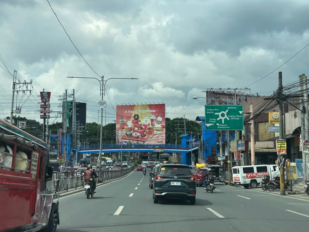
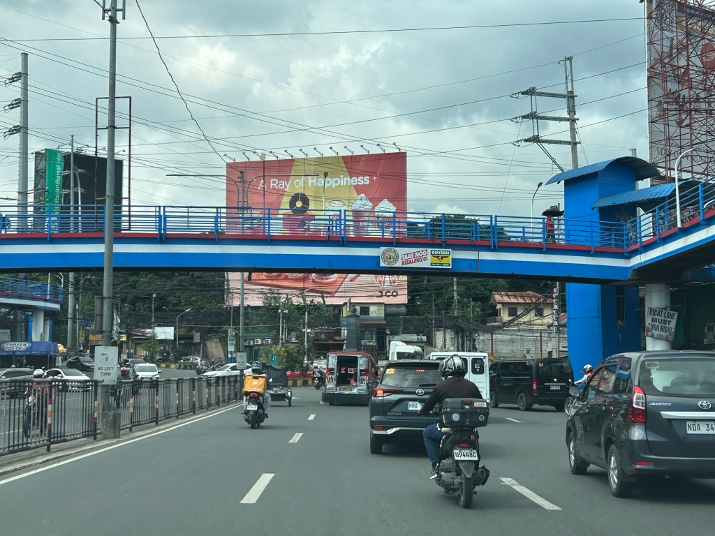
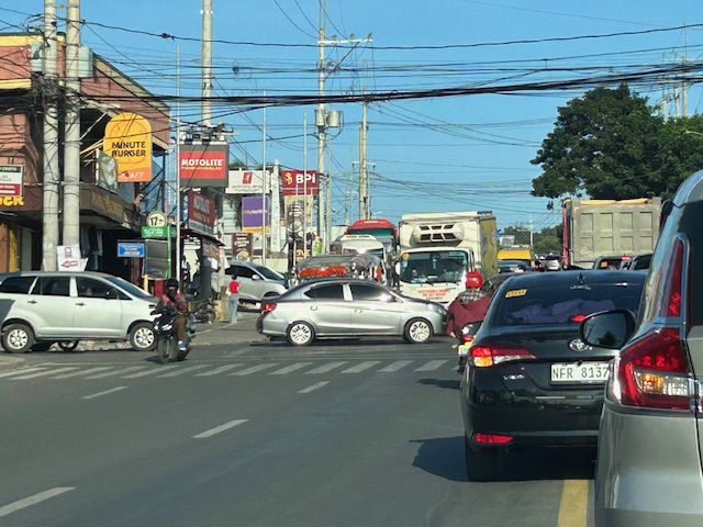
Complicated intersections in Rizal – Tikling Junction
There are several major intersections in Rizal Province. Among them are 3 junctions in Cainta, Taytay and Antipolo – Cainta Junction (Ortigas Ave Ext.-Felix Ave), Masinag Junction (Marcos Highway-Sumulong Highway), and Tikling or Kaytikling Junction. The first two are signalized intersections. The last one is supposed to be a roundabout. All three are problematic in various ways and have been associated with congestion along the major roads intersecting at these junctions.
Tikling is quite interesting as traffic seems to have worsened after it was set up as a roundabout. Taytay enforcers have been deployed here but they seem to contribute more to worsening congestion rather than easing it. Motorists familiar with the area will tell you that traffic is better when there are no enforcers. Unfortunately, not all motorists here are from the area or are familiar with the rules for navigating or positioning at a roundabout. And so the intersection is often constricted with vehicles whose drivers and riders don’t practice courtesy.
Perhaps a combination of geometric improvements and more clever enforcement/management can improve intersection performance?
–
On roundabouts and how they can improve safety at intersections
Roundabouts are perhaps something that should be considered for Philippine roads. The concern, however, is that Philippine drivers don’t know how to navigate or position themselves in roundabouts. And the results as we have seen in several cases are congested roundabouts or rotundas.
AASHTO (September 26, 2025) “State DOTs Highlight How Roundabouts Improve Safety,” AASHTO Journal, https://aashtojournal.transportation.org/state-dots-highlight-how-roundabouts-improve-safety/%5BLast accessed: 10/19/2025]
To quote from the article:
“To highlight the safety benefits of roundabouts, the Ohio Department of Transportation recently released an analysis of crash data from 76 intersections statewide that had been converted to roundabouts. That analysis indicated single lane roundabouts decreased injury crashes by 69 percent while multi-lane roundabouts resulted in a 25 percent decline.”
And here another quotable from the same article:
“For us, it’s simple. Roundabouts remove cross-traffic turns and eliminate T-bone crashes, while improving traffic flow,” said PennDOT Secretary Mike Carroll …”“Any design that dramatically reduces the most serious crashes we see on the road is worthy of consideration in our projects.”
The article also includes a YouTube video on traffic circles.
–
Is it possible to have zero traffic deaths in a year?
Is it possible to have zero traffic deaths in a year? Is it even probable? As it turns out, yes. Here’s an article on what Helsinki did in order to make this a reality:
Andrei, M. (August 1, 2025) “Helsinki went a full year without a traffic death. How did they do it?” ZME Science, https://www.zmescience.com/science/news-science/helsinki-went-a-full-year-without-a-traffic-death-how-did-they-do-it/ [Last accessed: 8/19/2025]
To quote from the article:
“A lot of factors contributed to this, but speed limits are one of the most important,” said Roni Utriainen, a traffic engineer with the city’s Urban Environment Division.
More than half of Helsinki’s streets have a speed limit of 30 km/h (approximately 20 mph). Half a century ago, the city barely had half of its area with a 50 km/h limit (30 mph). They gradually worked to reduce the speed limit, especially around schools and kindergartens.
Smarter street design also played a key role. Pedestrian and cycling infrastructure was prioritized for upgrades in recent years. More and more people started using public transit or bikes, or just walking. Substantial investments also made public transit more efficient and reliable.“Public transport in Helsinki is excellent, which reduces car use, and with it, the number of serious accidents,” Utriainen noted.
Another key component was bringing the police on board. Helsinki introduced automated traffic cameras and enforcement systems, which also helped bring down reckless driving.”
Complex intersections in Davao City
My first project upon my return from Japan in 1999 was the Davao City Transportation and Traffic Management Plan Study. We found a few interesting intersections there. These included junctions with more than 4 legs. If all or most movements were allowed at these intersections, they would be most complicated and risky due to the number of conflicts. Of course, not all movements are allowed and many legs are one-way meaning there are fewer conflicts and less risky.
 These intersections are large and while there are traffic signals, they were off when I was there.
 Surprisingly, there was no congestion or near crashes. Either, traffic was light at the time (before 7AM) or motorists were driving at a level similar to Vietnam (where vehicles were like ants as they moved at intersections).
A bit of trivia here – 1999 to 2002 was the only period in a long time when a Duterte was not mayor of the city. This was the time the former president relinquished the mayoralty in favor of his Vice Mayor and was instead congressman representing the city. He immediately returned after one term rather than serve out 3 terms.
–
On the need to rethink traffic metrics
While Level of Service (LOS) criteria is a concept that can be applied to many other transportation facilities and aspects, among the LOS criteria that have been the subject of much criticism (and perhaps rightfully so especially in the context of safety) are the ones used for intersections. These are associated with delay reduction, which always favors vehicular throughput. The latter means basically, high LOS corresponds to prioritizing car (or motor vehicle) movement while not particularly taking into consideration the safety and movement needs of other road users (not using motor vehicles). Here is an interesting article on this matter:
Boenau, A. (July 9, 2025) “The old traffic math that keeps destroying neighborhoods,” Fast Company, https://www.fastcompany.com/91362348/road-design-traffic-math-destroying-neighborhoods-los [Last accessed: 7/15/2025]
Quoting from the article:
Here are three important questions for experts to ponder:
- Is slow-moving car traffic ever safer than fast-moving traffic?
- Do we have any obligation to provide safe and convenient access for people when they aren’t inside cars?
- What are the economic downsides of wider, faster streets in the central business district?
When planners and engineers truly wrestle with those questions, they can choose to remain a conformist who ignores the damage of traffic metrics, or become an outlier in the industry and make a positive impact that might be felt for generations to come. Things can get better in the end.
–
Again, I must say that rethinking roads and streets should be context sensitive. Still, safety should be the top concern especially for areas that is predominantly residential and/or school. Safety, after all, comes first in the definitions of transportation and traffic engineering.
–
A new bottleneck along Marcos Highway in Antipolo City?
I’ve been wondering why there seems to be much congestion along the westbound side of Marcos Highway in the morning just before we reach SM Cherry. It is usually flowing there but the past weeks when we used the route instead of Sumulong Highway, traffic was really bad. As I am quite observant about the traffic and always looking for reasons or causes, I found that this was due to the alternative route Antipolo ‘opened’ that many motorists now take when traveling between Marikina and the side of Antipolo heading in the general direction of Cogeo.
The alternate route connects Marcos Highway and Sumulong Highway via TOCS Avenue (which intersects Marcos Highway near SM Cherry) and Sampaguita Street (which intersects Sumulong Highway past Masinag Junction and near the Hillside Centre Plaza before Soliven Avenue). If you’re coming from Marikina and heading in the direction of Cogeo or even Antipolo Simbahan then this route may provide shorter travel time as you won’t have to go around Masinag Junction to make an effective left turn to Marcos Highway (direct left turns at Masinag are not allowed).
 This is the view from the queue approaching the intersection of TOCS Avenue with Marcos Highway from the eastbound side of the highway. Note that traffic is not flowing from the junction along the eastbound (Metro Manila bound) side of the highway.
 A closer look with vehicles turning left to Marcos Highway from TOCS Avenue. There are usually Antipolo traffic enforcers facilitation (read: favoring) traffic from and to TOCS Avenue. This results to build-up along Marcos Highway where most traffic is through traffic.
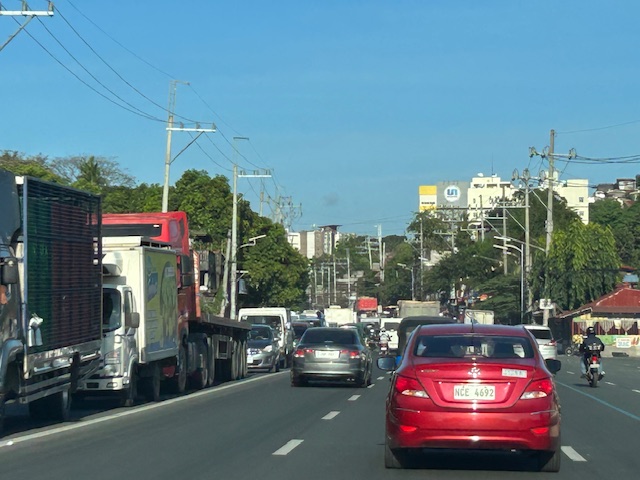 The resulting congestion affects many travelers including freight along the westbound (Metro Manila-bound) direction of Marcos Highway.
While the alternate route likely provides shorter travel times for those coming from Marikina to Antipolo/Cogeo and vice versa, this is at the expense of more people and goods who and that travel along Marcos Highway. Antipolo should realize this even with basic observations on the traffic build-up in the area. Traffic for that alternate route should not be prioritized to the detriment of travelers along Marcos Highway.
–
Zamboanga’s first flyover
We passed by the construction site of Zamboanga City’s first flyover at the intersection of the Pan Philippine Highway (AH 26) and Veteran’s Avenue. I recall there was a lot of pressure from DPWH for the city to approve its construction. The previous mayor didn’t want to approve the project because the perception was that it was not required and there were other options to consider before a flyover was to be constructed. However, many people including the then congressman and now mayor probably thought the flyover would be the solution to the congestion experienced at the intersection. Add to that the perception that the flyover is also somewhat a symbol of progress.


We won’t know until its completion and the ‘normalization’ of traffic in the area to determine whether the flyover has ‘solved’ traffic congestion in the area. The problem with this approach to ‘solving traffic’ is that it is usually a short-lived alleviation of a symptom of the real problem, which is transportation. Zamboanga City has deferred rationalization of public transport routed despite analysis and plans pointing to a streamlined and optimized transportation system if this was pursued. The City commissioned a Transportation and Traffic Management Plan Study in the previous administration but the plan and its recommendations have been shelved, another example of such being casualties of a change in administration of an LGU.
–
Tikling junction traffic
Easily a pet peeve along my commute is Tikling or Kaytikling Junction in Taytay, Rizal. I think traffic here is worse than two other major junctions in Rizal Province – Cainta Junction and Masinag Junction in Antipolo City. And that is because of the combination of traffic management (or mismanagement) by elements of the Taytay Municipal Government and motorists lack of understanding of how vehicles should position (or travel) at roundabouts. Of course, the volume of motor vehicle traffic converging at this junction would probably merit traffic signals over a roundabout but for most times when there are no enforcers here, traffic is somewhat more efficiently flowing as drivers and riders are forced to give way in order to not constrict traffic.
 Enforcers often employ the “buhos” system of prioritizing traffic for one leg at a time. However, instead of a quick transition from one leg to another, they tend to give more time to vehicles coming out of the Manila East Road and turning left and (west)bound for Ortigas Avenue Extension. The long time allocated to the latter means long queues for traffic coming down from Antipolo and those from Cainta.
 Enforcers are partial to outbound traffic from Taytay rather than make an effort to have more equitable ‘go’ time for all legs at the junction.
One wonders who is in charge of traffic for Taytay considering they mismanage traffic everyday. [Though I also wonder why the rest of Rizal including Antipolo and Cainta can’t seem to be bothered by the congestion emanating from Tikling.] As if to prove the point of incompetence, another problematic intersection is the Highway 2000 – Barkadahan Bridge – East bank road intersection, which is signalized and yet somehow always congested (or saturated). But that’s another story.
–
A real battle of Katipunan – the search for a transportation solution
Is it obvious that I was alluding to the classic match-ups of the two major universities – Ateneo De Manila University and the University of the Philippines Diliman – that are located along Katipunan Avenue for the title of this article? That is deliberate on my part as there is a ‘real’ battle along Katipunan Avenue, and it does not involve sports.
Following is a recent article from the Philippine Collegian that reports on the current state of traffic along the corridor:
https://phkule.org/article/971/private-cars-mainly-to-blame-for-katipunan-traffic-transport-experts
I have written before and many times about transport and traffic along Katipunan Avenue. This road has been part of my daily commute since 1988 when I was admitted to UP Diliman as a B.S. Civil Engineering major. Back then Katipunan was not as wide as it is now, especially along the section between UP Diliman and the MWSS complex. That section only had 2 lanes then. What is not a wide center island with large, old acacia trees used to be the frontage of MWSS. So now you can probably imagine how much land was ceded by MWSS for road widening.
I also wanted to write about Katipunan in part as a sort of farewell to the former MMDA Chair and Marikina Mayor Bayani Fernando (BF), who recently passed away. Much of how Katipunan looks like and the traffic situation today can be traced to what transpired during his time at MMDA. I will refrain from writing about this and him for now. I am actually thinking of writing a series about BF and his time as Mayor in Marikina, as MMDA Chair, and his brief stint as DPWH Secretary. This short article will do for now.
A zipper lane along Katipunan?
Yesterday, the Metro Manila Development Authority (MMDA) started another experiment along Katipunan Avenue in Quezon City. They introduced a zipper lane along the stretch fronting Ateneo’s Gate 2 and Miriam College’s main gate (about 740m – less than a kilometer). This single lane was supposed to ease traffic congestion along the northbound direction of Katipunan (aka Circumferential Road 5 or C5 or Pres. C.P. Garcia Avenue), which is saturated with vehicles especially during the morning peak.
While we wait for the official pronouncements regarding this experiment, the impacts are likely to be marginal as the original northbound lanes are jammed with vehicles. Thus, there is a tendency for the entry to the zipper lane to be blocked. MMDA staff will also have to stop vehicles at the exit if they will allow the movement of left-turning and U-turning vehicles at the junction with B. Gonzales and Miriam’s main gate. While it may seem an exercise in futility, we have to appreciate the continuing effort of MMDA for such schemes. The bottomline though is the MMDA has limited options to address the hellish traffic along Katipunan. The schools and other establishments would need to put their heads together to formulate a more sustainable solution for this corridor.

