
Home » Traffic Management (Page 14)
Category Archives: Traffic Management
What’s wrong with Marcos Highway?
Traffic along the eastbound direction of Marcos Highway in the late afternoons to evenings have worsened particularly for the section stretching from Aurora Boulevard in Quezon City to Imelda Avenue in Cainta. It takes me at least 45 minutes just to traverse that section and then just under 30 minutes the rest of the way to my home in Antipolo. In addition, there is the traffic along Katipunan, which can be quite unpredictable despite the traffic signals now installed at two major intersections near Ateneo and Miriam. The congestion along Marcos Highway is usually due to several factors:
- Rush hour(s) traffic – the sheer number of vehicles during the afternoon/evening peak is enough to cause traffic congestion along Marcos Highway. This is no longer for an hour but for a period usually spanning about 4 hours (5 to 9 PM). It’s become so bad that I am no longer surprised when I go home late some nights to find out it’s still congested at certain points (usually Santolan and Ligaya) past 9 PM.
- People occupying the road – commuters waiting for a ride along Santolan, Ligaya and Metro East/Sta.Lucia often occupy not just one but 2 to 3 lanes of Marcos Highway. This drastically reduces road capacity. For some reason, the MMDA and LGU traffic enforcers could not persuade them to clear the carriageway or at least encroach only on the outermost lane.
- Errant road public transport – loading and unloading operations of jeepneys and UV express happen in the middle of the road. This is partly due to the fact that people already occupy 1 to 3 of the outermost lanes of the road. It is also partly due to driver behaviour as many PUV drivers are unruly. These are also maybe because the enforcers are not doing their jobs managing traffic and apprehending those violating rules and regulations whether driver or pedestrian.
- Major trip generators – there are already 4 malls along Marcos Highway (SM Marikina, Robinsons Metro East, Sta. Lucia East Grand Mall, and SM Masinag) and a 5th is already under way with Ayala constructing a mall at Ligaya. These will attract and produce significant traffic with vehicles generally contributing to congestion in the direct vicinity of the malls but spreading along all major roads. Unfortunately, Marcos Highway is one if not the only access road that these malls have.
A lot of people using their own vehicles live in areas served by Marcos Highway including those beyond Masinag and Cogeo. There are so many subdivisions and other residential areas in these parts east of Metro Manila that vehicles from these residential areas alone can cause sever congestion at Masinag Junction. But this should not come as a surprise given that there is no efficient mass transport system in these areas, which are served primarily by jeepneys and tricycles. Obviously, the quality of service of existing road public transport encourages people to get their own vehicle. And obviously, too, the solution is in a project that is considered “bitin” – LRT Line 2, which currently terminates at Santolan. The extension project has long been delayed and could have a significant impact on transport and traffic once it is constructed and becomes operational.
The past two weeks, I have proceeded to take C-5 and turned to Ortigas Avenue Extension on my way home. Surprisingly, traffic has not been bad at Cainta junction and I have only occasionally encountered congestion at the section in front of the BF Metals plant where jeepneys turning around tend to block traffic during their maneuvers. I estimate that I average just under an hour on this route, a savings of 30+ minutes from my original home-bound route via Marcos Highway and Sumulong Highway. I figure that I will most likely keep using this route as traffic will continue to worsen along Marcos Highway in the run-up to Christmas.
–
Some questions on a gloomy Saturday morning
On gloomy Saturdays like today, I often tend to sort of contemplate on some questions coming from events and articles the past few days. I don’t really want to answer these questions right now and immediately but would rather let these and the follow-ups play around in my mind. I would rather not do some shout outs on social media about these questions as some friends tend to be sensitive and I don’t really want to make a lot of effort carefully framing posts on FB just so they won’t appear to be offending certain persons who might be over-zealous about their advocacies or who would be so defensive of their organizations. Here are some questions running around in my brain right now:
1. Does DENR have the mandate to require sidewalks and bikeways along all roads? Design and implementation-wise, isn’t this supposed to be under the DPWH (for national roads) and the LGUs (for local roads)? Is this more a policy statement? But then shouldn’t this come from DOTC?
2. Is going out of your way really the way to get noticed and be awarded? Are there no points for people doing a great job at what they are supposed to be doing?
3. Shouldn’t an agency first check if they are doing what they are supposed to do and the outcomes reflect their objectives? Are emissions testings and monitoring successful or do we still have a lot of smoke-belchers on our roads? If they already have their hands full with their tasks according to their mandate, shouldn’t they first mind their business before even encroaching into another agency’s tasks?
4. Does media have to give so much airtime to a driver of a luxury vehicle who assaulted a traffic enforcer?
5. Why does it seem to be so much fuzz about Uber? Is it just on social media? Do most other commuters give a damn about it when they really can’t afford availing such services?
6. Are government engineers bereft of an appreciation for the arts, culture and heritage? Are they too mechanical or dumb to understand what planning and design really is all about?
–
Congestion due to roadworks at Sumulong-Olalia
The Sumulong Highway sections emanating from its intersection with Olalia Road have been experiencing traffic congestion in the mornings the past few days due to road works being undertaken at the intersection, and along Olalia Road and the Masinag-bound side of Sumulong Highway. Some days, traffic has been bearable and its just like having an ill-set traffic signal at the intersection where it would take you several cycles before getting through. Recently, however, many motorists have lost patience (or probably are simply pasaway) and have been encroaching on the opposing traffic lanes, much to the dismay of those who opted to follow rules. This panggugulang or going ahead of others need to be lessened with those guilty being apprehended or turned back to discourage future transgressions of traffic rules.
 Counter-flowing vehicles towards the Sumulong-Olalia intersection
 Queue at the curve towards the direction of Olalia Road
 A look at the side mirror shows a long line of vehicles along Sumulong. The queue sometimes reaches the strip of stalls selling cashew, suman, and other local delicacies.
There’s really very little one can do about traffic management in the area considering the limited space available for vehicles turning to/from Olalia Road. It’s basically one-way at the approach to Sumulong Highway so there will definitely be a queue along the outermost lane of Sumulong due to the constriction at Olalia. However, in the morning, there is an obvious difference in the directional distribution of traffic along Sumulong with most vehicles moving in the direction towards Masinag rather than to Antipolo Church. That means the Antipolo-bound traffic can fit along a single lane while opposing traffic can use three lanes – 2 bound for Masinag and 1 for Olalia. Enforcers may want to use traffic cones for this temporary traffic management scheme as without such tools, there is a tendency for a bit of confusion as impatient drivers resort to encroaching on the opposing lane (counter-flow) and resulting in more severe congestion (and unsafe conditions) as they attempt to merge with traffic at the intersection. Of course, that goes without saying that it only takes one idiot to counter-flow for others to follow.
–
The return of traffic signals at Katipunan
It’s been more than a decade since the MMDA implemented what was formally called the Grand Rotunda Scheme. To most, it will always be the U-turn scheme that was implemented all around Metro Manila. After seeing what seemed like success along roads like Commonwealth and Quezon Avenue, it was concluded that the U-turns were the answer to Metro Manila’s traffic woes or at least the part that’s blamed on signalized intersections. The perception by many at the time was that traffic signals were not working and caused so much congestion as evidenced by the long queues at intersections. This is not entirely false as intersections with in-optimal settings would definitely bring about congestion especially along corridors or networks where signals are not coordinated. It was, however, a generalization at a large scale and led to more experiments of opening and closing slots in order to determine which would be the most effective combinations. These experiments and their outcomes include drivers becoming more aggressive in order to maneuver ahead of others at the U-turn slots. Weaving has become the norm and in many cases have increased the risk of road crashes.
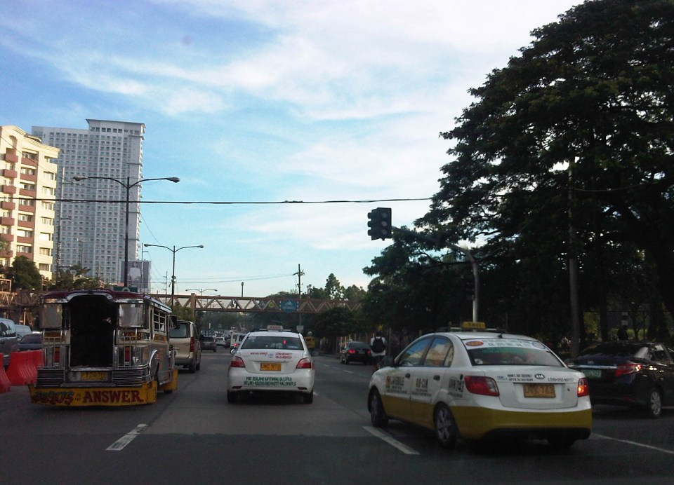 Traffic signals have been installed and the section of the median island has been removed across Ateneo’s Gate 3. This will become a three-leg intersections once again but I hope the signals will not favor Ateneo over through traffic along C5.
 Traffic lights are already installed along the southbound side of Katipunan at the approach to the junction with Miriam College’s Main Gate. This will be a four-leg intersection as across Miriam is B. Gonzales Street that connects to Esteban Abada.
The signals are supposed to be operational starting September 13, which is a Saturday. Perhaps this is to try it out first during that weekend and for the MMDA to do some tweaks before the real deal that is traffic on Monday. But then how can you simulate traffic generated by the two schools in the area except maybe if there is significant enough traffic on Saturday? Did the MMDA or its consultants do some simulation using their computers and the VISSIM software they acquired many years ago? Or will we see more of the experiments as signals are fine-tuned according to the conditions along Katipunan?
We are hopeful that the signals along Katipunan will help improve the traffic along this very busy corridor. The results for sections of C5 from Libis (QC) to Ugong (Pasig) are promising and many people I know have told me that traffic has improved. Of course, this may also be partly due to the one-lane policy the MMDA has implemented for trucks. It’s never just one scheme or measure that will work wonders for Metro Manila traffic. It will always be a combination that will alleviate traffic woes in the metropolis. We’ll soon know what will become of traffic along Katipunan. We should, however, temper expectations at least for the 6:30 – 7:30 AM period during weekdays when traffic peaks in the vicinity of Ateneo and Miriam. The sheer volume of vehicles generated by the schools will overwhelm any system that is put up in the area. Nevertheless, for the rest of the day at least traffic flow should improve when signals are operational once again for Katipunan.
–
EDSA: Taft to Tramo
The EDSA-Taft Ave. intersection was in the news a few weeks ago due to the MRT3 train that derailed and overshot the end of the line along EDSA. Being a major intersection for roads as well as for rail (MRT3 and LRT1), it is a very crowded area. Nearby, too, is the Redemptorist church in Baclaran that attracts a lot of people especially during Wednesdays. Following are a few photos of the area showing the conditions on the pedestrian overpasses and at street level.
 The pedestrian overpass at EDSA-Taft is also a mall of sorts given the merchandise being sold at informal shops at the overpass.
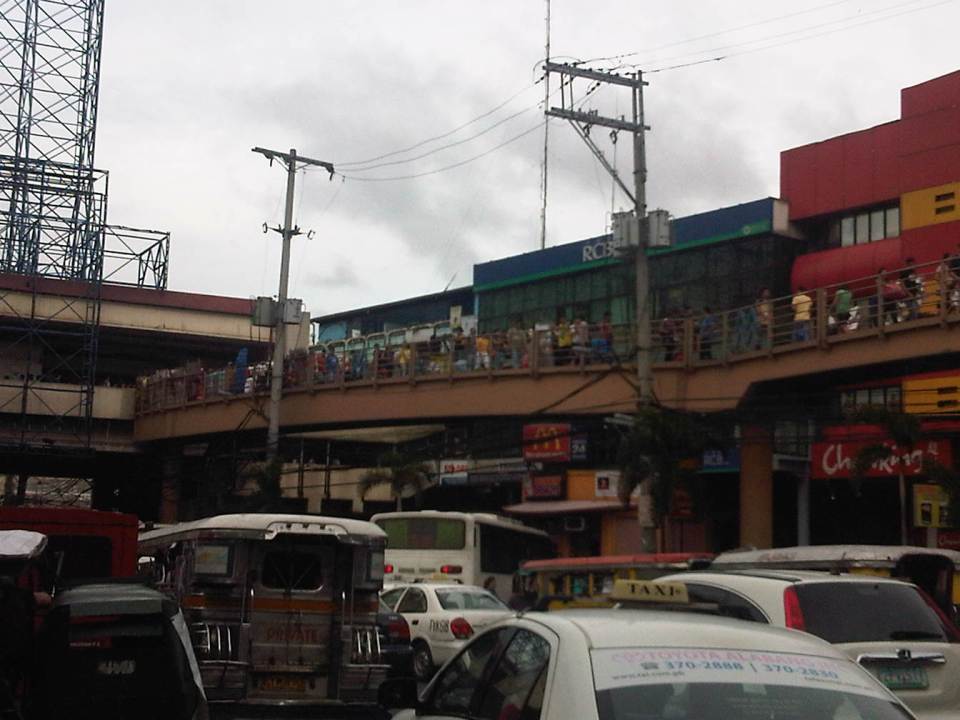 The overpass connects to the EDSA-MRT 3 Taft Ave. Station. This is the MRT 3’s end station and the overpass system connects the MRT 3 Taft Ave. Station with the LRT Line 1 EDSA Station. The connection was not and is still not a smooth one, which has been the subject of criticism from a lot of people.
 The overpass allows people to walk around this large intersection
 Pedicabs freely travel along this stretch of EDSA between Taft and Tramo on lanes designated for public utility buses and clearly violating regulations regarding what vehicles are allowed on EDSA. You can also see in the photo a cart full of merchandise being pushed along the curbside lane.
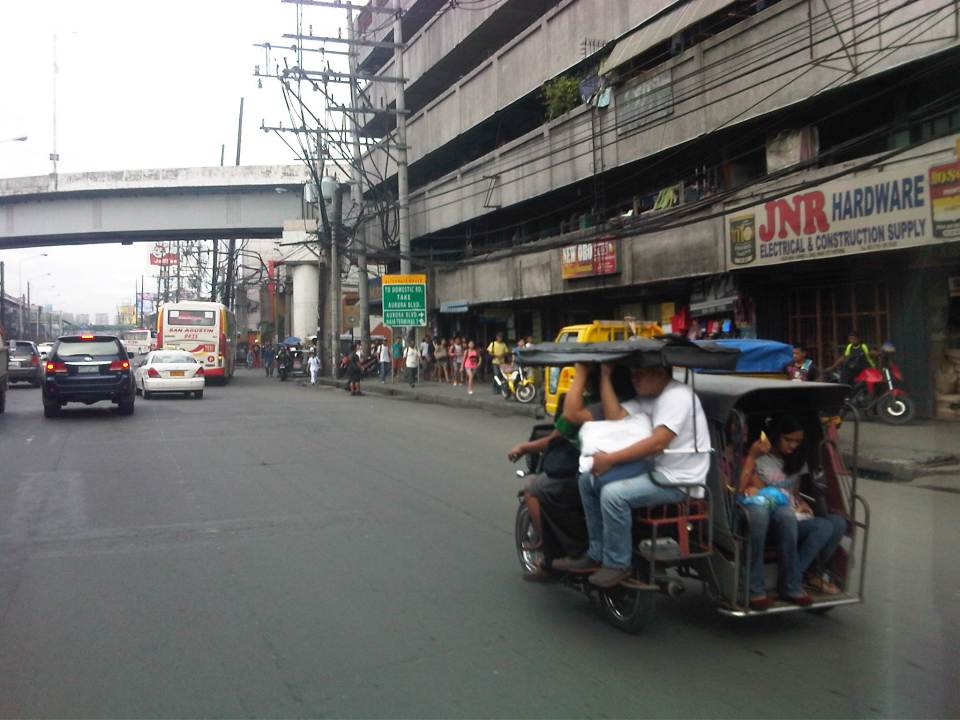 A motor tricycle ferrying passengers along EDSA just before Tramo (that’s the street above which is an overpass from EDSA southbound).
–
2014 Professorial Chair lectures on transport topics
The 2014 Professorial Chair Colloquium of UP Diliman’s College of Engineering was held from yesterday until today. Most of the lectures concerning transport were presented today. Here are some of the highlights of the lectures delivered this morning:
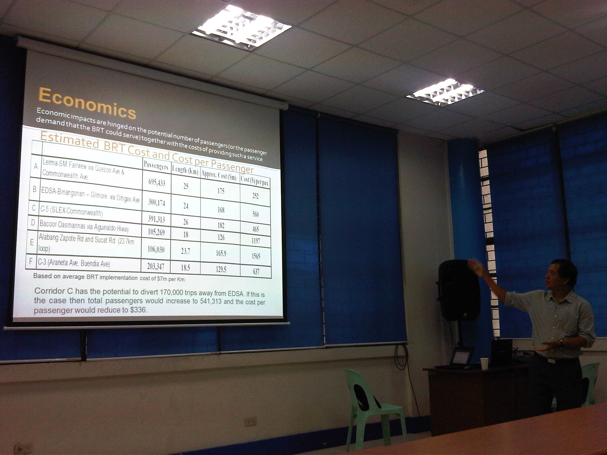 Dr. Ric Sigua, Director of the Institute of Civil Engineering, making a point about the economics of Bus Rapid Transit (BRT).
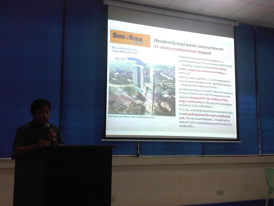 Dr. Sean Palmiano, Director of the National Center for Transportation Studies, explaining the finer points of traffic impact assessment for high density residential developments.
 Prof. Happy Denoga of the Department of Mechanical Engineering explaining on the advantages of hybrid systems for vehicles.
 Dr. Karl Vergel of the Institute of Civil Engineering talking about the on-road tests for jeepneys using B5 or 5% CME-blended fuels in a project commissioned by the Philippine Coconut Authority.
 Comparison of jeepney mileage using 2% and 5% blended fuels.
 Dr. Edwin Quiros of the Department of Mechanical Engineering’s Vehicle Research and Testing Laboratory (VRTL) discussing the dynamometer tests conducted for jeepneys using B5 fuel.
There were other presentations but unfortunately, I wasn’t able to attend these as lectures were spread among various venues at the college. That’s often the hang-up of having parallel sessions during these colloquiums. Nevertheless, it is nice to know that transport remains a popular subject for these lectures.
–
Re: traffic congestion along Katipunan
Yesterday was a holiday in Quezon City so most offices and schools were closed. It was not a holiday elsewhere so through traffic along Katipunan Avenue would have been “normal.” This is assumed especially for trucks that have been blamed as the cause of the severe congestion. I was curious about how traffic would be with the holiday in QC and through traffic could practically be “isolated.” There still was significant traffic generated by establishments like restaurants and cafes along Katipunan. It was a regular weekday and not like it was a Sunday. Following are photos that were taken around 2:00 PM when the truck ban is not enforced in the area.
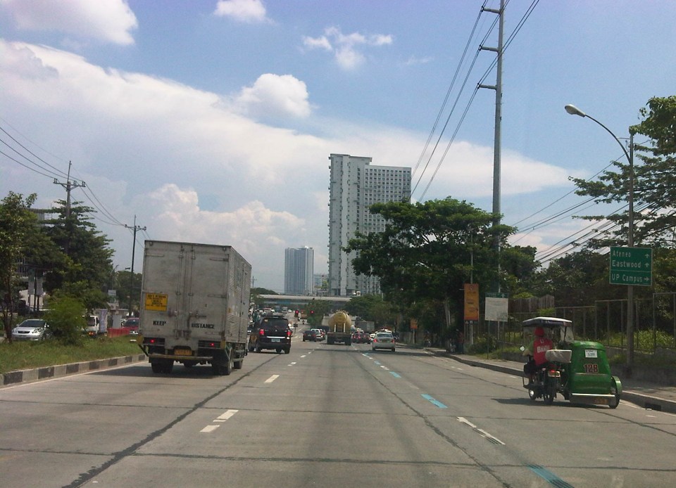 Free-flowing traffic along the section across from the UP Town Center – There were no long queues at the approach to the Katipunan-C.P. Garcia intersection.
 Free-flowing traffic along Katipunan across from Ateneo – the two universities generated few private car traffic yesterday during a period when there’s usually a lot coming in and out of the campuses due to the dismissals in the early afternoon.
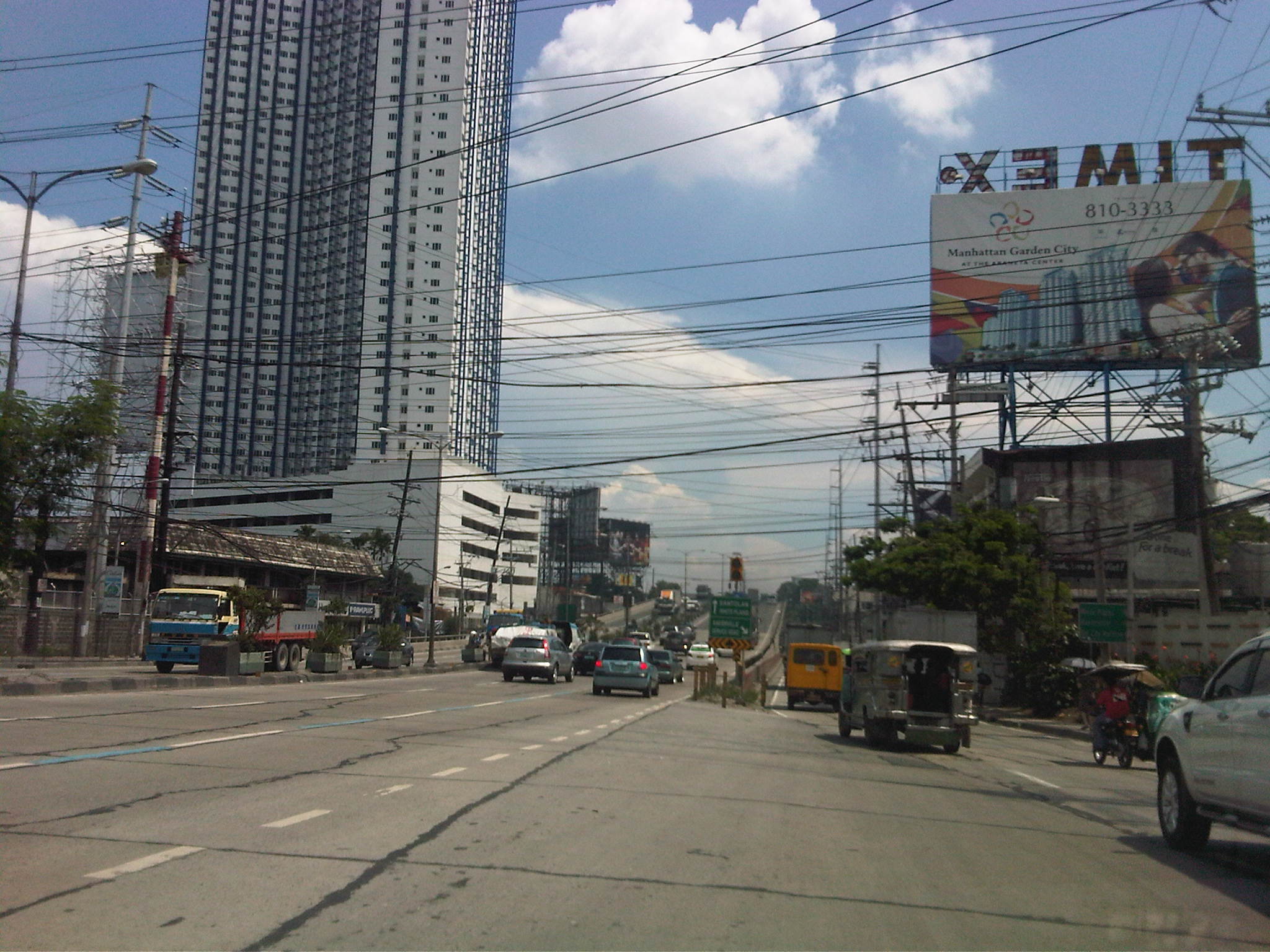 Free-flowing traffic along the Katipunan-Aurora overpass – in the early afternoons, the northbound side of Katipunan is usually full of vehicles mainly private cars and trucks. While there were many trucks yesterday, their numbers were not enough to cause traffic jams.
I think the traffic situation yesterday provided a clear picture that the major traffic generators along Katipunan are mainly the reason for traffic congestion along the stretch from Blue Ridge to Balara. These are mostly the schools (Ateneo, Miriam and UP) that generate so much private vehicle traffic on weekdays and Saturdays. Sundays are different because there’s no school nor work at offices on this day. With the QC holiday, the through traffic was still there owing to work and school in other cities (e.g., Residents of QC would still have to travel to Makati or Ortigas if their workplaces are located there. Similarly, students residing in QC whose schools are in the University Belt in Manila would have to travel.). This means there is really a need to understand why there is congestion and what causes it. A lot more effort is needed for this understanding and to ultimately reduce traffic congestion along this stretch of C5. Pointing fingers among agencies and simply putting the blame on one sector of traffic (e.g., trucks) will not get us anywhere. The solution will require strong cooperation among stakeholders and will definitely be not a painless undertaking for many.
–
Sound opinions on transport and traffic
One of my favorite reads is the column by former NEDA Director General Cielito Habito on the Philippine Daily Inquirer (Inquirer.net). Regardless of whether he is writing about transport or any other topic, his articles are consistently clear and logical. Here are a couple of articles from his column “No Free Lunch” about the more recent transport and traffic issues.
Traffic dilemmas – which appeared August 12, 2014
More railways in our future – which appeared August 19, 2014
I’m not sure if those in-charge or responsible for planning and building our transportation system read his columns. They will learn a lot from these articles especially as the former NEDA DG is practically sharing his experience and wisdom – things badly needed these days especially at the DOTC.
–
What’s causing traffic congestion along Katipunan?
An article came out today on a popular online news site stating that the Metropolitan Manila Development Authority (MMDA) blames the Land Transportation Franchising and Regulatory Board (LTFRB) for the severe traffic congestion that is experienced daily along Katipunan Avenue (part of Circumferential Road 5). The article may be found in the following link:
MMDA: LTFRB to blame for Katipunan traffic
Reading the article, I would like to think that the MMDA likely misunderstood the advisory from the LTFRB extending the “non-apprehension policy” for trucks that have not renewed their franchises. This policy is not the same as the truck ban scheme being implemented in Metro Manila by the MMDA and LGUs. The trucks using Katipunan Avenue during the prescribed period that they are allowed travel along this and other roads are not violating any laws or regulations. Meanwhile, the increase in the volume of trucks can only be attributed to an increasing demand for goods that translate into freight movement. There are very limited alternatives to Katipunan Ave., which is a truck route (note: most of EDSA is not a truck route), and there are few wide roads that can accommodate the volume of trucks carried by C5.
I use Katipunan everyday as it is the main road between my home and my office. I can say that traffic has worsened along this stretch of C5 and one can always see the long queue of vehicles caught in traffic along the northbound side of Katipunan especially from the afternoon to night periods. There are many causes of traffic congestion along Katipunan Ave. and during times when trucks are banned from traveling, it is still congested due to the sheer number of private vehicles using the road. C5, after all, is a major road connecting Quezon City with Pasig, Makati and Taguig, which host major CBDs (Ortigas, Makati and Bonifacio Global City).
In the mornings, much private vehicle traffic is generated by the exclusive schools along Katipunan and the northbound side of the road is usually congested from C.P. Garcia all the way to Blue Ridge. Meanwhile the southbound side is full of vehicles from B. Gonzales (across Miriam College’s main gate) to Tandang Sora. In the afternoons and evenings, traffic congestion is caused mainly by traffic returning from Ortigas, Makati, BGC, etc. to Quezon City and elsewhere where their passengers reside. Road capacity is usually reduced by the parked and standing vehicles that usually occupy a couple or more lanes along Katipunan southbound.
I guess the MMDA would just have to do a better job of managing traffic along this corridor. However, they can only do so much given the sheer volume of private and freight traffic using Katipunan and the limited options for reducing traffic over the immediate to short terms. Only an efficient mass transit system (including walking and cycling for short trips) and a significant mode shift from private to public transport can provide a long term solution to traffic congestion along Katipunan. Until then, congestion along Katipunan will continue to worsen and this will further be exacerbated by the full development and operation of the U.P. Town Center and other high rise developments along the road. Good luck to all of us using Katipunan Ave.!
–
The inconvenience of pedestrians
Walking is our most basic mode of transport and yet it seems that we have failed to design facilities that would make us walk more conveniently and comfortably. Many Philippine cities have been developing their transport systems that favor road transport and motorized vehicles while generally neglecting the needs of pedestrians. Metro Manila cities have been quite inconsistent in the way they deal with the needs of pedestrians (i.e., walking) and often pass on the blame to the DPWH. While that agency also is definitely responsible with a lot of issues pertaining to suitable designs of transport infrastructure, I think LGUs should also be responsible and take up the challenges with respect to design of people friendly facilities. There are a lot more local roads than the national roads under the DPWH. And so LGUs, especially the more developed cities have a bigger role in developing their transport infrastructure to be more people oriented.
 Pedestrians can no longer cross at-grade at the intersection of Quezon Avenue and Araneta Avenue. Note the vendor in the photo (with umbrella) crossing counter-flow with his pedicab full of plastic merchandise. The cyclists in the photo are risking their lives and limbs in crossing the intersection. Fortunately for them, there seems to be no traffic enforcers around to apprehend them. The “yellow box” has been replaced by a “red box” in many intersections including this one.
 The pedestrian overpass at Quezon Ave.-Araneta Ave. as seen from the sidewalk along the Q.C.-bound side of Quezon Ave. The sidewalks are often obstructed by vendors but fortunately the overpass itself is not clogged by vendors unlike other overpasses.
 This overpass along EDSA is the outcome of pedestrian crossings being only an afterthought (some would say aftermath) of the EDSA MRT design. It is an example of the “pwede na yan” (this will do) attitude of many engineers and architects when it comes to transport systems.
All of the above examples are found in Quezon City. That city is among the most wealthy cities in the country and there have been a lot of transport-related developments in the past few years that are more people oriented. These include the construction of sidewalks, overpasses and underpasses outside those typically under the MMDA. However, there are still a lot to build and may I say correct in order to promote walking and other non-motorized transport in the city. Quezon City and other cities can be walkable cities and walkability should not be limited to CBDs that are often (and again) passed on to the private sector for development. LGUs should not be too dependent on what the private sector can offer in terms of infrastructure for walking and cycling. There are not many responsible private companies out there who would commit resources towards walkable and cycling-friendly developments. Often they are tempted to maximize space for buildings, even sacrificing space for parking and motor vehicles, and ultimately at the expense of the general public. This is where LGUs, and not even national government, comes in to put things into order. However, the caveat here is that LGUs should have a plan to guide them in development and again, there are few LGUs that have this capability and capacity to plan and implement such plans. And here is where national agencies like the DOTC and the DPWH can provide help to LGUs given their resources and expertise.
–
 Caught (up) in traffic